Map Projections
1/4
Earn XP
Description and Tags
Flashcards on map projections, their advantages, and disadvantages.
Name | Mastery | Learn | Test | Matching | Spaced |
|---|
No study sessions yet.
5 Terms
Mercator Projection
All land has correct shape and can be used for oceanic navigation, but the size of land is massively distorted.
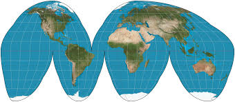
Goode's Projection
Minimizes distortion of the size and shape of land masses and accurately displays land masses, but land masses appear large compared to oceans and can't be used for oceanic travel.
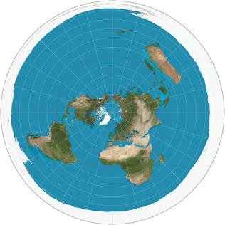
Polar Projection
Size of continents is realistic, but distortion increases as you move away from the poles.
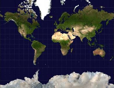
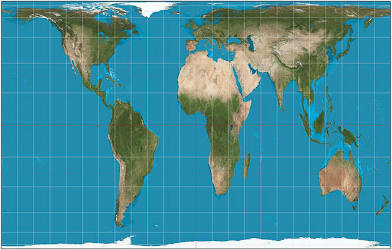
Gall-Peters Projection
Size of land masses is accurate and more accurately depicts the size of developing countries, but the shape of land is inaccurate.
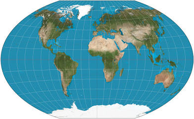
Winkel Tripel (Robinson) Projection
No major distortion and oval shape appears more like a globe than a rectangle, but area, shape, size, and direction are slightly distorted.