Dynamic Planet Science Olympiad Vocabulary - Edit
1/104
There's no tags or description
Looks like no tags are added yet.
Name | Mastery | Learn | Test | Matching | Spaced |
|---|
No study sessions yet.
105 Terms
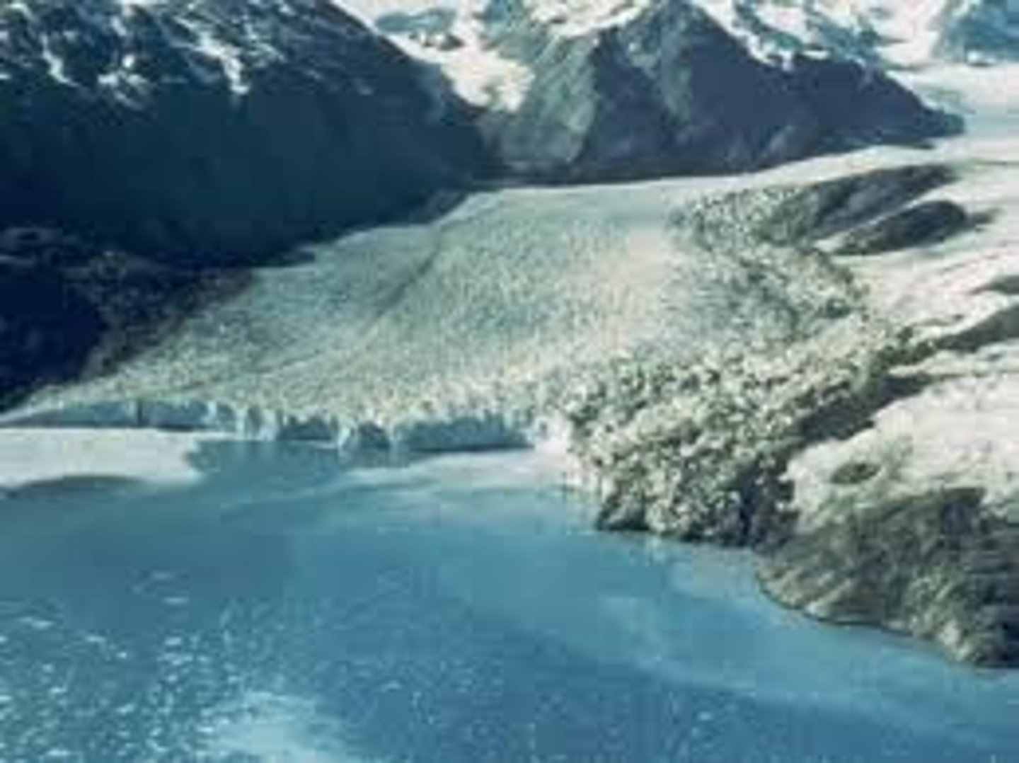
Fjords
is an inlet formed by the marine submergence of formerly glaciated valleys and depressions within a rocky glaciated terrain of low relief
Firn
granular snow, especially on the upper part of a glacier, where it has not yet been compressed into ice.
Properties of ice
The specific heat of ice at the freezing point is 2.04 kilojoules per kilogram per degree Celsius. The thermal conductivity at this temperature is 2.24 watts per metre kelvin. Another property of importance to the study of glaciers is the lowering of the melting point due to hydrostatic pressure: 0.0074 °C per bar.
Ice crystal structure
In an ice crystal the water molecules are arranged in layers of hexagonal rings. ... The hexagonal ring structure of an ice crystal
Glacial ice formations
Under the pressure of the layers of ice and snow above it, this granular ice fuses into denser and denser firn. Over a period of years, layers of firn undergo further compaction and become glacial ice. Glacier ice is slightly less dense than ice formed from frozen water because it contains tiny trapped air bubbles.
Glacial snow formations
Snow cover, also called snowpack, is the total of all the snow and ice on the ground. It includes both new snow and previous snow and ice that have not melted. New snow is a recent snow deposit in which the original form of the ice crystals can be recognized. ... This type of snow is associated with glacier formation.
Accumulation zones
the area above the firn line, where snowfall accumulates and exceeds the losses from ablation, (melting, evaporation, and sublimation). The accumulation zone is also defined as the part of a glacier's surface, usually at higher elevations, on which there is net accumulation of snow, which subsequently turns into firn and then glacier ice.
Equilibrium line
The annual equilibrium line separates the accumulation and ablation zone annually. Is the amount of snow loss compared to the amount gained.
Influence of bed- Wet ground
Causes the glacier to move faster because of less friction causes the glacier to melt faster indirect. As well this could cause under ice rivers.
Influence of bed- Sediment
Creates divits in the ground where the glacier has been examples are the great lakes
Influence of bed- Dry ground
Causes friction could pick up rocks and other objects left behind by plant and animal life. After the glacier melts the objects picked up will deposit.
Influence of bed- Bare rock
Causes friction slows the glacier down also creates starvation on the rock. Examples are the finger lakes
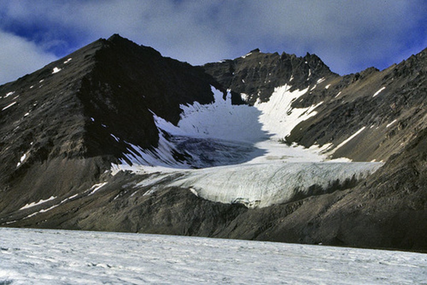
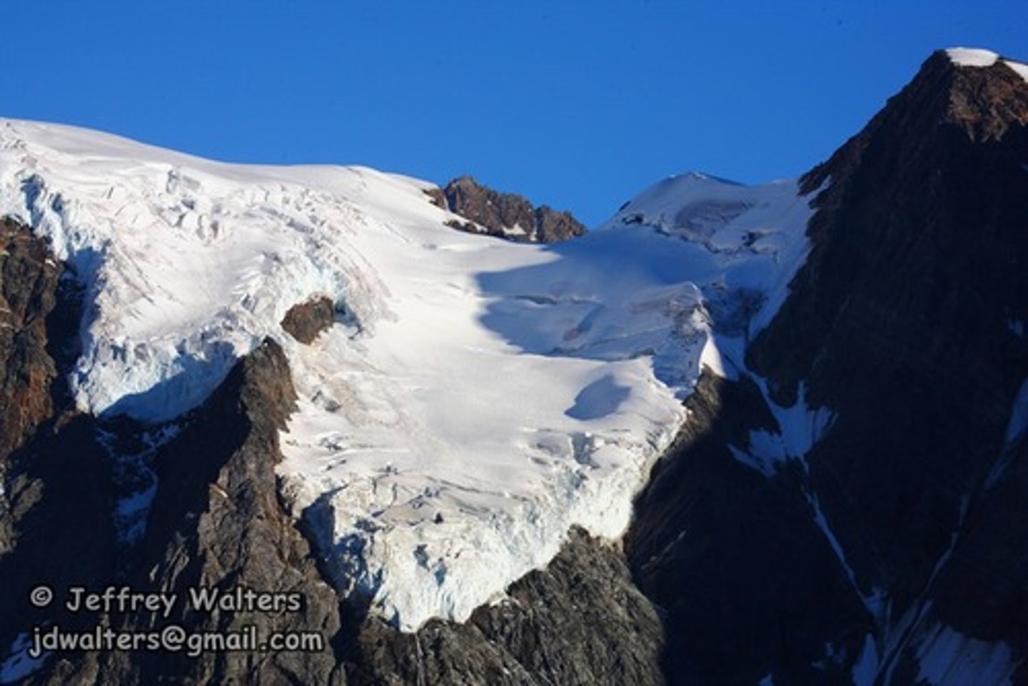
Alpine Cirque
amphitheater-like valley formed by glacial erosion.
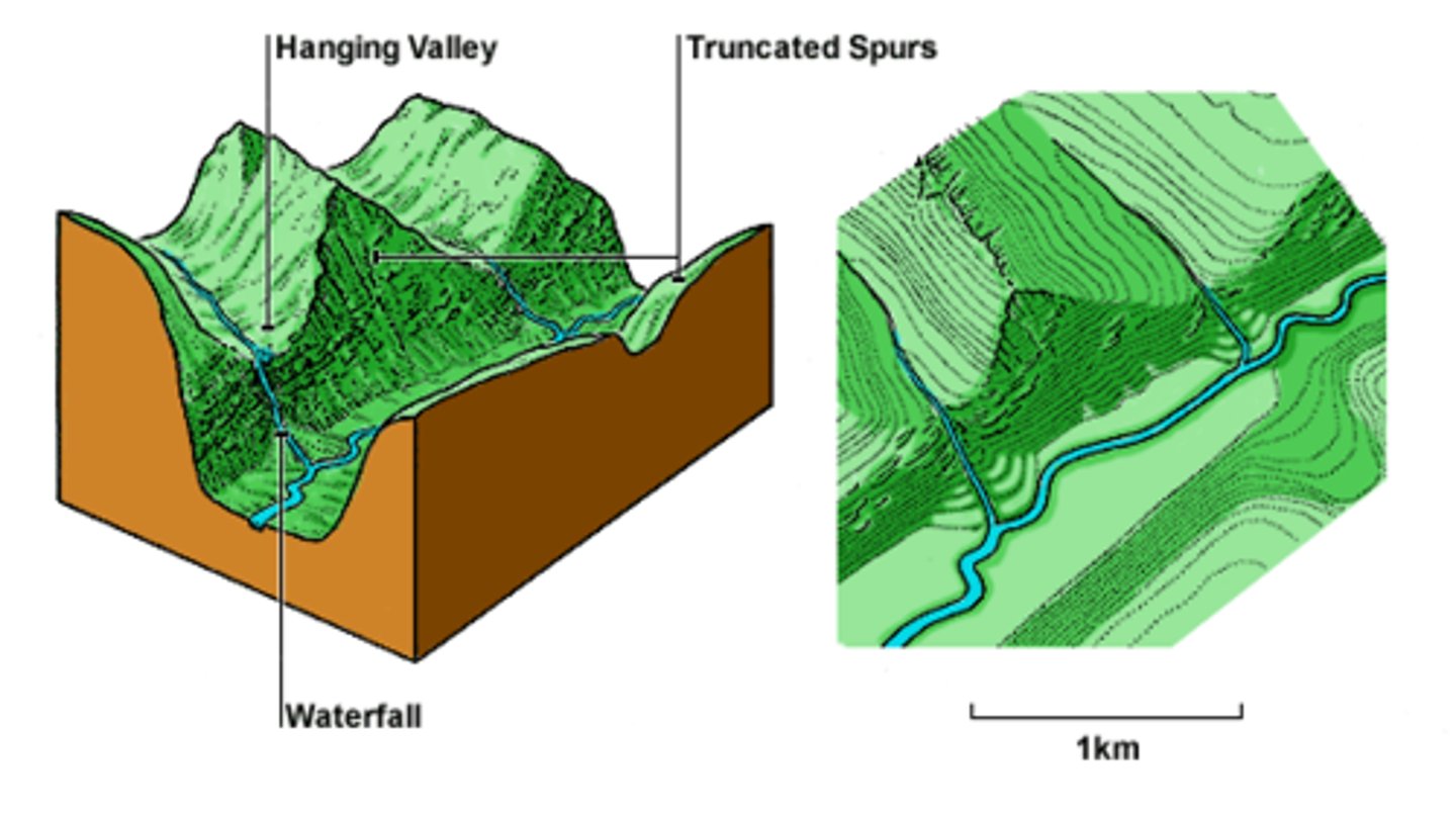
Alpine Hanging
has been widened and deepened by glacial erosion, leaving the side valley cut off abruptly from the main valley below.
Alpine Piedmont
spill into relatively flat plains, where they spread out into bulb-like lobes.
Continental
is a mass of glacier ice that covers surrounding terrain and is greater than 50,000 km2
Ice Stream
is a region of an ice sheet that moves significantly faster than the surrounding ice.
Ice Rise
is a clearly defined elevation of the otherwise totally flat ice shelf, typically dome-shaped and rising 100 to 200 metres above the surrounding ice shelf.
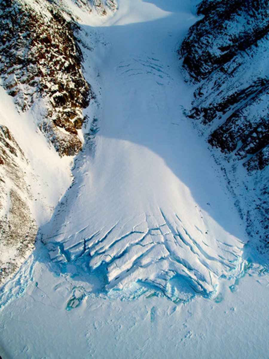
Icefalls
_______ often happen when glaciers flow over a steep drop or squeeze through narrow places. That portion of glacier ice flows faster and becomes heavily crevassed.
Ogives
are alternating bands of light and dark ice that form on some glaciers just below icefalls. The ice flows faster down the center of the glacier, forming ridged arcs of ice that bend downstream.
Surface Melt
this water that melts off the top off the glacier permeates through the glacier and ends up in under glacial lakes and rivers.
Surface Lakes
are lakes created on the surface of a glacer the water then finds its way to underglaical lakes or rivers.
Drainage
glacial rivers will form and relocate the water eather down hill or in a hole created by the glacier.
Moulins
a vertical or nearly vertical shaft in a glacier, formed by surface water percolating through a crack in the ice.
Subglacial Lakes
may cause changes in ice flow, by draining rapidly and lubricating the ice-bed interface, allowing ice streams to flow even more rapidly. Despite the fact that they are overlain by up to 4000 m of dense ice, changes in __________ lake levels are observable at the ice surface. Recent inventories have found 379 lakes in Antarctica - and we are bound to find more
Jokulhlaups
is a type of glacial outburst flood. It is an Icelandic term that has been adopted in glaciological terminology in many languages. Ice river
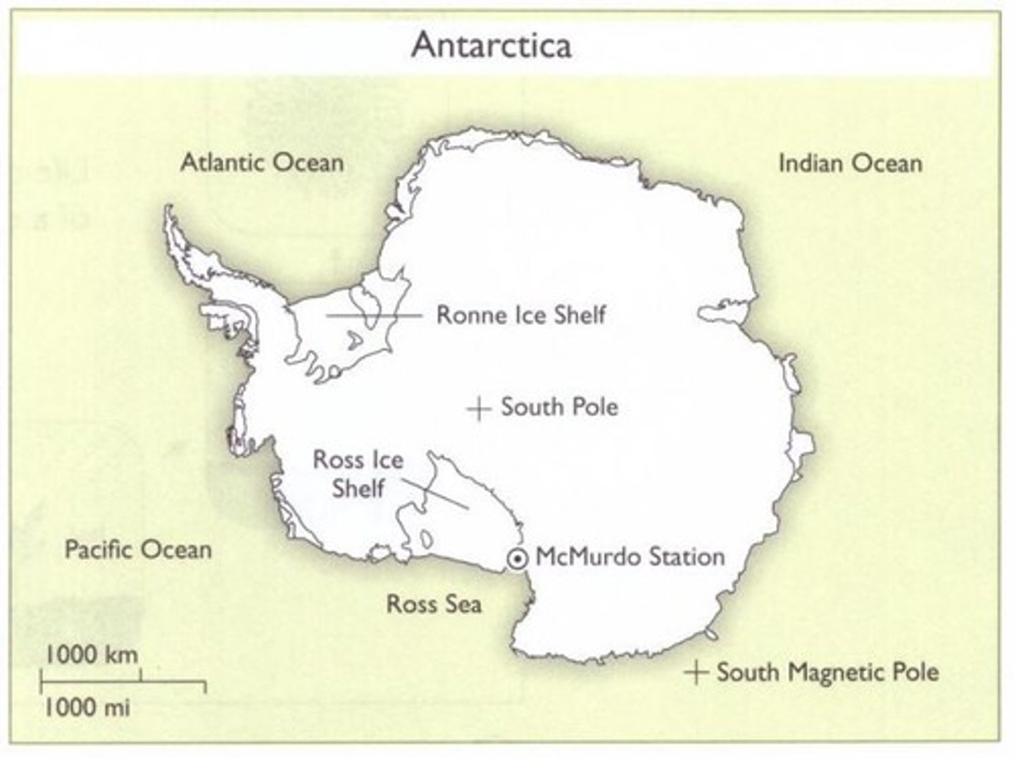
Ice Shelf
a floating sheet of ice permanently attached to a landmass.
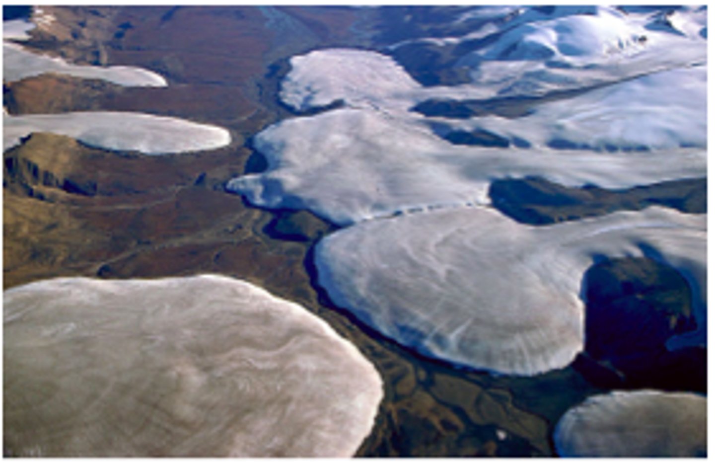
Ice Cap
a covering of ice over a large area, especially on the polar region of a planet.
Ice Tongue
is a long and narrow sheet of ice projecting out from the coastline.
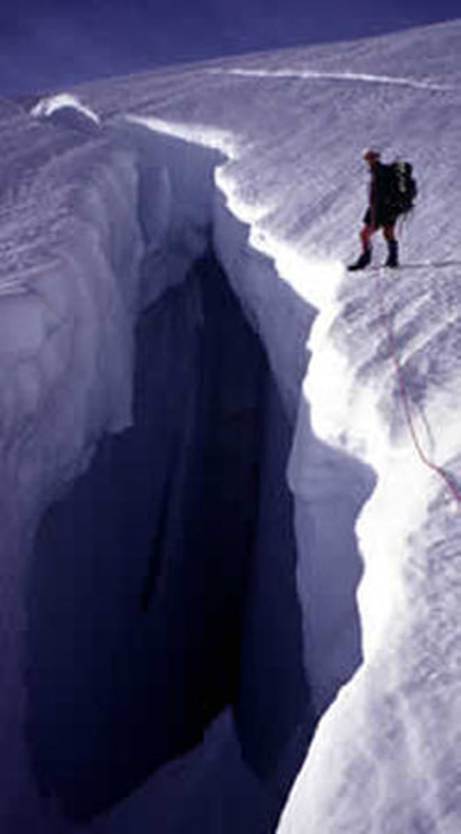
Crevasses
a deep open crack, especially one in a glacier. That the ice is moving away from the main glacier. This happens because of ice melt.
Greenhouse Gases
ice cores can tell us about past levels of greenhouse gases and how they affect the Glaciers. Theses effects can range from huge changes in ice levels and in colder climates they can gain more height
Isolation
exposure of an object to the sun. Intensity of incoming solar radiation incident on a unit horizontal surface at a specific level.
Aerosols
quite-short lived, cause a hole in the ozone layer and can create faster melting speed on glaciers.
Sea Level Changes
caused by many factors but, glacial melt and also gravitational forces caused by the moon through theses changes are not permanent.
Ice Sheet Variations
caused by ether global cooling and warming, there are also affected by gravity pulling ice toward the core.
Isostatic Effects on Earth Crust
glaciers create hole in the crust, theses holes can range from the size of ponds to the size of the great lakes the
Neoproterozoic
The most severe glaciation known in the geologic record occurred during the Cryogenian, when ice sheets reached the equator and formed a possible "Snowball Earth"
Late Paleozoic
attributed to a decrease in atmospheric CO2 concentrations associated with expansion of land plants, as plants both enhance silicate rock weathering—which consumes CO2—and increase the storage of organic carbon on land. However, plant expansion and carbon uptake substantially predate glaciation.
Eocene Oligocene
this ice age has no real reason for this ice age but some guesses are impacts and volcanic activities.
Pleistocene
the last ice age caused by the rise of land in what is now panama this then forced cold water to move up the eastern american cost. We are in the warming period of this ice age.
Ice Cores
The ratio of "light" oxygen-16 to "heavy" oxygen-18 in a sample, for instance, reveals the global temperature when the ice formed; it takes colder temperatures for water vapor containing the lighter oxygen isotope to turn into precipitation. Examining the gasses trapped in ice cores is how scientists first learned that the amount of carbon dioxide and the global temperature have been linked at least the last million years of Earth's history.
A Milankovitch cycle
Changes in the shape earth's orbit and tilt that cause glacial periods and interglacial periods.
Laurentide Ice Sheet
including most of Canada and a large portion of the northern United States, multiple times during the Quaternary glacial epochs
Water level rise
in terms of sea level contribution, on the order of about 1 millimeter per year
Altimetry
how high the glacier is and how much water it has
Landsat
the direction the glacier is moving
Seismology
similar to those of shallow crustal rocks. Thus, internal and boundary dynamic processes, as well as internal structures, of Earth's glaciers and other cryospheric features, are fully amenable to study via seismological methods.
Gravity
Glaciers can affect
Larsen B
3,250 square kilometers, or 1,250 square miles in January 31 and April 13, 2002
Kilimanjaro
(<5700 m) glacier, located in Africa
Amundsen Sea Embayment
from 1992 to 2011 the Smith and Kohler glaciers retreated 35 kilometers
Cryospheric
is the frozen water part of the Earth
Kame terrace
a flat-topped mound or hill composed of sorted sand and gravel deposited by meltwater in a former glacial lake
Fjords
a long, narrow, deep inlet of the sea between high cliffs, as in Norway and Iceland, typically formed by submergence of a glaciated valley.
Cirque glacier
glacier formed in a bowl shaped depression in mountains
valley glacier
glaciers that flow through valleys in mountains, these are sometimes cirque glaciers that escaped their depression.
Piedmont glaciers
a valley glacier that flows out into an open field, they usually spread out into a fan, or a bulb shape. When multiple of these come together, they form ice fields and ice sheets.
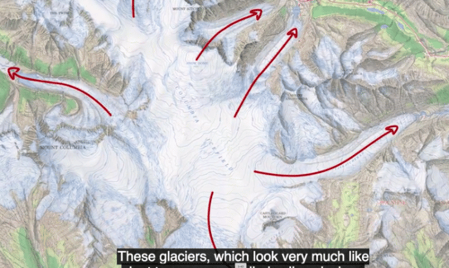
ice fields
large areas of interconnected glaciers, they usually cover everything but the mountain peaks, which are called nunatuks when they stick out of the ice.
outlet glaciers
when ice fields feed out ice to a valley beyond the coverage of the ice field.
tidewater glaciers
when a glacier reaches a water body, and it terminates at the shore line, and starts calving pieces into the ocean.
hanging glacier
when a valley glacier retreats to a high plain, but a part is still resting on the slope of the previously carved valley.
ice streams
narrow and flat parts of a glacial system that flows much faster then the glacier, they are heavily crevassed and are known to have abrupt shear margins.
ice sheet
a mass of glacial land ice greater than 50,000 km^2
subglacial lakes
lakes contained deep within the layers of an ice sheet
ice shelves
glacial ice that is connected to a landmass, and floats, or extends out towards the sea.
ice rise
when ice gets on top of rock in the seabed, these happen to ice shelves, they are usually dome shaped.
ice cap
a mass of glacial ice that covers less than 50,000 km^2
ice tongue
a long and narrow sheet of ice projecting out from the coastline to the ocean.
crevasses
cracks in a glaciers surface usually caused by moving over a rocky terrain {indicates the glacier is flowing over rocky terrain}
icefalls
when a glaciers flow through a really steep surface or has to squeeze through a tight space, and moves really fast and stretches and thins and becomes heavily crevassed. {indicates flow is down a steep surface or into a tight space}
ogives
Alternating bands of light and dark ice that forms ridges. Dark= summer, Light=winter. They kind of bend towards the middle. {indicates the middle of the glacier flows faster than the sides}
cirque
A bowl shaped basin carved by a glacier (erosional)
tor
a high rock, a high rocky hill, or pile of rocks
u-shaped valley
The shape of a valley formed by the erosion of a glacier
hanging valley
A valley left by a melted tributary glacier that enters a larger glacial valley above its base, high up on the valley wall.
arete
a sharp parallel ridge of rock formed when two cirque glaciers come together but don't join.
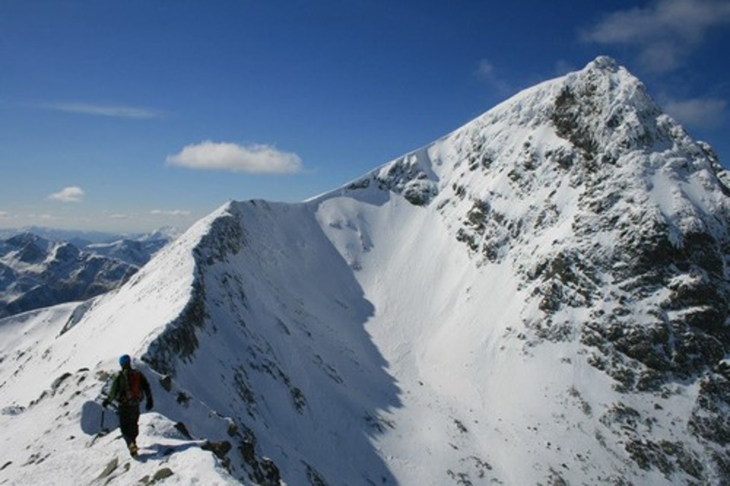
horns
a pyramidal peak that forms when three or more cirque glaciers that come together.
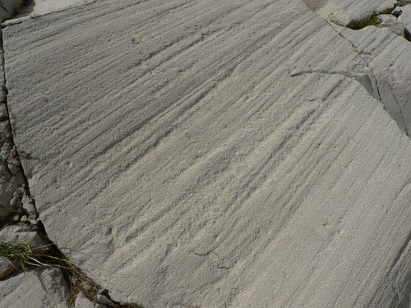
Grooves & striations
they are gouged and scratched into the bedrock as the glaciers move downstream.
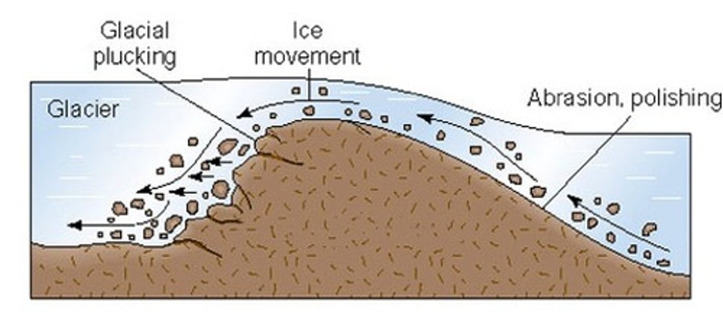
roche moutonnee
a knob of bedrock that is carved into an asymmetrical hill, and in the "stoss" end, the glacier smooths it out by abrasion, and the "lee" end, the glacier does plucking.
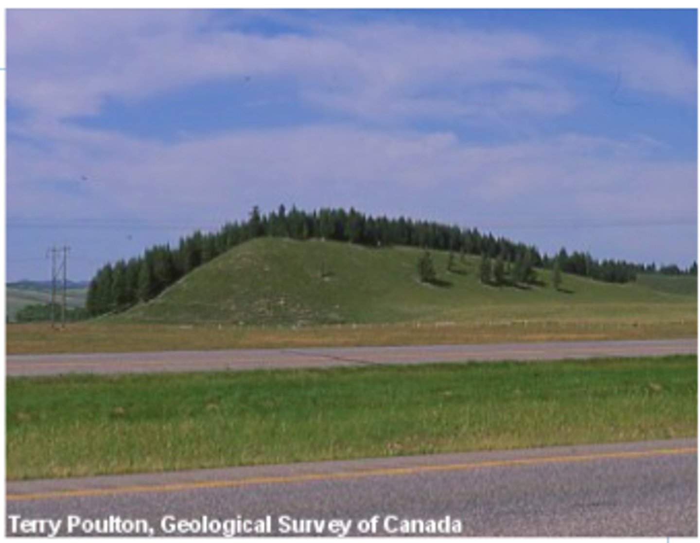
drumlins
small hill or mound in a streamlined shape that is made out of deposited till. Stoss end is the steep side with a possible resistant rock, and the lee end is the smoothed out end. The ice flow is from stoss end to lee end
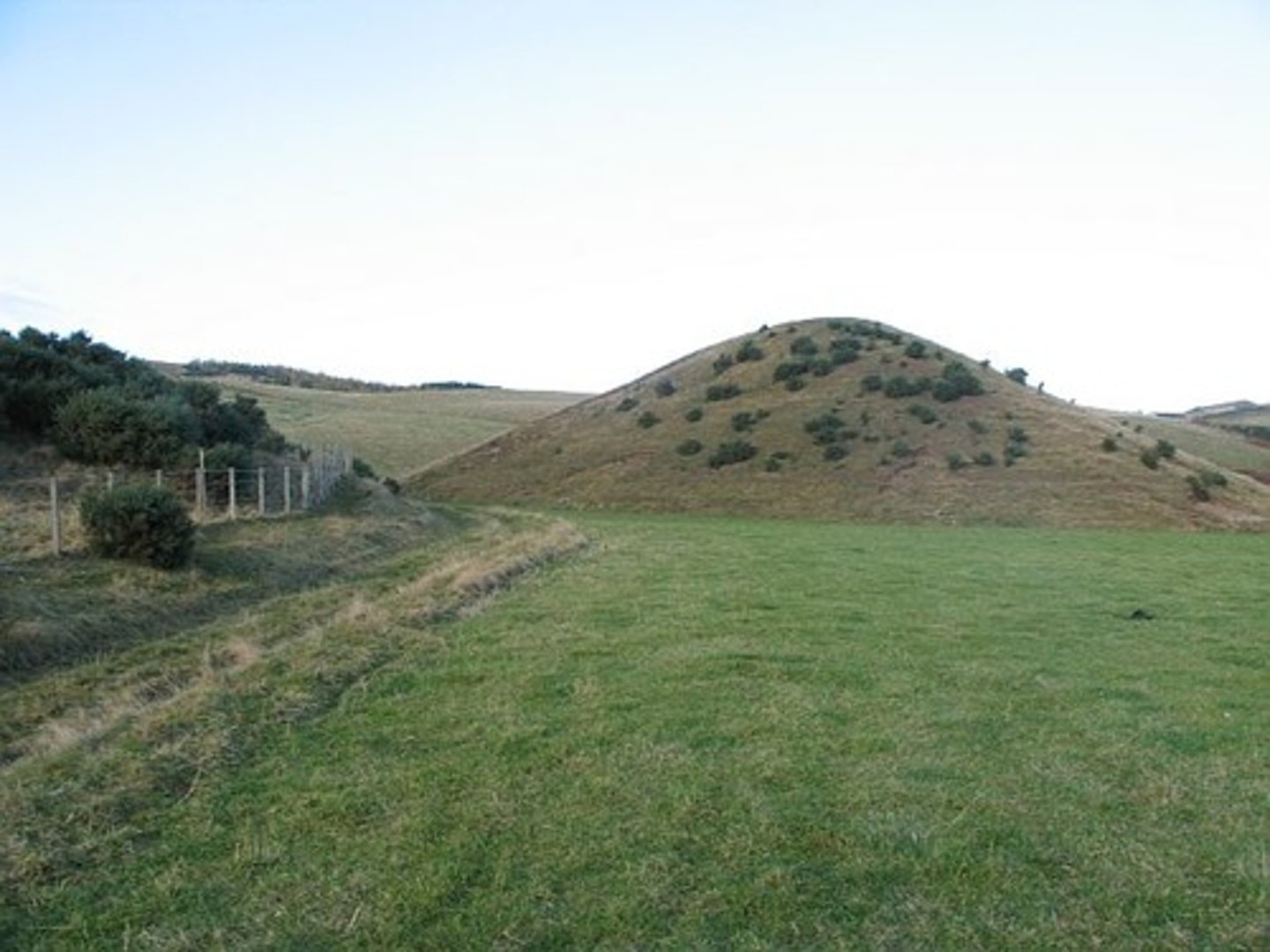
kames
smaller than drumlins, irregular shaped mounds of deposit that accumulate as a glacier retreats.
esker
long ridge of material deposited by a melt water stream flowing beneath a glacier

kettles
bits of glacial ice that breaks and forms a depression in the ground, then melting, forming these.
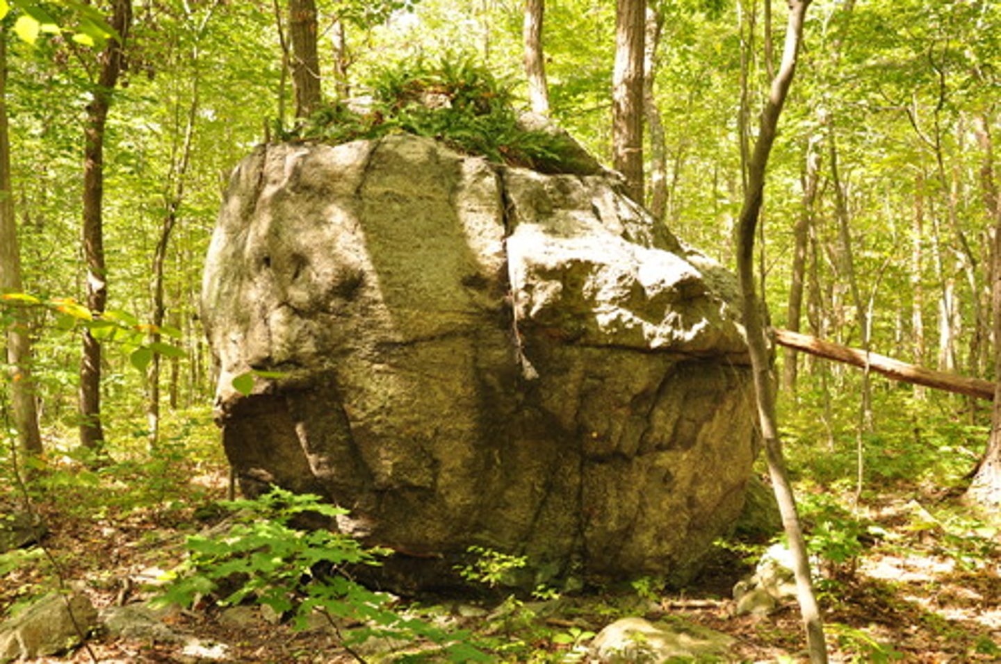
erratics
rocks and boulders that are picked up and transported by a glacier and left when the glacier melts, these rocks usually are "native" to the area they are left in.
till
The sediments deposited directly by a glacier
moraine
glacial debris that is classified based on how it is deposited
entrainment
a glacier picking up loose material around it, this can happen by regelation or the glacier just picking it up.
reccessional moraine
when the glacier is in a general retreat, and it stagnates or advances, sediment is deposited, and this is what it's called. These are behind the terminal moraine.
terminal moraine
the deposit that marks the furthest advance of the glacier
englacial debris
sediment carried within the body of a glacier
plucking
the glacier freezing onto masses of rock, and glacier flow causing this mass being pulled and broken off, and carried by the glacier.
supraglacial debris
Material transported on the surface of the glacier, medial moraines and lateral moraines are supraglacial debris
lateral moraine
material that has been pushed off to the sides by the glacier.
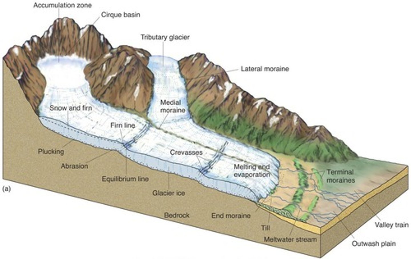
medial moraine
when two valley glaciers converge, their lateral moraines come together and this is the outcome.

ground moraine
a layer of till under the glacier (subglacial
debris) deposited as the glacier retreats
supraglacial lakes
lakes formed by surface melt
swamp zone
firn in the accumulation zone that is saturated with water caused by surface melt.
surface melt
ablation on the surface
moulins
A cylindrical, vertical shaft that extends through a glacier and transports water from the surface to the base. They are carved by melt water from the glacier's surface. they can lubricate the base, and speed up flow.
drainage
melt water moving from moulins, crevasses, and other holes to englacial or subglacial systems