Chapter 6: Observation Equations for Multi-GNSS
 Call Kai
 Learn
Learn Practice Test
 Spaced Repetition
 Match
Match Flashcards
 Knowt Play
1/7

There's no tags or description
Looks like no tags are added yet.
Name | Mastery | Learn | Test | Matching | Spaced | Call with Kai | Chat |
|---|
No analytics yet
Send a link to your students to track their progress
8 Terms
pseudorange nedir
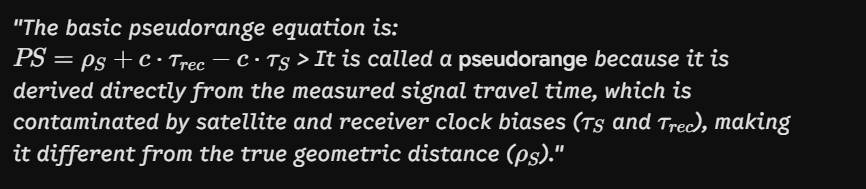
The core measurement in standard GNSS positioning is the pseudorange. It's the distance derived from the signal's travel time, but it's not the true geometric distance because it's contaminated by errors, most notably clock biases
The basic pseudorange equation
Write down the observation equation (PR Single Frequency) and explain all terms. Which term has the greatest influence on the error?
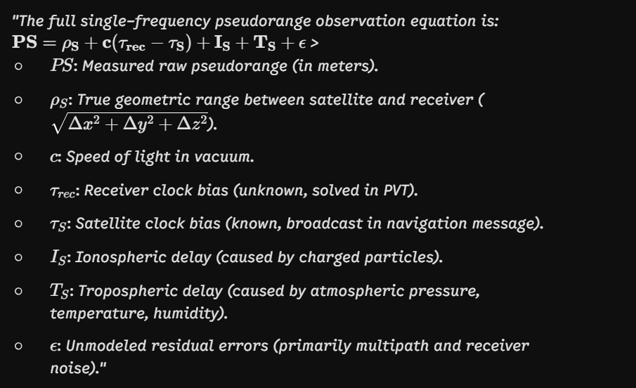
In the single-frequency pseudorange observation equation, which term has the greatest influence on the error? Distinguish between numerical unknown and environmental error.
1. Numerically Largest Unknown: The receiver clock bias ($c \cdot \tau_{rec}$) is the largest numerical bias (equating to hundreds of kilometers), but it is solved for as part of the navigation position solution.
2. Largest Unmodeled Environmental Error: The ionospheric delay ($I_S$) is the most significant error source directly degrading accuracy for a standard single-frequency user, contributing errors of tens of meters.
Solving for Position: Least Squares Estimation
Why is Least Squares Estimation used in GNSS positioning, and what role does linearization play in this process? (Türkçe İpucu: GNSS konumlandırmada En Küçük Kareler yöntemi neden kullanılır ve lineerleştirmenin bu süreçteki rolü nedir?)
1. Over-determined System: When tracking more than 4 satellites (more observations than the 4 unknowns: $x, y, z, \tau_{rec}$), measurement noise prevents an exact solution. Least Squares is used to find the best-fit solution that minimizes the sum of squared residuals.
2. Linearization: The pseudorange range equation is non-linear (contains square roots of coordinate differences). Linearization using a Taylor series expansion around an initial guess transforms the problem into solving for small corrections ($\Delta x$) to the estimated position.
4 bilinmeyen için 4'ten fazla uydu varsa mükemmel tek bir kesişim noktası çıkmaz. Hataları minimuma indiren "en iyi tahmini" bulmak için Least Squares kullanılır. Mesafe formülü kareköklü (nonlinear) olduğu için de Taylor serisi ile doğrusal hale getirilir ve adım adım düzeltme miktarları çözülür.
Memory Hook: > More than 4 Satellites $\rightarrow$ Over-determined $\rightarrow$ Minimize Squared Residuals via Taylor Series Linearization.
Explain the Covariance Matrix in GNSS positioning and describe how Dilution of Precision (DOP) reflects satellite geometry.
1. Covariance Matrix: The matrix $\mathbf{Q_{xx} = (A^T A)^{-1}}$ is the covariance matrix of the estimated unknown parameters. Its diagonal elements represent the variances ($\sigma_x^2, \sigma_y^2, \sigma_z^2, \sigma_t^2$) or uncertainties of the estimated 3D position and receiver clock bias.
2. Dilution of Precision (DOP): DOP is a dimensionless factor derived from the covariance matrix that quantifies the strength of the satellite geometry:
Low DOP: Satellites are well-distributed across the sky $\rightarrow$ High positioning accuracy.
High DOP: Satellites are clustered closely together $\rightarrow$ Poor accuracy / weak geometry.
Key DOP types include PDOP (Position), HDOP (Horizontal), and VDOP (Vertical).
Kovaryans matrisi $\mathbf{(A^T A)^{-1}}$, bulduğumuz $x, y, z$ koordinatlarının ne kadar şaşabileceğini (varyansını) gösterir. DOP ise uyduların gökyüzündeki dizilimidir: Uydular dört bir yana dağılmışsa DOP düşüktür ve konum mükemmel çıkar. Uydular tek bir noktada büzüşmüşse DOP yüksektir ve konum hatası büyür.
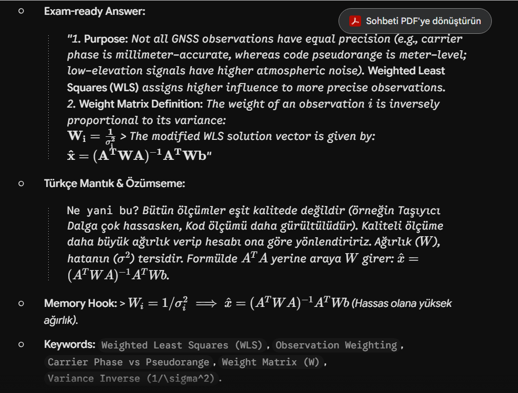
Why is observation weighting introduced in GNSS positioning, and how is the weight matrix $W$ defined?
Multi-GNSS Positioning