HGAP Unit 1 Map Projections
0.0(0)
Card Sorting
1/4
Earn XP
Description and Tags
Map projections that need to be memorized!
Study Analytics
Name | Mastery | Learn | Test | Matching | Spaced |
|---|
No study sessions yet.
5 Terms
1
New cards
Mercator Projection
Distortions: makes land masses by poles appear larger.
This projection preserves direction but greatly distorts size, especially at higher latitudes.
2
New cards
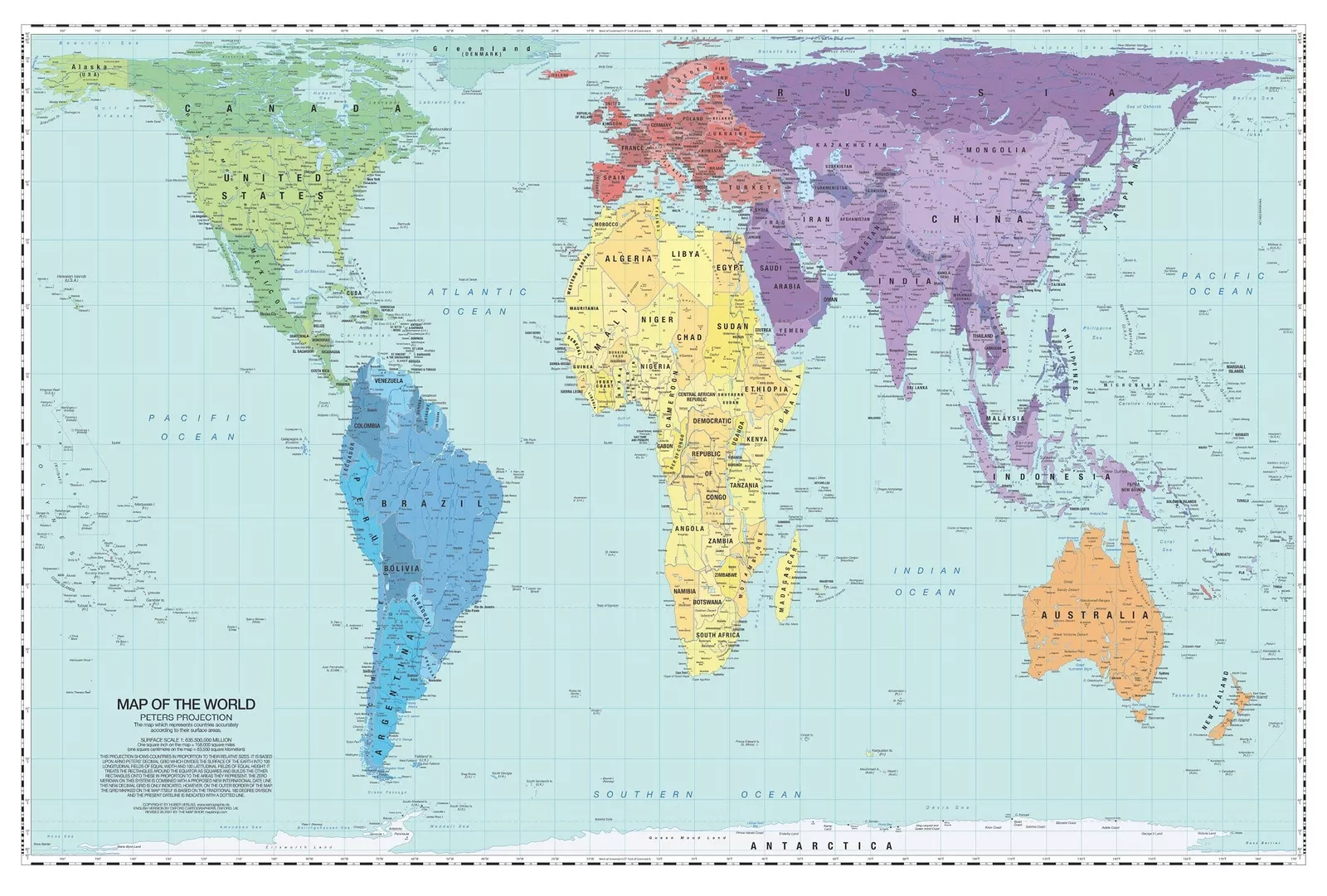
Peters Projection
Preserves size but distorts shape.
3
New cards
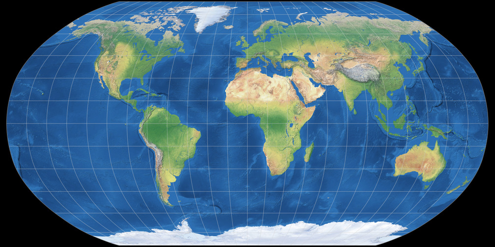
Robinson Projection
Closest to true! No major distortions (size + shape are a little off) and preserves appearance.
4
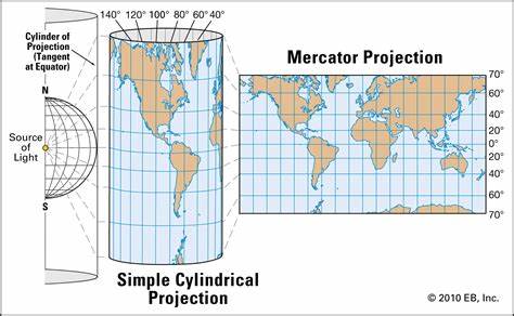
New cards
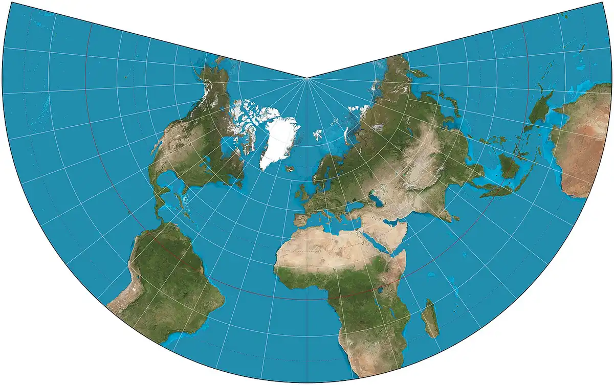
Conic Projection
Longitude lines only cover one pole + direction isn’t constant. Size + shape close to reality.
5
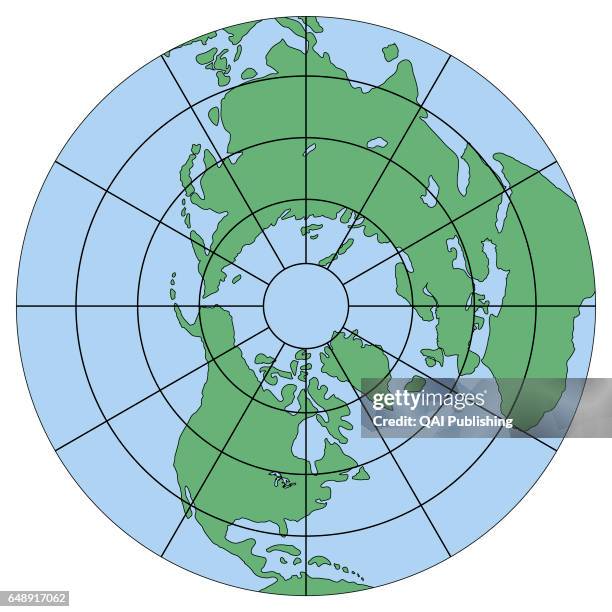
New cards
Azimuthal/Polar Projection
Pilots use because shows shortest distance between 2 places.
Distortions: direction not constant, low latitudes lack definition