Module 2 - The Water Planet
1/77
Earn XP
Description and Tags
Name | Mastery | Learn | Test | Matching | Spaced |
|---|
No study sessions yet.
78 Terms
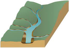
drainage basin
an area of land where all the water flows into a single common point, such as a river, lake, or ocean; a natural "collecting area" for water that all drains into the same place.
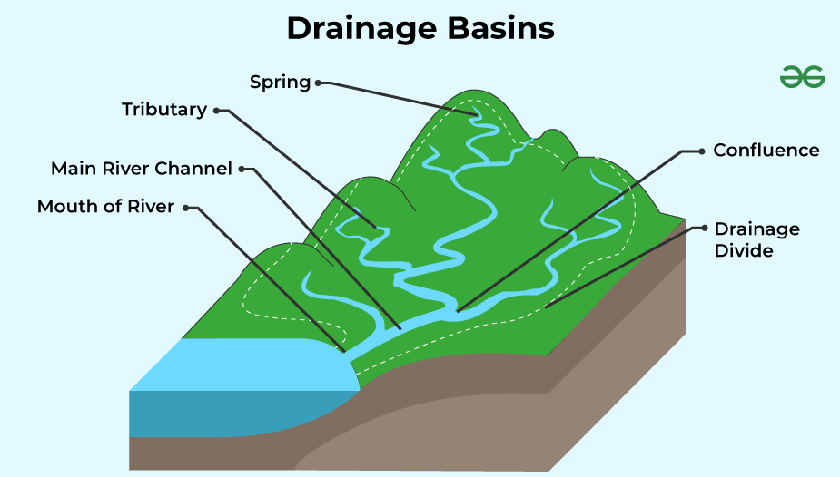
tributaries
smaller rivers or streams that flow into and join a larger main river or body of water; smaller "branches" that contribute water to the bigger "trunk" of the main river.
drainage divide
a line or boundary that separates one area where water flows into one set of rivers and lakes from another area where water flows into a different set of rivers and lakes; a natural border determining the direction of water flow.
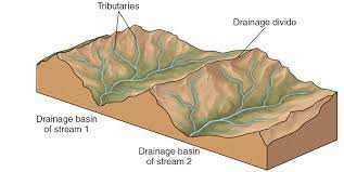
sub-basin
a smaller area within a larger drainage basin where water from rainfall or snowmelt collects and flows into its own set of rivers and water bodies; a miniature version of a drainage basin, focused on a specific region within the larger area.
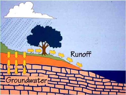
runoff
rainwater or melted snow that flows on the ground into bodies of water, instead of being absorbed into the soil.
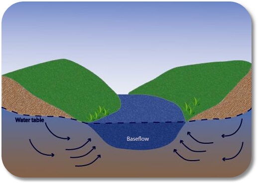
baseflow
the consistent, steady flow of water in rivers and streams that primarily comes from underground sources like aquifers, providing a reliable water supply even between rainfall events.
hydrograph
a graph that shows how the water flow in a river or stream changes over time in response to factors like rainfall or snowmelt.
rising limb
the part of a hydrograph that shows how the water in a river or stream is starting to increase after rain or snowmelt, like the "going up" part of a roller coaster.
recession limb
the part of a hydrograph that shows how the water in a river or stream gradually decreases after reaching its highest level, like the "coming down" part of a roller coaster.
lag time
the time it takes for rainwater to travel from the point of rainfall to the peak flow in a river or stream, like the delay between a rain shower and the river rising.
discharge
the amount of water flowing in a river or stream at a specific location, measured in terms of volume per unit of time, such as cubic feet per second (cfs) or cubic meters per second (cms).
velocity
how fast and in which direction a fluid, like water or air, is moving. It measures the speed of flow.
overland flow
when water from rainfall or snowmelt visibly flows over the ground's surface, often creating small streams or puddles as it moves downhill.
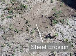
sheet erosion
when a thin, even layer of topsoil is gradually washed away from a large area of land by rainfall or surface water, creating a uniform loss of soil across the surface.
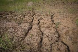
rill erosion
when small, shallow channels or grooves are formed on the soil's surface due to the flow of water, often caused by rainfall, and can lead to the loss of topsoil.
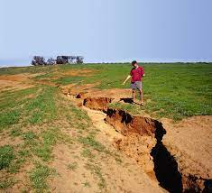
gully erosion
when water creates deep, well-defined channels or gullies in the land by eroding the soil, typically due to the flow of rainfall or runoff.
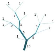
Strahler Method
small streams start as first order, and when two first-order streams come together, they become a second-order stream. When two streams of different orders meet, the higher order wins.
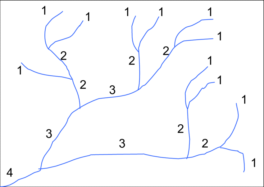
Shreve Method
small streams start as 1, and when two of the same size meet, they become 2. If two different-sized streams meet, the bigger one decides the number
groundwater
water that's hidden below the Earth's surface in the saturated zone, which is where all the spaces between soil and rocks are filled with water
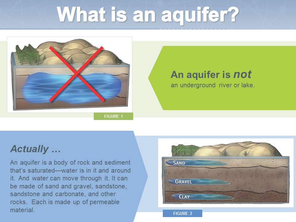
aquifer
an underground sponge made of permeable materials like sand, gravel, or rock. It stores and provides groundwater because these materials let water flow through them. It's a source of water for wells and springs.
unsaturated zone
the in-between layer underground where the soil and rock have both air and some water, but not all the spaces are saturated. It acts as a buffer between the land surface and the groundwater table, helping rainwater seep down and recharge the groundwater.
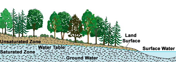
saturated zone
an underground sponge where all the spaces between soil and rock are full of water. It's located beneath the unsaturated zone and above the bedrock, and the water level in this zone can rise and fall, depending on factors like rainfall and water use.

unconfined aquifer
an underground water reservoir where the water level, known as the water table, rises and falls depending on factors like rainfall and human water use. It's directly connected to the land's surface.
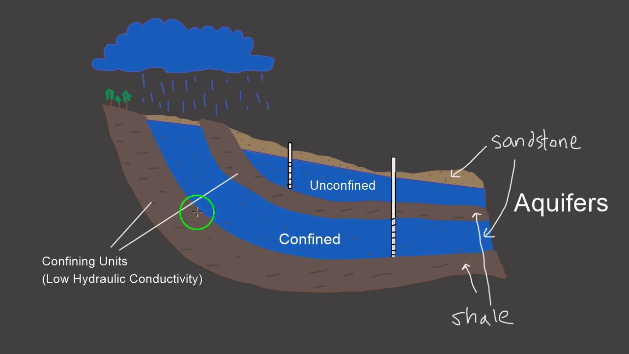
confined aquifer
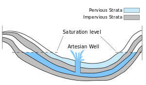
an underground water reservoir between impermeable layers of rock or clay that doesn't let water move in or out easily. the water in a confined aquifer can be under pressure and may flow up to the surface on its own when you dig a well into it.
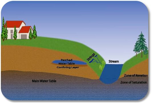
perched aquifer
a small, isolated puddle of groundwater located above the main water table; separated from the larger underground water source by a layer of impermeable material; doesn't directly connect with the main groundwater system. It's like a separate, elevated water pocket that gets its water from rainfall.
potentiometric surface
an imaginary map that shows the pressure and potential levels for groundwater to flow underground; helps scientists understand how water moves in aquifers; a way to visualize the hidden forces that control groundwater movement.
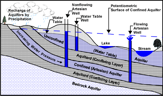
artesian well
a well that taps into a confined aquifer where the groundwater is naturally under pressure and can flow to the surface on its own; found in areas of water in-between impermeable materials.
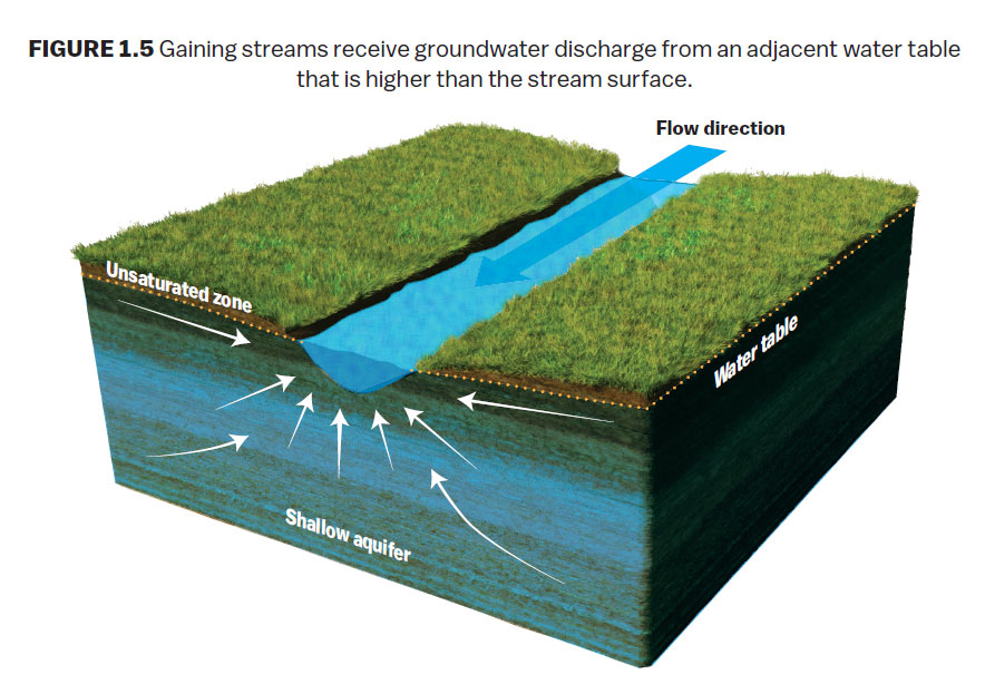
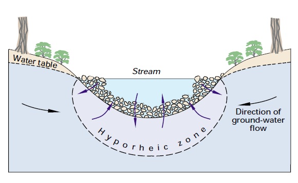
gaining stream
a stream or river that receives more water from groundwater seepage than it loses through surface runoff or evaporation; it gains water from the surrounding groundwater, causing its flow to increase.
losing stream
a stream or river that loses more water to the groundwater system than it gains; water from the stream seeps into the ground, contributing to the recharge of the local aquifer.
disconnected stream
a channel that doesn't have a continuous flow; might be a stream that flows only during specific times of the year, like after heavy rainfall; can appear to be disconnected because they have seasonal or intermittent flow, as opposed to flowing continuously.
hyporheic zone
the subsurface area beneath and adjacent to a flowing river or stream, where there is a dynamic exchange of water between the surface water and the groundwater; the area where the river water interacts with the sediments and groundwater below.
dry valley
a valley that doesn't have a continuous, permanent flow of surface water and is often found in arid or semi-arid regions. Water may flow seasonally or intermittently.
karst valley
a valley shaped by the dissolution of soluble rock, like limestone, creating distinctive features such as caves, sinkholes, and disappearing streams; formed as a result of the dissolution of the underlying rock by water
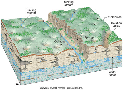
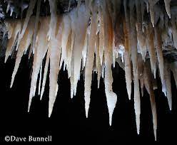
stalactites
hang from the cave ceiling and form as water drips down and leaves mineral deposits, building elongated, icicle-like structures.
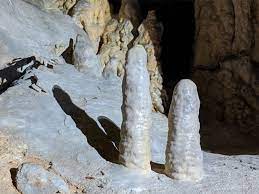
stalagmites
grow up from the cave floor as the mineral-rich water drips onto the ground and accumulates, creating upward-pointing formations.
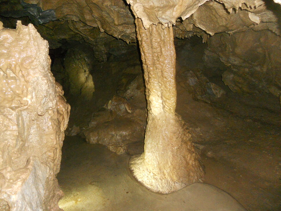
columns
created when a stalactite hanging from the cave ceiling and a stalagmite growing up from the cave floor meet and fuse together.
fluvial
processes, landforms, or features that are associated with or influenced by the movement and actions of water in rivers and streams; ex: floodplains and meanders
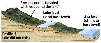
base-level
the lowest point to which a river can erode its channel. It can be the sea for long-term erosion or local features like lakes and dams for shorter-term effects.
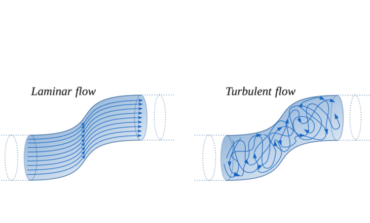
laminar flow
orderly flow of a fluid in which its particles move in parallel layers with minimal mixing between adjacent layers. the motion of the fluid is predictable, and the flow is characterized by linear paths.

turbulent flow
chaotic flow that occurs when a fluid's velocity exceeds a certain threshold, causing the fluid to mix
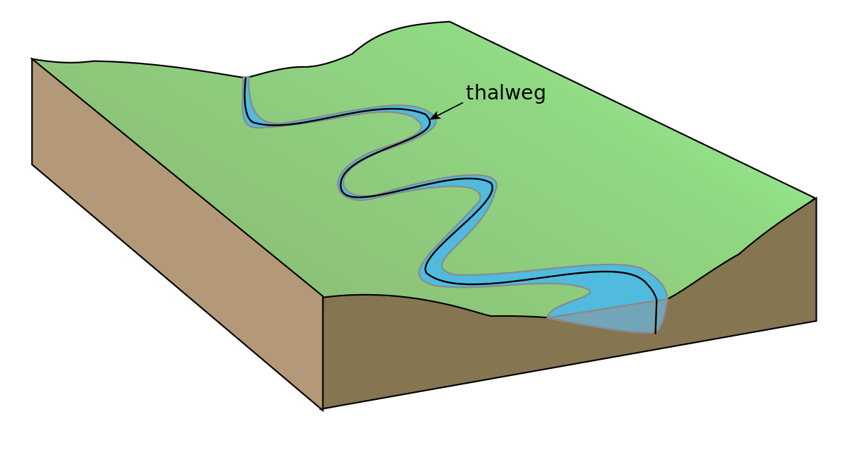
thalweg
the curve along a river or stream that represents the deepest part of the channel; the natural path that the water follows
helicoidal flow
water flow pattern characterized by a corkscrew-like or spiral motion; caused by the presence of irregularities or obstacles in the river channel that disrupt the normal flow patterns such as rocks or changes in depth.
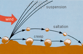
saltating
the jumping and bouncing movement of small particles, like sand or pebbles, carried by the flow of wind or water. It's a common process in sediment transport and can lead to erosion and deposition
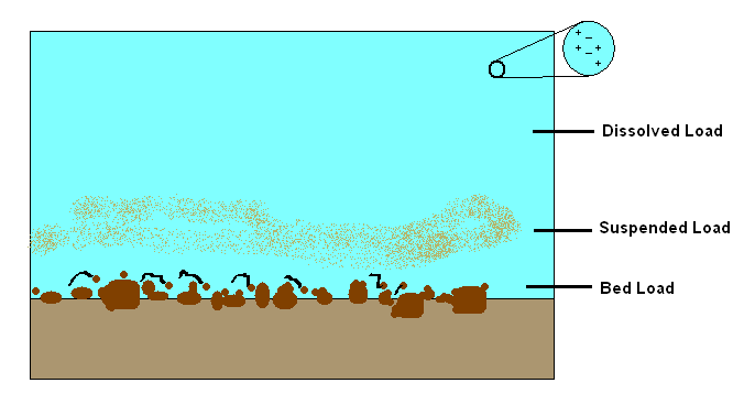
dissolved transportation
the movement of dissolved substances, such as minerals, within a fluid; not visible as solid particles

suspended transportation
the movement of solid particles, such as silt, clay, and fine sand, that are suspended in a fluid; not dissolved but are carried within the fluid's flow, remaining suspended rather than settling to the bottom

bedload transportation
the movement of larger, solid particles like gravel, pebbles, and cobbles along the bottom of a river; do not remain suspended in the flow but instead move by sliding, rolling, or bouncing along the bed of the waterbody
lateral accretion
process in which sediment is deposited along the sides of a river; results in the gradual widening of the channel or the growth of the riverbank; occurs as sediment is carried by flowing water and then gets deposited along the banks due to reduced flow velocity or changes in the direction of the current
vertical accretion
process that involves the deposition of sediment on the floor of a river; the accumulation of sediment raises the elevation of the riverbed; occurs as a result of sediment being transported by the flowing water and then settling and accumulating on the bottom.
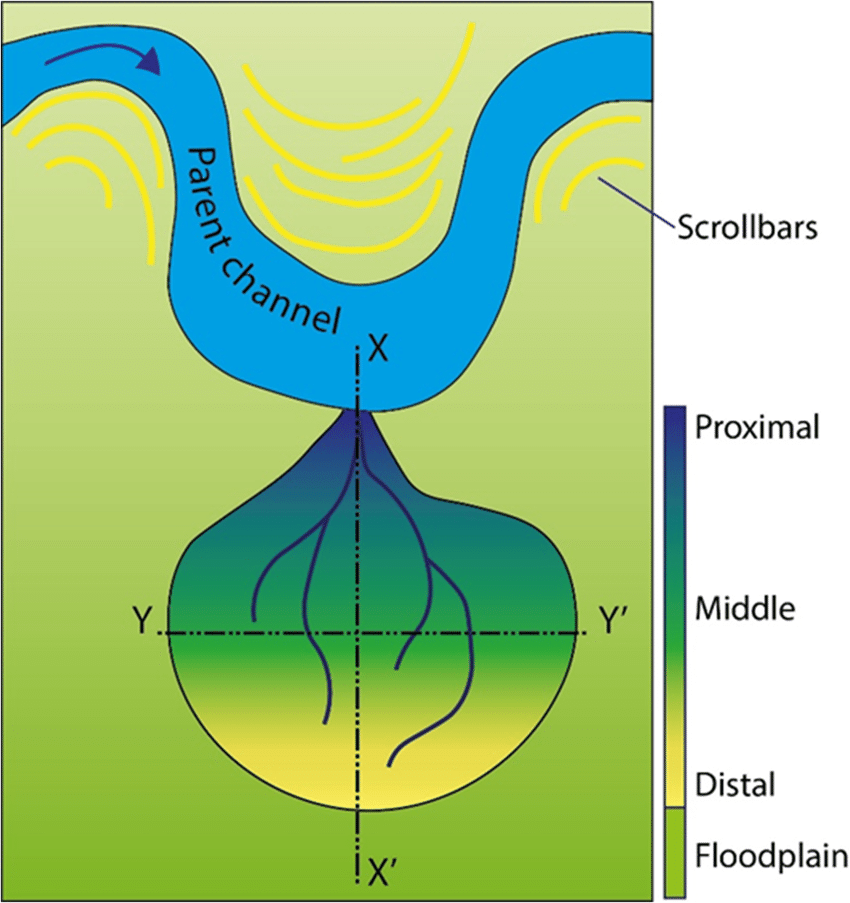
crevasse splay
a fan-shaped deposit of sediment and debris that forms when a river overflows its banks during periods of high flow or flooding; occurs at the point where a river breaches its natural levee, allowing water, sediment, and materials to spill out onto the adjacent floodplain; found in river deltas and alluvial plains
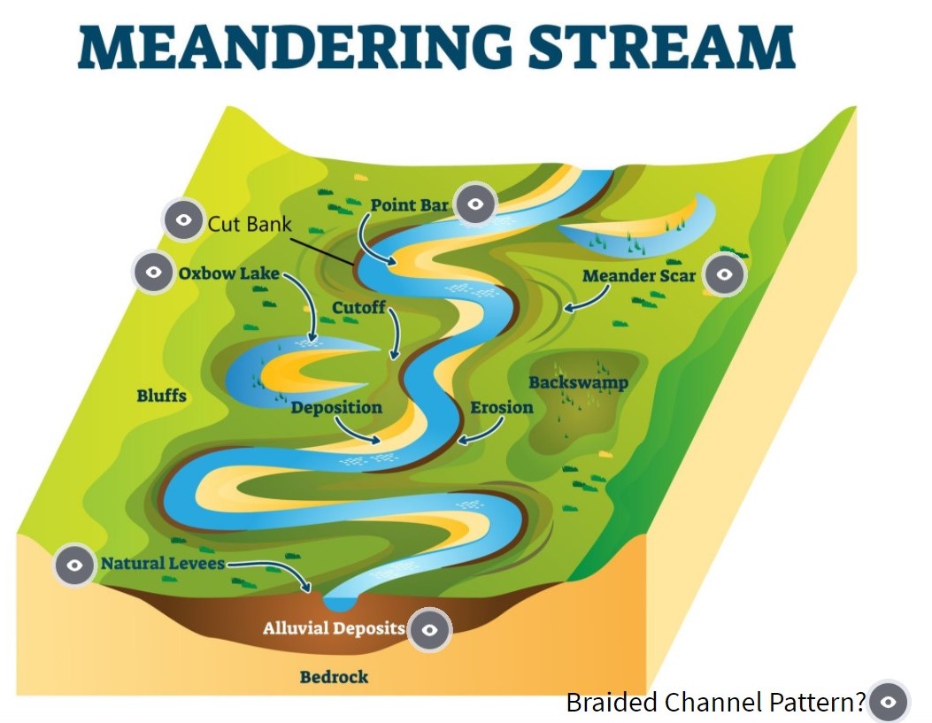
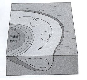
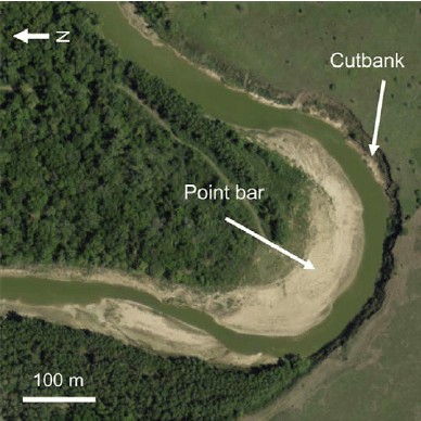
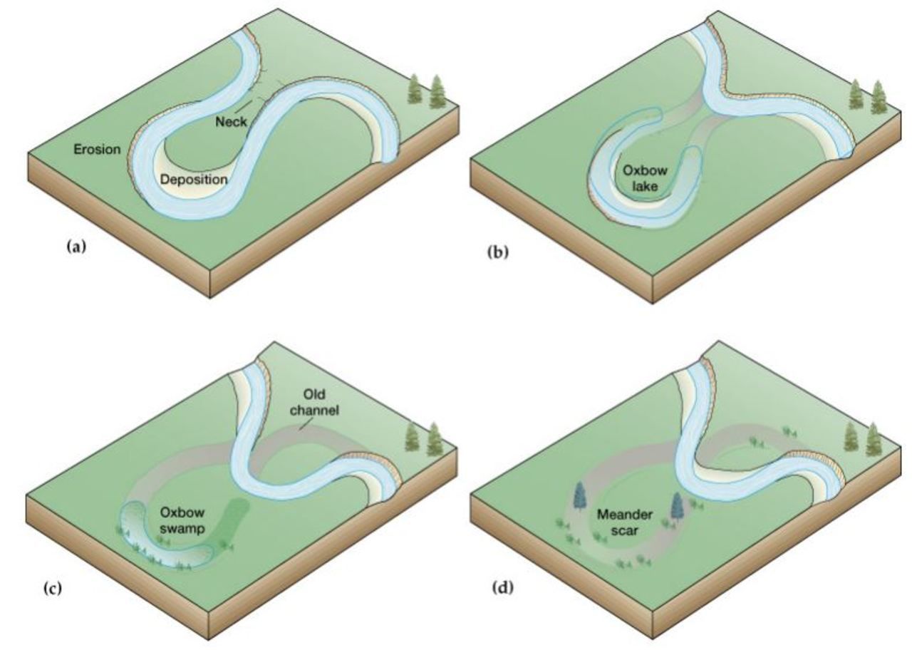
cutbank
an eroded, steep bank or cliff that forms on the outer curve or meander of a river or stream; results from erosion from the flowing water as it undercuts the outer bank, causing the bank to collapse; characterized by their exposed, unvegetated faces and are typically found on the outer bends of meandering rivers.

point bar
a deposit of sediment that accumulates on the inner curve or meander of a river; forms as flowing water loses energy on the inside of a meander and deposits sand, silt, and gravel; characterized by their gently sloping, often vegetated surfaces
levees
natural or man-made raised barriers built along the sides of rivers to help control and manage water flow and prevent flooding; designed to confine the water within the river channel and prevent it from spilling over into adjacent low-lying areas during periods of high water levels or floods
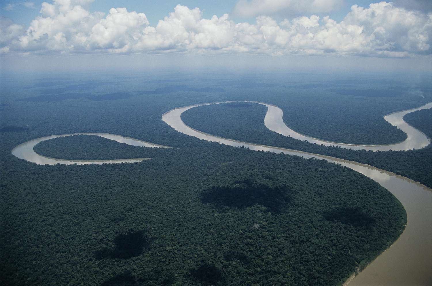
oxbow lake
U-shaped bodies of water that form when a meandering river changes its course over time; often separated from the main river channel; result from a natural process of river migration + erosion and are typically found in river floodplains.
meander scar
dry, crescent-shaped depressions that remain after an oxbow lake has formed and the meandering river has been abandoned; results from river erosion; may fill with sediment or vegetation
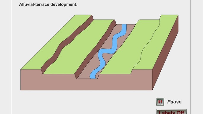
terrace
a flat or gently sloping landform that is typically elevated above the surrounding terrain; often formed by a combination of processes, including river or glacial activity, tectonic uplift, or sea level changes.
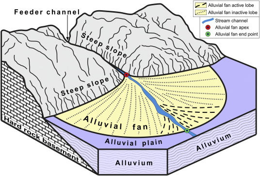
alluvial fans
a fan-shaped landform created by sediment deposited by a river as it flows out of a mountainous area onto a flatter, lower-lying surface; often found in dry regions and can have fertile soil.
alluvial bench
a flat or gently sloping terrace-like landform formed by the deposition of sediment by a river, typically positioned above the active floodplain.
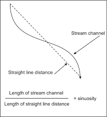
sinuosity
the degree of meandering in a river course; a measure of how much a river's path deviates from a straight line; calculated by dividing the length of the river's course by the straight-line distance between its start and endpoint; high sinuosity > 1
avulsion
a sudden change in the path of a river, caused by a flood or tectonic activity; a river abandons its existing channel and creates a new one, leaving behind the old channel as a dry or abandoned riverbed.
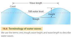
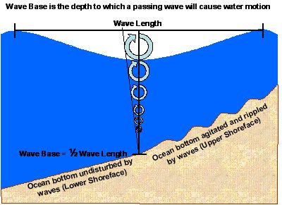
wavelength
the horizontal distance between two consecutive wave crests (or wave troughs); represents the length of one complete wave cycle in the water, peak to peak or trough to trough
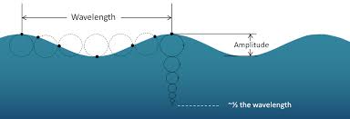
crest
the highest point or peak of a wave, which is the point where the wave's amplitude reaches its maximum value

trough
the lowest point or valley of a wave, which is the point where the wave's amplitude reaches its minimum value
wave base
the depth below which the water remains undisturbed by the passing wave
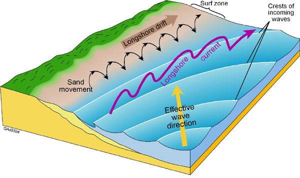
longshore drift
the movement of sediments along the coastline of a body of water; occurs as a result of waves approaching the shoreline at an angle and then carrying sediment particles in a zigzag pattern parallel to the coastline.
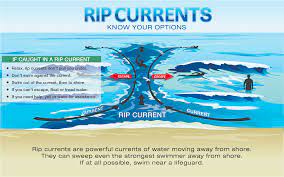
rip current
powerful and narrow channel of fast-moving water that flows away from the shore and out to sea; caused by the interaction between incoming waves and the shape of the seabed; do not swim toward the shore if you are stuck in one
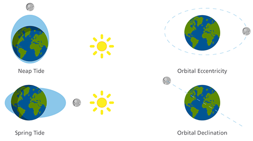
spring tide
occur when the sun, the moon, and the Earth are approximately aligned in a straight line, creating a stronger gravitational pull on the oceans; high tides are higher and low tides are lower

neap tide
occurs when the moon, Earth, and sun form a right angle; lower high tides and higher low tides
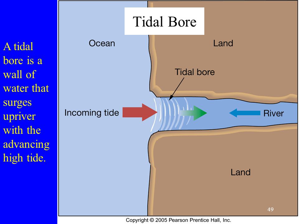
tidal bore
a rapid and often dramatic rise in water level as the incoming tide progresses against the current, that creates a distinct and forceful wave.
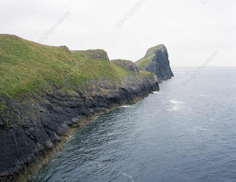
promontory
a prominent and elevated point of land that extends out into a body of water; narrow and may be rocky or covered in vegetation
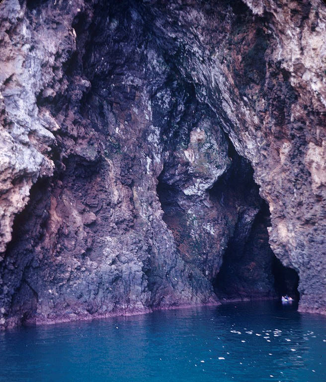
sea cave
formed by the erosion of the sea on coastal rock formations; found along coastlines with rocky terrain; characterized by their unique location within cliffs and are accessible directly from the water.

sea stack
a tall, isolated pillar of rock that rises vertically from the sea or ocean, separate from the mainland or the coast; the result of coastal erosion, where erosional forces gradually wear away the surrounding rock, leaving behind a freestanding pillar
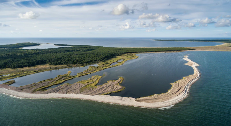
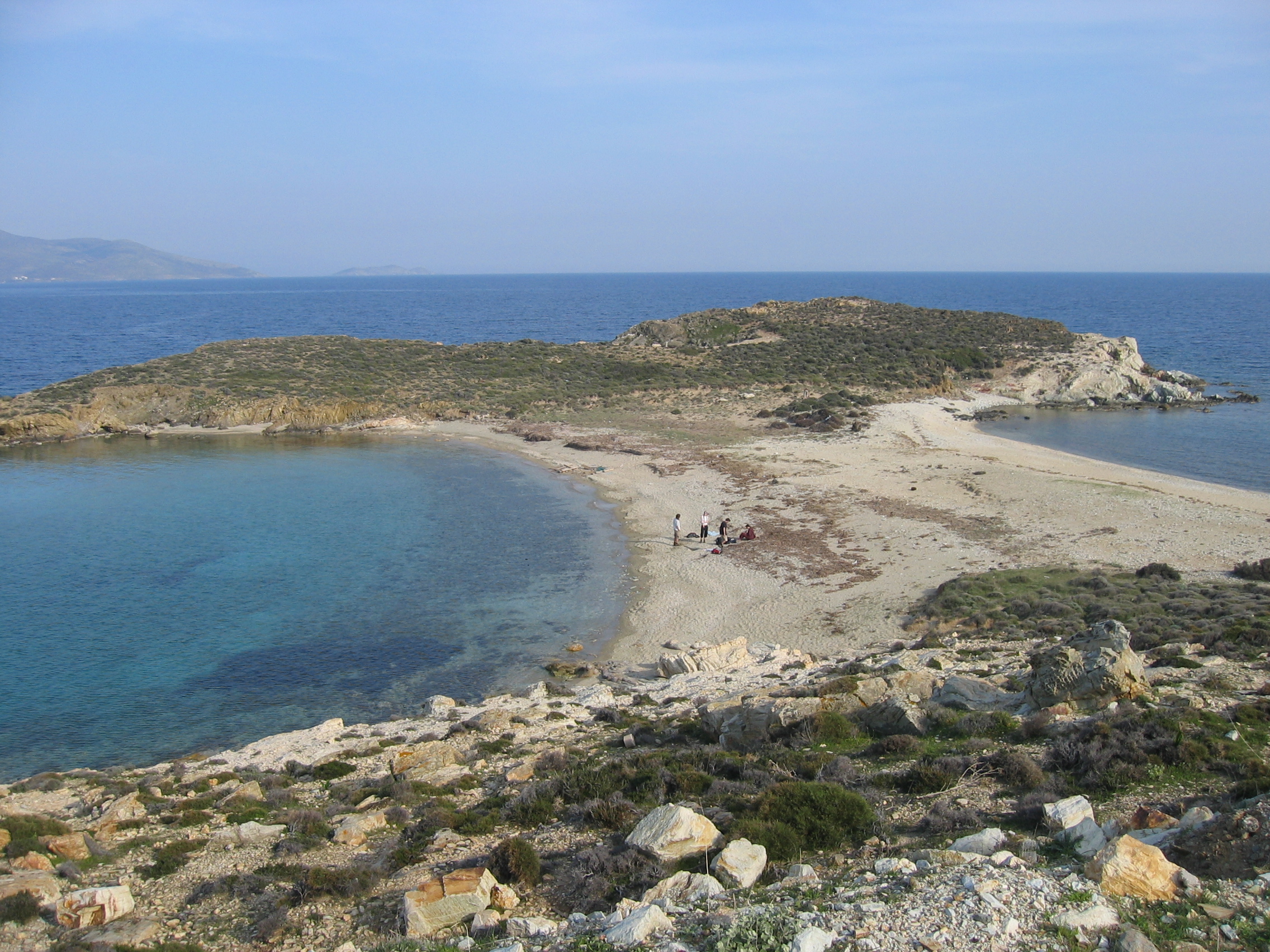
spit
a narrow and elongated coastal landform that forms as a result of the deposition of sediment, typically sand and gravel, by longshore drift; extends outward into a body of water; one end is attached to the mainland and the other extending into the water.
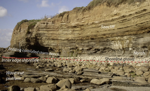
wave cut platform
a flat, relatively horizontal, and rocky seabed surface located along a coastal area; formed as a result of erosion/abrasion where the waves carry sand, pebbles, and larger rocks that wear down and erode the underlying rock surface.
tombolos
narrow strips of sand or gravel that connect an island to another piece of land; forms through the accumulation of sediment; can vary in size, shape, and length, depending on the specific coastal conditions and the rate of sediment deposition.
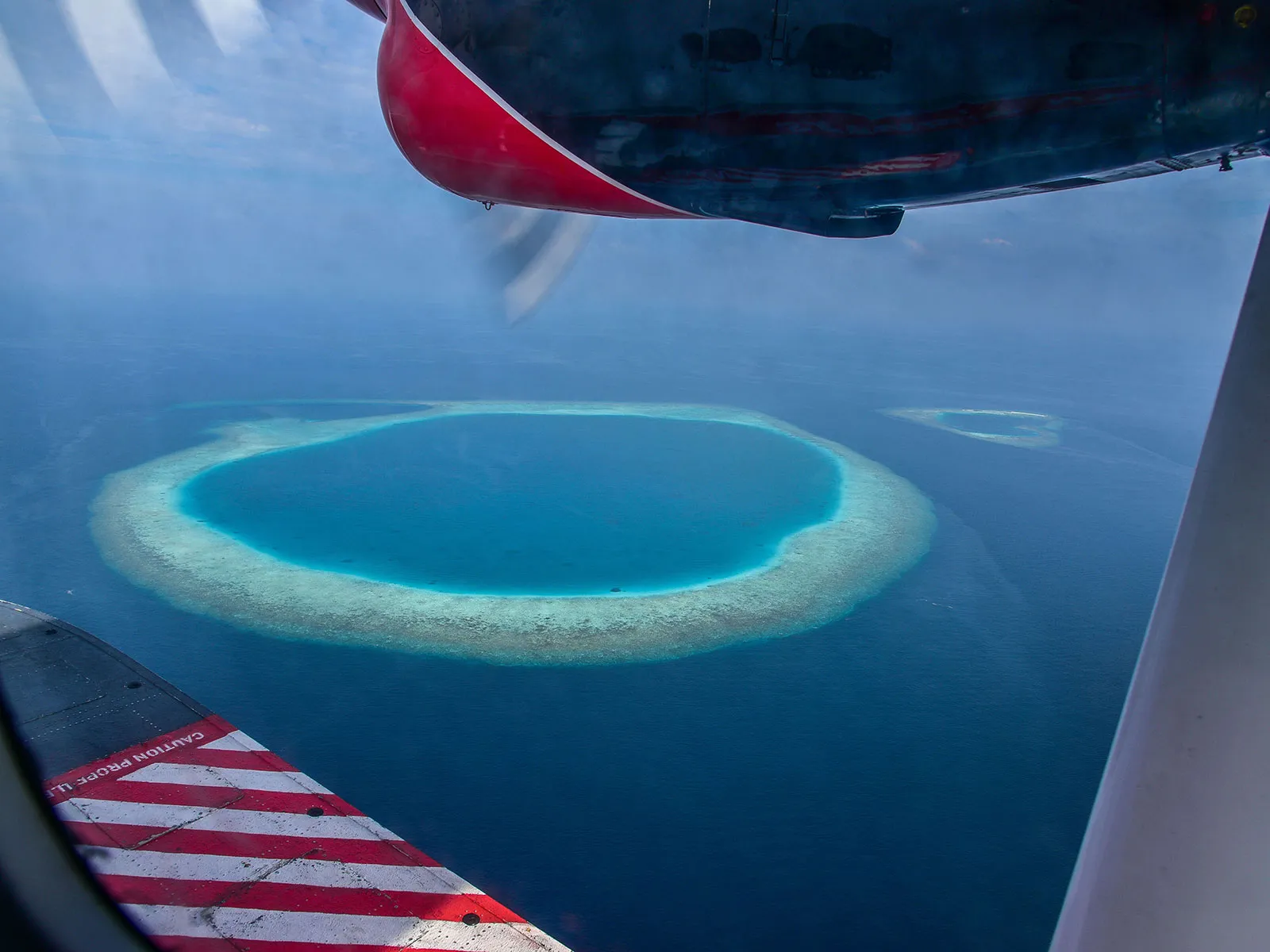
atolls
a ring-shaped coral reef or island that encircle a lagoon; found in tropical regions; formed by the growth of coral reefs around the rim of submerged volcanic islands. the central volcanic island erodes and subsides, leaving behind a lagoon surrounded by the coral reef.
infiltration rate
the rate at which precipitation or water from various sources enters the soil or ground surface and moves into the subsurface; determines how much water can be stored within the drainage basin, whether it sustains streamflow, and whether it reduces surface runoff