GEOG 181 Week 3
1/19
There's no tags or description
Looks like no tags are added yet.
Name | Mastery | Learn | Test | Matching | Spaced |
|---|
No study sessions yet.
20 Terms
What is the shape of the Earth?
Oblate spheroid
What shape can we use to represent Earth?
Ellipsoid
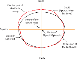
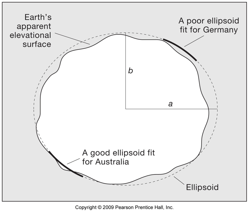
Why are there different types of ellipsoids to model the Earth?
Different ellipsoids were developed to fit different regions of the Earth
WGS 1984 ellipsoid
Developed for the global GPS system
What can we use to represent the lumpy surface of the Earth?
Geoid
Latitude
Measures our position north or south of the equator
Lines of latitude are called
Parallels of latitude
Average length of a degree of latitude
111km
Parallels of longitude run in what direction?
East and west, measuring 90° north or south of the equator
Longitude
Measures our position east or west of the prime meridian
Where is the prime meridian located?
Greenwich, England
Lines of longitude are called?
Meridians
Are lines of longitude parallel?
No, they converge at the poles
The length of one degree of longitude at the equator
111km
Length of one degree of longitude at a particular latitude
Length of 1º longitude = 111 km * cosine (latitude)
Great circles
Created by intersecting a plane with the centre of the Earth
Small circles
Created by intersecting a plane with Earth, not going through the origin
Loxodromes
A line of constant bearing or compass direction
The meridians of longitude represent how much of a great circle route?
Half
Datum
A mesh of reference points which translate positions indicated on maps to their real position on the surface of the Earth