Rock-It Science - Maps as Model - Unit 1
1/39
There's no tags or description
Looks like no tags are added yet.
Name | Mastery | Learn | Test | Matching | Spaced |
|---|
No study sessions yet.
40 Terms
International Date Line
longitude line 180 degrees east or west of the prime meridian
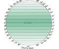
latitude
distance, measured in degrees, north or south of the equator
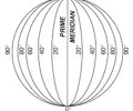
longitude
distance, measured in degrees, east or west of the
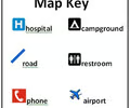
map legend
key that explains symbols on a map
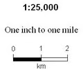
map scale
relates distances on a map to actual distances
map view
shows Earth's surface from above
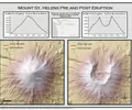
profile view
shows an object as though you were looking at it from the side
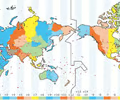
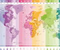
time zone
area on Earth where people use the same time; there are 24
aerial
operating or occurring overhead
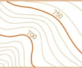
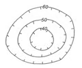
contour interval
topographic map line that connects points of equal elevation
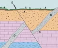
cross-section
a profile view that shows a vertical slice through rocks below Earth's surface
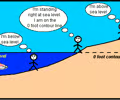
elevation
height above sea level
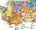
geologic map
shows the surface geology of an area
relief
difference in elevation between the highest and lowest point
remote sensing
collecting information about an area without being there
slope
measured steepness of the land; to calculate: elevation (rise) divided by distance (run)
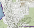
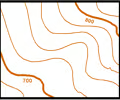
topographic map
shows detailed shapes and natural and human-made features of Earth's surface
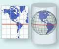
cylindrical projection
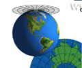
conical projection
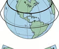
planar projection
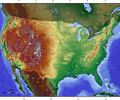
relief map
use shading and shadows to identify mountains and flat areas
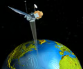
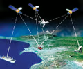
global positioning system
a group of satellites used for navigation; 3 satellites required to locate a point, a 4th satellite can give elevation
GPS
global positioning system
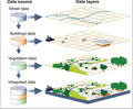
geographic information system
integrated, computerized information used to store and analyze map data and create digital maps
GIS
geographic information system
Landsat
series of satellites used to collect data about Earth's changing surface
OSTM/Jason
series of satellite missions used to determine ocean topography, circulation, sea level, tides, El Nino and La Nina events, and climate changes
SeaBeam
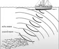
device that uses sonar to map the bottom of the ocean
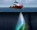
sonar
a system for the detection of objects under water and for measuring the water's depth by emitting sound pulses and measuring the time for their return
hachures
short lines drawn inside a closed loop indicate a depression or crater; point downslope
closed loops
contour lines never cross
index contour
heaviest contour lines, each labeled with elevation
sea level
the average elevation of the worlds ocean between high and low tide
ridges
contours point downslope
valleys
contours point upslope
topography
the shape and height and depth of the features of a place
compass
device having a magnetic needle that indicates direction on the earth's surface by pointing toward the north
point elevation
fall between contour lines on a map
meridian
an imaginary circle of longitude on the earth's surface passing through the north and south poles
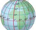
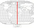
Prime Meridian
the meridian of 0° longitude from which other longitudes are calculated