Environthon Aquatics Manual Quizlet
 Call Kai
 Learn
Learn Practice Test
 Spaced Repetition
 Match
Match Flashcards
 Knowt Play
1/178

There's no tags or description
Looks like no tags are added yet.
Name | Mastery | Learn | Test | Matching | Spaced | Call with Kai | Chat |
|---|
No analytics yet
Send a link to your students to track their progress
179 Terms
the earth is ___ water
2/3
Aquiclude
May have water, but it is unable to allow water to pass through it due to low permeability (less so that's aquitard)
Percolation
water flows through the ground
Interflow
subsurface runoff - sideways movement of water in unsaturated zone
Throughflow
interflow that returns to the surface
Hydraulic head
mechanical energy available, Elevation head + Pressure head
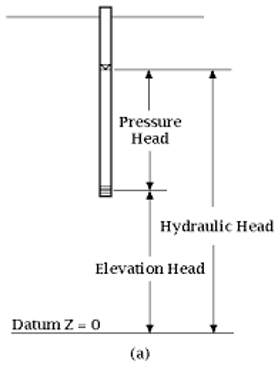
Potentiometric surface
surface that water would rise too if no pressure/confining surface
Soil Water
Water in unsaturated zone
As soil dries,
it is harder to remove water from it
The smaller the particles,
the more surface area = the more tension for equal amount of water
Aquitard
May contains water, but has poor permeability and allows water to pass through only at a slow pace (but faster than aquiclude)
Field Capacity/drained upper limit
soil moisture left in soil after being drained for a few days.
Wilting point
soil water content when plants start to wilt
Plant Available water
field capacity - wilting point
Soil moisture deficit
amount of water (in mm) needed to fill soil back up to field capacity
Catchment
area for which all the water flows into one river/stream
Divides
highest ridges that separate different catchments
Lotic
moving waters (rivers, streams)
Ephemeral rivers
river that only flows after rainfall
Substrate
type of substance on the bottom of the stream
Dendritic
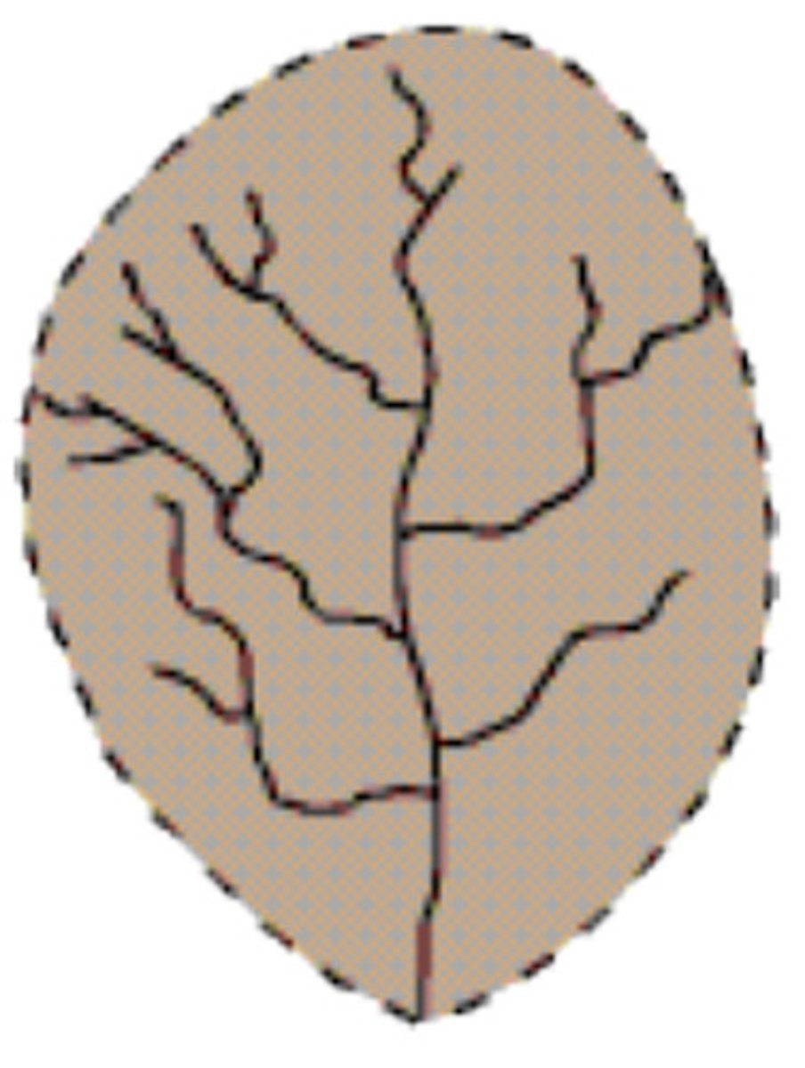
Where does dendritic river pattern form?
On uniform substrate with a gentle slope
Rectangular
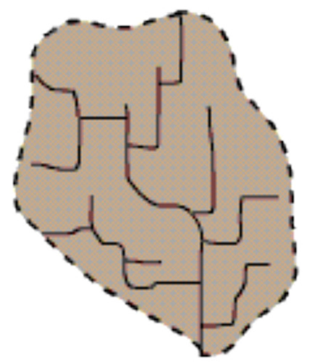
Where do rectangular river patterns form?
On substrate with rectangular joint
Trellis
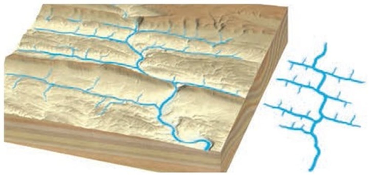
Where do trellis drainage patterns develop?
substrate with parallel ridges/valleys from folding
Parallel
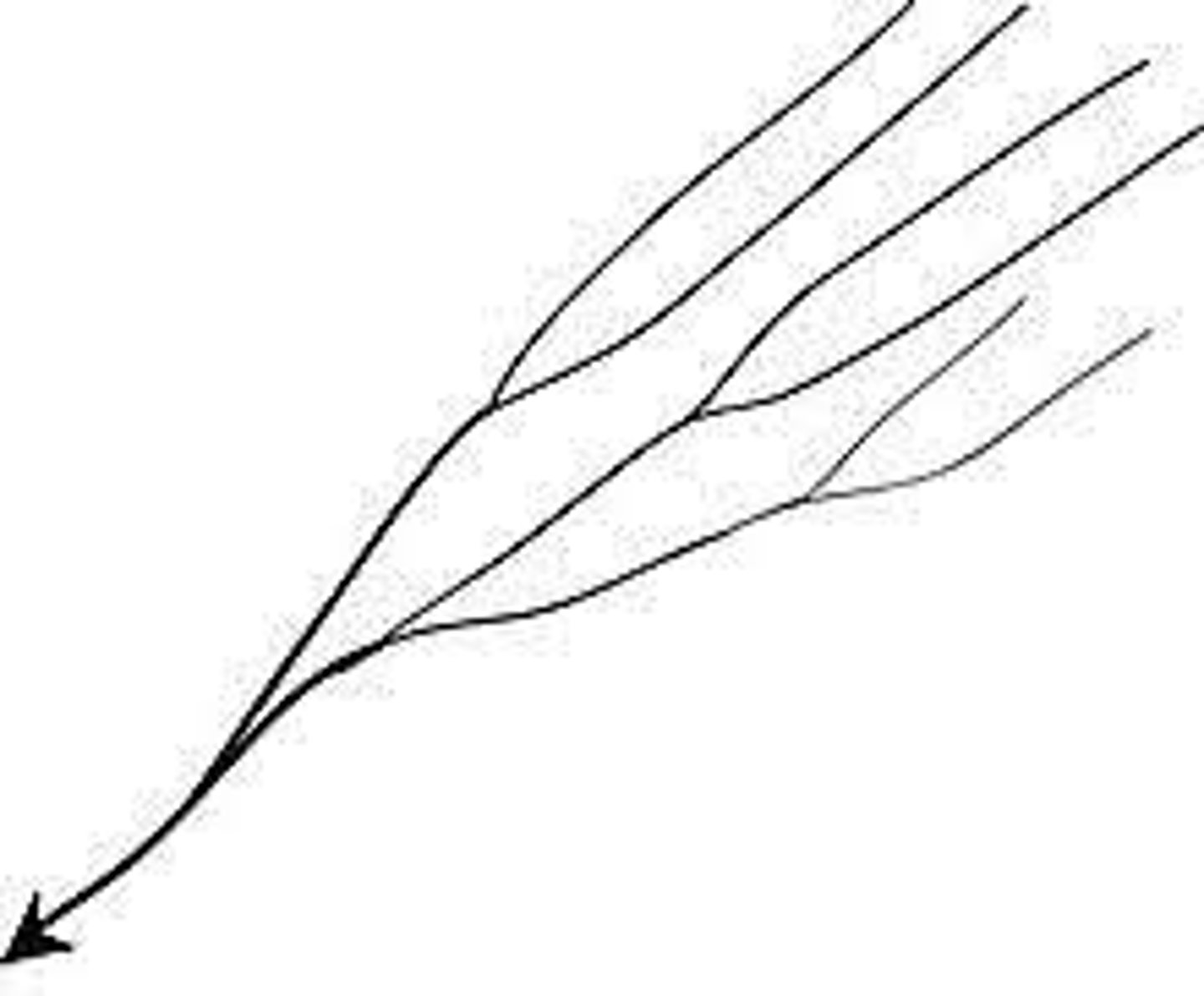
Where do parallel drainage patterns form?
on uniform steep slopes with weak substrate and no vegetation
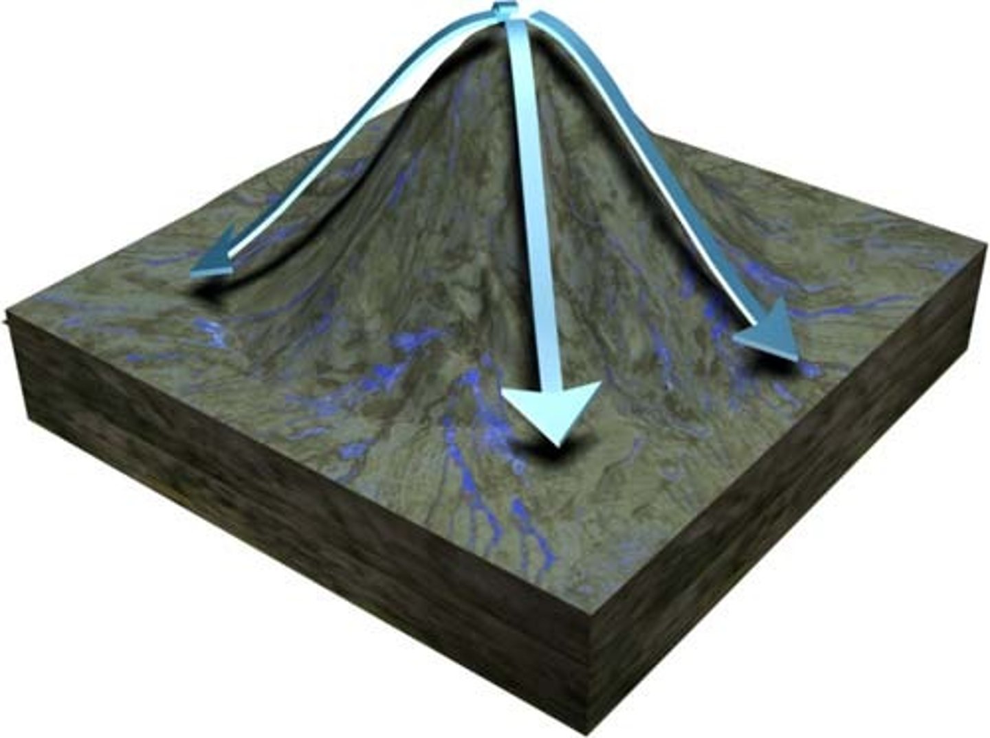
Radial
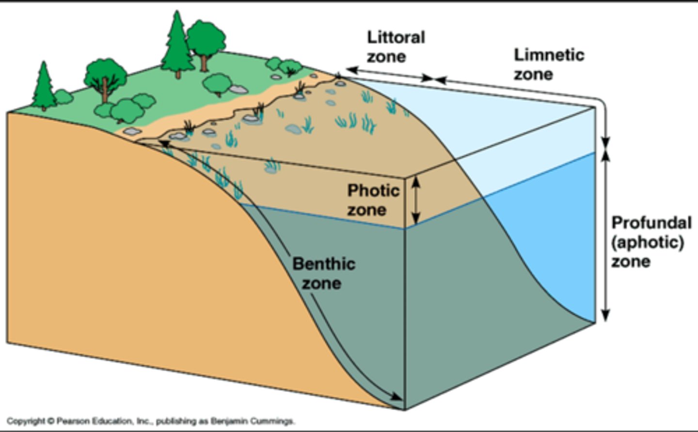
Draw the zones of a lake
Where do radial drainage patterns form?
on a volcano generally
Braided channel (generally have...)
generally have high sediment load, lots of bars that shift
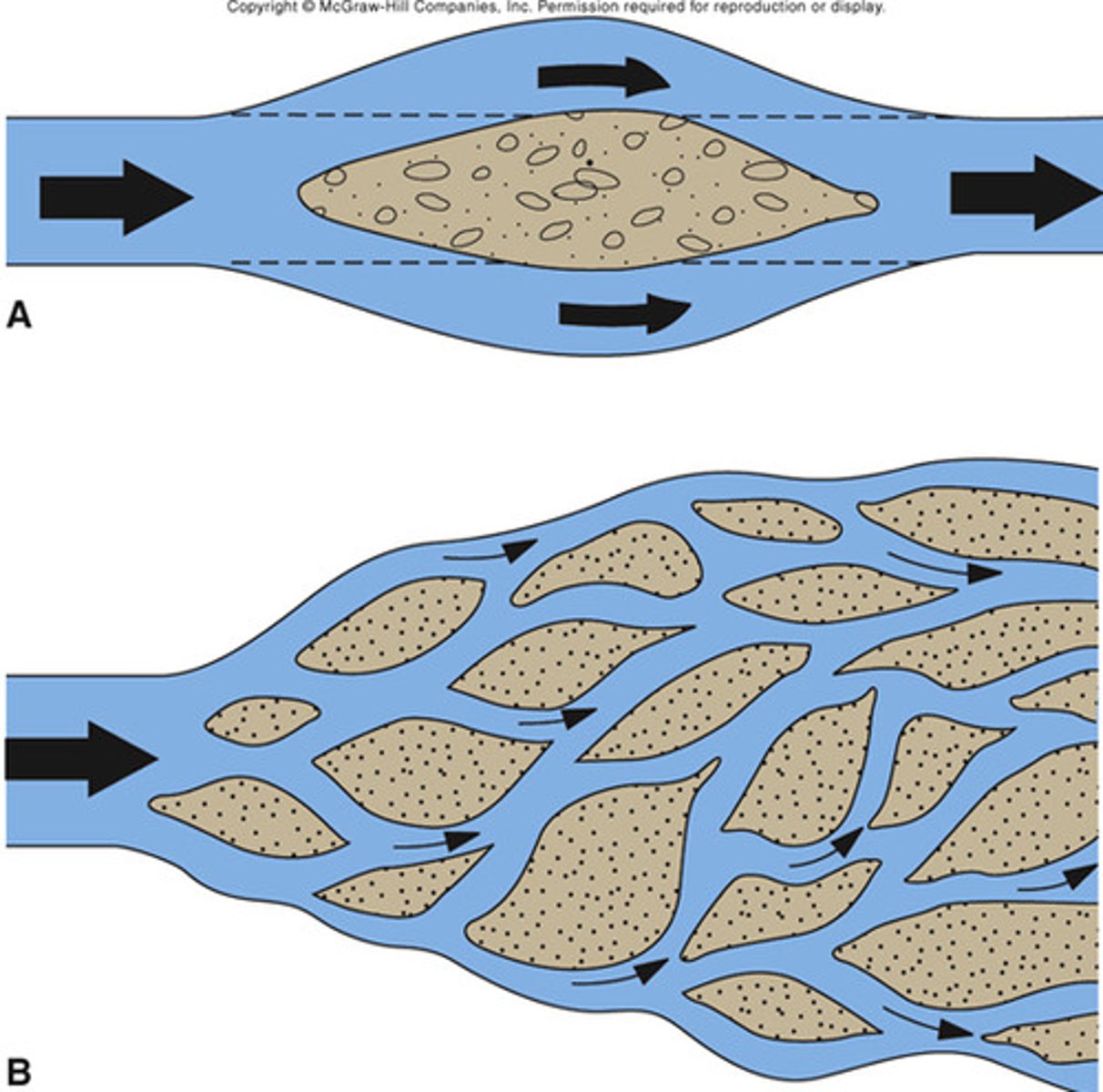
Where do braided channels develop?
once an alluvial fan is built streams flowing over its surface create braided channels
Alluvial fan
A fan-shaped deposit of sediment formed when a stream's slope is abruptly reduced
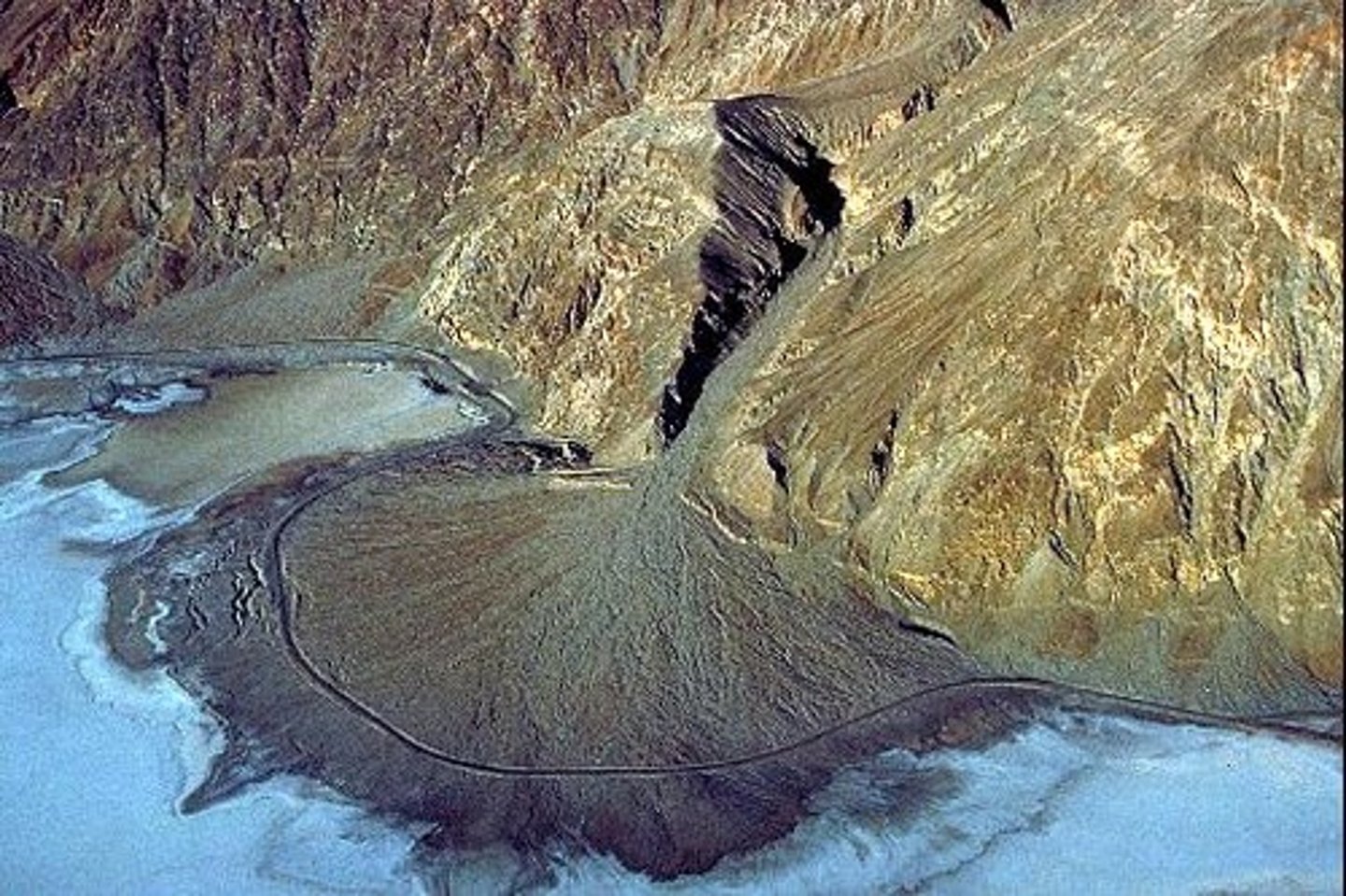
Meandering channel
most mature streams
River Continuum Concept
Shows interactions between watershed/bank and stream
Models how biological communities change as you move down a stream
proportion of the four functional groups change throughout continuum
River Continuum Concept classifications
Headwaters (orders 1-3)
Midreaches (orders 4-6)
Lower reaches (order >6)
allochthonous
Sediment that came from a different location
Autochonthous
Sediment "native" to the area
Headwaters - River continuum
shaded by thicker riparian canopy → limited photosynthesis
Dependent on allochthonous materials/heterotrophic
Temps more stable
Mid reachers
channel widens, increase in sunlight and temps
Shifts to autochthonous materials
Increased biotic diversity
Low reaches
increasingly reliant on phytoplankton, also organic particles from upstream
Increase in turbidity
Increased physical stability → more competition/reduced species richness
Ways streams can erode
Scour (from abrasion w/suspended sediment), Breaking and Lifting, Attrition, Dissolution
Attrition
process of erosion that occurs during rock collision and transportation
Stream carries sediment via
Dissolved Load, Suspended Load, Bed Load (saltation)
Competence
largest size particle river can carry. Dependent only on velocity
Capacity
total volume of particle river can carry. Depends on discharge
When does deposition happen?
river no longer has the competence to carry sediment
Headwaters
erosional zone, streams are fast and cut v-shaped valleys
Transfer zone
amount of erosion= amount of deposition
Depositional zone
at low elevations, sediment deposited and river meanders
Base level
how far down stream can erode. Ultimate base level = the ocean
Does discharge and velocity increase/decrease as you go downstream?
increase
Photic
light can pass through, photosynthesis occurs
Aphotic
no light
Limnetic
well-lit, open surface waters farther from shore, depth to which sunlight can penetrate the water
Benthic
the lake bed
Lakes in Fall
surface is cooled. lake becomes isothermal and overturns
Lakes in Winter
surface is cooled and ices over. Coldest water & ice at top, warmer water at bottom
Lakes in Spring
surface is warmed to 4C, lake becomes isothermal, overturns
Water is densest at what temperature?
4C
Isothermal
having a constant temperature
Consequences of Stratification
deeper waters (hypolimnion) can become hypoxic or anoxic, deeper waters can accumulate toxic gasses (ie H2S as a result of anaerobic decomposition)
Overturning
mixes the water, giving the deeper waters oxygen, and bringing nutrients to the shallow waters. If this happens to fast, could kill life because the toxic gasses are introduced too quickly
What are wetlands (Manual definition)
any area saturated for at least part of the year, with hydric soils and a special vegetational type
common flora and fauna in marshes
Pickelerweed, bulrush, cattail
egret, muskrat
common flora and fauna in swamps
red maple, black willow, aspen, cottonwood
snapping turtle, muskrat
common flora and fauna in fens
sphagnum moss, sedges
voles, shrews, muskrat
what is the name of the wettest area of a fen
sedge flat
common flora and fauna in bogs
sphagnum moss, bog turtle, muskrat
common flora and fauna in vernal pools
Wood Frog. Blue-spotted Salamander. Spotted Salamander. Jefferson Salamander. Marbled Salamander.
Rice Cutgrass
common flora and fauna in
What makes a wetland?
Hydrophytic vegetation, Hydric soils. Gleyed from reduction. Gray to black <2 chroma, Hydrology: look for water @ the surface, channels, etc. <6.6 ft of water
How are wetlands formed
Either paludification or terrestrialization
Paludification
generally with bogs, moss grows and traps water
Terrestrialization
lake gets more eutrophic over time, gets shallower, accumulates nutrients, more vegetation
8 Wetland benefits
-Improved water quality: filters out pollutants
-Reduces sedimentation
-controls erosion
-Flood Control: wetlands slow water and store it
-Water Supply: helps recharge groundwater
-Habitat: provides habitat for many endangered species., Important nurseries for fish and resting areas for migratory birds,
-Economic Benefits: timber, mammals, birds, shellfish,
-Recreation: for people (a lot of birders help economy), education, research
-Important in nutrient cycling, provides an anaerobic environment which is needed for many processes
TYPES OF ESTUARIES by geology/formation
Tectonic Estuaries
Bar Built Estuaries (lagoons)
Fjord-Type/Glacial
Coastal Plain/Drowned River Valley
TYPES OF ESTUARIES by stratification
Vertically Mixed
Partially Mixed
Stratified Salt Wedge
Stratified Fjord Type
Hypersaline
Estuarine Circulation
freshwater flows at surface from head to mouth, saltwater flows subsurface from mouth to head.
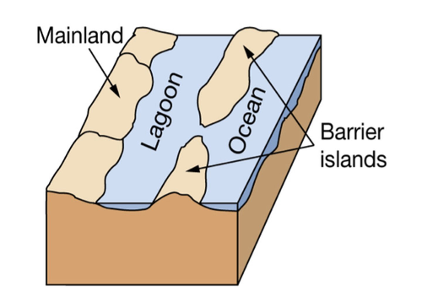
Bar-built estuary
lagoon separated from ocean by sand bar or barrier island
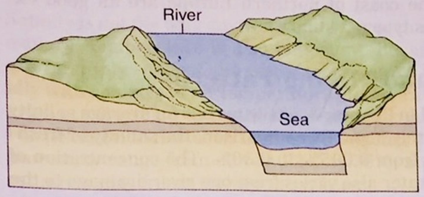
Tectonic estuary
an estuary formed when a depression along a fault line fills with water (e.g. San Francisco Bay)
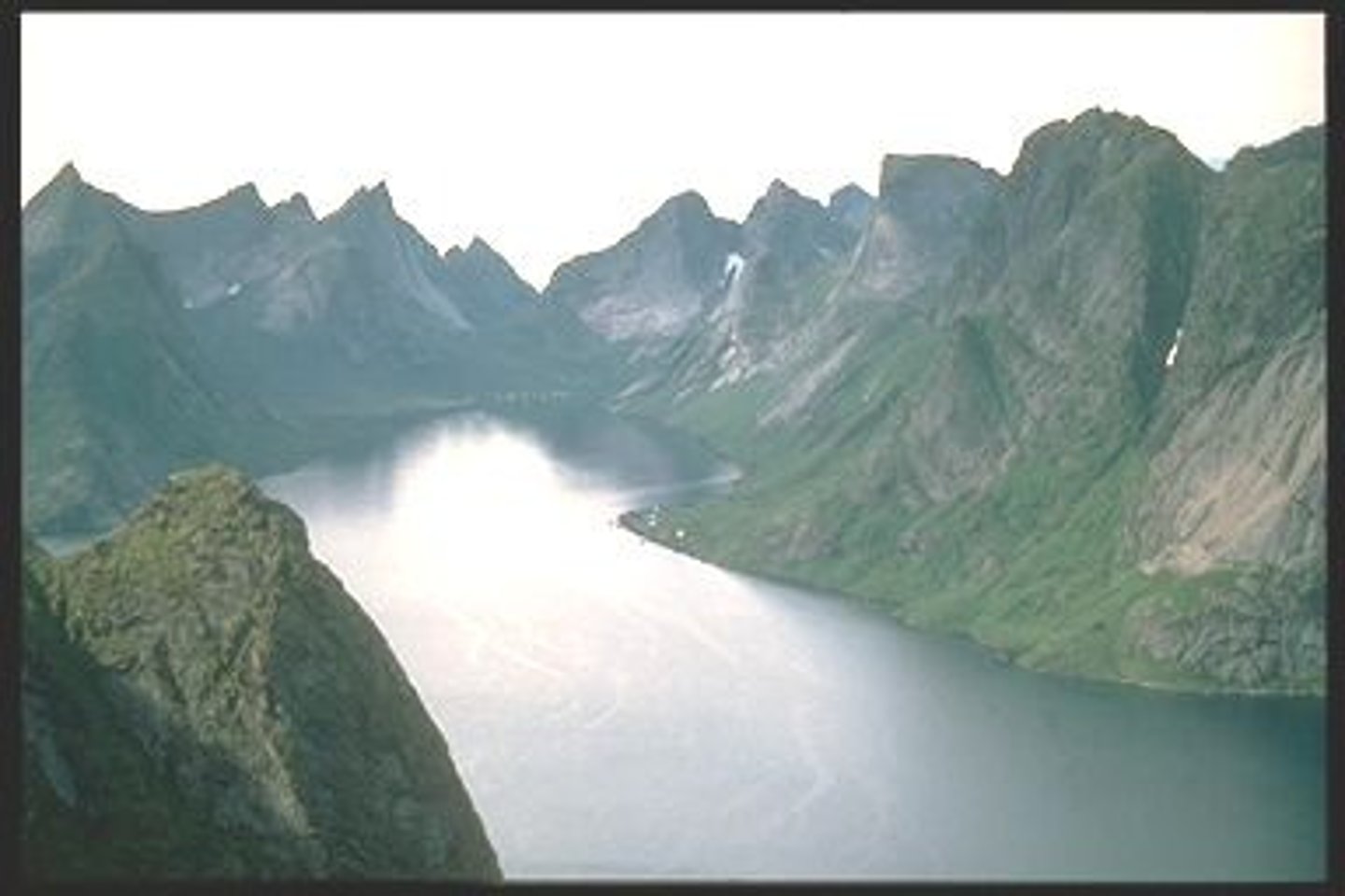
Fjord
a narrow inlet of the sea between cliffs or steep slopes
Pelagic
open water in the middle of a lake
Profundal Zone
deep water below light penetration level
photic
sunlit upper waters from surface to where light dims to 1% of the surface
____% is ocean water
____% is fresh water
97
3
Fresh water:
icecaps and glaciers ___%
Groundwater ____%
Accicable water ____%
79
20
1
Water cycle
evaporation/transpiration, condensation, precipitation
transpirtation
process by which H2O is lost through the stomata of the leaves, 90% of all water taken in by the is transpired
water table
highest level of saturated zone
vadose zone/ unsaturated zone
above water table w/out groundwater
Saturated zone
the area of permeable rock or soil that is totally filled or saturated with water
Capillary fringe
region above the water table with water drawn up by capillary action (from dipole-dipole attraction)
Aquifer
a body of permeable rock underground that can contain or transmit groundwater.
unconfined vs confined aquifer
influenced by surface vs between two aquitards and ergo can't be controlled by surface conditions
Porosity
Percentage of open space : total volume of rock
permeability and its factors
ability to transmit a fluid
factors: size of rock & connection of pore space
Infiltration and factors
the process by which water on the ground surface enters the saturated zone
permeability, porosity, gravity & water pressure difference (high pressure/gravity moves to low pressure/gravity)
Laminar vs. Turbulent Flow
Smooth vs chaotic and unpredictable
smooth bed vs rocky & high erosion of channel by suspended load