GCSE AQA Rivers
5.0(1)
Card Sorting
1/50
Last updated 3:35 PM on 10/30/22
Name | Mastery | Learn | Test | Matching | Spaced | Call with Kai |
|---|
No analytics yet
Send a link to your students to track their progress
51 Terms
1
New cards
Source
The place where a river starts, usually in an area of highland.
2
New cards
Mouth
The place where the river ends, where it meets the sea.
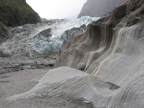
3
New cards
Watershed
An area of highland which separates 2 drainage basins, it marks the boundary between them.
4
New cards
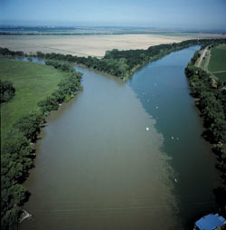
Tributary
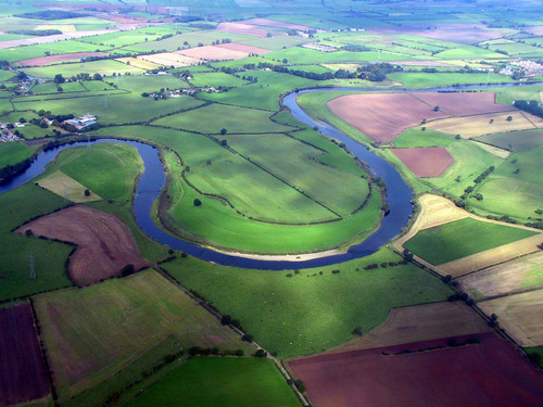
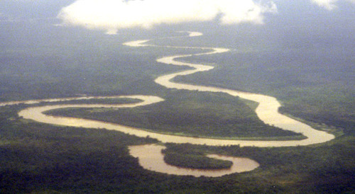
A smaller river which joins a larger river.
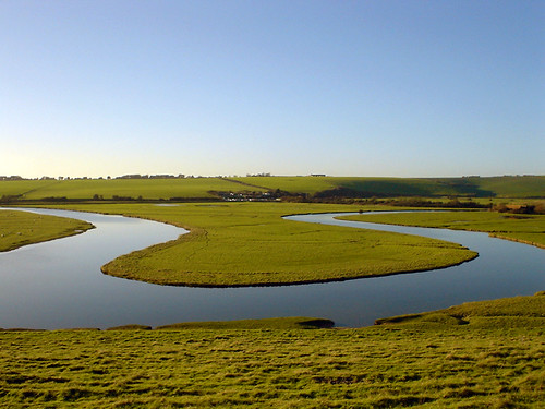
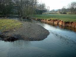
5
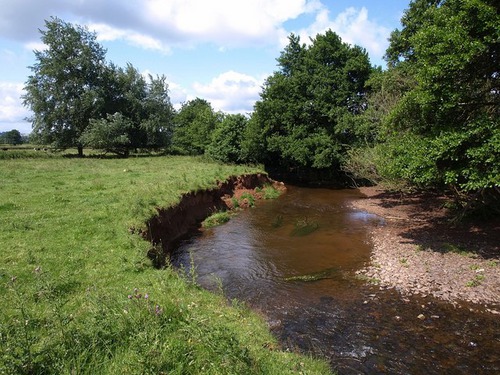
New cards
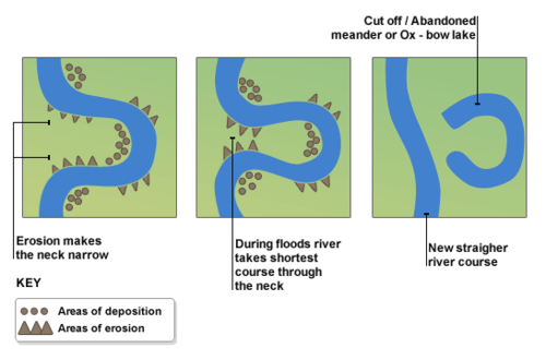
Confluence
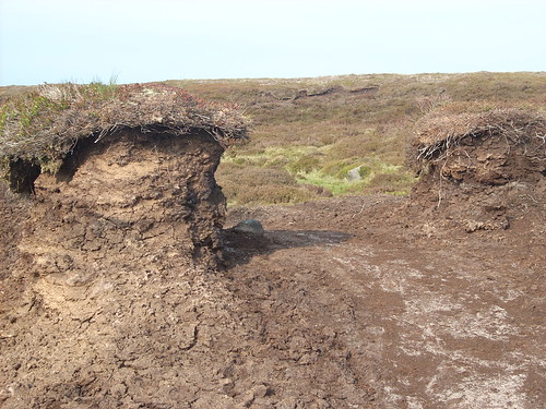
The point at which 2 rivers meet.
6
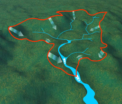
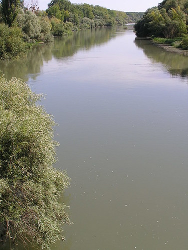
New cards
Catchment
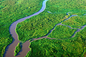
The area where water drains into a drainage basin.
7
New cards
Drainage basin
The area of land drained by a river.
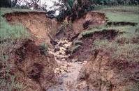
8
New cards
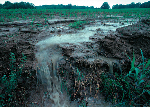
Surface run-off
When water flows over a hard surface (e.g. a river)
9
New cards
Condensation
When a gas cools and turns into a liquid. This forms clouds at high altitudes.

10
New cards
Transpiration
When plants release water vapour from their bodies (or more specifically the stomata in their leaves).
11
New cards
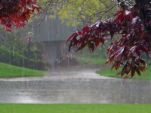
Precipitation
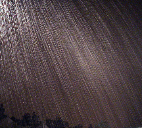
The fancy word for rain, sleet, snow, hail etc
12
New cards
Evaporation
When a liquid turns to a gas and rises.
13
New cards
The Hydrological (Water) Cycle
This cycle shows how water moves between the land, seas and atmosphere via precipitation, evaporation etc

14
New cards
Discharge
The volume of water in the river, measured in cumecs (m3/sec).
15
New cards
Upper course
This is the name given to the start of a river's journey, here it is small, youthful and full of energy.
16
New cards
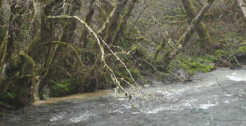
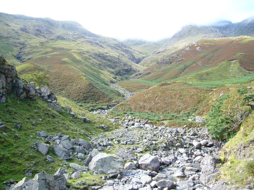
V-Shaped valleys
These are features formed in the upper course of a river due to downwards erosion. The characteristic shape of these features gives the name.
17
New cards
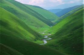
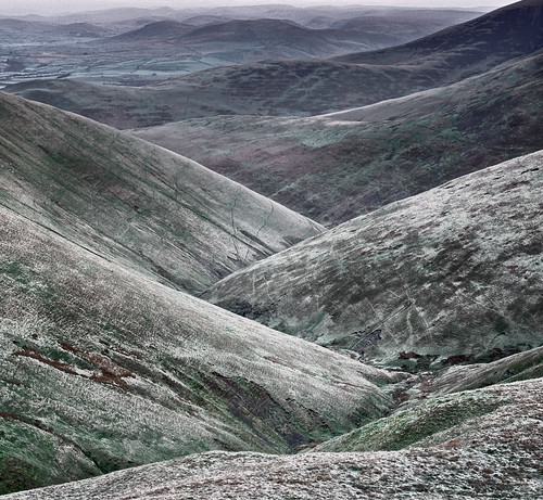
Interlocking spurs
These are features formed in the upper course of the river as it flows downhill and winds its way between more and less resistant rock.
18
New cards
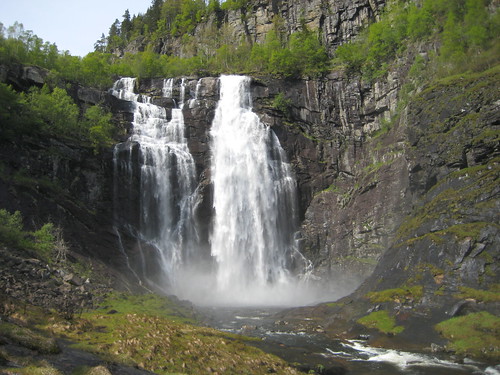
High Force, River Tees
This is the name of the largest waterfall in the UK and the river which creates it.
19
New cards
Waterfalls
These are features formed in the upper course of a river when it flows over two types of rock with different resistances. The less resistant rock is cut back more quickly than the more resistant rock and a plunge pool is formed. These retreat upstream when the soft rock is eroded away, creating overhangs which collapse due to gravity.
20
New cards
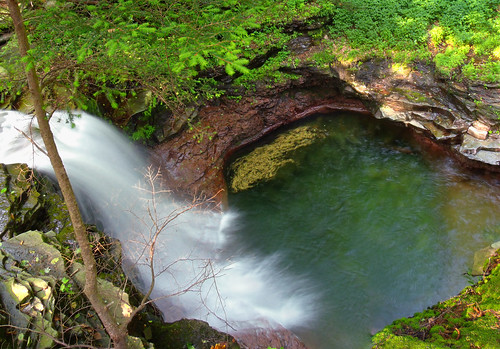
Plunge pool
This is a feature formed at the bottom of a waterfall, it is created by the force of the water hitting the riverbed. It is deepened by corrasion between the boulders.
21
New cards
Steep-sided gorge
This is a feature left behind when a waterfall retreats upstream.
22
New cards
Vertical erosion
This is the type of erosion that occurs mostly in the upper course of a river, after it has used most of its energy to overcome the force of friction.
23
New cards
Lateral erosion
This is the type of erosion that occurs mainly in the lower course of a river, it is erosion in a sideways direction.
24
New cards
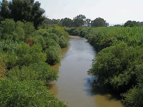
Middle course
This is the middle section of the river's journey.
25
New cards
Meanders
Bends in the river that occur in the middle course.
26
New cards
River beach/slip-off slope
This is a feature formed on the inside bend of a meander due to deposition (due to low velocity and high friction).
27
New cards
River cliff
This is a feature formed on the outside of a meander where the thalweg erodes the banks through hydraulic action and corrasion.
28
New cards
Meander migration
This is the name of the process in which a meander moves and becomes more exaggerated due to constant erosion and deposition.
29
New cards
Erosion
This is the destructive action of the water in the river which wears away land.
30
New cards
Ox bow lakes
This is a feature formed when the neck of a meander narrows so much that the river simply cuts through in times of flood (as it is a more direct route out to sea).
31
New cards
Lower course
This is the last section of a river's journey, here it is large and fast.
32
New cards
Levees
These are natural barriers formed by the continuous flooding of a river on to the flood plain. The river deposits heavier materials such as clays and the front and lighter materials like silt at the back. Over time, these features form.
33
New cards
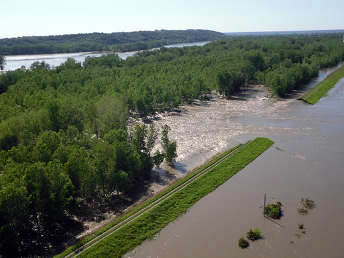
Floodplain
This is a feature formed when the river floods and deposits sediment. These are usually very fertile.
34
New cards
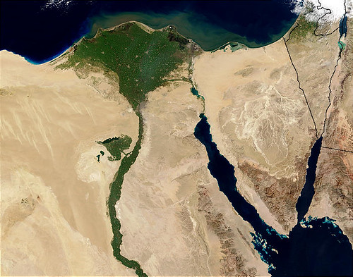
Deltas
These are features formed by huge quantities of sediment being deposited at the mouth of a major river such as the Nile. For these to form you need a small tidal range, low wave energy and large amounts of sediment.
35
New cards
River capacity
How much water the river can hold.
36
New cards
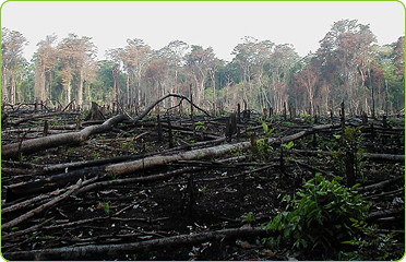
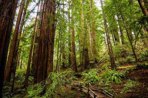
Deforestation
This is a human cause of flooding, when people remove trees and reduce interception.
37
New cards
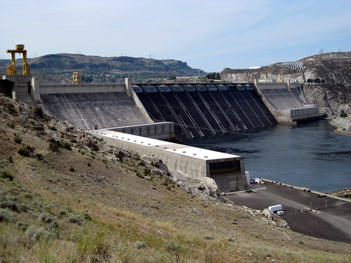
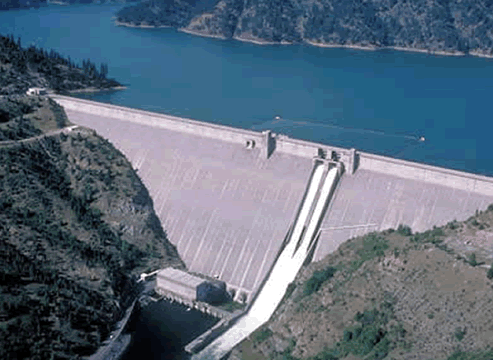
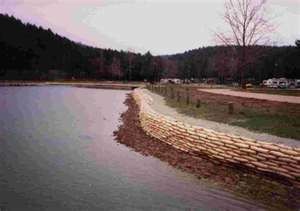
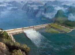
Dams
These are a device used to store water, if they burst it can cause a catastrophic flood. They are also a type of hard engineering technique which holds back water in times of flood.
38
New cards
Impermeable rock
This is a physical cause of flooding; it is a type of rock that does not allow percolation so increases surface run off.
39
New cards
Saturated ground
This is a physical cause of flooding; this is when the ground becomes so soaked with water that it cannot hold any more and increases surface run off.
40
New cards
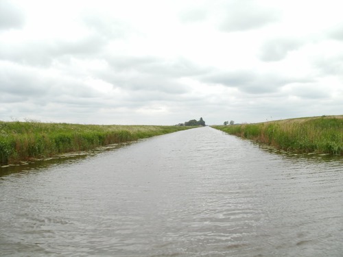
Hard engineering
A type of technique that interrupts and works against nature e.g. channelisation.
41
New cards
Soft engineering
A type of technique that uses nature against itself e.g. afforestation.
42
New cards
Flood relief channels
This is a type of hard engineering technique which alters the course of a river to divert flood water away from settlements. Is expensive but very effective.
43
New cards
Embankments
This is a type of hard engineering technique, they are raised banks along the side of a river which increase channel capacity and prevent bank erosion. These can be used as walkways by pedestrians but can be ugly.
44
New cards
Channelisation
This is a type of hard engineering technique in which the river channel is straightened or deepened to allow it to carry more water out to sea faster. This is very long lasting and effective but can lead to a greater risk of flooding downstream.
45
New cards
Flood defences
These are techniques and devices installed to protect against floods.
46
New cards
Flood walls
This is a type of hard engineering technique in which a wall is constructed to form a barrier against the flood water.
47
New cards
Floodplain zoning
This is a type of soft engineering technique. The local council examine the flood risks in different areas and prevent buildings in theses areas (e.g. on a flood plain). This can aggravate the problem of housing shortage but lessens surface run off.

48
New cards
Washlands
This is a type of soft engineering technique in which certain areas of land are allowed to flood naturally to prevent flooding in other areas. These can become fertile farmland but cannot be used as they flood too often.
49
New cards
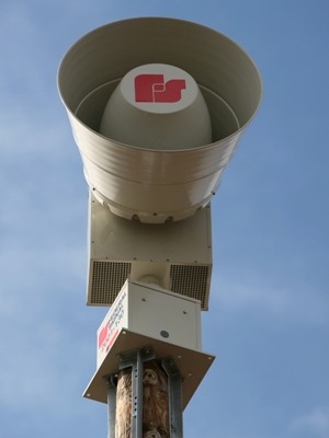
Warning systems
This is a type of soft engineering technique which warns residents of an imminent flood. This is a very cheap flood defence but can be vandalised.
50
New cards
Afforestation
This is a type of soft engineering technique. Trees are planted in the catchment area to increase interception. This is a cheap method of reducing flooding but can increase fire risk.

51
New cards
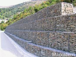
Gabions
These are a type of hard engineering technique. Wire cages are filled with rocks resistant to erosion and are placed along the banks of the river. They also reduce erosion but are ugly.