Key Geographic Concepts and Map Types
1/68
There's no tags or description
Looks like no tags are added yet.
Name | Mastery | Learn | Test | Matching | Spaced | Call with Kai |
|---|
No analytics yet
Send a link to your students to track their progress
69 Terms
Map
A two-dimensional (flat) representation of a geographical area
Data aggregation
The process of collecting and organizing large amounts of information
Spatial perspective
A geographic outlook that seeks to identify and explain the uses of space
Spatial patterns
The placement or arrangement of objects on Earth's surface
Time-distance decay
Near things are more related than distant things, and interaction between two places decreases the farther apart they are
Map symbols
Graphic elements that help organize the information in the map
Legend
Explains the meaning of map symbols and colors. Usually presented in a box in a corner of the map
Compass rose
A drawing that shows the map's orientation and the four cardinal directions of north, south, east, and west. Usually found at the edge of a map
Scale
Ratio between the map and the distance on the earths surface
Topographic map
A graphic representation of the three-dimensional configuration of Earth's surface. Shows the natural or physical features of a landscape, including its elevation
Reference maps
Emphasize geographic locations on Earth's surface
Thematic maps
Emphasize spatial patterns of geographic statistics or attributes
Choropleth map
Shows data aggregated for a specific geographic area, typically a political unit such as a country, province, or state
Electoral College
A body of people representing the states of the US, who formally cast votes for the election of the president and vice president
Food deserts
Locations in which most or all of the population struggles to access - or afford - enough nutritious food
Climate Change
The long-term changes in global temperatures and other characteristics of the atmosphere
Cartogram Map
Distorts the geographic shape of an area to show the size of a specific variable, such as the birth rate or the unemployment rate
Dot density map
Simply and effectively shows density differences in geographic locations across a map
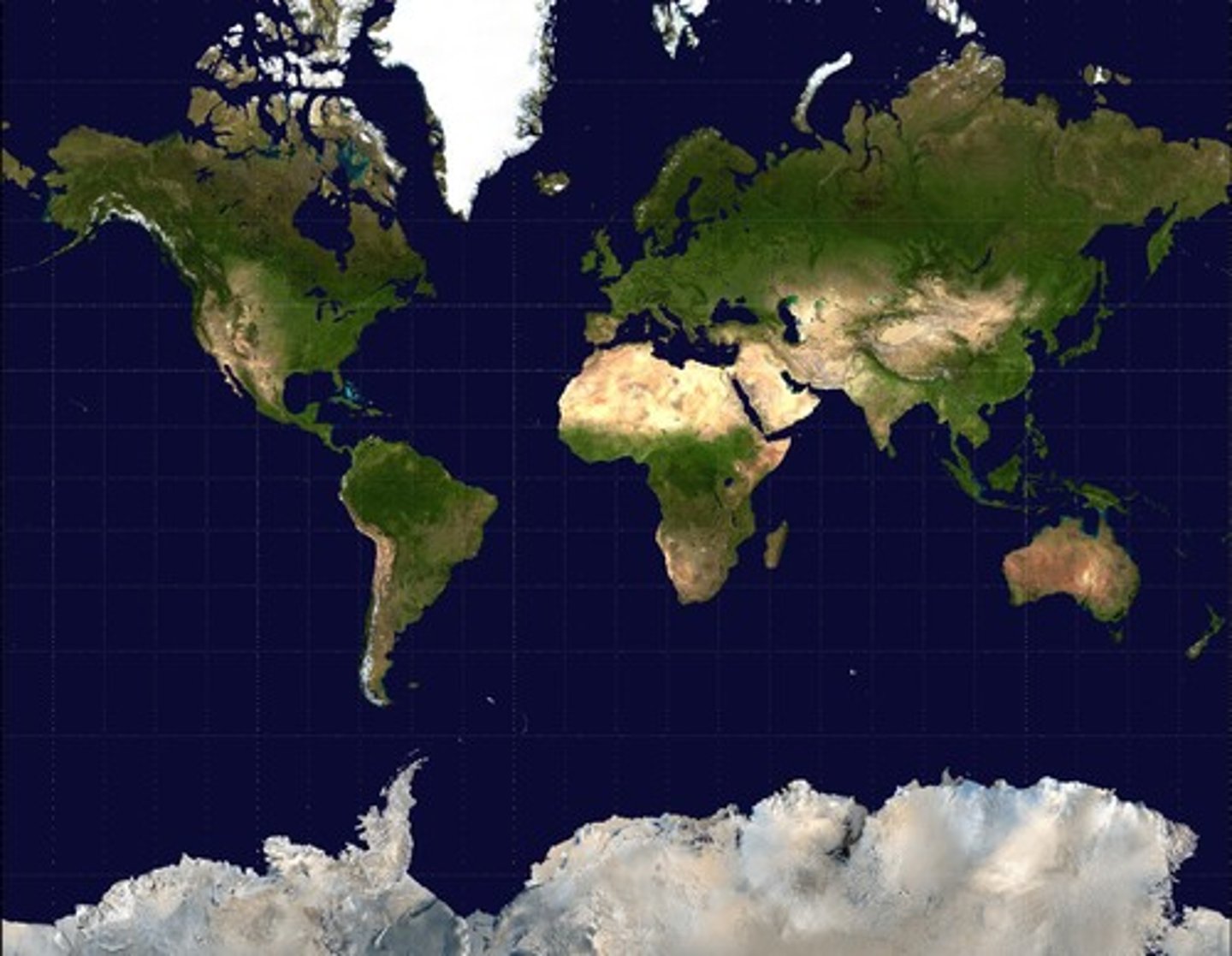
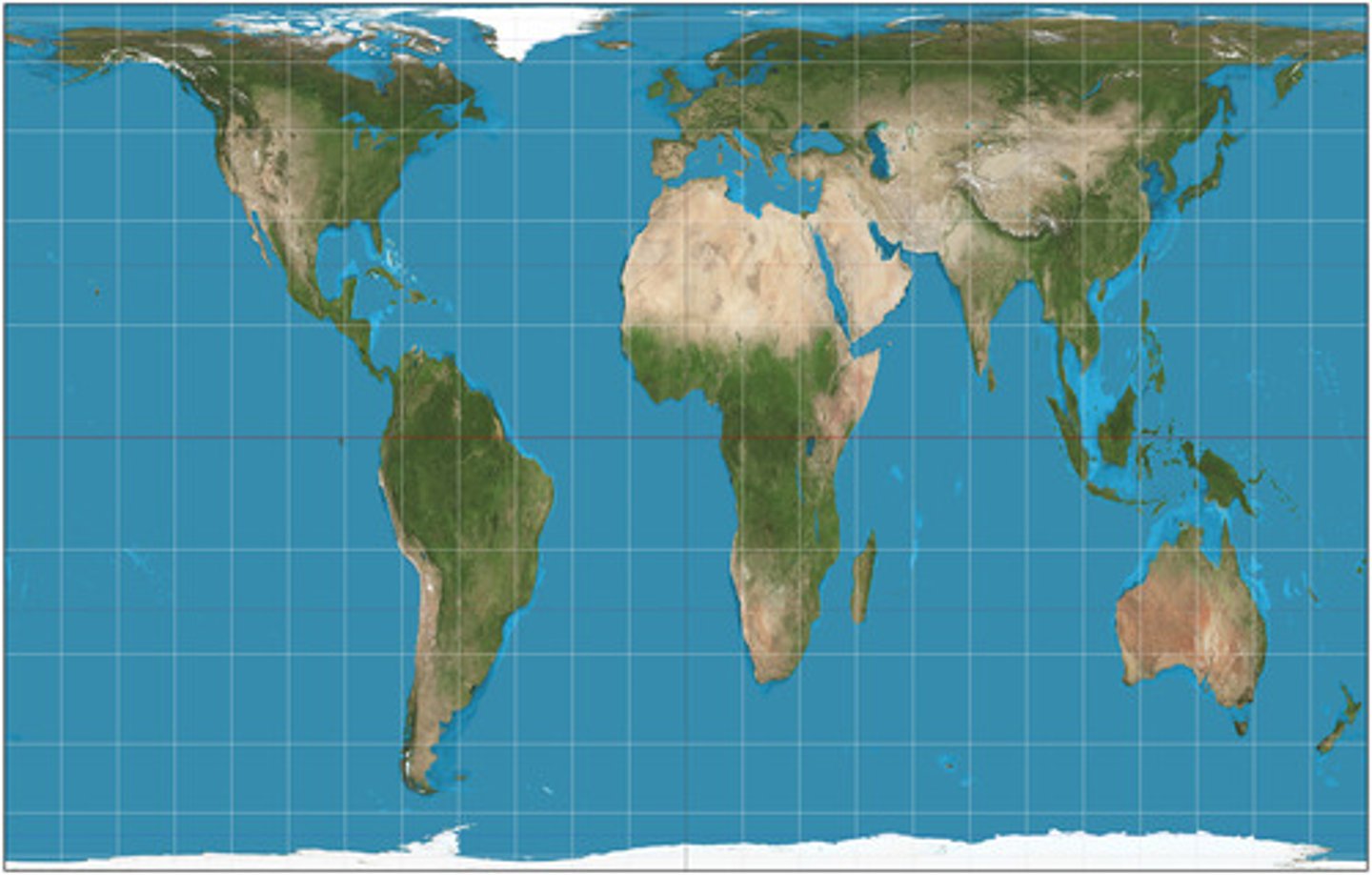
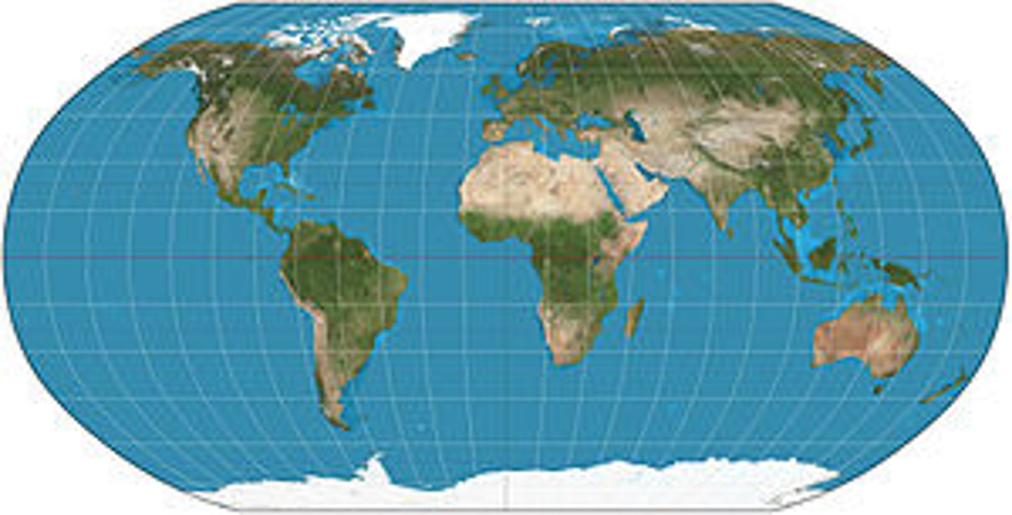
Map Projection
Represents the surface of Earth or a celestial sphere on a plane (two-dimensional) surface
Census
An official count or survey of a population, typically recording various details about individuals, such as age, sex, and race
Absolute location
Precise position on Earth's surface. The intersection of your latitude and longitude pinpoints your exact location
Aerial photography
Produces fine-grained, high-resolution, highly detailed images
Satellite imagery
Images of Earth's surface gathered from sensors mounted on orbiting satellites
Geographic Information System (GIS)
Software application for capturing, storing, checking, and displaying data related to positions on earths surface.- Ex display of hotels, restaurant's, gas stations.
Remote Sensing
the scanning of the earth by satellite or high-flying aircraft in order to obtain information about it.
Cartography
The science of making maps
Spatial Perspective
a way of looking at the human and physical patterns on Earth and their relationships to one another
Mercator Projection
a map projection of the earth onto a cylinder
Peters Projection
a rectangular map projection that maps all areas such that they have the correct sizes relative to each other.
Robinson Projection
A map projection of a world map which shows the entire world at once.
lattitude lines
Horizontal, measure east-west
Longitude Lines
Vertical, north-south
Space
Areas we occupy as humans, physical gap or distance between objects
Place
Refers to how we modify space based on who we are as a group of people.
Cultural Landscape
the visible imprint of human activity and culture on the landscape
Globalization
Actions and conditions in one place are increasingly linked to actions and conditions in other places around the globe.
Interdependences
Refers to the ties established between regions and countries that over time collectively create a global economic system.
Difussion
the spreading of ideas
Expansion
the act of spreading and ideas as well as increasing knowers and areas of occurrence
Hierarchical Diffusion
Occurs when ideas leapfrog from one important person, community, or city to another, bypassing other persons , communities, or rural areas
reverse hierarchical diffusion
Occurs when ideas leapfrogs from lower level of hierarchy to a higher level
Contagious Diffusion
The rapid, widespread diffusion of a feature or trend throughout a population. without regard for hierarchy
Stimulus diffusion
accepting underlying principle, even though a specific characteristic is rejected.
Relocation diffusion
The spread of a feature or trend through bodily movement of people from one place to another.
friction of distance
the inhabiting effect of distance on the intensity an volume of most forms of human interaction
natural resources
Raw materials supplied by nature, used for economic gain
Nonrenewable resources
are available on earth in limited quantities, cannot be renewed at a certain point.
Environmental sustainability
ensuring the natural environment is used in a way that will preserve resources into the future
environmental determinism
A doctrine that claims that cultural traits are formed and controlled by environmental conditions.
Possibilism
The theory that the physical environment may set limits on human actions, but people have the ability to adjust to the physical environment and choose a course of action from many alternatives.
Geographic Scale
the geographic level of the area(s) under investigation
Global scale
Interactions occurring at the scale of the world, in a global setting.
regional scale
Interactions occurring within a region, in a regional setting.
national scale
as viewed across the whole country
local scale
A spatial scale that is essentially equivalent to a community.
other study tools...
-complete blank packet
-define words (word pyramid quiz)
Situation
the location of a place relative to other places
Distribution
The arrangement of something across Earth's surface.
site
physical characteristics of a place
space-time compression
reduction in the amount of time it takes for something to reach another place.
Concentration
The spread of something over a given area.
Density
The frequency with which something occurs in space
Connections
Relationships among people and objects across space
Diffusion
the way phenomena, ideas, and technology travel over space
MDC
more developed country, generally wealthier
LDC
less developed country, generally poorer
Formal Region
well-defined areas that share a common attribute such as language, culture, religion, or economic activity, there is no disagreement over the area a formal region occupies
functional region
a type of region defined by a specific social or economic attribute (a node) that is often based in the center of the region as a type of focal point - EX: school district
perceptual region
areas defined by perception and feelings rather than based on objective geographic characteristics - E: silicon valley, midwest