Movement System and SWOT Analysis
1/43
There's no tags or description
Looks like no tags are added yet.
Name | Mastery | Learn | Test | Matching | Spaced | Call with Kai |
|---|
No analytics yet
Send a link to your students to track their progress
44 Terms
Movement Systems
- Pedestrian
- Road layouts
- Vehicular circulation
Pedestrian
An important facet of architectural and urban design
Attractors
objects which distract pedestrians from following a direct path towards their destinations
Road Layouts
- Grid system
- Radial system
- Linear system
- Curvilinear system
Grid system
equally spaced streets or roads which are PERPENDICULAR to each other
Grid system
often used for its regularity, simplicity, and convenience
Radial system
has a COMMON CENTER, with straight channels of circulation radiating from this center point.
Radial system
The typical pattern created by TRADITIONAL CITY GROWTH from the original settlement
Linear system
Typical road layout in the Philippines
Linear system
Circulation connects FLOW BETWEEN TWO POINTS
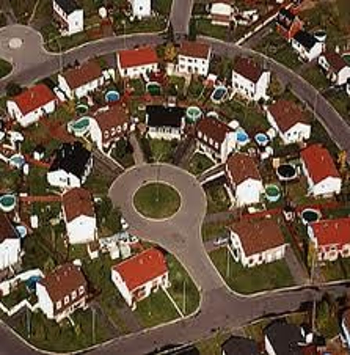
Curvilinear system
ADAPTS TO THE TOPOGRAPHY of the land
Curvilinear system
most COMON to RESIDENTIAL neighborhoods/suburbs
vehicular traffic flow
ROAD HIERARCHY is based on [blank], from high intensity to low intensity
Freeways/expressways/motorways
designed to allow movement of LARGE VOLUMES OF TRAFFIC between, around, or through urban areas
Freeways/expressways/motorways
has no grade-level intersections
Arterial Streets/ highways
CONTINUOUS VEHICULAR CHANNELS that connect with expressways
Arterial Streets/ highways
typically TWO-THREE LANES wide in each direction
Arterial Streets/ highways
All crossings are controlled by traffic signals
Collector-distributor streets
TRANSITION between arterial streets and the local access streets of a neighborhood
Collector-distributor streets
provides access to adjacent residential properties
Local access streets
provides access to LOW INTENSITY USES
Local access streets
streets consist of loops and CUL-DE-SACS or combination of the two
Cul-de-sac
a street or passage closed at one end
National Primary Roads
• A contiguous length of significant road sections extending linearly without any breaks or forks that connect major cities (at least around 100,000 population) comprising the main trunk line or the Provincial Roads backbone of the national road system.
National Secondary Roads
• Directly connect cities to national primary roads, except in metropolitan areas
• Directly connect major ports and major ferry terminals to national primary roads Municipal and City Roads
• Directly connect major airports to national primary roads
• Directly connect tourist service centers to national primary roads
• Directly connect cities (not included in the category of major Barangay Roads cities) Directly connect provincial capitals within the same region Expressways
• Directly connect major national government infrastructure to national primary roads or other national secondary roads
Bypass/Diversion Roads
These roads divert through traffic away from the city/municipality business centers.
Primary and Secondary roads
- Bypass/Diversion Roads
- roads that would connect or fill the gap between ADJOINING NATIONAL ROADS (protruding) to form a continuous national road network.
National Tertiary Road
Other existing roads under DPWH which perform a LOCAL FUNCTION
Provincial Roads
• Connect cities and municipalities without traversing National Roads.
• Connect National Roads to barangays through rural areas.
• Connect to major provincial government infrastructure.
Municipal and City Roads
Roads within the Poblacion
Roads that connect to Provincial and National Roads
Roads that provide Inter-Barangay connections to Major Municipal and
City Infrastructure without traversing Provincial Roads
Barangay Roads
Other Public Roads (officially turned over) within the barangay and not covered in the above definitions
Expressways
Highways with limited access, normally with interchanges; may include facilities for levying tolls for passage in an open or closed system
strengths, weaknesses, opportunities, threats
SWOT
SWOT
this framework facilitates better decision-making by capitalizing on advantages, minimizing risks, and optimizing the use of resources
strengths and weaknesses
Internal factors in SWOT analysis
opportunities and threats
external factors in SWOT analysis
Strengths
• Existing infrastructure on-site
• Accessibility
• Good PHYSICAL ATTRIBUTES (topography, soils and geology)
• NATURAL FEATURES on-site (bodies of water, earth and rock formations, notable flora and fauna)
• HISTORICAL attributes
Weaknesses
• Inadequate infrastructure
• Issues in accessibility
• Environmental and man-made HAZARDS
• Building and zoning restrictions
Opportunities
• Nearby GOVERNMENT PROJECTS which are beneficial to the site (ex. upgrading of infrastructure )
• Improving ECONOMY, increasing demand for services
Threats
• Changes in governance
• Adjacent development (ex. high-rise building)
• Social and political risks (ex. lack of peace and order)
• Pandemic
Example of Strengths
- Existing runway and passenger terminal building
- Existing road to Catbalogan City
Example of Weaknesses
- Need to upgrade airport facilities
- Some areas are SLOPING
- Some areas are prone to GROUND SHAKING, FLOODING
- Existing communities near the airport facilities
Example of Opportunities
- focus on the PLGU of Samar on TOURISM INITIATIVES
- PLGU of Samar intends to UPGRADE THE AIRPORT (bigger aircraft, night operations.
Example of Threats
- Low travel DEMAND (partly due to the PANDEMIC)