APHG Unit 1: Thinking Geographically; Vocab
 Call Kai
 Learn
Learn Practice Test
 Spaced Repetition
 Match
Match Flashcards
 Knowt Play
1/61

There's no tags or description
Looks like no tags are added yet.
Name | Mastery | Learn | Test | Matching | Spaced | Call with Kai | Chat |
|---|
No analytics yet
Send a link to your students to track their progress
62 Terms
Political Map
Shows states, countries, and capitals. Example: A map showing the borders of the 50 US states.

Physical Map
Shows natural features. Example: A map showing the Rocky Mountains and the Mississippi River.

Road Map
Shows highways, streets, etc. Example: A map showing the interstate system connecting New York and Chicago.

Choropleth Map
Uses various colors to show the location and distribution of spatial data; generalized, not precise. Example: A map showing population density by state, where darker blue means more people.
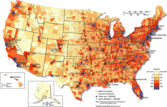
Dot Density Map
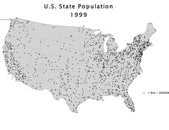
Each dot represents a specific quantity of a spatial characteristic; can be confusing with overlapping data. Example: A map of US farms where one dot equals 1,000 acres of wheat.
Graduated/Proportional Symbol Map
Uses symbols of different sizes to indicate different amounts of a variable; big circles don't allow for precise location of data. Example: A map where the size of a circle over a city represents its total population.

Cartogram Map
The sizes of countries are shown according to a specific variable; some countries might become visually unseeable. Example: A map where China and India are drawn massively distorted because it's showing total population.

Isoline Map
Uses lines that connect points of equal value to depict variations in the data across space; mostly used for temperature, weather, and elevation. Example: A weather map with lines connecting areas that have the exact same temperature.

Absolute Location
The exact or precise location of a place using an address, latitude, and longitude. Example: The White House is located at 1600 Pennsylvania Avenue NW, Washington, DC.

Relative Location
The location of a place based off other areas nearby or in relation to another place. Example: The grocery store is next to the gas station, across from the high school.

Absolute Distance
The exact amount of units between points, such as kilometers, miles, or feet. Example: The drive from my house to the beach is exactly 14.2 miles.

Relative Distance
The distance between places based off of time, cost, or difficulty of travel. Example: The trip to the city takes about 45 minutes in light traffic.

Absolute Direction
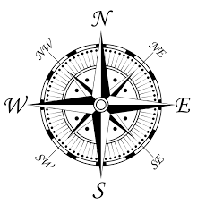
The exact and precise direction using cardinal directions like N, S, E, W. Example: Head exactly South on Interstate 95.
Relative Direction
A relative relationship like "turn left at the target"; not precise. Example: Take a right at the giant oak tree, then it's on your left.

Clustering
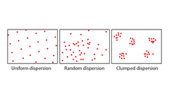
The closeness or density of specific variables in a defined area. Example: Fast food restaurants heavily clustered around a major highway exit.

Dispersal/Distribution
The farness of specific variables, or the way something is spread out over an area. Example: Farmhouses dispersed far apart across the Great Plains.
Patterns and Spatial Associations
Indicates that two or more phenomena may be related, associated, or correlated with one another. Example: High asthma rates found in neighborhoods located near heavy industrial factories.

Map Projections
The process of a cartographer showing the curved surface of the earth on a flat map; they distort shape, area, distance, and direction (S.A.D.D.). Example: The Mercator projection, which makes Greenland look as big as Africa.

Map Distortion
Changes in shape, area, distance, or direction that occur when representing the 3D Earth on a 2D flat surface (S.A.D.D.). Example: The Mercator projection distorting the true size (area) of landmasses near the North and South poles.

Geographic Information Systems (GIS)
Computer system/software that stores, analyzes, and displays information from multiple digital maps/data sets; primarily used for data analysis. Example: Urban planners layering a map of flood zones over a map of residential neighborhoods to see who is at risk.

Satellite Navigation Systems/GPS
Satellites orbit the earth to triangulate point information to receivers for absolute location. Example: Using Google Maps or Apple Maps on a smartphone to navigate to a new restaurant.

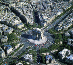
Aerial Photography
Professional images captured from planes or drones. Example: A drone taking an overhead picture of a stadium during a football game.
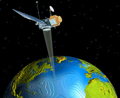
Remote Sensing
Use of cameras or sensors on aircraft or satellites to collect digital images of the earth's surface. Example: Satellites tracking the growth and movement of a hurricane in the Atlantic Ocean.
Census
An official count of population including information such as age, race, sex, and location. Example: The US government sending out surveys every 10 years to count every resident and collect demographic data.

Distance Decay
The interaction between two places declines as the distance increases. Example: The signal of the wifi decreases the further away you are. Or, you are less likely to shop at a grocery store that is 50 miles away if there is another one just 5 miles away.

Time-Space Compression
The increasing sense of accessibility and connectivity which seems to bring humans in distant places closer together. Example: The internet allowing someone in New York to instantly video chat with someone in Tokyo.

Toponym
The name given to a place, which often reflects the culture, history, or characteristics of that place. Example: The city name "Los Angeles", which reflects the area's Spanish colonial history. (The Angels)

Sense of Place
Factors that contribute to the uniqueness of a specific place or location. Example: The unique architecture in European countries makes it easy to tell them apart from the USA.

Placelessness
A location without a sense of place or distinct attributes. Example: A generic strip mall with a Target and a Starbucks that looks exactly the same in Ohio as it does in Texas.

Cultural Landscape/Built Environment
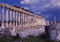
Physical artifacts created by humans that make up any landscape. Example: The terraced rice paddies built into mountains in Southeast Asia, or a skyline of skyscrapers.

Sequent Occupance
The idea that a place is influenced by different groups of people who lived there previously, with each group leaving its own cultural impact. Example: A city in Spain featuring Roman ruins, Islamic mosques from the Moors, and modern Catholic churches all in one area.
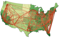
Spatial Interaction
Connections, contacts, movement, and flow of things between places. Example: Millions of people travel by plane per month to different spots all around the world.
Regionalization
The process geographers use to divide and categorize the world or space into smaller areas of analysis. Example: Dividing the United States into the West, Midwest, South, and Northeast for easier study.
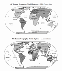
Site/Physical Landscape
Environmental features of a location like climate, water sources, topography, soil, and vegetation. Example: A city built on a natural harbor with a mild climate and fertile soil.

Diffusion
The process by which a characteristic spreads across space from one area to another. Example: The global popularity of K-Pop music spreading outward from South Korea.

Relocation Diffusion
The spread of an idea or trait through the physical movement of people from one place to another. Example: European colonists bringing the Spanish language to Latin America.

Contagious Diffusion
A type of expansion diffusion where an idea or trait spreads rapidly and continuously outward from the hearth through a population. Example: A funny video going viral on TikTok overnight.

Hierarchical Diffusion
A type of expansion diffusion where a feature or trend spreads from a person or place of authority, power, or influence down to other people or places. Example: High fashion trends starting on Paris runways before eventually trickling down to local retail stores.

Stimulus Diffusion
A type of expansion diffusion: a basic idea spreads to a new place but is changed to fit the local culture. Example: McDonald's serving veggie burgers in India instead of beef.

Carrying Capacity
The idea that land can hold a measurable amount of plant and animal life. Example: A small pasture that can only produce enough grass to feed exactly 50 cows before running out of food.

Sustainability
The use of earth's renewable and non-renewable natural resources in ways that do not constrain resource use in the future. Example: Selectively logging a forest and immediately replanting new trees so the forest doesn't disappear over time.

Human Environment Interaction
The interaction between people and their ecosystem. Example: People building huge dams on a river to prevent local flooding and generate electricity.
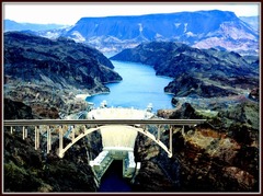
Cultural Ecology
A geographic approach that has a positive bias toward human-environmental coexistence and the interaction with people and their ecosystem. Example: Indigenous farming practices that work harmoniously with local weather patterns rather than fighting them.

Theory of Environmental Determinism
The belief or theory that the physical environment determines how people live, behave, and develop societies. Example: The idea that people living in the freezing Arctic must rely entirely on hunting and wearing heavy furs because their environment makes farming completely impossible.

Theory of Possibilism
States that the physical environment creates possibilities and limits for humans, but humans can choose how to adapt and modify it to their advantage. Example: Humans building advanced air conditioning and irrigation systems to thrive in a harsh desert environment like Dubai.
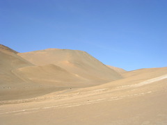
Small Scale Maps
Shows a large area with small amounts of data; zoomed out. Example: A world map showing the entire continent of North America on one page.

Large Scale Maps
Shows a small area with large amounts of data; zoomed in. Example: A highly detailed map showing every walking path on a single college campus.

Global Scale
Analyzing data across the entire planet to understand worldwide patterns. Example: Tracking the worldwide spread and supply chains of global trade networks.
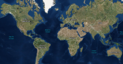
Regional Scale
Examining a broad geographic area encompassing multiple countries that share distinct cultural or physical traits. Example: Studying the economic trade agreements between nations in Latin America.

State/Country/National Scale
Analyzing data strictly within the borders of a single sovereign country. Example: Analyzing the national unemployment rate or birth rate of Canada.

Sub-State Scale
The primary political and administrative divisions within a country. Example: Comparing the different sales tax rates of Texas and California.

County Scale
A regional administrative subdivision within a sub-state or province that groups multiple cities, towns, and rural areas together to manage local services. Example: Los Angeles County managing public health services and courts for all its local cities.

City/Local Scale
Focusing on the data and geographic boundaries of a single municipality, town, or urban center. Example: The city council of Chicago passing a new local zoning law for downtown buildings.
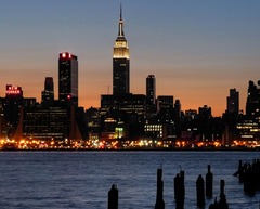
Census Tract
A small statistical subdivision of a county, roughly the size of a large neighborhood, used by governments to track hyper-local demographics and economic data. Example: A government checking the median household income for a specific 5-block neighborhood.

Regions
An area of Earth grouped together because the places within it share at least one common physical or human characteristic. Example: The Middle East is considered a region because the countries there share a hot, dry climate and similar cultural traditions.

Formal Region
An area united by one or more specific traits. Example: The state of Florida, which is defined by strict political borders. (ESPN)

Economic Formal Region
Places united by money or business. Example: The Euro zone in Europe where all countries in it use the Euro as currency.

Social Formal Region
Areas that share human or cultural traits. Example: The middle east, where the vast majority of people are Muslim // Islam. Or the "Francophone world" defining the regions across the globe where French is the primary language.

Political Formal Region
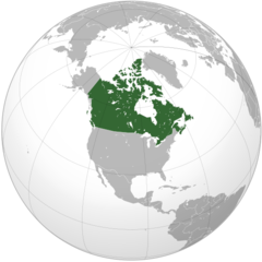
Official areas with strict, legally defined boundaries where a specific government has authority. Example: The borders of a recognized country like Canada, or the city limits of Seattle.
Natural // Environmental Formal Region
Areas categorized by shared natural and physical features, such as climate zones, biomes, or mountain ranges. Example: The Sahara Desert or the Amazon Rainforest.

Functional Region
An area organized around a central node or focal point where the characteristic diminishes as it moves outward. Example: The delivery zone of a local Domino's Pizza, where service stops past a certain mile marker.

Perceptual (Vernacular) Region
A place that people believe exists as part of their cultural identity, based on feelings and attitudes rather than strict facts. Example: The "American South," which has no official borders but is known for shared cultural traits like sweet tea, accents, and hospitality.
