1st 6-weeks Texas history
1/28
There's no tags or description
Looks like no tags are added yet.
Name | Mastery | Learn | Test | Matching | Spaced |
|---|
No study sessions yet.
29 Terms
Coastal Plains
*The region of Texas that receives the most rain.
*Home of the state capitol (Austin)
Southeastern Culture
This Native American group lived in the upper part of the coastal plains and farmed (agricultural)
*Lived in grass thatched dome houses
*Made pottery
*Hunted deer, bear
Puebloan Culture
*This Native American group lived in the Mountains and Basins region (agricultural), lived in adobe houses
*Made jewelry
*Hunted buffalo
Gulf Coastal Culture
*This Native American group lived along the coast and were nomadic.
*Lived in houses made of sticks and animal hides
*Were warriors
*hunted small animals and fished
Plains Culture
*This Native American group lived in the Great Plains and were very skilled on horses (nomadic)
*Lived in tepees
*Used the buffalo for everything
Buffalo
*The most cherished food source for most Native American groups
Adobe
*A brick or building material made of sun-dried earth and straw; Used by Pueblo natives for housing
Canoes
*How Gulf Natives traveled around
1519
*The year of the first map of the Texas coastline
Pineda
*Drew the first map of the Texas coastline
*Encouraged more exploration because of his map
Coronado
*Did not find the cities of Gold (Cibola) for Spain
*Found Palo Duro Canyon
*Told Spain to stop sending explorers b/c there was no gold
Cabeza de Vaca
*Shipwrecked in Galveston; First European to step foot in Texas; slave and medicine healer to Natives.
*Wrote a book about his journey
La Salle
*Set up first French settlement in Texas; Made Spain interested in Texas again
Cortes
*Conquered the Aztec tribe and established Mexico City
*Because of he established Mexico City, Spain called the new colony New Spain
Natural Texas and Its People
*Era defined by geography and early Native American tribes
Age of Contact
*Era defined by European exploration into North America
Red, Sabine, Rio Grande
*Border rivers of Texas- know where they are located
Red River
Northeast of Texas and a Border
Sabine River
East Texas border
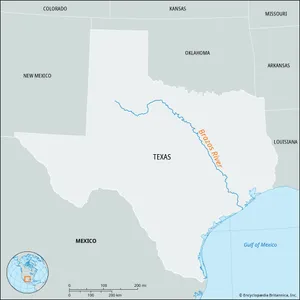
Brazos River
here
Nueces River
South of Costal Plains
Rio Grande
West border of Texas
Great Plains
*Flattest region on earth and stretches all the way to Canada
Coastal Plains
*Abundance of rain, fertile soil, hurricanes, high population
North Central Plains
*Adequate rainfall, hill country
Mountains & Basins
*El Paso, Dry, Extreme Temperatures
3 G's
God, Gold, Glory-Reasons for Spanish exploration
wealth, land, gold, trade routes to Asia
reasons for European exploration
Elevation
height above sea level- increases as you move west across Texas