AP Human Geography - Unit 1 (Thinking Geographically)
1/50
Earn XP
Name | Mastery | Learn | Test | Matching | Spaced | Call with Kai |
|---|
No analytics yet
Send a link to your students to track their progress
51 Terms
absolute location
the precise point where a place is located on Earth
geographic information system (GIS)
a computer system that stores, organizes, analyzes, and displays geographic data
latitude
Distance north or south of the equator
longitude
Distance east or west of the prime meridian, measured in degrees
prime meridian
Imaginary line drawn from the North Pole through Greenwich, England, to the South Pole
place
specific human and physical characteristics of a location
site
The characteristics of a place (immediate location), Ex: soil type, climate, labor force, human structures
situation
the location of a place relative to other places and its surroundings
toponym
place name
distance decay
decline of activity or function with increasing distance from its point of origin
density
number of something in a specifically defined area Ex: population density is the number of people per square mile
projection
The system used to transfer locations from Earth's surface to a flat map.
diffusion
The process of spread of a feature or trend from one place to another over time
formal region
An area in which everyone shares in one or more distinctive characteristics
GPS
a system that determines accurately the precise position of something on Earth through satellites, tracking stations, and receivers
remote sensing
process of gathering data about Earth from instruments far above the planet's surface
Reference Maps
Maps designed for people to refer to for general information about places
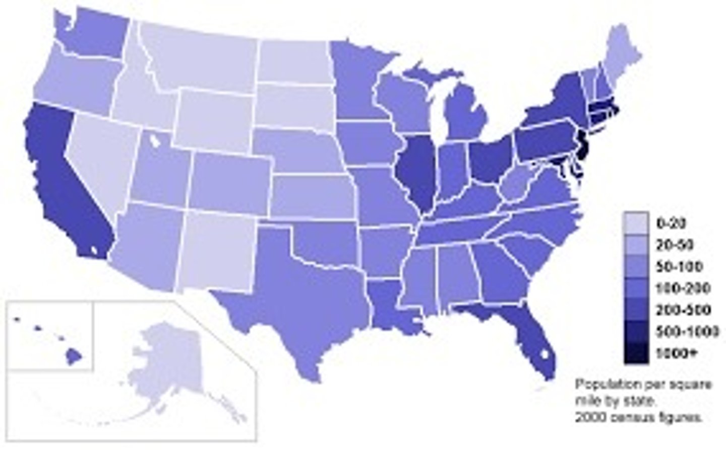
choropleth map (thematic)
uses various colors, shades of one color, or patterns to show the location and distribution of data
thematic map
a map that shows a particular theme, or topic ex: choropleth, dot distribution, graduated symbol, isoline
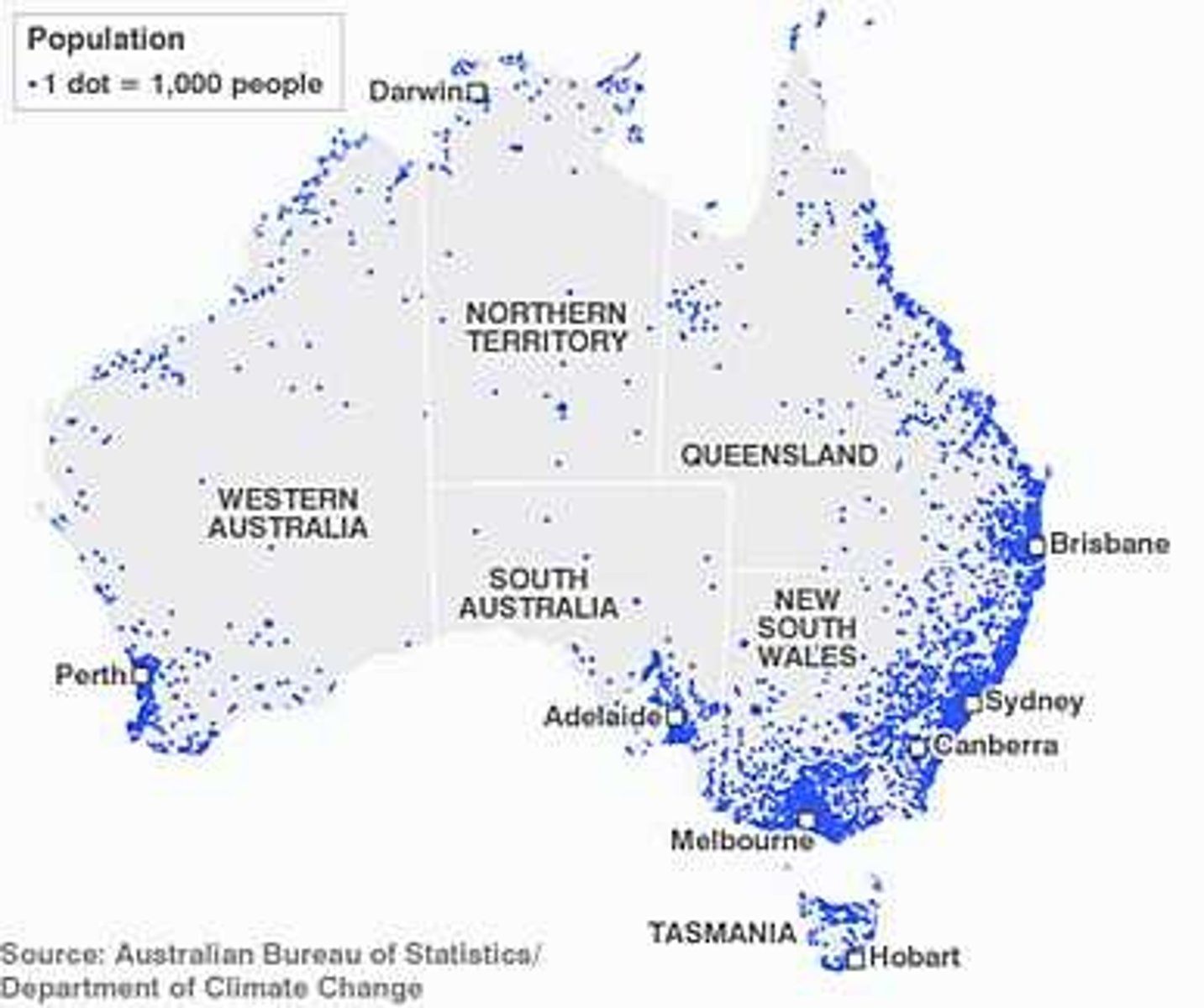
Dot Distribution Map
A map where dots are used to demonstrate the frequency or intensity of a particular phenomena
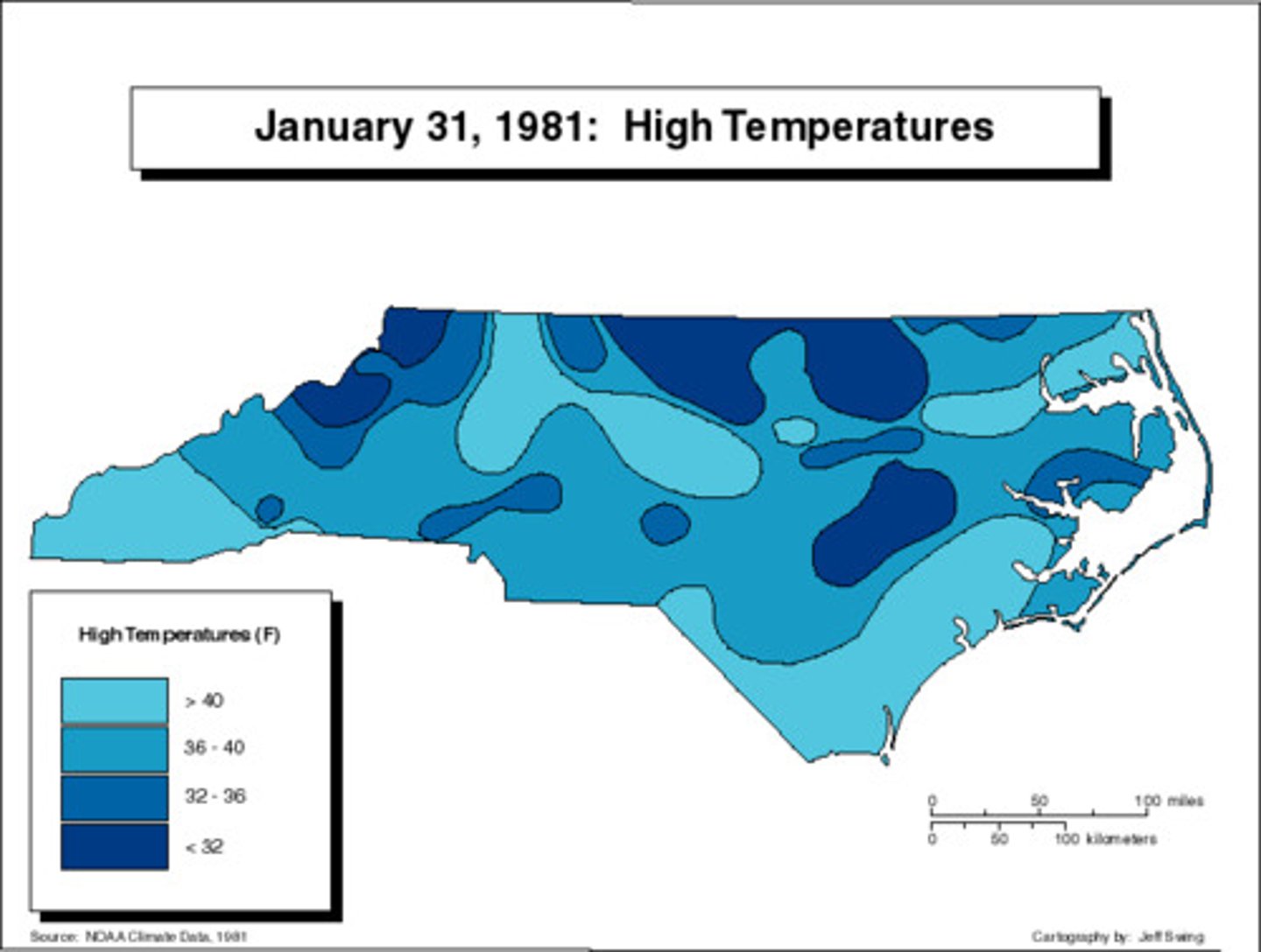
Isoline Map
A thematic map with lines that connect points of equal value.
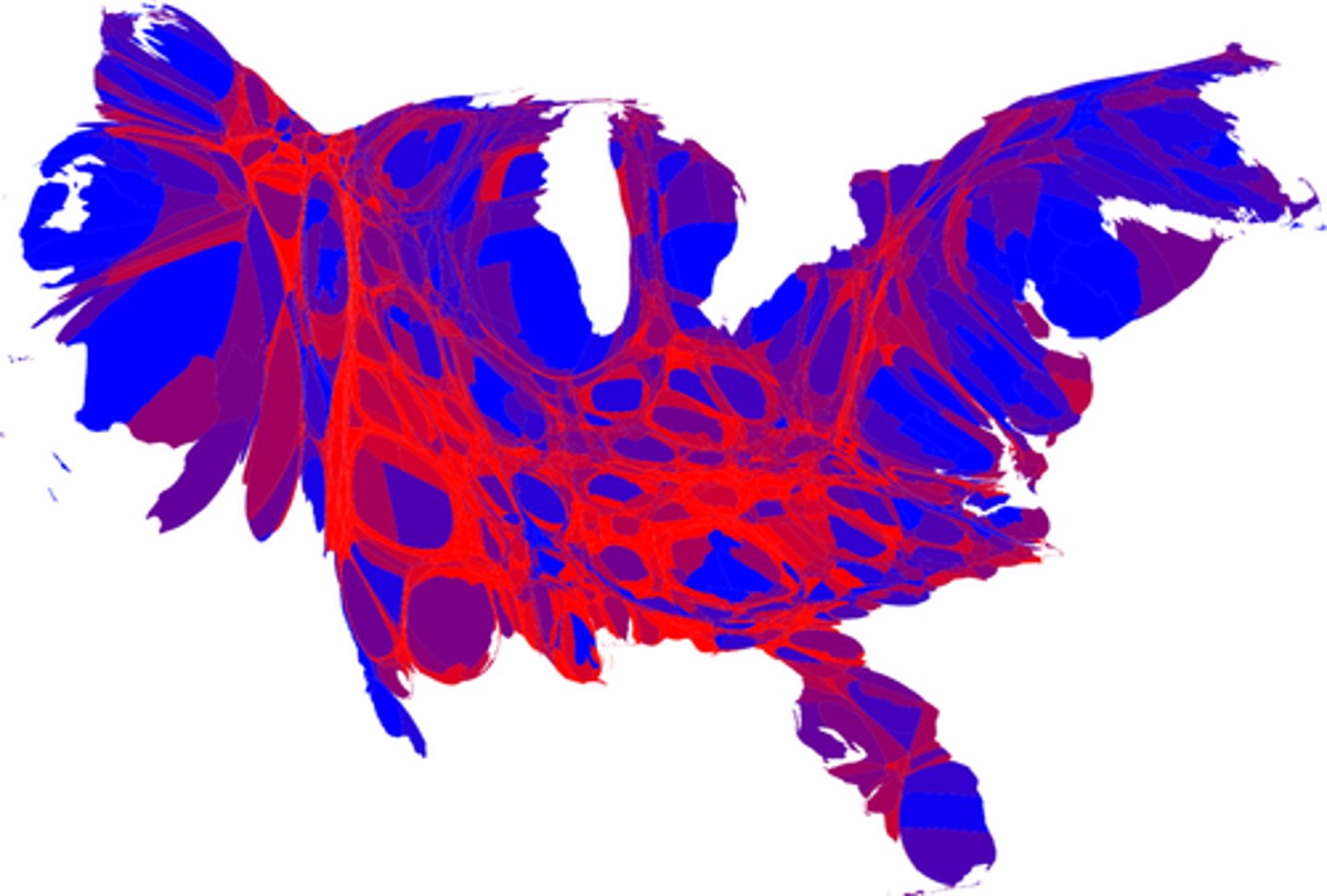
Cartogram (thematic)
the sizes of countries are shown to some specific statistic
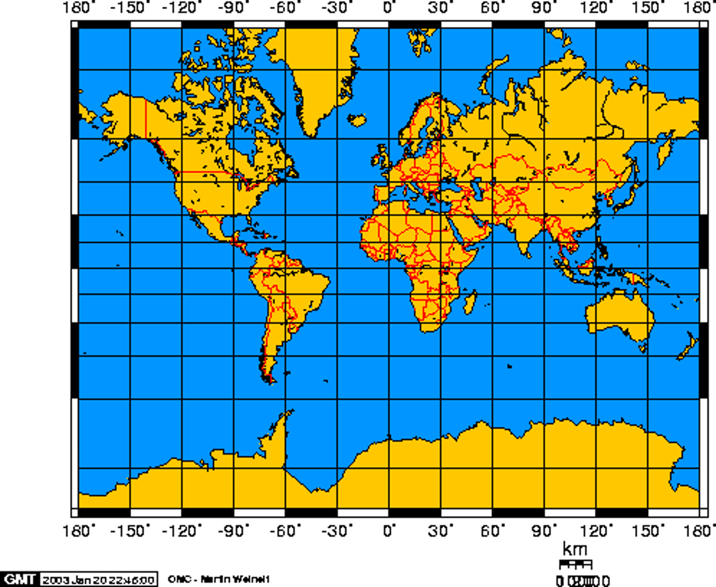
Mercator Projection
a projection of a map of the world onto a cylinder in such a way that all the parallels of latitude have the same length as the equator, EX: used especially for marine charts and certain climatological maps.
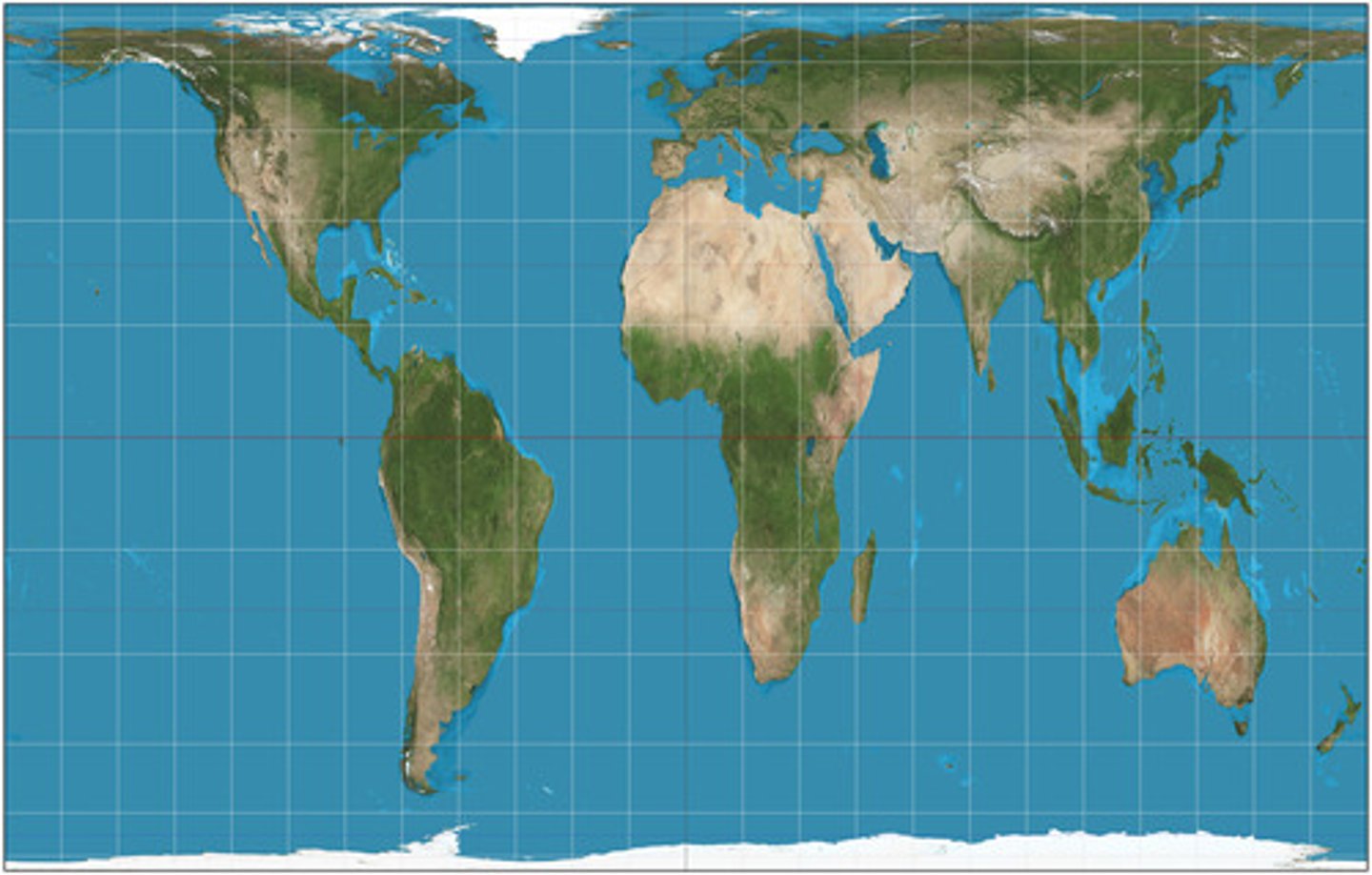
Peters Projection
focuses on keeping landmasses equal in area. As a result, the shapes are distorted, and the map looks unfamiliar to viewers
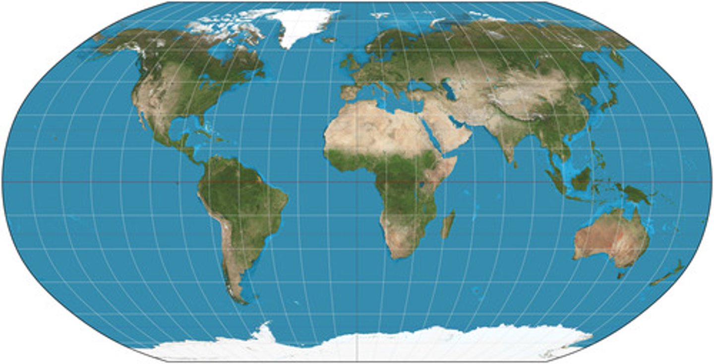
Robinson Projection
Projection that attempts to balance several possible projection errors. It does not maintain completely accurate area, shape, distance, or direction, but it minimizes errors in each.
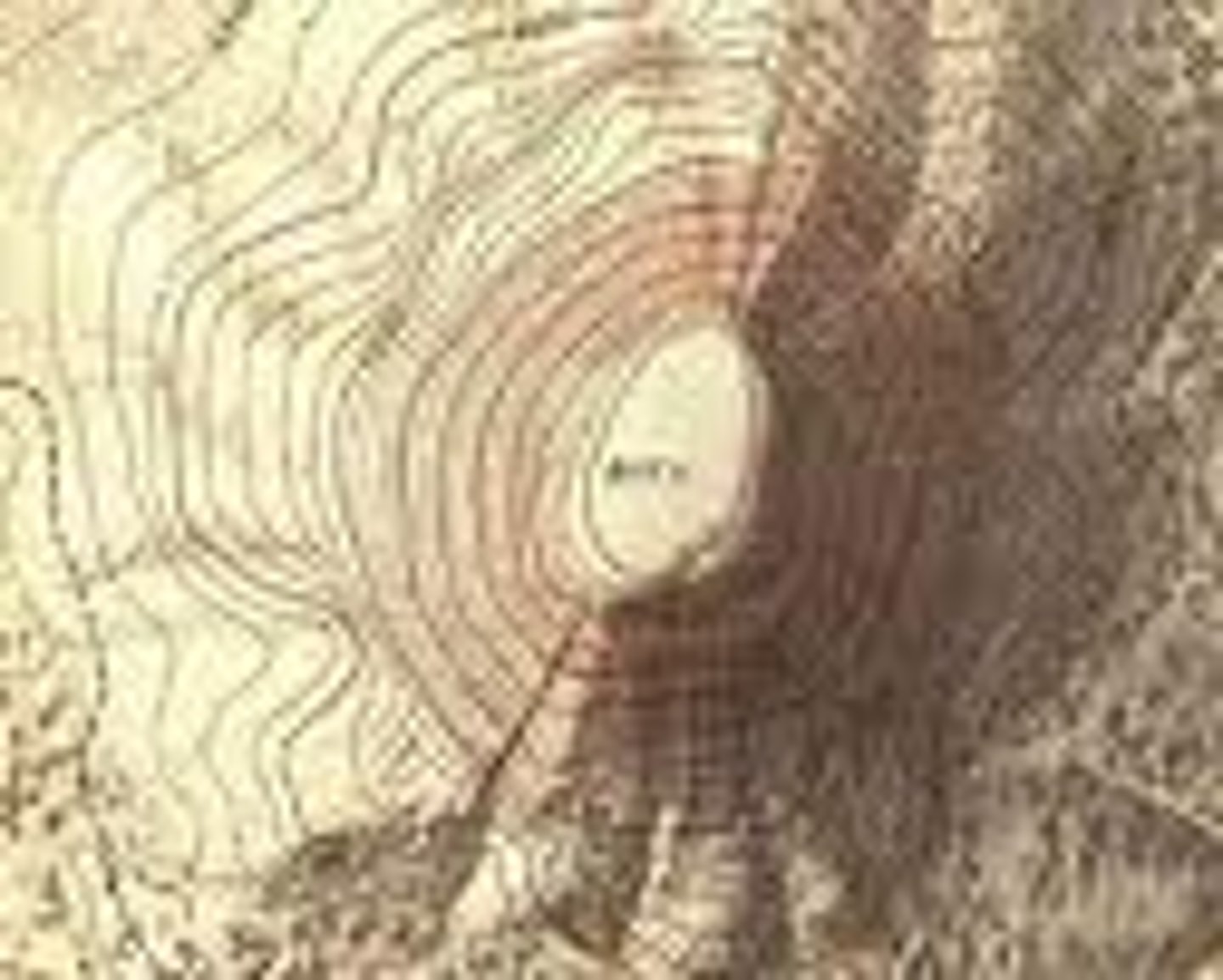
topographic map
a map that shows the surface features of Earth
Possibilism
viewpoint that people, not environments, are the dynamic forces of cultural development
Enviornmental Determinism
The belief that physical environment determines potential for societal development.
Sustainability
The use of Earth's renewable and nonrenewable natural resources in ways that do not constrain resource use in the future.
natural resources
Materials or substances such as minerals, forests, water, and fertile land that occur in nature and can be used for economic gain
large-scale map
Depicts a small area (such as downtown Phoenix) with great detail
small scale map
A map that shows a larger area without much detail
clustered
Gathered closely together in a group
absolute distance
A precise distance between locations
border zone
A region where cultures overlap and blend into a recognizable border culture (Ex: Tex-Mex)
census
A survey that is taken every ten years in the U.S. to determine population and demographic data
contested boundaries
Boundaries that are disputed for religious, political, or cultural reasons
global scale
Scale that identifies and analyzes geographic phenomena at a global level
regional-scale
Scale that identifies and analyzes geographic phenomena within a particular region of the world
national-scale
Scale that identifies and analyzes geographic phenomena within a specific country
local scale
Scale that identifies and analyzes geographic phenomena within a state, province, city/town, or neighborhood
polar projection
A projection that is centered on one of the poles of the earth (N or S)
relative distance
The distance of one place (or person) in relation to the position of another place (or person)
relative location
The position of one place (or person) in relation to the position of another place (or person)
regional analysis
Not to be confused with regional scale - this is when you compare two areas using data to analyze trends or connections
time-space compression
The decreasing distance between places as measured by travel time or cost
absolute direction
Corresponds to the direction on a compass: N,S,E,W and combinations such as NE or SW
functional region
A geographic area that has been organized to function politically, socially, culturally, or economically as one unit
nodes
Central points from where functional regions are coordinate or direction (Ex: capital city)
Perceptual/Vernacular Region
An area that is pecieved to exist by the people who live there based on widespread accepatance and use of a unique regional name (Ex: Bible Belt)
proportional/graduated circle map
A map that uses symbols (usually circles) of different sizes to represent data values