L12 How plate tectonics & climate shaped Ireland pt 2.
1/23
There's no tags or description
Looks like no tags are added yet.
Name | Mastery | Learn | Test | Matching | Spaced |
|---|
No study sessions yet.
24 Terms
From deserts to coal swamps
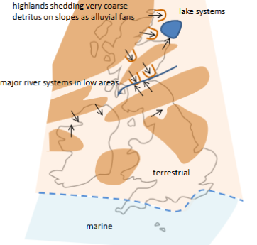
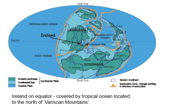
Ireland at the equator 420 - 300 million years ago
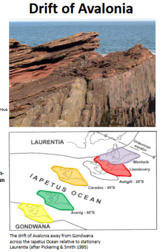
Drift of Avalonia
Result of Avalonia
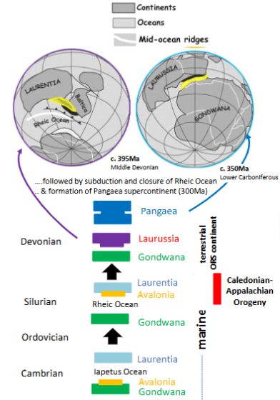
amalgamation of Avalonia Laurentia and Baltica - with mountain belts formed during their collision
creates a major continent: Laurussia or informally, Old Red Sandstone Continent
transition from marine sediments to terrestrial (land-based) sedimentation at low palaeolatitudes south equator
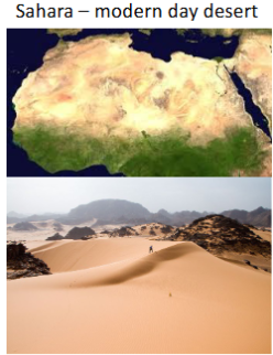
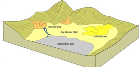
Desert environments - shedding of mountains
alluvial fans (scree slopes and debris flows)
episodic river activity
unconfined floods over floodplains
aeolian (wind-blown) deposits
lacustrine (i.e. lake) deposits
periodic rain storm in desert rivers can be very dangerous.
Early Devonian (400My)
Brown bits are mountains
Blue bits are ocean
N.B. don’t have to remember each detail just know the bits.
Eroded several years
Rounded clasts of cobble and boulder grade in matrix
alluvial fan deposits
→ game of throne = this is
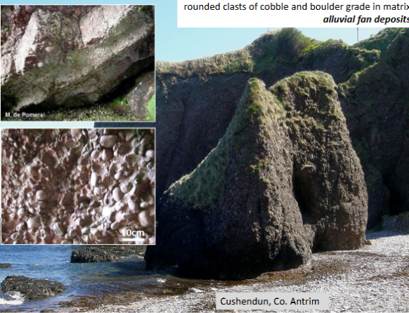
The stormlands
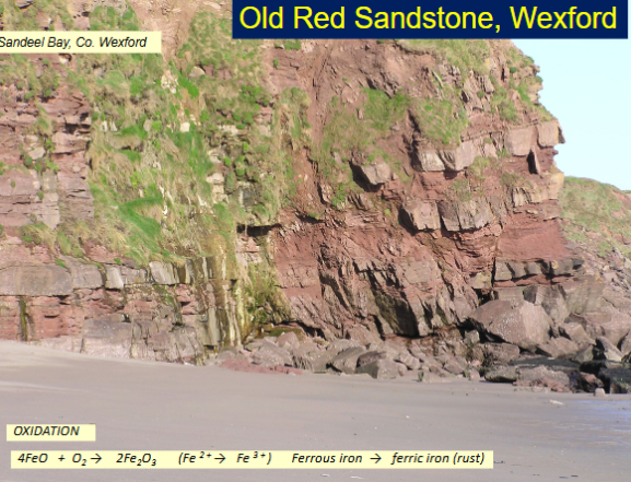
Old Red Sanstone, Wexford
It’s red because of the oxygenated airated environment and it’s above water → FE3+ so it’s not green coloured
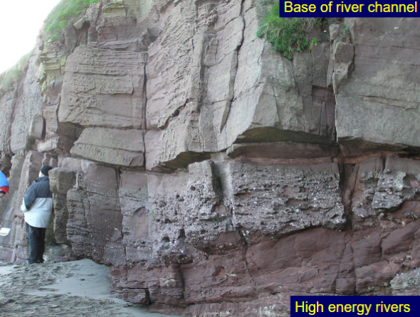
Base of river channel
carried lots of fragments previously
high energy rivers
Early and Middle Devonian
Sea is migrating northwards
transgression → migrates over ireland
lakes are formed though, massive lakes. periodically fill up and dry out.
Orcadian basin
Lake in Scotland
Colour coding types of rock
Dark blue = deep, light blue = shallow, brown = river, pink = salts, boundaries of the river. going up and down generating salts at the side of the river.
illustrates nature of sequence for only 70m out of ca 750m thickness
High lake stands (i.e. when lake level is low and system is dry)
Cracks → dried up there
Death valley environment I guess
High lake stands (i.e. when lake level is high and system is wet)
Fossils of freshwater fish is discovered
Deoxyenated are effectivley dead deep down, the fish slowly goes down to the bed and is fossilised.
End middle and Late Devonian
coastal plain developed in the south
Lower carboniferous times (350-325Ma ago)
Ireland is stretched north and south, reefs are developing and tropical oceans are developed.
Early Carboniferous (355 My)
Carboniferous limestone
full of fossils
crinoids = stalk with lots of arms.
Middle carboniferous 328My
Dublin area was apart of the submarine rift, south of UCD has a fault (deer park)
Deep parts are the dark blue
Green bits are deltas and coal swamps, sediments are being formed as well = sandstones
Zn-Pb
Light blue are limestone
4km dropped in navan
2km dropped in ucd, dublin
black lines are faults
these extend deep into the earth, zinc and lead being developed because of this
Irish Zn-b Orefield
navan mines, 2km deep
Late Carboniferous (313My)
clogging it up with all the deltas
deltas have trees nearby, trees grow, die then more trees grow and have organic matter of coal/swamp.
ireland is up now, not underwater anymore.
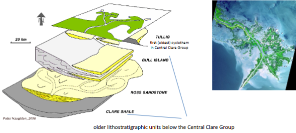
Central Clare Group, Western Ireland
can be related to the melting ice of africa
we’re in the tropics??
africa is in the poles
Formation of coal forming environment
Spatial distribution of climatic belts during Permo-Carboniferous