Case study: River Tees
1/19
There's no tags or description
Looks like no tags are added yet.
Name | Mastery | Learn | Test | Matching | Spaced |
|---|
No study sessions yet.
20 Terms
Where is the river Tees located?
north east England
Where is the source of the River Tees?
Pennine Hills (893m above sea level)
Where is the mouth of the River Tees?
Middlesbrough (flows eastward into the North Sea)
How long is the river Tees?
128km
What are some geomorphic processes & landforms in the upper course of the river Tees?
- mass movement & vertical erosion → v-shaped valleys
- differential erosion → waterfalls
- freeze-thaw weathering
- traction transporting large & angular load
What is the climate like in the upper course?
- very cold temperatures (drops 1°C every 100m)
- over 2000mm of rainfall per year
What are some key features found in the upper course?
- High Force waterfall & gorge
- Cow Green reservoir & dam
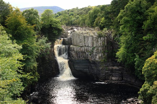
High Force waterfall
- highest waterfall in England (20m)
- located in Forest-in-Teesdale
- hard rock is whinstone & soft rock is limestone
- waterfall retreat has formed a 700m long gorge in the valley
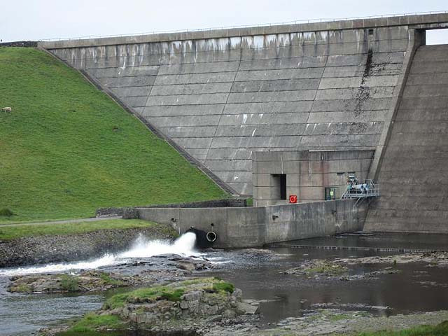
Cow Green reservoir
- built between 1967-1971
- 2 mile long reservoir with a ¼ mile long dam
- holds back 40,000 million liters of water
- used as a water supply for homes & industry
- manages flooding by the dam holding back water when there is to much & releasing it during times of low-flow
Human activity in the upper course
- tourism at High Force waterfall (e.g. picnics, water sports, walks)
- hill sheep farming as the steep land & thin/acidic soil is unsuitable for crops
- quarrying (e.g. Cemex quarry)
- water used to supply homes & industry
What are the positive & negative impacts of tourism in the upper course?
POSITIVE → creates job opportunities & income for locals (e.g. opening cafes, restaurants, hotels, visitor centers)
NEGATIVE → congestion, litter from picnics, holes in rock from harnesses, footpath erosion, visual & noise pollution
What are some geomorphic processes & landforms in the middle / lower course of the river Tees?
- meanders
- lateral erosion → widens the river
- suspension & solution transporting smaller & more rounded load
- deposition
What are some key features found in the middle / lower course of the river Tees?
- Tees estuary where there are huge mud flats (e.g. Seal sands)
- meanders from Stockton to Yarm & Darlington to Teesmouth (30km wide)
Human activity in the lower / middle course
- more urbanised & industrialised as the land is cheap, easily reclaimed & has good transport networks
- Seal sands (a protected wildlife habitat) attracts tourists
- Teeside port imports raw material & exports finished goods
- steelworks factory at Redcar
How has the river Tees been managed for flooding?
- Tees Barrage
- Yarm’s flood defence scheme
- artificial straightening of meanders
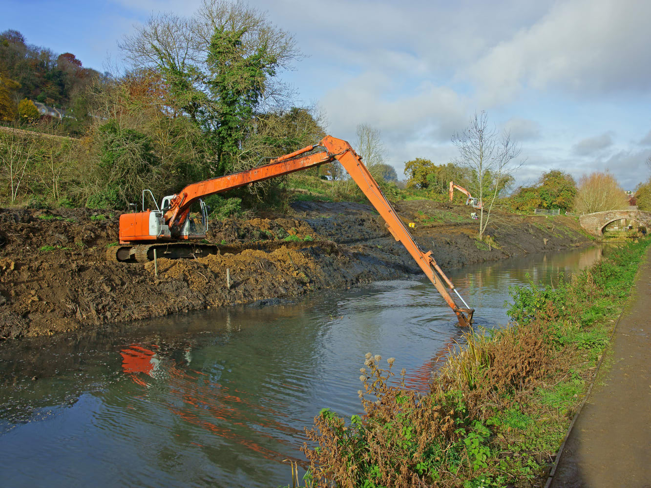
- dredging
- Cow Green reservoir
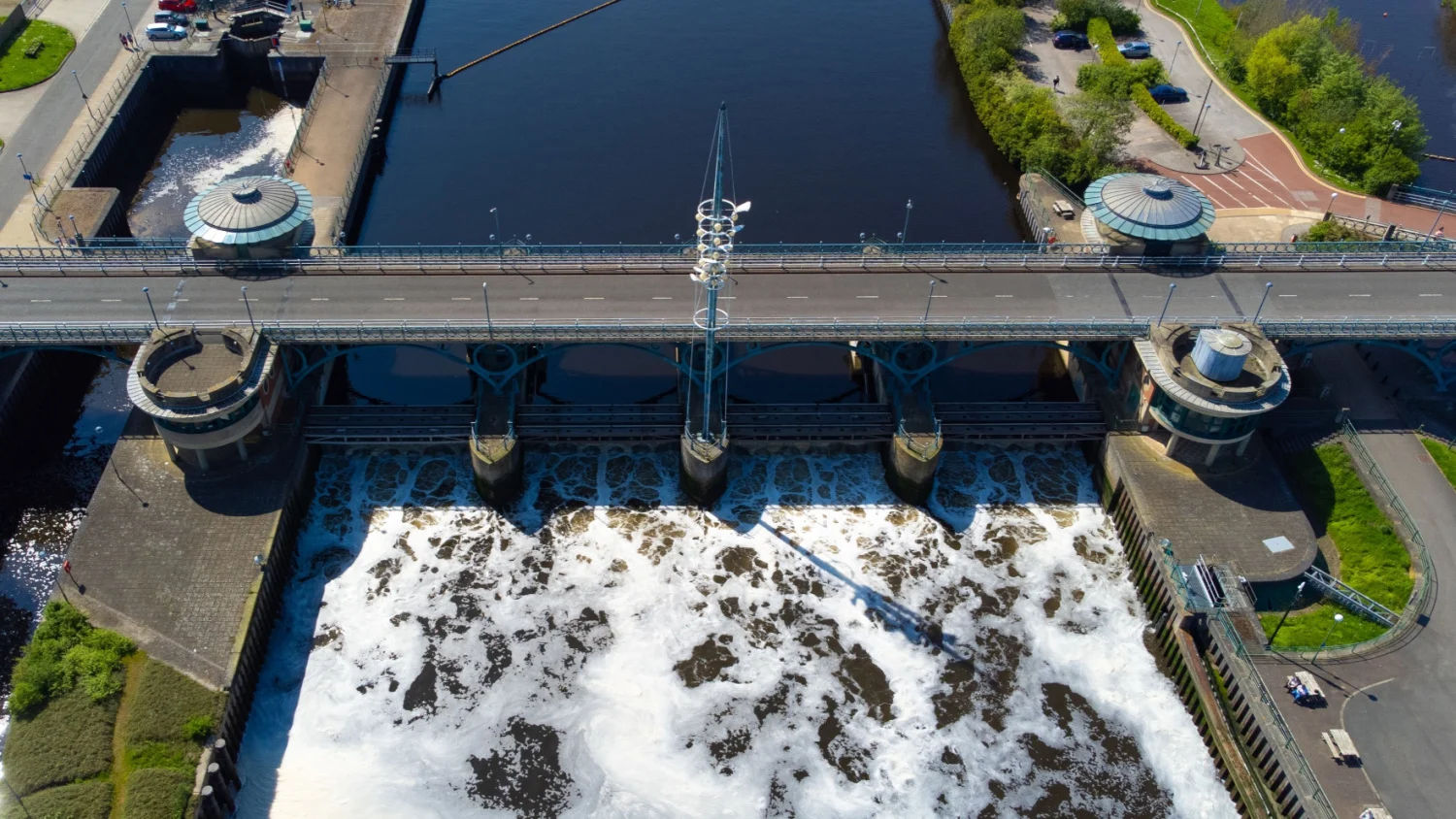
Tees Barrage
- lowers the water levels during high tides & storm surges
- increases the water quality as it does not mix with tidal salt water, keeping it fresh & clean
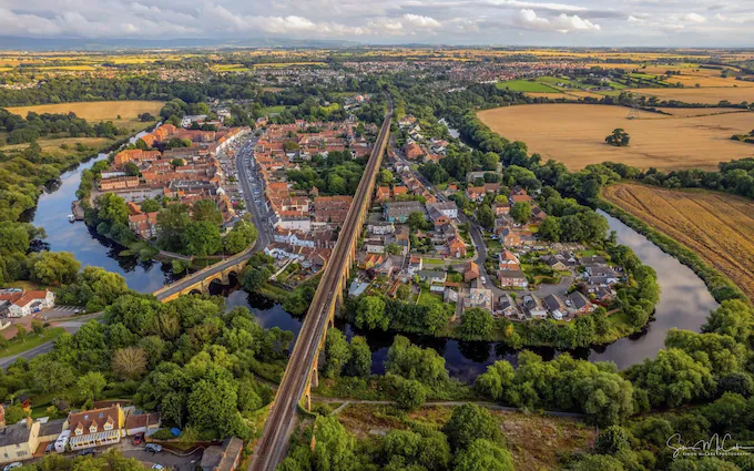
Yarm’s flood defence scheme
- Yarm is prone to flooding as it is in a large meander bend
- £2.1 million was spent on reinforcing concrete walls, earth embankments, gabions & better flood warning systems to reduce the risk
Artificial straightening of meanders
- in the 19th century, several meanders (e.g. Stockton to North Sea) were cut off to straighten the river
- this made the journey for voyaging boats shorter as well as reducing the risk of flooding
Dredging
- maintains a deep-water channel which allows the river to hold more water, reducing the risk of it over-filling & then flooding
- it also improves navigation for boats
How does flood management benefit the river Tees & the surrounding area?
- prevents damage of homes & eco-systems
- improves development & recreational value as people are more willing to invest in building housing, transport links, offices ext.. if the area is protected from flooding