Weather and climate combined
1/119
There's no tags or description
Looks like no tags are added yet.
Name | Mastery | Learn | Test | Matching | Spaced | Call with Kai |
|---|
No analytics yet
Send a link to your students to track their progress
120 Terms
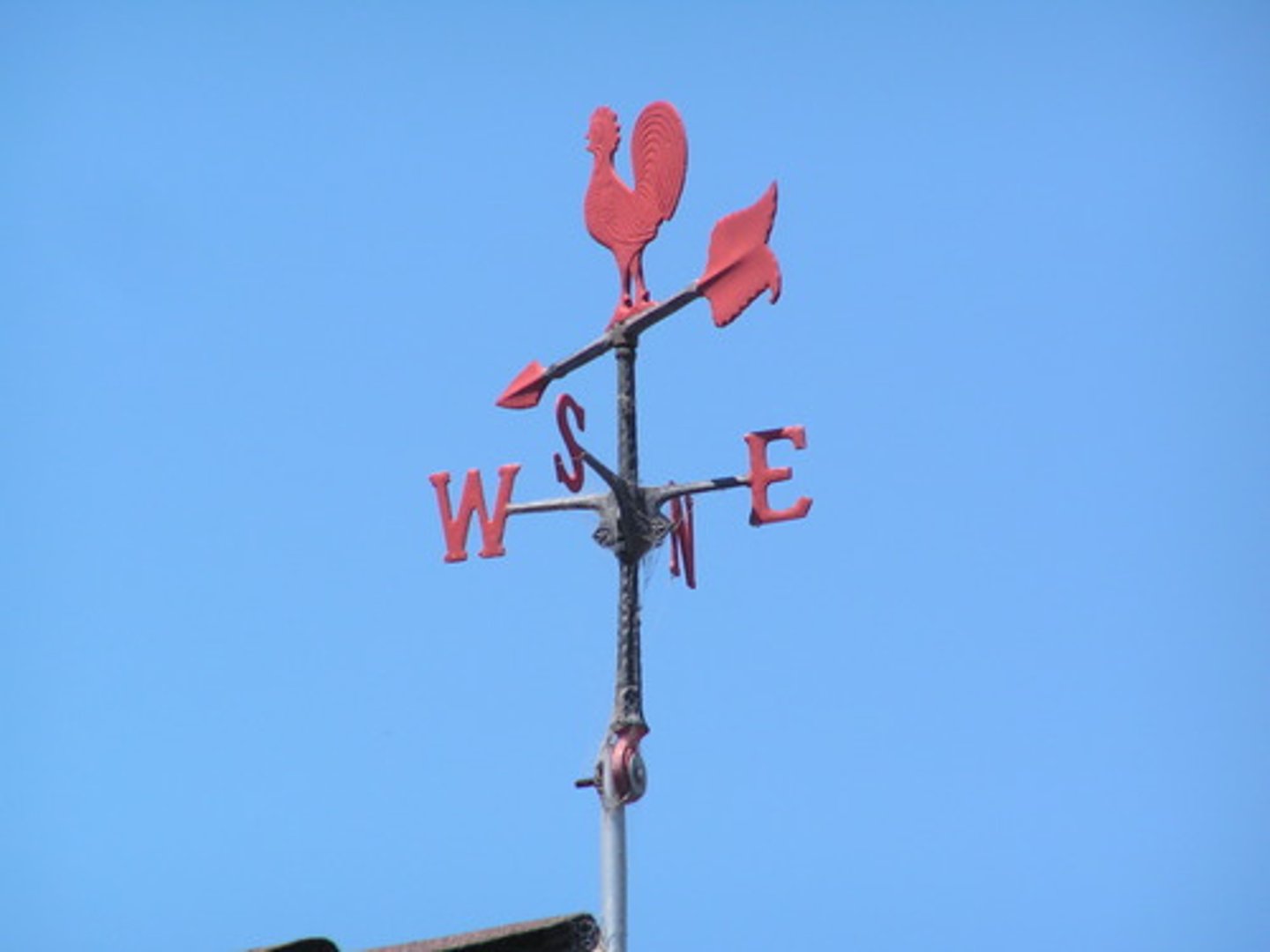
Wind vane
Measures wind direction.
Convection
Process of heat transfer by the circulation or movement of a liquid or a gas.
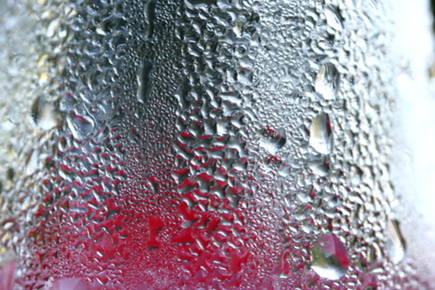
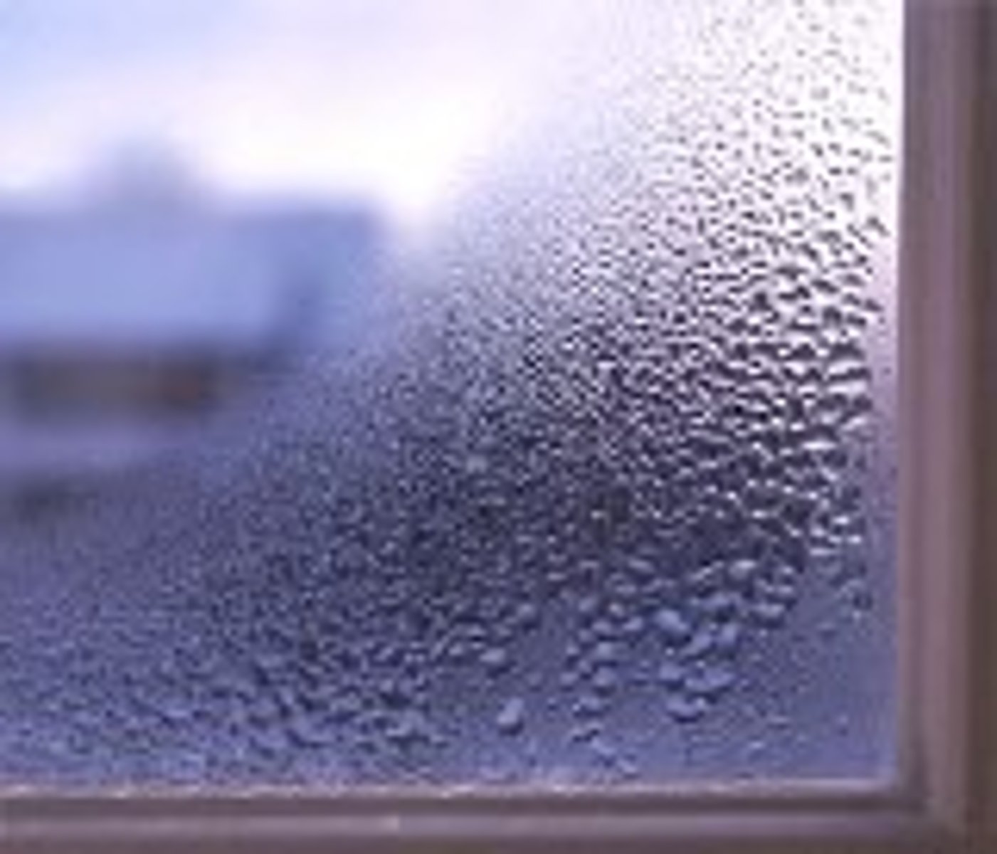
Condensation
The process by which molecules of water vapor in the air become liquid water.
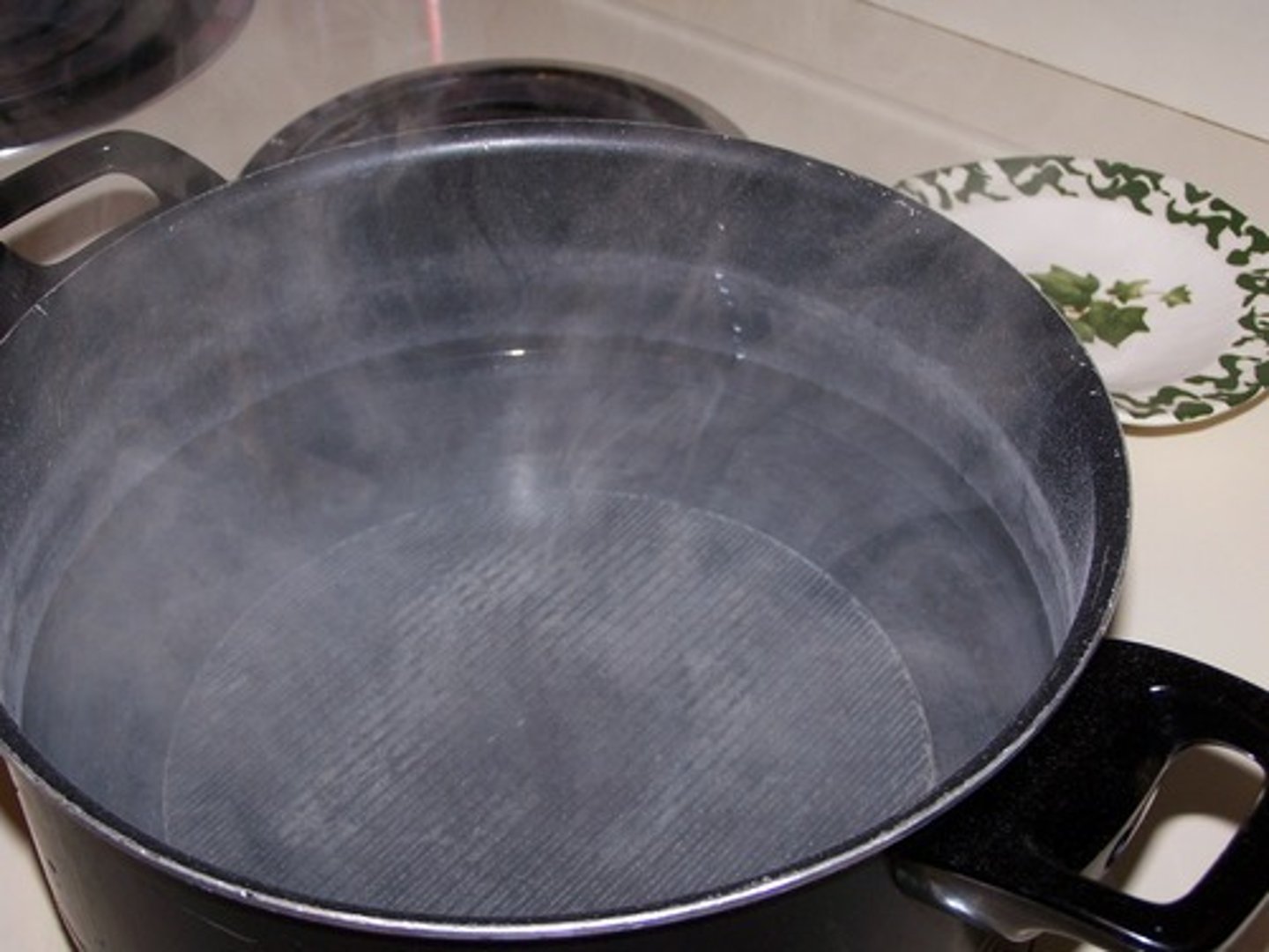
Evaporation
The process by which water molecules in liquid water escape into the air as water vapor.
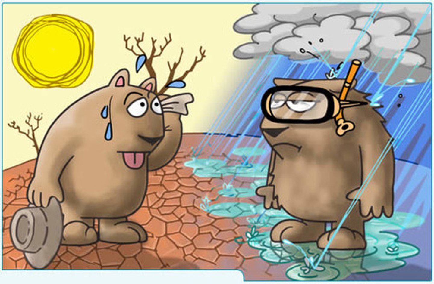
Weather
Day-to-day changes in atmospheric conditions, including temperature, air pressure, humidity, wind, cloud coverage, or precipitation.

Climate
Long-term average of weather in an area.
Polar
Dry, cold climate zone above 60 degree latitude.
Temperate
Seasonably variable climate zone between 40 and 60 degrees latitude, north or south of the equator.
Tropical
Warm, moist climate zone near the equator.

Air mass
Large body of air with the same temperature and humidity.
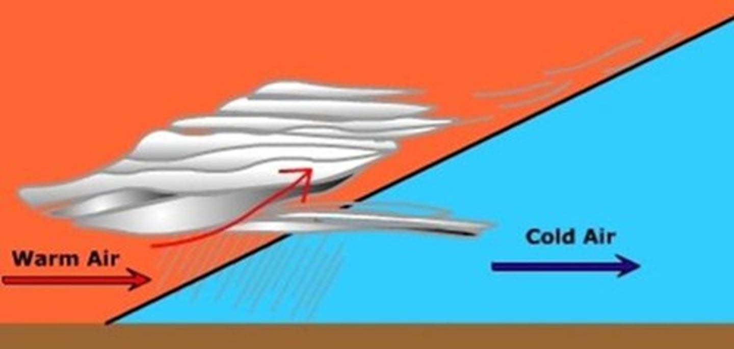
Front
Where two different air masses meet.
Humidity
Moisture in the air.
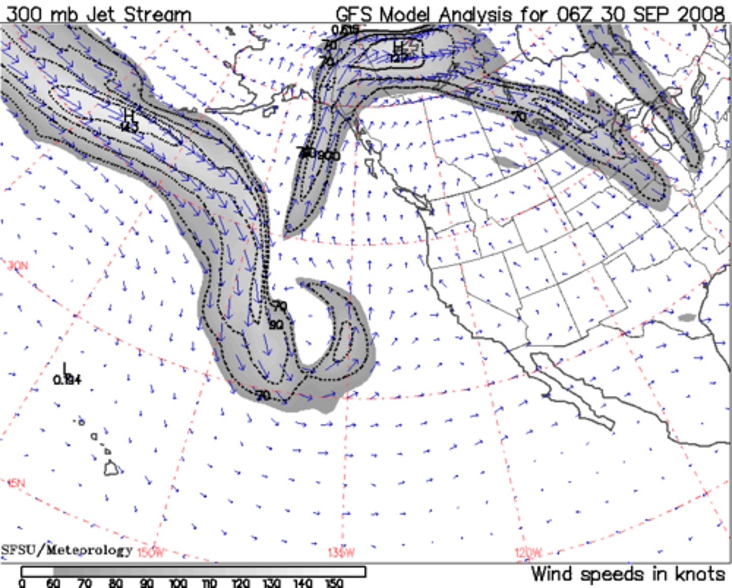
Jet stream
Fast moving stream of wind where cold, polar air meets warm air from the equator.
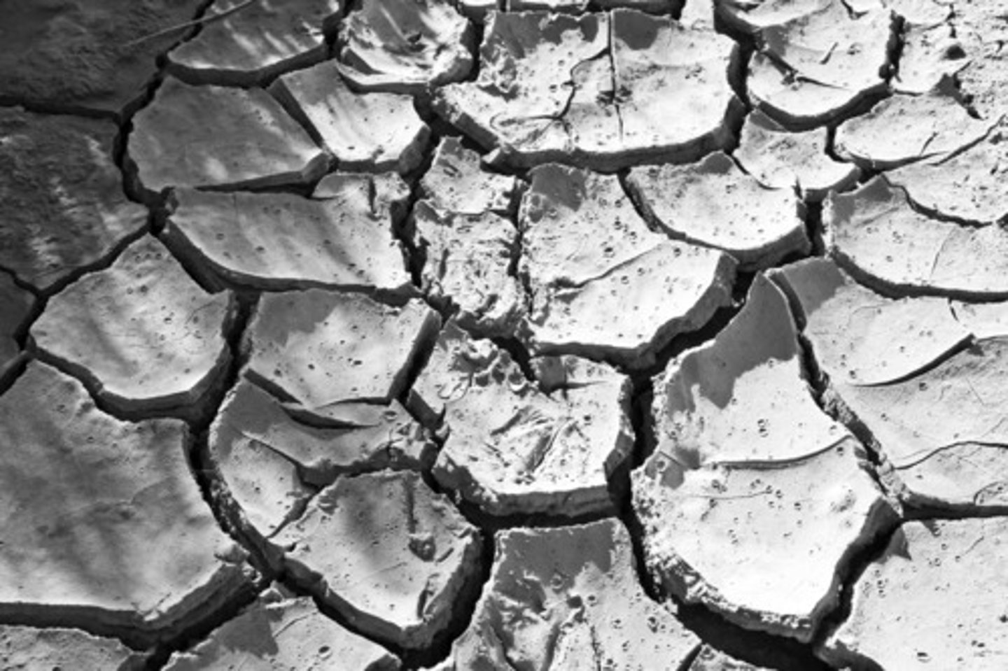
Drought
A long period of unusually dry weather.
Anemometer
Measures wind speed.

Barometer
Measures air pressure.
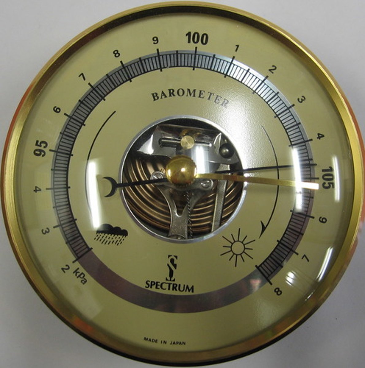
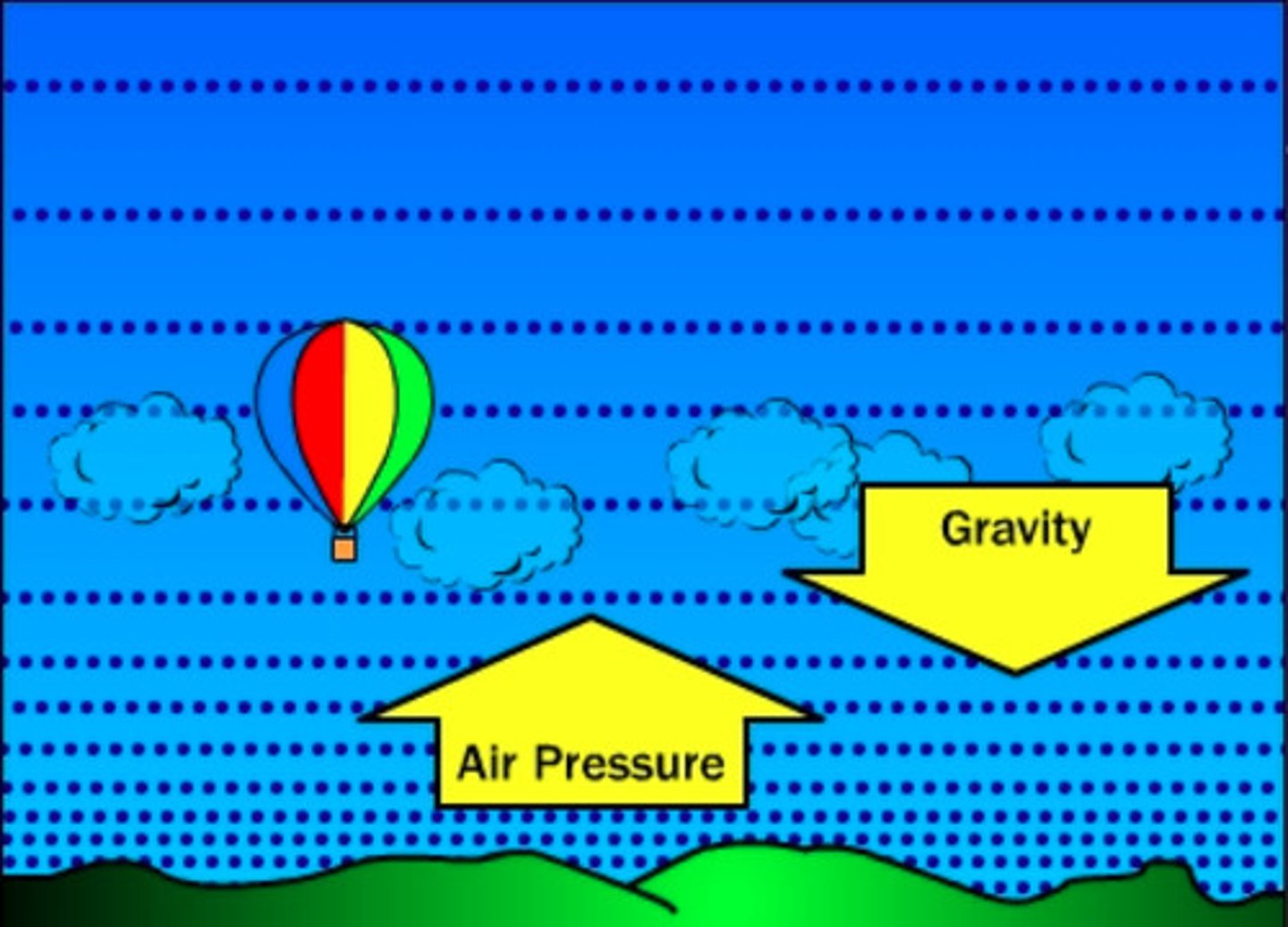
Air pressure
The pressure caused by the weight of a column of air pushing down on an area.
Atmosphere
The envelope of gases that surrounds Earth.
Precipitation
Any form of water that falls from clouds and reaches Earth's surface.
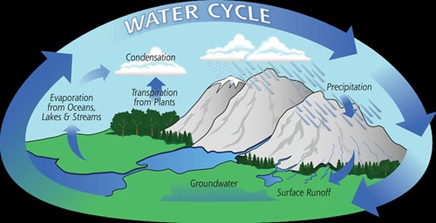
Water cycle
The continual movement of water among Earth's atmosphere, oceans, and land surface through evaporation, condensation, and precipitation.
Warm front
Warmer air; light and steady precipitation; move southwest to northeast.

Cold front
Colder air, heavy rain, thunderstorms, snow.
What is weather?
It refers to the state of the atmosphere at a particular place and time, described using variables including (air temperature, cloud cover, precipitation, wind speed, wind direction)
What is climate?
It is the average state of the atmosphere at a particular place over a long period of time, typically 25 years or more. (tropical equatorial, tropical monsoon, cool temperate)
Tropical equatorial description and location?
Generally high temperatures all year round about 27°C
Small annual temperature range of about 2-3°C
High annual precipitation of more than 2000mm
Precipitation falls evenly throughout the year
Location is between 10°N and 10°S of the equator
Havana, Cuba and Singapore
Tropical monsoon climate description and location
Generally high temperatures all year round, of about 25°C
Small annual temperature range of about 3-4°C
High annual precipitation of about 1500mm
Distinct wet and dry seasons
Location is between 5°N and 30°N of the equator and 5°S and 30°S of the equator
Chittagong, Bangladesh, Kochi, India
Cool temperate climate description and location
Four distinct seasons of spring, summer, autumn, and winter
Large annual temperature range of about 21°C
Annual precipitation is between 300-900mm
Precipitation falls evenly throughout the year
Location is between 45°N and 60°N of the equator and 45°S and 60°S of the equator.
London, United Kingdom, Paris, France
What are climate hazards?
Climates are changing due to natural and human-induced causes
Predictable weather patterns in many places are now beginning to change and becoming unpredictable
Extreme weather events, such as heat waves, droughts, floods, cyclones, and wildfires are expected to occur more often or with greater severity
These can impact natural and human system significantly (ecosystem and agriculture)
Climate change can destroy crops and disrupt food production, affect commuting and travelling, leading to great economic losses
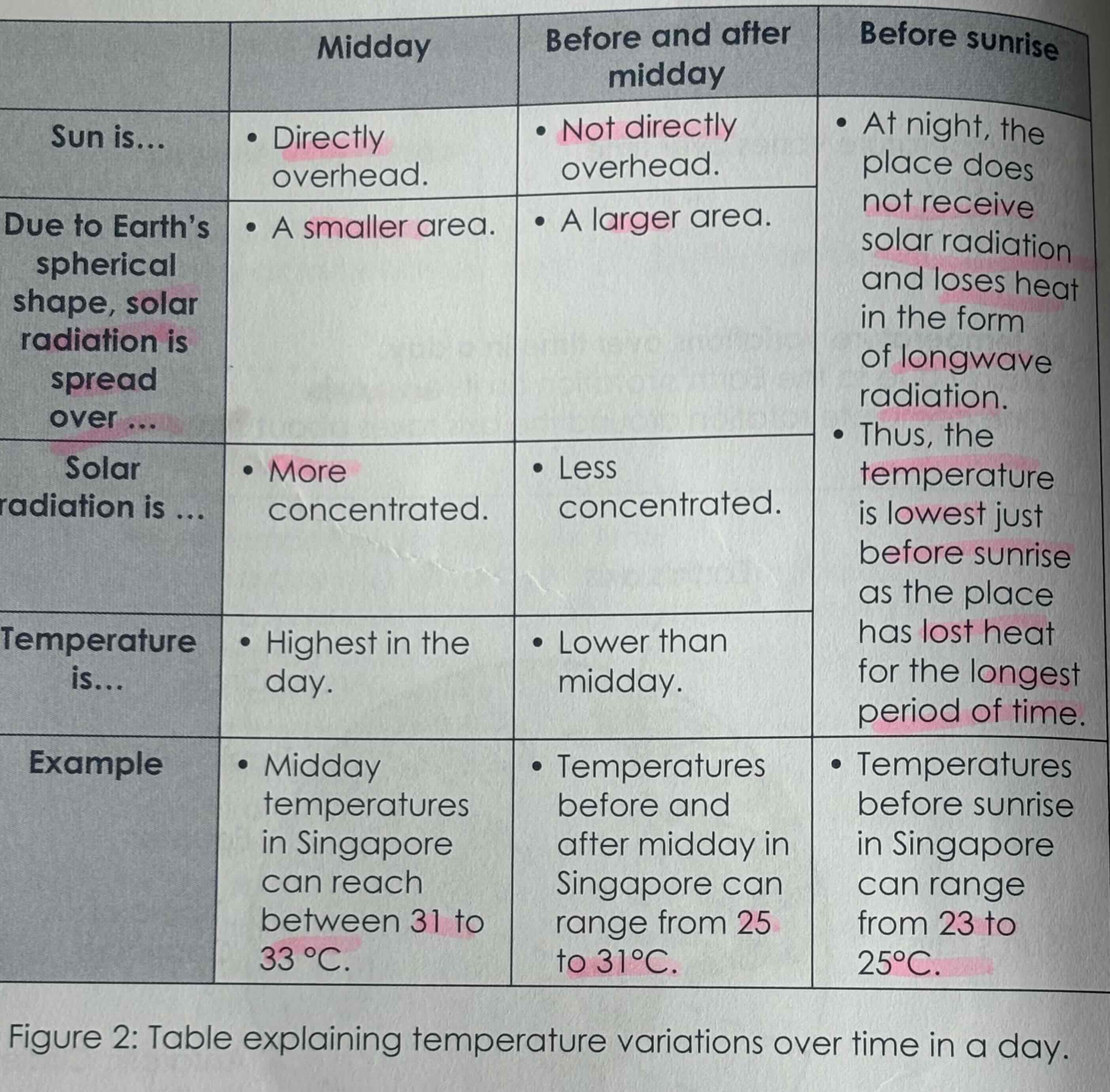
Air temperature variations over time in a day:
Mainly due to the Earths rotation( anti clockwise) on its own axis.
Temperature varies over time in a day as when the Earth rotates, the side of the Earth that faces the Sun experiences day and receives solar radiation, thus it experiences higher temperatures
In the morning and evening, the temperature is lower because the sun’s rays are less direct thus solar radiation is spread over a larger area and becomes less concentrated
Temperature is high at noon where the sun is directly overhead and solar radiation is more concentrated over a smaller area
As the Earth continues rotating, this side will eventually face away from the Sun and experience night time where it does not receive solar radiation, thus experiences lower temperatures.
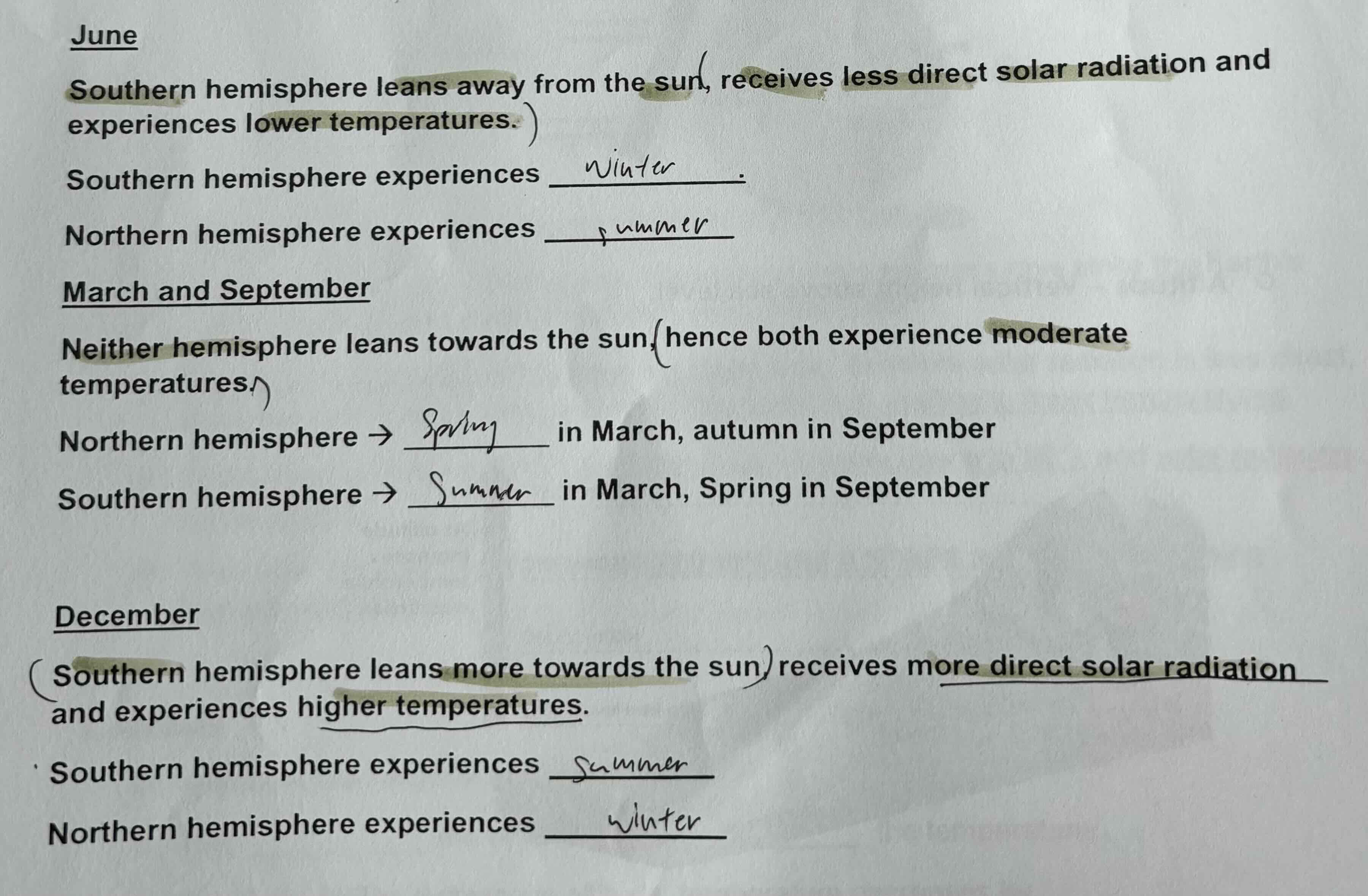
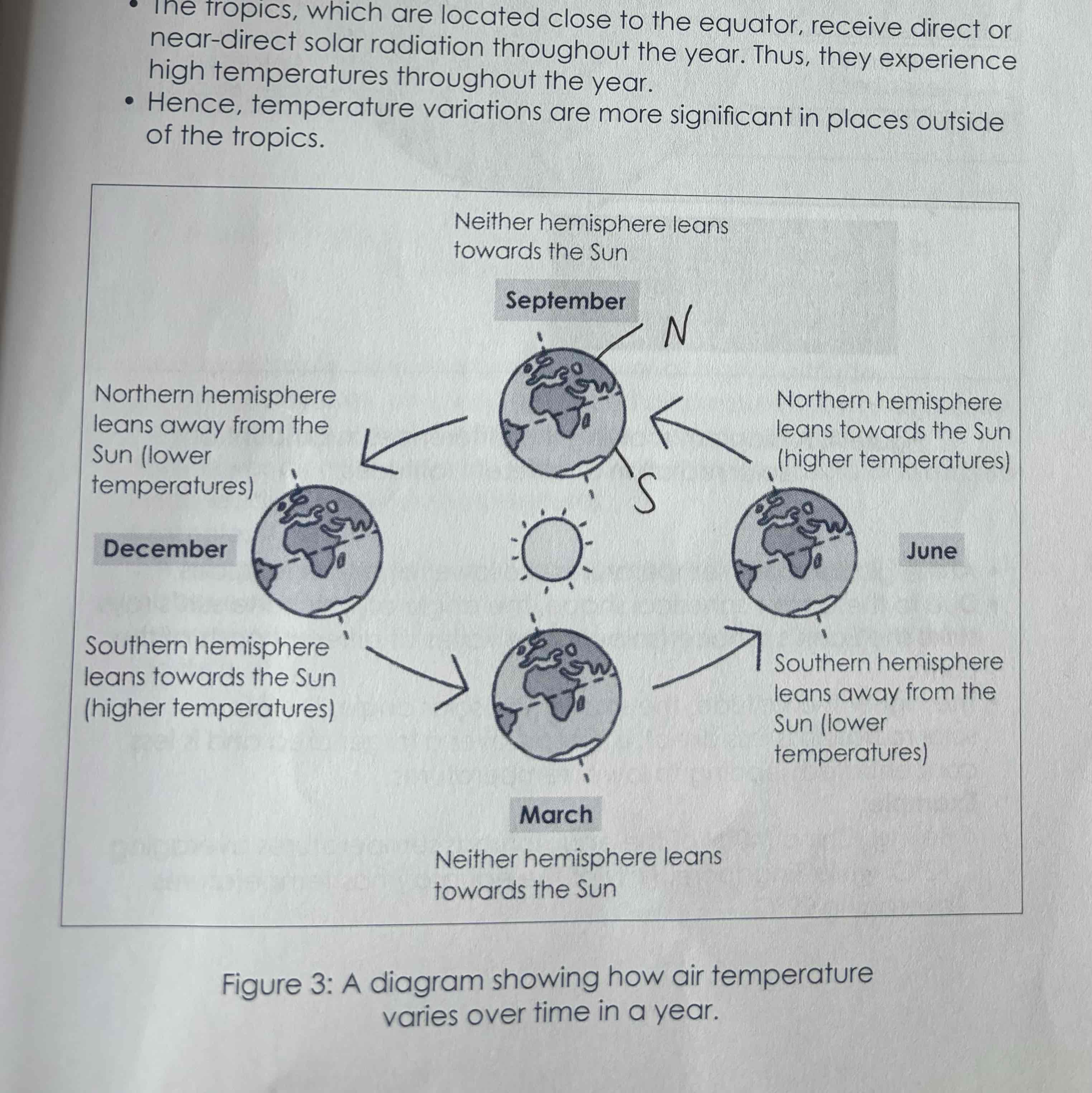
Air temperature variations over time in a year
Mainly due to the Earth’s revolution around the Sun
Earth’s axis is tilted 23.5c
As the Earth revolves around the Sun, hemisphere will receive different amounts of solar radiation across the year
Latitude and definition
Imaginary lines that forms circles around the Earth, parallel to the Equator
At the global scale, temperatures are lower at higher latitudes
Due to the Earth’s spherical shape, the angle at which the Sun’s rays strike the Earth’s surface (solar angle) varies at different parts of the Earth
The higher the latitude, the smaller the solar angle, therefore solar radiation is less direct, is spread over a large area is less concentrated, leading to lower temperatures
E.G: Beijing (40N) has temperatures averaging 12C, while SG (1N) has temperatures averaging 29C
Singapore is within the tropics, with high annual temp of 27
Altitude and definition
Vertical height above sea level
At a local scale, temperatures are lower at higher altitude
At higher altitudes, air is less dense and air pressure is lower as gravity pulls most of the air molecules towards the ground surface
With fewer air molecules, air has a lower ability to absorb and radiate heat, leading to lower temperature
E.G: Average temperatures at Genting highlands (altitude of 1700mm above sea level) is about 21C. Average temperatures in the surrounding areas which are at sea is about 32C
What factors affect air temperature at specific sites?
Type of surface
Distance from the sea
Type of surface
Dark surfaces (exposed soil and forests) generally absorb more solar radiation and radiate more heat, resulting in higher temperatures
Light-coloured surfaces (clouds and snow) generally reflect more solar radiation and radiate less heat, resulting in lower temperatures
Urban areas tend to have higher temperatures than rural areas because:
Urban areas comprise larger areas of dark surfaces (roads) which absorbs solar radiation and radiate more heat than forests and water-bodies
Glass-covered skyscrapers reflect sunlight to the ground surface, increases absorption of solar radiation and heat radiation by ground surfaces
E.g: Night-time temperatures at Singapore’s Central Business District were found to be 2c warmer than the areas near Macritchie reservoir, which has very dense vegetation
Distance from the sea
Coastal areas experience CSWW due to maritime effect, lower annual temperature range
Inland areas experience WSCW due to continental effect, higher temperature range
Sea heats up and cools down more slowly than land (due to thermal properties as land is solid, sea is liquid)
During winter, the sea is warmer than land, warming the air along coastal areas
During summer, the sea is cooler than land, cooling the air along coastal areas
Inland areas do not experience this moderating influence of the sea, and instead experience the continental affect
E.g: Anchorage, a coastal city in Alaska, USA, has a lower annual temperature range of 23c, while Fairbanks, an inland city in Alaska USA, has a higher annual temperature range of 40c
Water cycle
Evapotranspiration, plants give out water
vapour through transpiration, Sun’s heat causes water from water bodies to evaporate, forming water vapour
Condensation, as water vapour rises, it cools and condenses into tiny water droplets at dew point temperature and clouds are formed
Precipitation, when the water droplets in the clouds become big and heavy enough, they fall to the ground as precipitation
Infiltration, water on the ground surface infiltrates the subsurface of soil and rock
Surface runoff, water flows over the ground surface as surface runoff and enters a body of water
Groundwater flows, below the Earth’s surface, water moves horizontally above the impermeable rocks as groundwater flows.
How does water move on and below the earth’s surface
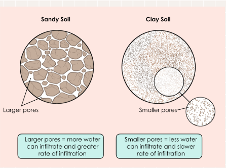
Type of soil
Infiltration rate and groundwater flows are faster in soil which has larger pores (sandy soil) than in soil which has smaller pores(clayey soil).The larger pores allow more water to infiltrate, allowing the water to move much more quickly.
How built-up an area is
Infiltration rates are lower in built-up areas where ground surfaces are covered in concrete roads which have tiny pores.
The speed of surface runoff is higher on smoother ground surfaces such as on roads and pavements in built-up areas, due to fewer obstructions and lesser friction.
Presence of natural vegetation
Infiltration rates and groundwater flow are faster where there is vegetation as the roots of plants loosen the soil, creating more open spaces of surface runoff to pass through
The speed of surface runoff is lower on vegetated areas as the stems and roots of grasses and plants act as barriers and increase the surface roughness
gradient of surface runoff
the speed of surface runoff is higher on steeper slopes than on gentler slopes as the force of GRAVITY acting on the earth is higher
relative humidity
refers to the ratio of the amount of water vapour in the air to the maximum amount of water vapour the air can hold at a given temperature
temp increase, rh decrease, rh increase, temp decrease
RH = actual amount of water vapour present in air/ max amount of water vapour the air can hold x 100
when temperature increases, the amount of water
vapour that air can hold increases, relative humidity therefore decreases
relative humidity is at 100 when air holds the max amount of water vapour, air is saturated
when RH exceeds 100, condensation occurs when
more water vapour is added to the air thru evaporation
air temperature drops
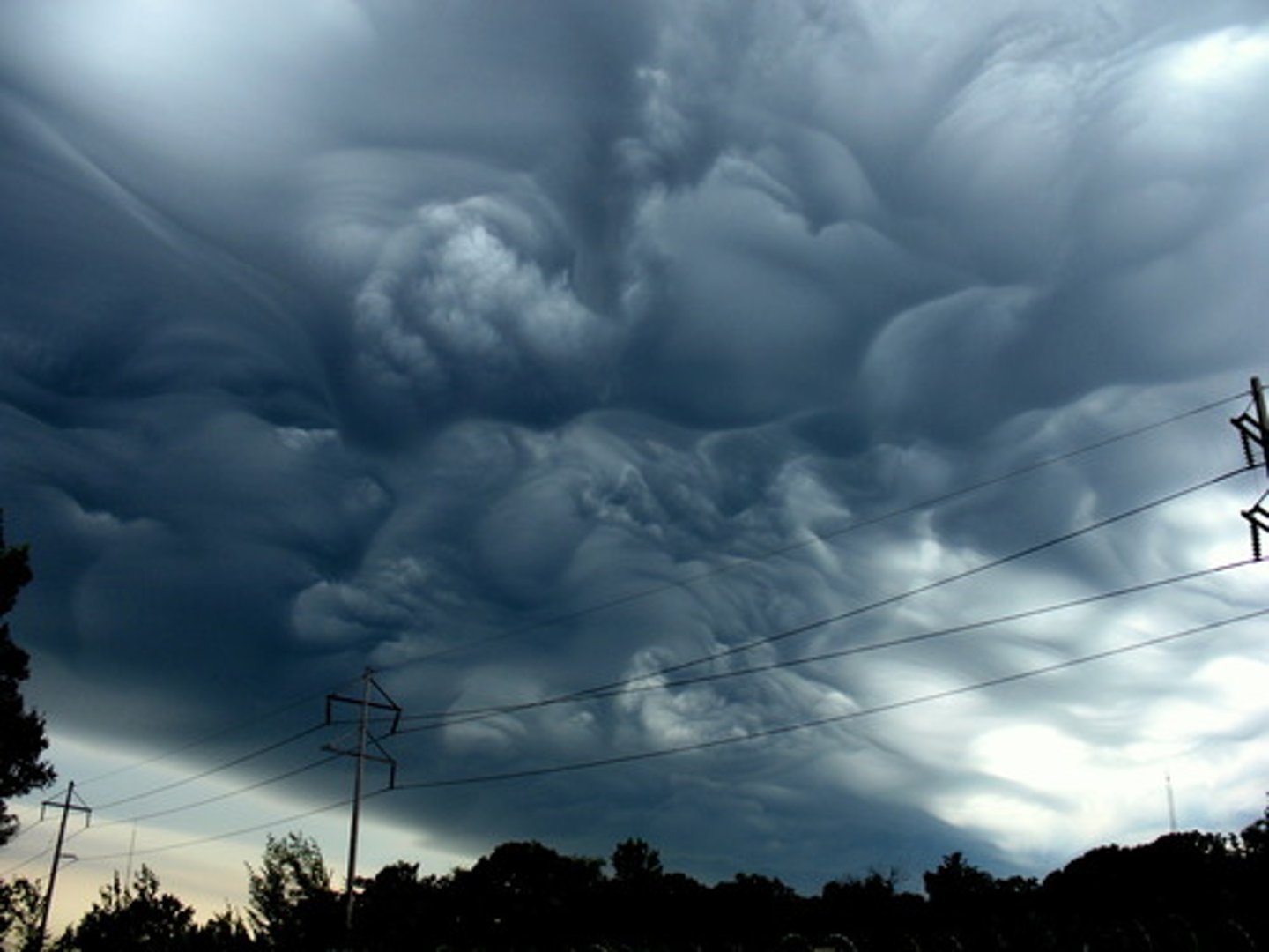
how are clouds formed
as air rises up in the atmosphere, it cools, reducing the amt of water vapour it can hold
eventually, amt of water vapour in the air exceeds the max amount of water vapour the air can hold (rh becomes 100 and air is saturated)
at this dew point temperature, air condenses into water droplets on CONDENSATION NUCLEI
condensation nuclei (dust and ash particles from volcanoes) provides surfaces where water vapour can change into water droplets or solid ice crystals and form clouds
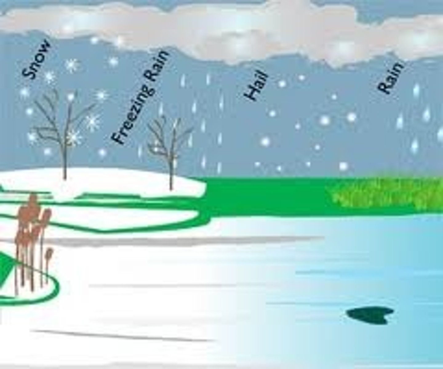
how is rain formed
water droplets in the clouds collide and coalesce and become bigger and heavier
the water droplets fall to the earth as raindrops once they are large and heavy enough over 5mm
sometimes these droplets break apart as they fall
rainfall may start as snow/ice crystals but melt when they fall into warmer air
convectional rain
in the day, heat from the sun is absorbed by the land, and the air above it gains heat
the warm air rises and cools, and condenses on condensation nuclei at dew point temperature. clouds are formed
water droplets in the clouds collide and coalesce, and when they become large and heavy enough, they fall to the ground as rain
e.g: frequent afternoon thunderstorms in singapore
relief rain
prevailing winds pick up moisture over the sea, and pushes the moist air up the windward side of the mountain.
the rising moist air cools and condenses on condensation nuclei or dew point temperature, clouds are formed.
water droplets in the clouds collide and coalesce, and when they become large and heavy enough, they fall to the ground as rain on the windward side.
as most of the moisture has fallen on the windward side, the leeward side experiences dry descending and is thus dry.
e.g: The windward side of the sierra nevada mountain ranges, USA, receives higher rainfall, and thus has lush forests. The leeward side is hot and dry, creating the Death valley desert.
how are winds formed
wind is the horizontal movement of air across the earths surface
it occurs due to the unequal distribution of air temperature, which results in an uneven distribution of PRESSURE GRADIENTS:
The further away you are from the Earth’s and its gravitational force, the fewer gas molecules are present in the atmosphere
In places with higher temperatures, air is heated, becomes less dense, and rises. This results in a void and lower atmospheric pressure. In places with lower temperatures, air cools, becomes denser, sinks, which results in higher atmospheric pressure.
the difference in pressure between two areas forms a pressure gradient
air moves from the area of higher pressure to the area of lower pressure to fill int he void, hence wind is formed
what determines the speed of wind
strength of pressure gradient
smaller pressure gradient: smaller difference in pressure between two areas, leading to slower wind speeds. larder pressure gradient: bigger difference in pressure between two areas, faster wind speeds.
friction
as moving air comes in contact with variations in the earths surface, it experiences frictional drag which reduces wind speed. the affect of frictional drag is greatest where there is uneven relief and rough surface on land. (valleys/mountains)
why do wind direction vary across the earths surface on a local scale
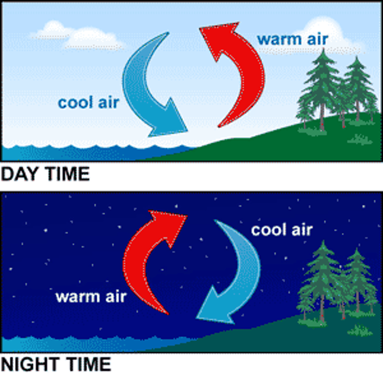
land breeze - night
in the night, both land and sea lose heat through longwave radiation.
the sea and the air above it lose heat slowly. the warmer air is less dense and rises, forming lower pressure over the sea.
on the other hand, the land and the air above it lose heat quickly. the cooler air is denser and sinks, forming higher pressure over land.
air moves from an area of higher pressure over the land to lower pressure over the sea, forming land breeze.
sea breeze - day
in the day, heat from the sun is absorbed by both the land and the sea through shortwave radiation.
the land and the air above it gains heat quickly. the warmer air is less dense and rises, forming lower pressure over the land.
on the other hand, the sea and the air above it gains heat slowly. the cooler air is denser and sinks, forming higher pressure over the sea.
air moves from an area of higher pressure over the sea to lower pressure over the land, forming the sea breeze.
why does wind direction vary across the earths surface on a regional scale
unequal distribution of air temperature across the earths surface results in varied pressure zones.
air moves across the earth over different regions from high pressure to low pressure zones.
as wind travel over large distances, they are deflected by the coriolis force. this occurs due to the earths rotation
northern - winds deflect to their right
southern - left
northeast monsoon
NORTHERN HEMISPHERE - winter/cooler temp from oct-feb. SOUTHERN exp summer/higher temp
IN NH, air cools n sinks, forming an area of higher pressure over central asia
IN SH, air warms up and rises, forming an area of lower pressure over australia
air thus moves from central asia towards australia, as the wind travels to their right due to the CORIOLIS effect, forms NE monsoon exp by countries like SG
southwest monsoon
from june to sept
in summer, air over central asia is warm, creating an area of low pressure.
in winter, the air over australia is cold, creating an area of high temperature,
air moves from aus to central asia (high p to low p)
when the winds cross into NH, they are deflected to the right forming southwest monsoon exp by SG
‘Monsoon winds bring the most variations in wind direction.’ How far do you agree with the statement? Support your answer with evidence.
I agree to a large extent that monsoon winds bring the most variations in wind direction.
The Northeast monsoon occurs from October to February. The Northern Hemisphere experiences winter and cooler temperatures and the Southern Hemisphere experiences summer and higher temperatures.
In the Northern Hemisphere, air cools and sinks, forming and area of higher pressure over Central Asia. In the Southern Hemisphere, air warms up and rises, forming and area of lower pressure over Australia. Air moves from Central Asia to Australia. As winds travel towards India, they are deflected to the right due to the Coriolis effect, forming the Northeast monsoon which is experienced by countries such as India, Singapore and Malaysia.
The Northeast Monsoon is dry and cool as little moisture is picked up from Central Asia, thus India experiences little rain. As the winds blow over the South China Sea, the winds pick up moisture in the form of water vapour, which brings heavy rain to areas such as Singapore.
When the winds cross over into the Southern Hemisphere, they deflect to the left, and continue to pick up moisture over the Indian Ocean, which brings rain to countries like Indonesia and Australia.
Land breezes happen at night when both land and sea lose heat to the environment through longwave radiation. The sea loses heat slowly, hence the air above the sea is warmer. The land loses heat quickly, hence the air above the land is cooler. The warmer air above the sea is less dense and rises, creating a void. An area of lower pressure develops over the sea. The cooler air above the land is denser and sinks. An area of higher pressure develops over the land. Air moves from area of higher pressure over the land to an area of lower pressure over the sea, forming land breeze.
In conclusion, monsoon winds bring variation in wind direction on a global scale across the equator and across the hemisphere and eventually get deflected due to Coriolis effect whereas land and sea breeze only brings variation in wind direction locally on a smaller scale across land either onto landmasses or water bodies.
Latitude
-horizontal lines
-distance north or south of the equator
-parallels
-concentric circles
-different lengths
Longitude
-vertical lines
-distance east or west of prime meridian
-meridians
-pole to pole
-converse at poles
-same length
23.5º
tilt of earth
23.5º N
Tropic of Cancer
23.5º S
Tropic of Capricorn
Remote Sensing
Collecting data from a distance
Passive Systems
-type of remote sensing
-measure natural energy
Active systems
-type of remote sensing
-direct an energy beam and measure amount returned
Geographic information systems (GIS)
A set of computer tools used to capture, store, transform, analyze, and display geographic data layers
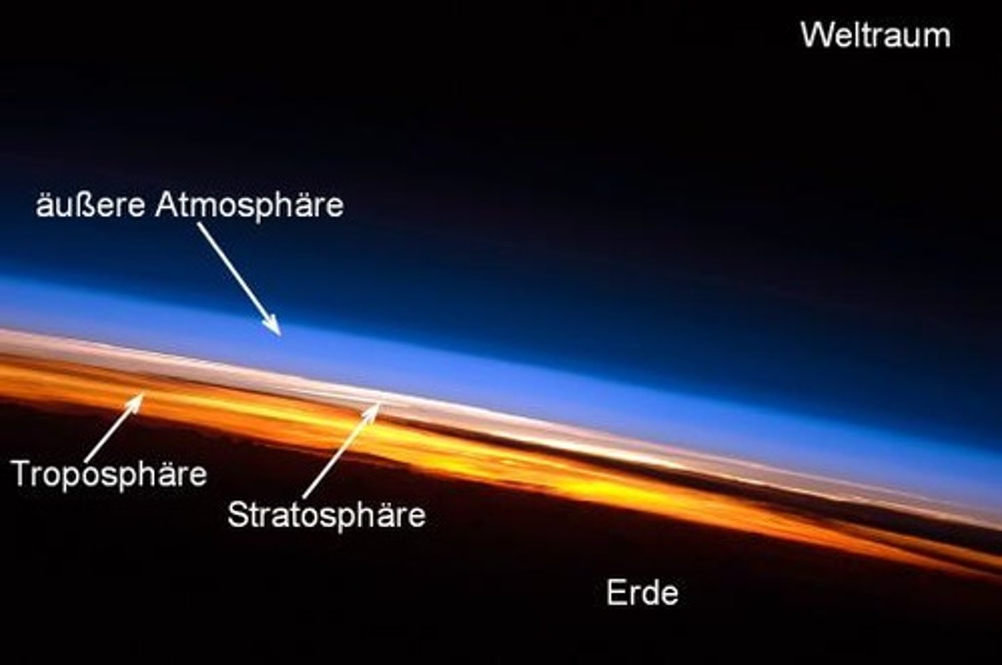
Layers of atmosphere
formed with different temperature, pressure, and composition
Pause
separates the layers of atmosphere
Atmospheric profile
based on density of air molecules and pressure of atmosphere
Troposphere
The lowest layer of Earth's atmosphere
gases in this layer are mixing
contains 70% of atmospheric mass
Stratospheric
gases here are layered by weight
jets fly through this layer
includes o-zone layer
in between troposphere and mesosphere
mesosphere
in this layer temperature is increasing with height
in between the stratosphere and thermosphere
thermosphere
in this layer the temperature can become very hot as gas molecules capture heat from the sun, in between space and the mesosphere
the o-zone
layer within the stratosphere that traps harmful UV-rays, which makes the layer itself very hot
made up of 03
kinetic energy
energy due to motion
can lead to heat
potential energy
stored energy
latent energy
form of energy transferred by changes in phases of matter
Convection
type of energy transfer
direct contact
advection
type of energy transfer
transferred by moving objects horizontally
radiation
type of energy transfer
transferred through electromagnetic waves
conduction
type of energy transfer
transferred through vertical motion
Electromagnetic radiation (EMR)
a form of energy that exhibits wavelike behavior as it travels through space
Stephen-Boltzman law
Amount of EMR increases as Temperature increases
Wien's Law
The higher the temperature of a body the shorter the wavelength of it's maximum radiation. (hotter = shorter wavelength)