GEOG LAB Exam #2
1/93
There's no tags or description
Looks like no tags are added yet.
Name | Mastery | Learn | Test | Matching | Spaced | Call with Kai |
|---|
No analytics yet
Send a link to your students to track their progress
94 Terms
Divergent plate boundaries
are areas where two plates are pulling apart and new crustal material is being created
convergent plate boundaries
areas where two plates are coming together or colliding;
examples of convergent plate boundaries
mountain ranges and deep ocean trenches
Oceanic-Continental Convergent Plate Boundaries
denser and thinner than continental crust, so it sinks into the mantle when they collide.
Key Features:
Subduction zones and deep ocean trenches (e.g., Peru-Chile Trench).
Volcanic mountain ranges on the continental plate (e.g., the Andes Mountains).
Earthquakes caused by the subduction process.
Oceanic-Oceanic Convergent Plate Boundaries
When two oceanic plates meet, the older plate (denser due to cooling) is forced beneath the younger one, forming a subduction zone.
Key Features:
Deep ocean trenches (e.g., Mariana Trench).
Volcanic island arcs (e.g., the Aleutian Islands in Alaska or the Philippines).
Intense seismic activity and underwater volcanoes.
Continental-Continental Convergent Plate Boundaries
Formed when two continental plates collide, leading to the uplift of mountain ranges and the creation of large mountain systems. This type of boundary is characterized by a lack of subduction and intense geological activity.
Which plate boundary (convergent, divergent, transform) contains the most geologic hazards? Which hazards occur here?
Convergent plate boundaries contain the most geologic hazards, including earthquakes, volcanic eruptions, and tsunamis due to the intense interactions between colliding plates.
Why doesn’t Australia (the country, not the plate) have any active volcanoes?
Australia is located in the middle of the Indo-Australian Plate, far from tectonic plate boundaries where volcanic activity typically occurs.
identify the type of plate boundary present:
Central America, between the Caribbean and Cocos plates
This is a convergent plate boundary, where the Cocos Plate is being subducted under the Caribbean Plate, often resulting in volcanic activity and earthquakes.
identify the type of plate boundary present:
The Red Sea, between the African and Arabian plates
This is a divergent plate boundary, where the African and Arabian plates are moving apart, leading to the formation of new oceanic crust and potential volcanic activity.
identify the type of plate boundary present:
The Himalaya, between the Indian and Eurasian plates
This is a convergent plate boundary, where the Indian Plate is colliding with the Eurasian Plate, resulting in the uplift of the Himalayas and frequent seismic activity.
identify the type of plate boundary present:
California, between the North American and Pacific plates
This is a transform plate boundary, where the North American and Pacific plates slide past each other, often causing earthquakes.
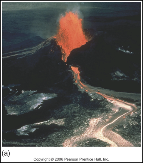
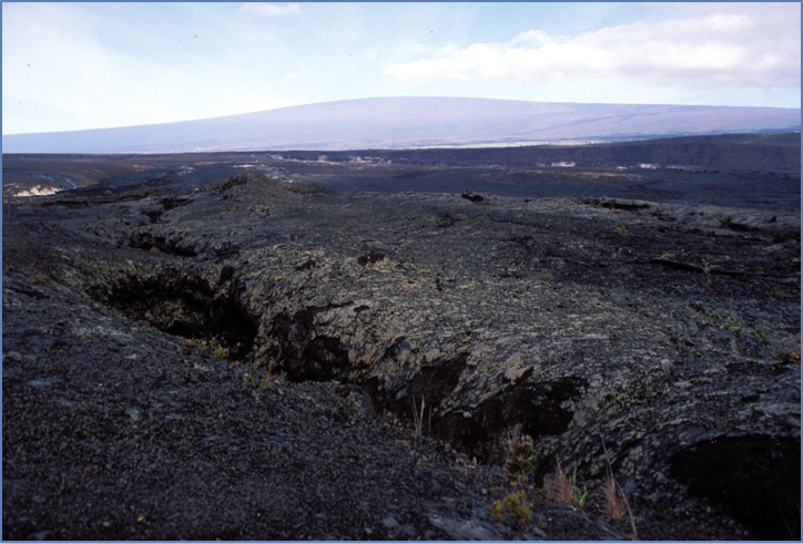
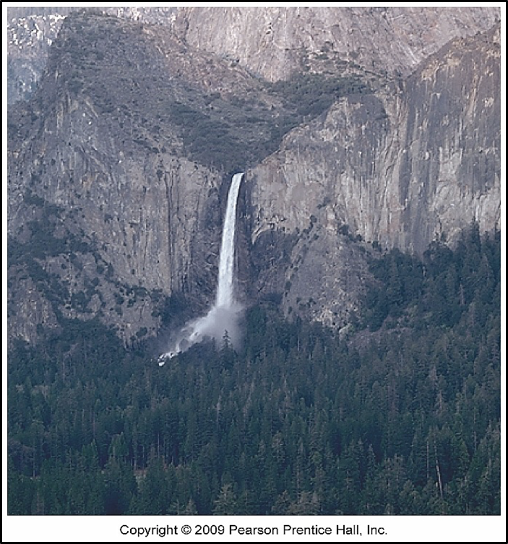
What are effusive volcanic eruptions?
where the magma has a much lower proportion of silica thus a lower viscosity allowing it to flow easily and produce relatively gentle eruptions, often resulting in the formation of lava flows rather than explosive activity.
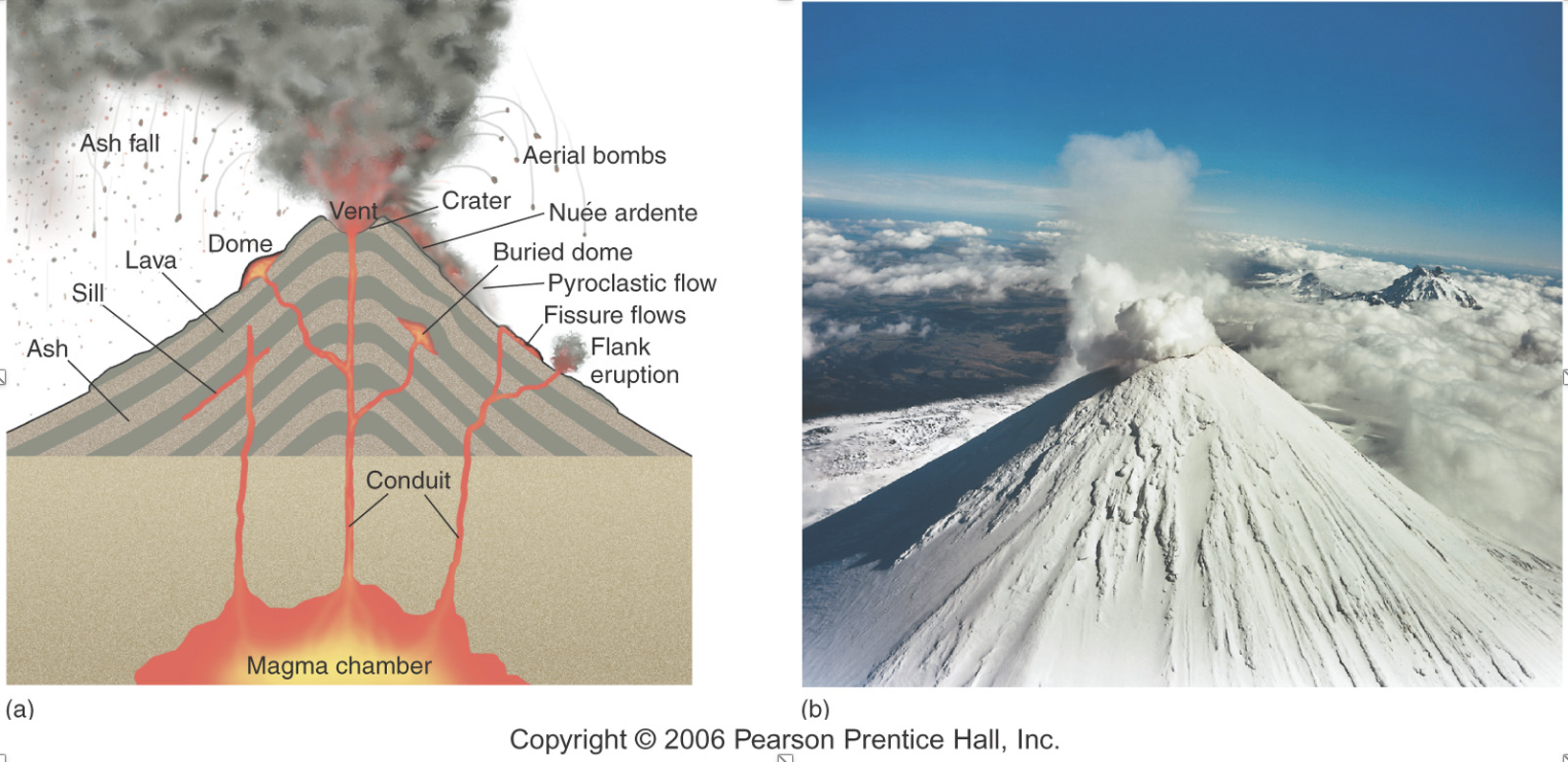
What are explosive volcanic eruptions?
4 characterized by a high silica content in the magma, resulting in higher viscosity. This leads to the buildup of pressure and violent eruptions, producing ash clouds and pyroclastic flows.
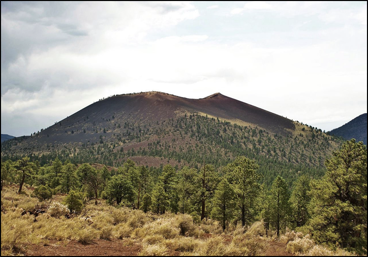
cinder cone
the result of an explosive eruption, but is comprised primarily of cinder-sized tephra.
Why are effusive eruptions not as explosive? What type of cone or other features may be formed because of effusive eruptions?
Effusive eruptions are not as explosive because there is less viscosity of silica in the magma, and not as much gas pressure built up. Shield volcanoes form after effusive eruptions. They also produce a volcanic cone with broad, gentle slopes, composed of layer upon layer of fluid basalt lava.
Describe the difference between volcanoes which form in places like Hawaii (Mauna Loa, etc.) versus those that form the Cascade Range (Mt. Rainier, etc.) in the U.S. (Type of cone, location relative to tectonic plates, type of eruption, etc.)
Volcanoes in places like Hawaii typically form hotspot activity. They usually have shield volcanoes and effusive eruptions. These eruptions are usually effusive explosions. Volcanoes that form in the Cascade Range are usually stratovolcanoes. Eruptions here are normally explosive eruptions.
intrusive volcanic features
If magma cools within the crust
extrusive volcanic features
features formed from the cooling of lava on the surfac
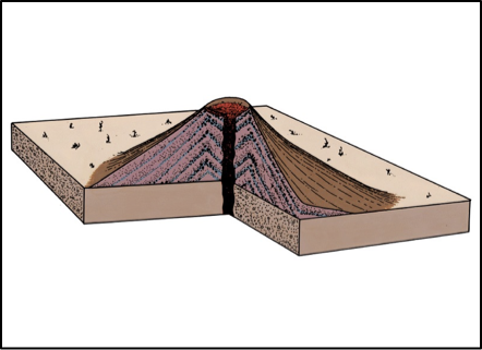
Shield Volcanoes
Description:
Broad, gently sloping cones made primarily of low-viscosity basaltic lava.Key Features:
Large base with a dome-like profile.
Built by successive, fluid lava flows.
Often associated with hotspot volcanism (e.g., Hawaiian Islands like Mauna Loa).
Eruption Style:
Effusive eruptions with lava flowing over long distances.
Stratovolcanoes
Description:
Tall, symmetrical cones built from alternating layers of lava flows, volcanic ash, and other pyroclastic materials.Key Features:
Classic "volcano" shape with steep upper slopes and gentler lower slopes.
Commonly associated with subduction zones (e.g., Mount Fuji, Mount St. Helens).
Capable of producing devastating eruptions.
Eruption Style:
Mixed; both explosive (pyroclastic) and effusive (lava flows).
what type of eruption is this
effusive
composite
cinder cone
cinder cone
shield volcano
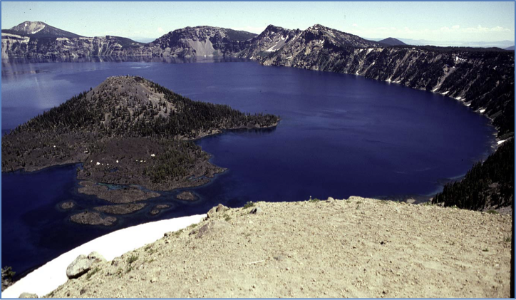
collapsed caldera
batholith
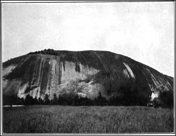
batholith stone mountain
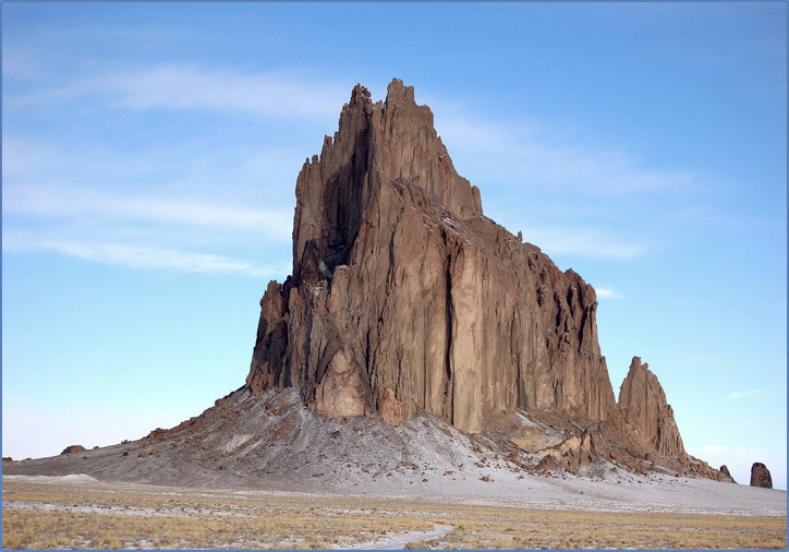
volcanic neck
Hydraulic action
is the work of the moving water itself, the turbulence caused by the flowing action of the stream
Abrasion
the process of a stream using the materials carried by the water to hit and dislodge other materials along the sides or bottom of the watercourse.
Corrosion
the process whereby materials dissolve into the water.
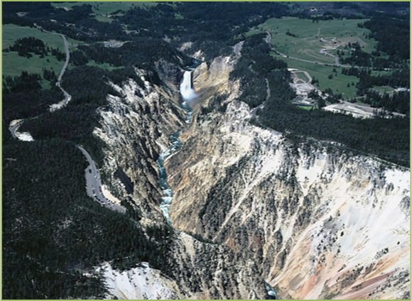
downcutting
making the watercourse deeper
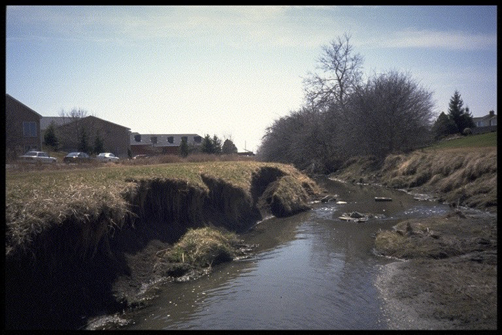
lateral erosion
making the watercourse wider
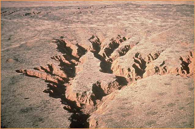
headward erosion
making the stream longer
hydraulic action and abrasion
lateral erosion
headward erosion
Left-Point Bar Right-Meander
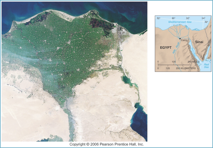
delta
youth stage v shaped
mature stage
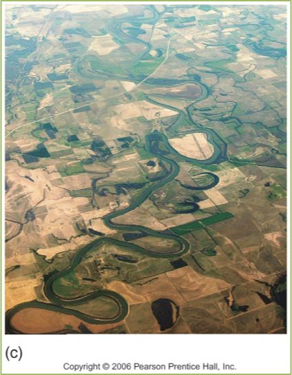
old age stage
Kettles
are formed when large blocks of the ice break-off from the glacier and sink into ground moraine as the ice sheet melts
kettle lakes
The eventual melting of these blocks forms depressions that may fill with water to form
kames
are round mounds of glacial drift left after the ice retreats.
drumlins
are elliptical shaped mounds formed as the ice retreats which can indicate the direction of glacier flow, which is parallel to the long axis of the drumlin in the direction of its tail
Meltwater streams
flowing beneath a glacier may form an ice tunnel, produced when the “warm” stream waters melt the ice.
esker
These tunnels may eventually fill up with sand and gravel and when the ice retreats, these deposits are left as sinuous ridge called an
Pluvial Lakes or Paleolakes
refers to lakes that existed during a past Ice Age,
Describe the formation of the Great Lakes in North America and how these are different from paleolakes.
The Great Lakes formed during the Ice Age when the land was covered by ice sheets that later melted and receded towards the south. The glacial erosion formed basins and valleys where the Great Lakes later emerged. These form in depressions scoured out deeper, wider, and longer by continental ice sheets. Paleolakes refers to lakes that existed during the past Ice Age, but do not exist today or are smaller today than in the past.
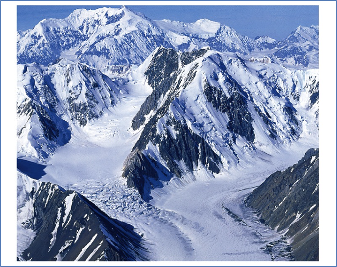
alpine glacier
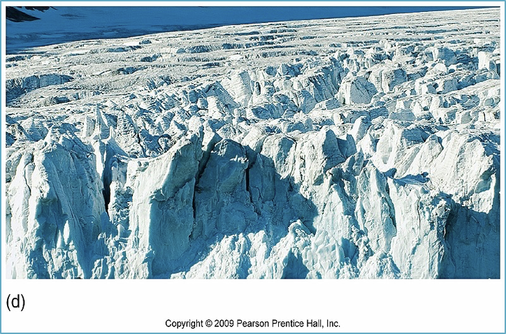
crevasses
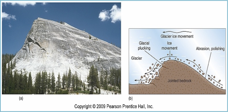
abrasion
glacial valley
hanging valley
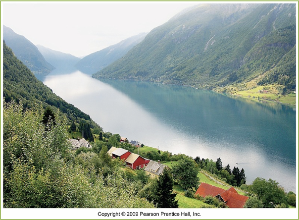
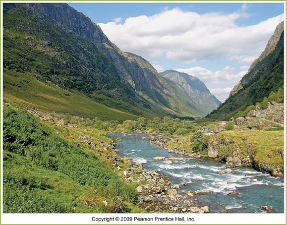
fjord
kames
kettle lakes
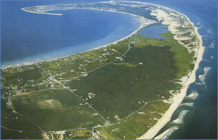
sandspit
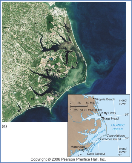
barrier island
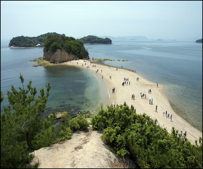
tombolo
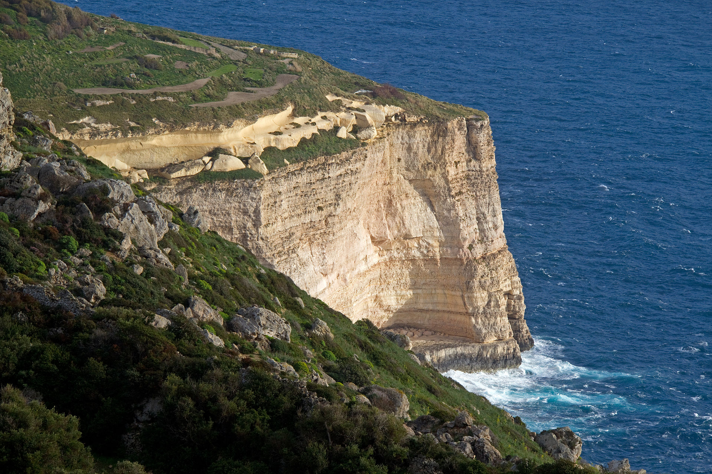
sea cliffs
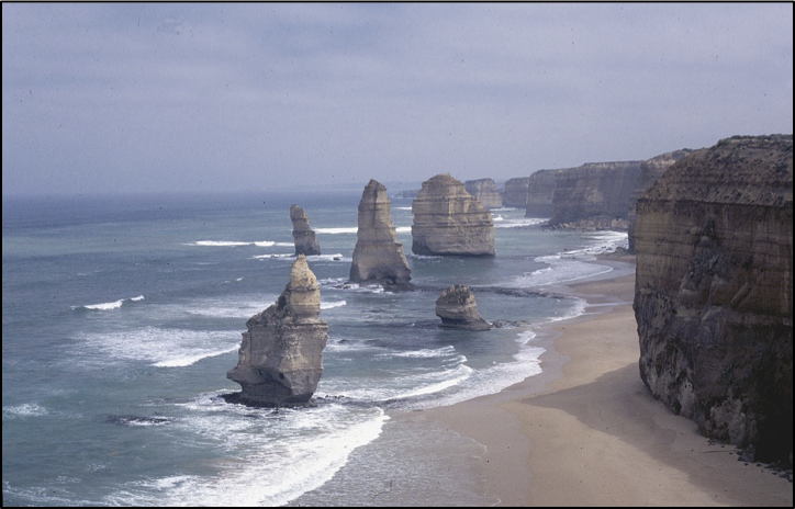
sea stacks
what are the 4 soil components? M.O.W.A
Minerals, organic material, water, air
What are the soil formation factors?
parent material, climate, biological agents, topography, and time.
Field Capacity
the ability of a soil to hold water against the downward pull of gravity.
the largest capacity
sand
the smallest capacity
clay
List the four soil forming processes in soil formation
The four primary soil forming processes are addition, transformation, depletion, and translocation
O horizon
addition
E horizon
Depletion
A horizon
transformation and addition
B horizon
Translocation
C horizon
Transformation
The four components of waves
Wave height, wave frequency, wavelength, wave period
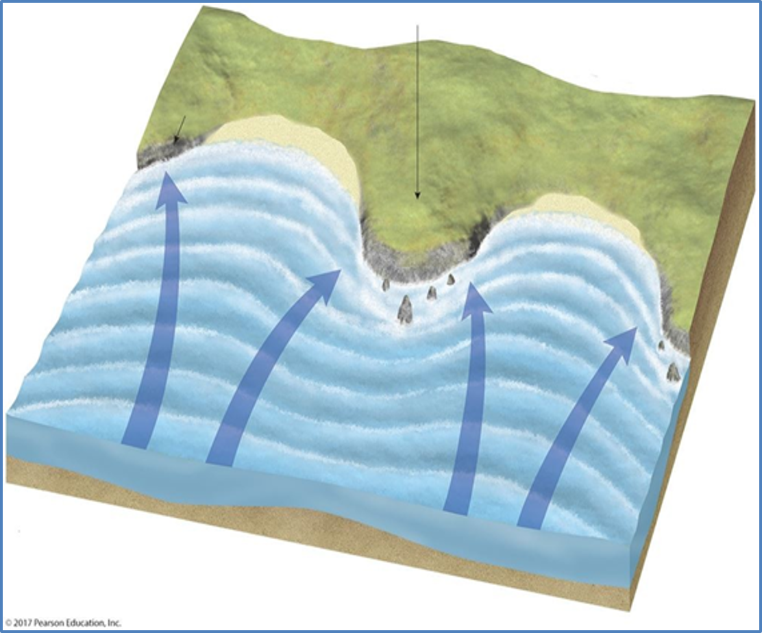
What causes wave refraction and how does this redirect energy along a coastline?
Wave refraction is caused by waves moving from deeper to shallower water at an angle at the coastline resulting in an uneven distribution of wave energy along the coast, concentrating it on some areas and minimizing it on others. Wave refraction redirect energy laterally along the shore forming currents.
blue
wave refraction
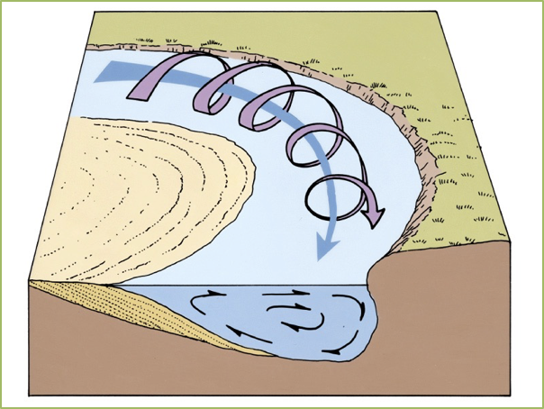
. Describe how longshore currents form and what is established as a result of these currents
Longshore currents are formed because of waves approaching the shore at an angle instead of parallel. Longshore or beach drift are established as a result of longshore currents.
The protrusion of land
Headland
rock mass
sea stack
flat area
wave cut platforms