Kinematics - Philippine Sea Plate & Marginal Basins
1/31
There's no tags or description
Looks like no tags are added yet.
Name | Mastery | Learn | Test | Matching | Spaced |
|---|
No study sessions yet.
32 Terms
4.0 km
Depth of South China Sea Basin
Pautot et al. (1986)
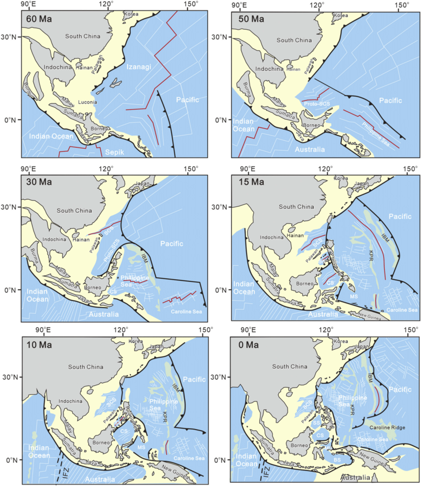
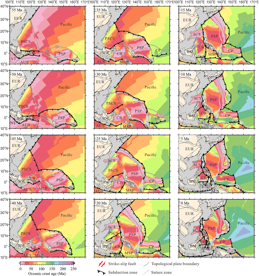
2 stages of SCS opening:
32 - 17 Ma along E-W axis
20 - 17 Ma along NE-SW axis
Holloway (1982) and Taylor & Hayes (1983)
Model 1 for SCS:
put the spreading, the prominent ridge being the Scarborough Ridge, in the basin on a roughly NE-SW direction starting around 32 Ma (Oligocene).
Briais et al. (1993)
Model 2 for SCS:
showed a progressive change in the orientation of the spreading system: roughly ENE-WSW from 32-30 Ma (Oligocene) and E-W from 30-27 Ma. By 26-24 Ma, the ridge jumped to the South, and a second basin started forming to the Southwest.
suggested that the SCS spreading ceased around 15.5 Ma (Middle Miocene).
Barchausen & Rosser (2002)
Proposed the spreading of SCS ceased somewhat earlier, ~18 Ma.
NW sub-basin - ENE-WSW spreading during 32-30 Ma.
WE sub-basin - E-W spreading during 30-27 Ma.
SW sub-basin - NE-SW spreading 26-24 Ma.
Essentially three sub-basins for the South China Sea according to Briais et al. (1993)
Rangin et al., (1990)
Model 3 for SCS:
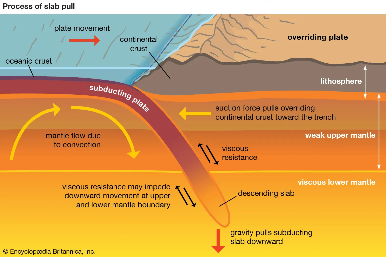
Trench pull.
Gravity-controlled trench-pull may be invoked to explain the rifting and spreading. The subduction along the Sunda Trench may be responsible for the opening of the proto-SCS (and even Celebes Sea) and the subduction of the proto-SCS south of Palawan may in turn explain the South China Sea opening.
Pubellier et al. (2003)
Model 3 for SCS:
Trench rollback (Back-arc basin model).
Rolls back due to getting longer as it subducts, and initiates spreading.

Tapponier et al. (1982; 1986)
Model 4 for SCS:
South China Sea opened as a side effect of the extrusion of Indochina
Contention: Timing of collision vs. opening of SCS & difficult to reconcile with a N-S spreading of the SCS.
Rangin & Silver (1991)
Characterized SSB:
Situated immediately to the southeast of Palawan, this small marginal basin composed of two sub-basins that are separated by an E-NE trending Cagayan de Sulu Ridge (CRS)
Formed starting at around ~20 Ma (Early Miocene)
Rangin & Silver (1991) - 2
Model 2 for SSB Formation:
The geochemcial signature of the oceanic basement, along with the basin’s position and age correlation with the arc volcanism along the CSR, suggests a back-arc spreading (starting ~20 Ma) origin for the Sulu basin.
Arc volcanism along the CSR ceased around 16 ma, following its collission with the rifted margin of China (Palawan Micro-continental block)
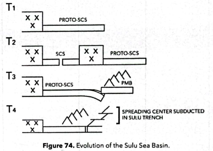
Rangin & Silver (1991) - 1
Model 1 for SSB Formation:
Formed through spreading along the Cagayan de Sulu Ridge (CSR)
Discredited. Basins opposite of the Cagayan de Sulu Ridge have different geochemical signature.
NW sub-basin- Continental basement
SE sub-basin - Oceanic basement
Celebes Sea Basin (CSB)
Basin located southeast of the Sulu Basin & Sulu-Zamboanga Arc
Lee and McCabe (1986)
Model 1 for CSB formation:
a trapped basin mechanism for CSB; could have split off as a basin from a previously larger Molucca Sea Plate.
Silver & Rangin (1991)
Model 2 for CSB formation:
a) Fragment of WPB
b) Back-arc basin
c) basin rifted from the SE continental margin
Hall (1996) and Nichols & Hall (1999)
Model 3 for CSB formation:
A fragment of the West Philippine Basin (WPB) of the Philippine Sea Plate.
argued that the CSB and WPB formed part of the same ocean basin with similarities in basement age, chemistry and stratigraphy.
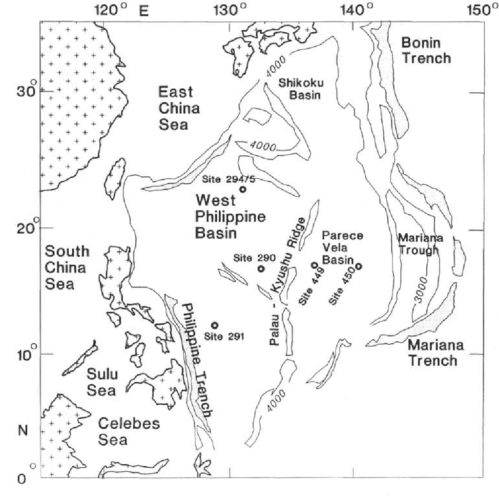
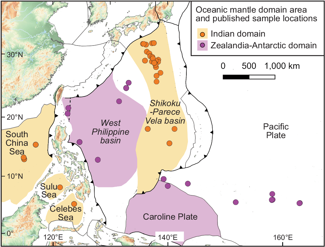
West Philippine Basin (WPB)
Occupies 50% of the Philippine Sea Plate
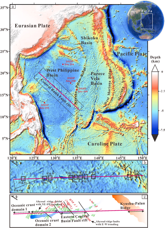
Central Basin Fault (Lineament)
Lineament where West Philippine Basin opened
Hilde and Lee (1984)
2 Stages of Opening of the WPB:
60 and 45 Ma at NE-SW - 4.4 cm/yr half spreading rate
45 and 35 Ma at NS orientation- 1.8 cm/yr half spreading rate
Trapped Oceanic Basin
by Uyeda and Ben-Avraham (1972), Hilde (1977), Lee (1984)
Model that suggests WPS as a trapped piece of the Pacific Plate during the 43 Ma kinematic reorganization of the Pacific Plate.
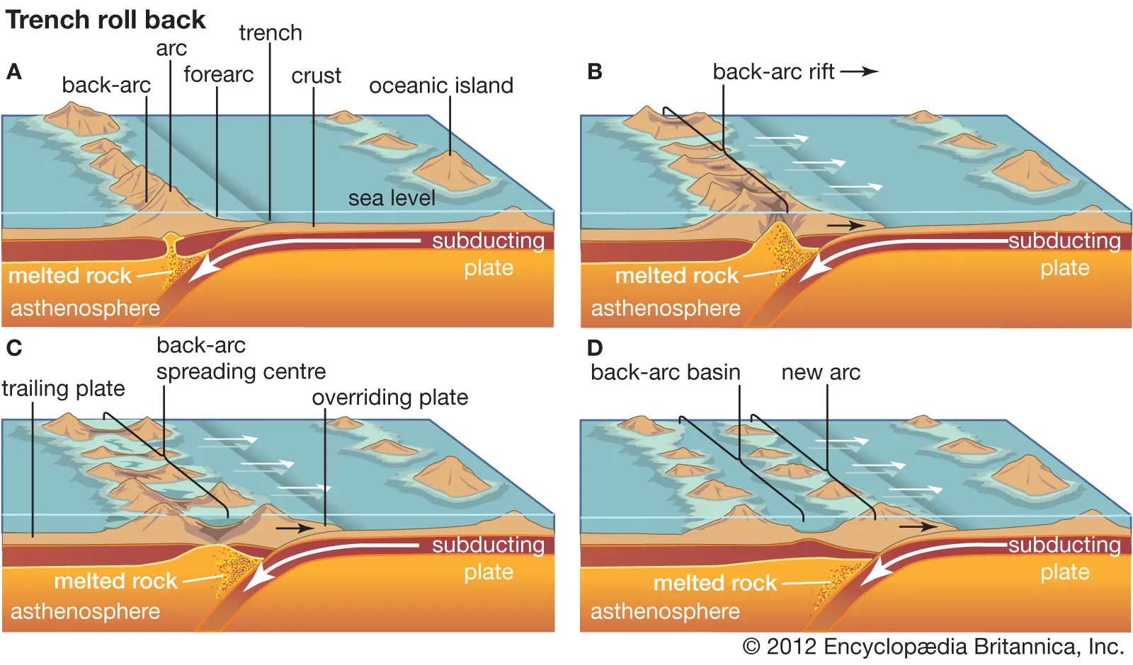
Back-Arc Basin Model
by Karig (1975), Mrozoqki et al. (1982), Seno and Maruyama (1984)
Model stating that WPB formed by back-arc spreading behind the Oki-Daito Ridge.
N-S
PVSB’s oceanic crust accelerates on a ______ spreading-axis.
Mrowzoski and Hayes (1979); Kobayashi and Nakada (1987):
Model for Opening of PVSB:
1st stage: 30 Ma - Parece Vela
2nd stage: 10 Ma - Shikoku
Oceanic accretion stopped at around 17 Ma
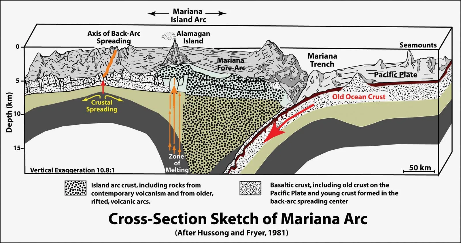
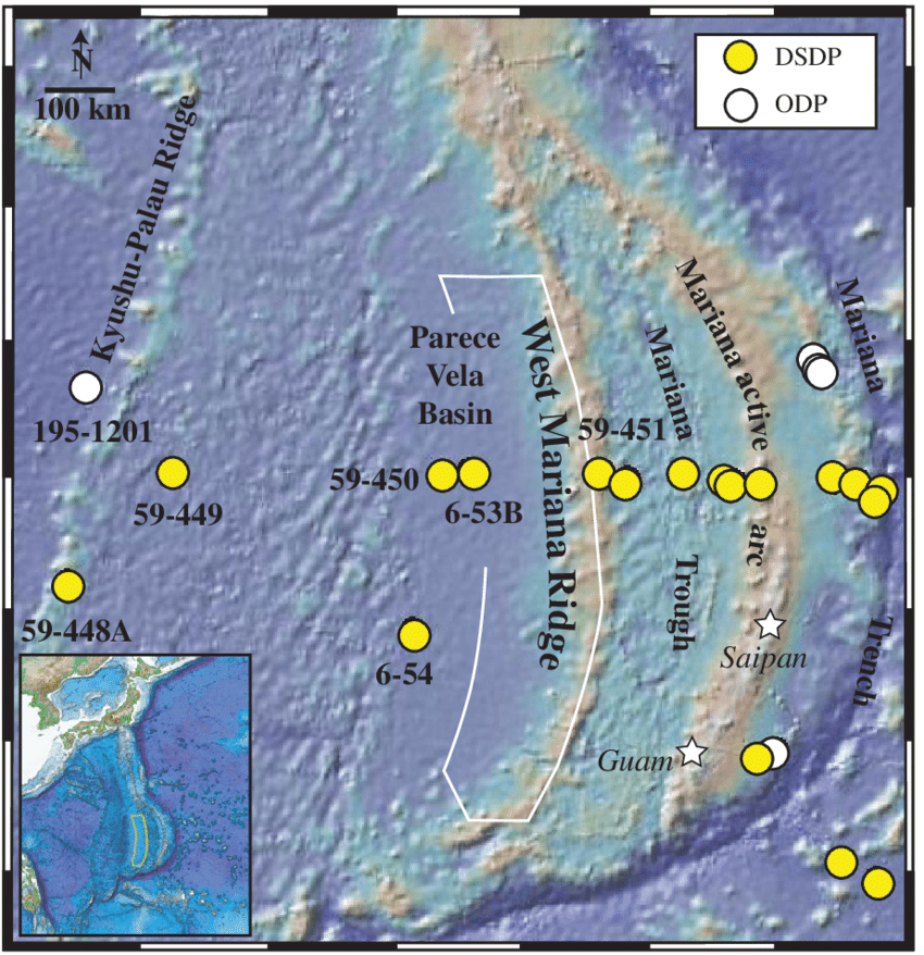
Marianas Basin (MB)
Philippine oceanic basin that opens around 6 Ma at a NS spreading axis and still presently active
Ayu Basin
Philippine oceanic basin that is a poorly known portion of the southern extremity of the plate.

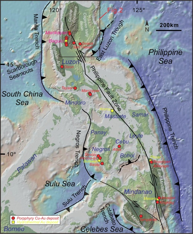
Palau-Kyushu Ridge
Submarine ridge in the PH Sea Plate that divides the WPB and PVSB
2,500 km long
Trapped Basin Model
Model for Palau-Kyushu Ridge:
Volcanic arc formed from the transformation of a transform fault to subduction zone at around 43 Ma.
Subduction retreated at 30 Ma and stopped, signifying the start of the opening of Parece Vela-Shikoku Basin
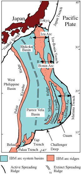
Izu-Bonin Ridge
Submarine ridge in the PH Sea Plate:
Eastern limit of Shikoku Basin
Volcanic arc of the active Bonin Trench colliding with the Japanese margin - Izu Peninsula in Central Japan
West and East Marianas Ridge define limits of Marianas Basin

West Marianas Ridge
Ancient volcanic arc of the Izu-Bonin Ridge that was active between 20-9 Ma.
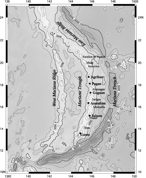
East Marianas Ridge
Volcanic arc of the active Marianas Trench (part of the Izu-Bonin Ridge)
Old-Day Kinematics
4 Ma PLATE REORGANIZATION
Relative movement changed from NNW to WNW since 5 Ma based on Taiwan collision and lzu-Misira-Boso region of Japan.
In Taiwan, at 4 to 6 Ma, 40° CCW.
In Japan, at 2 to 3 Ma, 30° CCW.
Present-Day Kinematics
NW DISPLACEMENT DIRECTION
3 Main Kinematic Parameters with respect to Eurasia:
1. Rotation pole located NE of Japan.
2. Relative displacement rate varies from N to S along the western edge of the PSP:
3 cm/yr - Latitude of the Nankai Trough.
9 cm/yr - Southern end of the Philippine Trench.
3. Relative displace direction whose azimuth is directed NS5W near Taiwan with a linear velocity around 7 cm/yr.