huge ap human unit 1
1/28
Earn XP
Description and Tags
1.1-1.7
Name | Mastery | Learn | Test | Matching | Spaced |
|---|
No study sessions yet.
29 Terms
A formal region is...
united by one or more specific traits.
Economic
Social
Political
ENvironmental
A functional region is...
rganized around a central node (focal point), relationship is typically based around economics, travel or communication.
A perceptual/vernacular region is...
based on a person’s perspective or perception of a certain location.
Informal!
Sense of place!
Cultural Ecology
The study of how humans interact or adapt to the environment.
Environmental Determinism
8th Century - European colonialism
Belief that climate and landforms are the most powerful forces shaping human behavior and societal/cultural development.
Fixed mindset of human capability
Possibilism
Modern
Limitations imposed by natural environment, but focuses on the role of human culture to modify and respond to the environment to better fit human needs
scale
Scale is the relationship of the size of a map to the amount of area it represents on Earth.
small scale
On a small scale map, more area would be shown in less detail (think “zoom out”)
large scale
On a large scale map, less area would be shown in greater detail (think “zoom in”)
scale of analysis
Scale of analysis is the level at which data is displayed on a map. It is important for you to identify the scale of analysis in four different ways: global, regional, national OR local.
How is data gathered?
Fieldwork/Field Observations: Physically visiting and recording, firsthand info there.
The US Census
Representative Districts - voting & democracy
Distribution of public funding for schools, law enforcement, roads, etc.
Personal, government & business decision making.
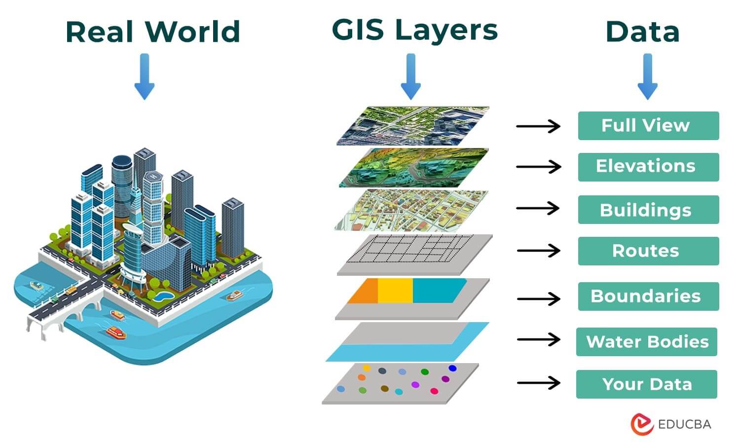
Geographic Information Systems (GIS)
Computer system/software that stores, analyzes, and displays information from multiple digital maps or data sets.
Satellite Navigation Systems/Global Positioning System (GPS)
Satellites orbit the earth and communicate to GPS receivers.
Absolute locatio
Remote Sensing
Cameras/sensors mounted on aircraft or satellites (high altitude) to collect digital images of the earth’s surface.
Toponym
place name; reflects the culture & history (Los Angeles/San Diego)
Site/Physical Landscape:
Environmental features; includes climate, water sources, elevation, topography
Distance Decay
Interaction between two places declines as the distance between the two places increases
Time Space Compression
Increasing sense of accessibility and connectivity which seems to bring humans in distant places closer together.
dot density
dots represent the specified quantity of a spacial characteristic
chloropleth maps
various colors or patterns to show location and distribution of spatial data
cartograms
size of countries are shown according to a specific variable. Area is distorted to show a variable.
Absolute location/SITE
EXACT AND PRECISE (address, coordinates, latitude and longitude) + things that never change
Relative location/SITUATION
Relationship to another place (ex: library is near park)
Projection
scientific method of transferring locations on Earth’s surface to a FLAT map
Winkel Projection
relative sizes of landmasses on map
same as reality
sparsely populated places become distorted (n&s poles, greenland, etc)
Mercator Projection
shape is distorted very little
direction is consistent
RELATIVE SIZE IS DISTORTED TOWARDS THE POLES
places higher in latitude seem larger than they are
Robinson Projection
Makes the world look visually pleasing
distorts both size and shape
stretching near poles
globalization
Globalization is the process of increased interconnectedness among people, businesses, and governments worldwide, driven by flows of ideas, goods, services, technology, culture, and information across borders.