Topic 9: Ocean Circulation
1/76
There's no tags or description
Looks like no tags are added yet.
Name | Mastery | Learn | Test | Matching | Spaced | Call with Kai |
|---|
No analytics yet
Send a link to your students to track their progress
77 Terms
Gulf stream migration
In summer 2008, migrated to a position closer to the Tail of the Grand Banks (TGB)
Consequences of Gulf Stream Migration/Collapse
Impinges flow of cold, O2-rich water
Among the fastest warming regions in the global ocean
Home to many ecologically and economically valuable marine species
Ocean currents
Continuous, directed movement of water from one place to another
2 types of ocean currents
Wind-driven: surface currents
Density-driven (thermohaline): deep currents
Surface currents
Wind-driven; horizontal movement in upper 10% of water, occur above and within the pycnocline
Deep currents
Density-driven (thermohaline); vertical movement, mixing, move 90% of all ocean water
slow-moving – 10 to 12 km/year
Flotsam definition
Floating wreckage of a ship or its cargo
Use of flotsam
Movement of flotsam can be used to track currents
sverdrups (Sv)
Units to measure massive amounts of water; one sverdrup = 1,000,000 m3 per second (1 Sv = 1 x 10⁶ m3/s)
Primary force behind movement of surface currents
Wind!
2% wind’s energy is transferred
Energy transfer from air to water via friction
Direction of surface current flow in N. Hemisphere
Currents flow to the right of wind direction (major wind belts)
2 reasons why surface waters move in a direction different than the wind
Ekman spiral
Ekman transport
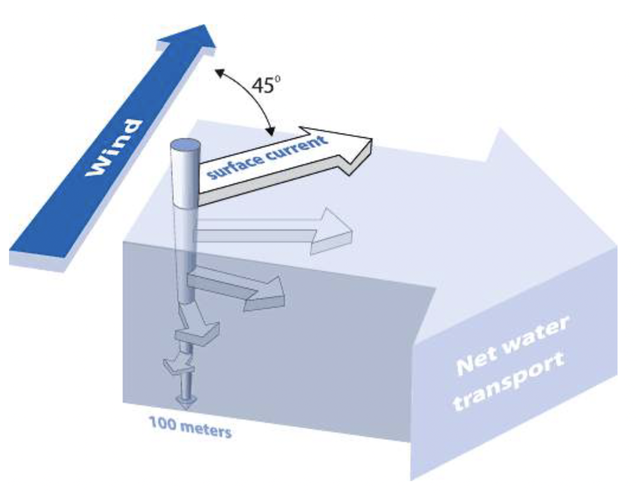
Ekman Spiral
Ocean circulation model:
Surface layer in contact with the wind moves 45 ̊ to the right (left in S. Hemisphere) of the wind direction in northern hemisphere (due to the Coriolis Effect)
Ekman spiral moves downwards: visualize many water layers moving at an angle to the right of the overlying layer (CREATES A SPIRAL)
Ekman spiral slows down due to friction as energy is passed from layer to layer
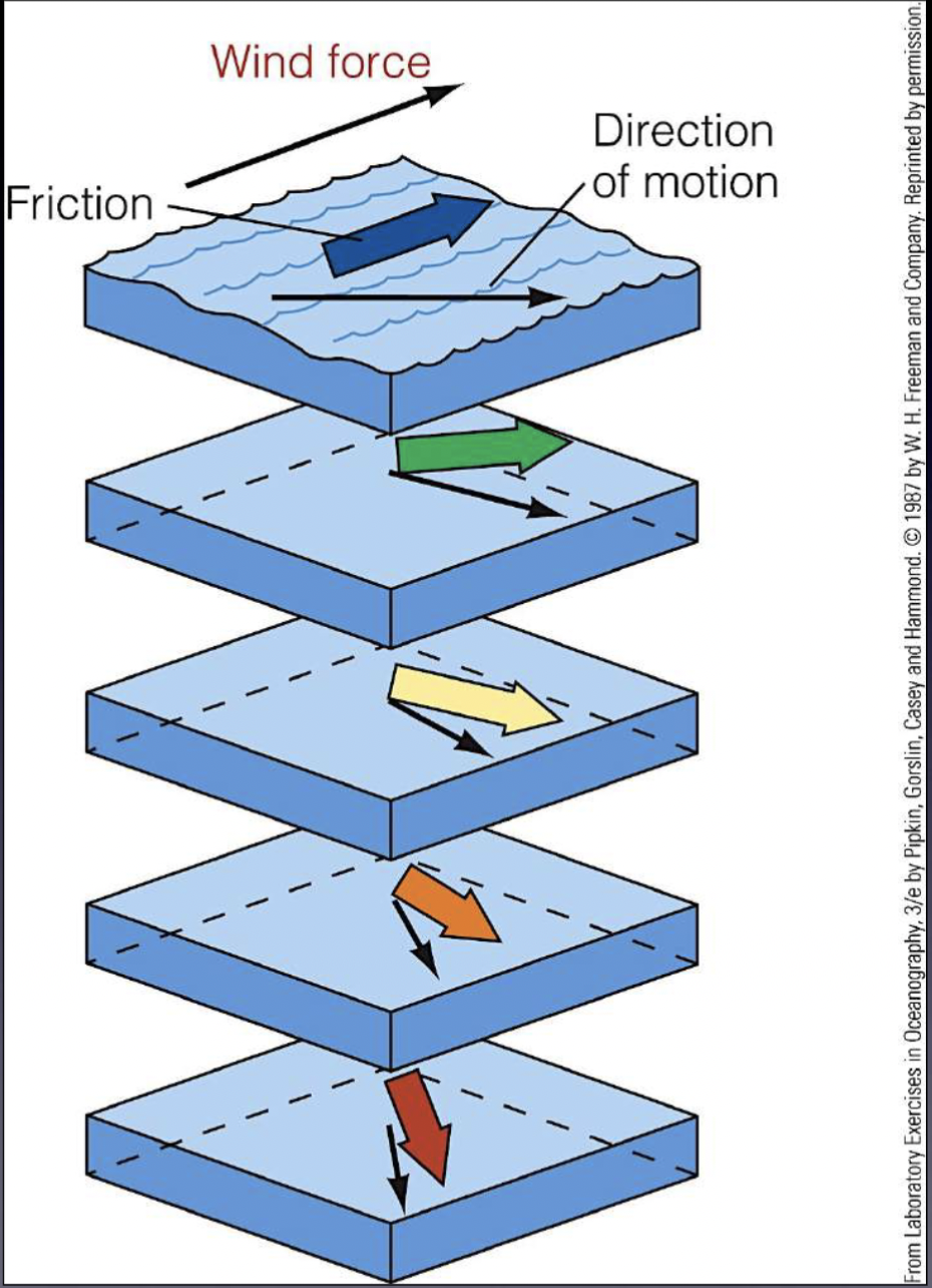
Ekman Transport
The net motion of water (down to about 100m) due to the blanace between:
The Coriolis effect
Turbulent drag forces within surface waters and geographic features (shoreline and seabed)
Theoretical direction of Ekman transport
90 ̊ to right - Northern Hemisphere
90 ̊ to left – Southern Hemisphere
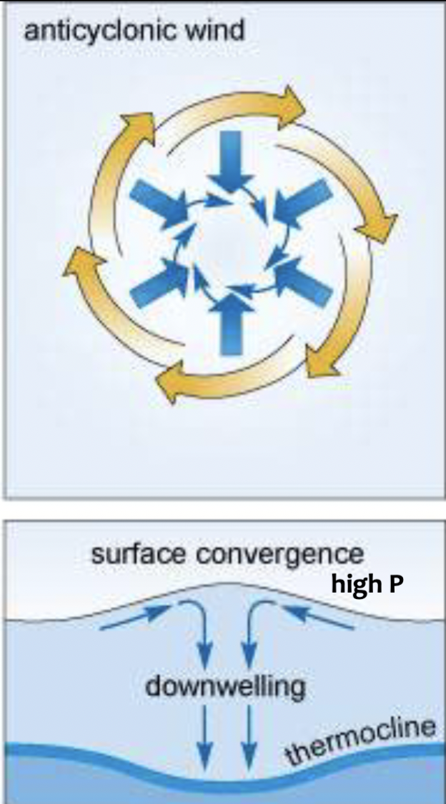
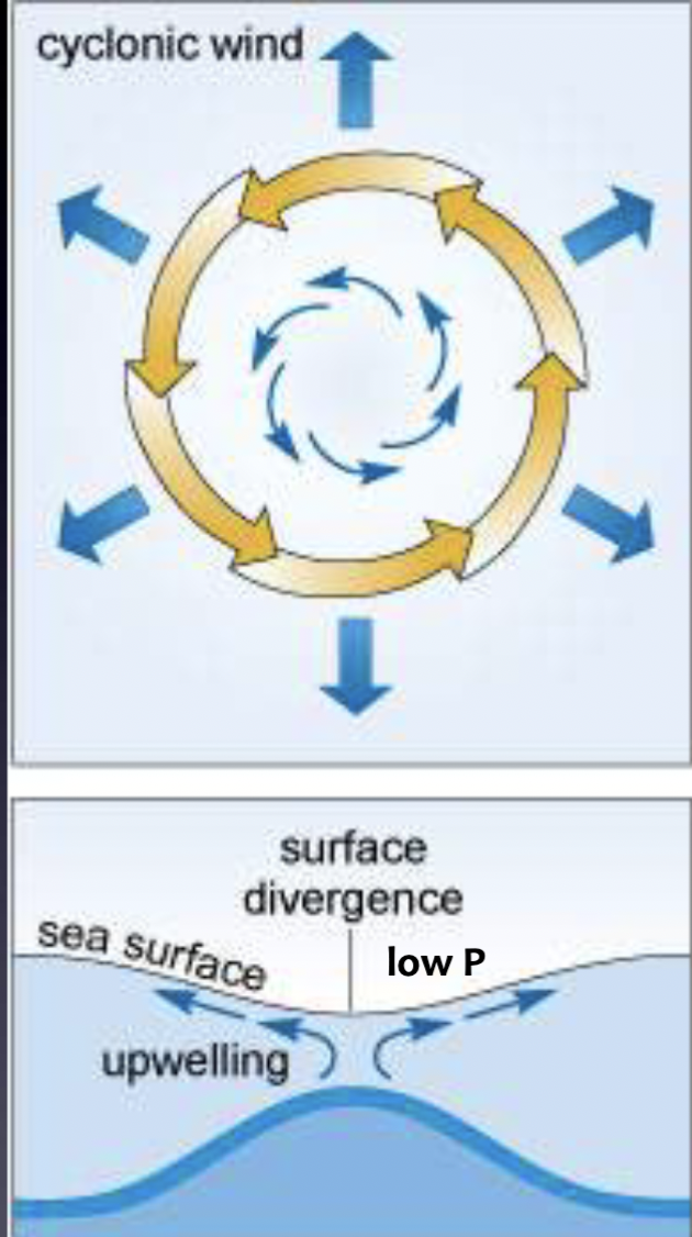
Causes of upwelling and downwelling
Water movement
Wind-driven
Ekman transport plays an important role
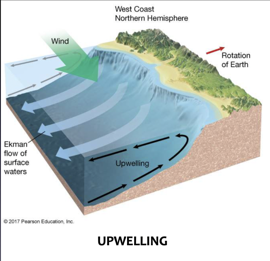
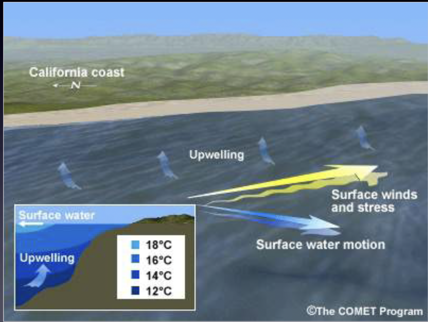
Upwelling
Upward movement of deep, cold, nutrient-rich water to surface waters
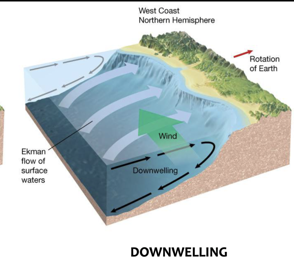
Downwelling
Downward movement of surface water to deeper parts of ocean
How Ekman transport influences coastal upwelling
Ekman transport moves water to the RIGHT of wind direction
Wind moves parallel to shore so movement occurs away from shore
Deeper water moves up (upwelling) to replace the ‘missing’ surface water
3 advantages of coastal upwelling
Brings cold nutrient-rich water to the surface
High biological productivity (biodiversity)
Essential for coastal fisheries (economy)
Influence of coastal upwelling on climate
Strong control on regional weather, causes:
cooler temperatures
fog and precipitation
Effect of coastal downwelling on deeper waters
Supplies deeper ocean with heat, dissolved materials and water rich in dissolved oxygen (water is low productivity, nutrient-poor)
How Ekman transport influences coastal downwelling
Wind blows (from the S) parallel to shore
Ekman transport moves water to the RIGHT of wind direction
This cases water to stack up against shore and move downwards
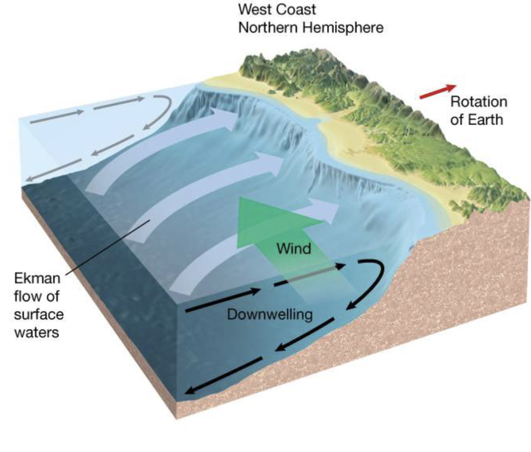
Convergence of water causes…
Downwelling
Divergence of water causes…
Upwelling
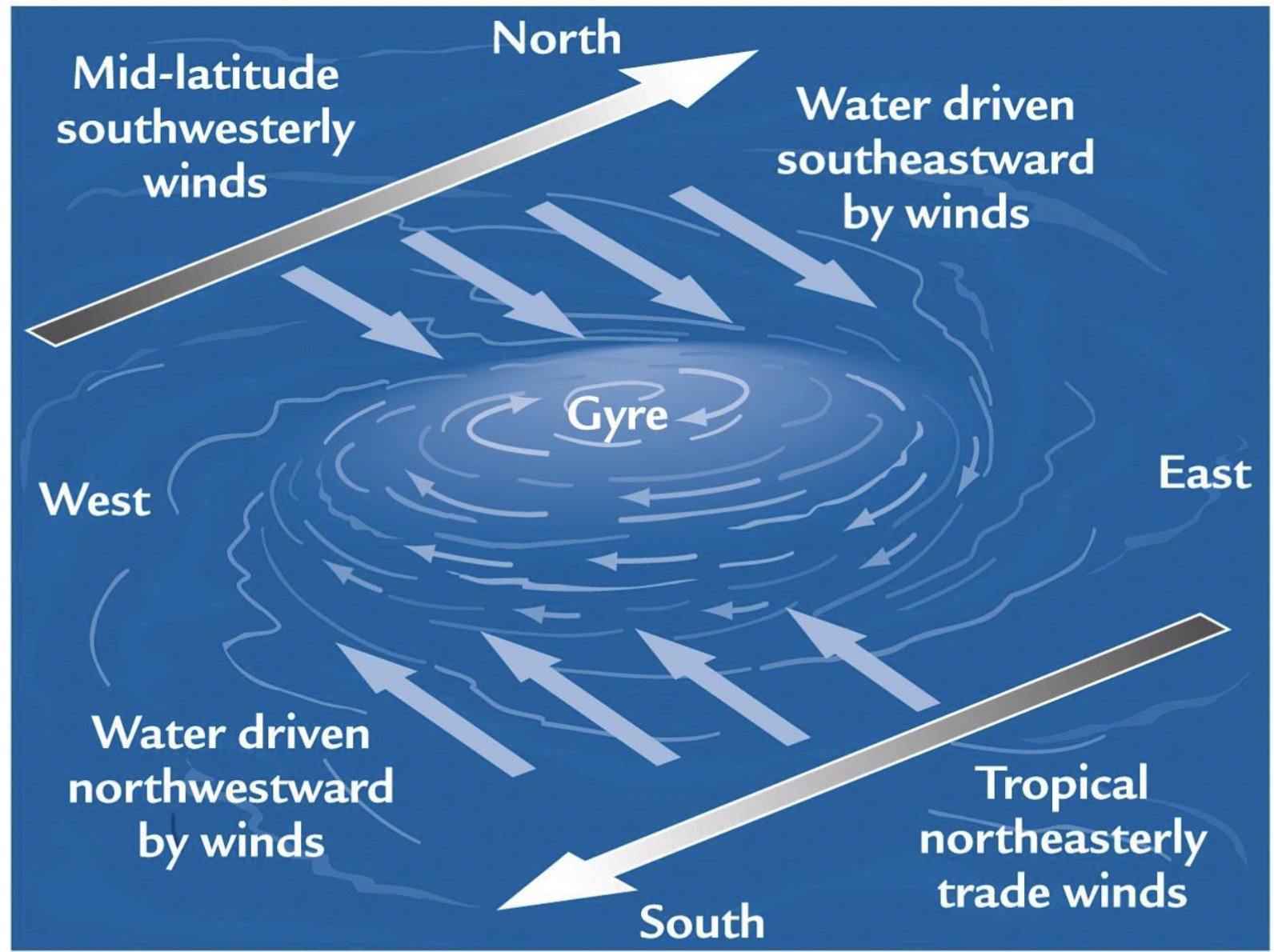
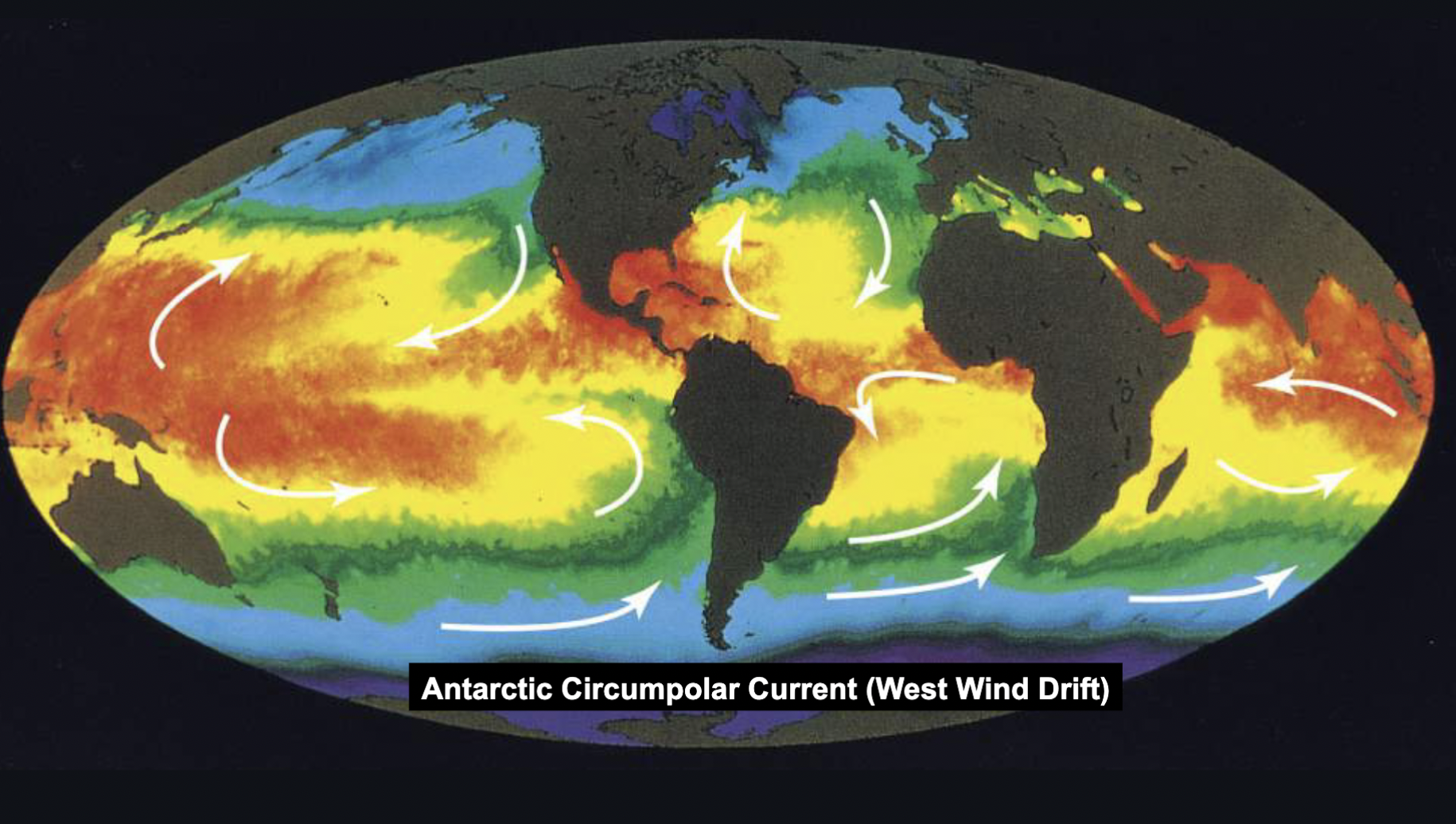
Gyre
Large-scale circular patterns of surface circulation
How gyres form
In the Northern Hemisphere, currents flow to the right of wind direction (major wind belts)
Ekman transport moves surface water to centre of a subtropical gyre
Geostrophic Currents
In idealized N Hemisphere, Ekman transport results in movement towards centre of the gyre where water piles up in the centre
However, gravity pulls water downhill –’flow downhill’ (water flow from region of higher pressure to lower pressure)
The movement of water ’downslope’ deflected by the Coriolis effect results in a clockwise current— GEOSTROPHIC CURRENT
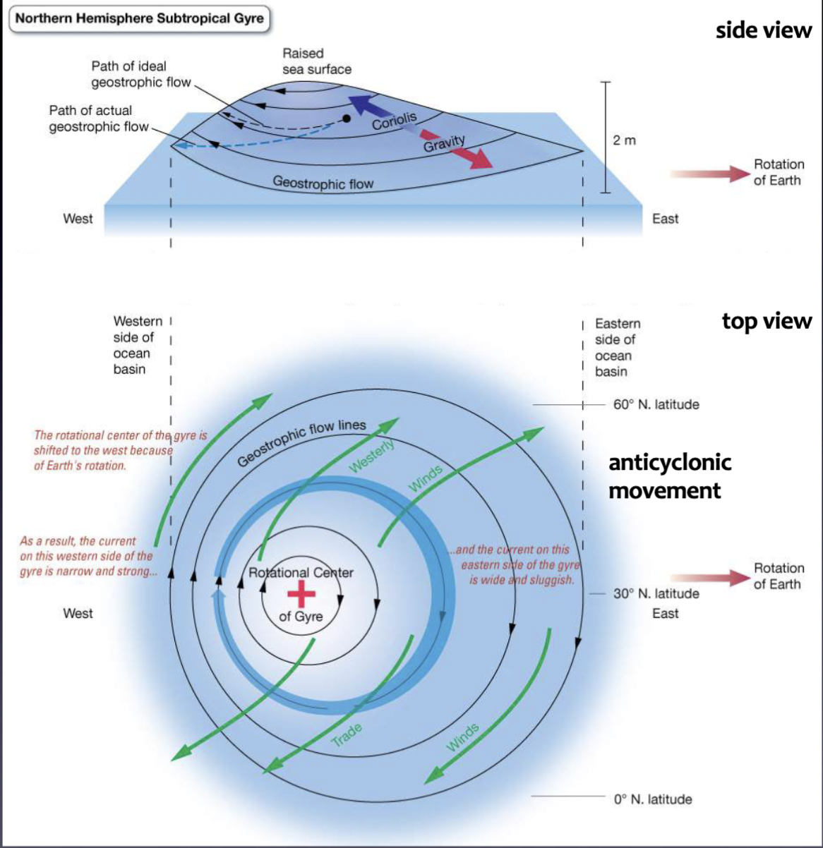
Major currents flow…
… around the periphery of ocean basins
6 current circuits in the world
5 subtropical gyres
1 is the eastward-flowing Antarctica Circumpolar Current (driven by westerlies)
Boundary currents + 2 types
Ocean currents with dynamics determined by the presence of a coastline
Western boundary currents
Eastern boundary currents
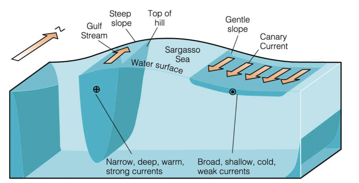
9 Characteristics of Western boundary currents
Warm
Narrow (< 100 km)
Deep
Swift (hundreds of km a day)
Large (usually 50 Sv or greater)
Sharp boundaries
Little or no coastal upwelling
Nutrient-poor
Form meanders and eddies
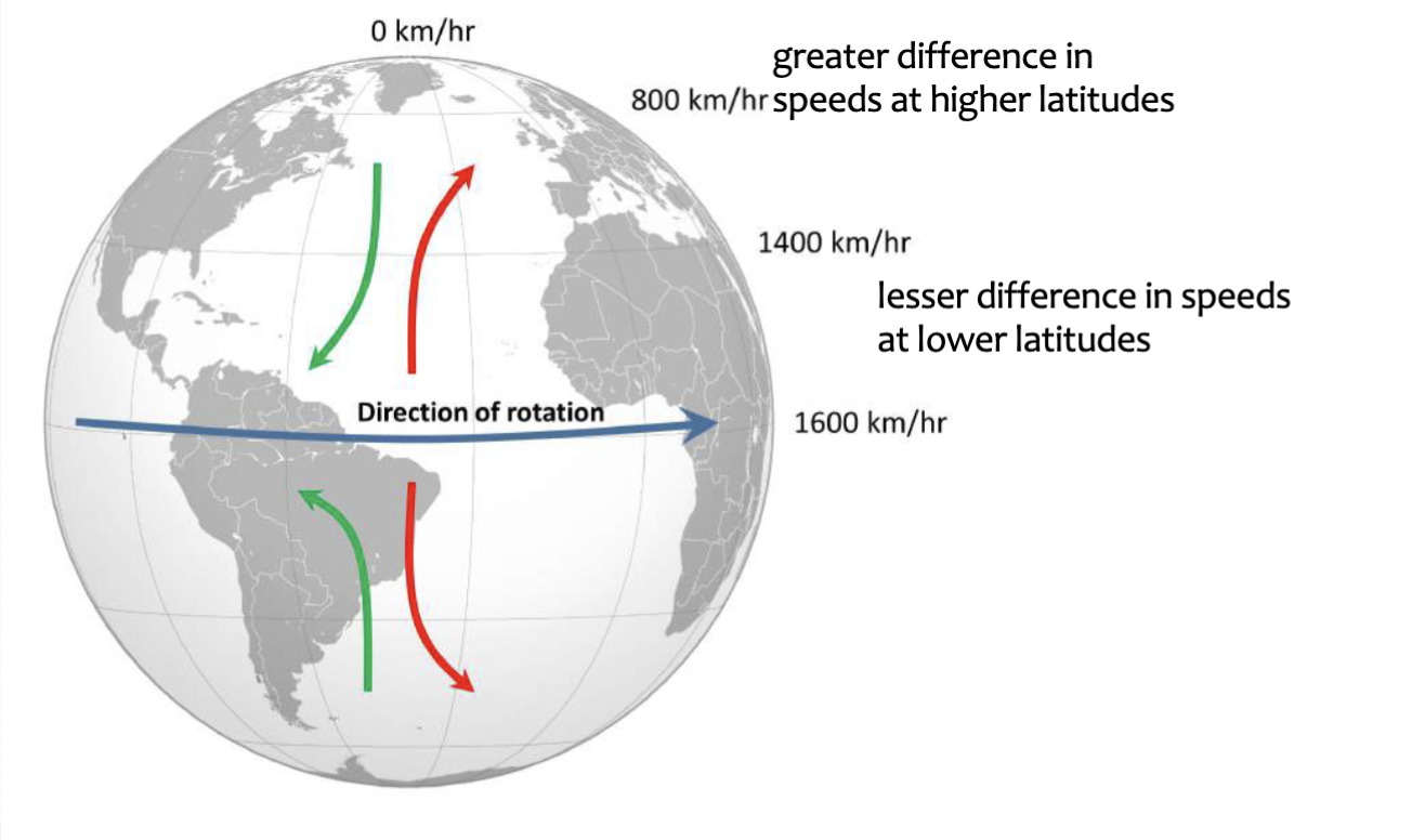
Westward intensification
Currents on the western side of a gyre are faster, deeper, and narrower than currents on the eastern side
Why does westward intensification occur
The Coriolis effect gets stronger with higher latitudes, it is stronger in the latitudes of the westerlies than in the latitudes of the trade winds
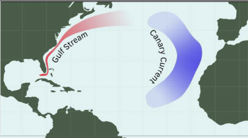
Example of Eastern boundary current
Canary Current (North Atlantic)
Example of Western boundary current
Gulf Stream (North Atlantic)
Purpose of Western boundary current
Transports warm water northwards
Where are subtropical gyres found
Centered around 30 degrees N or S of the equator
Direction that subtropical gyres circulate in
Northern Hemisphere = clockwise
Southern Hemisphere = counterclockwise
9 Characteristics of Eastern boundary currents
Rarely forms meanders and eddies
Cold
Broad (~ 1000 km)
Shallow (< 500 m)
Slow (tens of km per day)
Small (typically 10-15 Sv)
Diffuse (poorly defined) boundaries
Coastal upwelling common
Nutrient rich
Purpose of Eastern boundary currents
Moves cold water towards the Equator
Transverse currents
Currents that are connected by eastern- and western boundary currents within a certain gyre; driven by trade winds + westerlies
Currents that flow from east —> west
Equatorial currents
Currents that flow from west —> east
Northern/southern boundary currents
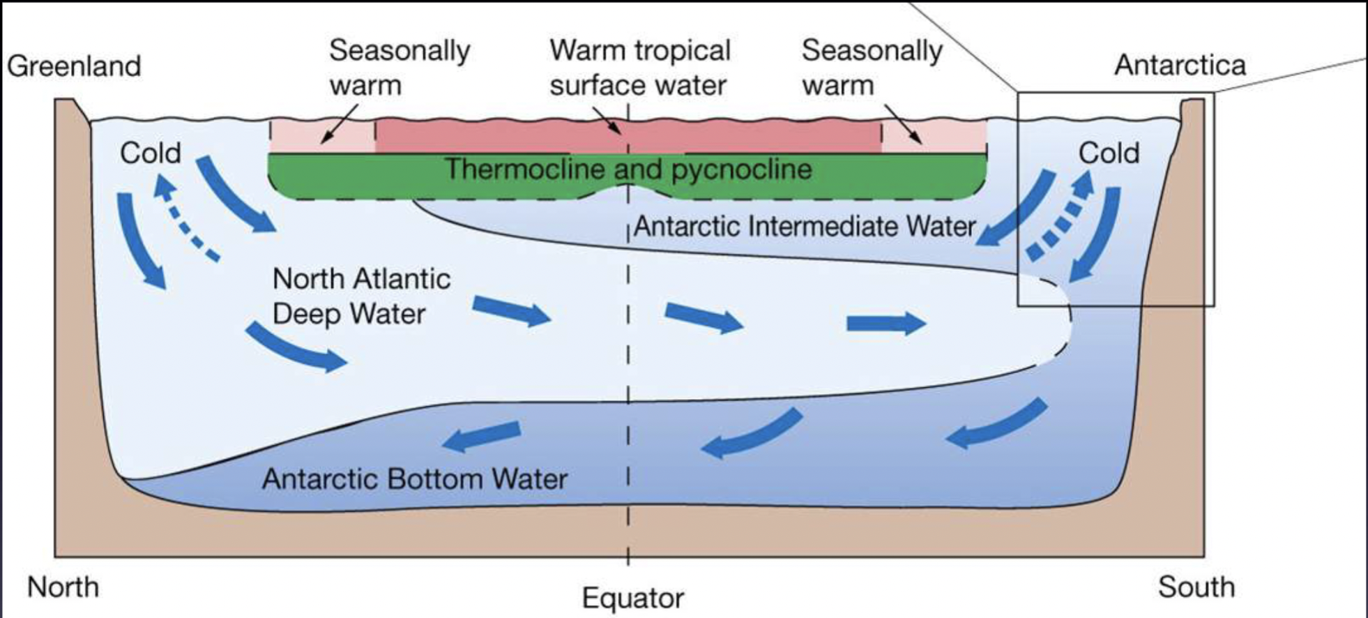
Where thermohaline circulation occurs
Links major surface and deep water currents in the Atlantic, Indian, Pacific, and Southern Oceans
Direction of thermohaline circulation movement
Vertical movement, but also horizontal flow
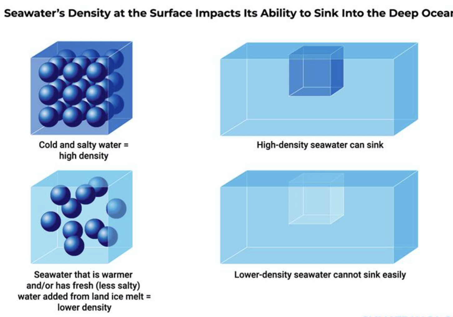
Cause of thermohaline circulation
Driven by differences in water density
Purpose of thermohaline circulation
Transports heat and delivers O2 to deep water
5 kinds of water masses
Surface water
Central water
Intermediate water
Deep water
Bottom water
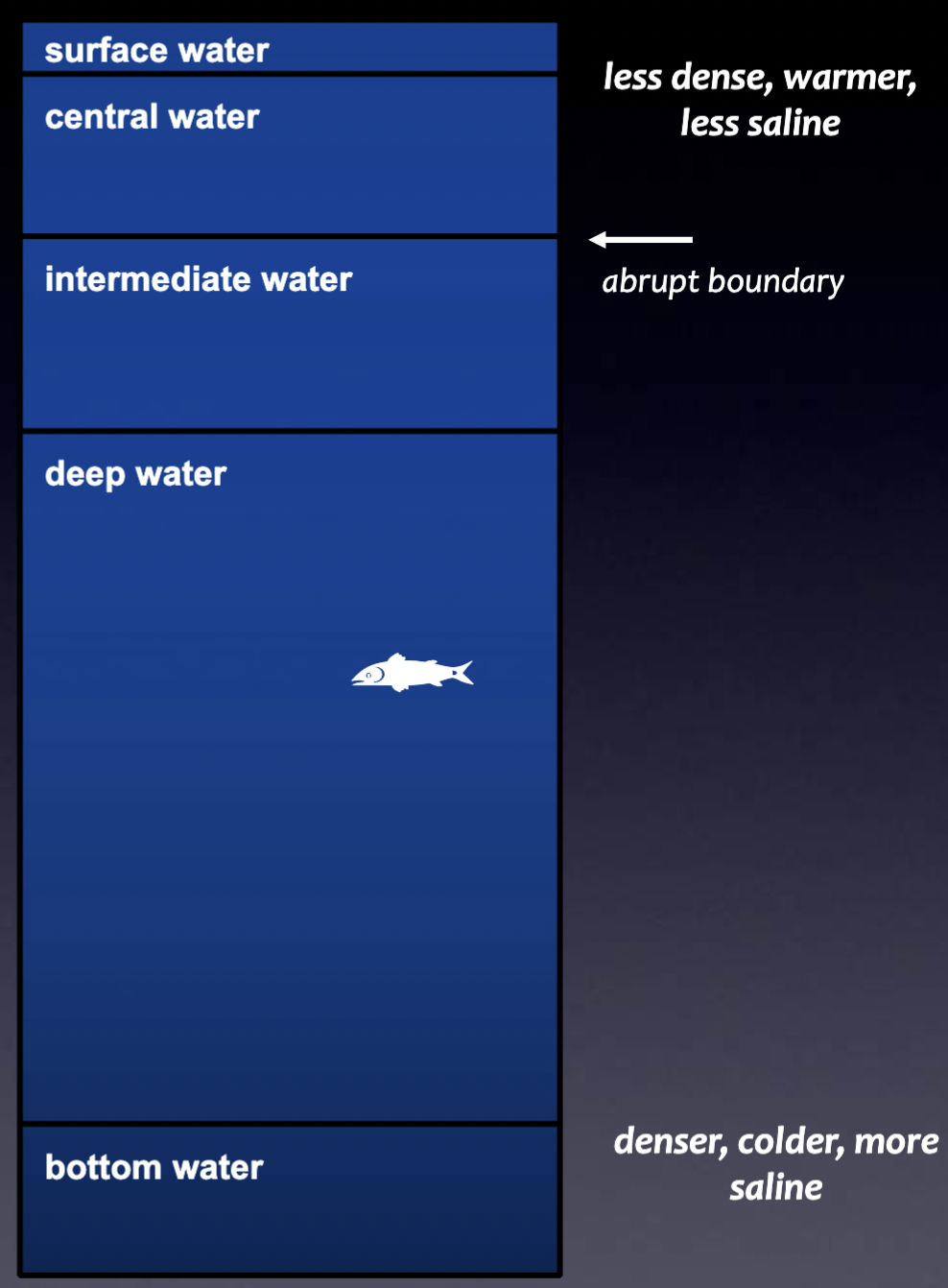
Surface water
From the surface to depth of 200 m; least saline, warmest, least dense
Central water
From end of surface water to bottom of main thermocline (latitude dependent)
Intermediate water
From bottom of main thermocline until depth of about 1500m
Deep water
Water not in contact with the bottom, to a depth of ~4000 m
Bottom water
Water in contact with the seafloor; densest, coldest, and most saline
2 named water masses
(water masses are named according to where they originate from)
North Atlantic Deep Water (NADW)
Antarctic Bottom Water (ABW)
Temperatures where intermediate water masses form
T = -1.5 to 14.0 degrees C
Temperatures where deep/bottom water masses form
T = -10.5 to 4.0 degrees C
Non-conservative characteristics of water masses
Changed in the course of time by chemical, physical or biological processes (dissolved O2, Δ14C)
Conservative characteristics of water masses
A water mass characteristic which has no sinks or sources in the ocean interior (temperature, salinity)
Where do water masses form
At the surface, can have subsurface mixing
surface conditions reflect in the characteristics of a water mass
Isopycnals
Lines of the same density across different pressures and temperatures (shape of line due to position of water masses)
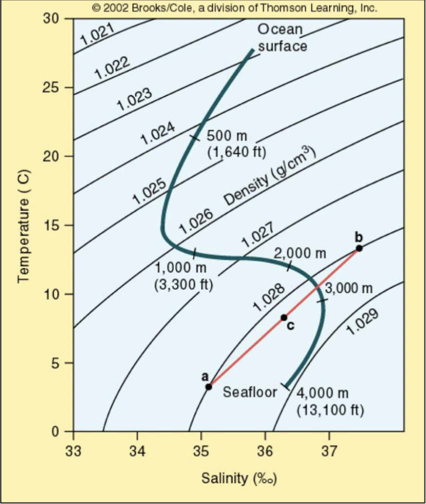
Caballing
When 2 distinct water masses (a,b) combine to produce a new water mass (c) of greater density
5 Characteristics of Antarctic Bottom Water (AABW)
High salinity (3.47%)
Low temperature (-0.5ºC)
Highest density of all water masses (1.0279)
Most oxygenated deep water
20 to 50 million m3 of brine/sec
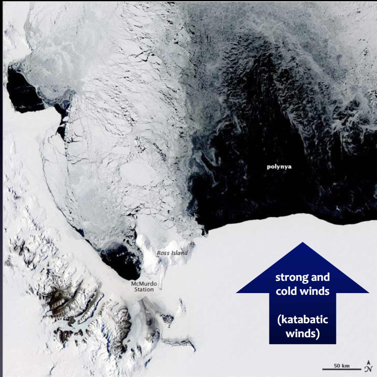
4 Steps to formation of Antarctic Bottom Water (AABW)
Wind blowing off Antarctica creates ice-free areas of water (polynyas)
The water is now exposed to cold wind, causing sea ice formation
Brine expulsion as it is added to sea ice
Salt concentrates in the remaining water
Water “flows downslope” and sinks (now AABW)
Cause of water masses having different characteristics
Surface conditions are reflected in the characteristics of a water mass
How AABW production is tracked
Use of seals with attached instrumentation – able to dive down underwater canyons
6 Characteristics of North Atlantic Deep Water (NADW)
High salinity
High O2
Low nutrients
Between ~ 1500 and 3500 m depth
Found throughout the length of the Atlantic (may extend as far as 10 degrees S)
Density less than AABW density
Where does North Atlantic Deep Water (NADW) form?
Forms in the Labrador and Greenland seas (Upper and Lower NADW)
Steps to formation of NADW
As warm water flows North, salinity increases
Wind blowing over the water - cools it and causes an increase in evaporation
Downwelling occurs and sea ice forms
Water mass sinks (now NADW)
4 Characteristics of upper NADW
Slightly warmer
Less dense
Convection in winter
Production – dependent on NAO (North Atlantic Oscillation)
3 Characteristics of lower NADW
Overflow water from Greenland-Iceland-Scotland Ridge
Colder
Denser
Global conveyor belt
System of thermohaline circulation driven by temperature and salinity (takes 1500 years to fully circulate, SLOW moving)
Purpose of global conveyor belt
Transfers heat and nutrients and brings O2 to deep water
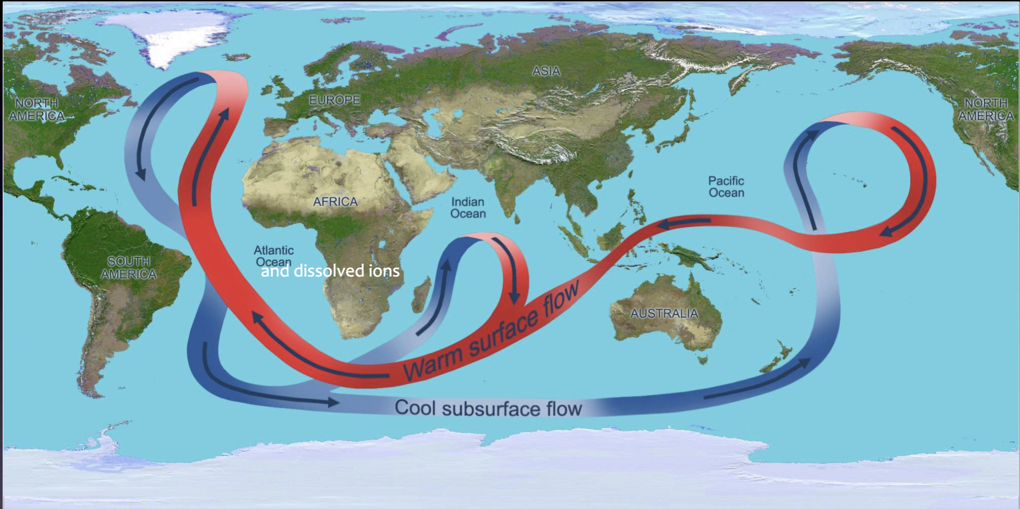
NADW vs Pacific Ocean water masses
NADW= most nutrient-depleted, CO2 depleted and well oxygenated water
Pacific Ocean water masses= most nutrient rich, CO2-rich and oxygen-depleted water
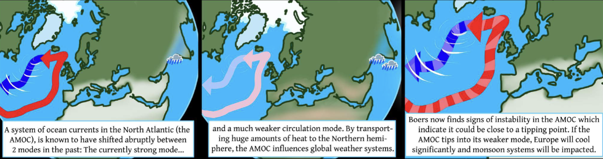
AMOC (Atlantic Meridional Overturning Circulation)
Series of surface and deep-water currents
Northward flowing warm water in the upper layer of the Atlantic Ocean (Gulf Stream)
Deep convection in the Nordic and Labrador seas
Southward flowing colder water at depth (NADW)
Danger faced by AMOC
Slowing down— major tipping point in climate change
4 Consequences of AMOC slowdown
Southward shift in rain belt
Weakening of African and Asian monsoons
Drying in Europe
Impacts food production