APHG Unit 1: Identifying Projections
1/4
There's no tags or description
Looks like no tags are added yet.
Name | Mastery | Learn | Test | Matching | Spaced |
|---|
No study sessions yet.
5 Terms
Winkel Projection
-accurate size of landmasses
-landmasses look smaller than those of interrupted maps of the same size
-areas towards the North and South poles are distorted
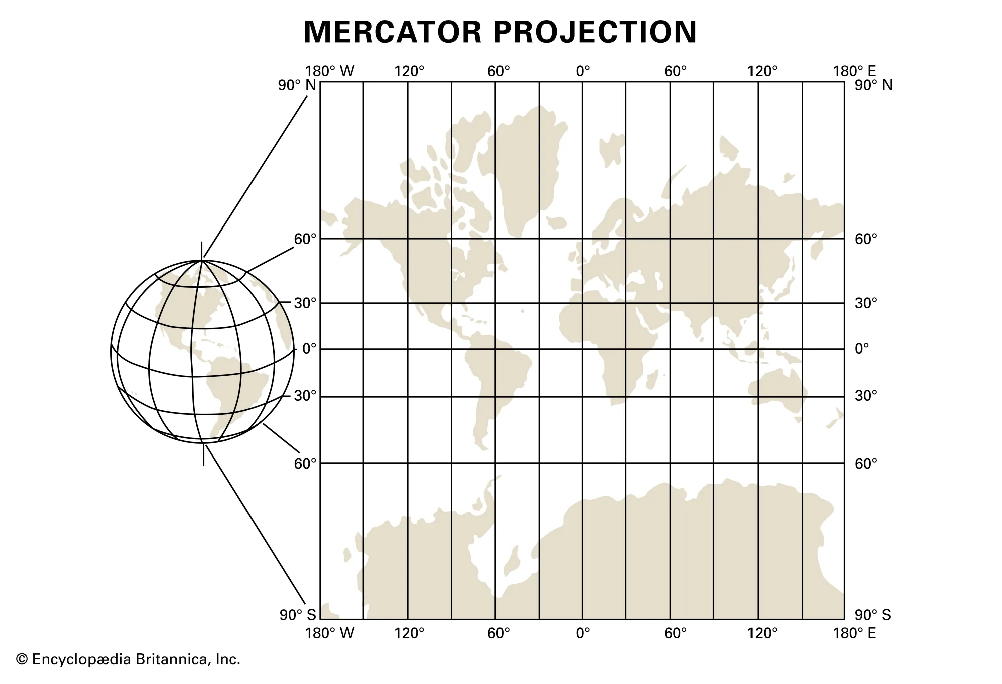
Mercator Projection
-Accurate Direction
-Used for naval expedition
-Significant distortion in size and location
-Greenland looks larger than Africa
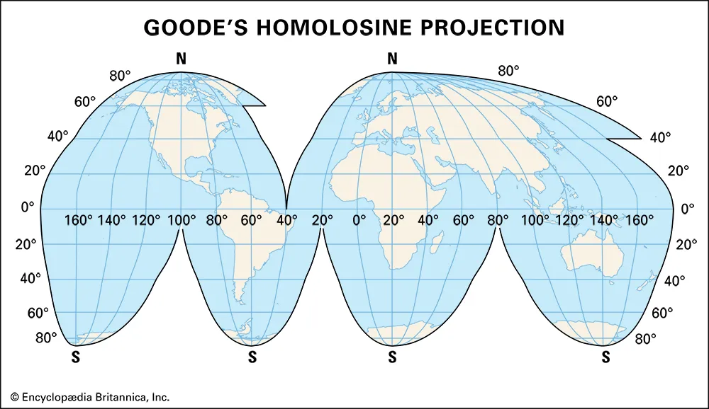
Goode Homolosine Projection
-True size and shape of land
-Distortion in distance at the edges of the map
-Would not be used as a reference for direction as it is an INTERRUPTED MAP
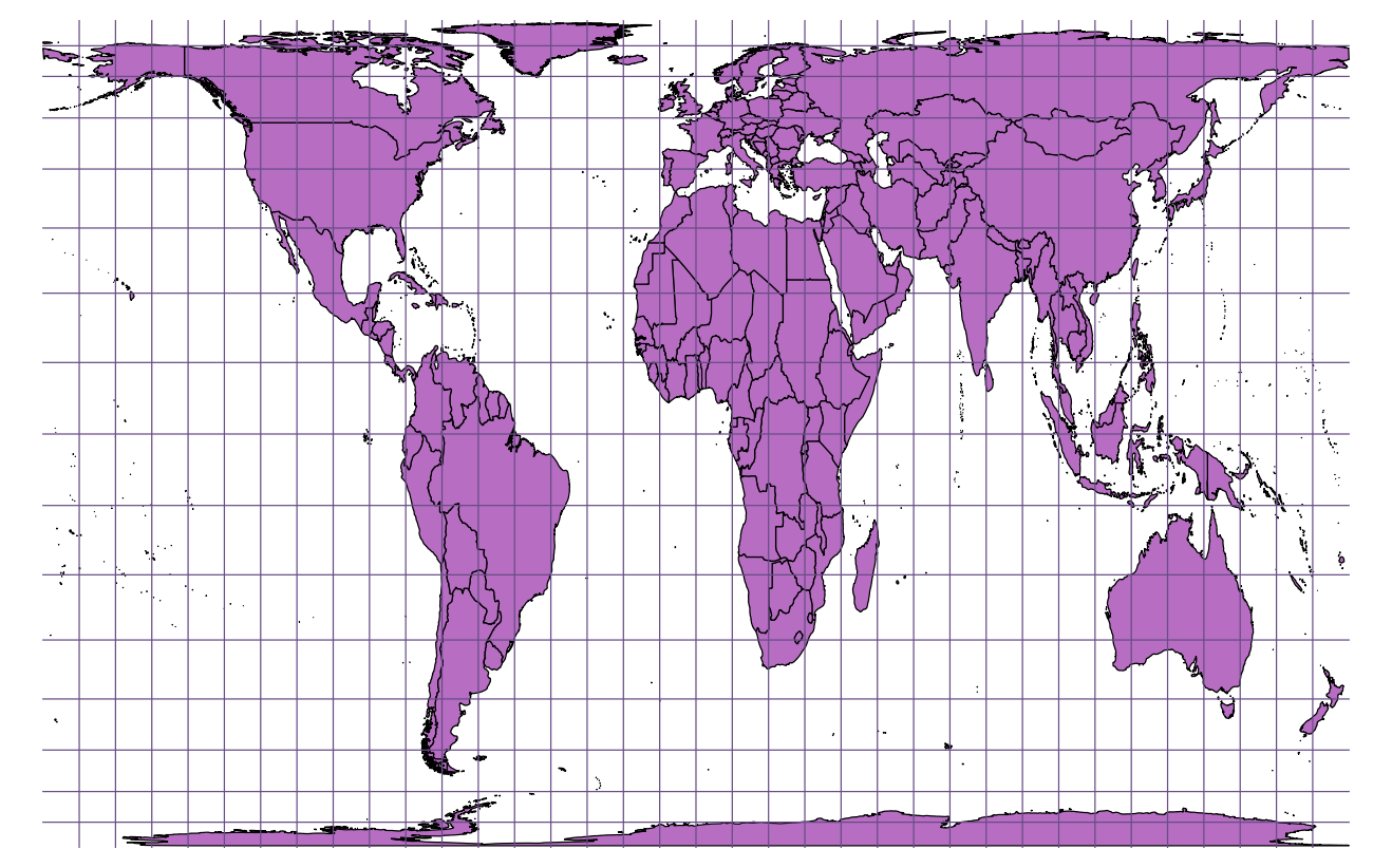
Gall-Peters Projection
-More accurate at showing Earth’s landmasses
-Distortion at direction and shape
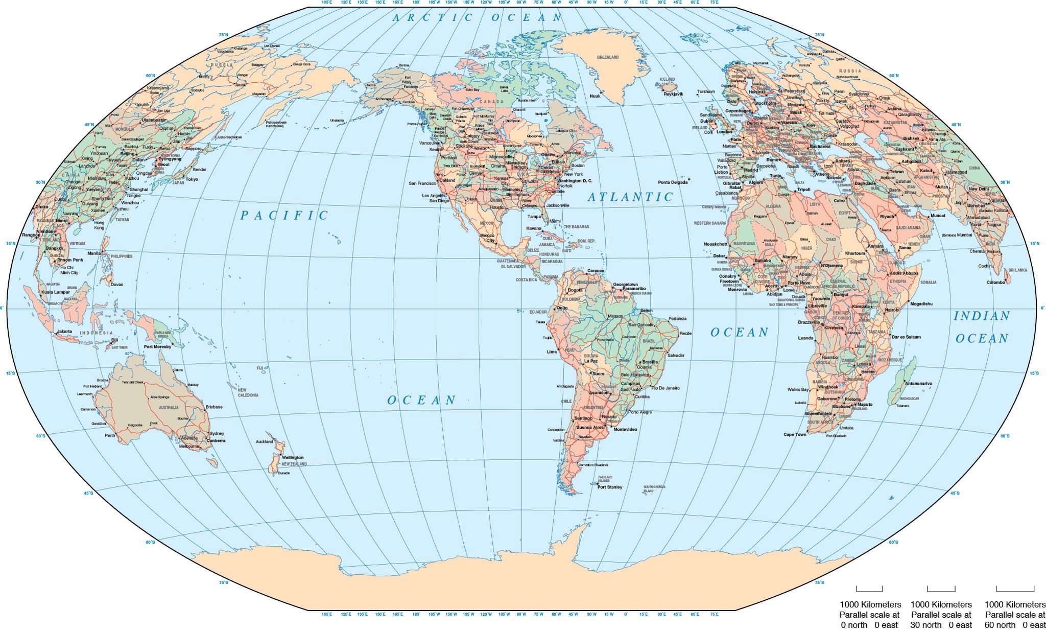
Robinson Projection
-tries to create a visually appealing map
-distorts the poles
-preserves the size and shape of landmasses
-spreads the distortion across the map