Geology Quiz 2
1/51
Earn XP
Name | Mastery | Learn | Test | Matching | Spaced | Call with Kai |
|---|
No analytics yet
Send a link to your students to track their progress
52 Terms
mass wasting
downhill movement of rock debrief by pull of gravity.
mass wasting triggers
earthquake activity
heavy rainfall
lack of vegetation
creep
very slow downslope movement of soil.
slides
descending mass remains relatively intact.
aquifer
the saturated rock which water can move easily through
unconfined aquifer
has water table
and is partially filled
confined aquifer
completely filled with underwater pressure
aquitard
rock that retards ground water flow due to low porosity.
contamination of groundwater
bacteria
pesticides
gasoline
heavy metals
fertilizers
water table
depth at which soil pore spaces become saturated with water
alpine glaciers
found in mountainous region
continental glaciers
large parts of continents covered by ice
glaciation
occurs in areas cold enough to allow accumulated snow to persist from year to year
ablation
loss of glacier due to melting, evaporation, or calving of icebargs
types of glacial valleys
u-shaped
hanging
truncated
elastic rebound theory
sudden release of strain along a fault
focus
point where seismic waves orginate
body waves
travel outward from focus in all directions
surface waves
travel along earth’s surface away from epicenter
p wave
compressional, parallel, fast, solids and fluids
s wave
transverse, perpendicular, solids only
love waves
side-to-side, can’t travel through fluids
seismometers
measures seismic waves
seismograms
permanent record of earthquake vibrations
richter scale measures
magnitude
earthquake related hazards
ground motion
fire
ground failure
shallow-focus earthquakes
common along mid-oceanic ridges
deep-focus earthquakes
occur around benioff zones
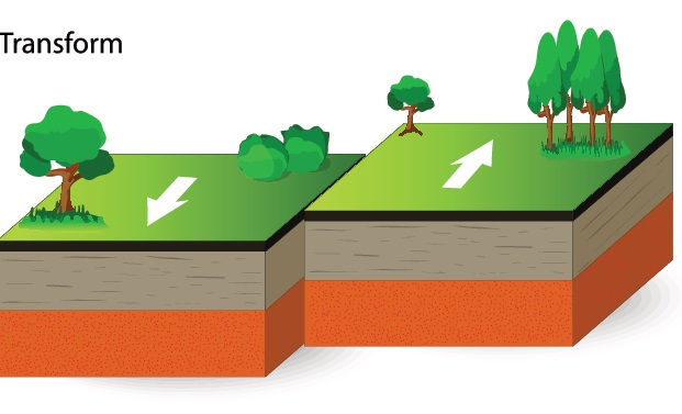
transform boundary
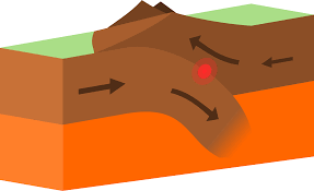
convergent boundary

divergent boundary
earthquake precursors
microseisms
rock property changes
animal behaviors
reducing earthquake damage
monitoring shaking
develop warning system alarms
shut down gas lines
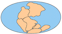
Pangaea geologist
wegener
DuToit
evidence of continental shift
fit of continents
fossils distributions
mountain belts
matching rock units
glaciation patters
Wegener’s theory weakness
centripetal and tidal force
name them bitch
period
normal faults
extensional motions (hanging wall down)
reverse/thrust faults
compressional motions (hanging wall up)
strike-slip faults
sliding side to side
7 large tectonic plates
african
antarctic
north american
pacific
south america
eurasian
indo-australlian
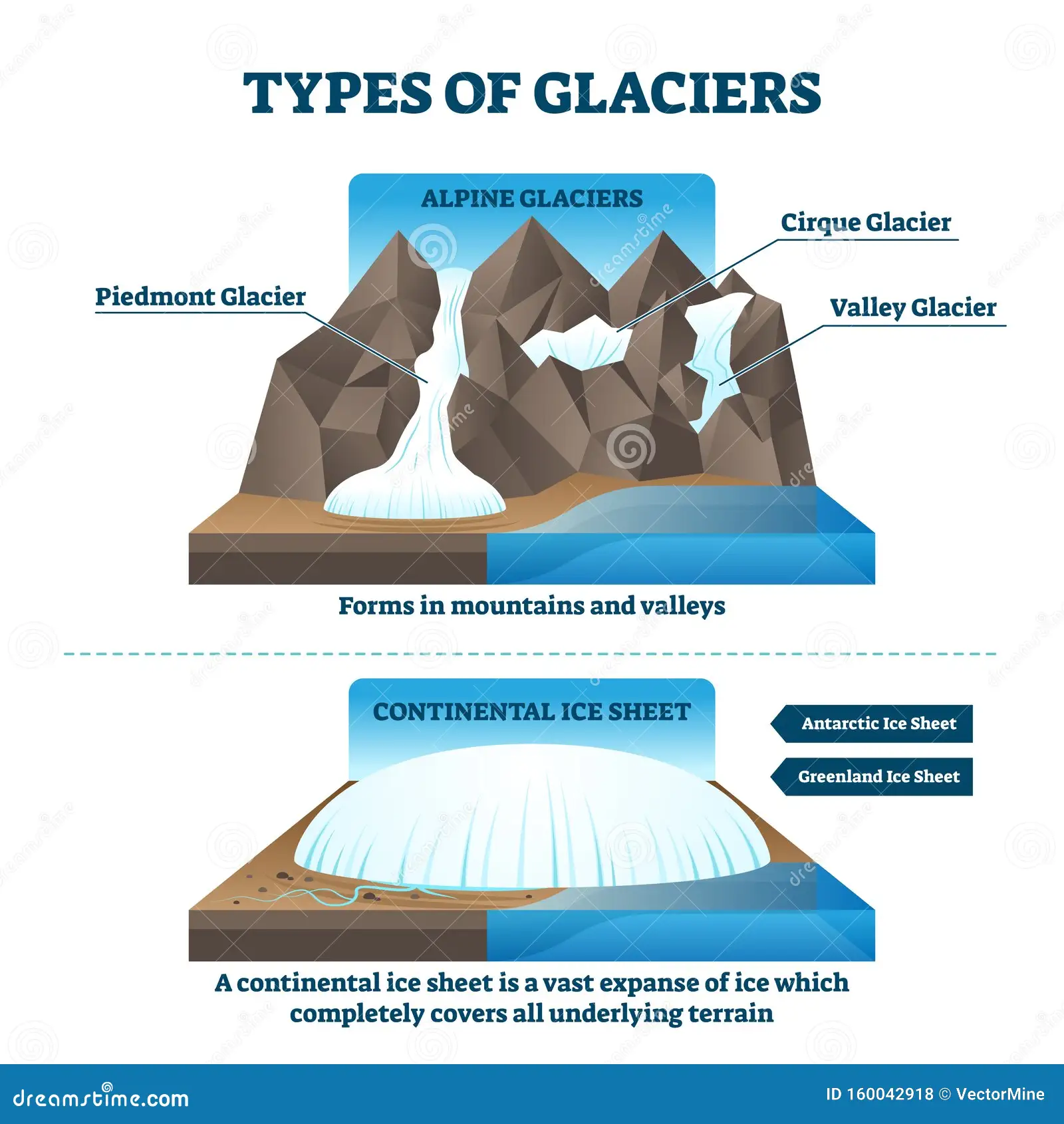
name the diagram
types of glaciation

name the diagram
glaciation
floodplain
flat valley of sediment deposited by stream
stream bed
bottom of channel
stream banks
sides of channel
channel
long narrow depression eroded by stream
meander
stream forms a series of bends
oxbow lake
abandoned meander loop
cut bank
outside bank of meander
point bar
slope of sediment on the inside of a meander