T-6A Navigation Shotgun questions
 Call Kai
 Learn
Learn Practice Test
 Spaced Repetition
 Match
Match Flashcards
 Knowt Play
1/186

There's no tags or description
Looks like no tags are added yet.
Name | Mastery | Learn | Test | Matching | Spaced | Call with Kai | Chat |
|---|
No analytics yet
Send a link to your students to track their progress
187 Terms
Minimum amount of crew rest required before flying
12-hour rest before beginning the flight duty period
When can Crew Rest begin?
After the last official duty is completed
Is Crew Rest optional?
No. Crew Rest is compulsory.
What is a flight duty period?
FDP starts when reporting for official duty, ending at final engine shutdown
Authorized weather sources in priority order
- MAJCOM approved weather sources (local weather flight products, central briefing facilities, and commercial websites or flight planning services)
- Regional OWS
- Other DoD military weather sources
- Other US Government Weather services (NWS, FAA, etc.)
- Foreign civil or military weather services
When is an alternate required?
- Worst WX (TEMPO or prevailing) at the ETA (w/in 1hr) is less than 2,000'/3 SM
- Crosswinds out of limits
- No compatible approach
- Denial of RVSM would prevent reaching destination (AETC)
- Consider factors such as: Radar Required, GPS required, Unmonitored NAVAIDs, No weather reporting capability, Lowest compatible approach mins > or equal to 1,500' or 3 NM
Can I file to a destination whose forecast includes TEMPO changes in ceiling/visibility lower than req?
Yes, but an alternate may be required.
What qualifies as an alternate?
- Worst WX (prevailing or TEMPO, except those caused by thunderstorms, rain showers, or snow showers) at the ETA (w/in 1hr) must meet or exceed:
- Ceiling of 1000 ft., or 500 ft. above the lowest compatible minimum (whichever is higher)
- Visibility of 2 SM or 1 SM above the lowest compatible minimum (whichever is higher)
How must a PIC compute the necessary fuel reserve?
- Flight time plus 10% up to 45 minutes or 20 minutes, whichever is greater
- For turbine powered aircraft use fuel consumption for best endurance at 10,000 feet MSL.
When landing at an uncontrolled field who is responsible for closing your flight plan?
The PIC
If 'Alternate NA' is depicted on an approach plate, can you list the field as an alternate?
No
What is RVSM?
- Reduced Vertical Separation Minimums
- Altitudes: FL290 - FL 410
- Reduces aircraft separation from 2000' to 1000'
Can USAF Aircraft fly in RVSM airspace?
- Yes if properly equipped
- If not equipped for RVSM, aircraft may enter RVSM airspace on an ATC workload permitting basis
When are cold weather temperature corrections required?
When departing or arriving at an airfield less than 0*C or if an inverse snowflake is depicted.
Do you apply cold weather temperature corrections to ATC assigned altitudes?
No
If NO changeover point is depicted along an airway, it means that ________.
The changeover is to be made at the halfway point between the two NAVAIDS
How is Class A airspace depicted on an En Route High Altitude Chart?
Open white area
When NO MEA is depicted, the MEA on a jet route is _______ feet MSL.
18,000
An asterisk (*) before an altitude along a low altitude airway indicates a(n) ________.
MOCA
VOR/DME symbol
A type of radio navigation system for aircraft that uses VOR (VHF Omnidirectional Range) and DME (Distance Measuring Equipment).

VOR symbol
VHF Omnidirectional Range

Displaced Threshold symbol
A threshold that is not located at the physical beginning of the runway, often due to obstructions.
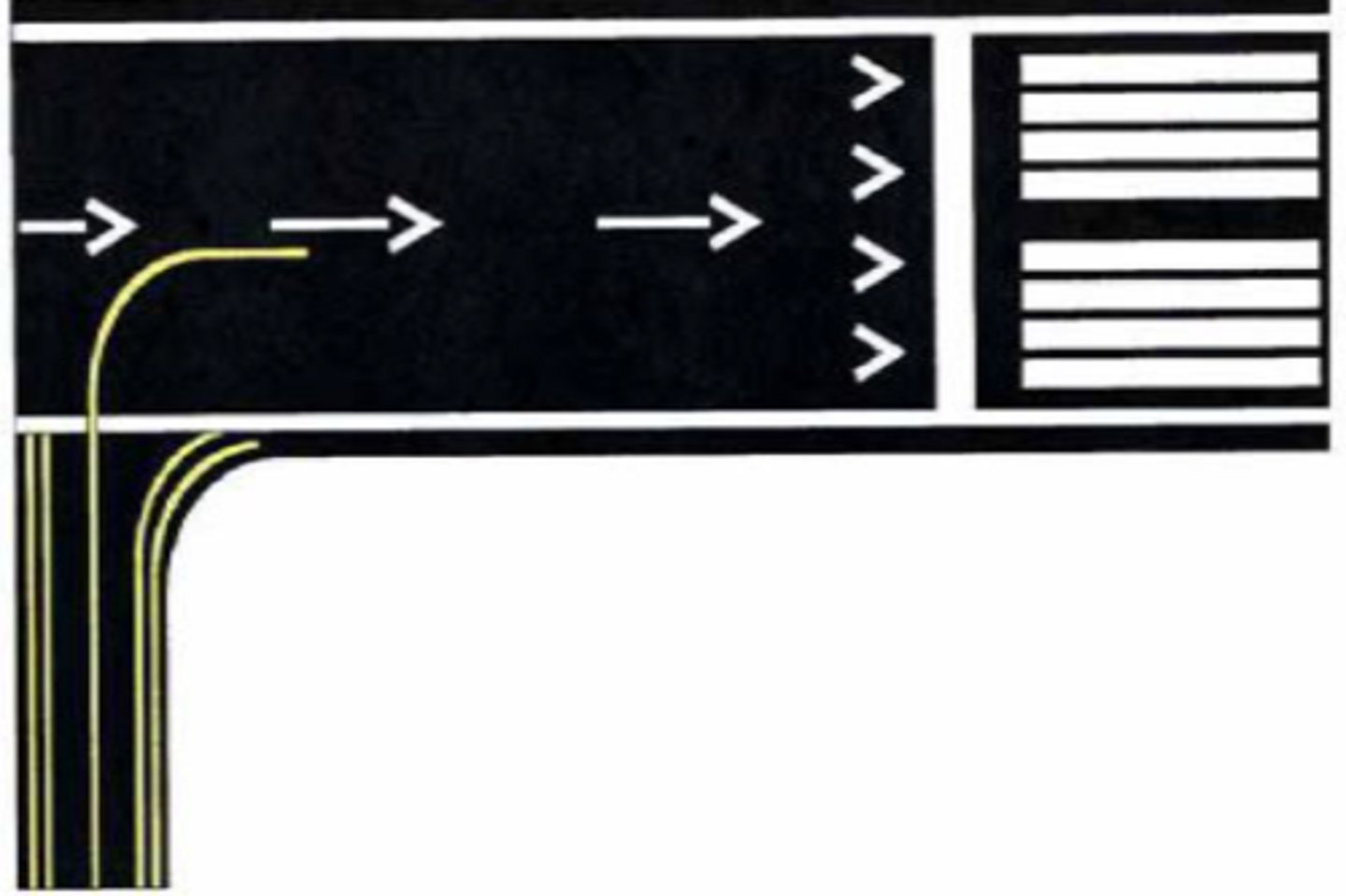
Obstruction symbol
Any object that penetrates the minimum obstacle clearance limits for airspace.
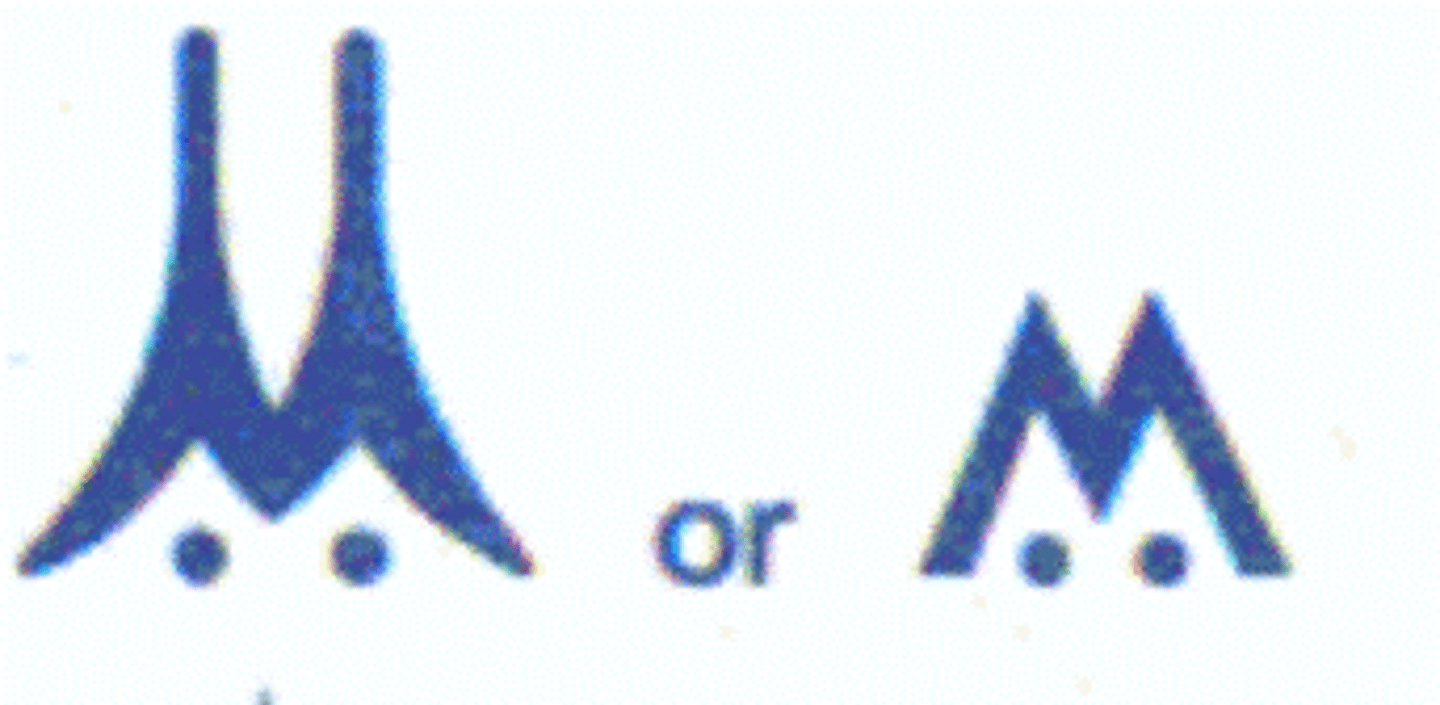
Mandatory Altitude symbol
An altitude that must be maintained by an aircraft during a specific phase of flight.
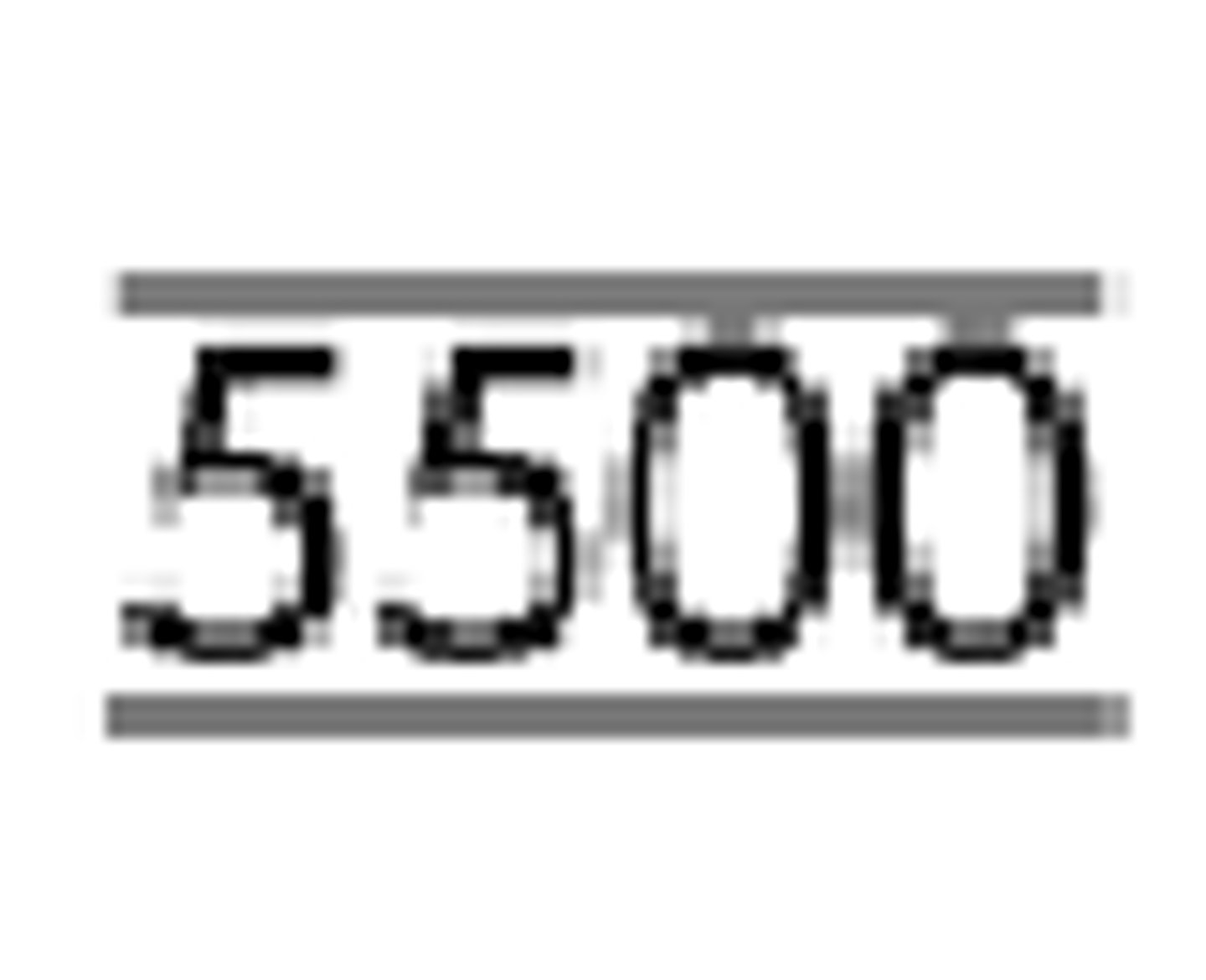
Mandatory Block Altitude symbol
A specified altitude range that must be adhered to for safety and operational reasons.
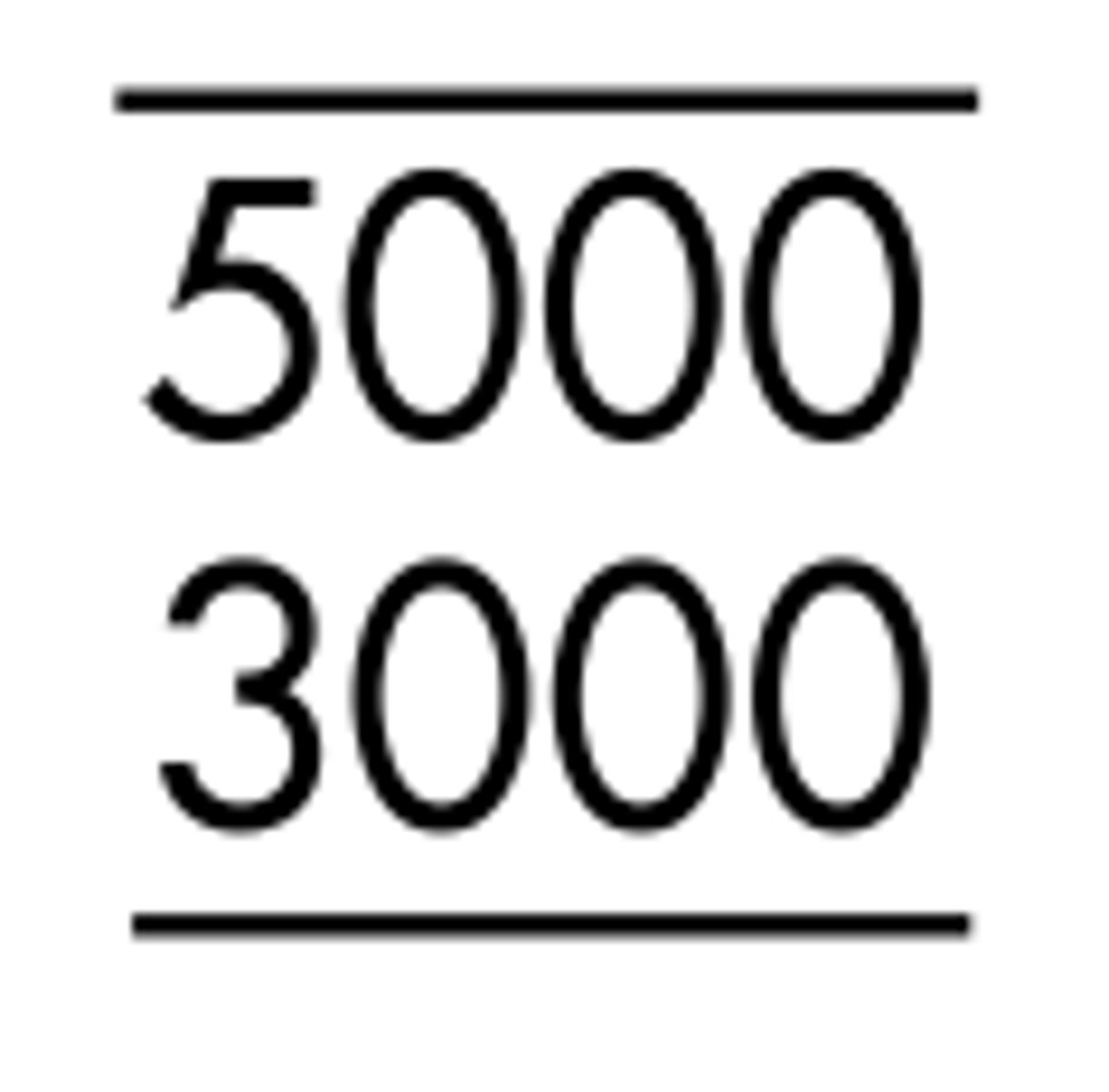
Visual Descent Point (VDP) symbol
A defined point on the final approach course of a runway where a pilot can begin descent to the runway.
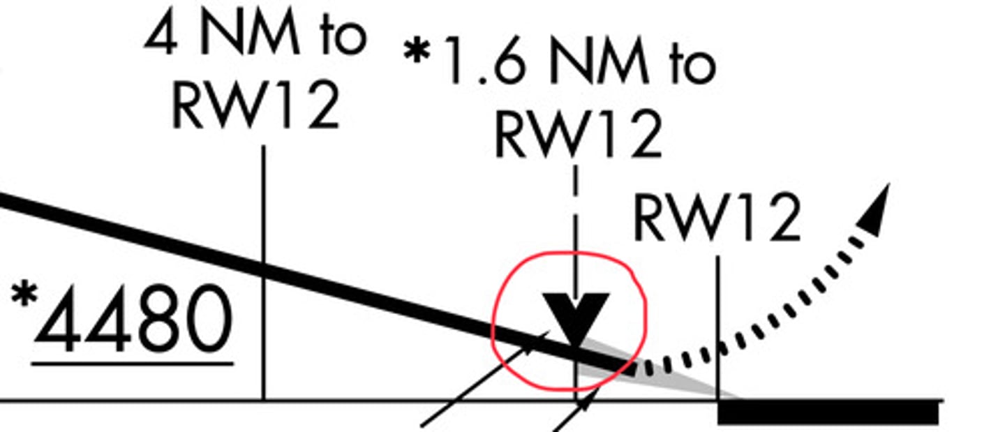
Missed Approach Point symbol
The point at which a pilot must execute a missed approach if the runway is not in sight.
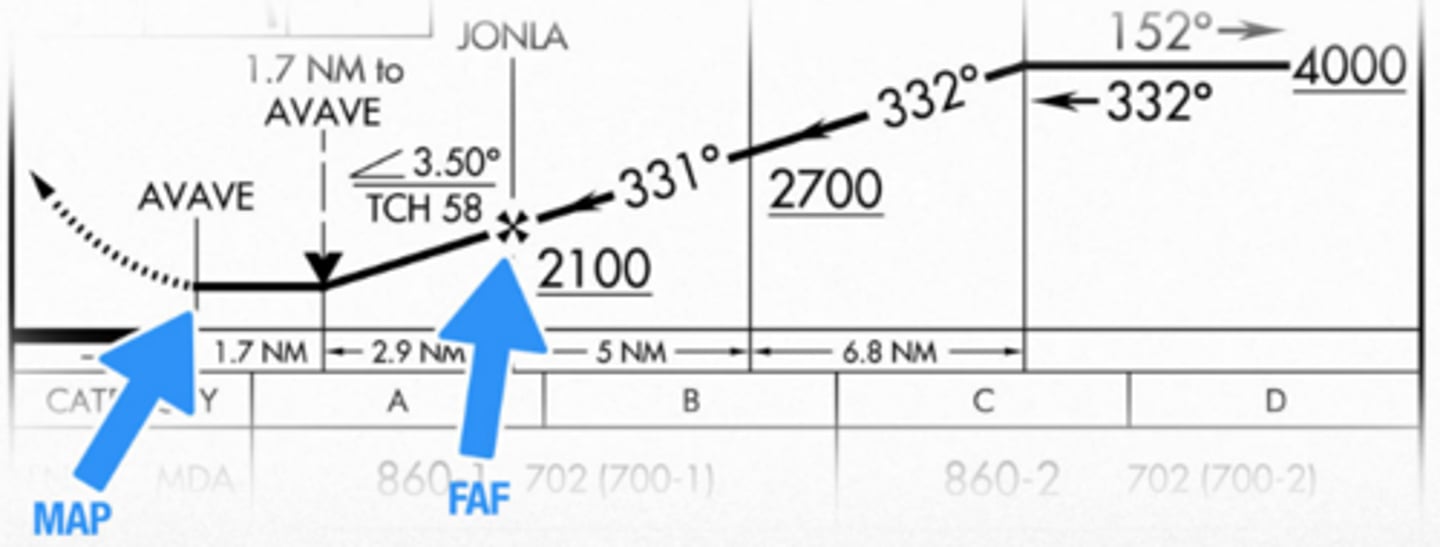
Glideslope Intercept Altitude symbol
The altitude at which an aircraft intercepts the glideslope during an ILS approach.
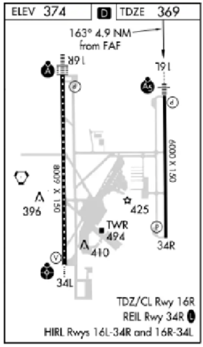
Touchdown zone elevation for RWY 16L on Mahlon Sweet Field
369 feet MSL
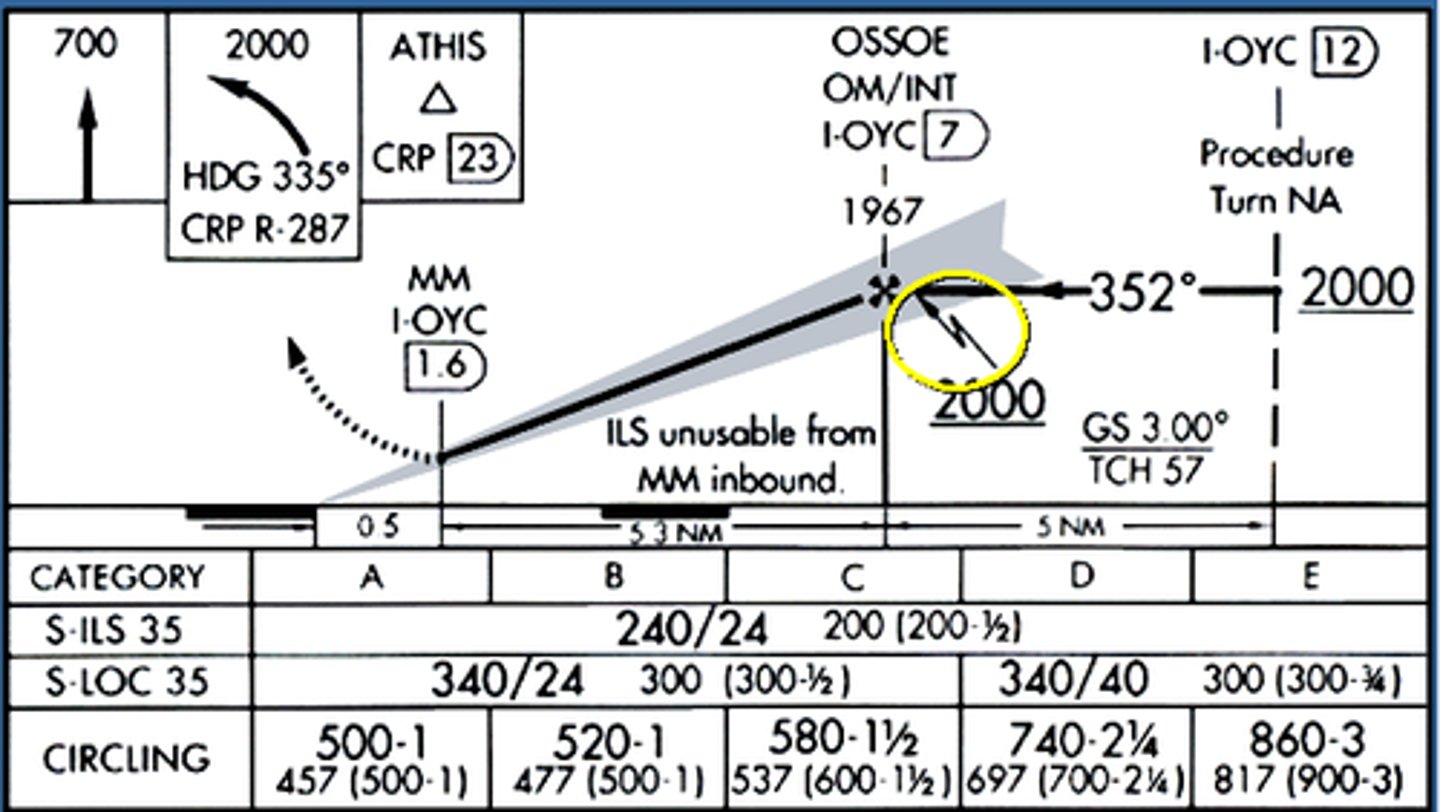
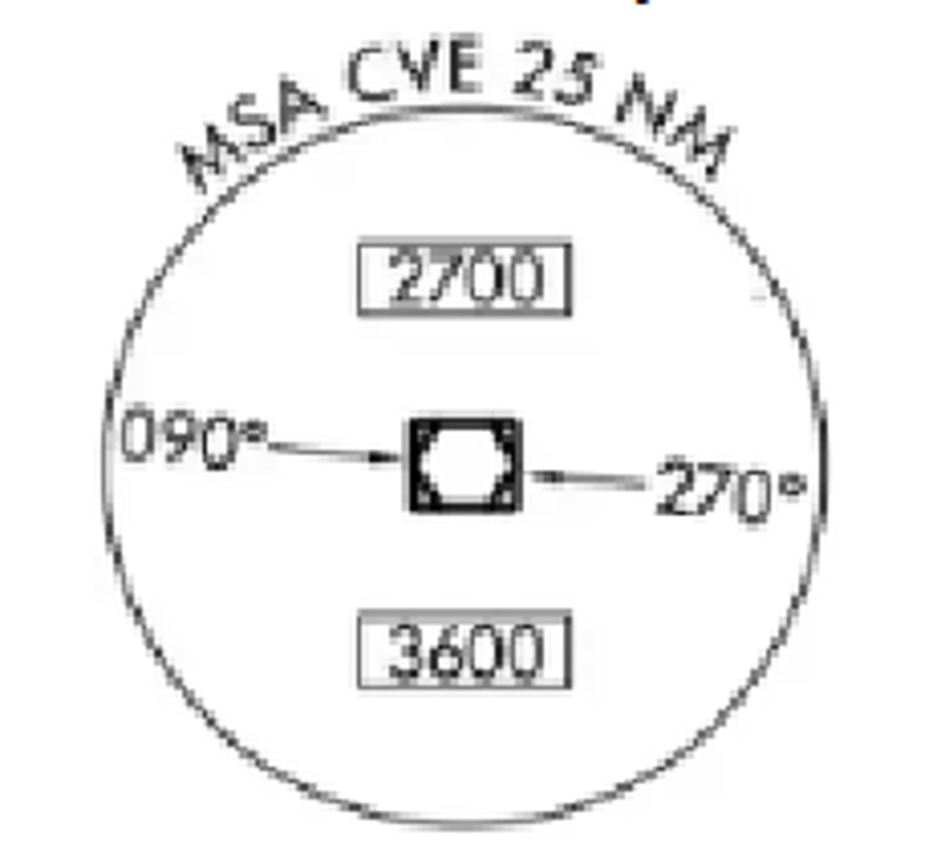
The symbol on the plan view represents a minimum safe sector altitude within 25 NM from the
CVE VOR/DME.
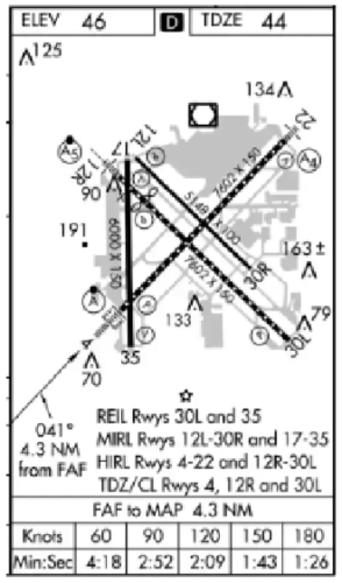
Which runway and landing environment lighting is available for approach and landing on RWY 4?
HIRL, PAPI, and ALSF-2.
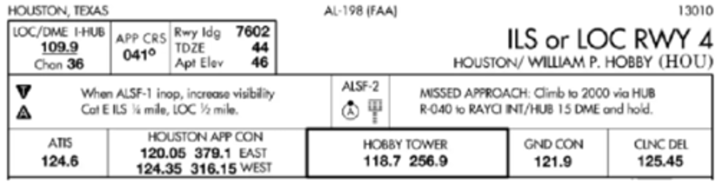
You are flying the ILS or LOC Y Rwy 4 approach to HOU. What frequency would you likely use to contact Houston Approach Control? (You are coming from the WEST)
124.35
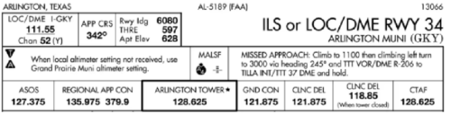
You're inbound to land using the ILS 34 approach. How much landing distance is available on RWY 34?
6,080 feet.
You have the required visual references are in sight. When should you leave the MDA and begin your descent to the runway?
VOR/DME PUC 1.4.
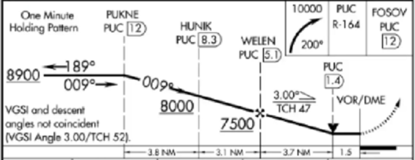
What determines the MAP for the straight-in VOR/DME RWY 36 approach?
To/from change at PUC VOR/DME.
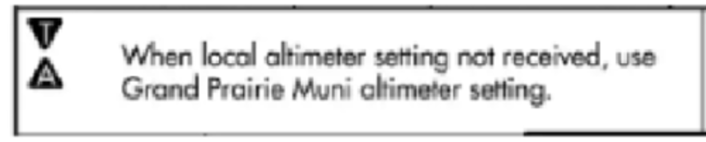
What does the symbol T within a black triangle in the minimums section of the IAP for a particular airport indicate?
Indicates takeoff minimums are not standard and/or departure procedures are published.
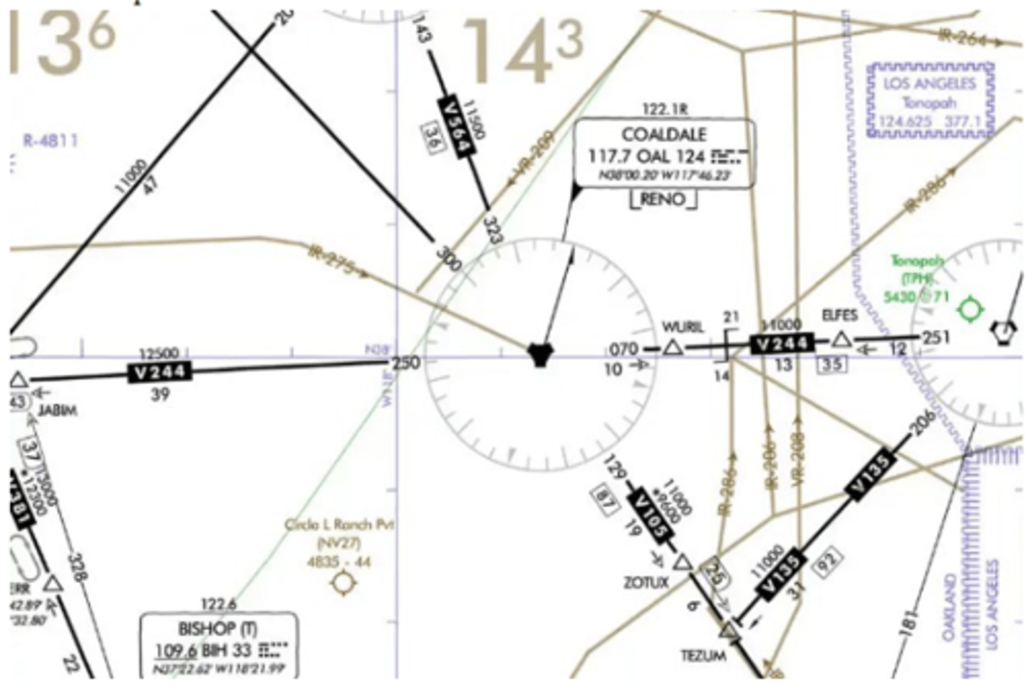
You're traveling east on V244 approaching the Coaldale (OAL) VOR, and you're in radar contact. Because the Coaldale VOR is a compulsory reporting point, do you need to make a position report?
Compulsory reporting points are located in areas where radar contact may be lost. In the event where radar contact is lost, you must make a position report at the compulsory reporting point. But if ATC doesn't tell you that radar contact is lost, you are not required to make a position report
You're instructed to enter a random hold assigned by ATC. You're currently at 16,000' MSL. How long should your inbound leg be?
1.5 minutes. Because you are above 14,000 ft MSL, your inbound leg should be extended to a minute and a half
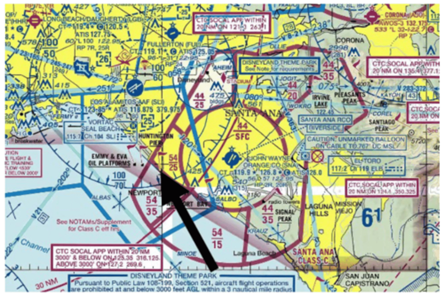
What is the order of airspace, starting from the surface, at Huntington Pier?
Class G from SFC-699' AGL
Class E from 700' AGL - 2,499' MSL
Class C from 2,500' MSL-5,400' MSL
Class E from 5,401' MSL - 6,999' MSL
Class B from 7,000' MSL - 10,000' MSL
Class E from 10,001' MSL - 17,999' MSL
Class A from FL180-FL600.
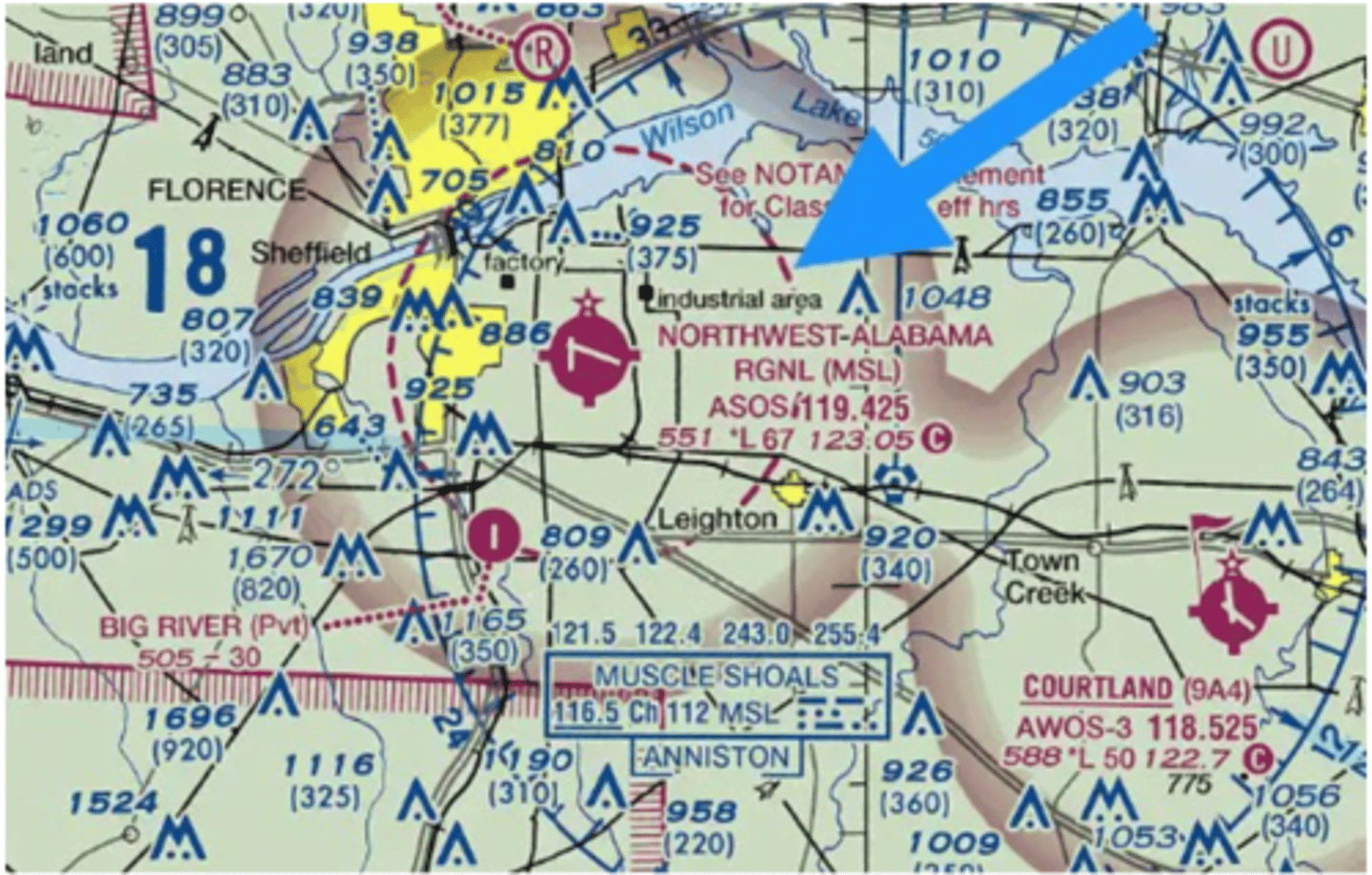
You're flying just outside of Huntsville, Alabama and plan to make a fuel stop at Northwest Alabama Regional (KMSL). What does a magenta dashed circle surrounding the airport indicate?
Indicates that Class E airspace is to the surface.
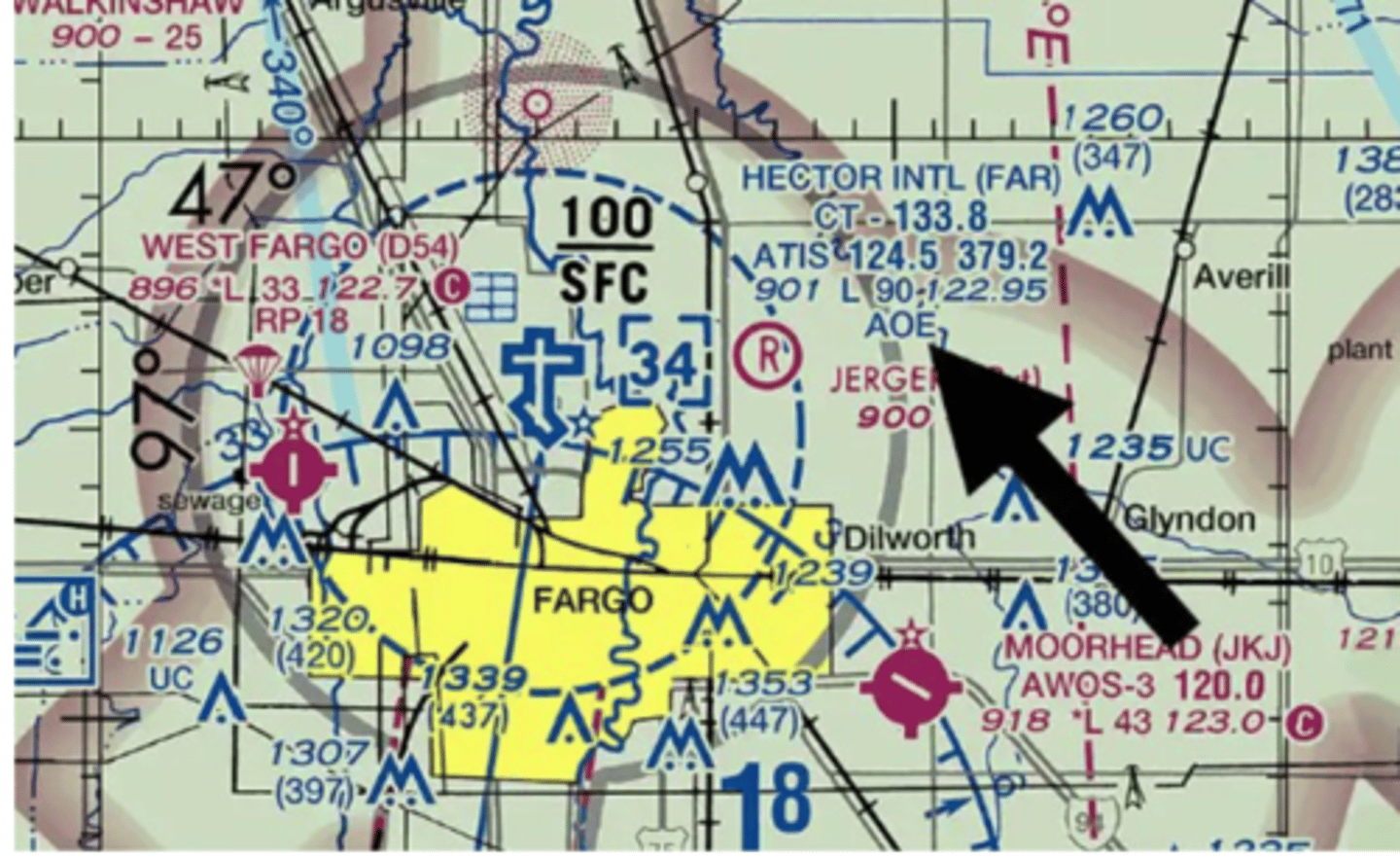
What does AOE indicate in Hector International's (KFAR) airport description?
Means the airport is an airport of entry with U.S. customs and immigration office.
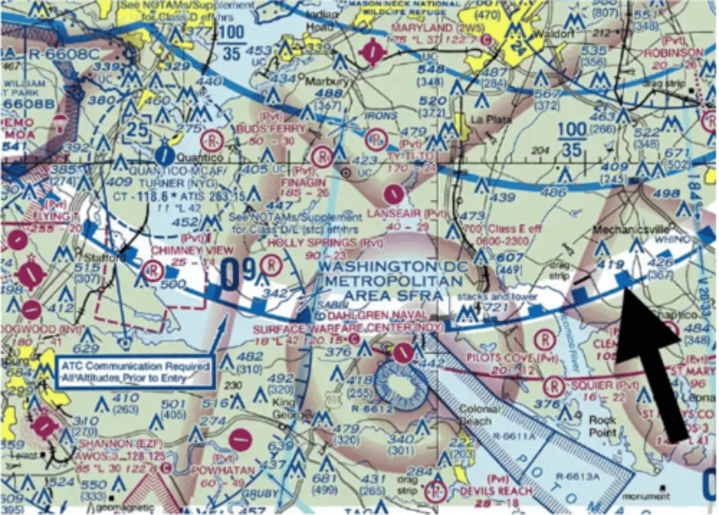
What type of airspace is indicated by the blue dashed line?
This is the Washington D.C. SFRA or Special Flight Rules Area. While operating within 30 NM from the DCA VOR/DME, you must have received specific training, be transmitting on a discrete squawk code, and be on a special flight plan
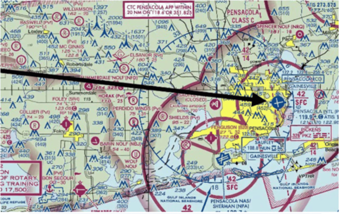
You are flying from Mobile Downtown (KBFM) to Pensacola International (KPNS). What frequency will you contact Pensacola Approach on?
In the white box above the Pensacola airspace, it says to contact Pensacola Approach within 20 NM on 118.6
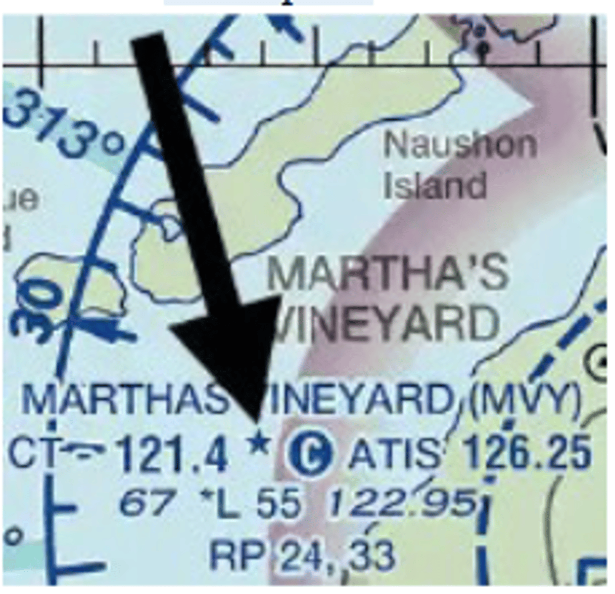
You are planning a flight to Martha's Vineyard (MVY). What does the star mean in the airport description?
This indicated that the tower operates part-time
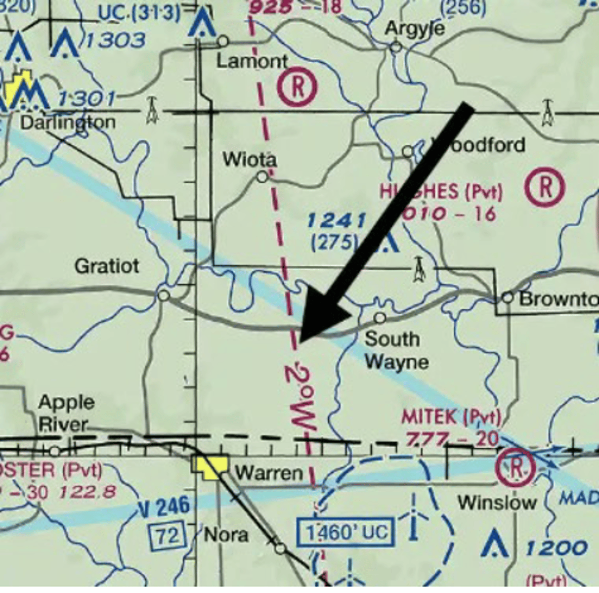
What is this line and what does it show?
Isogonic line, it shows degrees of variation
Variation is the difference between true and magnetic north
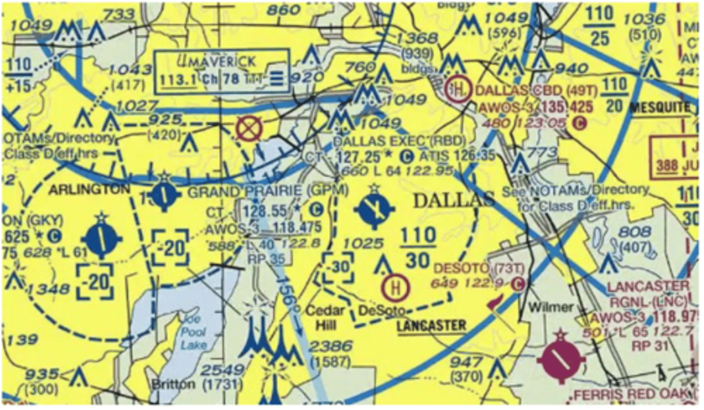
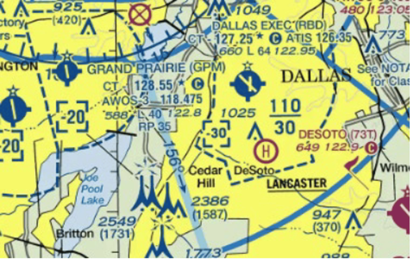
If Dallas Executive Tower is not in operation, which frequency should be used as a Common Traffic Advisory Frequency (CTAF) to monitor airport traffic?
127.25 MHz
This is denoted by the "C" inside the blue circle beside the frequency. 122.95 MHz is the UNICOM frequency and 126.35 MHz is the ATIS frequency.
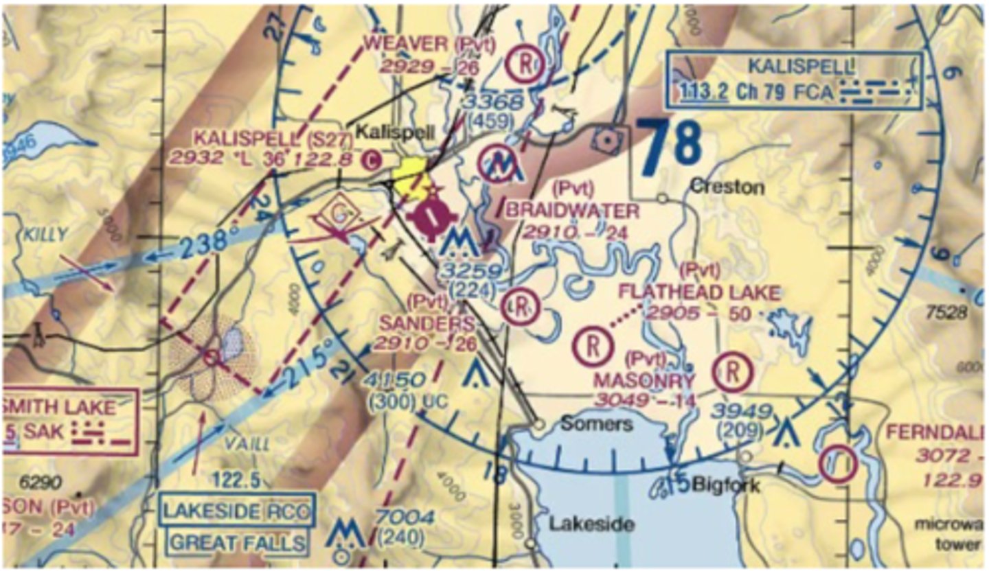
For information about the glider operations at Kalispell Airport, refer to
Chart supplement
Information about glider operations is contained in the remarks about the airport in the Airport/Facility Directory section of the Chart Supplement
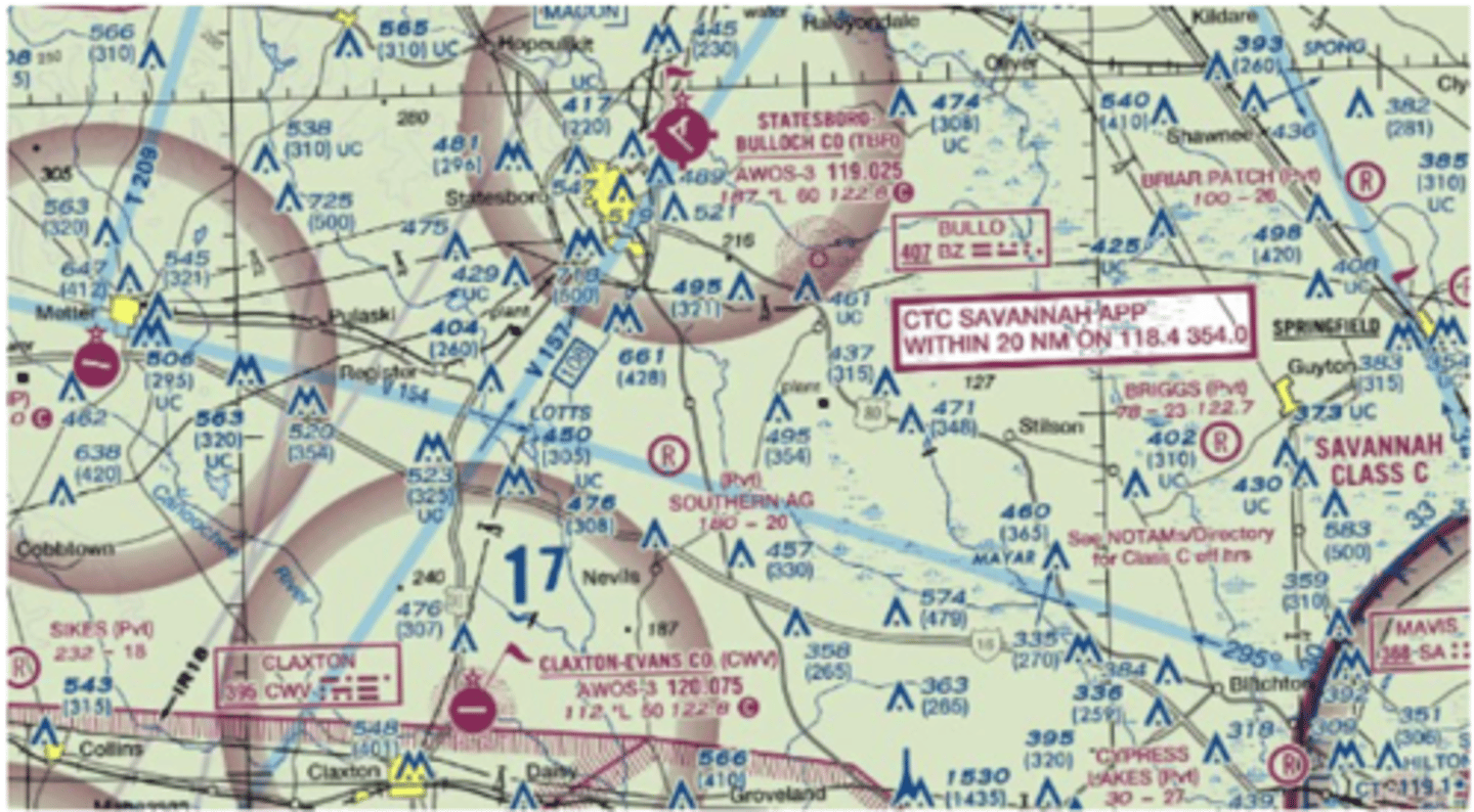
The flag symbols at Statesboro Bulloch County Airport and the Claxton-Evans County Airport are
Used to identify visual checkpoints on a sectional chart.
Visual checkpoints could include populated places, drainage patterns, roads, railroads, and other distinctive landmarks.
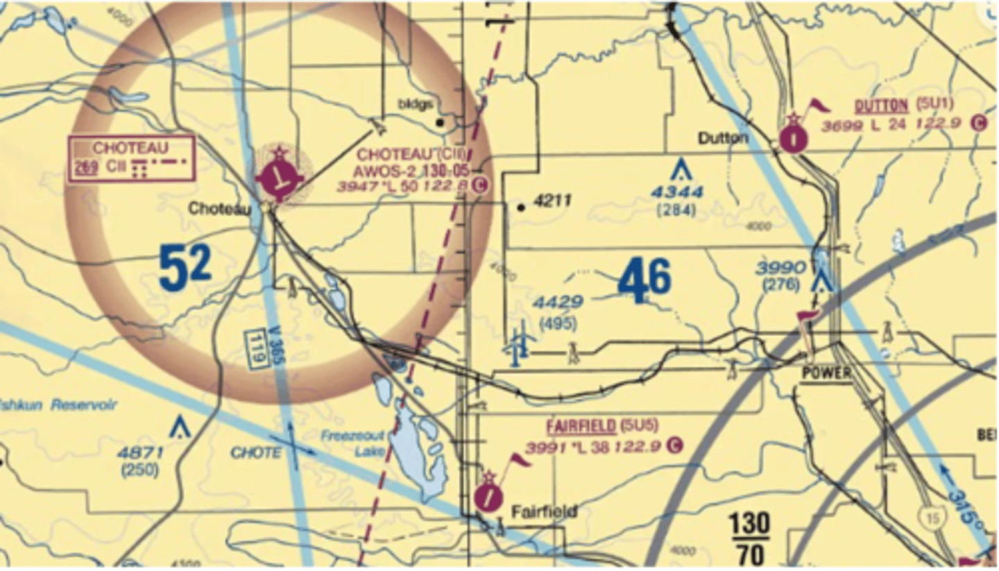
Which public use airports depicted are indicated as having fuel?
Choteau
The tick marks around the basic airport symbol for Choteau airport indicate that fuel is available and the airport is tended during normal working hours?
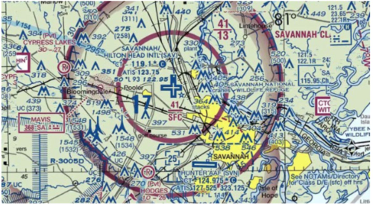
What is the height of the lighted obstacle approximately 6 nautical miles southwest of Savannah International?
AGL height of 1,534' and an MSL height of 1,548'.
The lighted obstacle just southwest and outside of the 5 nautical mile ring is labeled as being 1548 with 1534 in parenthesis
What minimum altitude is required to fly over the Cedar Hill TV towers in the congested area southwest of Dallas Executive Airport?
3,549 ft MSL
When flying over a congested area of a city, an altitude of 1,000' above the highest obstacle within a horizontal radius of 2,000' of the aircraft is required. The Cedar Hill TV towers have an MSL height of 2,549
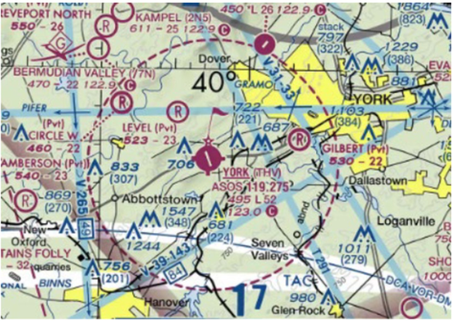
Identify the airspace over York Airport.
Class E airspace - surface up to but not including 18,000 feet MSL
In most areas of the United States, class E airspace extends from 1,200 feet AGL up to but not including 18,000 feet MSL. A dashed magenta line indicates areas that class E airspace begins at the surface and continues to the lower limit of class A airspace.
Minimum required weather to takeoff (AFMAN 11-202v3)
- Lowest compatible approach minimums
- 600 RVR.
Is it permitted to takeoff with thunderstorms or other conditions are producing hail, strong winds, gusts, heavy rain, lightning or microbursts in the vicinity? (AFMAN 11-202v3)
Only of the runway in flightpath are clear of hazards
True or false: Pilots must 'see and avoid' obstacles and terrain while executing a VFR departure (AFMAN 11-202v3)
True.
What minimum climb gradient is assumed for IFR departures? (AFMAN 11-202v3)
200'/NM
After takeoff under an IFR clearance, when can you turn? (AFMAN 11-202v3)
400' above the DER elevation (unless executing a closed pull-up, in which case, in accordance with TO guidance)
What methods are permitted for clearing low close-in obstacles? (AFMAN 11-202v3)
Lateral or vertical deconfliction
What height above the departure end of the runway is assumed at FAA and US Army fields?
35'
What height above the departure end of the runway is assumed at USAF and USN fields? (AFMAN 11-202v3)
0'
Under what criteria are Trouble T's published for an airfield? (AFMAN 11-202v3)
Obstacles within 3SM of the DER that required greater than 200'/nm to clear
What IFR departure method allows IFR aircraft in VMC to conduct climbing turns over the airfield until reaching a published altitude? (AFMAN 11-202v3)
VCOA (Visual Climb Over Airfield)
Can USAF Aircraft employ the VCOA method? (AFMAN 11-202v3)
Only if trained and certified by the MAJCOM
If unable to accept a SID, what modification should be made to your flight plan? (AFMAN 11- 202v3 5.24.4)
Indicate NO SID in flight plan remarks
If vectored off a SID should you expect to resume the SID? (AFMAN 11-202v3)
No, unless told "expect to resume"
If cleared a SID are you expected to climb to the published altitudes? (AFMAN 11-202v3)
No, unless directed to CLIMB VIA the SID, simply fly the lateral profile of the SID and adhere to assigned altitudes
What does "RNAV 1" designation provide for GPS accuracy? (AFMAN 11-202v3)
1 NM left or right of course centerline 95% of the time
What are the first three steps when using a ground based NAVAID? (AFMAN 11-202v3)
T - Tune
I - Identify
M - Monitor
What is the usable range of a localizer in the NAS? (AFMAN 11-202v3)
18 NM within 10 degrees of the published front course
For purposes of wake turbulence, what are the 4 ATC aircraft types and what spacing is provided? (AFMAN 11-202v3)
Small - None
Large - As needed
Heavy - 3 minutes
Super - 4 minutes
Above what altitude must USAF aircraft fly VFR Hemispheric Altitudes? (AFMAN 11-202v3)
3000' AGL
How low can non-emergency USAF aircraft operate over sparsely populated areas / open water? (AFMAN 11-202v3)
No altitude is listed. However, USAF aircraft may not operate closer than 500' to any persons, vessels, vehicles or structures.
How low can non-emergency USAF aircraft operate over non-congested areas? (AFMAN 11- 202v3)
500' AGL
How low can non-emergency USAF aircraft operate over congested areas? (AFMAN 11-202v3)
1000' AGL within 2000' radius of the highest obstacle
What is the minimum altitude for flight over national parks, seashores, lakeshores, recreation and scenic river ways, wildlife refuges?
2000' AGL
What is the maximum speed allowed below 10,000' MSL? (AFMAN 11-202v3)
250 KIAS
What is the maximum airspeed allowed within 4 NM of the primary airport in Class C or Class D airspace? (AFMAN 11-202v3)
200 KIAS
What is the maximum airspeed allowed in airspace underlying Class B or in VFR corridors through Class B airspace? (AFMAN 11-202v3)
200 KIAS
When does a violation occur?
A violation (pilot deviation) may result when a USAF aircraft deviates from a flight rule.
The PIC should not accept an aircraft for flight if they suspect the aircraft is not _______.
Airworthy
Aircrew will not fly or assume aircraft control for UAS:
If any alcohol was consumed within ____ hours prior to takeoff or if impaired by alcohol or any other intoxicating substance, to include the effects or after-effects.
12
Aircrew will not fly or assume aircraft control for UAS:
Within ___ hours after donating blood, plasma, or bone marrow.
72
Aircrew will not fly or assume aircraft control for UAS:
Within ___ hours of compressed gas diving including SCUBA, surface supplied diving, aircraft pressurization checks exceeding 10 minutes in duration below sea level or hyperbaric (compression) chamber exposure.
24
Can aircrew conduct unauthorized or impromptu flight demonstrations, maneuvers, or flyovers?
No
Can you use tobacco in any form in flight?
Technically no (unless ur cool)
Aircrew will use supplemental oxygen any time the cabin pressure altitude exceeds _____ feet MSL.
10,000
If cabin altitude exceeds _____ feet MSL following the unintended loss of cabin pressure, aircrew and passengers must be evaluated by a flight surgeon or other aviation medical authority prior to further flight.
18,000
When must position lights be on?
Between sunset and sunrise, turn on position lights when
- Operating an aircraft
- Towing an aircraft (unless clearly illuminated by an outside source)
- When parking an aircraft in an area likely to create a hazard (unless clearly illuminated by an outside source).
When must anti-collision or strobe lights be on?
Prior to engine start and until after engine shutdown
Aircraft in ____ have the right-of-way over all other air traffic.
Distress
When aircraft of the same category are converging at approximately the same altitude (except head-on or approximately so), which aircraft has the right-of-way?
Aircraft to the other's right
Order of priority for right-of-way for aircraft of different category?
Balloons, gliders, aircraft towing or refueling other aircraft, airships, rotary- or fixed-wing aircraft
Aircraft will squawk ____ in the absence of any ATC directions or regional air navigation agreements.
2000
VFR aircraft normally squawk either ____ or an ATC-assigned flight following code.
1200
Aircraft operating VFR or IFR in restricted areas, warning areas, or on a VFR military training route (VR) will squawk ____ unless another code has been assigned by ATC.
4000
Does RVR take precedence over any other visibility report for that runway?
Yes
What if a variable RVR report is received?
Aircrew will apply the lowest reported value
What's the difference between RNAV substitution vs RNAV alternate means of navigation?
- Substitute means of navigation refers to using a suitable RNAV system in lieu of out-of-service conventional NAVAIDS or non-installed or non-operable avionics.
- Alternate means of navigation refers to using a suitable RNAV system in lieu of operational conventional NAVAIDS without monitoring those NAVAIDs.
For turbine-powered aircraft use fuel consumption rates that provide _____ _____ at ______ feet MSL.
- Best endurance
- 10,000
What basis are non-RVSM aircraft handled on?
Workload permitting basis