SIGNS TO REMEMBER WA
 Call Kai
 Learn
Learn Practice Test
 Spaced Repetition
 Match
Match Flashcards
 Knowt Play
1/75

There's no tags or description
Looks like no tags are added yet.
Name | Mastery | Learn | Test | Matching | Spaced | Call with Kai | Chat |
|---|
No analytics yet
Send a link to your students to track their progress
76 Terms
Stop

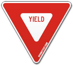
Yield
Slow Down and Stop to allow right of way if necessary
Speed Limit
Tells you maximum or minimum speed on road

Keep Right
Stay Right unless passing a vehicle

Automated traffic safety cameras
Cameras Automatically record images of you. Speeding tickets will be mailed.

Speed Warning
Signs indicate Speed change is recommended for a potential hazard or road condition.

Variable speed limit and advanced notification
Digital signs attempting to distribute the flow of traffic by posting changing speed limits, close entire lanes and provide warning information.

One way
Identifies where traffic flows only in the direction of the arrow. Never drive the wrong way on a one-way street.

No pedestrians
Pedestrians are prohibited from walking or entering this designated area or roadway.

No U-Turn
Drivers are not allowed to make a 180-degree turn to travel in the opposite direction.

No right turn
Vehicles are prohibited from turning right at the intersection or specified location.

No left turn
Vehicles are prohibited from turning left at the intersection or specified location.

No Trucks
Commercial trucks or heavy vehicles exceeding a certain weight limit are restricted from using the road.

No Parking

Do Not Enter

Wrong Way
To prevent hard on collisions

No passing and passing safety
You might see these signs where there are potential hazards (hills, curves, intersections) and other places a vehicle could enter the roadway.

Shared center lane left turn only
lane is reserved for left-turning vehicles from either direction and isn’t to be used for through traffic or passing other vehicles. Arrows often painted on road.

Roundabout/ Circular Intersection

Roundabout

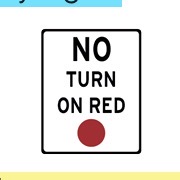
No turn on Red
Lane Use Control
Shows permitted or restricted movements for specific lanes during indicated times (ex. straight-only, turn-only, or prohibited lanes).

Mile Marker
Indicates your exact location along a highway in miles.

School zone speed limit
Requires drivers to slow down to the posted speed limit (ex. 15 MPH).

Reduced speed limit ahead
Prepares drivers to slow down soon.

Railroad Intersection (crossbuck)
Placed directly at a railroad track crossing to warn drivers to yield or stop for approaching trains.

Cross road
Warns that a four-way intersection is ahead

Curve
Indicates a gradual curve in the road ahead. (Note: Has a version with the arrow curving to the right)

Deer crossing

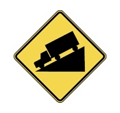
Hill
Warns of a steep downgrade ahead; drivers should check their brakes and slow down.
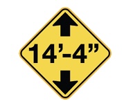
Low Clearance
Indicates the maximum height clearance allowed under an overpass or structure.
Merge
Warns drivers that their lane is coming to an end and they must merge into the continuing lane. (Note: Has a version where the left lane ends instead of the right).

Merging Traffic
Alerts drivers that a lane will be joining the main roadway. (Note: Has a version showing the side lane entering from the left).

Pedestrian Crossing

Reversing Curves
Indicates two consecutive turns in opposite directions ahead. (Note: Has a version that curves right first, then left).

School Crossing

Side Road
Warns that another road enters the highway at a right angle. (Note: Has a version showing the side road entering from the left).

Signal Ahead

Slippery when Wet

Soft shoulder
Warns that the dirt/gravel area off the edge of the road is unpaved or soft.

Stop Ahead

Sharp Turn
Alerts drivers to a sharp, sudden turn requiring lower speeds. (Note: Has a version with the arrow turning to the right).

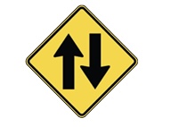
2-way Traffic
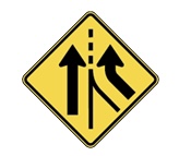
Added Lane (from right, no merging required)
Indicates that entering traffic is getting its own dedicated lane, so no merging is necessary. (Note: Has a version showing the added lane entering from the left side).
Advance warning bicyclists

Narrow Road or Bridge Ahead

Curve Left (35 mph rec.)
Warns of a curve ahead with a recommended speed. (Note: Has a version featuring an arrow curving to the right)

Divided highway (road) begins
Indicates that a highway separated by a median or physical barrier is starting ahead.
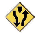
Divided highway (road) ends
Warns that the physical divider ends, returning to a standard two-way road.

Slow moving vehicles
Placed on vehicles that drive at speeds under 25 MPH.

Winding Roads
Warns of a series of three or more consecutive curves or turns ahead.

Advisory Speed
Recommends a safe maximum speed for an upcoming exit ramp or curve.

Chain Advisory
Electronic sign indicating that tire chains are mandatory due to winter conditions.

Light Rail
Alerts drivers to look out for trains crossing or running parallel in shared lanes.

Sharp Curve Ahead (Chevron)
Outlines the outer edge of a sharp curve to guide drivers. (Note: Has a version with the chevrons pointing to the right).

Railroad crossing
Advance warning sign alerting drivers that a railroad crossing is ahead.

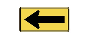
Traffic Direction
Indicates a mandatory direction that traffic must follow. (Note: Has a version with the arrow pointing to the right).
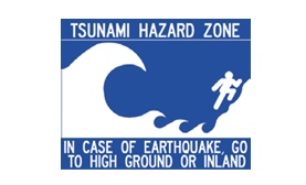
Tsunami hazard zone
National Forest
Route marker designating a roadway traveling through a National Forest. (Note: Route numbers vary).

Volcano evaluation route

Road Construction Ahead/ Construction

Worker Symbol (Road Worker)
Indicates that road maintenance or highway personnel are physically working in or near the roadway.

Detour
Directs drivers onto an alternate route to bypass closed road sections. (Note: Has versions with arrows pointing to the left, right, or straight).

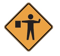
Flagger Symbol
Warns drivers that a flagger is ahead regulating traffic flow using a flag or paddle.
Road Work 1000FT
Prepares drivers for upcoming roadwork at a specific distance. (Note: Distance text varies)

Hospital
Directs drivers toward medical facilities providing emergency health services. (Note: Often includes directional arrows pointing left, right, or straight).

Rest Area
Directs drivers toward designated roadside pull-off locations with restrooms and facilities. (Note: Has versions with arrows pointing in different directions or specific distance listings.)

EV Charging Station
Indicates the availability of electric vehicle charging infrastructure. (Note: May include directional arrows or specific connector type labels).

Hiking/ Trails
Brown square sign marking access to hiking paths, trailheads, or outdoor walking areas. (Note: Specific recreation icons vary depending on the facility, such as camping, boat launches, or picnic areas).

Picnic Area

Skiing Area

City Mileage
Displays upcoming destination names alongside the remaining mileage to reach them. (Note: Text, cities, numbers, and layout vary completely based on the location).

Optional exit and exit only
Overhead/ roadside signs indicating exit numbers, cardinal directions, city destinations, and lane requirements (whether a lane is "Exit Only" = “ONLY” or optional = “OK”). (Note: Text, route numbers, arrows, and exit numbers vary).

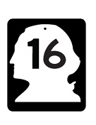
George Washington silhouette / State Route Marker
Marks highways managed and funded specifically by that individual state (George Washington head for Washington State). They connect cities and towns locally within state borders.
US highway Shield
Marks nationwide highways that cross state lines. While they are major roads, they are not always full freeways and can have traffic lights, lower speed limits, and cross-streets.

Interstate Shield
Marks high-speed Interstate freeways (like I-5). These are divided roads with no stoplights, no cross-street intersections, and access limited strictly to entrance and exit ramps. Also crosses state lines.
