AP WH MCQ
1/29
There's no tags or description
Looks like no tags are added yet.
Name | Mastery | Learn | Test | Matching | Spaced |
|---|
No study sessions yet.
30 Terms
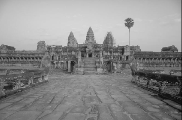
The photograph above of Angkor Wat in Cambodia is an example of
Hindu influence in Southeast Asia
The Mongol conquests of much of Eurasia in the thirteenth century tended to encourage trade along the Silk Roads primarily by
decreasing the risk of bandit attacks and reducing the number of local rulers collecting tribute from trade caravans

The act of the countess of Béarn in the image is most closely identified with which of the following political systems?
Feudalism

The image most directly illustrates which of the following features of the political development of medieval Europe?
Its decentralization, as European rulers frequently delegated authority to local subordinates.
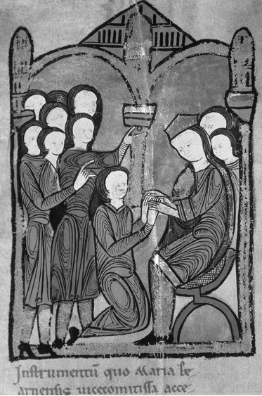
In Europe, political relationships of the type depicted in the image emerged most directly on account of which of the following developments?
Local elites’ need for military protection from more powerful lords
In the period 600 C.E. to 1450 C.E., states in Japan, Korea, and Vietnam had which of the following in common?
All were culturally influenced by China.
Which of the following resulted from the fragmentation of the Mongol Empire following the death of Genghis Khan?
The development of khanates in Central Asia
Which of the following most directly contributed to the decline of Eurasian urban populations during the fourteenth century?
Epidemic disease
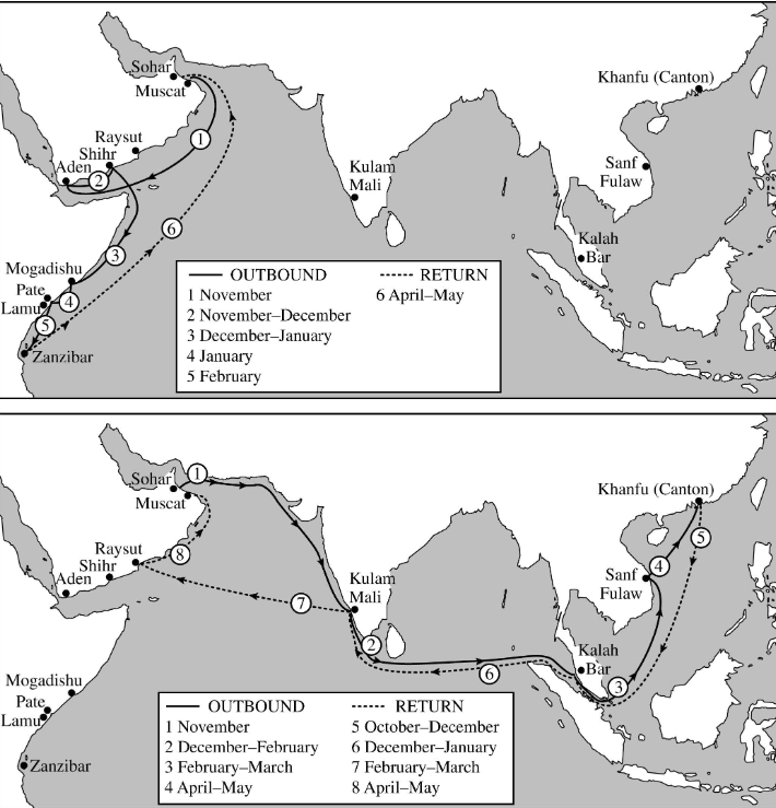
Based on the maps and your knowledge of world history, which of the following best describes the effect of the spread of Islam on Indian Ocean trade?
It led to the expansion and intensification of commerce along already existing trade routes.

The particular routes and timings of the voyages depicted on the maps best reflect which of the following characteristics of Omani merchants?
Their advanced knowledge of Indian Ocean currents and monsoon wind patterns

Which of the following factors contributed the most to Omani traders’ ability to undertake the voyages depicted on the maps?
Navigational and maritime innovations, such as the astrolabe and lateen sail

Based on the maps and your knowledge of world history, which of the following could be best inferred about the South and East Asian trading cities on the map?
They had Muslim diasporic merchant communities.
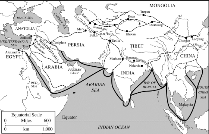
The lines on the map above illustrate which of the following?
Extent of trade routes
Which of the following was the most important factor in the spread of Islam in Southeast Asia in the period circa 1250–1500 C.E.?
The activities of Muslim traders and Sufi missionaries
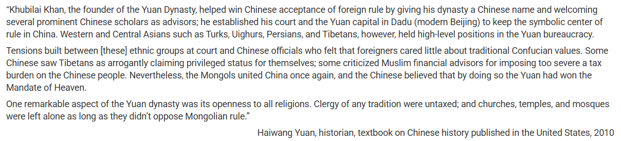
The author’s assertion in the second paragraph that Chinese people came to believe that “the Yuan had won the Mandate of Heaven” can best be understood in the context of which of the following?
Continuities in Chinese political and cultural traditions
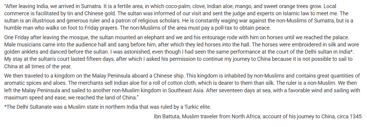
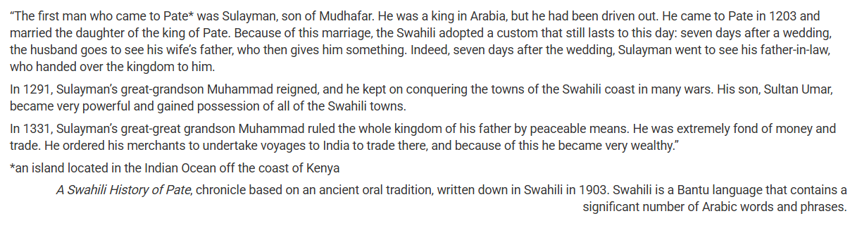
The purpose of Ibn Battuta’s account was most likely to
inform his audience about the cultural, political, and economic characteristics of the places he visited

Which of the following best explains the continuity in the trade routes between East Africa, the Arabian Peninsula, and India as shown on the maps?
Trade along the routes relied on sailors’ knowledge of the monsoon winds.
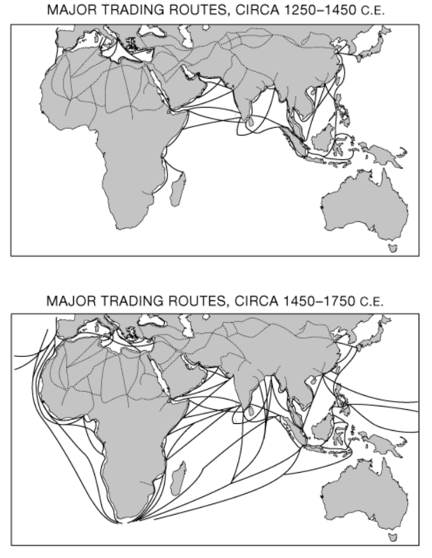
The maritime trade connections involving East Africa shown on Map 1 provided a setting for which of the following developments?
The spread of Islam

The expansion of trade routes along the coast of Africa as shown on Map 2 was most directly facilitated by which of the following?
Improved ship designs and navigational technologies
In the period 600 C.E. to 1450 C.E., merchant diaspora communities, such as those of Muslims in India, Chinese in Southeast Asia, and Jews in the Mediterranean, had which of the following in common?
They generally introduced their own cultural practices into the local cultures.
Which of the following lists three places Ibn Battuta, the fourteenth-century Muslim traveler, visited?
India, Mali, and Persia
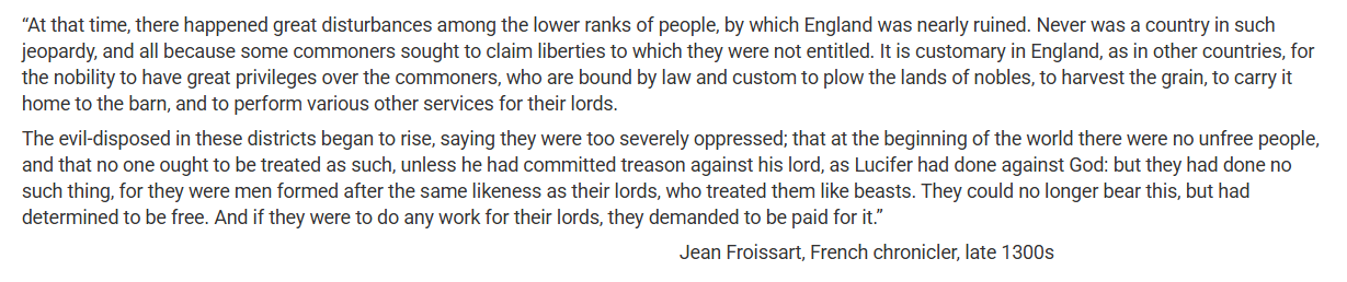
The events described in the passage represent a reaction against which of the following forms of coerced labor?
Serfdom
Between 200 B.C.E. and 1450 C.E., the Silk Roads linked which of the following?
East Asia and the Mediterranean Sea
Inca and Aztec societies were similar in that both
acquired empires by means of military conquest
Which of the following was the main reason that Buddhist thought had important social implications for South Asia?
It challenged hierarchies based on caste.
Which of the following developments best explains why many historians argue that the Song dynasty period (960-1279 C.E.) was pivotal in the development of China as an economic world power?
China’s population doubled and Chinese urban centers experienced massive growth during the Song period.
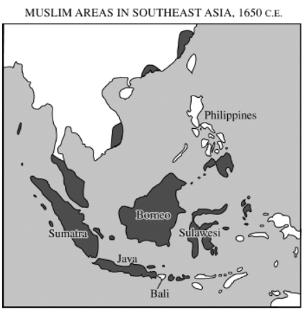
Which of the following factors best explains the distribution of Muslim populations shown on the map above?
Merchant activity
The first paragraph most directly illustrates how increasing regional interactions led to which of the following developments in the Indian Ocean in the period 1200–1450?
The introduction of new cultural traditions
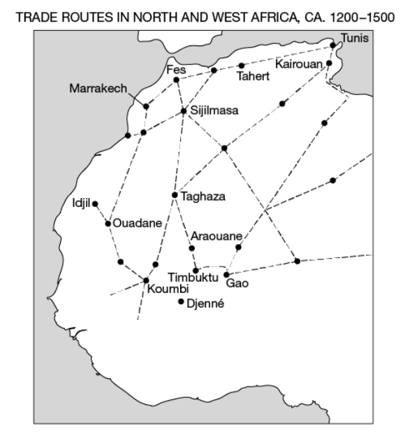
Which of the following led most directly to the development of the trading network on the map?
Innovations in transportation and commercial technologies such as caravanserai

Which of the following contributed most directly to an increase in trade along the routes on the map?
The expansion of empires such as Mali in West Africa