Module 1 - Map Types
0.0(0)
Card Sorting
1/10
Earn XP
Description and Tags
Study Analytics
Name | Mastery | Learn | Test | Matching | Spaced |
|---|
No study sessions yet.
11 Terms
1
New cards
reference map ☆
map type that shows reference information for a particular place, making it useful for finding landmarks and for navigating. emphasis on location
2
New cards
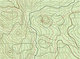
topographic maps
**reference** map that uses isolines to represent constant elevations
3
New cards
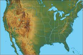
atlas/physical maps
\- often include much of the same data found on a political map
\- primary purpose is to show land forms like deserts, mountains, and plains. their topography style presents an overall better picture of local terrain.
\- primary purpose is to show land forms like deserts, mountains, and plains. their topography style presents an overall better picture of local terrain.
4
New cards
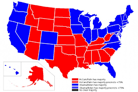
political map
maps that are designed to show governmental boundaries of countries and states
5
New cards
thematic map ☆
\- displays one or more variables such as population, or income level- within a specific area
\- emphasizes spatial patterns of geographic statistics
\- sometimes relationships between them
\- emphasizes spatial patterns of geographic statistics
\- sometimes relationships between them
6
New cards
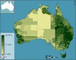
choropleth map
**thematic** map that uses tones or colors to represent spatial data as average values per unit of data
7
New cards
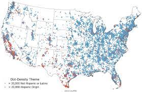
dot density / distribution maps
**thematic** maps that use points to show the precise locations of specific observations or occurrences, such as crimes, car accidents, or births
8
New cards
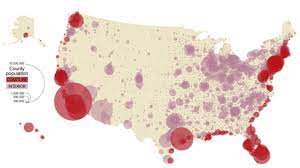
proportional / graduated symbol map
**thematic** map with symbols that change in size according to the value of the attribute they represent
9
New cards
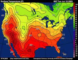
isoline map
\- **thematic**
\- continuous lines joining points of the same value
\- examples would be equal altitude (contour lines), temperature (isotherms), barometric pressure (isobars), etc.
\- continuous lines joining points of the same value
\- examples would be equal altitude (contour lines), temperature (isotherms), barometric pressure (isobars), etc.
10
New cards
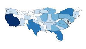
cartogram map
\- **thematic** mapping variable- such as travel time, population, gross national product, is substituted for land area or distance.
\- the geometry or space of the map is distorted in order to convey the information of this alternate variable
\- the geometry or space of the map is distorted in order to convey the information of this alternate variable
11
New cards
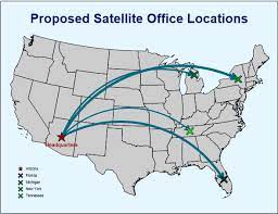
flow map
**thermatic** mix of maps and flow charts that show the movement of objects from one location to another