Map Types and Productions - APHG
1/15
There's no tags or description
Looks like no tags are added yet.
Name | Mastery | Learn | Test | Matching | Spaced | Call with Kai |
|---|
No analytics yet
Send a link to your students to track their progress
16 Terms
Thematic Maps
Maps that show spatial aspects of information or of a phenomenon. Think "themes"
*Includes choropleth, dot distributions, graduated symbol, isoline maps, and cartograms
Political Maps
Maps that show human-created boundaries and designations, such as countries, states, cities, and capitals.
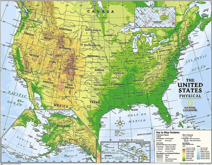
Physical Maps
Maps that show natural features, such as mountains, rivers, and deserts.
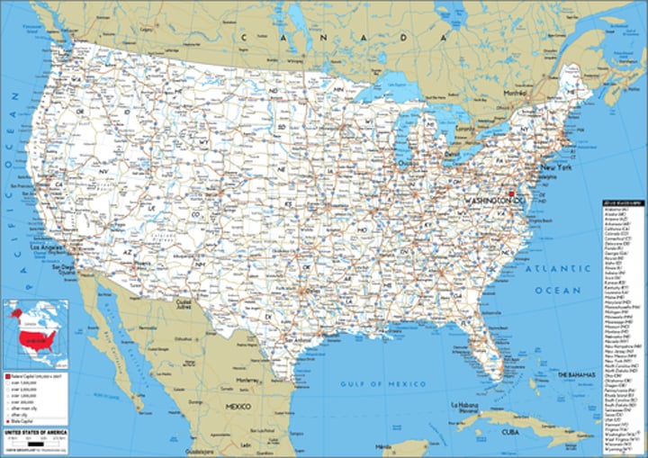
Road Maps
Maps that show highways, streets, and alleys.
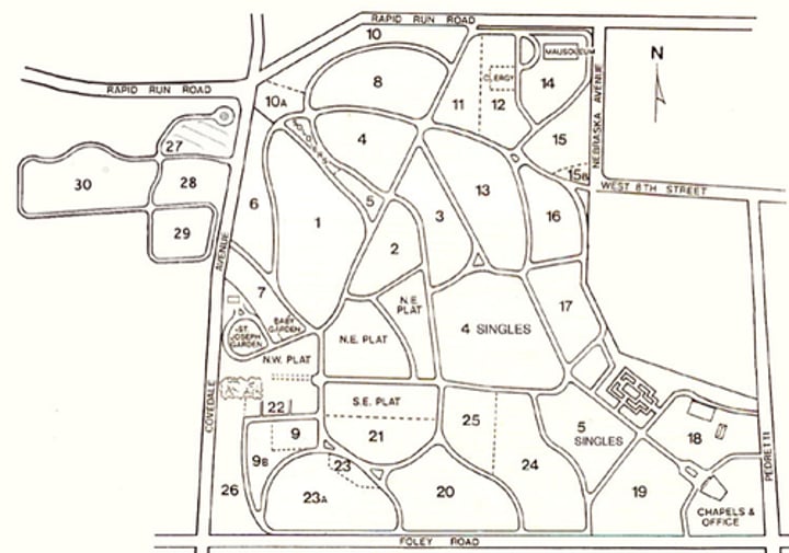
Plat Maps
Maps that show property lines and details of land ownership.
Locator Maps
Maps that illustrate the exact location of an event or place,
can often be used in books or other texts.
*Often uses symbols.
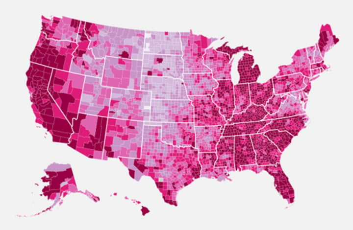
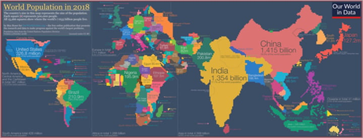
Choropleth Maps
Maps that use colors, shades, or patterns to show the location and distribution of spatial data.
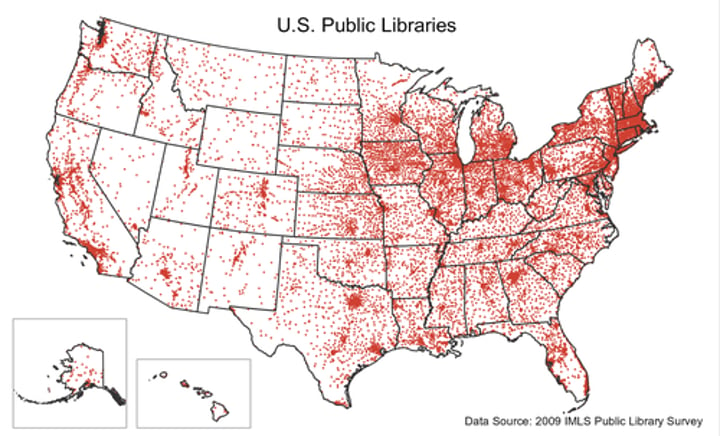
Dot Distribution Map
Maps used to show the specific location and distribution of something, with each dot representing a specific quantity.
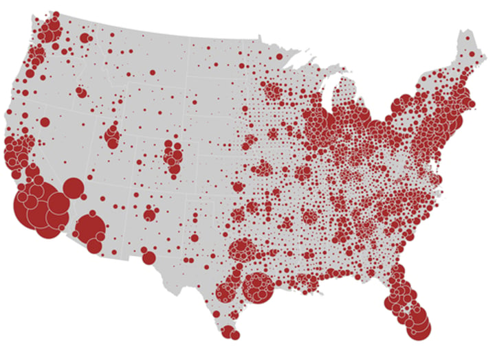
Graduated Symbol Maps
Maps that use symbols of different sizes to indicate different amounts of something. Larger sizes indicate more of something and smaller sizes indicate less.
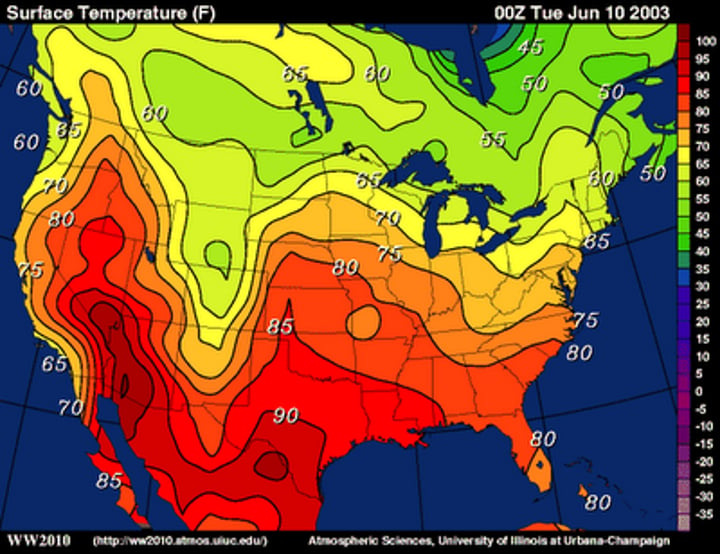
Isoline Maps
Maps that use lines that connect points of equal value to depict variations in data. Distance between the lines indicates a change.
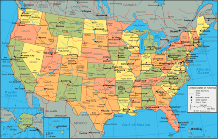
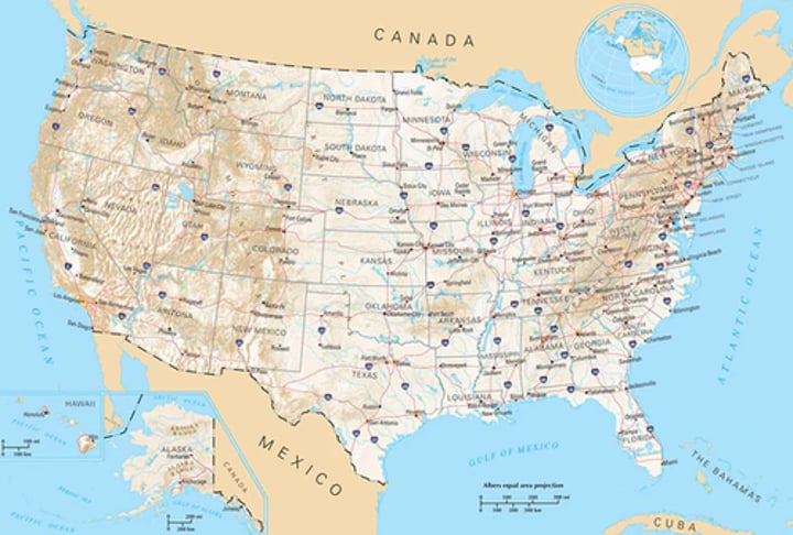
Reference Maps
Maps designed for people to refer to for general information about places. They show locations.
*Includes political, physical, road, plat, and locator maps
Cartogram Map
Maps where the sizes of places are shown according to some specific statistic.
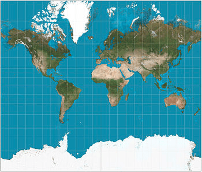
Mercator Map
Purpose:
Navigation
Strengths:
Directions shown accurately
Shapes are relatively the way they appear on the globe (near the equator)
Distortion:
Size of land masses is distorted
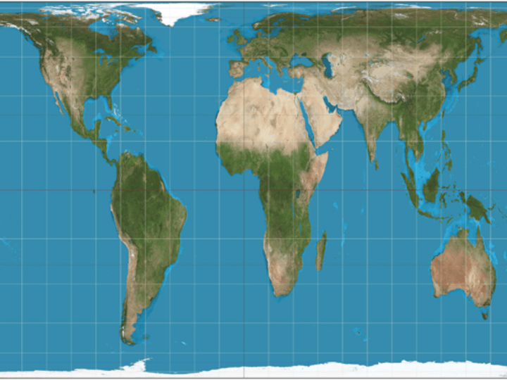
Peters Map
Purpose:
Illustrating spatial distribution
Strength:
Size of land masses are accurate
Distortion:
Shapes of land masses are inaccurate, especially near poles
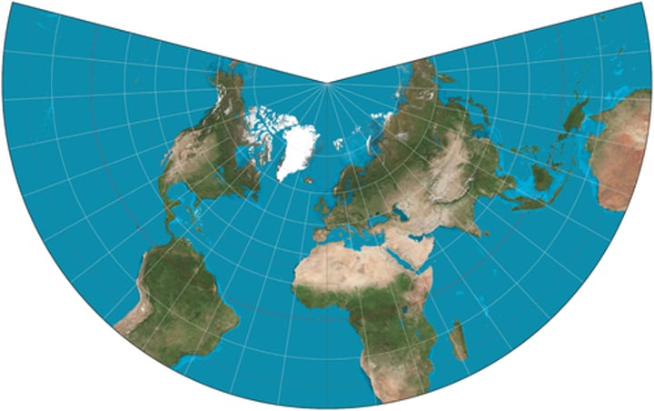
Conic Map
Purpose:
Best suited for regional mapping
Strength:
Size and shape are both close to reality
Distortion:
Longitude lines converge at only one pole (directional issues)
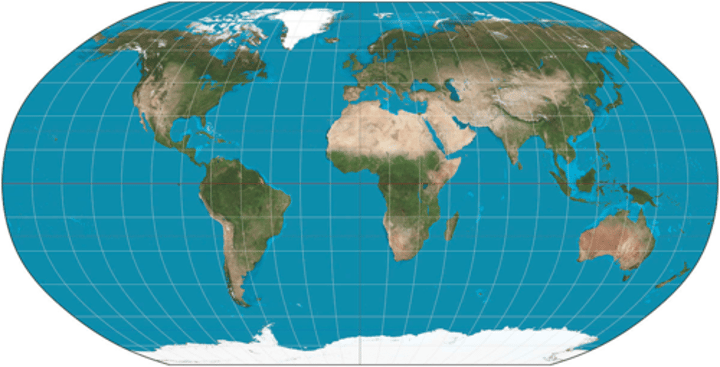
Robinson Map
Purpose:
General use
Strength:
No glaring distortion
Oval shape appears more like a globe
Distortion:
Area, shape, size, direction all slightly distorted (more pronounced near poles)