APHG Unit #1 Vocab
 Call Kai
 Learn
Learn Practice Test
 Spaced Repetition
 Match
Match Flashcards
 Knowt Play
 Podcast
1/81

There's no tags or description
Looks like no tags are added yet.
Name | Mastery | Learn | Test | Matching | Spaced | Call with Kai | Chat |
|---|
No analytics yet
Send a link to your students to track their progress
82 Terms
physical geography
The study of earth’s natural features and environment, including landforms, climate, soils and ecosystems. It examines the processes that shape the Earth's surface and how those processes affect human activities. Serves as a natural “stage” for human settlement and activity as well as how economy’s are built and political boundaries drawn.
Human Geography
sthe study of how human activity shapes, affects and is affected by the earth’s surface and spatial relationships, focusing on cultural, economic, and social dimensions.
four level analysis
a spatial framework/guide for geographic thinking using
-comprehension (what/where/when, establish facts and basic understanding of map/data)
-identification (spot and describe spatial patterns and trends in data and connections between different geographic phenomena)
-explanation (Why is something located where it is and how did it get there?)
-predictions (why does this data/pattern matter and predict possible future effects or impacts on ESPN / Economic, social, political, and environmental trends)
Analyze
to examine methodically and in detail, to break down geographic data/spatial patterns and study their relationships, why human activities occur where they do and to infer conclusions based on this
theory
a systematic set of ideas or models used to explain patterns, spatial relationships with phenomena and human activities/actions
concepts
ideas of how people, places and things are categorized/organized on Earth including describing location, movement, and interaction across the planet
processes
the sequence or actions, mechanisms, or events that creates, changes or explains a spatial patterns over time (pattern shows where things are on a map and a process explains the how and why of the location)
Models
representations of objects or systems (simplified spatial/visual/mathematical theories used to explain complex human patterns on Earth)
spatial models
stylized simplified representations of reality using shapes, diagrams and maps to convey theories about how humans arrange themselves, organize activities and utilize earth’s land and resources
non spatial models
models that use words, graphs, tables and or numbers rather than shapes and pictures in stylized maps. they focus on processes, trends, and changes over time instead of physical arrangements/location
time-distance decay
when two places become farther apart or the time and physical distance between them increase, the strength of their interaction drops. this is because transportation or people goods or ideas is more costly as distance increases
spatial patterns
the ways in which people places, objects and human/environmental phenomena across earth’s surface are physically arranged distributed or organized
networks
a set of interconnected nodes (the individuals, specific places or computers within a system) that are linked together by communication, transportation, or trade systems that allow for the flow of ideas, goods and people across space
quantitative data
information that is represented using numbers, counts, or measurements to study spatial patterns and human behavior (common in analyzing statistics)
geospatial data
informations/data that is directly linked to a specific location and its characteristics on Earth often used in mapping and analyzing spatial patterns.
qualitative sources
information that is descriptive and explores the qualities or characteristics of a particular phenomenon, (non numeric info that uses words, images, and descriptions.
scales of analysis
The different levels at which geographers analyze/interpret/organize data and spatial patterns “zoom level”
-global
-regional
-national
-local
reference maps
maps that show the absolute location of a place or geographic feature. Answers “where is it” without further info on statistical themes or data
political maps
maps depicting human made lines/boundaries such as territories, countries, states or major cities (a type of reference map)
physical maps
a map that shows nature features and characteristics of earth’s surface such as topography, water bodies, landforms or elevation (a type of reference map)
road maps
detailed representations of streets, highways, and road networks that help with navigation and travel. (a type of reference map) focusses on human made features instead of nature geography
plat maps
detailed maps that show the divisions of land ownership, property boundaries, and the layout of lots and buildings.
thematic maps
maps that focus on the spatial distribution, pattern or theme of a phenomena or variable instead of just physical/political features
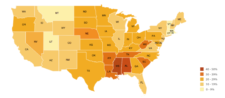
choropleth maps
uses different colors, shades or patterns to display data values
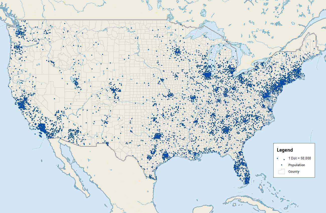
dot distribution maps
a type of thematic map that uses dots to represent the presence or quantity of a particular attribute/phenomena in specific areas, illustrating spatial distribution.
graduated / proportional symbol maps
utilizes symbols such as circles or bars that increase or decrease in size depending on the quantity of data value in a specific location

isoline maps
uses continuous lines across a region to join together points of equal value commonly seen in weather data (isobars=pressure maps) or in elevation (topographic maps)

cartogram maps
changes the physical size and shape of a geographic location based on specific quantitative data rather than showing accurate land area. this helps put visual emphasis on certain spatial patterns or distributions.

scale (cartographic and geographic)
cartographic scale: the ratio of the distance on the map to the real world distance
large-scale: zooms in closely to show a small area but with lots of detail
small-scale: zooms out to show lots of area but with less detail
geographic scale: the level of observation/point of view (local, national, regional, global)
absolute location
the exact, fixed location/position of a place on Earth’s surface. It uses the global grid system that is permanent and will never change.
relative location
the position of a place relative to its surroundings or other human/physical landmarks that can change depending on time/context
latitude
lines part of the global grid system that are horizontal (parallels) and are used to measure degrees north or south of the equator ranging from 0 - 90 N or S
Equator
the 0 degrees latitude line that cuts the world into North and South hemispheres and is the reference point for measuring latitude.
longitude
the vertical lines (meridians) that measure degrees East or West of the prime meridian ranging from 0 - 180 degrees E or W and they converge at the poles
prime meridian
the 0 degrees longitude line that passes through Greenwich, England and divides the Earth into eastern and western hemispheres and serves as the reference point for measuring longitude.
International Date Line
Imaginary line roughly following the 180 degree longitude meridian in the Pacific Ocean that separates two calendar days. If you cross it going east the calendar day goes back by one and going west advances the date by one day
relative location
the position of a place according to its proximity to other locations or landmarks, often described in relation to other places. can change over time because it relays on external conditions and its situation.
connectivity
the degree of direct linkage/connections between two places, nodes or regions relating often to transport or communication networks. Higher connectivity increases a places spatial interaction.
Accessibility
the relative ease of reaching a particular destination from other locations. It is determined by connectivity; more roads/better roads or airports means more accessibility. low accessibility for a place can mean uneven development or geographic isolation
Directions
The orientation of spatial phenomena
absolute direction
a compass direction such as north, south, east, or west that is based on the Earth's geographic coordinate system.
relative direction
a direction that relies on the location of other objects or points, often described using terms like left, right, forward, or backward. or culturally defined/known words such as deep south or out west.
patterns
the geometric/spatial arrangement of objects/phenomena on Earth’s surface that can reveal relationships or trends. they can be clustered dispersed linear or random
elevation
the physical height or distance of something above sea level topically in feet or meters. this can determine many factors such as temperature, oxygen, pressure, weather, terrain all leading to decreased human settlement as elevation is increased. (major influencing factor for population distribution)
distribution
the arrangement or spread of a feature/phenomenon. answers the question “where” and is analyzed by geographers for density (how often it occurs), concentration (how close/far apart things are) and patterns (its geometric layout)
Clustered (agglomerated) distribution
when phenomena or objects are grouped together closely in a concentrated area such as restaurants/shops in a mall or houses in a nucleated village
linear distribution
when phenomena are arranged into a straight line/continuous path such as houses or farms along a river or railroad track
dispersed distribution
when phenomena are spread far apart or scattered through a large geographic area such as farms in rural areas or giant malls in very rural or big cities (metropolis areas)
circular distribution
phenomena are arranged around a central point or node equally spaced from the core forming a circular/rounded layout. this could be neighborhood homes circling a particular market/park or concentric (rings inside rings) land use around a market.
geometric/grid distribution
phenomena are arranged in a regular, uniform, rectangular or shape like structure typically incorporating parallel lines and right angles. like city/urban street blocks or town squares allowing for more efficient travel.
random distribution
when there is no structure or predictable geometric pattern in the position of phenomena. weeds growing across a state/community field or pet owners in a city
Landscape analysis
the systematic study and description of a physical and cultural landscape . this allows for understanding of how humans have shaped, used and interacted with that environment over time. This includes examining land use patterns, vegetation, and human activities to assess changes and impacts on the landscape.
field observations
the act of physically going to a place to record first hand information about human activities, land use, and landscape features.
spatial data
any type of qualitative or quantitative info connected to a specific location on Earth.
remote sensing
the act of collecting geographic data about Earth’s surface using satellites or aircraft (any means of data collecting from a distance without physical contact).
Aerial photography
the act of taking photographs of the Earth s surface form an elevated perspective using things such as satellites, drones, balloons or aircraft. it is a main type of geographic data and provides a good birds eye view of things that ground level analysis misses. it is common in GIS (geographic info systems) and GPS to show changes over time.
Field work
the practice of collecting geographic data by in person visiting local places and observing show people interact with and change their environment. the difference between that and field observation is that observation is the act of directly watching, recording or mapping a locations physical/human characteristics while field work is just doing the work in person and outside of the classroom/lab
Geovisualization
the use of visual tools and techniques to represent geographic data in a way that makes it easier for people to analyze and understand spatial patterns, often involving interactive maps and 3D representations.
Global Positioning System (GPS)
a satellite based system that determines the exact location of something on Earth (including lat/long and altitude). it is widely used for navigation, mapping, and location tracking and provides absolute location compared to relative.
Geographic Information System (GIS)
a computer system that captures, stores, analyzes and displays geographic statical data by organizing it into layers which users can then mash up. GIS allows geographers to stack together different layers of spatial info such as roads, water, elevation or density onto one map making it easy to see connections and patterns.
GIS vs GPS
GPS finds the exact precise coordinate of something on Earth using satellite based systems that calculate the absolute location (longitude/latitude/altitude)
GIS is a computer system that takes this geographic data and stores, manages and visualizes it
Spatial approach
is a method of analysis that uses location, distance, direction, orientation, flow, pattern, and interconnection to understand the arrangement of phenomena studied across Earth’s surface. It also looks at movements of people and things, perceptions of space by humans and changes over time in a place. Some questions they might attempt to answer about spatial distributions are:
• Why are things where they are?
• How did things become distributed as they are?
• What is changing the pattern of distribution?
• What are the implications of the spatial distribution for people?
space
the area between two or more things. it is looked at for its arrangement, usage, and is reflected in peoples beliefs/opinions.
location
identifies where specific phenomena are located either relative (to another location) or absolute (using a grid system)
place
the precise and unique human and physical characteristics of a location. It encompasses the culture, landscape, and experiences that shape how an area is perceived and valued by individuals and communities.
site
site is the immediate trates for a location such as the soil type, climate, labor force, and human structures.
exp: the site of Riyadh, the capital and most populated city in Saudi Arabia, is a desert climate, a large labor force, and a modern Islamic city.
situation
this is the location of a place relative to its surroundings and the connectivity of it to other places. It considers how a place is affected by its relationships with nearby locations, including accessibility and economic ties.
exp: The situation of the city Riyadh is that it is roughly the center of the Arabian peninsula and the situation of this peninsula is that it is between the two continents of Africa and asia.
exp: the situation of a small town that now has a new interstate highway passing through is that it is suddenly more important than the ones not close to the interstate.
sense of place
the strong emotional connection or feeling people have tied to a certain place
exp: coming home from a long trip and being in your neighborhood at last
exp: Rome Italy might be described differently by a local resident than by an outsider or by a Catholic
than by a Hindu.
-if a place has no emotional ties in people / lacks uniqueness it has placelessness
toponyms
what a place is called or referred to (a name basically). Toponyms can reflect cultural history, physical features, or historical events associated with that location.
exp: the coast of Florida is dotted with communities with “beach” in the name—Fernandina Beach, Miami Beach, Pensacola Beach—all of which are on beaches
exp: . Iowa is named for a Native American tribe
confusing exp: greenland is icier than iceland
time space compression
the decreasing of the relative distance or time it takes to get somewhere because of improved transportation and communication. This concept illustrates how advancements in technology reduce the barriers of distance, making it easier for people and goods to move between locations.
exp: New York City and London are separated by an ocean, but the development of air travel greatly reduced travel time between them (feels much closer now than in 19th century even tho 3,500 miles is still the same)
spatial interaction
The movement, flow and contact of things between locations (can be physical such as roads or non physical such as information like radios or internet). places with more connection = more spatial interaction
flow
the patterns / movement of ideas. people, products and other phenomena between locations and space
friction of distance / distance decay
The concept that distance creates a barrier to movement or interaction is the friction of distance and the concept that when things are farther away they interact less is distance decay.
exp: radio signal getting weaker as it travels across space away from the radio tower (the weakening is the friction of distance)
patterns
the general arrangement of things being studied that geographers try to accurately describe. They reveal relationships, distributions, and trends in spatial data.
distribution
distribution is the way phenomena are arranged or spread out over an area that describe patterns. Geographers can look for patterns in distribution that can help decide the cause/effect of the distribution.
distribution patterns: clustered, dispersed, linear, circular, geometric, random or clustered
spatial association
two or more phenomena that may be related or associated with each other because of their matching patterns of distribution across an area.
exp: malaria cases distribution and the mosquito that carries it distribution
exp: bike stores and athletic clothes stores in a city (these may show the active people in the area but are not directly correlated)