Latitude & Longitude ES22-23
0.0(0)
Studied by 52 peopleCard Sorting
1/48
Earn XP
Description and Tags
Last updated 2:48 AM on 10/20/22
Name | Mastery | Learn | Test | Matching | Spaced | Call with Kai |
|---|
No analytics yet
Send a link to your students to track their progress
49 Terms
1
New cards
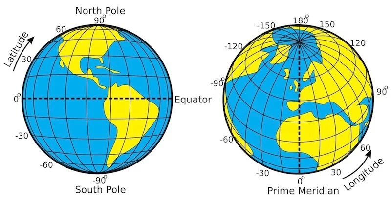
Coordinate/ Latitude & Longitude System
2 numbers are assigned to a specific point on a surface
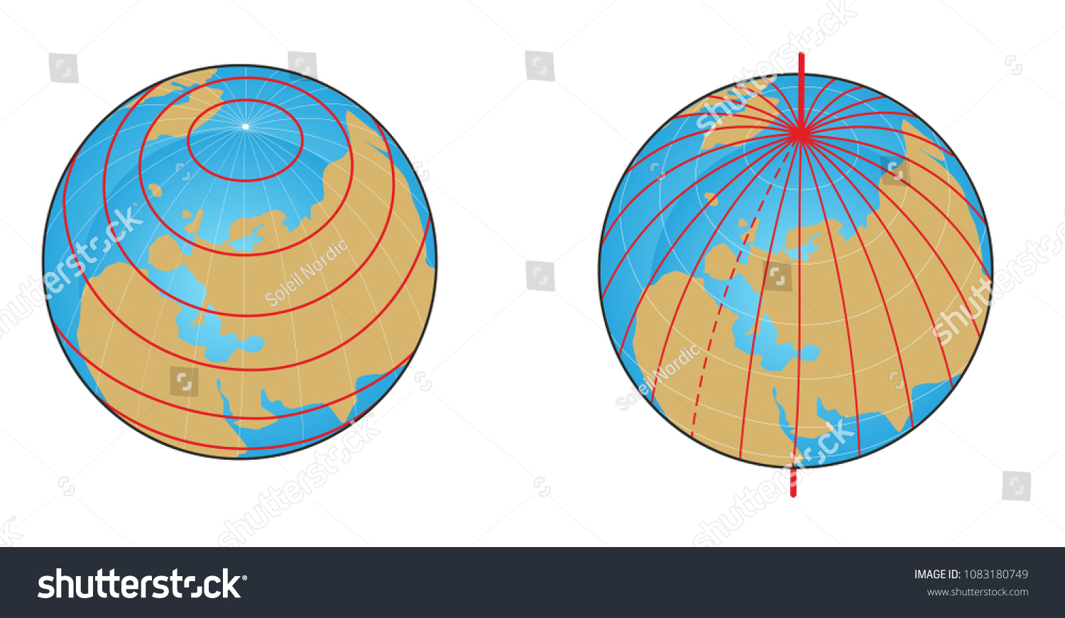
Grid of circular lines that cover Earth
*Often shown as a grid*
Grid of circular lines that cover Earth
*Often shown as a grid*
2
New cards
Coordinate/ Latitude & Longitude System image
image
3
New cards
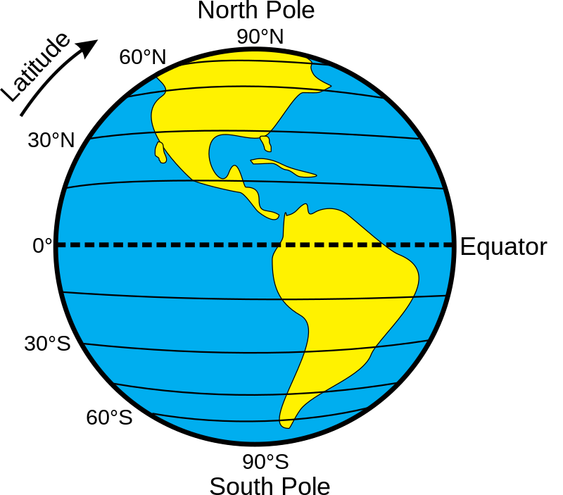
Latitude
a measurement of angular distance north or south of the equator
4
New cards
Lines of Latitude are ___
horizontal (think FATitude)
5
New cards
latitude lines run ___-___ and circle around the earth parallel to the ____
east, west, equator

6
New cards
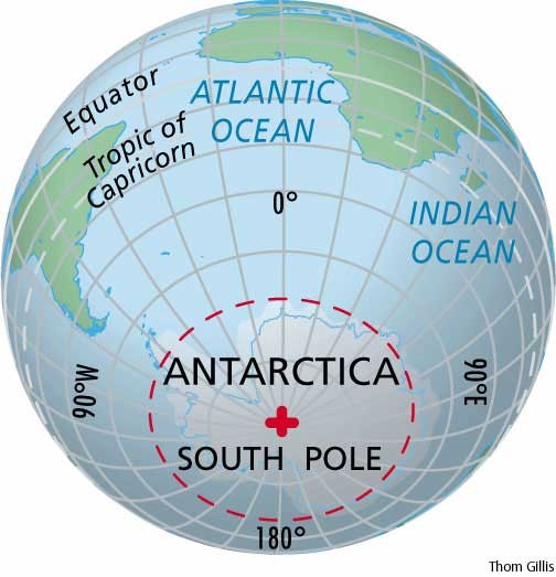
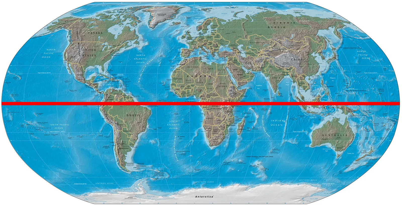
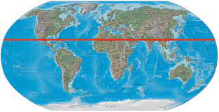
Equator
reference lines for latitude, located at 0°

7
New cards
north pole is located at...
90°N
8
New cards
south pole is located at...
90°S
9
New cards
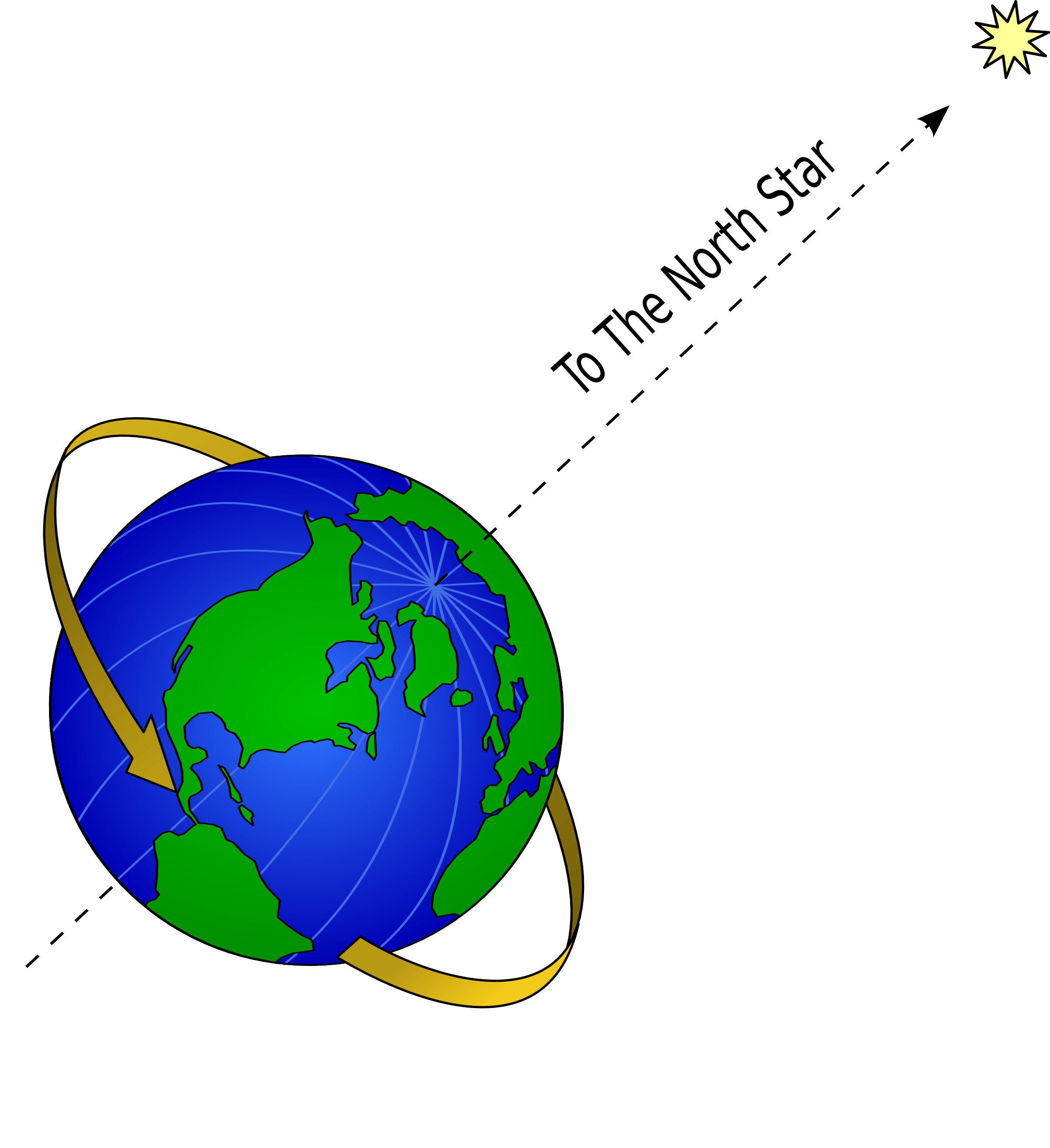
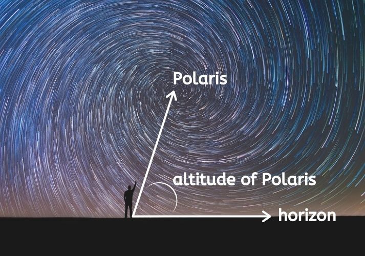
altitude of Polaris is the same as..
latitude in the Northern Hemisphere

10
New cards
can the Southern Hemisphere see the North Star?
naur
11
New cards
north star=
polaris
12
New cards
significant lines of Latitude
Equator
13
New cards
Latitude degrees go up to...
90°
14
New cards
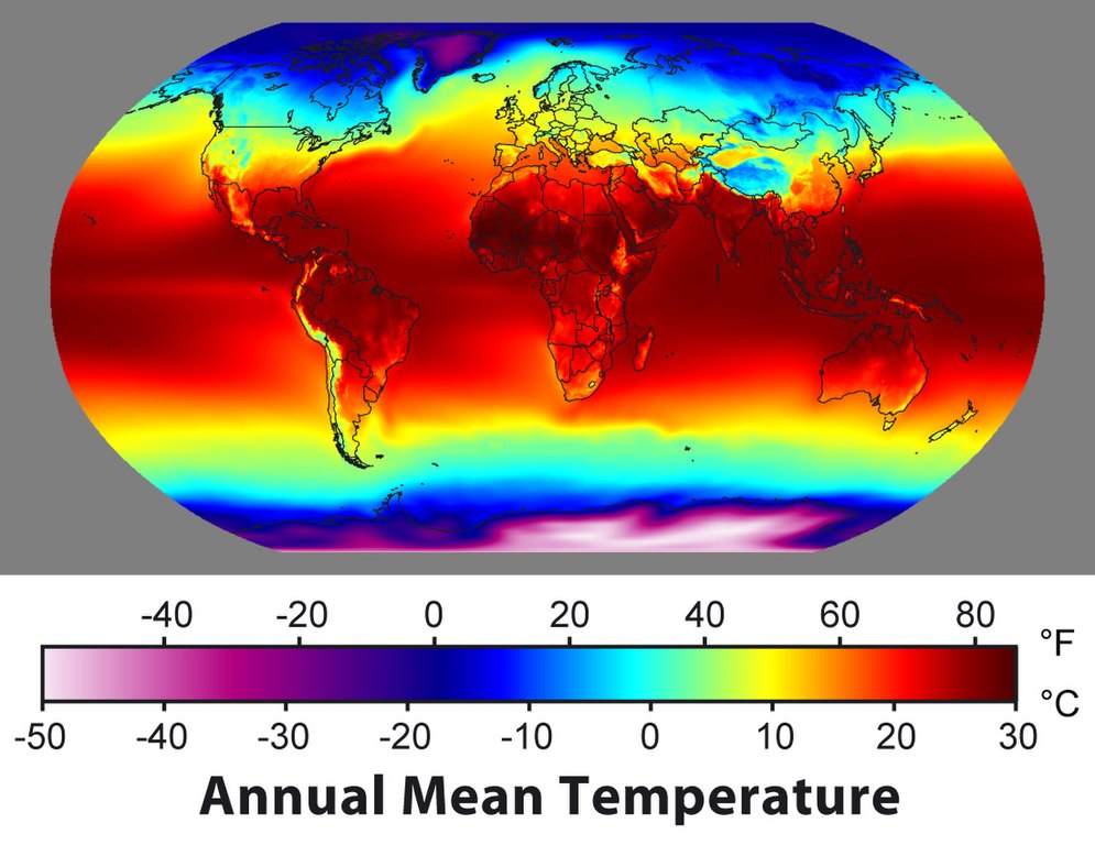
significance of Latitude
tells altitude of Polaris (Northern Hemisphere) & generally how cold/hot (proximity to equator)
15
New cards
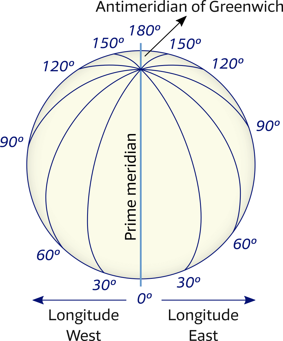
Longitude
a measurement of angular distance east or west of the Prime Meridian
connect at the poles
connect at the poles
16
New cards
Meridians of longitude are __ and connect the ___ and ___ poles
vertical, north, south (think LONG)

17
New cards
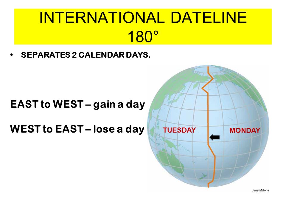
international dateline
line at 180°, you lose or gain a day when you pass it
18
New cards
going west =
subtracting
19
New cards
going east =
adding (think of EAsTing adds weight)

20
New cards
tropic of cancer
23° N
21
New cards
tropic of Capricorn
23°S
22
New cards
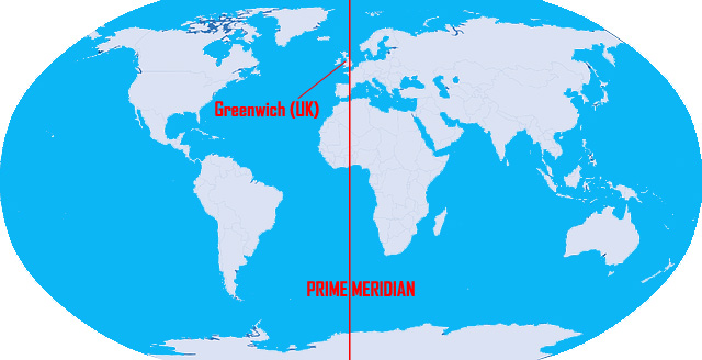
Prime Meridian
reference line for Longitude, is 0° (Greenwich, England)
23
New cards
longitude goes up to... degrees
180
24
New cards
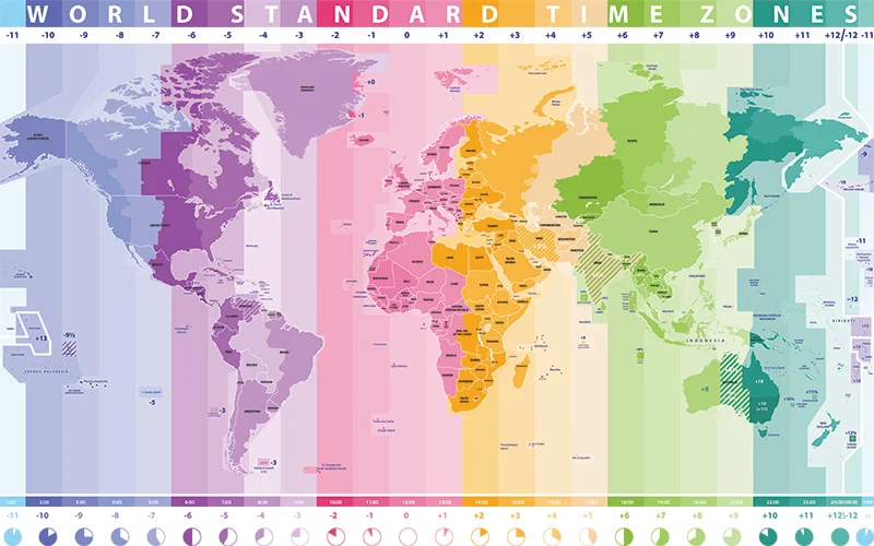
time zones
regions of the globe throughout the Earth which the same standard time is used

25
New cards
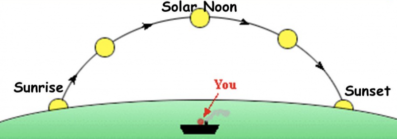
local noon/solar noon/ midday
12 pm (when the sun is highest in the sky)
26
New cards
how many time zones are there?
24 (360°/15=24)
27
New cards
the earth rotates ___° per hour
15
28
New cards
sunset
6 pm

29
New cards
sunrise
6 am

30
New cards
significant lines of longitude
Prime Meridian & International Dateline
31
New cards
significance of Longitude
tells the time
32
New cards
knowing the local time and the time at the Prime Meridian tells the..
longitude
33
New cards
longitude & latitude can be divided into __ and __
minutes and seconds
34
New cards
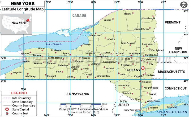
New York's latitude will always be in the __ range and always __
40s, North

35
New cards
New York's longitude will always be in the __ range and always __
70s, West
36
New cards
why are time zone lines not straight?
because of populated areas
37
New cards
Order that a point on the coordinate system is written
Latitude°Minutes'Seconds", Longitude°Minutes'Seconds"
38
New cards
solar time
time measured by Earth's rotation relative to the Sun
39
New cards
knowing your longitude and the time at the Prime Meridian tells the..
local time
40
New cards
right=
east
41
New cards
left=
west
42
New cards
Never Eat Soggy Waffles
clockwise order of a compass rose
43
New cards
Polaris is overhead at the..
North Pole
44
New cards
Polaris is horizontal at the...
Equator
45
New cards
earth's revolution takes...
365 days
46
New cards
earth's rotation takes...
24 hours
47
New cards
image of how to find polaris' altitude
...
48
New cards
image of how to find polaris' altitude
...
49
New cards
in order to look for polaris, you need to look...
north