Global History of Urban Design
 Call Kai
 Learn
Learn Practice Test
 Spaced Repetition
 Match
Match Flashcards
 Knowt Play
1/47

Earn XP
Description and Tags
HS25/FS26
Name | Mastery | Learn | Test | Matching | Spaced | Call with Kai | Chat |
|---|
No analytics yet
Send a link to your students to track their progress
48 Terms
Definition of the city
City is a self organized landscape/organism (Avermaete)
A man-made material and spatial project → actions and design made by men
City is the result of a combination of willful acts
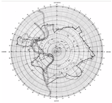
Forma Ubis Romae
massive marble map of the city of Rome created between 203-211 AC
Consists of 180 stone tables, together describing the logics of the city of Rome
Vitruvius and the ten books of architecture
City as a combination of building + construction and ideas + concepts
also called Fabrica (praxis) and ratiocinatio (theory)
Alberti’s idea of the city
every part of the city makes a whole
construction of a house like a mini city
building the city as a repetition of existing and production of new
Urban Design as Engagement
Is about engaging with a certain condition in a particular situation and not about creating an ideal
11 characteristics that need to be considered
11 characteristics of urban design
the ground → topography influences form and streets of a city (Constantinople), soil influences construction of buildings
Materials → locally sourced materials provide a city image (baked bricks in Colombia)
Climate → influences layout of cities (orientation etc, Montreal)
Culture → urban design expresses particular cultures
Philosophy → urban design relates to bigger ideas
Religion → religious principles are traceable in urban fabric
Politics → political systems underline their importance in urban design (Berlin, Stalin Allee)
Social → urban design kann nutzen schaffen, but can also separate social groups
Economic → economic concerns are often a key driver of urban design because urban design can change economy
Technical → often linked to technical inventions
Art → often used as critic
6 regions where urban revolution took place 9000 BC
mesoamerica
ades
egypt
mesopotamia
indus
china
Gordon Childe
Says that the urban revolution took place as from 9000 BC in 6 regions simultaneously and independently
neolithic revolution
→ new tools lead to new concept of time (linked to harvest, ernte), and agriculture
Resource surplus (Überschuss) → more harvest than needed, storing
Social surplus → people living in groups in small settlements can create safety for each other
Cultural surplus → exchange of cultural knowledge & skills lead to new artefacts and new crafts
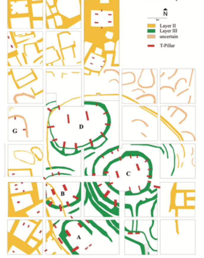
Göbekli Tepe, Turkey
9000 BC
first urban settlement
built on top of a hill
houses surrounding oval temples for religious rituals
only made out of stone
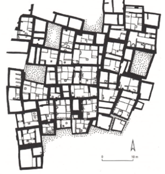
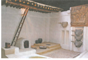
Catal Hüyük, Turkey
7400 BC
at the time most complex & largest settlement in southwest asia
one story housing made out of mud bricks and wood
kitchen, sleeping room + ritual space
one house touched another → safety and stability
no streets, public roofs for accessing the houses
Bronze Age Cities of Mesopotamia
5000 BC set of Sumerian cities with cultural and political centrality emerged between the rivers
Sumerian cities had religion as main motive
the were independent self governing cities with basic political unit
each city belonged to a god/goddess with a central located temple
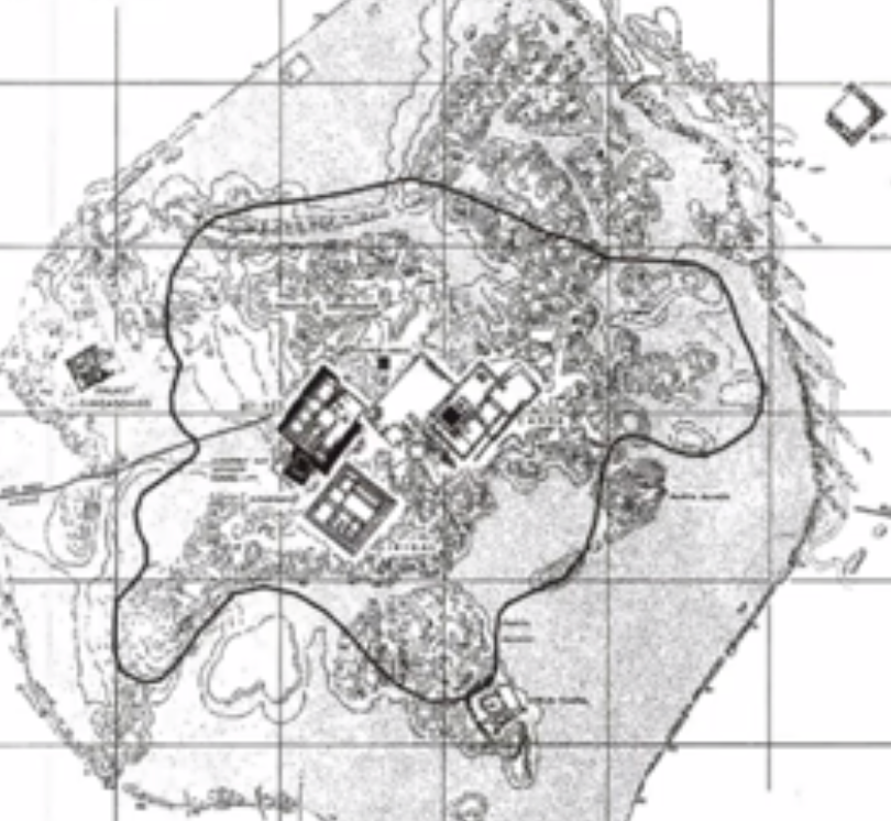
Uruk
2300 BC
had a religious/administrative/economic center
line drawings on clay tables used for geographic maps
layers after layers of mud made the Ziggurat, where the most important buildings were situated
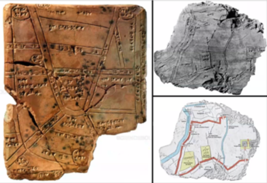
Nippur
inscription of the city in a clay cuneiform tablet with a map showing streets/canals and fields
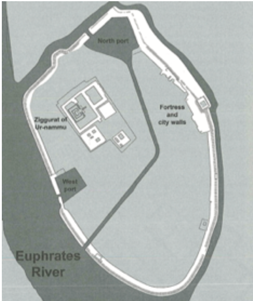
Ur
2100 BC
oval city wall with main functions integrated inside it
religious center on ziggurat
2 leveled courtyard house made out of mudbricks
new brick constructions like true arch, barrel vault etc
Cities of the Indus Valley civilization
hydraulic civilization
water as a resource very important, religion was less central compared to Sumerian cities
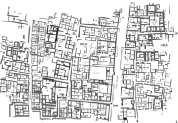
Mohenjo-Daro
2600BC
almost gridded street pattern
buildings made of fire bricks
hierarchy of streets → Main Street with stores, secondary with houses
fresh water system in houses with storage
Great Bath as center of public moments, activities etc
hydraulic civilization
difference between Greece and Rome urban design
→ Both cases mission about bringing specific way of life to distant places, conforming people to the norms/forms of the empire
Greece: polis or city-state expressed specific way of life related to the question of politics
Rome: City as the main unit of administration as well as contact between ruler and ruled
Agora
central figure of greek polis
center for religious, political and cultural function
cluster of buildings and open spaces (bsp. temple for religion and bouleuterion+Metroon as center of politics and archive, Odeon as theater) and the “stoa” as a connecting element
Hippodamus of Miletus
500/400 BC
founder of “the new cities” → pioneer of urban planning
ideal city for 10’000 men, bzw 50’000 people (including slaves, women, children)
divided citizens into 3 classes
Soldaten
Handwerker
Landwirte
also land divided into
heilig
public
private
city has a grid (one grid with small sign where agora is places, second grid with bigger adaption to the ground)
Alexander the Great
Did spread ideology of greek city into the east to Asia and Egypt
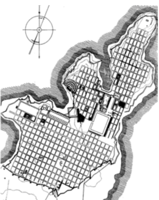
City of Miletus
490 BC rebuild with grid system
Hippodamus of Miletus planned it
two grids, smaller one for tight areas, larger one for more open areas
Agora is located where the two grids meets and connects two harbors
Planning Tool of Greek Empire
Agora + Urban Grid main tools
regulated and rational urbanism → city blocks divided into 10 Einheiten with courtyard houses 17×17m, placed facing south to get sun
bigger Einheiten for people at the top of social hierarchy
urban grid variated from city to city
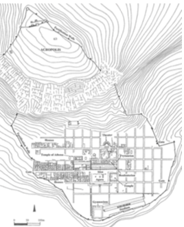
Priene
330 BC
Raster strenger an Topografie angepasst
not central located Agora
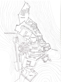
Pergamon
hellenistic city
280 BC
had a city wall for defense
2 centralities
agora on lower side
acropolis on the upper side
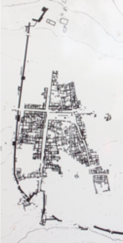
Megara Hyblaea
480 BC
western city with Greek ideology (nowadays Italy)
grid was folded according to topography
grid therefore gets different directions
agora is placed where the different directions come together
Forum
represented centrality where things were discussed (like Agora)
is a civic place (bürgerlich)
included buildings like temples, basilicas and political meeting places (Comitium + Curia)
Roman living types
Domus + Atrium for rich people (around 30%), grosszügig, privat, innenhof
Insulae for poor people (around 70%), mehrgeschossige Mietshäuser, eng, laut
Roman city planning
2 main axes through a city
Cardo Maximus → North-South
Decumanus Maximus → East-West
Forum at the crossing point of the two axes
Grid did not consider the topography, only secondary streets could adapt a little
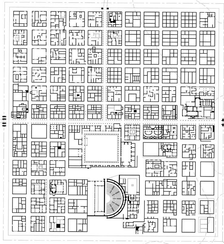
Timgad
100 BC
typical roman colonial city
regular grid with regular blocks
flat area so no necessity for variation
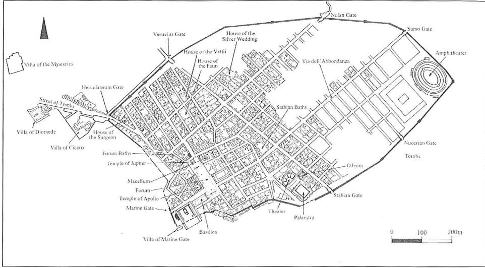
Pompeii
80 BC
already existing settlement
transformed with adding forum + basilica as well as some administrative offices
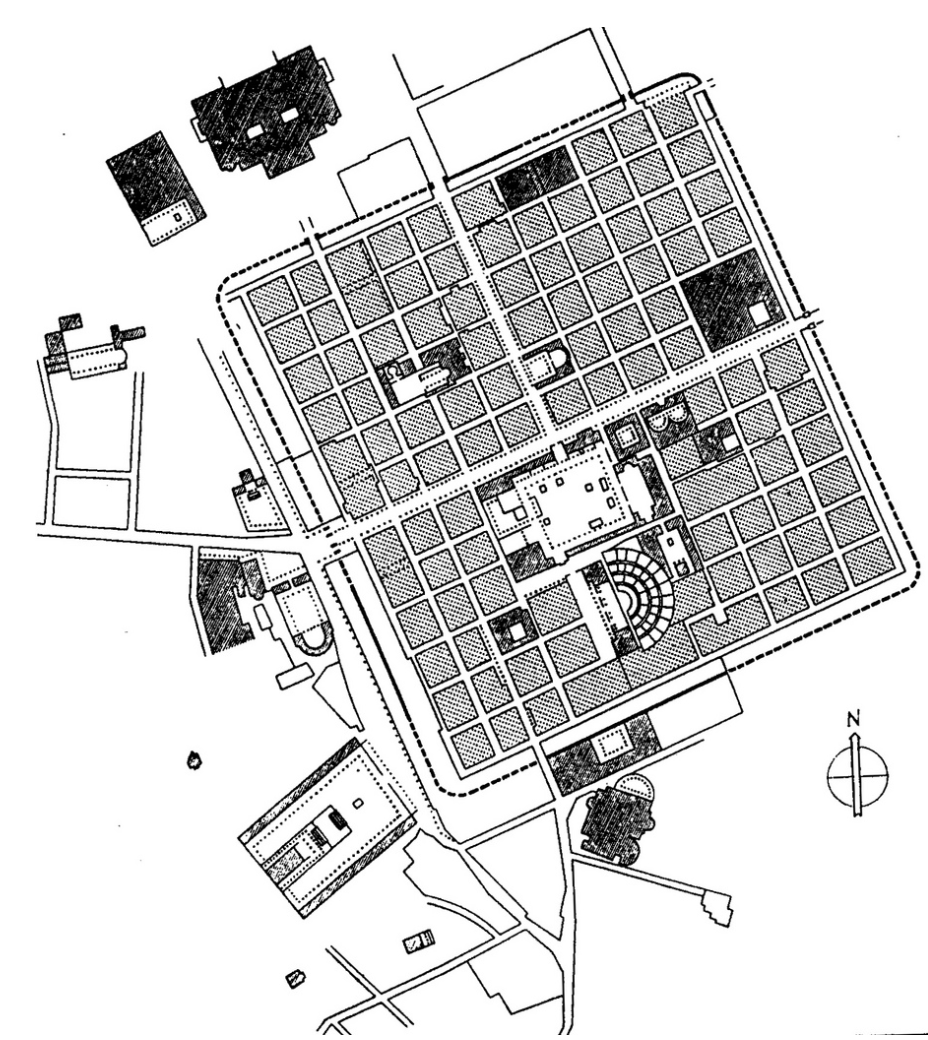
Augusta Raurica
40 BC
colonial city with military principles
perfectly used grid with cardo + decumanum max and forum at crossing point
Trading in Middle Ages
the Hanseatic League and Asiatic League conquered a lot of land in Europe
connected cities through network of shipping and trade
these cities required new infrastructures that were adequate for trade and shipping by sea as well by land, but also storage and exchange infrastructure (warehouses, notaries)
similar/same building materials + ways of building can be recognized in these cities
middle age urban design
Religious, especially Christianity became more important
Cathedral replaced roman/greek temples
Defense, trade and feudal structures shaping the city
monasteries (kloster)
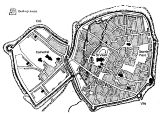
Arras, France
Binary City with old roman part (left) and monastery (complex of buildings, right)
Both religious entities become the double core of the city
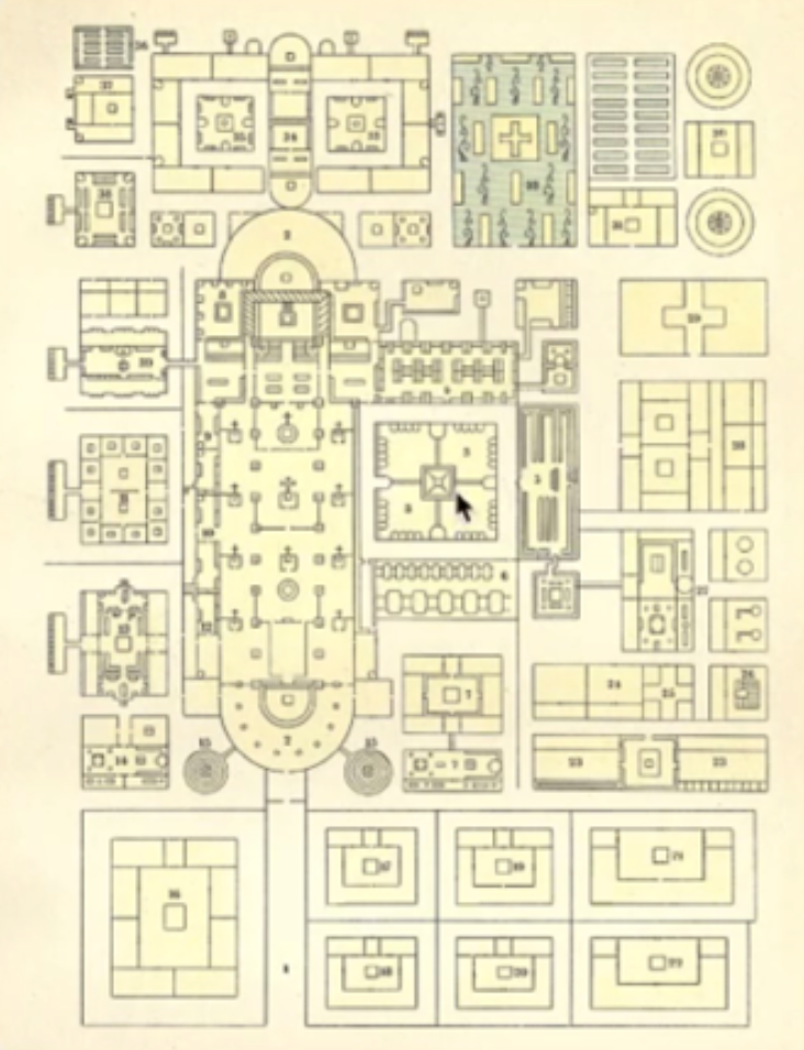
Monastery Plan of St. Gallen
functions as a little city
church in the middle
included hospital, courtyard, guest rooms, school etc.
Burhs
Cities that emerged from the idea of defense with a wall, inside was housing + agriculture for longer staying
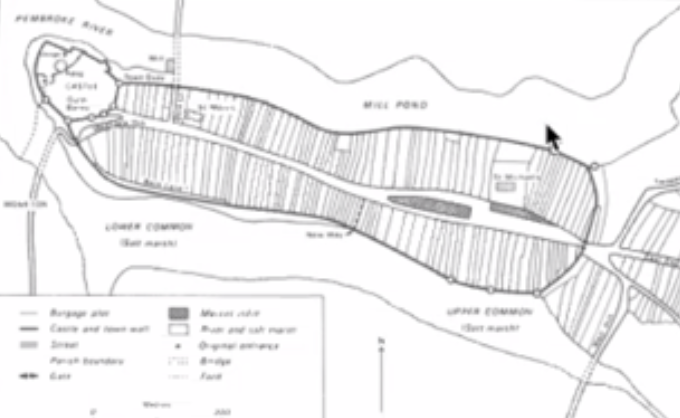
Pembroke, England
1250
typical burh with wall + towers and a main street
herringbone pattern → houses to the street, long strip of private land for farming to the wall
castle to retreat in case the enemies reached the town
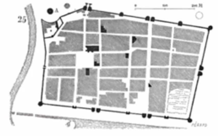
Aigues-Mortes, France
1250
A bastide → town of defense (mainly built in France)
often grid pattern with central plaza (Carra) surrounded by urban blocks (moulons)
15 towers around the city
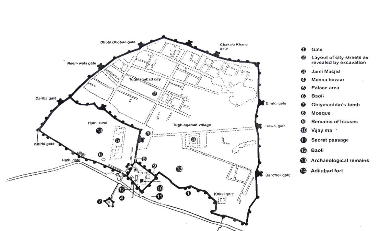
Tughlakabad fort, Delhi
1330
relatively ordered bastioned defense city
massive walls
water engineering was important
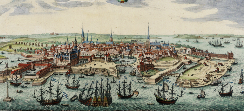
Copenhagen
1200
typical Hanseatic city with warehouse, shipyard+diverse harbor, fortified castle and marketplace
brick city
stone + wood foundations
traded backed clay bricks
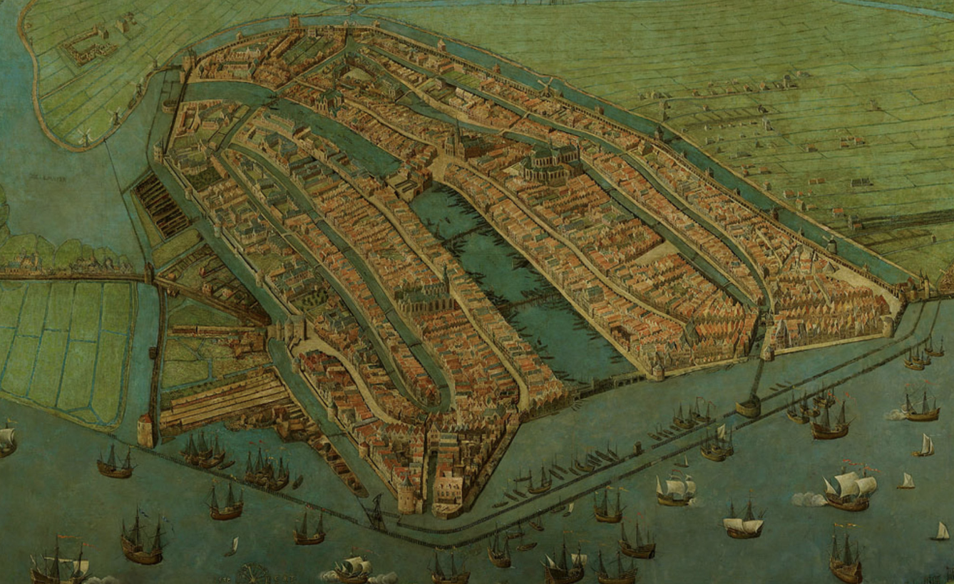
Amsterdam
a lot of trade
Religious orders created large civic complexes such as hospitals + orphanages (Waisenhäuser)
first universities emerged
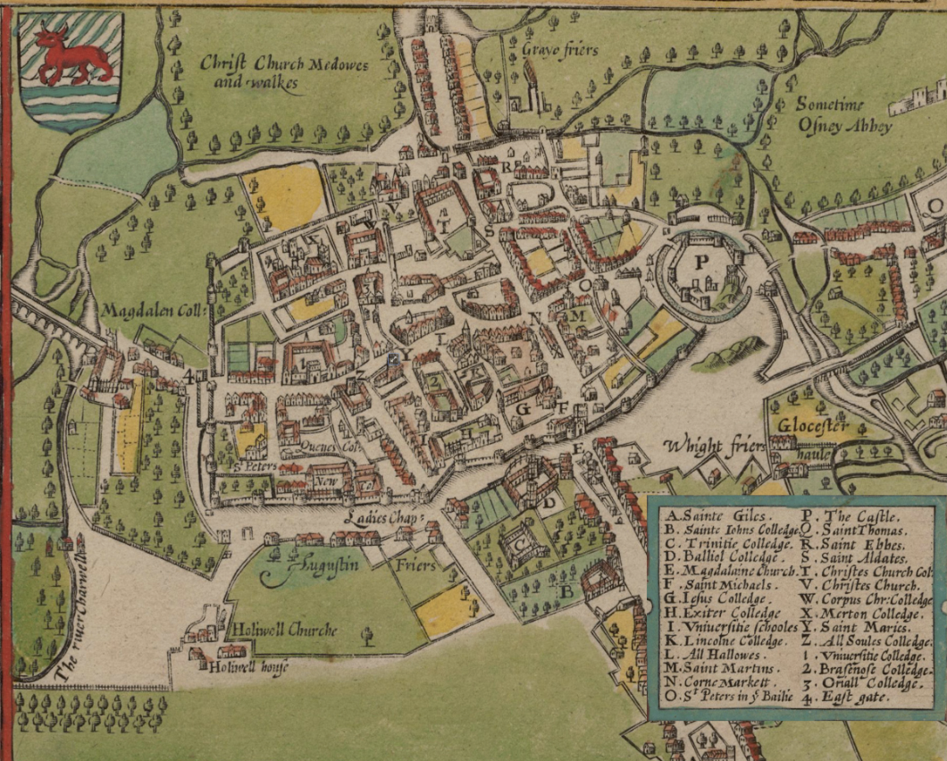
Oxford
university city
urban complex including buildings for teaching, meeting, living and collective/green spaces
urban fabric in Middle Ages
houses were built in wood + stone for foundation
→ after many fires more parts of the houses were made out of brick
City-State
Cities that became fully self-governing and independent from the feudal system
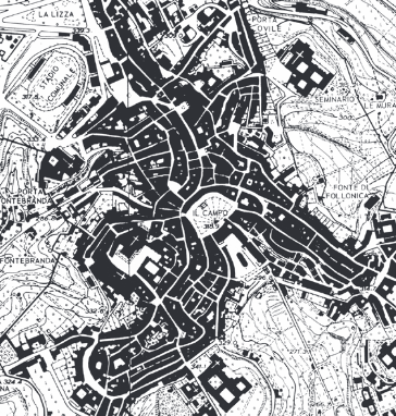
Siena
ca. 1300
tuscan-medieval city-state
originates from the merging of settlements with own church, wall, towers due to defense
Palazzo Publico showed new public governance (main square used for public events)

Florence
ca. 1300
tuscan-medieval city-state
built upon roman existing planning
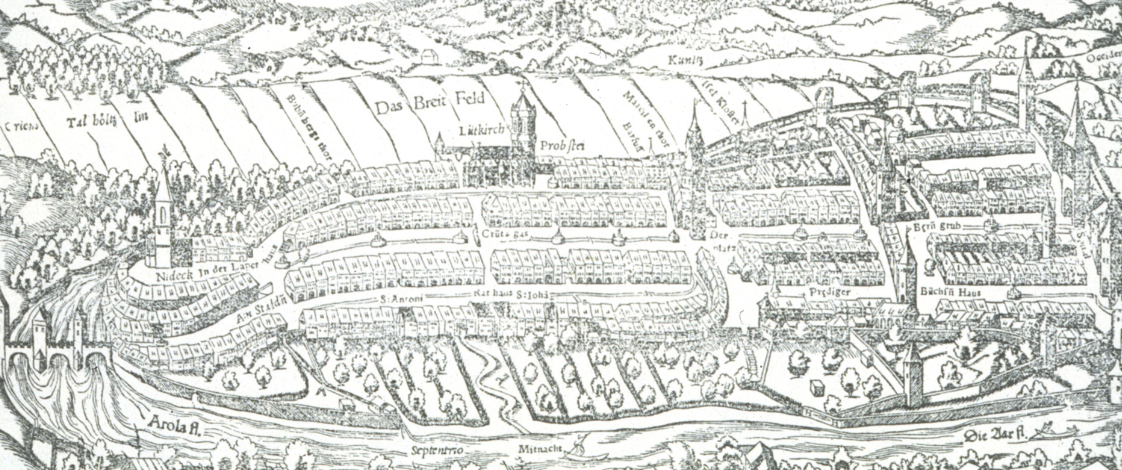
Bern
Part of Zähringer Cities (north CH to south GER)
walled city with castle outside the walls
oval shaped urban plan with Main Street called Marktgasse
Herringbone pattern