APHG-U1.1-3
1/22
There's no tags or description
Looks like no tags are added yet.
Name | Mastery | Learn | Test | Matching | Spaced | Call with Kai | Chat |
|---|
No analytics yet
Send a link to your students to track their progress
23 Terms
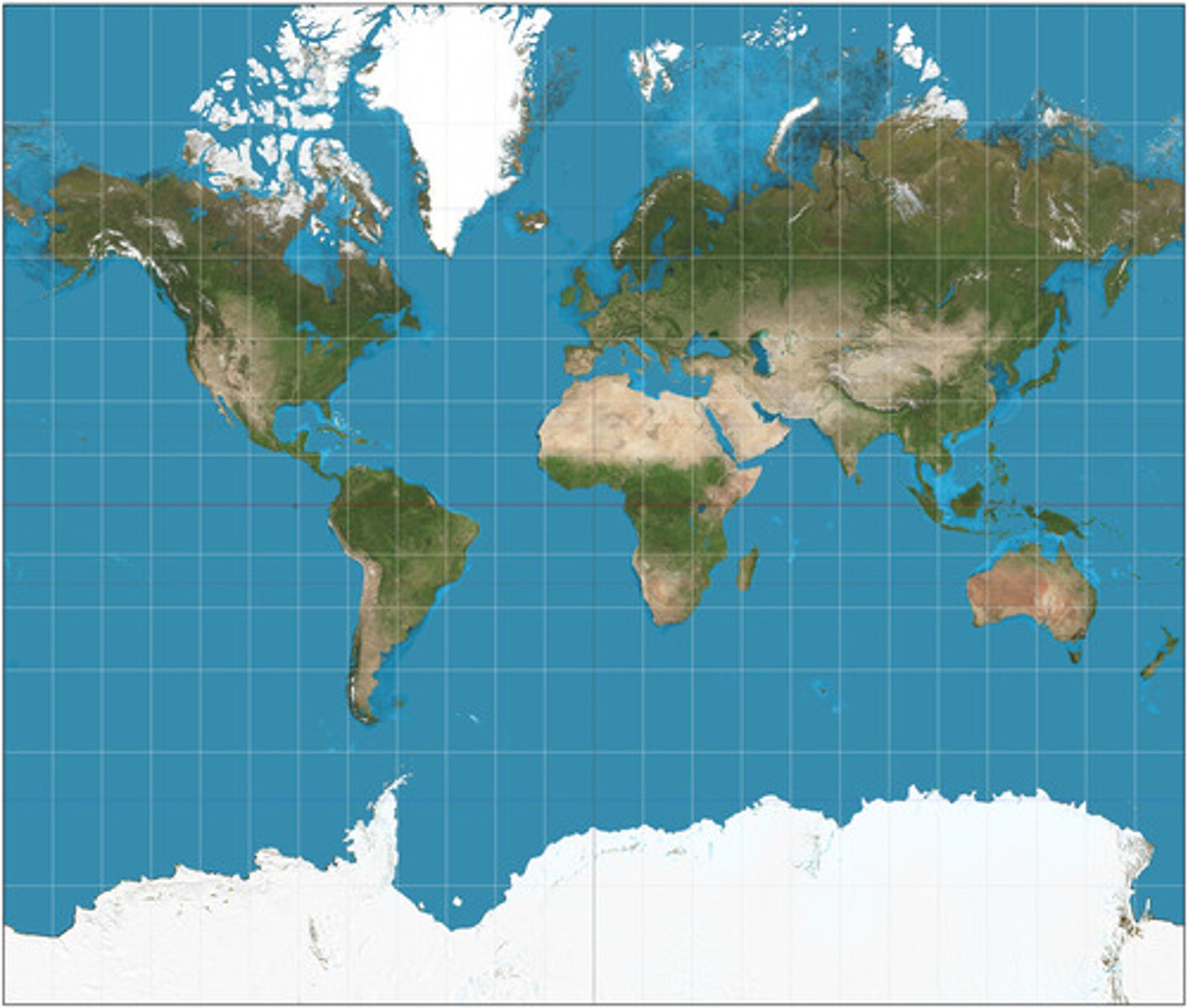
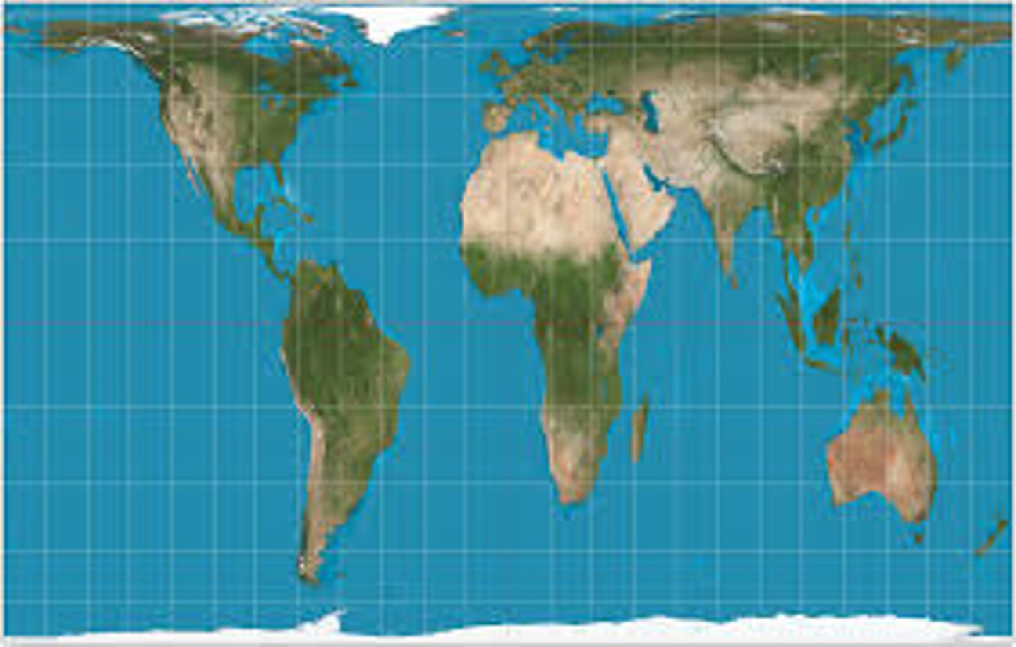
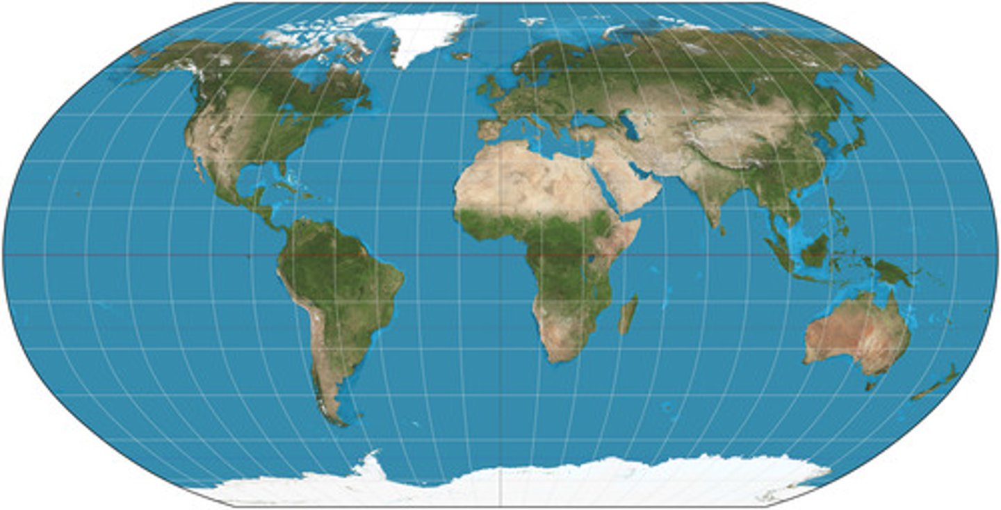
Map Projection
the system used to transfer locations from earth's surface to a flat map
Distortion
problems created when "flattening" the earth (distance, direction, area, and shape)
Geographic Information Systems (GIS)
a computer system which could collect, store, retrieve and depict spatial date from the real world
Remote Sensing
the scanning of the earth's surface by satellite or a high flying airplane to obtain information about it
Quantitative Data
information represented with numbers
Qualitative Data
descriptive data represented with words
Landscape Analysis
Using techniques like field observations & photographic interpretations to help understand people, places and regions
Concentration
It refers to whether a feature is spread out evenly over space or clustered together
Pattern
Geometric arrangement of a feature in space
Density
The total number of objects in an area
Ex: 1,000 people per square mile
Spatial Thinking
looking for and explaining patterns of phenomena in an area
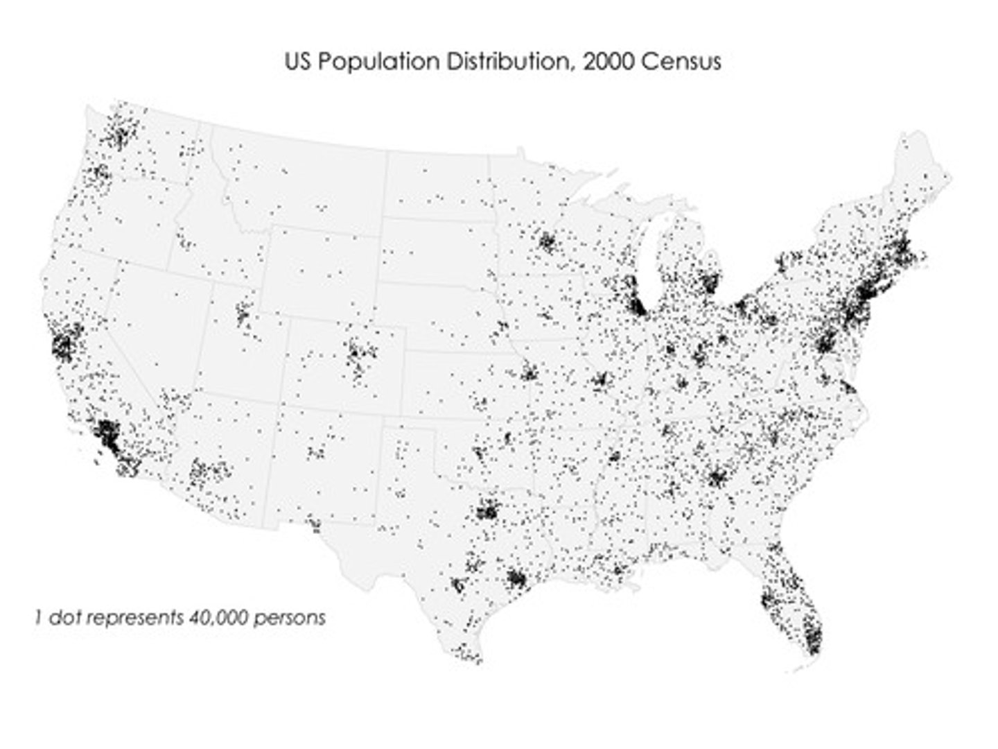
Dot Map
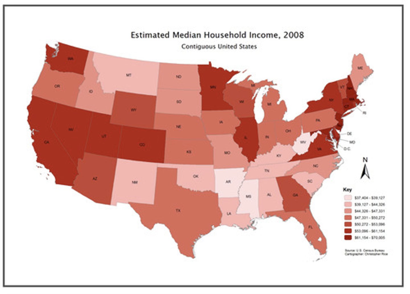
Choropleth Map
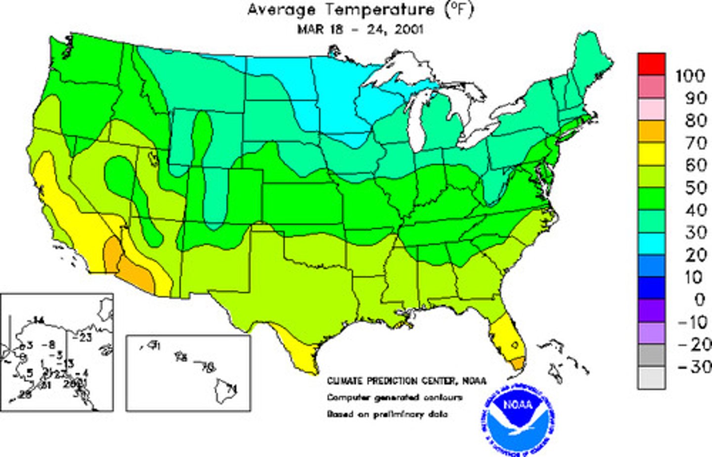
Isoline Map
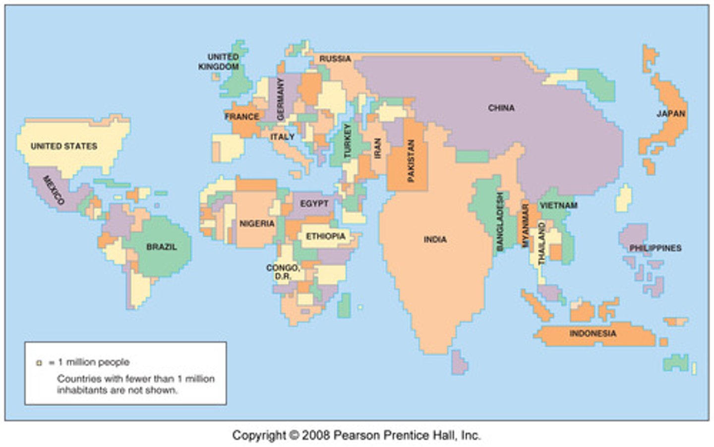
Cartogram Map
Global Positioning System (GPS)
an example of a "satellite navigation system" which helps us determine absolute location of something
Reference Map
a map that gives you locations or the shortest route between two places.
Thematic Map
a map that illustrates a topic or feature of an area (e.g., climate)
Visualization
converting geographic data or ideas into graphics in order to better understand or communicate them
Mercator Projection
Gall-Peters Projection
Robinson Projection
Census Data
data acquired by the government about local areas throughout the US