Somerset levels floods 2013/2014 - hazards at a local scale
1/9
There's no tags or description
Looks like no tags are added yet.
Name | Mastery | Learn | Test | Matching | Spaced |
|---|
No study sessions yet.
10 Terms
When and where did the floods occur?
when
late 2013 and early 2014 Somerset levels and moors experienced widespread flooding
particularly in catchments of the rivers Parret and Tone
estimated 100million cubic meters of floodwater covering 65 square Km
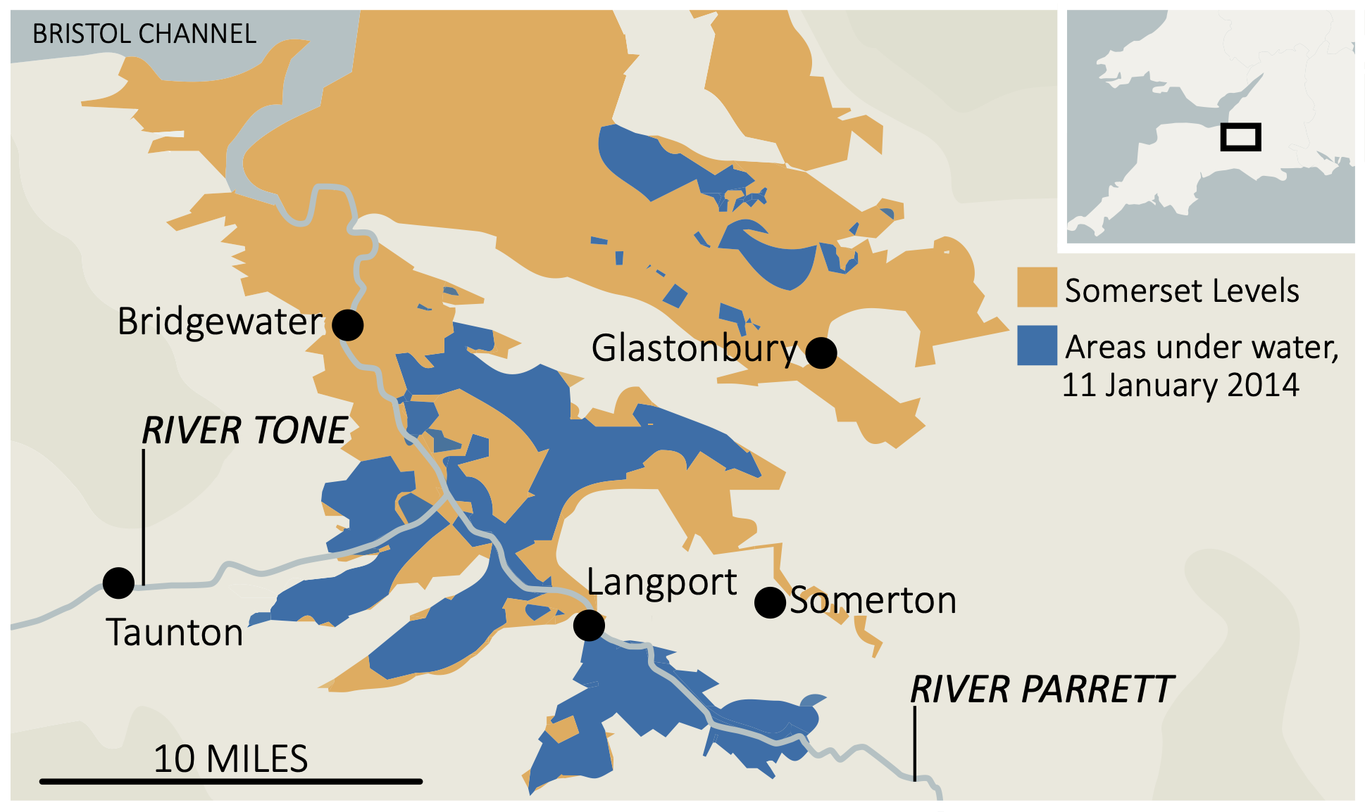
where are the Somerset levels located?
SW England with some of it’s main drainage outlets being the river Brue Parrett and tone running to the Bristol channel
extends 170,000acres
What were the human causes of the floods?
management = despite management strategies a lack of maintenance meant the rivers had not been dredged in 20+years meaning levels had risen due to sediment build-up
land use = agricultural practices and land use change mean original hydrology of the area is altered making it more susceptible to flooding
development = urbanisation and infrastructure in the region increases runoff
What were the physical causes of the floods?
heavy rainfall = January 2014 was the wettest on record with around 350mm of rainfall in jan and feb causing river banks to burst/overflow
topography = levels are in low lying areas sitting on average 3-4m above sea level. the flat topography of the land makes the drainage after a flood or in storm events hard.
geography = situated close to the Bristol channel which one of the highest tidal ranges in the world. tidal surges at the time were prominent due to the amount of rain
What were the social impacts of the floods?
over 600 houses flooded meaning people were places in temporary accommodation for several months after the event
disruption to day to day activities as people unable to get to work, services shops etc
in areas power was cut off
16 farms had to be evacuated
villages such as moorland were cut of as roads had flooded
What were the economic impacts of the floods
Somerset country council estimated £10 million in damages
railway lines were cut off around Somerset causing losses in the transport industry
1000 livestock were evacuated and 14000 acres of farmland were under water for 3-4 weeks
What were the environmental impacts of the floods?
floodwater was contaminated with sewage
there was widespread destruction of habitats
stagnant water had to be reoxidised before being pumped back into rivers to avoid disruption to water wildlife
debris of floods left
What were the political impacts of the floods?
criticisms from local communities for lack of maintenance and flood management
What were the immediate responses to the floods?
residents were evacuated and given temp accom elsewhere
local community volunteers helped support by helping people get to school, setting up support facilities etc
temporary flood defences eg sandbags
weather warnings were issued as sever
What were the long term responses to the floods?
20 year plan introduced to reduce risk of future flooding, the aims were
to dredge 8km of tone and Parrett
develop better drainage and pumping mechanisms which had been previously developed in 2015 by Somerset rivers authority