AP Human Geo- mid unit 1 quiz
 Call Kai
 Learn
Learn Practice Test
 Spaced Repetition
 Match
Match Flashcards
 Knowt Play
1/62

There's no tags or description
Looks like no tags are added yet.
Name | Mastery | Learn | Test | Matching | Spaced | Call with Kai | Chat |
|---|
No analytics yet
Send a link to your students to track their progress
63 Terms
Human Geography
Part of the discipline of geography concerned with spatial differences and patterns of human activity and its inter relationships with the physical environment
Map’s purpose
A tool for storing reference material
A tool for communicating
Scale
A comparison of distances on a map to distances on Earth
Geographic scale
Scale bar
Verbal Scale
Written statement
Fractional scale
Representative fraction
Small Scale
Less Data
Large Scale
More Data
Projection
Method to represent earth’s curved surface on a flat map
All distort one of the 4 map properties
Shape
Area size
Distance
Direction
Robinson (oval/elliptical)
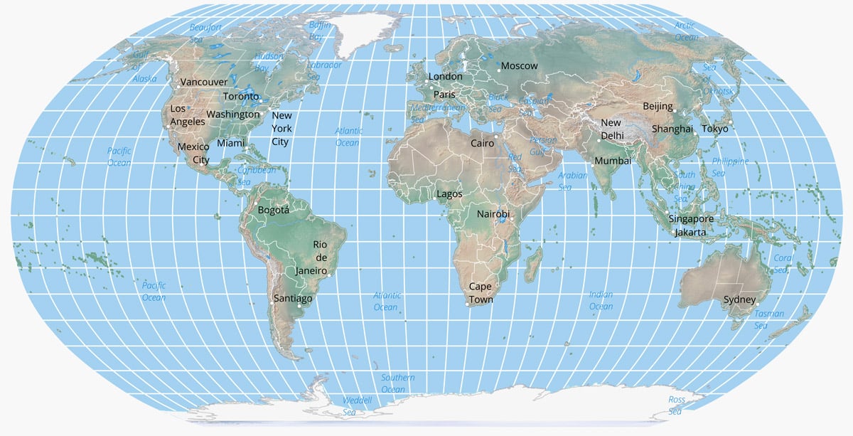
What does the Robinson map preserve?
Curvature of globe
What does the Robinson map distort?
High latitudes, no right angles
What does the Robinson map used for?
Best job of representing spatial relationship
Goodes- interrupted
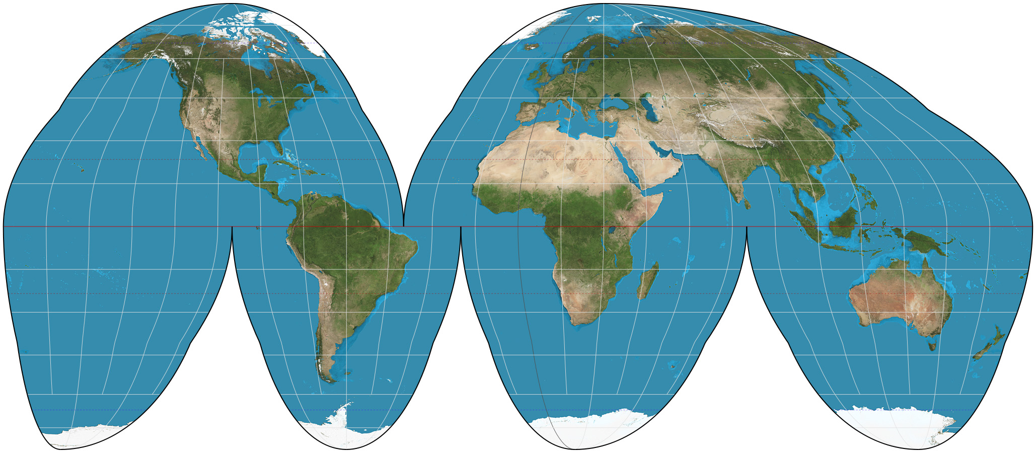
What does the goodes-interupted map preserve?
Size of areas
What does the goodes-interupted map distort?
Proximity relationships (D, D, S)
What does the goodes-interupted map used for?
Increases lobes and decreases distortion
Mercator

What does the Mercator map preserve?
latitude and longitude
What does the Mercator map distort?
Farther distances from the equator have really high latitudes
What is the Mercator map used for?
Ships captains
Azimuthal- Polar projection map

what does the Azimuthal- Polar projection map preserve
Correct distance
what does the Azimuthal- Polar projection map distort
Only see one hemisphere
what does the Azimuthal- Polar projection map used for?
Airline pilot
Types of Maps
Mental, Reference, and Thematic
What is a mental map?
Images about an area developed by an individual on the basis of information or impressions.
What is a reference map?
A map type designed to show general geographic information, boundaries, and the locations of places rather than a single specific data pattern.
What is a thematic map?
Map that is portraying some point of data about an area
Isoline map
Continuos lines joining points of the same value
Choropleth map
Shows level of data with color and shading
Proportional map
Use symbol to show intensity of frequency
Dot map
Represents quantities or occurrences by a dot legend
Cartogram
Uses statistical data to change shape or territory
GIS
Geographic information system
GPS
global positioning system
Remote Sensing
ariel imaging, changes curvature of ground from sky/space
EX: Hurricane movement
Models
To explain patterns and predict future behaviors
Ex: Where/why things are located in a city. Why population growth lessons?
Spatial Analysis
Relating to space on or near Earth’s surface, study the arrangement of places and areas
Location (absolute)
Identification by coordinates- Mathematical location
Ex: latitude/longitude and street address
Location (relative)
Position in relation to that of other places/activities
(This is how we usually find directions)
Distance (Absolute)
The shortest distance from point A to point B
Distance (Relative)
Takes into account things like time, cost, location of roads, ect.
Direction (Absolute)
Exactly which way
Ex: Compass directions
Direction (Relative)
Cultural beliefs and ideologies in reference to a place (perceived idea)
Site
Physical and cultural characteristics of a place (absolute)
Situation
A city is located somewhere because of what it is next to
Ex: A city nearby the trans-continetial railroad due to the rest stops needed
Distribution
Arrangement of things on earth’s surface analyzed by:
Density, dispersion, and pattern
Arithmetic density
People in relation to land
Physiological density
Number of people to farmable land
Agricultural density
Farmers to farmable land
Region
Earth’s areas that display significant elements of internal uniformity and external difference from surrounding areas
Region purpose
To make infinitely varying world understandable, to organize and group areas for analysis/comparison
Region Characteristics
Location- Ex: N. Africa, Near East
Spatial extent- Define territories where we have uniform sets of features
Boundaries
Hierarchy arranged- No one alone stands as a key to understanding
Types of regions
Formal
Functional
Perceptual
Formal regions
Has essential uniformity in one or more limited combination of physical and cultural characteristics
Functional Region
A node or central point all other points are connected to by interactions or the movement by people, goods, or ideas.
Ex: city to suburbs, news to listeners
Perceptual Region
Mental map divisions, reflect feelings and impressions of the individual
Core of a region
Center/heart, possesses all traits of the region, focus on region
Doman of a region
Area in which traits of a region are dominant but a little bit less intense
Sphere of a region
Zone of outer influence, traits are present but not necessarily dominant