11 Visualizing terrain & Topographic maps
 Call Kai
 Learn
Learn Practice Test
 Spaced Repetition
 Match
Match Flashcards
 Knowt Play
1/21

There's no tags or description
Looks like no tags are added yet.
Name | Mastery | Learn | Test | Matching | Spaced | Call with Kai | Chat |
|---|
No analytics yet
Send a link to your students to track their progress
22 Terms
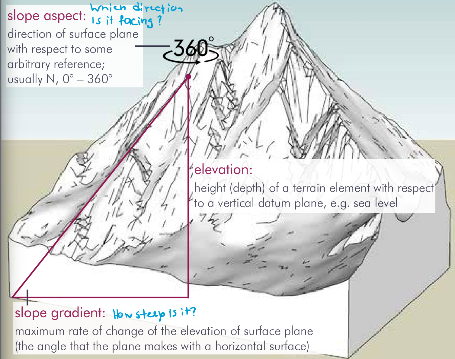
What are characteristics of terrain?
elevation (height with respect to vertical datum plane e.g. ellipsoid)
relief (changes in elevation, = slope gradient)
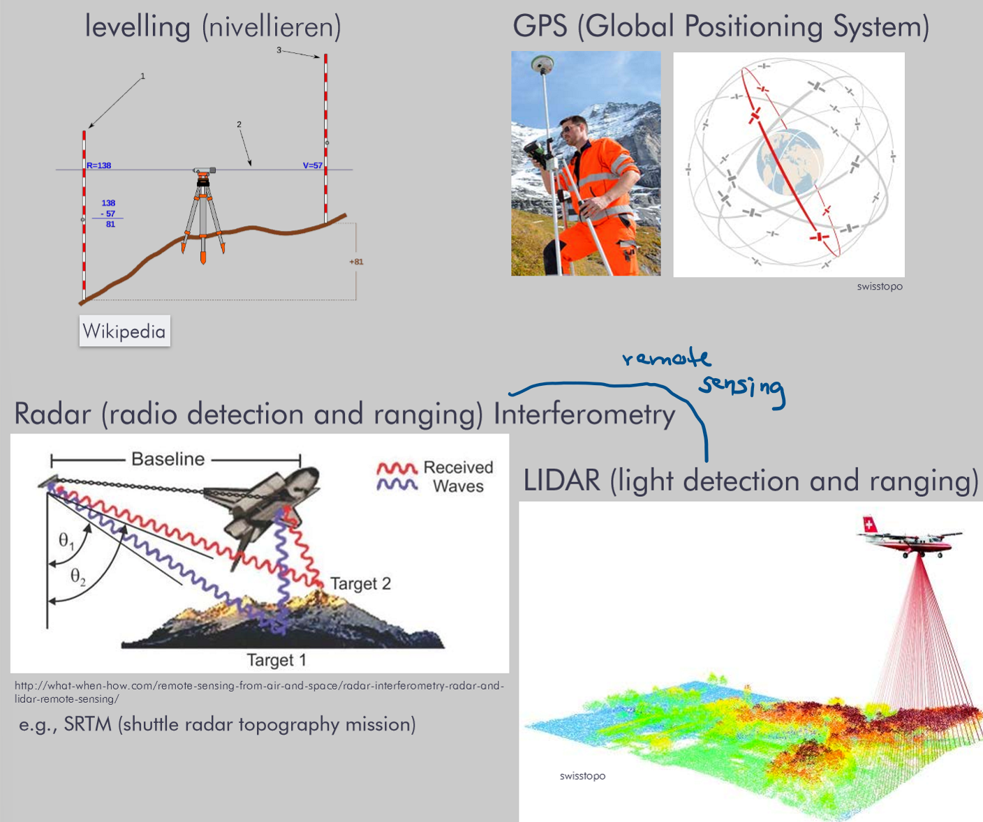
How can elevation be measured?
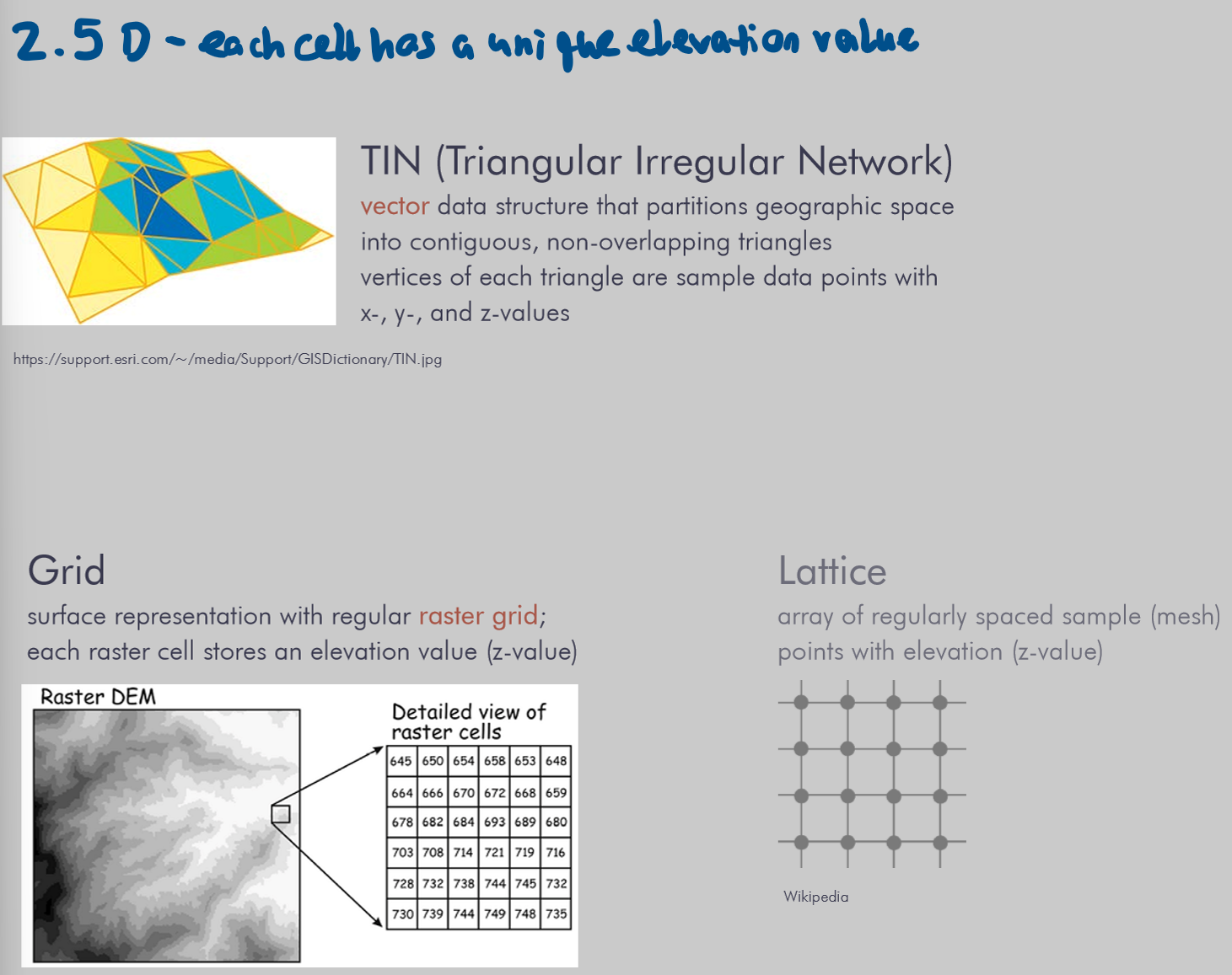
How can elevation be represented digitally?
representation of bare-earth terrain without vegetation or manmade features
What are historical terrain depitctions?
Before - 1800 (A):
stylized hills and mountains
bird eye viewsof terrain on maos
block diagrams, orthographic views, contour lines, hachures
After - 1800 (B):
shaded reliefs with charcoal or airbrush
Today:
digital terrain modeling
geovirtual reality
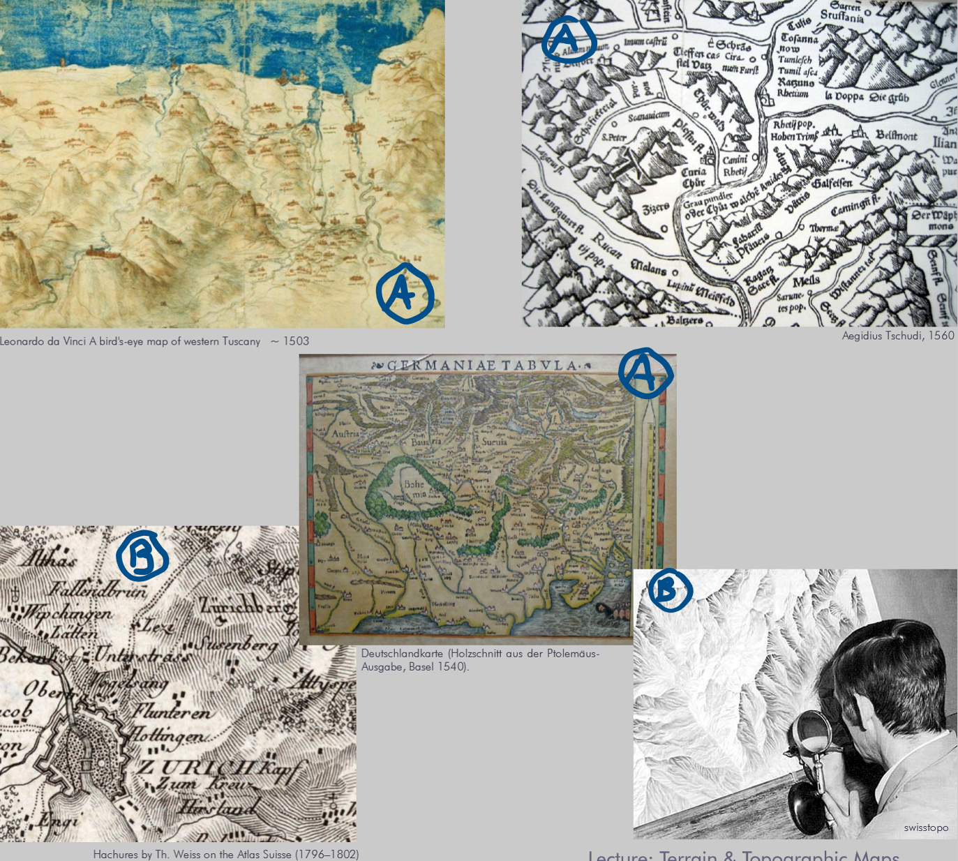
Methods for depicting terrain (+example)
What are the 2 approches for depicting terrain?
vertical (orthographic)
oblique (persepctive, bird’s eye)
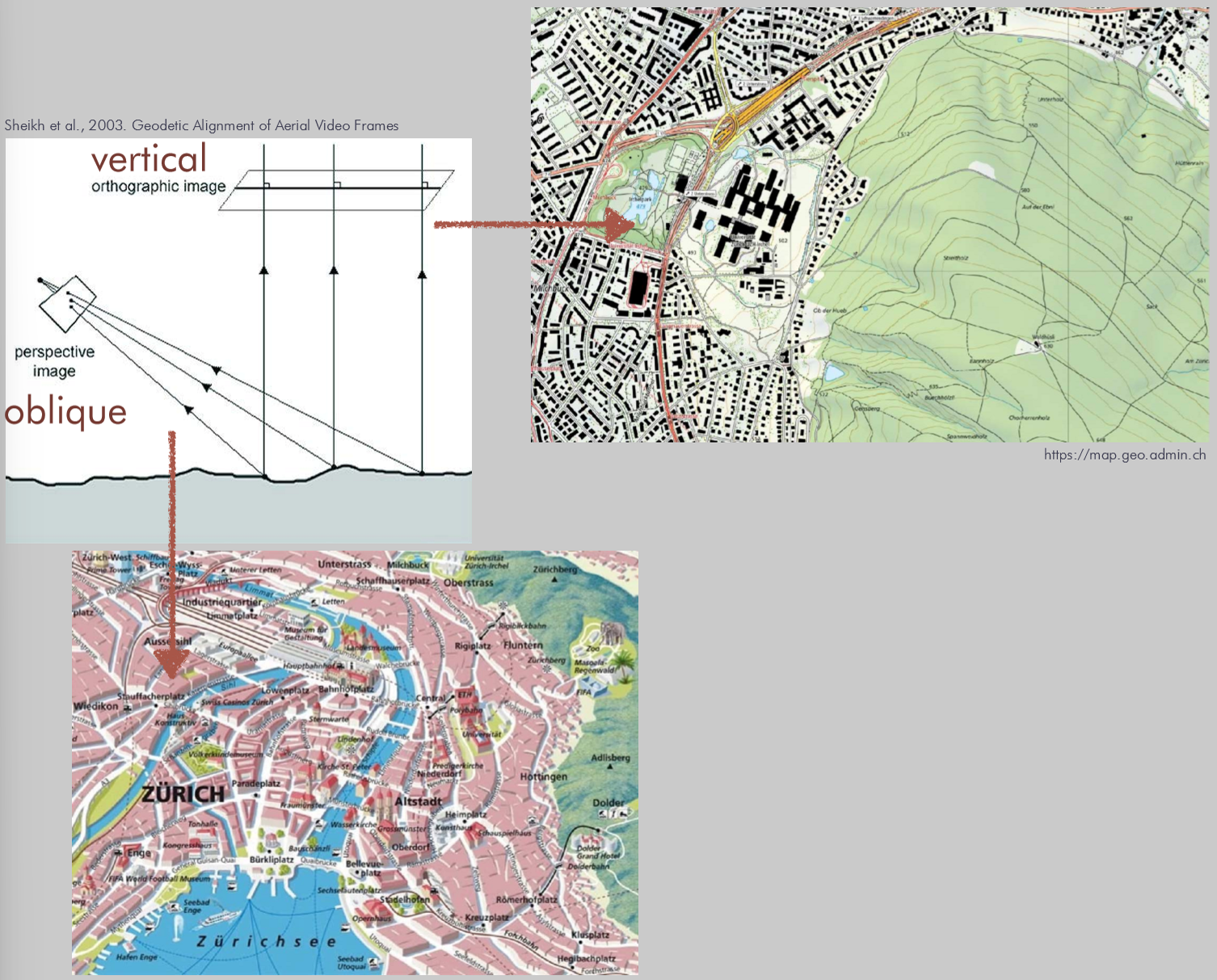
Methods for depicting terrain:
Vertical plane views
2D map perpendicular to the vertical datum plane
uses elements to depict terrain
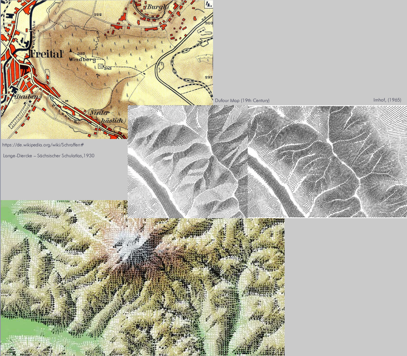
hachure
physiographic
contour lines
shaded relief (hillshading)
geomorphological representations
What is hachure?
short lines of varying width drawn in direction of steepest gradient, usually combined with lightning effect
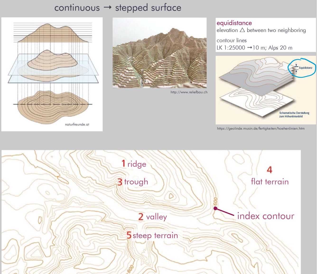
What are contour lines?
What is equidistance?
lines that connect points of equal elevation, usually relative to mean sea level
equidistance is the Δ elevation between two neighbouring contour lines
→ show geomorphological forms
→ terrain can be imagined
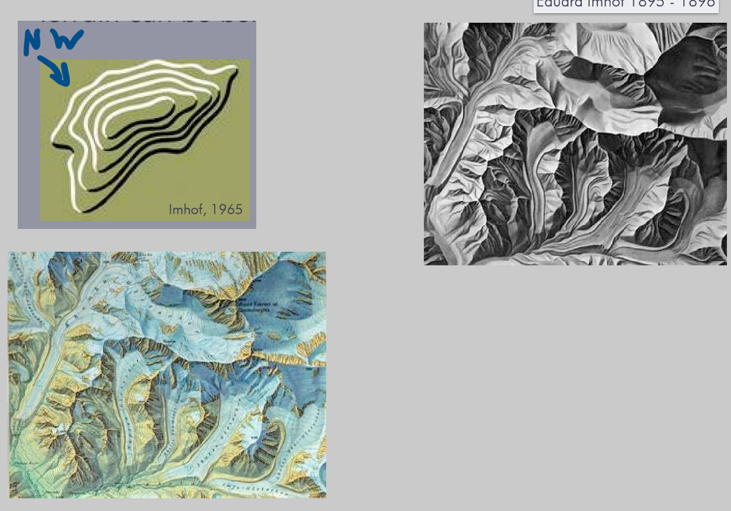
What is hillshading (shaded relief)?
light source (usually from NW) is casted across terrain to create lighted and shadowed parts
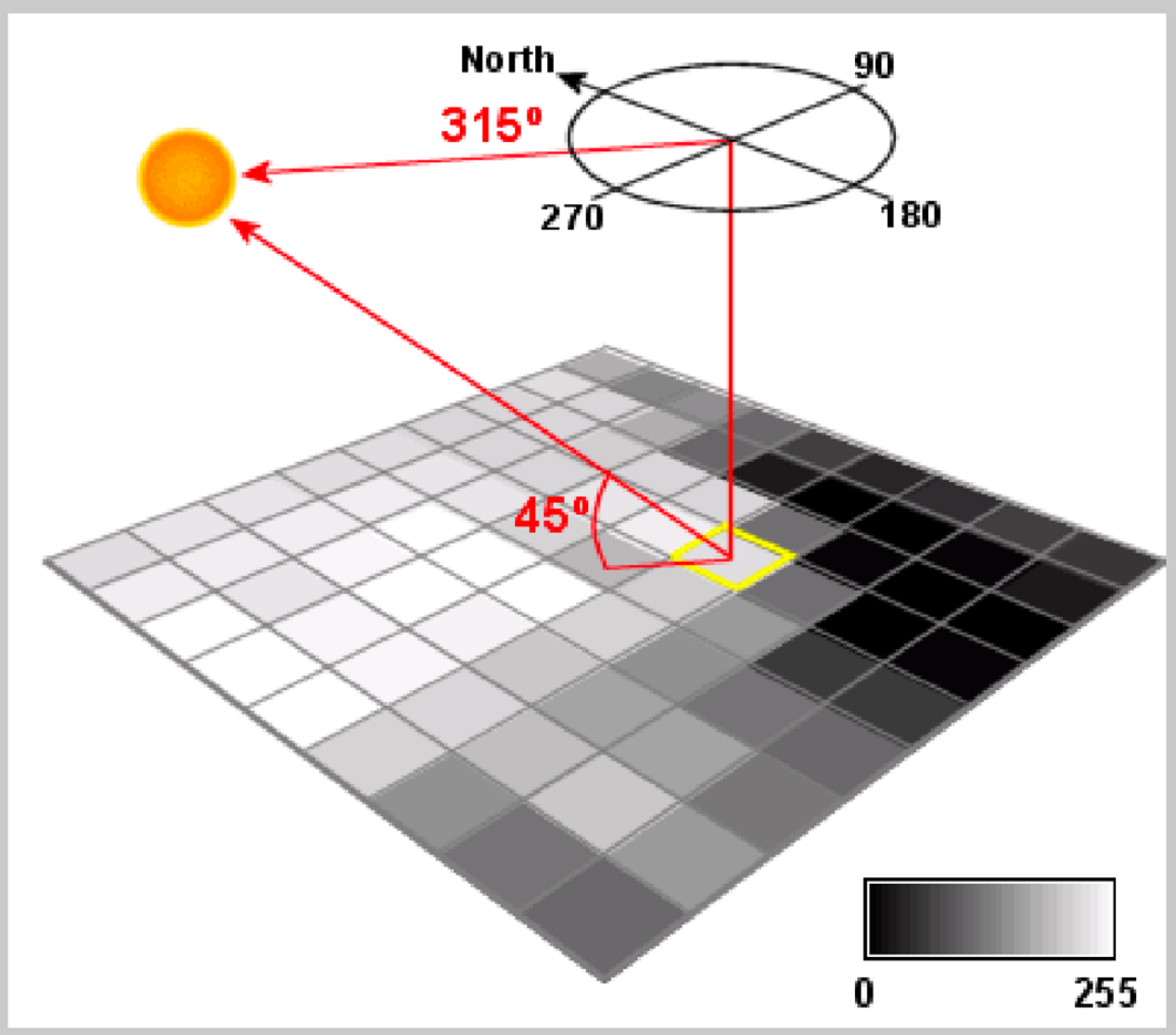
How does analytical hillshading work?
raster analysis function with defaults (azimuth: 315° and altitude/illumination 45°)
1. Calculate the slope gradient (inclination) and the slope aspect (direction/azimuth)
2. Set illumination: sun azimuth and elevation
3. Estimate reflectance of the surface
4. Assign map reflectance value to RGB (colors).
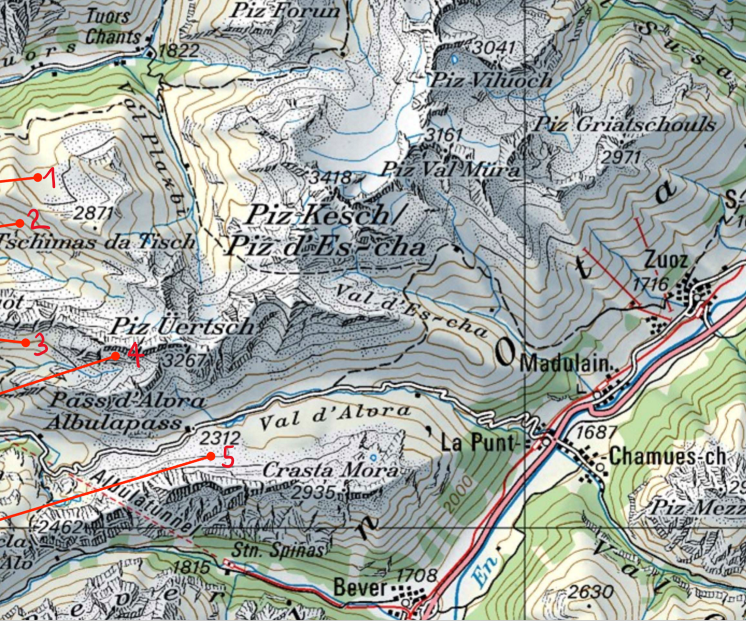
Name one example for vertical views
Swiss style
Sun tint (1)
Relief shading (2)
Contour lines (3)
Rock drawing: depiction of outcrop/bedrock exposures (4)
Scree pattern (= Geröll): depiction of loose rocks covering a slope (5)
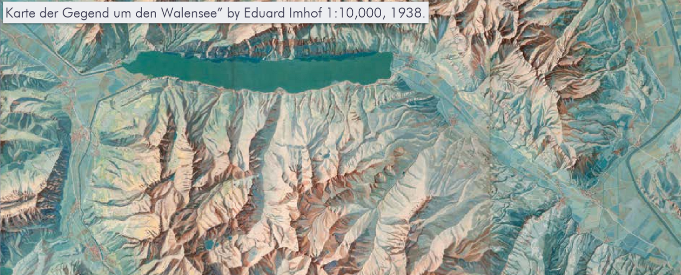
Name a second example for vertical views
Hypsometric tinting
Use of color hues to represent terrain & enhance relief cues
Color transition is continuous/discrete
Low altitudes, fertile → greenish
Medium altitudes, above tree line → brownish
High altitudes, snow/rocks → blueish/white
Methods for depicting terrain:
Oblique views
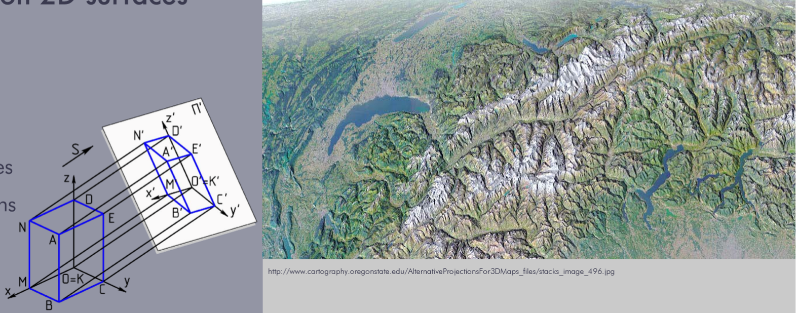
appear 3D, but are 2D on surfaces
panoramas / panorama maps
draped images
block diagrams
What are pros and contras for oblique views?
PRO
More attractive
Lack of abstraction
Digitally easy to produce
CONTRA
Not as accurate as plane views
Traditionally only a single view oblique was possible
Traditionally difficult/expensive to produce
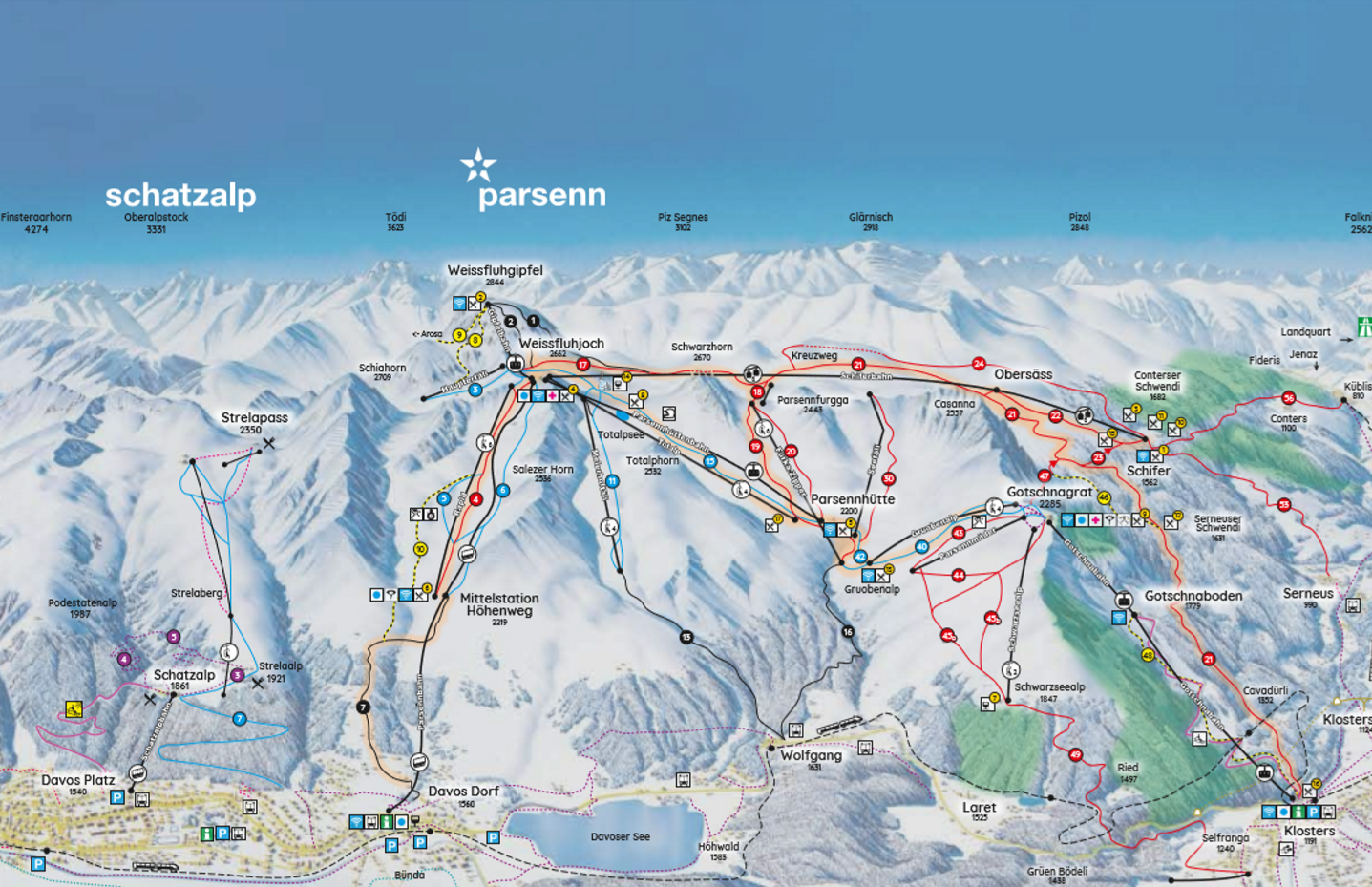
What are panorama maps?
More picture-like representation, less abstract
Distorted
Popular in tourism (e.g. ski region maps)
Production: handmade or digital (DEM)
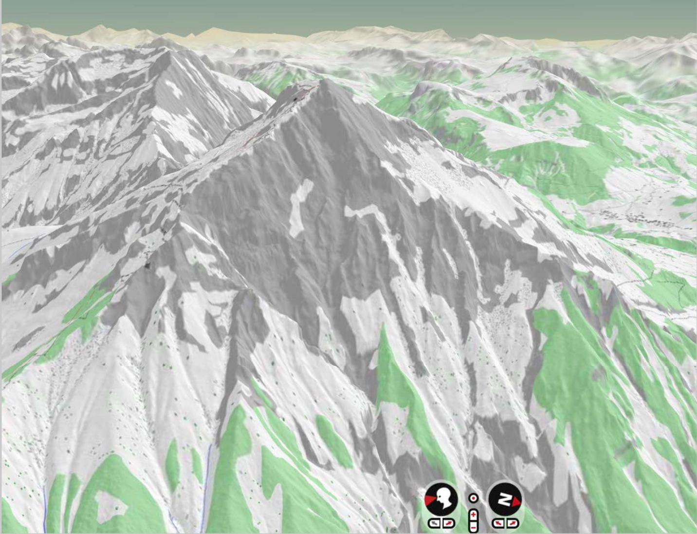
What are draped images?
Images that are draped over the terrain with DEM
can be aerial photo / satellite image / raster map
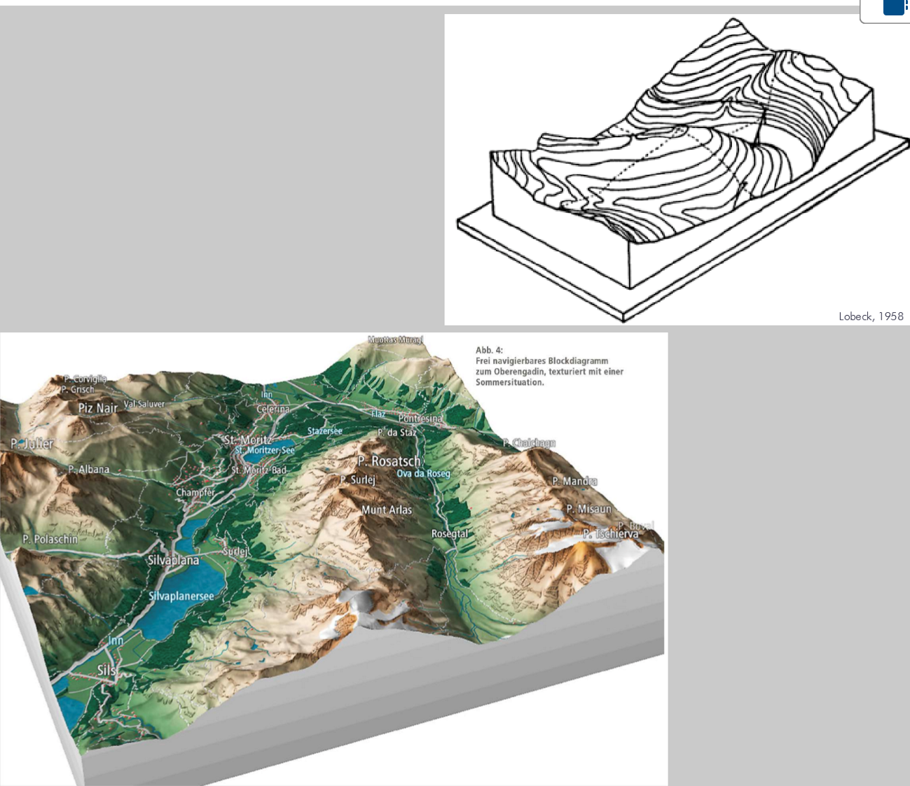
What are block diagrams?
Oblique view of a terrain including a cutaway of the subsurface
You can also add geological features
What can be represented with topographic maps?
Configuration of landscapes without relief
Urban areas (buildings)
Transportation network (roads)
Hydrography, water bodies (rivers, lakes)
Landcover (vegetation, cropland)
Individual features (antenna)
Boundaries (of countries) •
Terrain (with relief, 3D)
Toponyms (Labelling of the features)
Map grid, marginalia
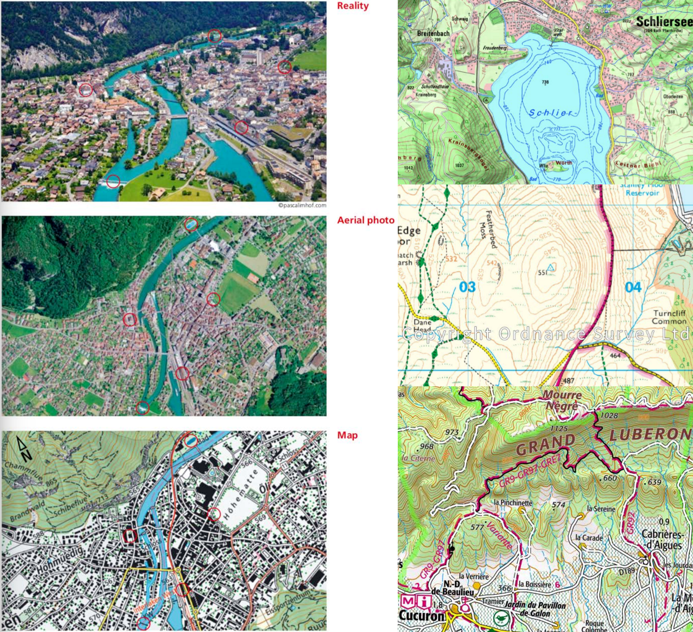
Basic functions of topographic maps
1. Show the spatial configuration of natural and manmade features (what,where)
2. Show relationship, topology and connectivity of features
3. Show distance, direction and area
4. Tool for all spatial problems
5. Orientation, navigation and route planning
What can be analyzed with a topographic map?
Navigation
distances
directions
Terrain features
Texture, surface (hue, texture)
Elevation
Geomorphological points
Aspects (light direction, azimuth)
Slope (contour lines)
Gradients (inclination, elevation with contour lines)
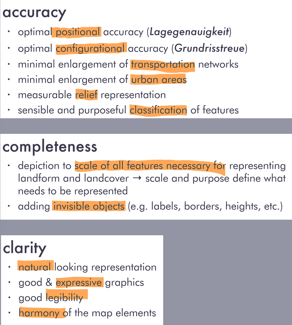
What determines a good map?