AP Human Geography - Unit 1 Test Map Projections
1/9
There's no tags or description
Looks like no tags are added yet.
Name | Mastery | Learn | Test | Matching | Spaced |
|---|
No study sessions yet.
10 Terms
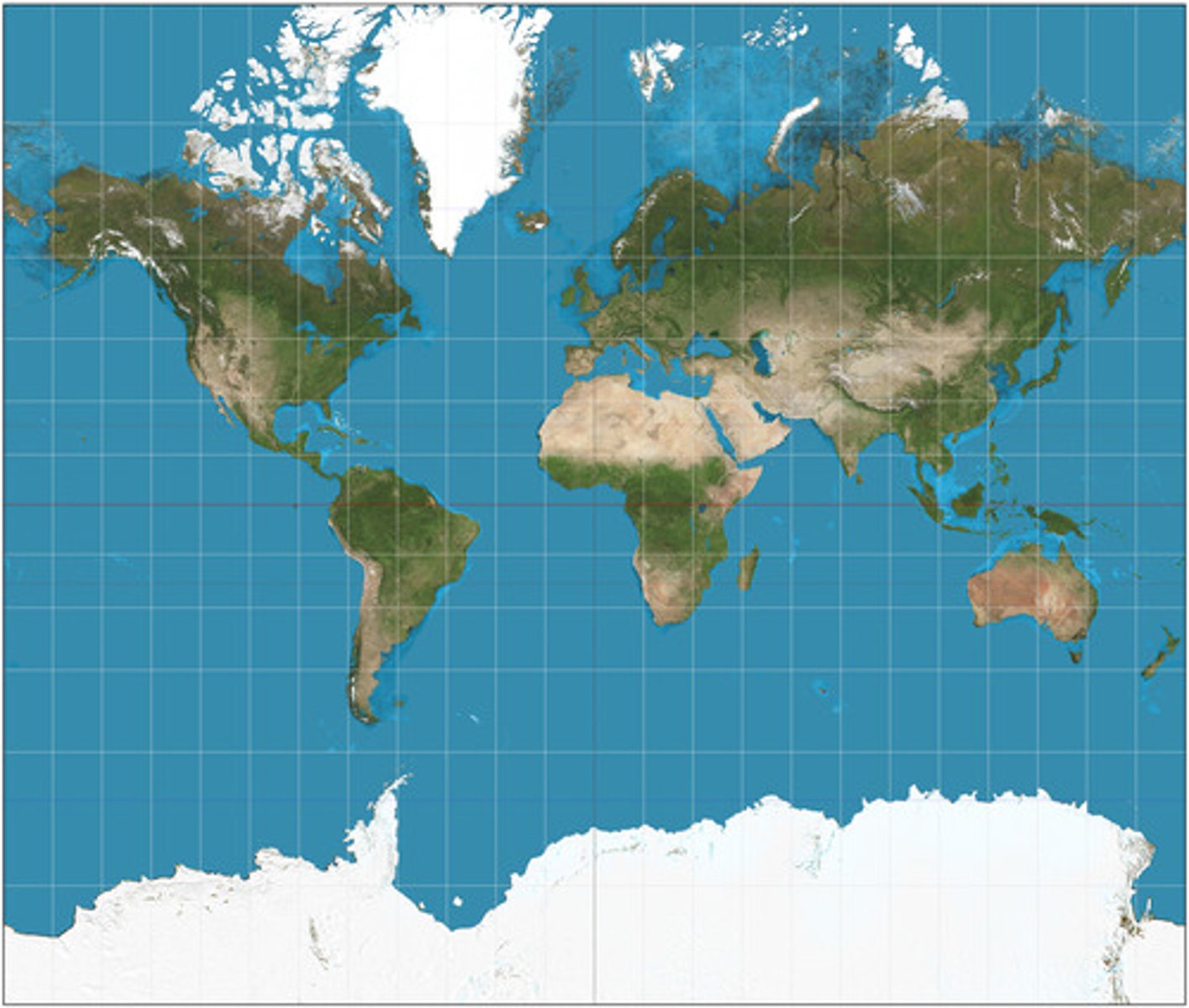
mercator projection
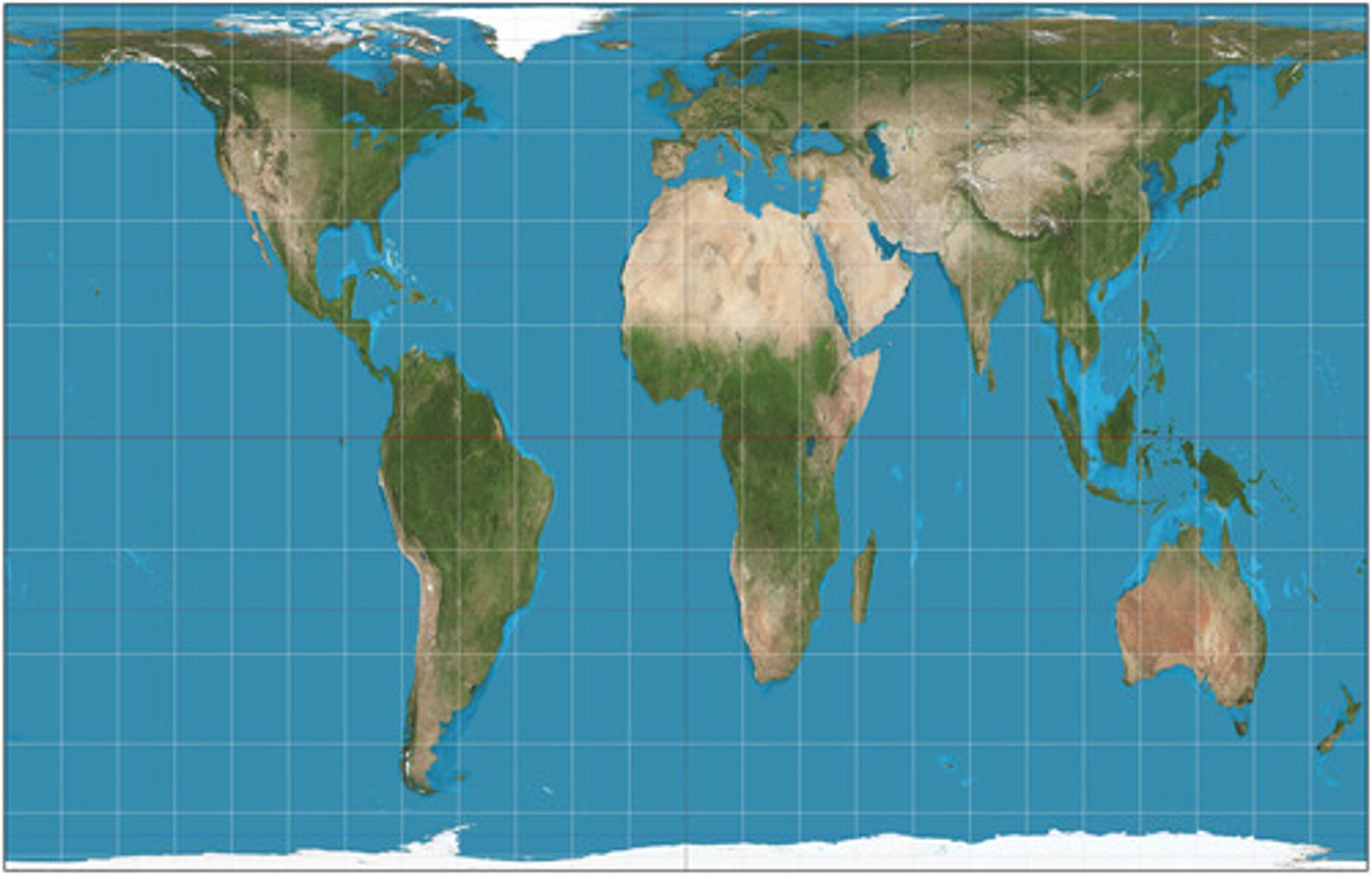
peters projection
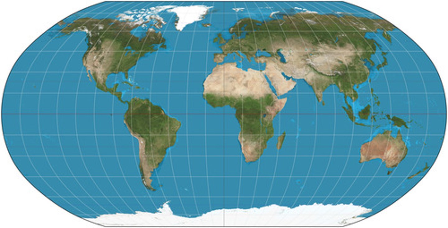
robinson projection
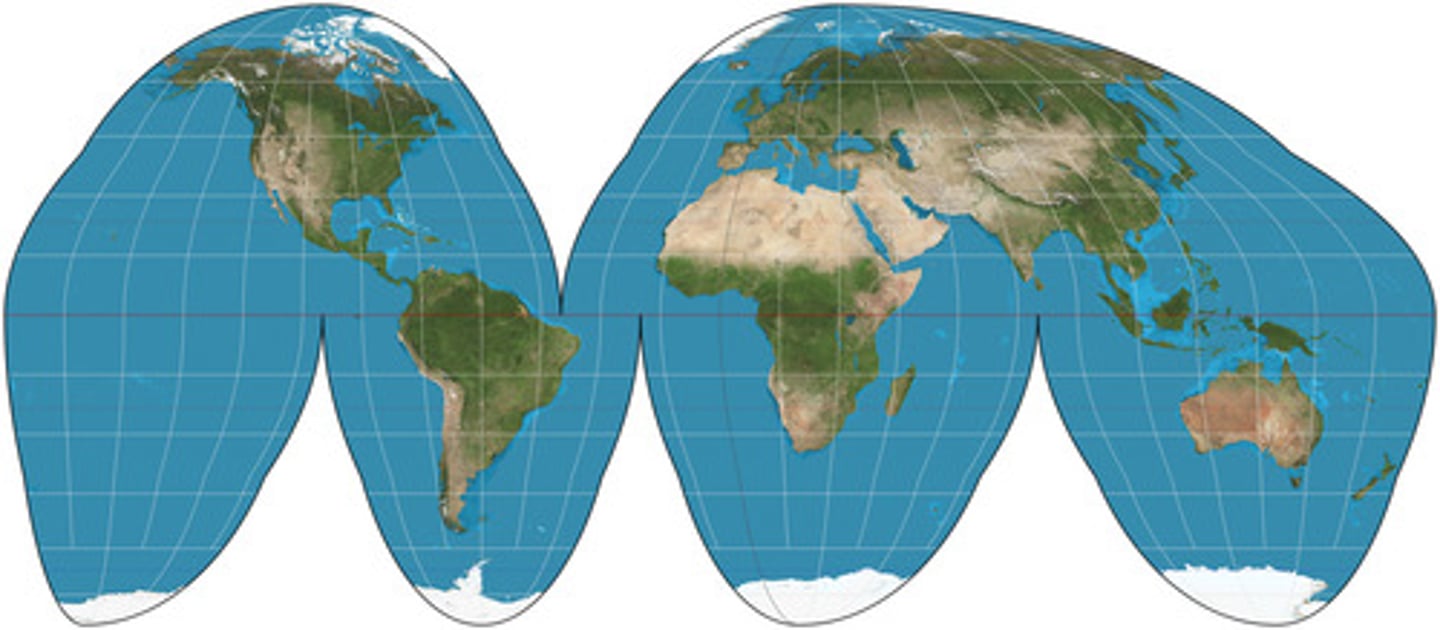
goode homolosine projection
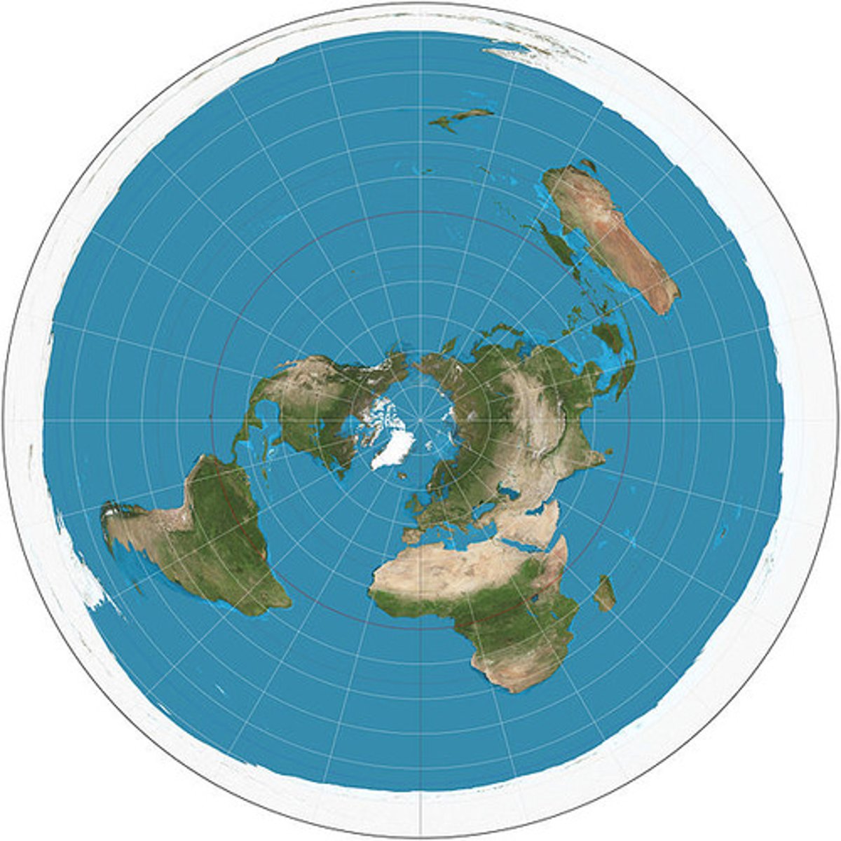
azimuthal projection
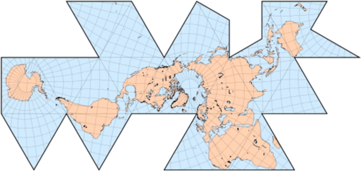
fuller projection
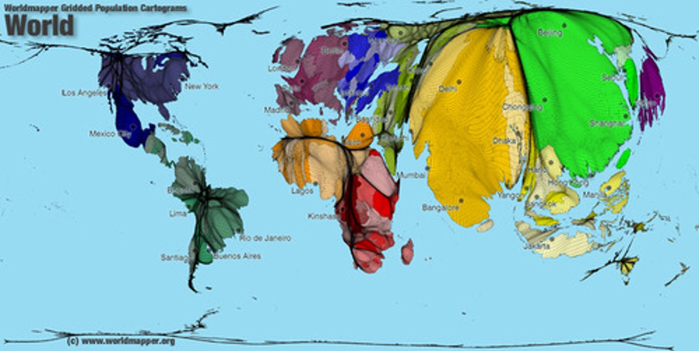
cartogram
a type of map where the geometry or space of the map is distorted in order to convey the information of this alternate variable
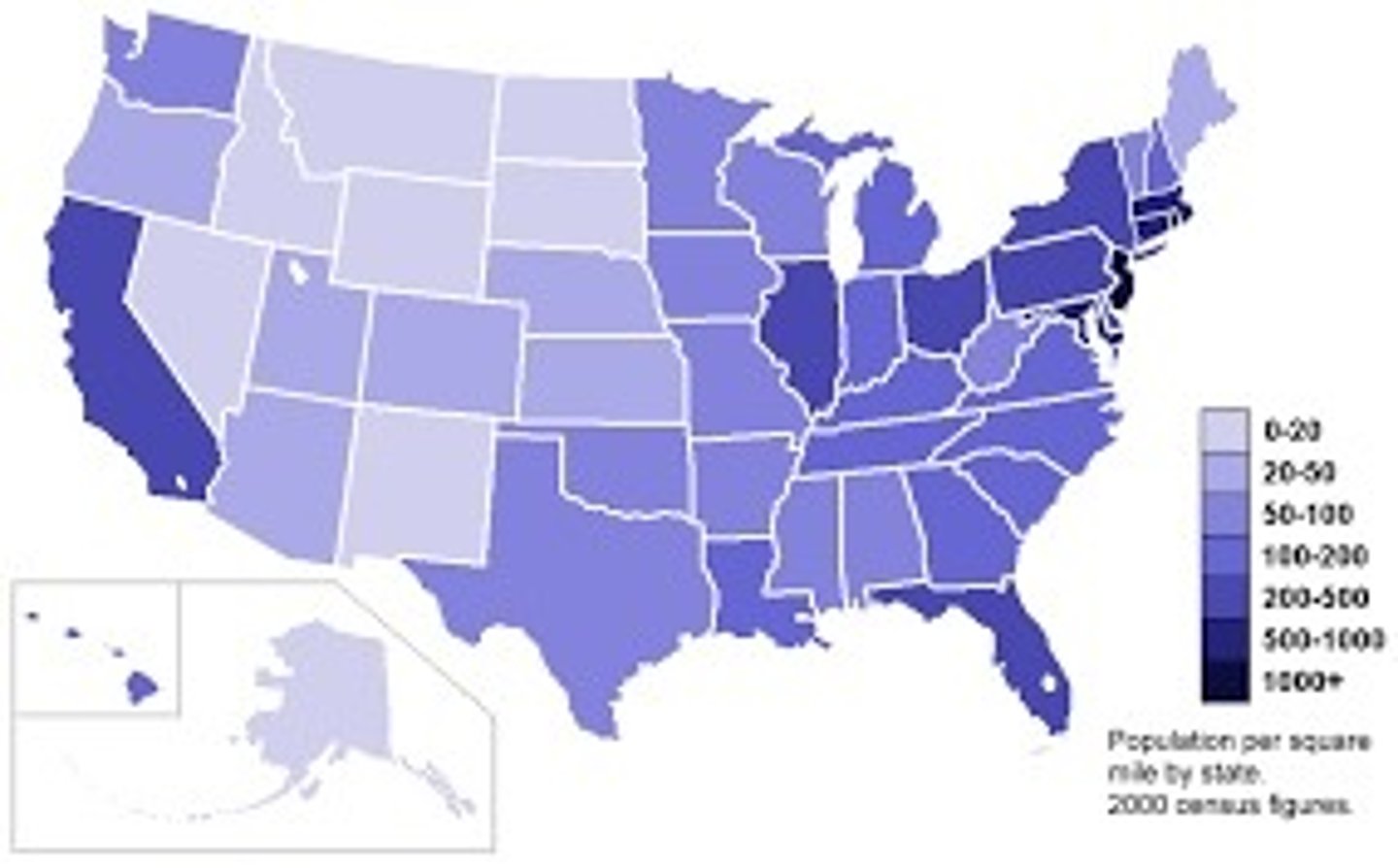
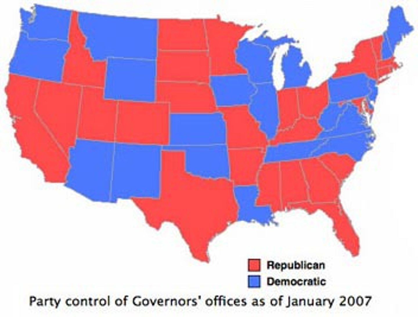
choropleth
a map that uses differences in shading, coloring, or the placing of symbols within predefined areas to indicate the average values of a property or quantity in those areas.
thematic map
a type of map especially designed to show a particular theme connected with a specific geographic area. can portray physical, social, political culture economic, sociological, agricultural, or any other aspects of a city, state, region, nation, or continent
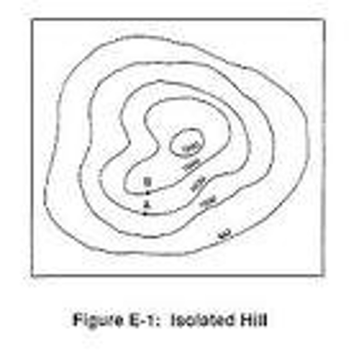
topographic map
a type of map characterized by large-scale detail and quantitative representation of relief, usually using contour lines, but historically using a variety of methods