(3) Drainage Basin Systems and Water Balance
1/56
There's no tags or description
Looks like no tags are added yet.
Name | Mastery | Learn | Test | Matching | Spaced |
|---|
No study sessions yet.
57 Terms
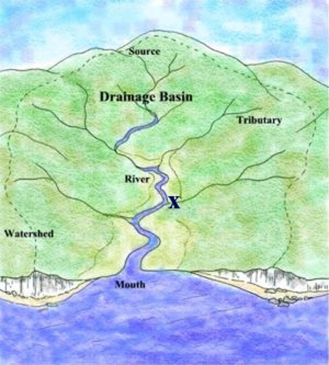
Drainage Basin
the area from which a single stream or river and its tributaries drains all of the water
the edge of the river basin is marked by a boundary called the Watershed
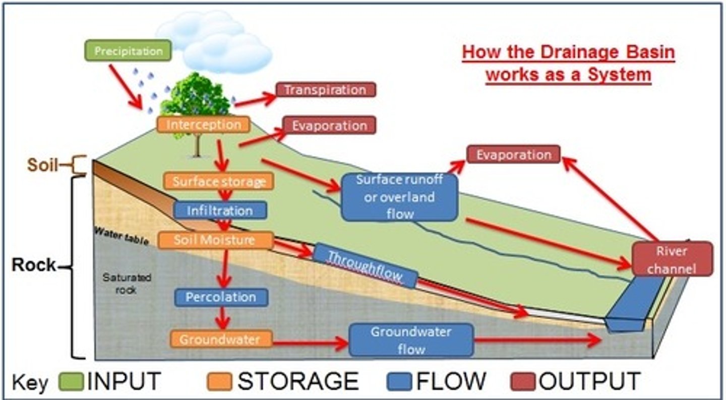
Drainage basin system
open system with inputs of precipitation and outputs of evapotranspiration
matter and energy come from external sources that feed into and take away from the system
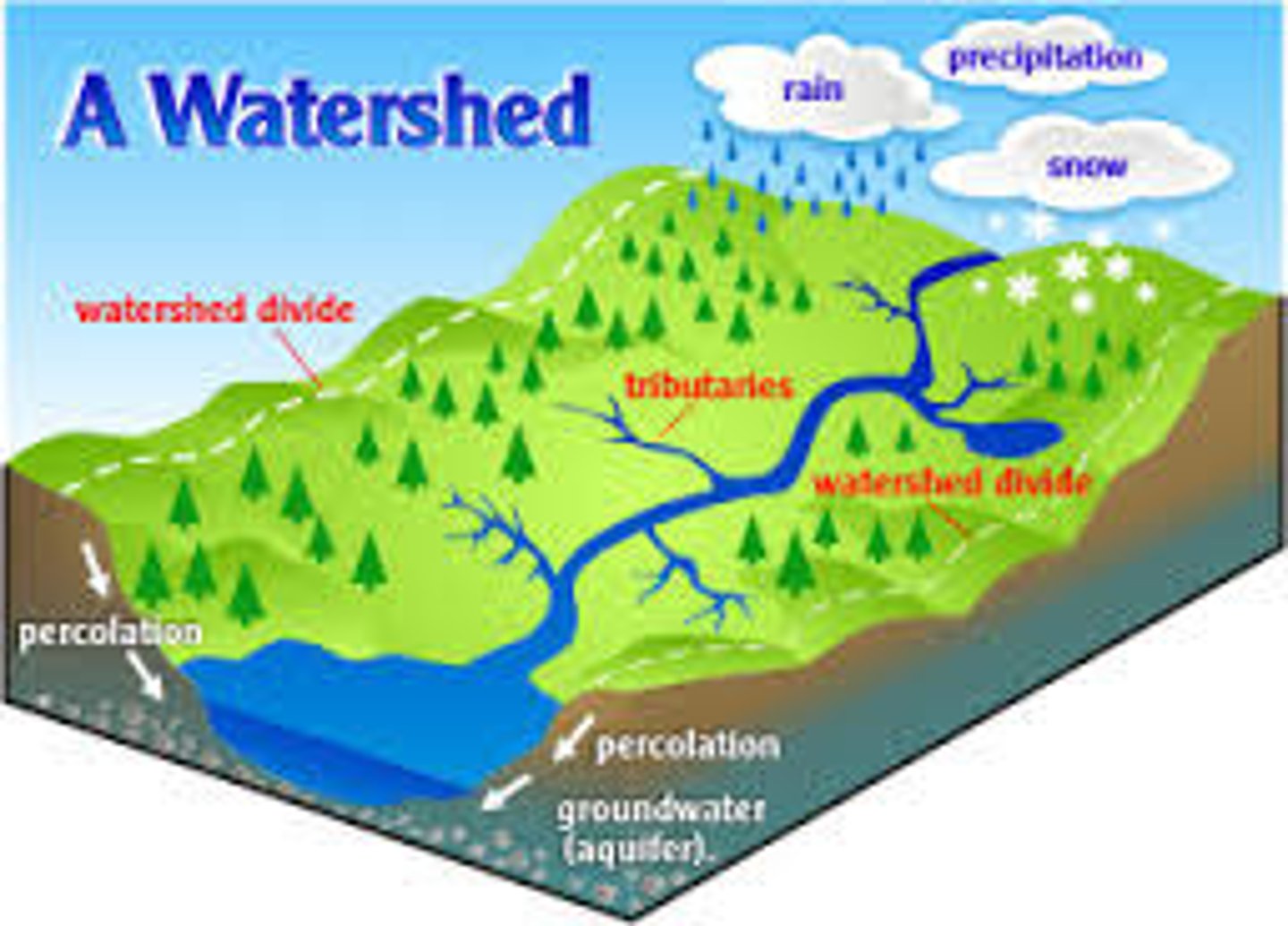
Drainage Basin System - INPUTS
Precipitation
Groundwater Flow
Infiltration
Overland Flow
Throughflow
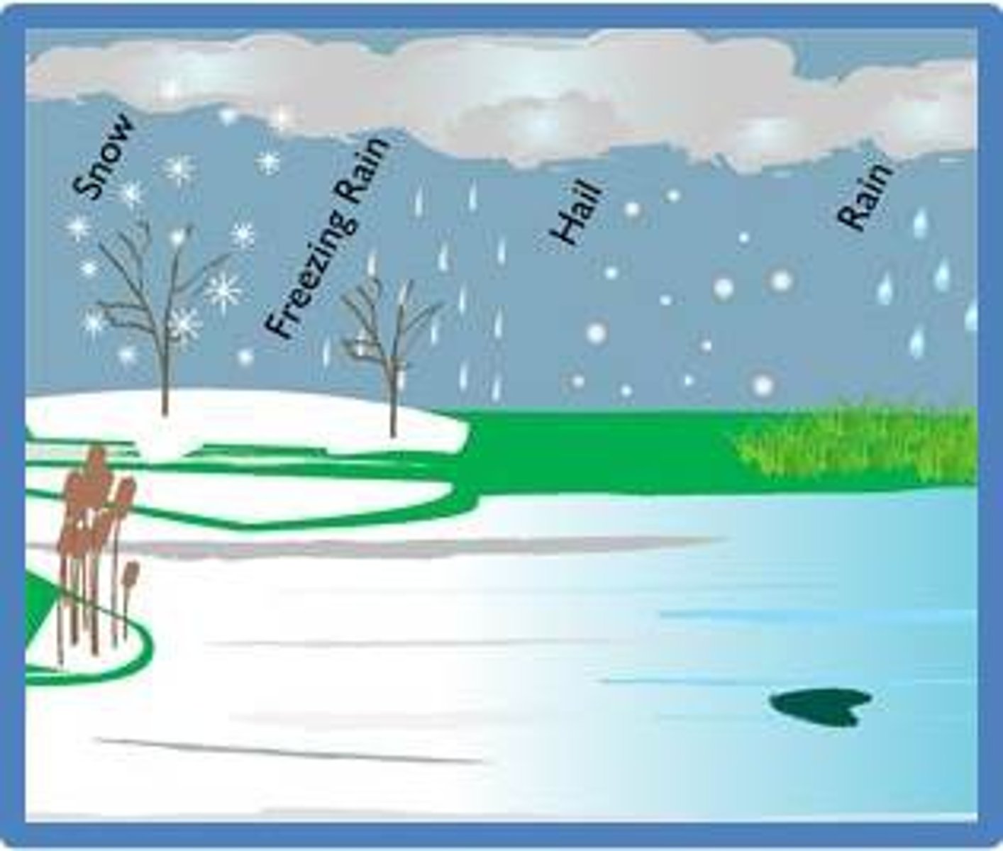
Drainage Basin System - Precipitation
INPUT
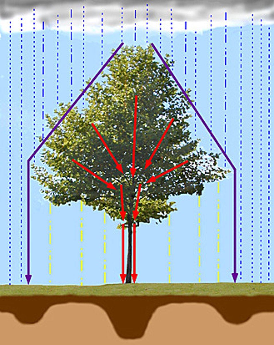
water enters the drainage basin system as precipitation
intercepted by plants and trees where it can be stored and transpired
- stem flow takes time for water to drip through leaves + down stems to ground surface
- some can be stored as puddles
- flows over the ground as overland flow or infiltrates soil
- some water taken up by plants is transpired transpired
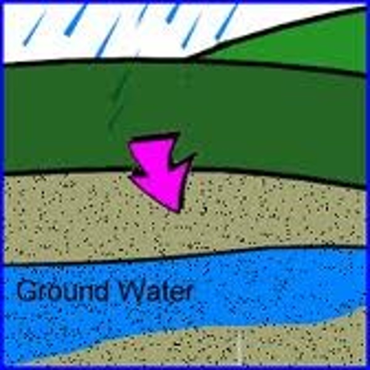
Drainage Basin System - Groundwater flow
INPUT
feeds rivers through their banks and bed
slow method of transfer
carries on supplying water well after an individual rainfall event has occurred
... why rivers can continue to flow during dry periods
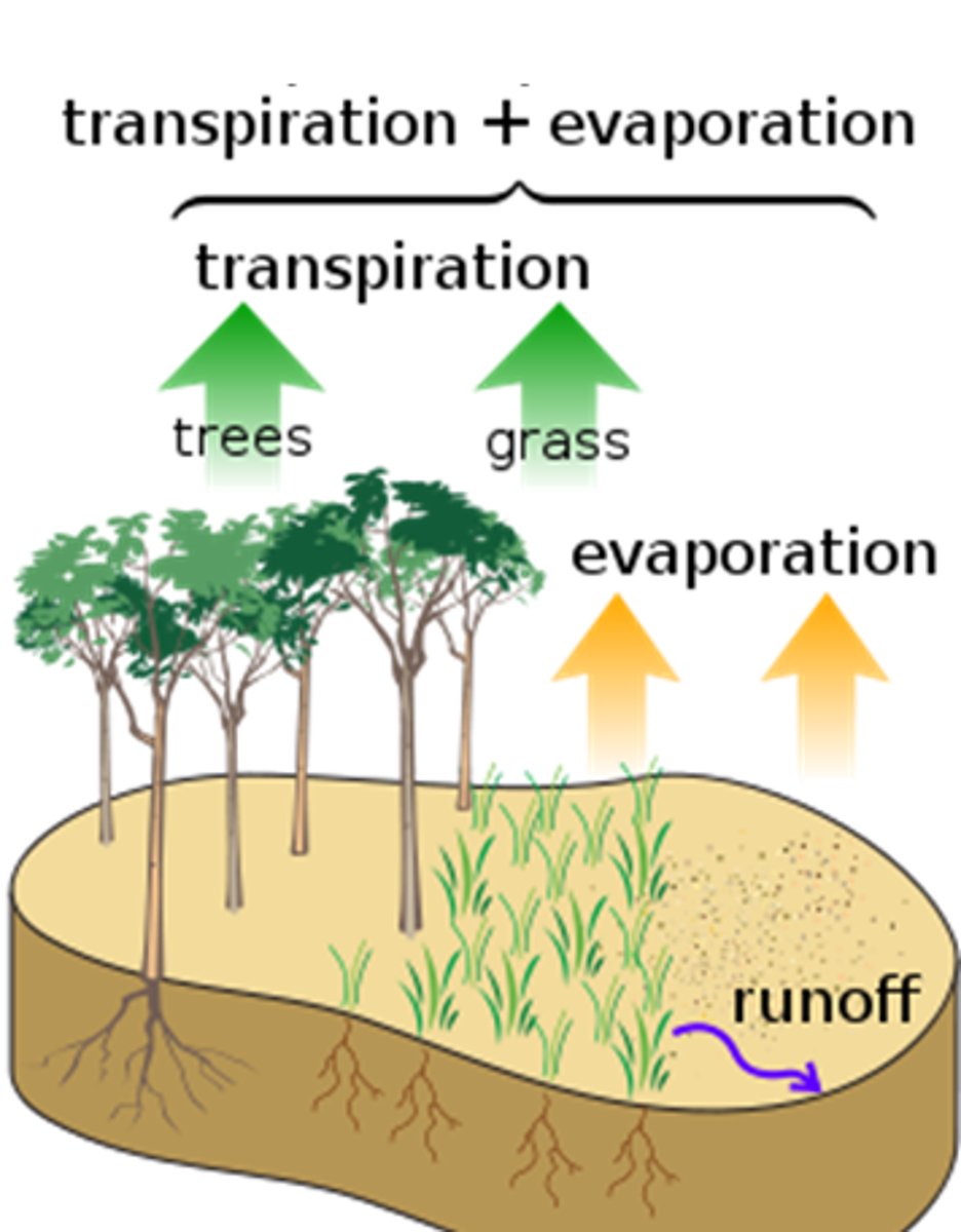
water moves out of the system as runoff, when the river flows into lakes/seas/evapotranspiration occurs
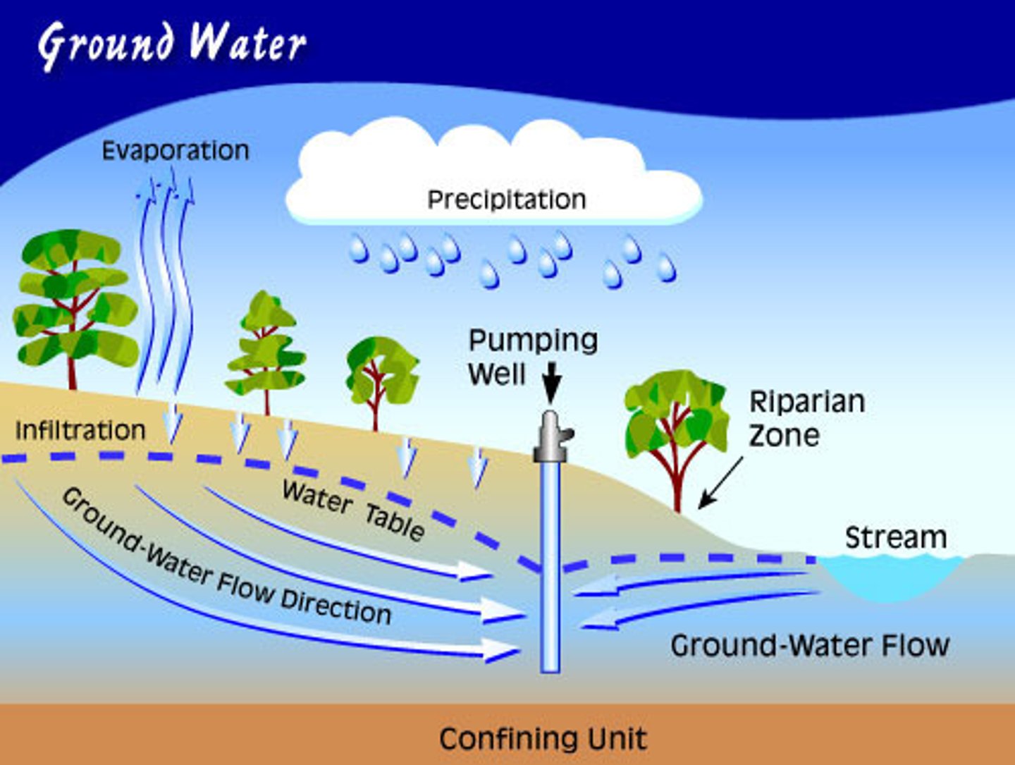
Drainage Basin System - Infiltration
INPUT
the infiltration capacity = the rate of infiltration
... an important factor that determines the extent to which soil is saturated
(also depends on soil type and preexisting conditions)
infiltration capacity is exceeded when the soil is unable to absorb water at the rate at which it is falling (or melting - snow)
- thin, frozen or already saturated soils will usually have low infiltration capacity
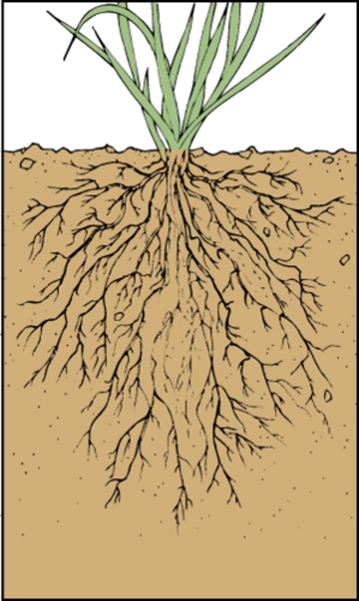
- trees may promote infiltration as the roots from pathways for water to percolate underground
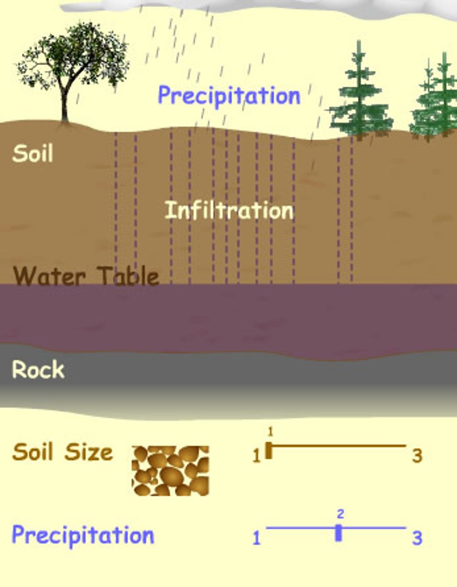
how does water infiltrate soil
a combination of capillary action and gravity
capillary action = the molecular attraction of water molecules to soil particles
gravity is usually the dominant force
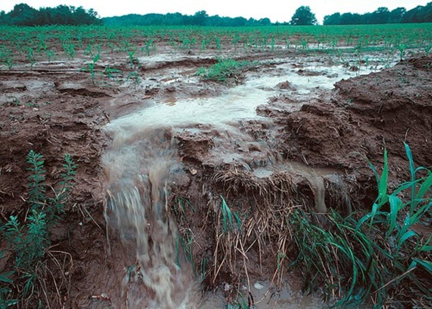
Drainage Basin System - Overland Flow
INPUT
if water is unable to infiltrate, it may run off the surface as overland flow
(surface runoff)
can flow across a large surface area (sheetflow) or concentrated into small channels known as rills
overland flow on agricultural land is not common in the UK as much of the land is covered by vegetation
bare soil, or urban areas with concrete roads commonly have overland flow, often leading to flooding
Drainage Basin System - Throughflow
INPUT
once in the soil, water may be either stored as soil water or pass through as throughflow, dependent on the depth and texture of the soil
water passes through the soil until it reaches the water table or the underlying bedrock
... if bedrock is impermeable, no further movement downward occurs
... if bedrock is permeable, water will seep through pores in rocks (can take 1000's of years or happen quickly)
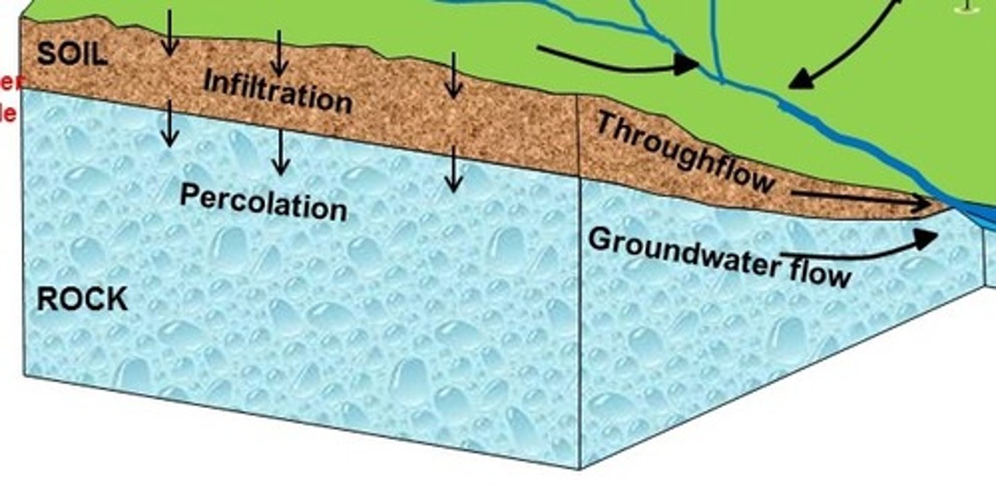
sheetflow
Surface water that moves downslope in a thin film as overland flow; not concentrated in channels larger than rills.

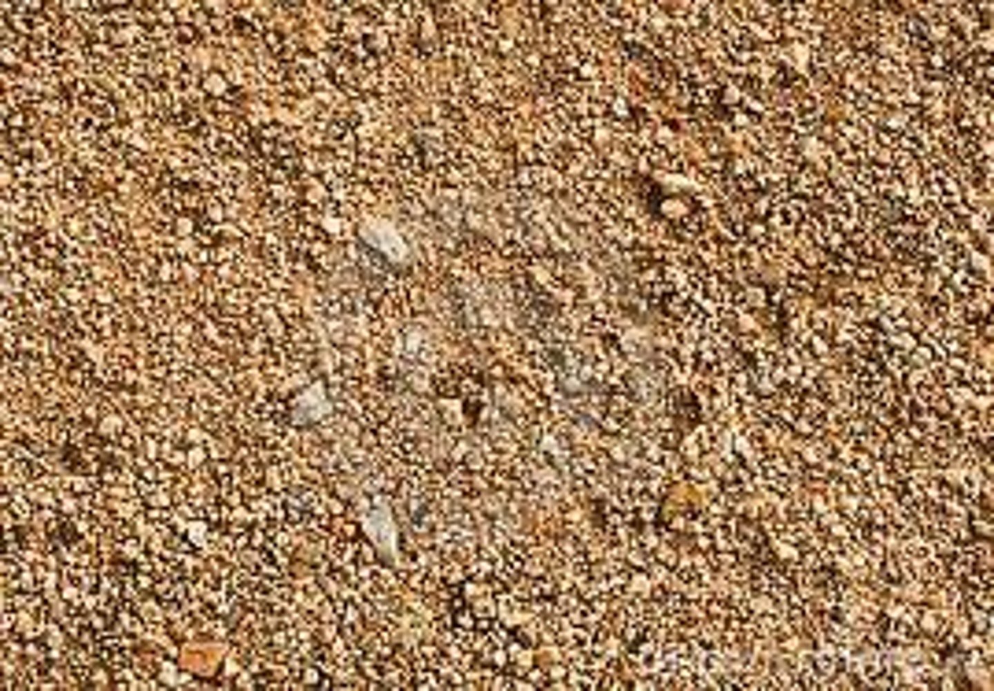
Drainage Basin System - Throughflow (COARSE, SANDY SOIL)
coarse, sandy soil absorbs and transfers water rapidly
... animal and plant root activity creates discrete "pipes" within the soil that increase rate of transfer
this can contribute to flood hazards as such soils have low field capacities
(retain little water)
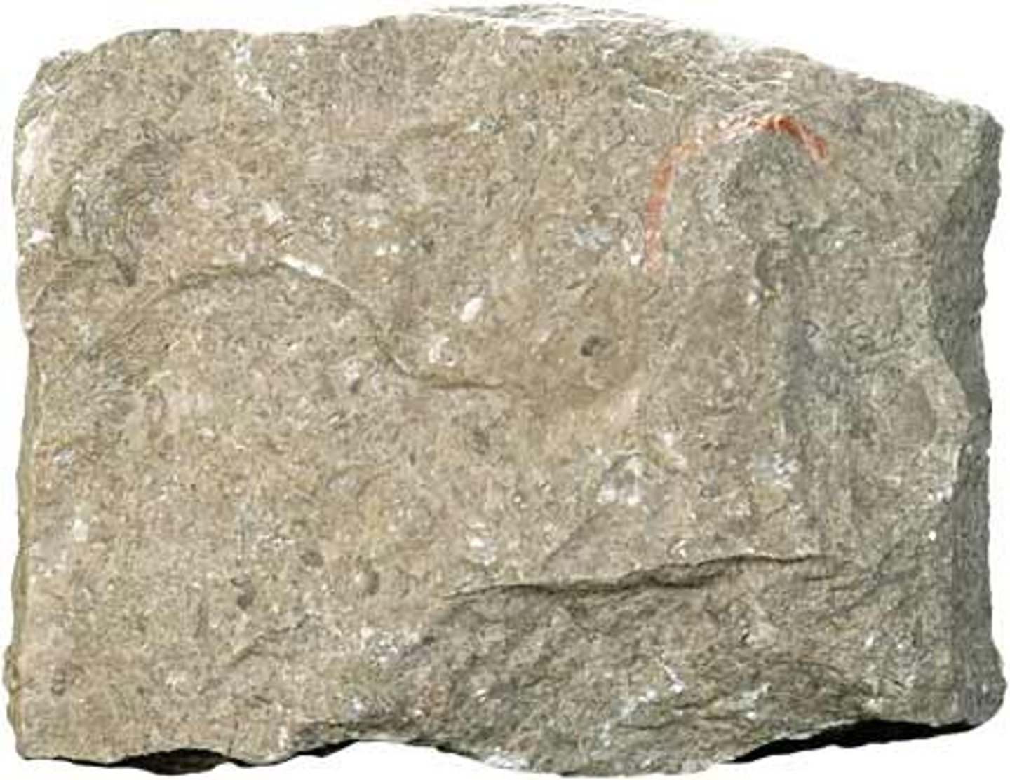
Drainage Basin System - Throughflow (Limestone Rocks)
jointed rock
can transmit water very quickly
e.g., Cheddar Gorge, Somerset
study of water through limestone calculated a rate of 580cm/hour
(same for granite)
... sandstone rates = around 200cm/h
... unconsolidated gravel = around 20,000 cm/h
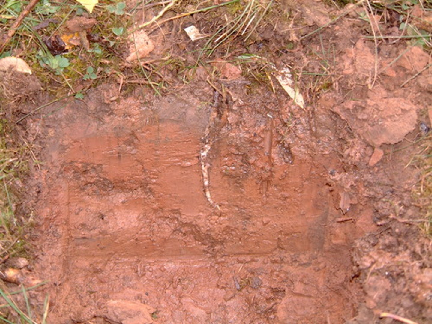
Drainage Basin System - Throughflow (CLAY SOILS)
clay soils drain more slowly and have high field capacity
soils tend to be wet as they do not allow water to be transferred readily
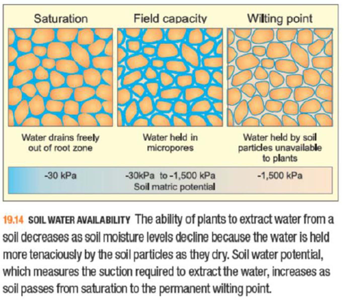
Drainage Basin System - STORES
Interception
Soil Water
Field Capacity and Wilting Point
Aeration Zone Storage
Surface Water
Groundwater
Channel Storage
Drainage Basin System - Interception
STORE
= water that is caught and stored by vegetation has been intercepted
... after interception, 1 of 3 things can happen to the water:
1. Interception loss - water that is retained by plant surfaces and which is later evaporated away or absorbed by the plant
2. Throughfall - water that either falls through gaps in the vegetation or which drops from leaves or twigs
3. Stemflow - water that trickles along twigs and branches and finally down the main truck
Drainage Basin System - Channel Storage
STORE
= refers to all water that is stored in rivers, streams, and other drainage channels
Drainage Basin System - Soil Water
STORE
= exists in the subsurface soil layer above the water tables
... from here water may be absorbed, held, transmitted downward, towards the water table, or transmitted upwards towards the soil surface and the atmosphere
(capillary action)
Drainage Basin System - Interception (Spatial and Temporal Variations)
- Varies with different types of vegetations
- Interception is less from grasses than from deciduous woodland owing to the similar surface area of the grass shoots
- Interception increases with crop density
- Coniferous trees interact more than deciduous trees in winter, but this is reversed in the summer
- Marked seasonal changes in storage occur in biomes and ecosystems that are characterised by deciduous vegetation
Drainage Basin System - Soil Water (Spatial and Temporal Variation)
- In coarse textured soils much of the water is held in fairly large pores at fairly low suctions while very little is held in small pores (UK soil)
- In fine textured clay soils the range of pore sizes is much greater and there is a higher proportion of small pores in which the water is held at very high suctions
Drainage Basin System - Field Capacity and Wilting Point (Spatial and Temporal Variations)
- The field capacity of a soil depth largely depends on its texture
- Sandy soils have a low field capacity and reach their capacity very quickly
- Clay soils have a high field capacity and reach this capacity more slowly
- Clay and leam soils take longer to reach capacity due to the slow rate of infiltration and the large volume of water required to be absorbed
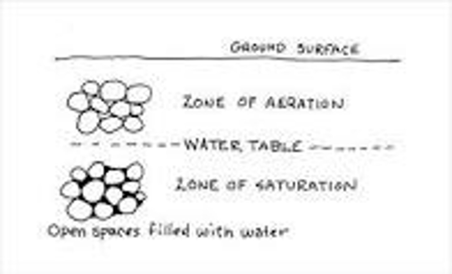
Drainage Basin System - Aeration Zone Storage
STORE
= refers to the moisture in the little soil that is immediately above the groundwater store
... it is unsaturated and contains air and moisture in its pore spaces
Drainage Basin System - Aeration Zone Storage (Spatial and Temporal Variations)
- This zone varies seasonally and depends on the depth of the water table
- Following heavy rainfall and spring melt, there should be an increase in the amount of water percolating down towards the water table
- Human withdrawal of groundwater may make the aeration zone deeper
Drainage Basin System - Surface Water
STORE
... many types, some of which are temporary and some of which are permanent
Drainage Basin System - Field Capacity and Wilting Point
STORE
the amount of water held in the soil after excess water drains away after a rainfall event
i.e., saturation or near saturation
...Wilting point refers to the threshold level of soil water below which plants cannot extract sufficient water to maintain their mechanic strength
Drainage Basin System - Groundwater
STORE
... refers to subsurface water that is stored under the surface in rocks
... groundwater accounts for 30.1% of all freshwaters on earth
... while some moisture may be recycled by evaporation into atmospheric moisture within a matter of days or weeks, groundwater may not be recycled for as long as 20,000 years
Drainage Basin System - Surface Water (Spatial and Temporal Variations)
- Temporary sources include small puddles following a rainstorm and turloughs (seasonal lakes in limestone in west Ireland that develop during winter due to higher water tables)
- Permanent stores include lakes, wetlands, swamps, peat bogs and marshes
- Surface water storage is impacted by the building of dams and the creation of reservoirs
Drainage Basin System - Groundwater (Spatial and Temporal Variations)
- In small drainage basins, seasonal variations in groundwater may be more noticeable than in large drainage basins
- Due to extraction by human activities many of the world's major groundwater stores are becoming depleted
- The Ogallala aquifer of the high plains of Texas has experienced a fall in the water table of 30-50m in less than 50 years the aquifer has narrowed by more than 50% and there have been reductions in the area irrigated and in crop yields
- The aquifer under Saudi Arabia is a fossil aquifer in that it is not being replenished and is predicted to by dry by 2030
Drainage Basin System - Channel Storage (Spatial and Temporal Variations)
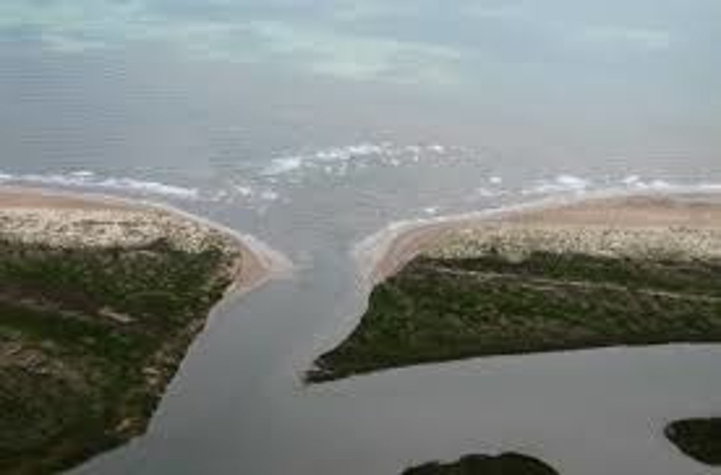
- Some rivers are seasonal while others may disappear underground either naturally
(e.g., in areas of carboniferous limestone)
or in urban areas where they may be covered
(i.e., the lost rivers of London, the fleet and the Effra = culverted)
Drainage Basin System - OUTPUTS
evaporation
evapotranspiration
potential evapotranspiration
river discharge
Drainage Basin System - evaporation
= the change in the state of water from a liquid to a gas
--> heat energy is required for this to occur
... can occur from the surface of any water store, including the ocean, surface water on the land and water intercepted temporarily on plant leaves
... globally most important from oceans and seas
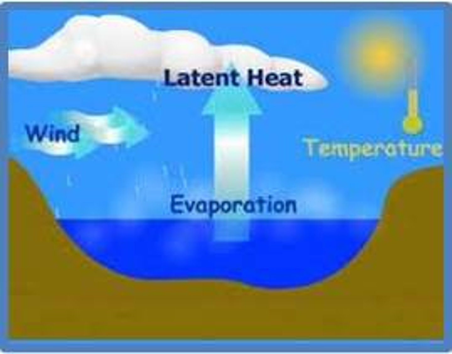
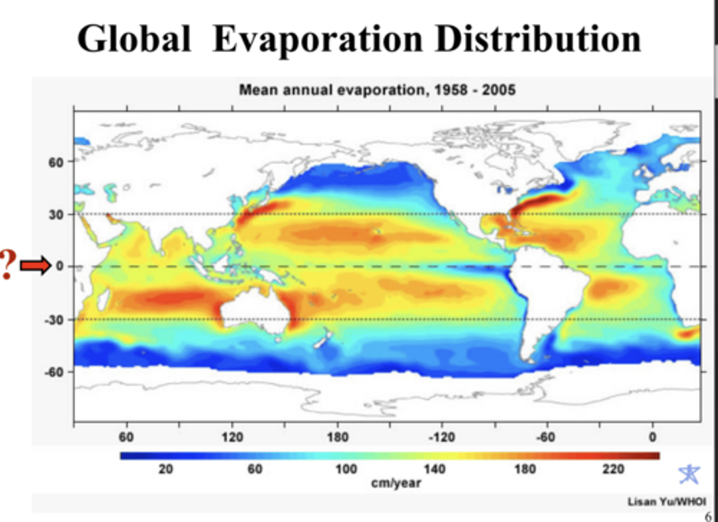
Drainage Basin System - evaporation (Spatial and Temporal Variations)
- Increases under warm, dry, windy conditions and decrease under cold, calm conditions
- Evaporation losses are greater in arid and semi-arid climates than in polar regions
- Factors affecting evaporation include meteorological factors (temperature, humidity, and wind speed)
- Temperature is the most important factor
- Other factors include the amount of water available, vegetation cover, and colour of the surface (albedo/reflectivity)
Drainage Basin System - evapotranspiration
= the term used to describe a combination of evaporation and transpiration
... transpiration is the diffusion of water from vegetation into the atmosphere, involving a change from liquid to gas
... water is lost through the stomata (pores) of leaves and different types of vegetation vary greatly in terms of the rates of transpiration which are allowed
Drainage Basin System - river discharge (Spatial and Temporal Variations)
- River discharge can vary seasonally - some monsoonal rivers experience peak discharge in summer whereas some high latitude and high-altitude rivers have their peak following spring melt
- Other rivers have a maximum flow during winter, and others still have complex regimes which are a mix of different regimes
Drainage Basin System - potential evapotranspiration
= the distinction between actual ET and P.ET is the concept of moisture availability
... potential evapotranspiration is the water loss that would occur if there was an unlimited supply of water in the soil for use by vegetation

Drainage Basin System - potential evapotranspiration (Spatial and Temporal Variations)
- The actual evapotranspiration rate in Egypt is less than 250mm because there is less than 250mm of rain annually, but given the high temperature, if the rainfall reached 200mm there would be sufficient heat to evaporate that amount of water. Hence the evapotranspiration rate would be 200mm
- The factors affecting evapotranspiration include all those that affect evaporation. Some plants and cacti also have adaptations to help them reduce moisture loss
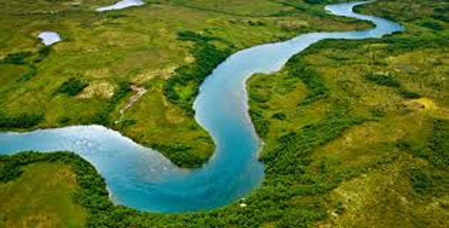
Drainage Basin System - river discharge
= the movement of water in channels such as streams and rivers
... the water may enter the river as direct channel precipitation or it may reach the channel by surface runoff, groundwater flow or throughflow
Drainage Basin System - evapotranspiration (Spatial and Temporal Variations)
- ET represents the most important aspect of water loss, accounting for the loss if nearly 100% of the annual precipitation in arid areas and 75% in the humid areas. Only over ice and snow fields, bare rock slopes, desert areas, water surfaces and bare soil will purely evaporative losses occur
- Transpiration varies with vegetation. Broad leaves have relatively high rates of transpiration whereas needle shaped leaved and spines on cacti have evolved to minimise water loss. Transpiration also varies with crop types - grass like crops such as corn and wheat transpire less than broad-leaved crops like cabbages or turnips
infiltration capacity
the amount of water that can infiltrate the soil
... when reaches capacity, water will begin to build up on top of the soil and surface storage
- During intense periods of rainfall, water cannot infiltrate the ground fast enough which leads to flooding of surface storage
permeability
porous or pervious
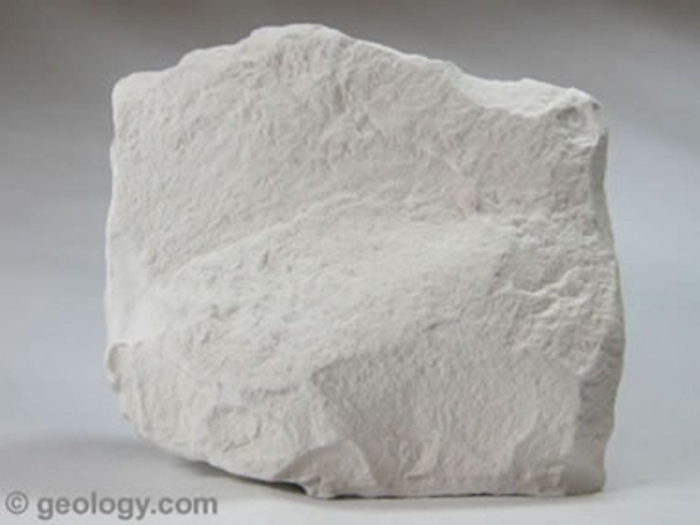
porous rock
is a rock that contains many cracks and open spaces between their particles
e.g., chalk
pervious rock
rock that allows water to soak into it
e.g., carboniferous rock - limestone

moisture saturation
Zone where water has saturated all the available pore space in the ground
channel storage
water stored in a river
transported as channel flow or river discharge

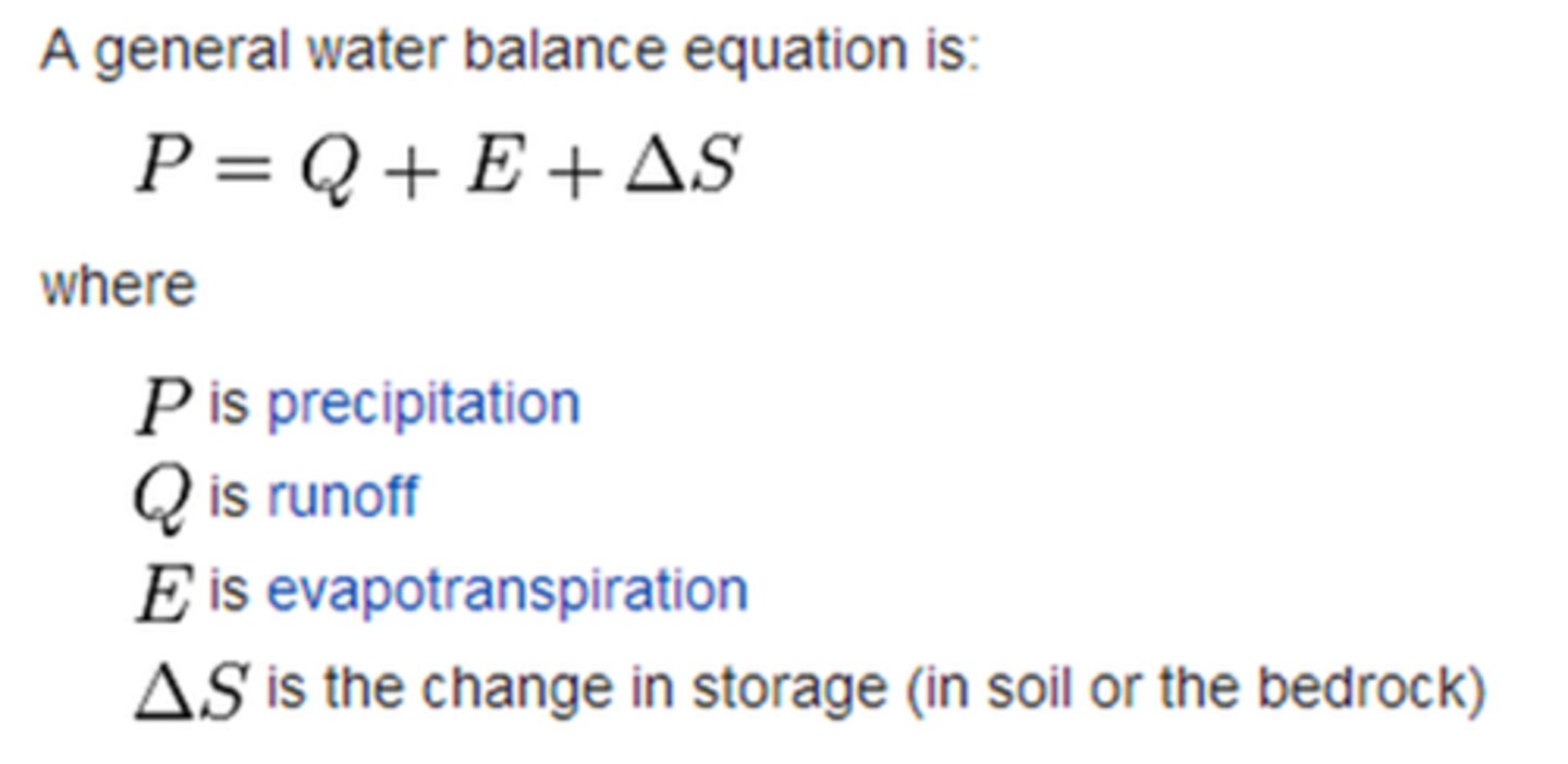
water balance
on a longer timescale there must be a balance between the inputs and outputs within a drainage basin scale system
Water balance equation
precipitation = total runoff + evapotranspiration + change in storage (in soil and rocks)
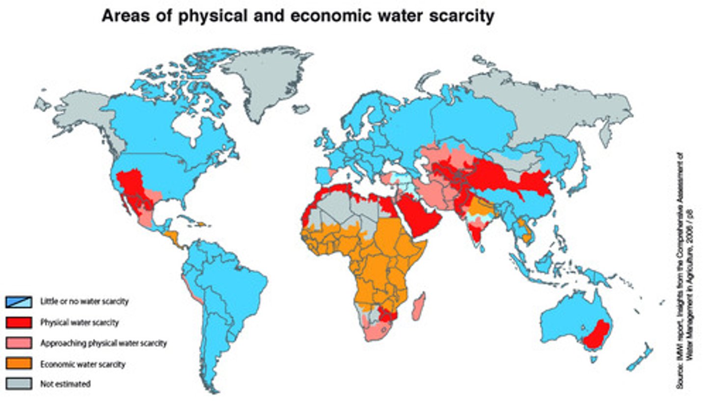
water scarcity
= a lack of water to sufficiently meet the needs of a population
driest areas receive less than 6cm of precipitation per year
9% of the worlds population suffer from water scarcity
water scarcity in Malawi
= the same size as the UK, one of the least developed countries in the world
70% of inhabitants are living on £1.50 a day
33% living in Malawi live more than a 30 minute journey from basic water facilities
... not a shortage of water but a shortage of safe water
- lack of investment into water storage and cleansing means population suffers from economic water scarcity
- over half the water is lost through the leaks or stolen before it meets mains taps
- Pollution and Contamination from farm animals, rubbish and percolation
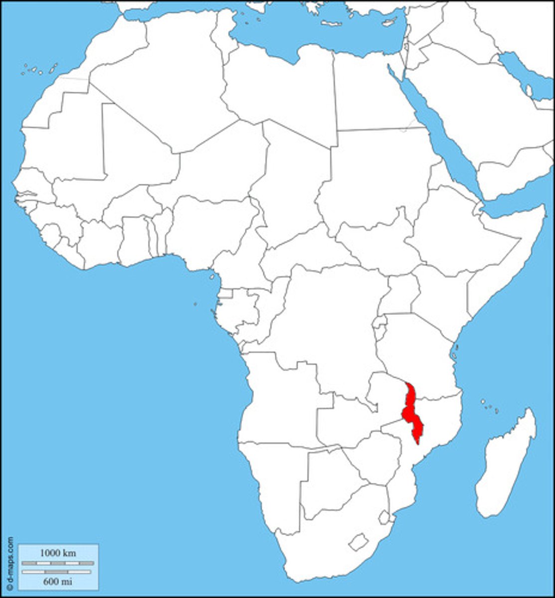
water scarcity in Malawi - Solutions
- adding chlorine and purifying chemicals to water at home
- investments into regions water infrastructure
northern hemisphere water balance
Evapotranspiration rates are highest during the summer months
Precipitation rates are highest during the winter months, and drop during summer months
soil utilisation and soil moisture recharge

soil moisture utilisation
= plants have been using the water from the soil for plant functions and evapotranspiration during the summer months
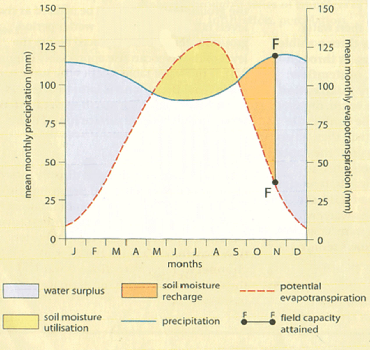
soil moisture recharge
= where water taken from soil in summer months is returned due to low pressure systems and increased precipitation in the winter months, until it reaches "F"

"F"
= field capacity attained
where water moisture levels are full within soils (saturated) so any extra water becomes surface runoff or will percolate rocks if possible
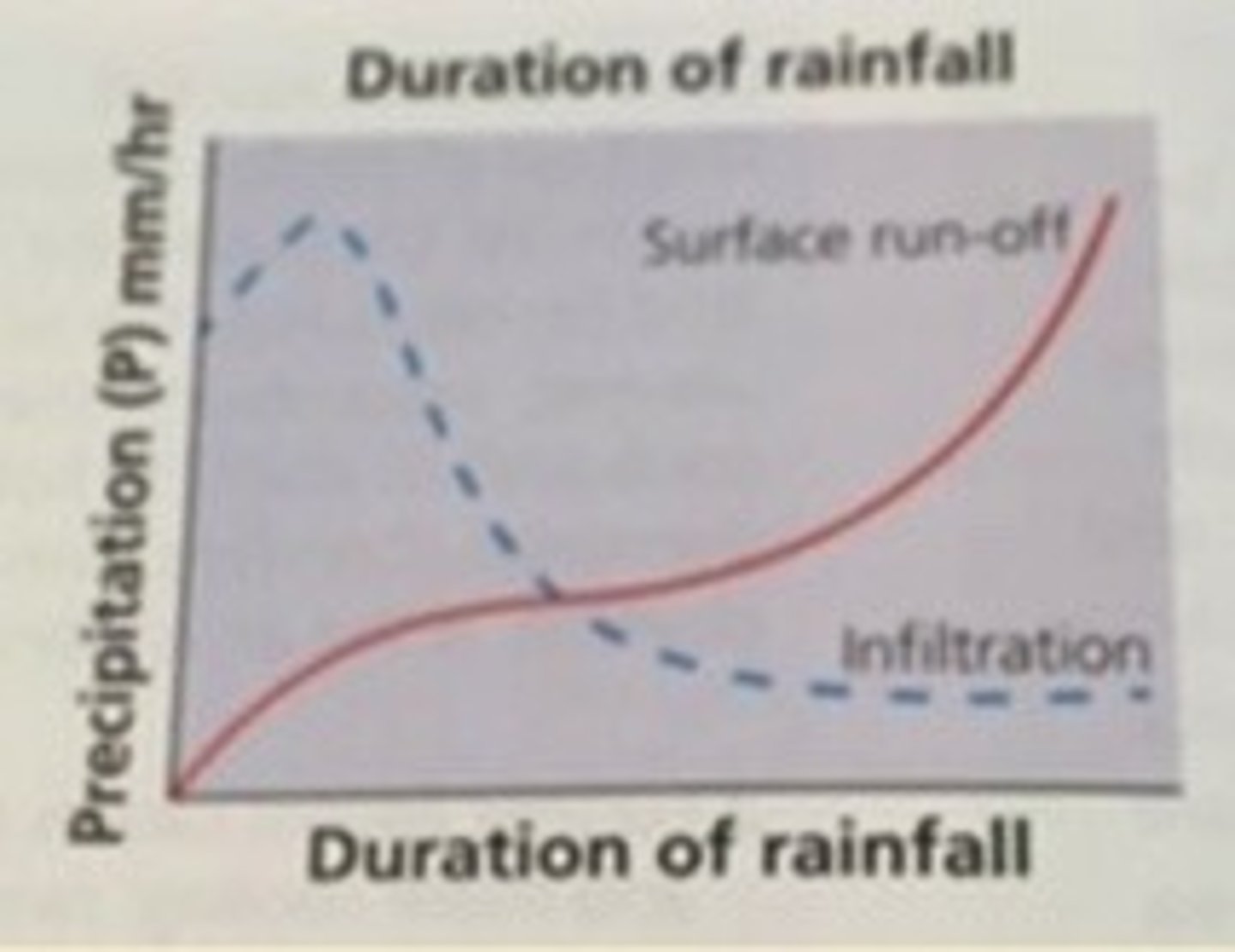
duration and infiltration rate
soil texture determines saturation level
time until reached saturation influences infiltration rate
benefits of vegetation in stormwater management
- Provides stable cover and reduces erosion
- Root structure promotes infiltration
- Transpiration of water
- Interception
- Evaporation
- Restoration of soil infiltration capacity (drying soil)
- Cycles of growth and decay to help build healthy soil
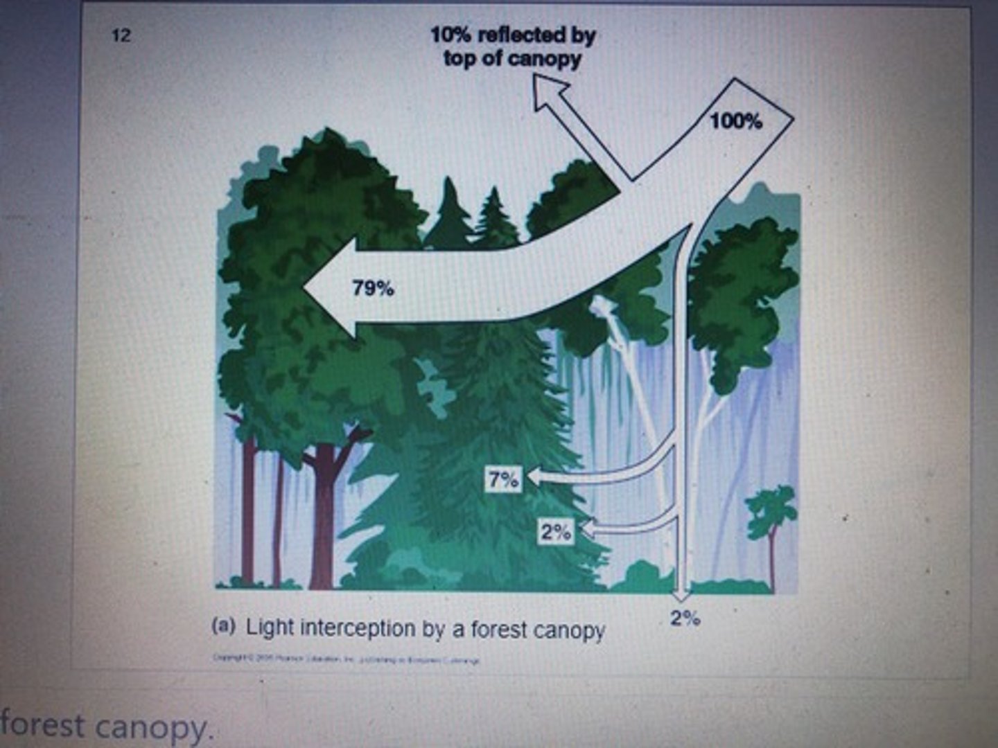
rainfall interception
- Canopy interception = 10% - 20% of water so that it does not reach the soil
- Forest floor interception = 1 - 5% and depends on thickness of litter, water holding capacity, frequency or wetting and evaporation rate
- Minimal interception of water for grass cover
Large scale global evapotranspiration rates per year
Pattern of high evapotranspiration rates per year around the equator, with northern south America countries, central African countries and south east Asian countries receiving around 1250-1500 mm/year.
Rainforests around the equator = highest annual evapotranspiration
The more north or south you go, the lower the annual evapotranspiration rates
Tropics of cancer = 0-500 mm/year (Russia, Canada, Norway)
South of tropic of Capricorn = 0-500 mm/year (Chile, Australia, South Africa)
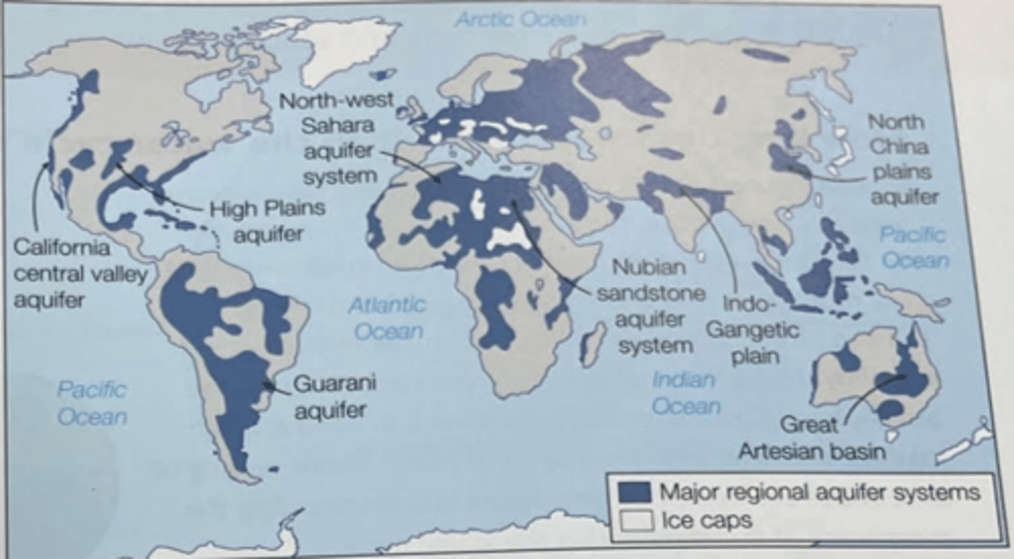
global distribution of aquifers
Large areas of complex layering from plate tectonics leads to complex hydrological structure
e.g., Andes mountain range
... fold mountains from plate tectonics
e.g., India
complex layering of flood basalts
Wide spread of distribution between local/shallow aquifers and major basins
... dependent on rock type found there and percolation possible