Southeastern Archaeology Exam 1
1/94
There's no tags or description
Looks like no tags are added yet.
Name | Mastery | Learn | Test | Matching | Spaced | Call with Kai |
|---|
No analytics yet
Send a link to your students to track their progress
95 Terms
Physiographic Provinince
A region defined by its distinct geological and physical features, including landforms, soils, and climate, which influence the cultural and environmental characteristics of its inhabitants. Each physiographic province has specific character, relief, and environment which contributes to its uniqueness.
Ecoregions
areas defined by ecological characteristics, such as climate, vegetation, and wildlife, that influence the biodiversity and ecosystems within them. Biodiversity ecoregions are relatively large areas of land or water where the proobability of encountering different species and communities at any given point remains relatively constant.
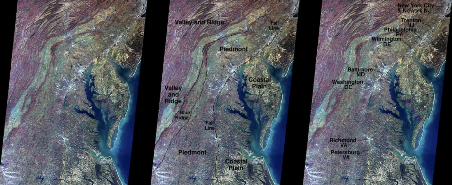
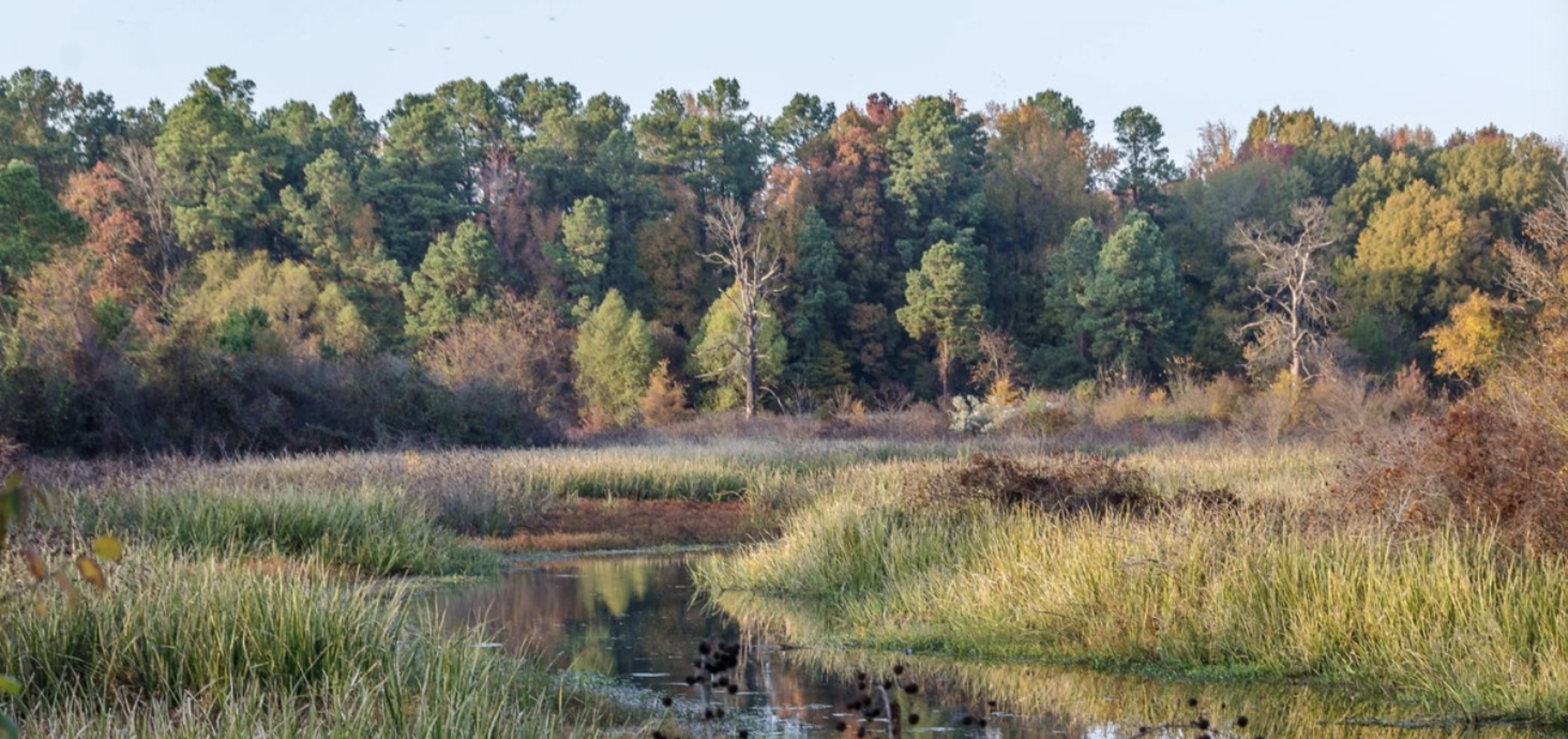
Costal Plain
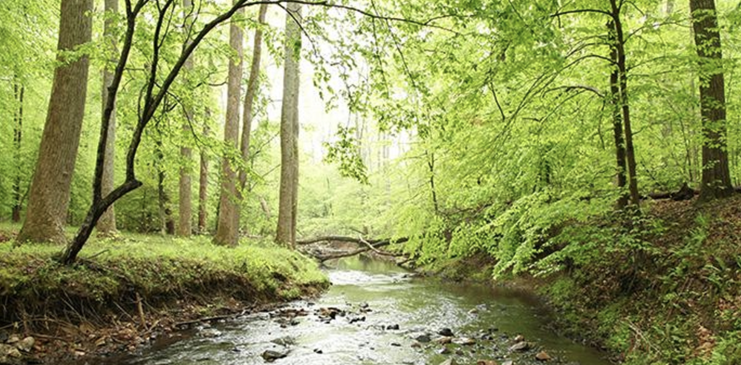
extends along the Atlantic Ocean and the Gulf of Mexico, characterized by low elevation and flat terrain. It is divided into the Outer Coastal Plain, the Middle Atlantic Coastal Plain, and the Southern Coastal Plain. This region features a variety of wetlands, estuaries, and barrier islands and typically experiences a warm climate conducive to diverse ecosystems, including forests, marshes, and agricultural areas. The soils are often poorly drained, leading to unique habitats that support a wide range of plant and animal species. The Coastal Plain is significant for its biodiversity and is often important for tourism, agriculture, and fisheries.
Piedmont
Considered the nonmountainous portion of the old Appalachians highland by physiographers, the northeast-southwest trending Piedmont ecoregion comprises a transitional area between the mostly mountains ecoregions of the Appalachians to the northwest and the relatively flat coastal plain to the southeast. soils tend to be finer textured than in coastal plain regions. potential natural vegetation here was oak-hickory pine forests; early travelers called it the sea of Oaks.
Sandhills
The ecoregion consists of a unique landscape characterized by rolling hills and sandy soils. This region is primarily found in the central part of the United States, notably in North Carolina and Nebraska. The topography features well-drained, sandy soils that support a varied flora, including longleaf pine forests, wiregrass, and an understory of diverse plants adapted to dry conditions. The Sandhills region is significant for its biodiversity, especially in terms of specialized species that thrive in its sandy substrates. The climate is generally warm, making it conducive for diverse ecosystems, while the sandy soils can retain moisture during droughts but dry out quickly during hotter periods.
Outter Coastal Plain
An ecoregion that features a low-lying landscape along the Atlantic Ocean, primarily characterized by its flat terrain and a mix of wetland and maritime ecosystems. This region includes coastal marshes, estuarine systems, barrier islands, and is influenced by tidal movements. The Outer Coastal Plain is known for its biodiversity, hosting various plant and animal species adapted to saline and brackish environments. The climate is typically warm and humid, conducive to the growth of salt marshes, and supports important habitats for migratory birds and aquatic species, making it vital for both ecological balance and recreational activities like fishing and birdwatching.
Middle Atlantic Coastal Plain
Ecoregion that stretches from Delaware to the South Carolina/Georgia border and consists of low elevation flat plains, with many swamps, marshes, and estuaries. Its low terraces, marshes, dunes, barrier islands, and beaches are underlain by unconsolidated sediments. Poorly drained soils are common, and the region has a mix of coarse and finer textured soils.
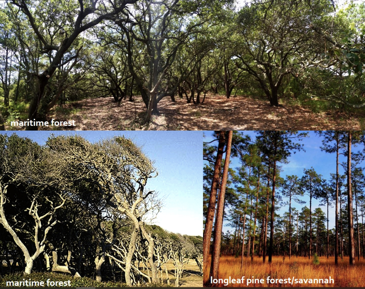
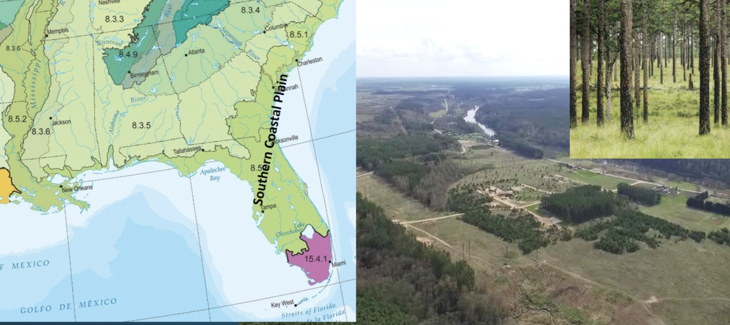
Southern Coastal Plain
This ecoregion is lower in elevation with less relied and wetter soils than the Southeastern Plains. It is warmer, more heterogeneous, and has a longer growing season and coarser texture than the middle Atlantic coastal plain. It features diverse ecosystems, including wetlands, forests, and agricultural areas, and supports a variety of plant and animal species. it consists mostly of flat plains, but it is a heterogeneous region containing barrier islands, coastal lagoons, marshes, and swampy lowlands along the Gulf and Atlantic coasts.
Southeastern Plains( Inner Coastal Plain)
These irregular plains have a mosaic of cropland, pasture, woodland, and forest. elevations and relied are greater than in the Southern Coastal Plain, but generally less than most of the Piedmon. Streams in this area are relatively low-gradient and sandy-bottomed.

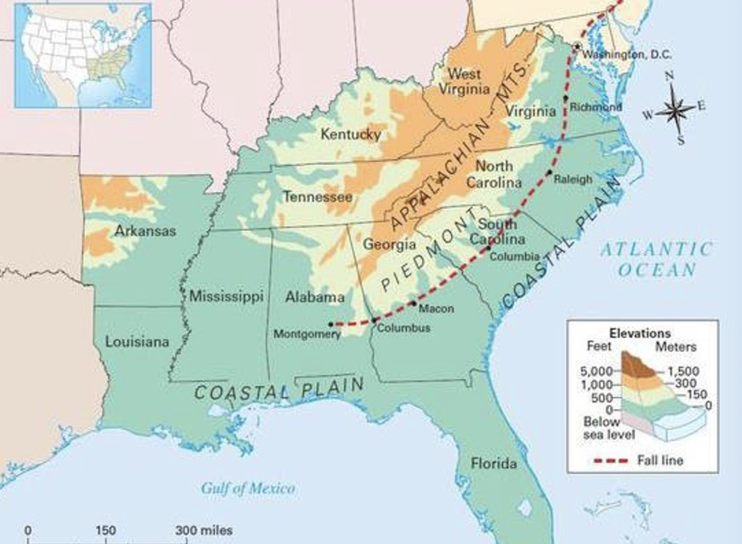
The Fall Line
a geological boundary, forming a gently sloping region that rapidly loses elevation from the north to the south. creating a series of waterfalls, the geologic regions to the north of the __ __ include the Appalachian plateau, the valley and ridge, the blue ridge, and the piedmont. The upper coastal plain and lower coastal plain regions occur south of the __ __.
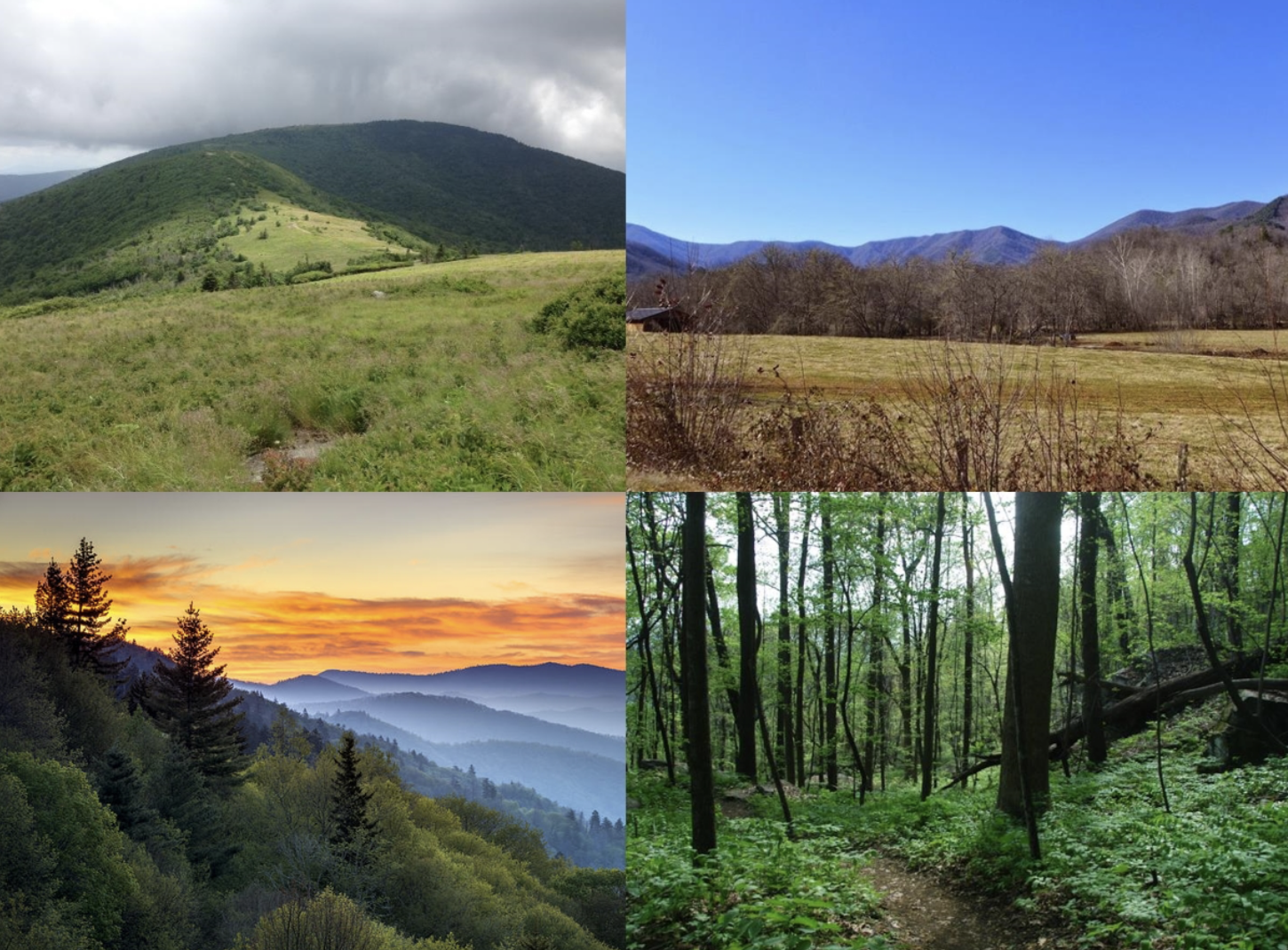
The Blue Ridge Physiographic Province
extends from southern Pennsylvania to northern Georgia, varying from narrow ridges to hilly plateaus to more massive mountainous areas(with high peaks reaching over 6600 feet), annual precipitation of over 100 inches can occur in the wettest area while dry basins can average as little as 40 inches.
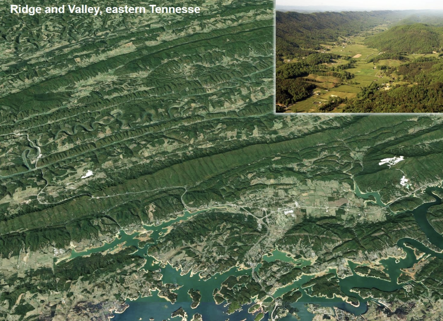
Ridge and Valley
This northeast-southwest tending, relatively low-lying, but diverse ecoregion is sandwiched between generally higher, more rugged mountainous regions with greater forest cover. Springs and caves are relatively numerous. present-day forest voer about 50% of the region. the ecoregion has a great diversity of aquatic habitats and species of fish.
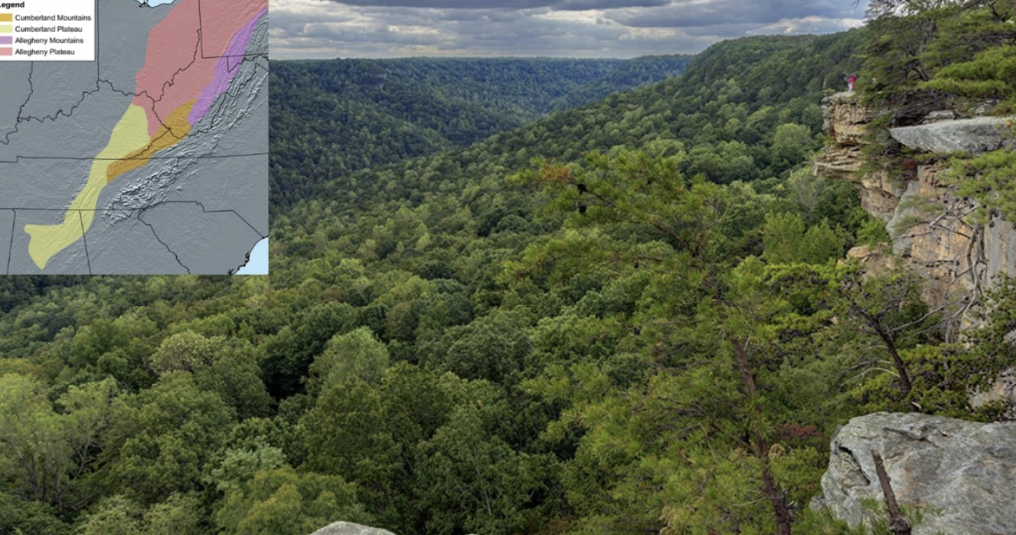
Cumberland Plateau( appalachain plateaus)
stretching from Kentucky to Alabama, these open low mountains contain a mosaic of forest and woodland with some cropland and pasture. The eastern boundary of the ecoregion is relatively smooth, only slightly notched by eastward flowing streams. The western boundary next to the interior plateau has a rougher escarpment that is more deeply incised.
Interior Low Plateaus
diverse ecoregion extending from southern India and Ohio to northern Alabama. The natural vegetation is primarily oak-hickory forest, with some areas of blue stem prairie and cedar glades.
diverse fish fauna

Mississippi Valley loess Plains
This ecoregion stretches from near the Ohio River in western Kentucky to Louisiana.
Western soils are deep, steep, silty, and erosive
flatter topography is found to the east, and streams are less gradient

Mississippi Alluvial Plain
extends along the Mississippi river from the confluence of the Ohio river and Mississippi river southward to the Gulf of Mexico. The ecoregion provides important habitats for fish and wildlife and includes the largest continuous system of wetlands in North America. It is also a major bird migration corridor used in fall and spring migrations, known as the Mississippial natural vege flyway. Potentitation is largely southern floodplain forest.
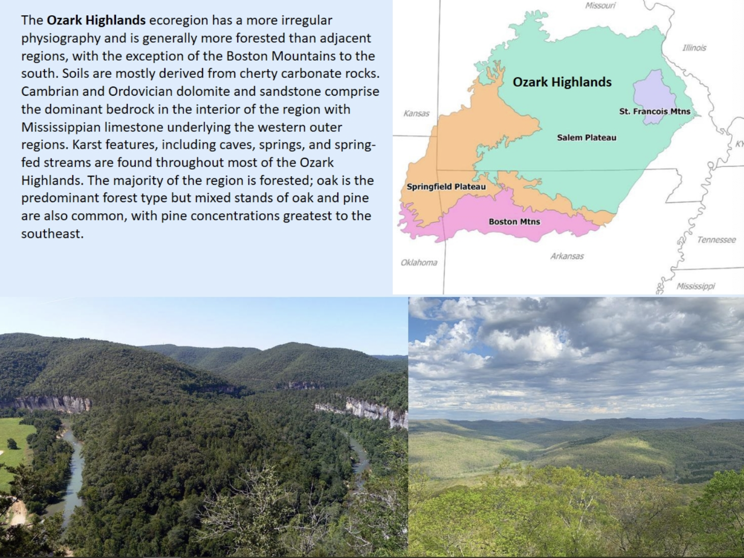
Ozark Highlands
Ecoregion has a more irregular physiography and is generally more forested than adjacent regions, with the exception of Boston mountains to the south.
Southeastern Plant and animal recources
white-tailed deer
elk(wapiti)
bison
black bear(high fat content)
red wolf
cougar, pumas, and mountain lion
racoon, opossum, striped skunk, spotted skunk, and gray fox
gray squirrel, fox squirrel, red squirrel, and chipmunk
cardinal, common crow, chickadee, and woodpecker
passenger pigeon
turkey, ruffled goose, and bobwhite quail
Southern and northern flying squirrel, muskrat, beaver, otter, and mink
Fisher aka black catamount
turtles, fish, snakes, alligator
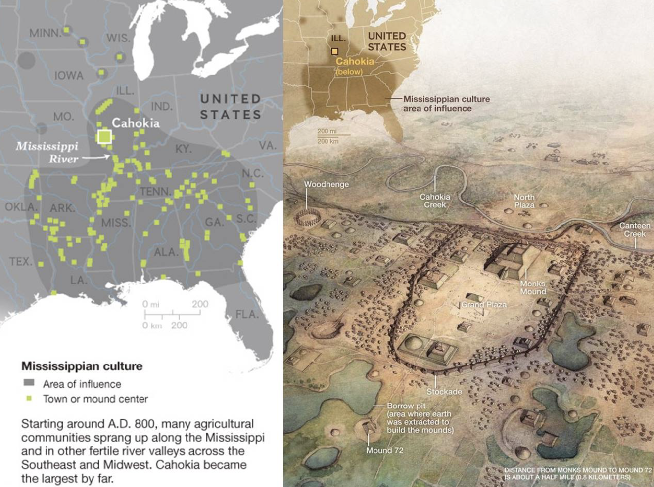
Mississippian Culture
starting around A.D. 800
Cahokia became the largest community along the Mississippi and in other fertile river valleys
Caddon Family
Caddo
Oklahoma
Arkansas
Louisiana
east Texas
Iroquoian Family
Cherokee(southern appalachian Mountains)
nottoway/meherrin(southeastern virginia)
tuscarora(northeastern north carolina)
Muskogean family
Alabama(central)
Apalachee (Tallahassee area)
Chickasaw(northern Mississippi and western Tennessee)
Choctaw(central Mississippi)
creek(central Alabama and Georgia)
Hitchiti(central Georgia)
Koasati(Northern Alabama)
mikasuki(southern georgia)
Seminole(Florida)
Siouan-catawba family
biloxi( gulf of mexico)
catawba( south carolina)
ofo( western mississippi)
quapaw( west virginia)
tutelo( western virginia)
woccon( tiwdewater north carolina)
Timucua
Northern Florida
in 1540 population 200,000+
1700 less than 1,000
by 1800 population was 0
None of the above languages
Atakapa( Texas and Louisiana coasts)
chitimacha( Mississippi delta and Louisiana)
Natchez(western Mississippi)
tunica( northwest Mississippi)
yuchi
Social and political organization
Southeastern societies were kin-based, with organization and roles at multiple scales referring to kinship
individuals
maintain strong personal autonomy but are governed by corporate norms of behavioral expectations
kinship roles and obligations
Community roles and reciprocity
Personal identity and roles are strongly linked to corporate identity, age, gendered practice, and lineage
gendered relations
individual identity and societal roles were strongly conditioned by gender
encoded into cosmology, worldview, religious belief, and ritual practice.
Households
tend to be extended
multigenerational coresidential units associated with lineage( usually matrilineage)
roles conditioned by lineage, age, and gender
Clans
Macrolineages, either real or fictive, crosscut society and communities
primary organizational feature of Southeastern societies
Membership in society is based on clan membership
moieties: some societies divided clans into moieties, (usually red and white) that parallel binary dualistic models of cosmovision
Towns and communities
multi-household coresidential and economic units, typically comprising multiple clan segments
interconnected kinship lineages
In some societies, each town is divided by moiety with specific assigned ritual roles and privileges
autonomous and self contained but often ranked
tribes and nations
largest level of kinship network
considered to be “ closed,” but kinship networks often crosscut these amorphous units
tend to be multi-town associations linked by common language, shared culture, and shared decent
women gendered roles
ancient division of roles is embedded in a cosmovision defined by dualism and balanced by opposition
regarded as nonhierarchical; complementary dualistic
Women’s domain was the plant world, production, reproduction, and controlled farming
Women’s roles are directly associated with life, fertility, food production, order, and ritual cleanliness
Men’s traditional roles
centered around hunting of deer, bison, bear, and small game
animals were viewed as the domain of men
Undertook war and diplomacy
management, disorder, and participation in chaotic affairs and “bloodiness ritually dirty”
Men led the public ceremonies and conducted government functions but ultimately deferred to women's control of town and household
Basic Social Unitt
a small village or, in some instances, a larger town, that were sometimes nucleated settlements protected by palisades. were also often social groups composed of dispersed households, families, or hamlets united around a common and ceremonial center.
council house or temple and an associated square ground
typical manifestations of public architecture
towns were often autonomous
political status of local communities varied greatly in time and space
caddo village 1870’s
settlement pattern with domestic space, public space, and ritual space all ordered within the confines of a village
has been maintained among some southeast groups up to the modern era
in this settlement pattern local houses varied considerably but a community often had a common area where political and ceremonial activities took place
town in the southeastern native sense
social and political organization similar to our contemporary concept of church congregation rather than a simply voluntary residential organization
You are born into your mother’s town, and your affiliation and allegiance to that group of people continue throughout your life
Your town is your primary identity
political organization
complex chiefdoms of the Mississippian and early contact period encompassed wide regions and numerous ethnic groups within an integrated and political and ideological sphere
Social stratification also varied widely between groups and through time
apical chiefdoms and totally egalitarian bands existed simultaneously across the southeast
Cosmovision
a general perception of the world including ideas about structure, origin and relation of human life to those concepts
Axis Mundi
world axis
center intergrative link
connection of human to supernatural
Above world
place of order and harmony
sun, thunders, and morning star
this world
flat plan floating on sea
beneath world
place of chaos and death but also rebirth and fertility
underwater panther, snakes, and horned serpent
the night sky with the stars and the moon
path of souls
journey of dead through sky vault along milky way to portal to enter world of the dead
Dualism, balance, and cyclicity as pervasive principles
ritual intended to rebalance world forces; observances and events occur in varied cycles
humans viewed as weak, flawed actors; not human-centric system
presence of embodied supernaturals
immortals
little people
horned serpents
transgress layered domains via portals
ability to interact with humans to bestow special knowledge or abilities or to correct transgressions
“medicine” as mediation
restore balance
connection to supernaturals
health of individuals and community closely linked to religious practice
knowledge based rather than power based
“medicine” knowledge widely shared
ritual knowledge as currency
shared across cultural groups and identities
constitutes integrative tool
maize based economies and societies
important to the southeast for the last 1000 years
surplus production of maize and control and direction of surpluses were the bases for increasing political complexity and residential stability among southeast native societies
observance of green corn ceremony( 4-7 day long festival of ritual dances that mark the high point of the annual ritual cycles)
Indigenious origin traditions
cite in both emergence from caves and/or migrations from unknown lands
Thomas Jefferson
hypothesized where the inhabitants of America came from
said people might have passed from Asia into America over these straits
resemblances between Indigenous peoples of America and those of Siberia Eastern Asia would suggest then that the former indigenous American are descendants of the latter
Ales Hrdicka
the Czech-born father of American physical anthropology
affirmed human colonization of the American continent from east Asia via migration across the bearing strait
asserted 3000 year timeline
George McJunkin
african american ranch foreman
discovery of indusputable artifacts with indisputable pleistocene(ice age)faunal remains
Folsom
broke through the ice age barrier
overturned the absence of ice age humans in the america’s
Clovis
culture sites were not chronometrically dated until 1964
considered element of the Paleoindian period which corresponds with the first peopling of the western hemisphere
materials in Alaska are sparse and chronologically late
Pre-clovis
considered element of the Paleoindian period which corresponds with the first peopling of the western hemisphere
Siberia
presumed region of origin for Paleoindian peoples
yielded no Clovis culture sites or anything that looks like a direct precursor
Paleogenomics
advances in extraction and sequencing of DNA
revolutionized our understanding of the origins and timing of the peopling of Americas
provides insights into the genetic connections between ancient populations in siberia and native American groups
The late glacial interstadial
when humans spread through the americas
Molecular genetics
Spread from south Siberia
Beringia
Connected Siberia and the americas
Paleoamericans
diverged from ancient PaleoSiberians about 24,000 years ago
Southward expansion
appears to have been a rapid expasions establishing populations all the way to souther chile 14,500 years ago
mississippi river
Green

tennessee river
Peach

savannah river
Light pink

cumberland river
Blue

chattahoochee river
Dark pink

tombigbee river
Red

oconee river
Brown

red river
Orange
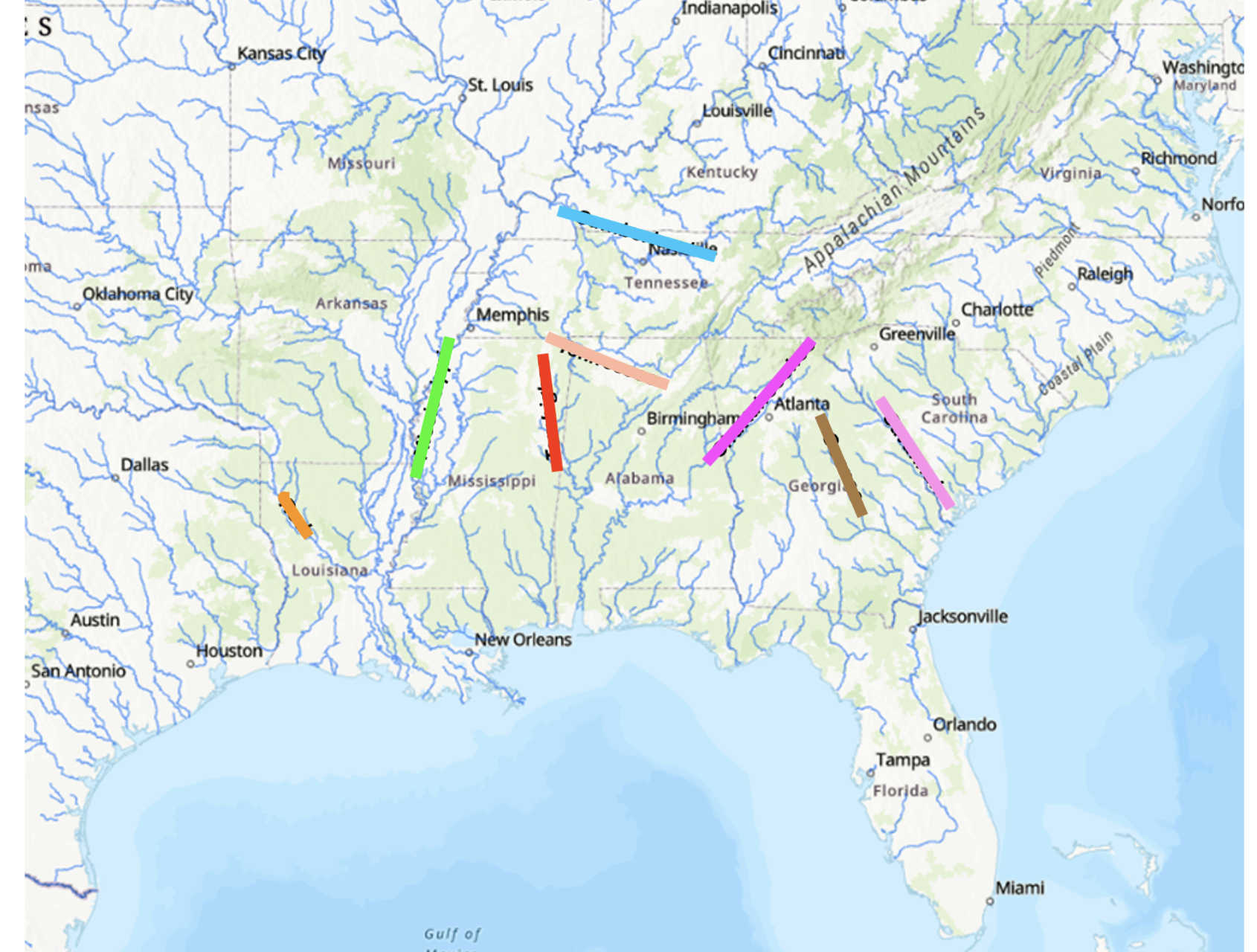
Arkanas river
not marked

Topper SC
green

Dust cave
Dark pink
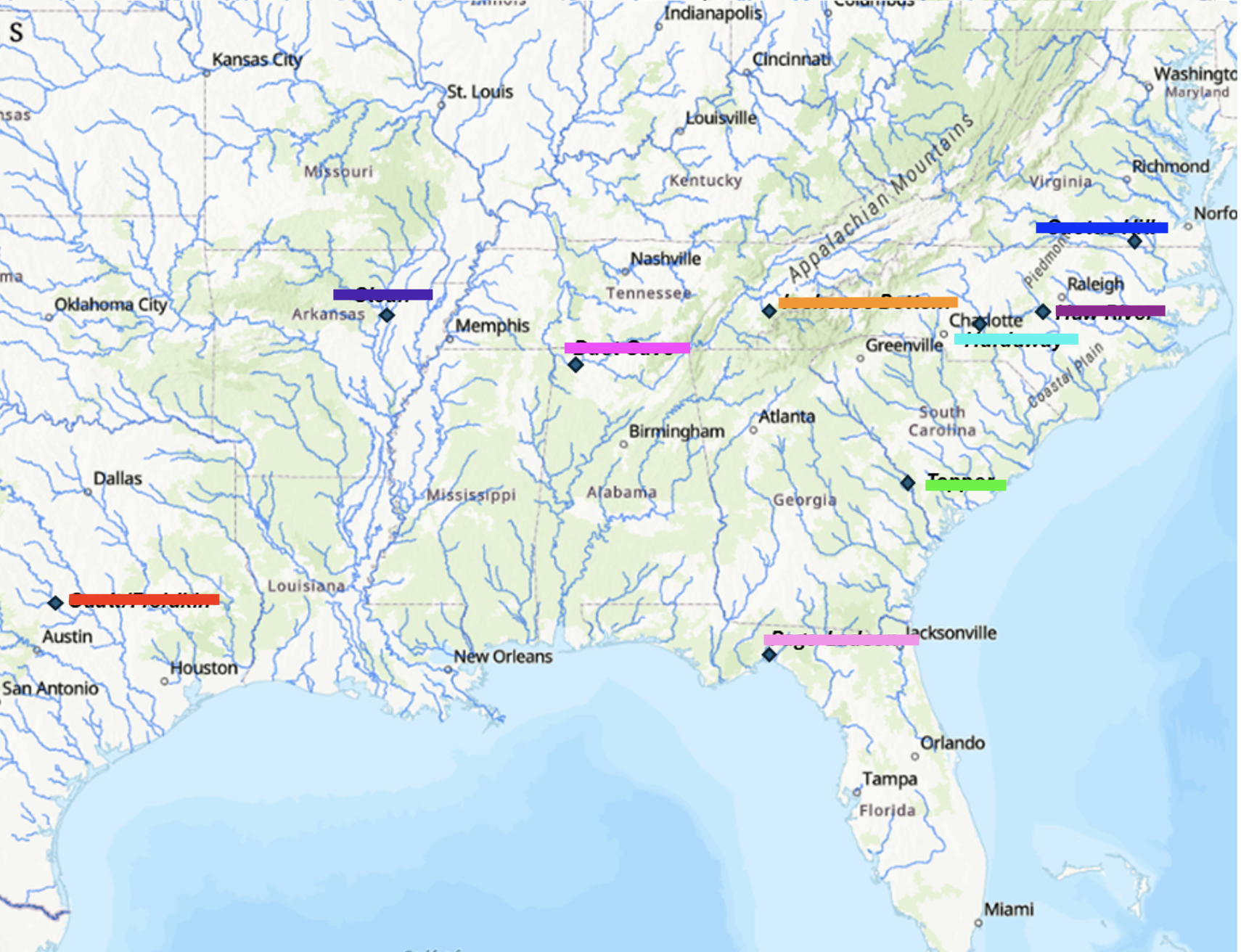
Gault/Freidkin
Red

Hardway NC
light blue

Icehouse Bottom
Orange

Slaon Site
purple

Haw river
Maroon

Cactus Hill
dark blue

Page-ladson
light pink

Coastal Plain
7
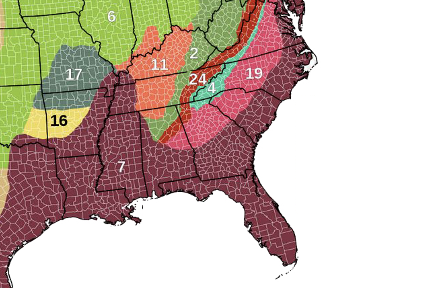
Piedmont
19

Blue ridge
4

Valley and Ridge
24

Appalachain Plateaus
2

interior low plateaus
11

centeral lowlands
6

ozark plateaus
17

ouachita
16

What are the Major objective of archaeology? what are we trying to do?
Major Objectives
develop temporal sequences of past cultures: employing excavations and analysis based on scientific principals
reconstruct the lifeways of the past human societies
understand cultural processes
trying to do
understand cultural evolution
connect the past to the present
preserve and interpret cultural heritage: protection of sites from destruction, excavations take place to find artifacts to try and understand what their everyday life was like
track climate change effects, recourse use, and land management
What and why are curated technologies give examples.
tools and artifacts that were designed for long-term use, maintenance, and transport
why?
efficiency: reusable and durable
scarcity of raw materials: helped materials last longer
versatility: multifunctional and most of the time capable of being adapted
examples:
Clovis composite spear system: binding and shaft
blades and knives
ground stone tools: axes and grinding stones
bones and antlers: organic tools that were sharpened and repurposed
Discuss models for Early Archaic period settlement organization.
hunter-gatherer theory: corner notches and side-notched points related to hunting smaller game, serrated edge as a result of resharpening(maximum perseverance of the blade width
Economic diversity: increased use of local materials
Changes in mobility
regionalization: more sites increasing population
all in the context of climate change toward modern conditions
residential(whole group moves to follow resources)
High mobility model
Residential mobility model: moves during the year, for example, forager
Logistical mobility model: fewer residential moves, for example, collectors
the hunter-gatherer theory emphasizes the use of specialized tools for hunting smaller game, which indicates adaptation to available resources; economic diversity points to a reliance on local materials, reflecting resource management; changes in mobility patterns showcase how human behavior shifted in response to environmental changes; and regionalization indicates growth in population and site numbers due to these adaptations.
what was the “mound builder myth, and what were its effects of the development of southeastern archaeology?
widely held belief that the large earthen mounds found across the southeast were built by a superior race and that they couldn’t be built by indigenous peoples.
excavation claims of very tall individual remains
debunked in the late 1870s when conclusive evidence of no physical difference between the people buried in the mounds and modern Indigenous peoples
delayed recognition of Indigenous achievements → primitive and incapable of complex society-building
destruction of sites for looting and supposed evidence of a lost race
both positive and negative