APHG Unit 1 Flashcards
1/46
Earn XP
Name | Mastery | Learn | Test | Matching | Spaced |
|---|
No study sessions yet.
47 Terms
Absolute Distance
The distance between two points, communicated using precise quantitative units of measurements.
Absolute Location
The precise place where something can be found, often described using latitude and longitude coordinates.
Cartogram
A map where the sizes of places are distorted in order to represent some specific statistic.
Cartography
The art and science of mapmaking - representing a geographic area on a flat surface.
Choropleth Map
Maps that use various colors, shades or patterns to show the location and distribution of spatial data.
Clustered
A descriptor for when there is a high level of density and a low level of distribution of data.
Conic Projection
A map projection used primarily for reginal mapping, as size and shape are preserved but direction is very distorted due to latitude lines converging at only one pole.
Density
How often or how much something occurs within a space
Dispersed
A descriptor for when there is a low level of density due to a high level of distribution.
Distance Decay
The theory that the interaction between two places decreases as the distance between them increases.
Distribution
Where something occurs within a space.
Dot Distribution Map
A map that shows the specific location and distribution of something using dots. Each dot represents a specific quantity.
Environmental Determinism
A philosophy that states that human behaviors and culture are a direct result of the surrounding environment.
Formal region
An area defined by official boundaries, that is created on the basis of one or more shared chararistics.
Functional Region
An area organized around a node or focal point and defined by an activity that occurs across the region
Geographic information system
A computer system that captures, stores, analyzes, and displays geographic data.
Globalization
The spread of businesses, products, people and ideas around the world.
Global Positioning System
The system that determines the precise location of something on Earth using satellites and receivers.
Isoline map
A map that uses lines that connect points of equal distance to depict variations in data. The distance between the lines indicates a change.
Latitude
The distance north or south of the Equator
Locator map
Illustrations used in books and advertising to show specific locations mentioned in the text.
Longitude
The distance east or west of the Prime Meridian (imaginary line that runs from pole to pole through Greenwich, England, which marks 0 degrees)
Map Projection
Th process of showing a curved surface on a flat surface.
Map scale
The ratio between the size of things in the real world and the size of things on a map.
Mercator Projection
A map projection used primarily for navigation that accurately depicts direction and the shape of land masses near the equator. The size of land masses is distorted, especially near the poles.
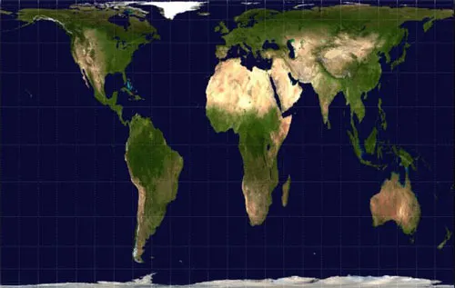
Peters Projection
A map projection that depicts the size of land masses accurately and is best used for illustrating spatial distribution. The shape of land masses is distorted, especially near the poles.
Physical Map
A map that shows natural features, such as mountains, rivers, and deserts.
Plat Map
A map that shows property lines and details of land ownership.
Political map
A map that shows human-created boundaries and designations like countries, states, cities, and capitals.
Possibilism
The theory that the environmental conditions of a place can limit its culture but that culture is primarily determined by social conditions.
Qualitative Data
Humanistic data that is not represented as a statistic and is collected through means such as interviews, surveys, or observation.
Quantitative Data
Data associated with mathematical models and statistical techniques.
Reference Map
A map designed for people to refer to for general information about places.
Region
An area defined by one or more traits, characteristics, or features that make it different from surrounding areas.
Relative Distance
Distance measured using metrics like time, effort, or cost.
Relative Location
The description of where something is in relation to something else.
Remote sensing
The process of capturing images of Earth’s surface from the air, using things like satellites or planes.
Road Map
A map that shows highways, streets, and alleys.
Robinson Projection
A map projection most commonly used for education or display purposes that has no glaring distortion but area, shape, size, and direction are all slightly distorted.

Scale of Analysis
The level at which data in a map is displayed.
Site
The physical character of a place (combination of physical features like climate, water sources, vegetation, and elevation that help give a place a distinct character.)
Situation
Where something is located relative to its surrounding features.
Sustainability
Use of Earth’s resources in ways that ensure their availability for future generations to use.
Thematic Map
Maps that show spatial aspects of information or a type of phenomenon.
Time-Space Compression
The reduction in the time it take to diffuse something to a distant place, as the result of improved communication and transportation technologies.
Toponym
The name given to a place on Earth.
Vernacular Region
An area that people believe exists as part of their cultural identity. Boundaries vary widely because people have a different sense of what defines and unites this type of region.