The River Brock case study
 Call Kai
 Learn
Learn Practice Test
 Spaced Repetition
 Match
Match Flashcards
 Knowt Play
1/7

There's no tags or description
Looks like no tags are added yet.
Name | Mastery | Learn | Test | Matching | Spaced | Call with Kai | Chat |
|---|
No analytics yet
Send a link to your students to track their progress
8 Terms
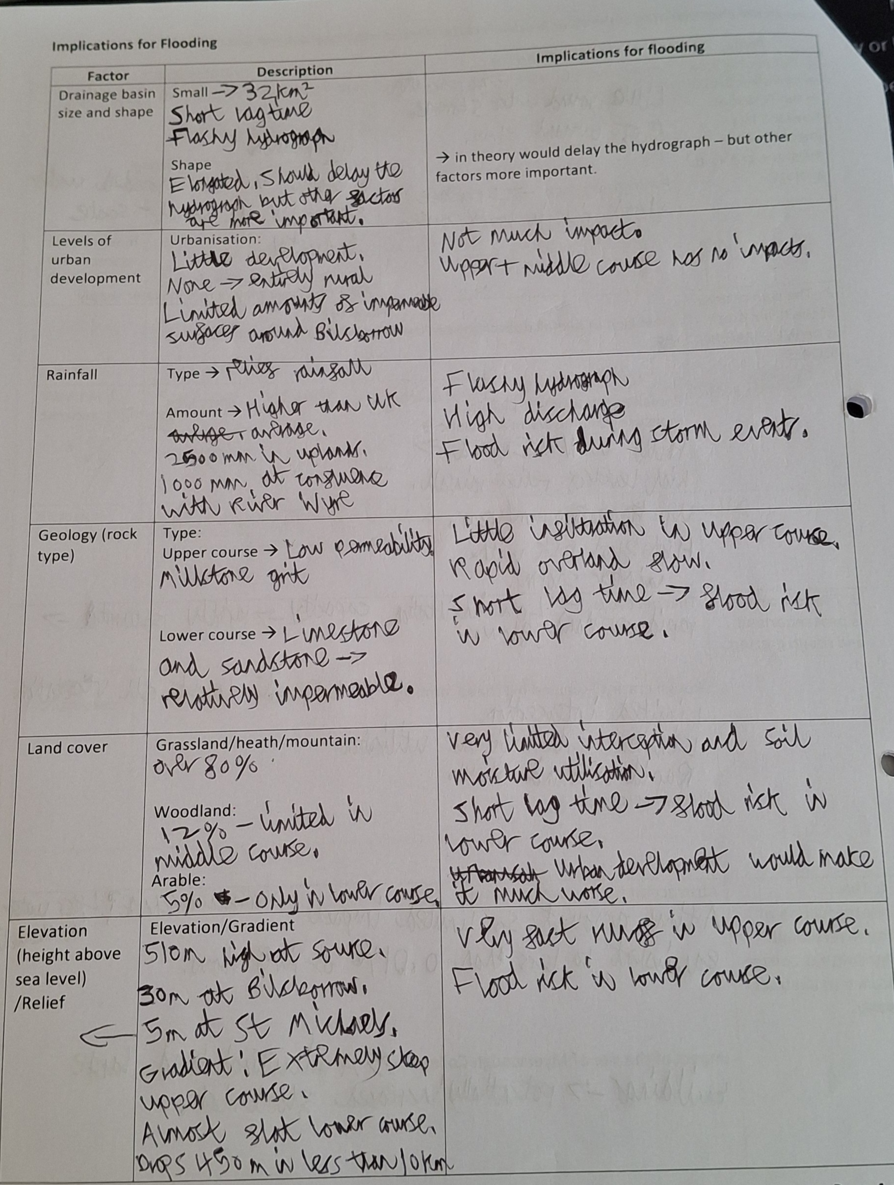
How big is the River Brock’s catchment area and what type of area is it?
32Km2
It drains an entirely rural area
It is a 17.8km narrow elongated basin
Source in the Forest of Bowland and tributary of the River Wyre - confluence in St Michaels
What is the rock and soil type like along the River Brock?
Millstone grit hills are impermeable north and carboniferous limestone(permeable) to the south
Grass and peat soil types on high moors and boulder clay lower down
What are the human impacts on the River Brock?
Flow is almost completely natural with limited human impacts - 95% of the flow is unaffected by humans
Beacon Fell regulates water flow/quality in the catchment
Myserscough College have a license to abstract a maximum of 45m3 per day with an annual maximum of 16592m3
What is the upper, middle and lower course like of the River Brock?
Source at Fairsnape Fell - 510m above sea level with a steep upper course where hill sheep farming takes place
Less steep middle course where there is a narrow wooded valley
The lower course is almost completely flat with a confluence as St Michael’s 60m above sea level. Dairy farms are situated along the lower course
What is the river channel like?
Narrow, shallow, often meanders
Range of widths and lots of deposited material
What is the weather like in the River Brock drainage basin
Seasonal changes in discharge with a lot of precipitation
In England so temperate climate
How do the characteristics of the River Brock affect transfers, stores, flood risk and water supply
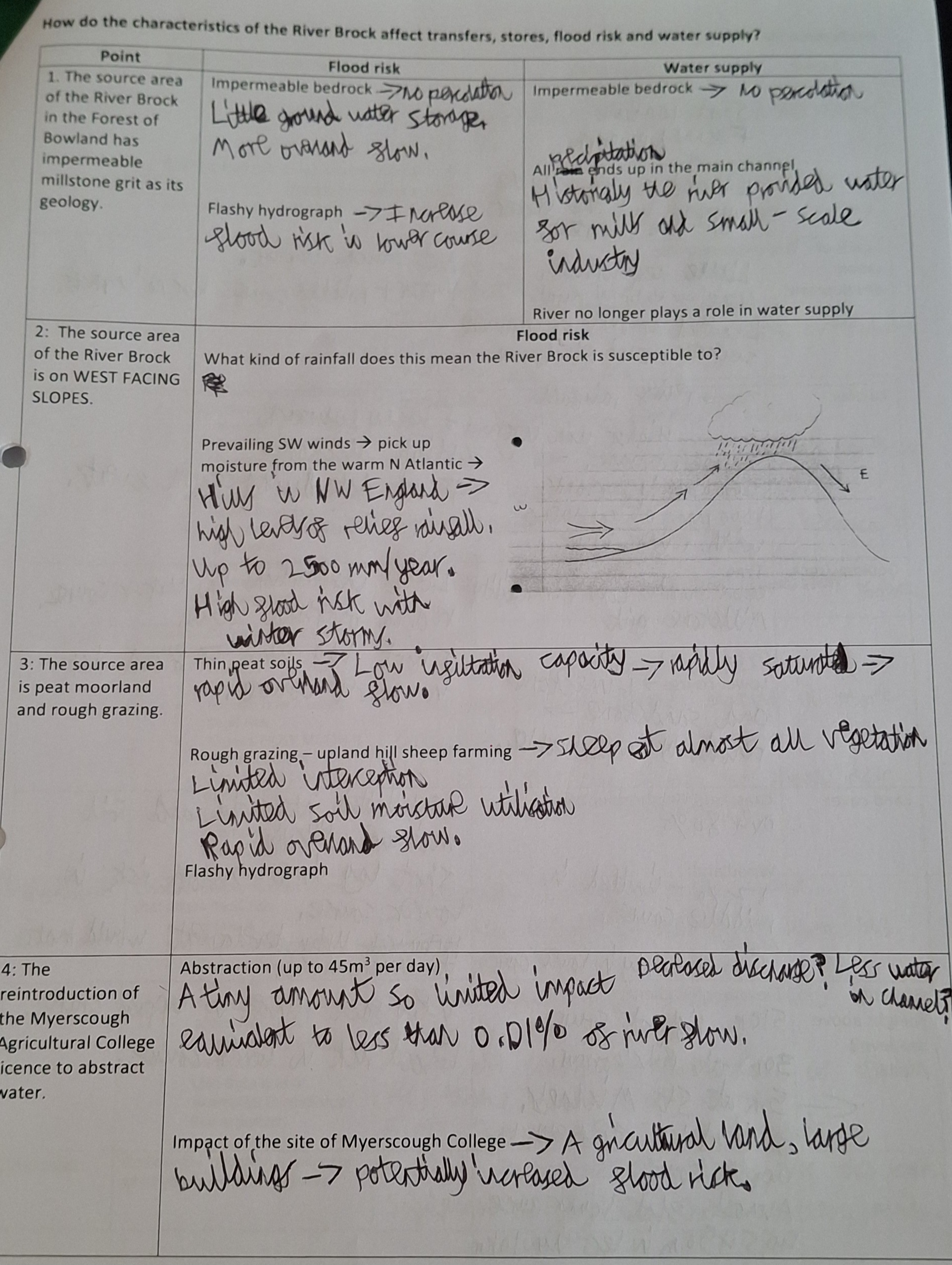
How do the characteristics of the River Brock affect transfers, stores, flood risk and water supply