Topography
1/14
There's no tags or description
Looks like no tags are added yet.
Name | Mastery | Learn | Test | Matching | Spaced |
|---|
No study sessions yet.
15 Terms
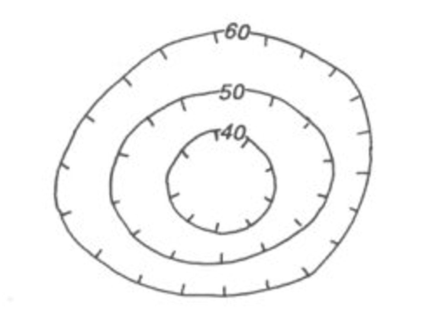
contour lines
lines that connect points of equal elevation
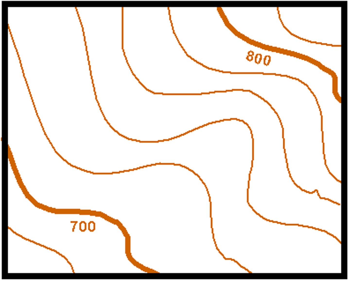
index contour lines
A contour lines that is darker than nearby lines and has its elevation labeled.
compass rose
shows direction on a map (especially north)
topographic map
shows an area's shape, height and land features by using contour lines.
Hatch marks/hachures
dashes on contour lines that show low lying areas (depressions) on a topographic map
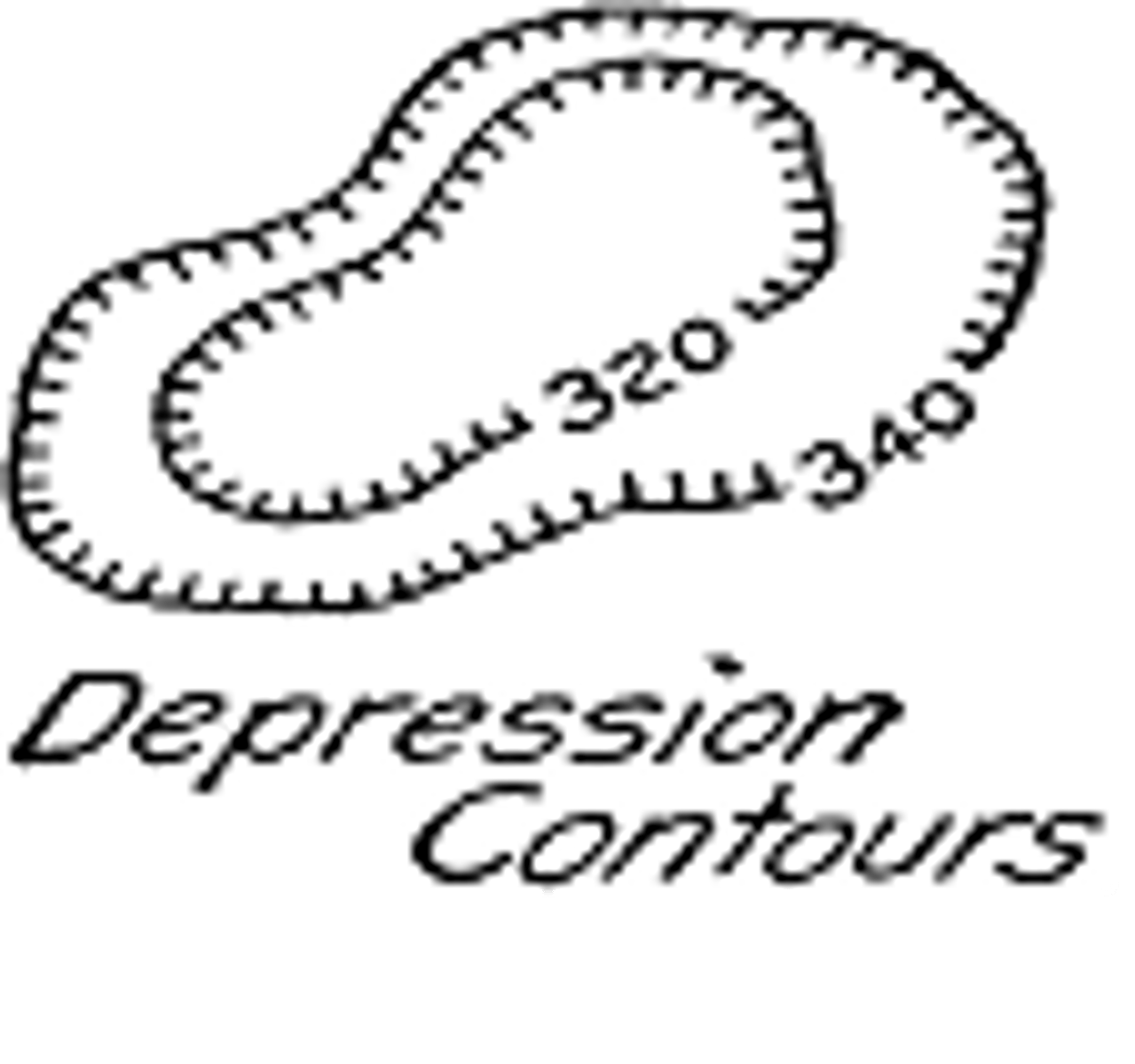
depression
shown by hatch marks on contour lines
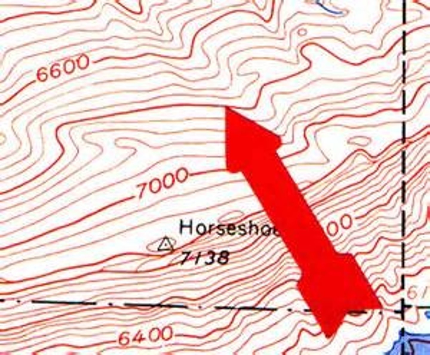
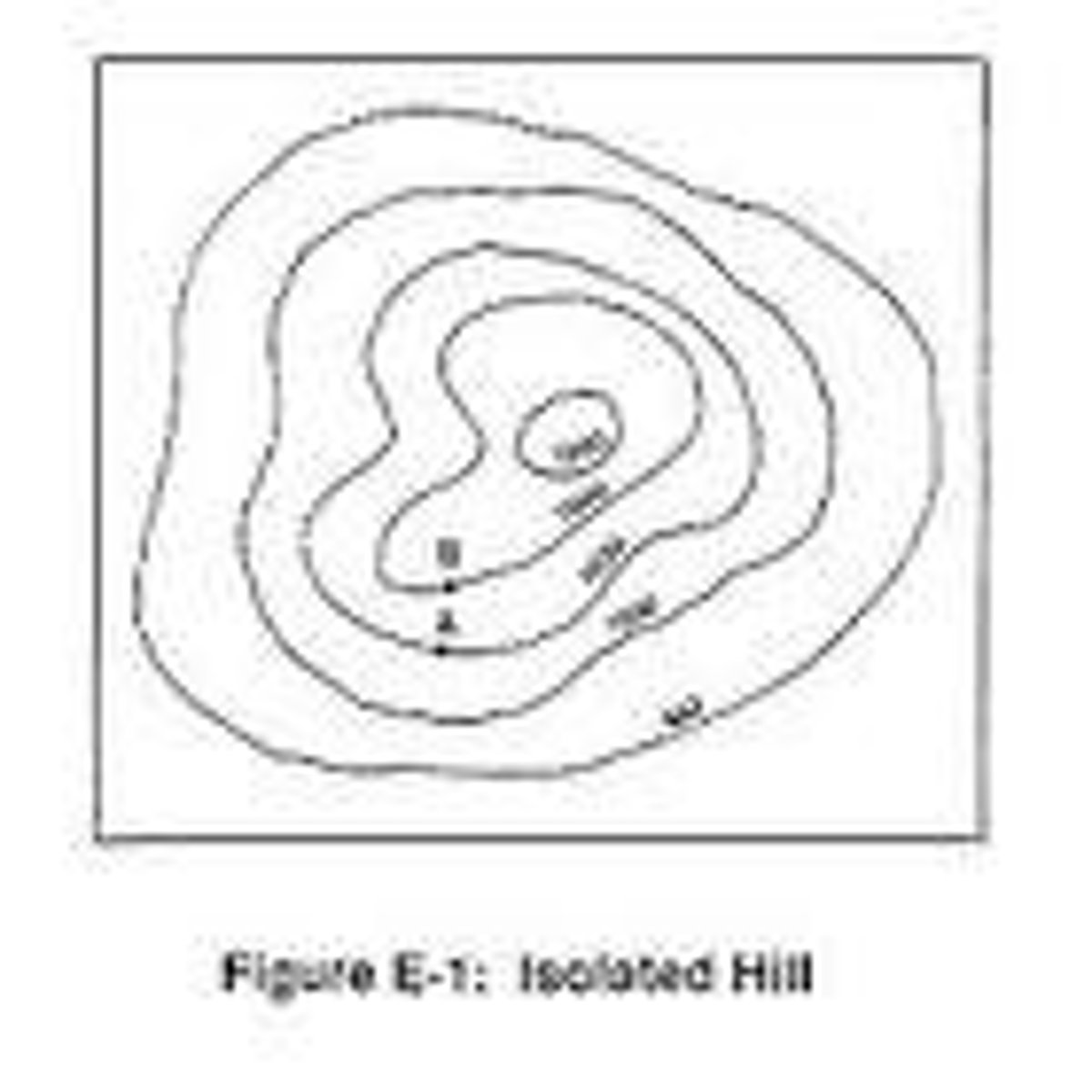
indicates a hill or mountain
Rings of consecutively smaller contours lines, rings inside rings
highest possible elevation of a hill/mountain
one number below what the actual elevation would be if there was another contour line
possible elevation of an area at the top of a hill /mountain
a range value of elevation from the last contour line up to the last possible value before another contour line would be drawn
contour interval
the change in elevation from contour line to contour line
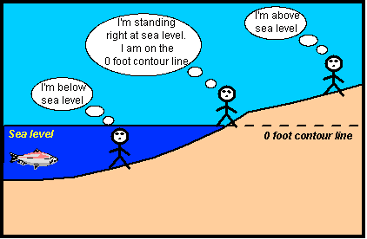
elevation
height above sea level
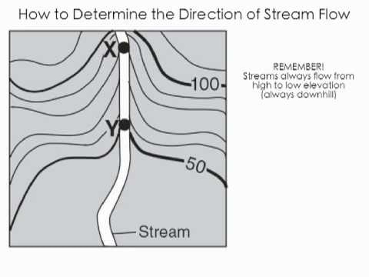
stream flow
always flow opposite the "bends" , v-shaped lines in the contour lines
relief
difference in elevation between highest and lowest parts of an area
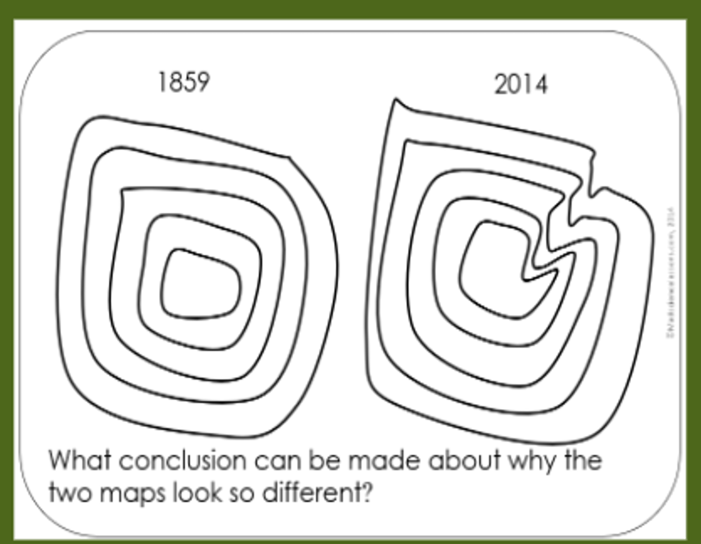
steepness on a hill/ mountain
contour lines are stacked real close together
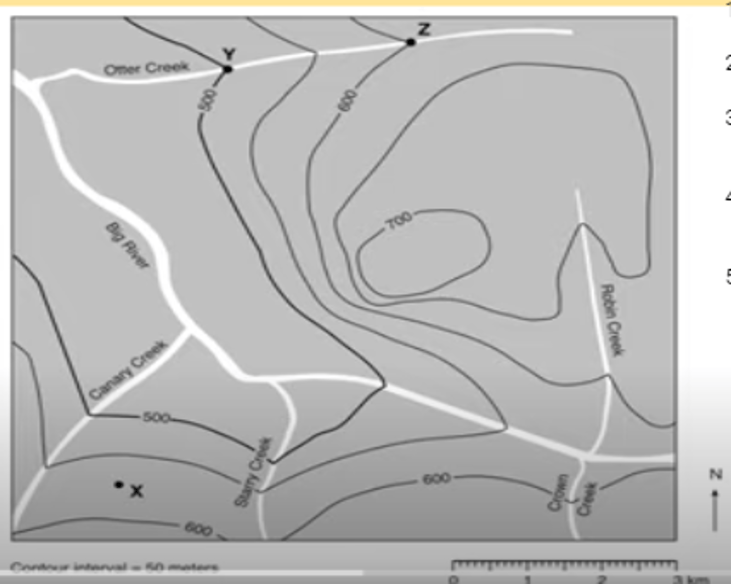
low steepness on a hill/mountain
contour lines are further apart