Wetland Delineation
1/25
There's no tags or description
Looks like no tags are added yet.
Name | Mastery | Learn | Test | Matching | Spaced | Call with Kai | Chat |
|---|
No analytics yet
Send a link to your students to track their progress
26 Terms
What legislation requires a permit before dredging or filling in US wetlands?
Section 404 of CWA
Requires permittees to avoid and minimize wetland impacts & provide compensatory mitigation for unavoidable impacts
Delineate def
"to mark the outline of"
Wetland delineation def
outline wetland boundaries
Why is delineating important?
it determines whether its necessary to obtain a Section 404 permit to dredge or fill wetland
How do we know how to evaluate and delineate?
the USACOE (1987) published technical manual based on soils, hydrology, and vegetation.
(often used for environmental consulting)
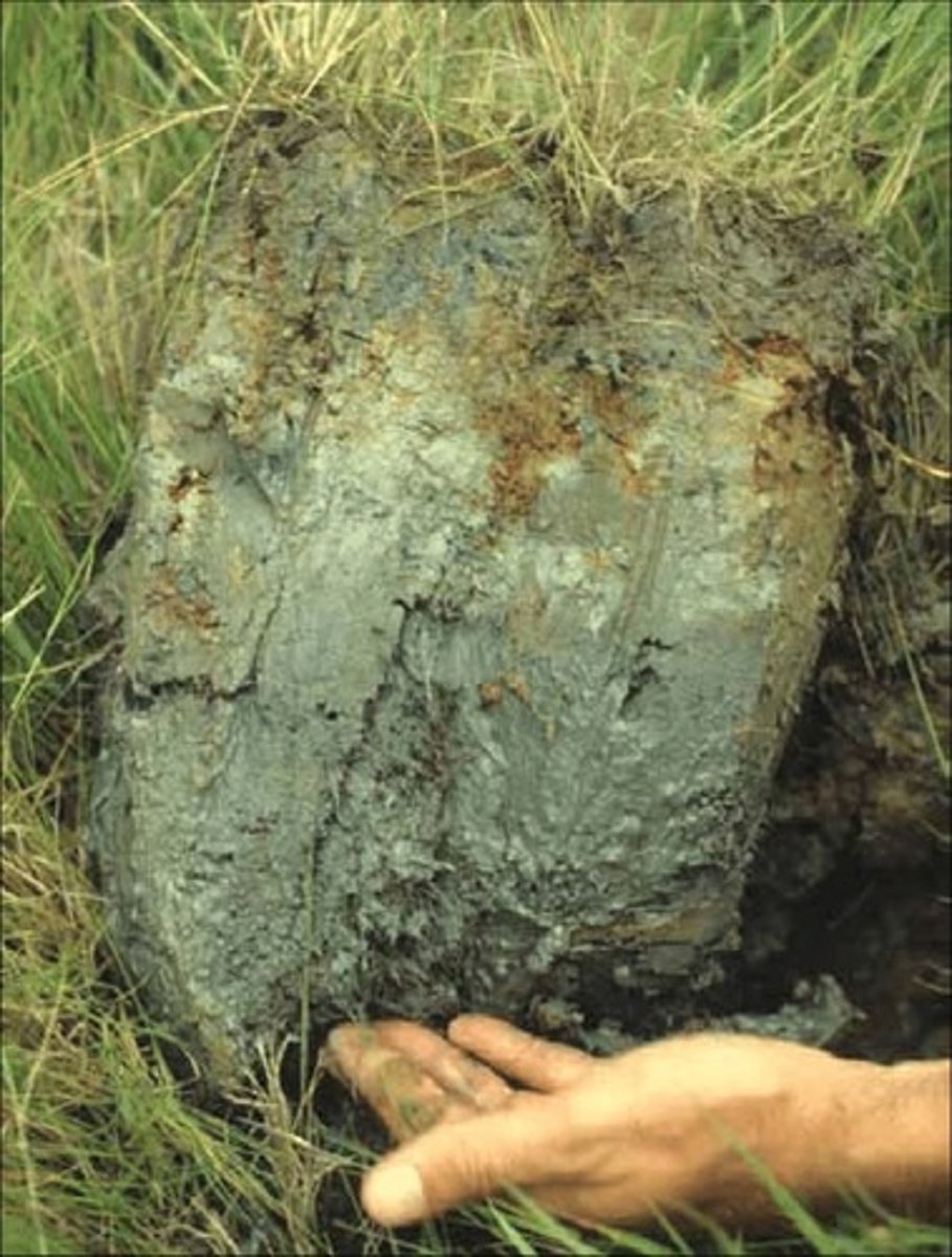
What to initially look for when determining if a soil is hydric...
- low chroma, gleying, reduced soils
- rhizospheric oxidation
- peaty, fibrous
- hydrogen sulfide smell (rotten eggs)
7 Criteria for Non-Sandy hydric soils
- Organic soils (histosols)
- Histic epipedons (surface soils rich w/ organic matter, saturated 30 days most years)
- Sulfide material
- Aquic or peraquic moisture regime: ground water present
- Reducing soil conditions (reduced aka ferrous iron)
- Soil colors: gleyed, mottled, low chroma
- Soil on hydric soils list
3 aspects of Munsell soil color chart
1. Hue = Main color (R,YR,Y)
2. Value = degree of lightness (0 = black to 10 = white)
3. Chroma = color strength, vibrancy (0-10)
Munsell color chart for hydric soils
- chroma < 2 if mottles present
- chroma ≤ 1 if mottles not present
- low chroma, reduced, grayish
Indicators of Hydrophytic Vegetation
dom species are:
- obligate (OBL) >99%
- Facultative wetland (FACW) 67-99%
4 Ways to Assess Hydrophytic Veg
- Rapid Test
- Dominance test
- Prevalence index
- Morphological adaptations
Rapid test
- all dom species are OBL or FACW
- quickest method for obvious cases
Dominance test
- based on % cover
- more than 50% of dominant plants across all strata are OBL, FACW or FAC
Prevalence index
index ≤ 3 = hydrophytic veg dominance
*index calculations performed with dominance test results*
Morphological adaptations
- adventitious roots, lenticels, multi-stemmed trunks, shallow roots
- must be observed on more than 50% of individuals of a FACU species living in area
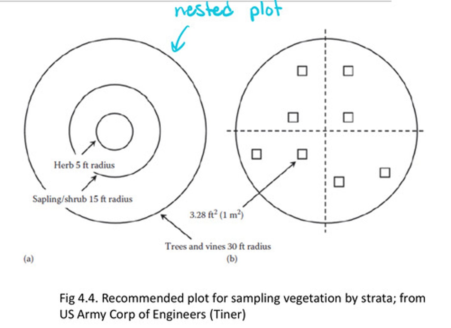
Delineation veg sampling
- nested plots of multiple strata
o for patchy/heterogeneous herbaceous layer nested 1 x 1m quadrats useful
o use avg. cover for hydrophytic determination
- percent cover is main abundance measure for all species
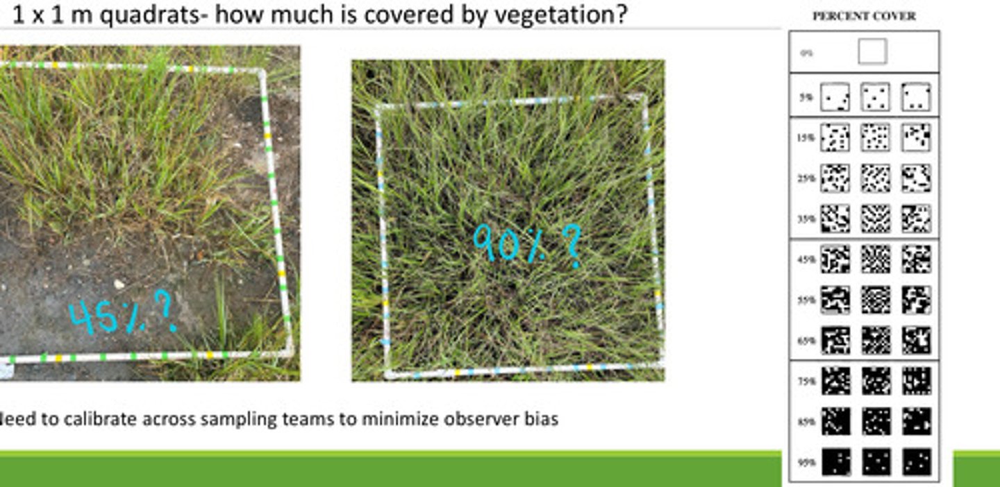
Visually measuring percent cover in a 1 x 1m quadrat
- how much over the area appears to be covered by veg?
- best estimate you can, working with others to get the most accurate values
2 sources of data for determining wetland hydrology
- Recorded data from database
- field data
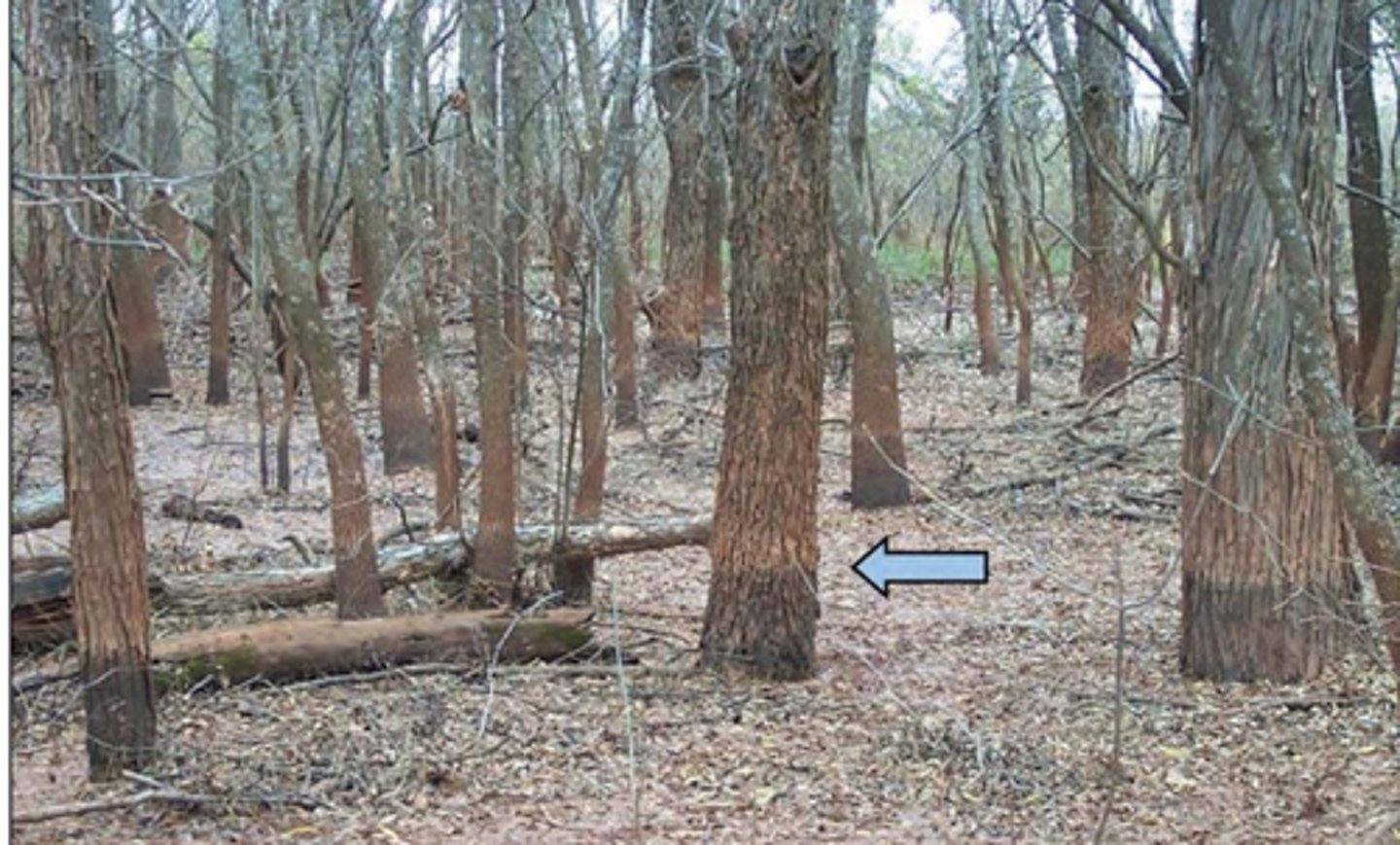
Field data: Hydrology indicators
- observed inundation
- observed soil saturation
- water marks on trunks
- drift lines
- sediment deposits
- drainage patterns within wetlands
Water marks
light and dark colored areas in seasonally flooded wetland
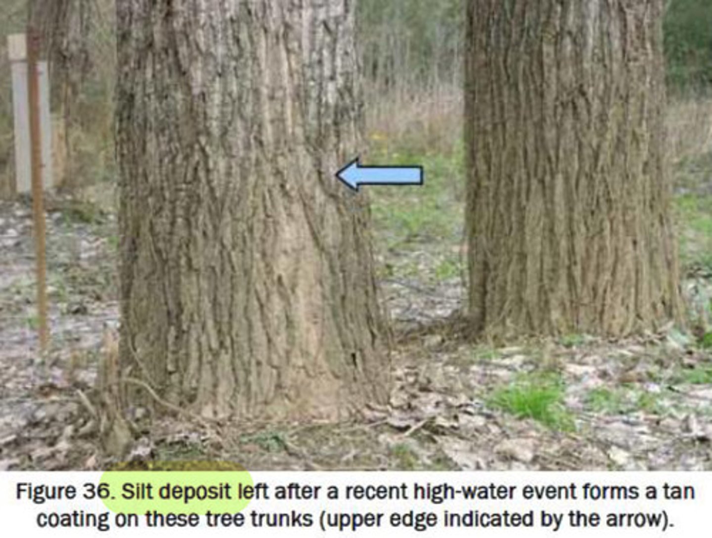
Silt deposits
tan coating on tree trunks usually after high-water event
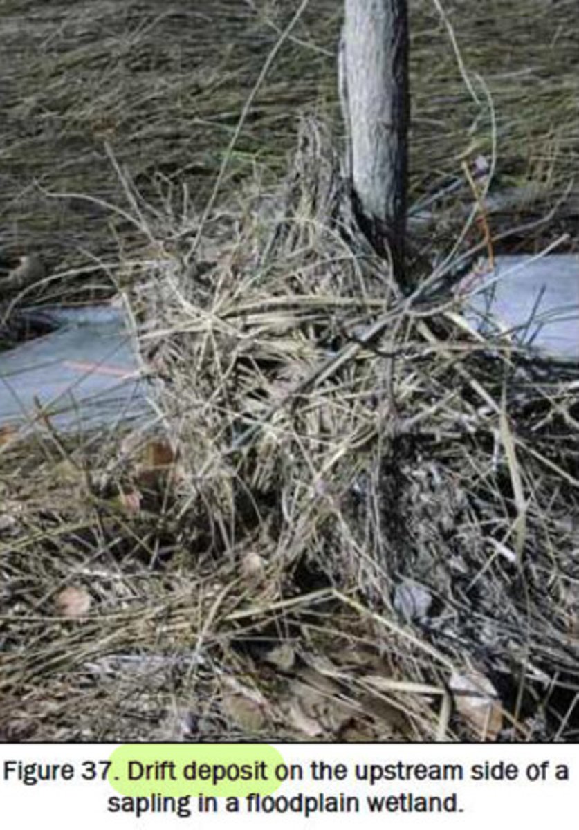
Drift deposits
debris that collects from upstream in patches
Most common delineation method
Level 3: combo of level 1 & 2 where onsite and offsite inspection are require
Least common:
Comprehensive determination:
- if debated or sensitive project, but can take a long time!
2 steps of Wetland delineation
1. Offsite data gathering = determine topography, soils if sampled already, get background of area
2. Onsite data gathering = observations and sample data
Offsite delineation methods
preliminary data gathering:
- NWI wetland maps
- Soil surveys
- USGS quad maps
- Stream and tide gage data
- EIAs, EISs
- Local experts
- Applicants plans
Onsite delineation methods
- visit site in different seasons
- recognize topography and borders (floodplains, isolated depressions)
- walk the site to get familiar with plant communities, soils, and topography
- sketch map of gen. outline of wetland and sample locations
- GPS and Flag wetland boundaries w/ colored/numbered flags