Presenting GIS Data
1/24
There's no tags or description
Looks like no tags are added yet.
Name | Mastery | Learn | Test | Matching | Spaced |
|---|
No study sessions yet.
25 Terms
Map design is an interative multi-step process:
Select
Arrange
Symbolize
Review
Edit

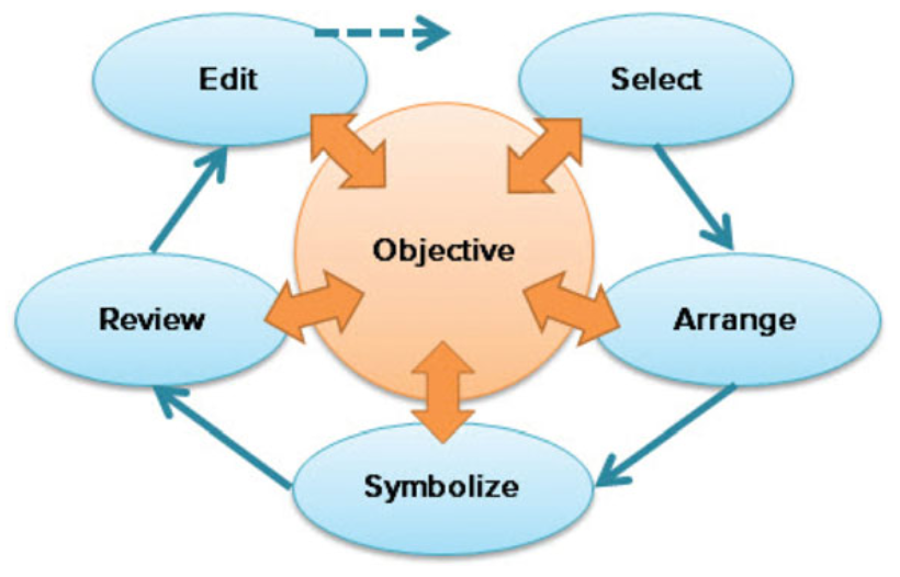
Objective
Each step of map design refers back to the _________ for the map.
Determining the objective.
The most important design step is…
What is the purpose?
Who is the audience?
What is the medium?
Under what conditions will it be viewed?
Key questions for designing an objective:
Locating points of interest (google maps)
Navigating from one place to another (road atlas)
Compiling complex collected data (geologic map)
Convincing the reader of a fact or hypothesis
Comparing data from different times or locations
Analyzing data to learn new information
Etc.
Purposes of maps:
Who will be viewing the map?
What is their expected level of knowledge?
About subject matter
About maps in general
Do they have special requirements?
Color blindness, large print?
Important audience considerations:
Paper map
Report, wall map, poster, etc.
Electronic files
PDF, GIF, etc.
What format(s)? File sizes? Delivery method?
Computer screens
What size? which types of computers?
Projection screen
Mobile devices
Tablets? Smartphones?
Possible map mediums:
Static and unchanging
Fixed paper size and scale
High resolution
May be complex with many levels of information
View is committed
May serve multiple purposes
Paper maps are characterized by being:
Interactive
Viewing size may vary by device
Poor light/sunlight on mobile divices
Short viewer attention span
Competes for attention
Should do one thing really well
Web maps are characterized by being:
Good maps tell a story
Who are the lead players?
Which layers play a supporting role?
Do some layers distract from the story?
Selecting data layers:
Privacy issues
Sensitive information that requires approval
Unintended consequences
Data omission:
Cartographic generalization
Simplification of a data set for better performance on a map.
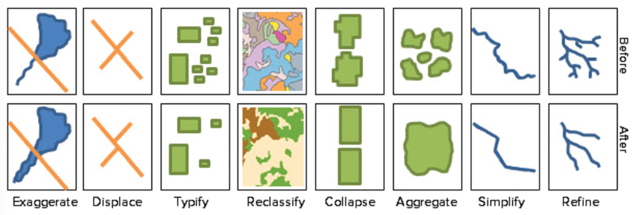
Exaggerate, displace, typify, reclassify, collapse, aggregate, simpligy, or refine data.
A cartographer might:
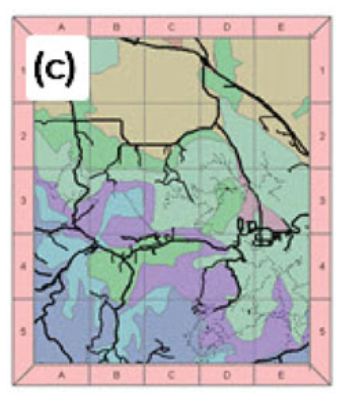
Graticule, measurement, index
Map grids:
Graticule grids
Put longitude-latitude marks around the map frame.

Measurement grids
Show x,y coordinates.
Index grids
Show lettered and numbered squares.
Map elements
Placed on a layout to support the map.
Location map
Title
Scale bar
Legend
North arrow
Neatlines
Citations
Graphics or photos
Examples of map elements:
Visual hierarchy
The order in which a reader preceives the elements of a map.
Balance, arrangement, negative space, symbols, etc.
The visual hierarchy is established by the cartographer’s choice of…
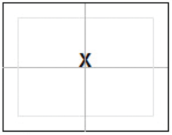
Visual center
About 5% higher than the geometric center. Maps centered on geometric center may feel “heavy".”
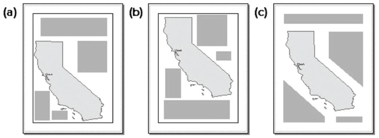
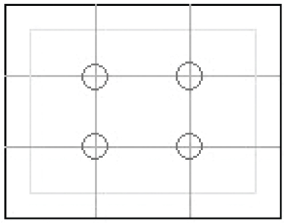
Rule of Thirds
The guideline is used to compose and crop photographs but also works for maps. Place important items at the intersections of lines dividing the page into thirds.
Alignment
Place elements in ordered columns rather than a haphazard arrangement. Align edges of boxes exactly using guides and snapping.

Balancing elements
Avoids crowded or open areas. Uses negative space as a design tool to seperate or combine elements more subtly than neatlines.