AP Human Geography Unit 1: Thinking Geographically Study Guide
 Call Kai
 Learn
Learn Practice Test
 Spaced Repetition
 Match
Match Flashcards
1/44

Earn XP
Description and Tags
Vocabulary flashcards generated from the AP Human Geography Unit 1 study guide covering map types, map scale, projections, geospatial technologies, spatial concepts, human-environment interaction, scales of analysis, and regional analysis.
Name | Mastery | Learn | Test | Matching | Spaced | Call with Kai | Chat |
|---|
No analytics yet
Send a link to your students to track their progress
45 Terms
Reference Maps
Maps that show the locations of various features and landmarks in relation to one another, designed for general navigation and orientation.

Political Maps
A type of reference map that emphasizes political boundaries, displaying nations, states, and their subdivisions, often including capitals and major cities.

Physical Maps
Maps that illustrate the physical landscape, including landforms like mountains, valleys, and plains, as well as bodies of water, often using color gradients to indicate elevation.

Topographic maps
Maps that represent the terrain's three-dimensional shape through contour lines, showing elevation and landforms in detail. They provide information on slope steepness and land use.

Thematic Maps
Maps that focus on specific themes or subjects, such as population density, climate, or economic activities, often using colors or symbols to convey information effectively.
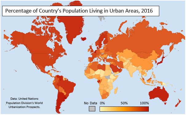
Choropleth Maps
A type of thematic map that uses differing shades or patterns to represent statistical data, often illustrating variations in quantities across geographical areas.
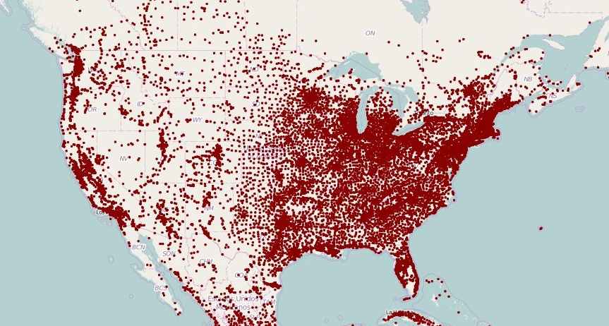
Dot Density Maps
A type of thematic map that uses dots to represent the presence or quantity of a feature or phenomenon in a certain area, allowing for visual representation of density and distribution patterns.

Isoline Maps
A type of thematic map that uses continuous lines to connect points of equal value, such as elevation or temperature, illustrating gradients and patterns across a geographical area.

Cartogram Maps
A type of thematic map that transforms statistical data by distorting the sizes of geographical areas according to a particular variable, allowing for a visual comparison of data such as population or economic metrics.

Flow Maps
A type of thematic map that uses arrows or lines to show the movement of people, goods, or information between locations, indicating direction and volume of flow.
Absolute Distance
The quantifiable amount of space between two locations, measured in units such as miles or kilometers. It is an objective measure that does not consider cultural or social factors.
Relative Distance
The measure of the space between two locations based on social, cultural, or economic factors, often described in terms such as time or cost rather than physical distance.
Clustering
The spatial arrangement of a phenomenon where individuals or objects are grouped together in proximity, often influenced by geographical, social, or economic factors.
Dispersal
The spatial distribution of individuals or objects that are scattered across a given area, typically resulting from geographical, social, or economic influences.
Elevation
The height above a given level, usually sea level, which can influence climate, vegetation, and land use patterns.
Large Scale Map
A type of map that displays a smaller area in greater detail, typically representing features at a scale of 1:100,000 or larger, allowing for more accurate measurements and information.
Small Scale Map
A type of map that depicts a larger area with less detail, usually at a scale of 1:250,000 or smaller, making it useful for understanding broader geographic trends.
Ratio Scale
A scale that expresses the relationship between distance on the map and distance in real life as a ratio, allowing for measurements without the need for a specific unit.

Mercator Projection
A cylindrical map projection that distorts size and distance but maintains accurate angles and directions, making it useful for navigation.

Robinson Projection
A map projection that aims to balance size and shape distortion, providing a visually appealing representation of the entire world, making it effective for general use.
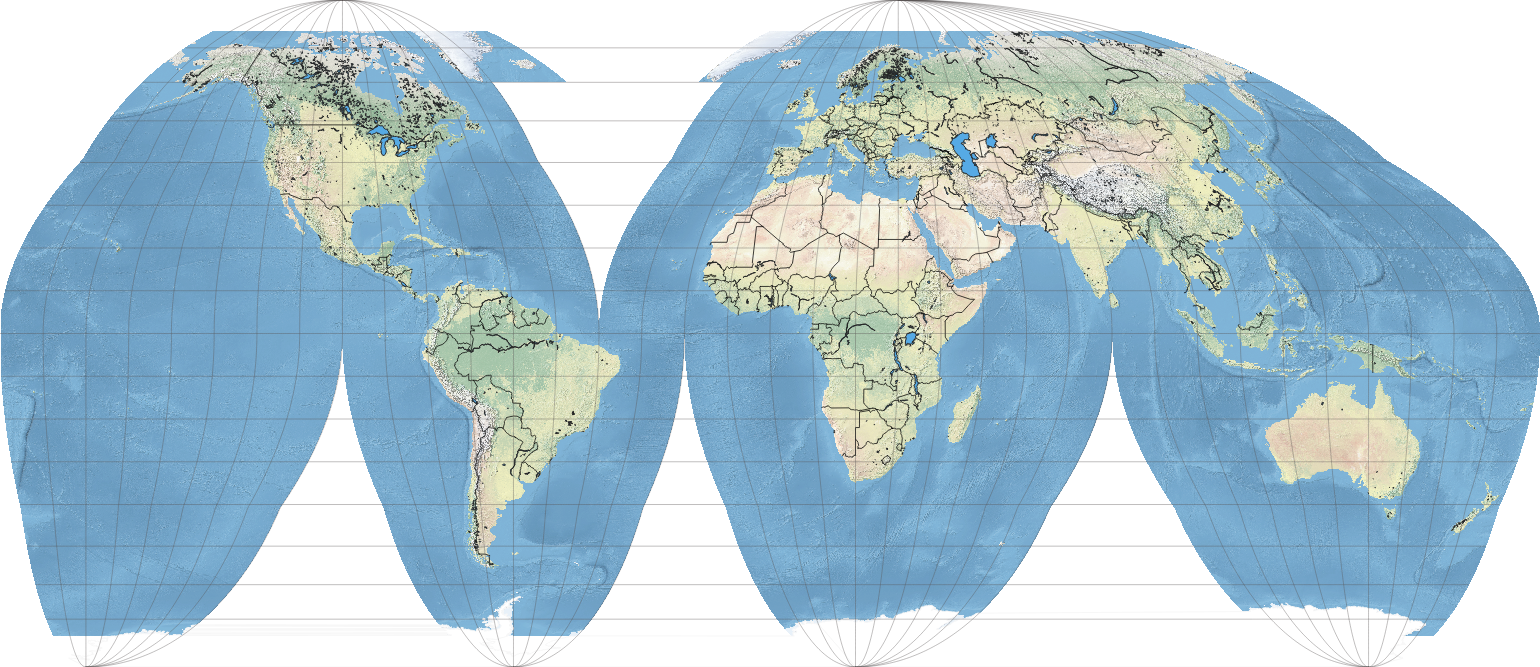
Equal Area Projection
A type of map projection that preserves area relationships, ensuring that regions on the map are proportional in size to their actual area on the Earth, making it useful for thematic mapping.

Azimuthal (Polar Projection)
A map projection where the surface of the Earth is projected onto a plane, often centered on a pole, useful for showing polar regions and great circle routes.

GIS (Geographic Information Systems)
A system designed to capture, store, manipulate, analyze, manage, and present spatial or geographic data, allowing users to visualize and interpret information related to the Earth's surface.
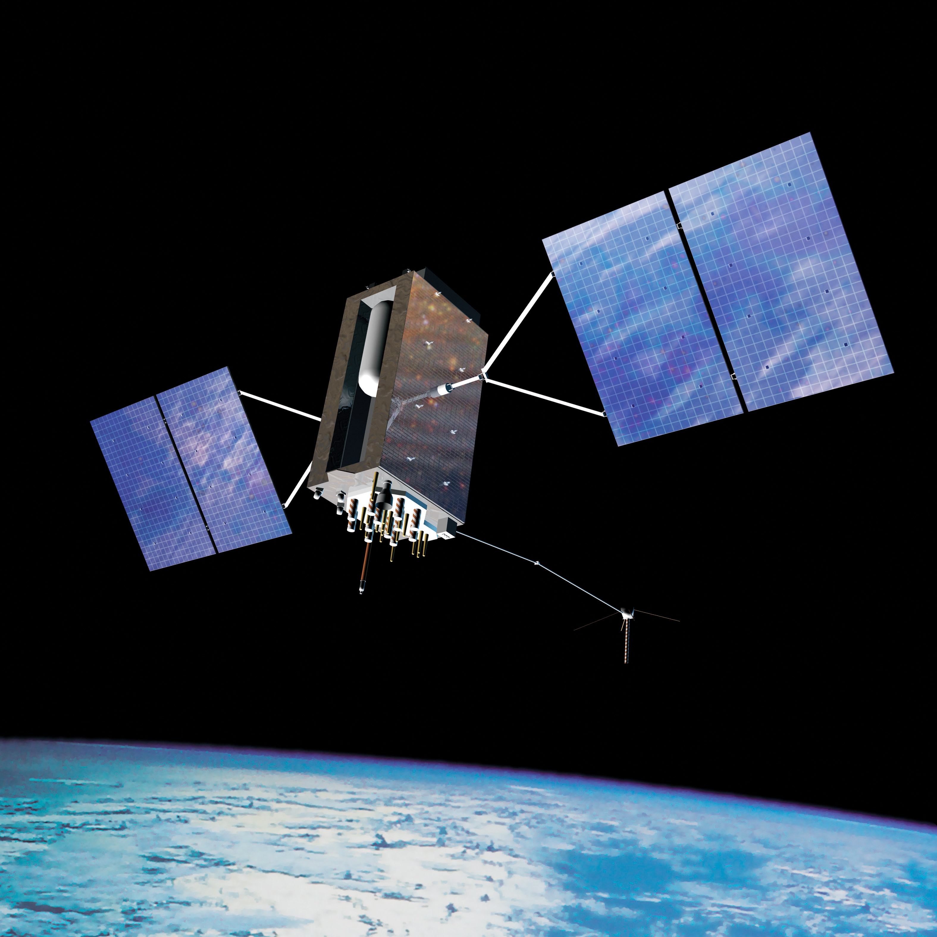
GPS (Global Positioning System)
A satellite-based navigation system that allows users to determine their exact location (latitude and longitude) anywhere on Earth, often used for navigation and mapping.
Remote Sensing
The acquisition of information about an object or area from a distance, typically using satellite or aerial imagery to gather data about the Earth's surface without direct contact.
Quantitative Data
Data expressed in numerical form, allowing for statistical analysis and measurement of patterns, trends, and relationships in geographical studies.
Qualitative Data
Data expressed in non-numerical form, focusing on descriptions, qualities, and characteristics observed through surveys, interviews, or observations in geographical studies.
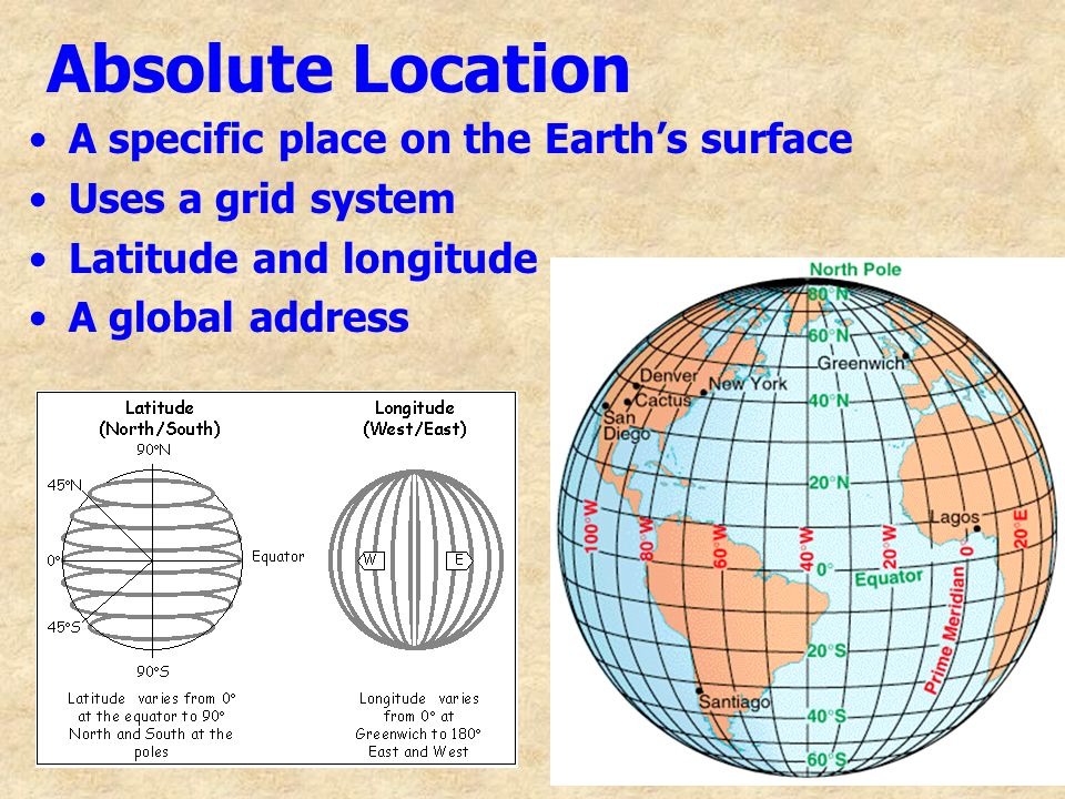
Absolute Location
The exact position of a place on the Earth's surface expressed in coordinates, typically using latitude and longitude.

Relative Location
The position of a place in relation to other places, often described using landmarks, distances, or direction.

Distance Decay
The theoretical principle that as the distance between two places increases, the interaction or influence between them decreases. This concept is often applied in cultural and economic geography.
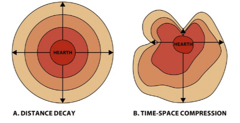
Time Space Compression
The phenomenon where the time it takes to travel between places decreases due to advances in transportation and communication technology, leading to a greater connection among distant places.
Toponymy
The study of place names, their origins, meanings, and use, often revealing cultural, historical, and geographical insights about an area.
Sustainability
The ability to maintain ecological balance by using resources in a way that meets current needs without compromising the ability of future generations to meet theirs. It encompasses environmental, economic, and social dimensions.
Enviromental Determinism
The theory that the physical environment, particularly climate and geography, shapes human behaviors, cultures, and societal development, often exaggerated in its implications and influence.
Possibilism
The theory that the environment sets constraints on human actions, but people can alter and adapt to their environment, allowing for a variety of cultural developments.
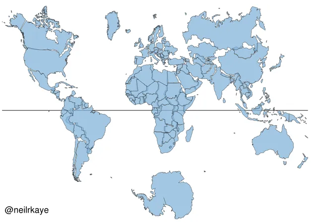
Global Scale
Refers to the examination of phenomena and processes that occur at a worldwide level, influencing global interactions and patterns across countries and regions.
Regional Scale
Refers to the analysis of geographical phenomena and processes that occur within specific regions, focusing on localized patterns and interactions.
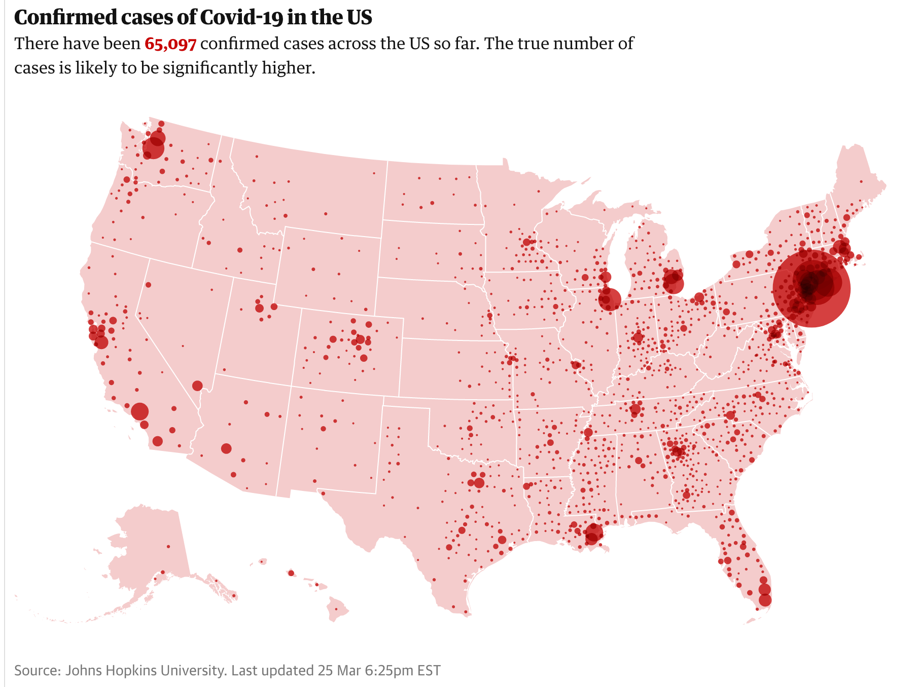
National Scale
Refers to the assessment of geographical phenomena and processes at the level of individual countries, including government policies, economic activities, and cultural practices.
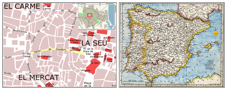
Local Scale
Refers to the analysis of geographical phenomena and processes that occur in specific, smaller areas such as towns or neighborhoods, emphasizing detailed, localized interactions and characteristics.
Aggregation
Refers to the process of grouping individual data points into larger categories or areas, which can influence the understanding of spatial patterns and relationships in geography.
Formal Region
An area defined by common cultural or physical traits, often established by official administrative boundaries. These regions are recognized for their distinct characteristics that unify the area.

Functional Region
Refers to an area organized around a central focal point, where the surrounding areas are linked to the core through various social, economic, or political activities. This type of region often demonstrates how certain functions are distributed across space.

Perceptual/Vernacular Region
An area defined by subjective perceptions and feelings, often influenced by cultural identity and individual experiences, rather than strict boundaries or criteria.
Regional Boundaries
The defined limits that establish the extent of a region, distinguishing it from neighboring areas based on various criteria such as culture, function, or perception.
Contested Boundaries
Boundaries that are disputed or challenged by multiple groups, often leading to conflicts over land use, governance, or cultural identity, reflecting differing perspectives on territorial claims.