AP Human Geography Review
1/20
There's no tags or description
Looks like no tags are added yet.
Name | Mastery | Learn | Test | Matching | Spaced | Call with Kai |
|---|
No analytics yet
Send a link to your students to track their progress
21 Terms
Distance Decay
As distance increases the number of occurrences of the characteristic decreases.
Reference Maps
Maps that show the physical features about places or the general information.
Thematic Maps
designed to illustrate a particular theme or subject
Choropleth Map
Type of thematic map.
Shows shades of a map to show intensity of a charecteristic or size of a data point.
Choreo = dance = color = choropleth
Dot map
Thematic map
Show distrobution of some data
Dots do not change size
Proportional Symbol Map
Thematic map
Larger size of symbols = larger size of data point
Isoline Map
Thematic map
Group areas into similar regions.
Example: elevation map showing which regions have similar elevations by drawing line around area.
Cartogram
Thematic map
Distorts the sizes of countries to show the size of the statistic.
Small vs Large Scale
Small scale shows more area with less detail
Large scale shows less area with more detail.
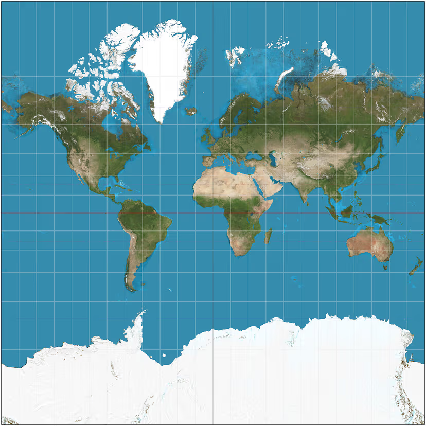
Mercator Projection
Shape and direction is accurate (good for navigation)
Map is rectangular
Size of poles are distorted
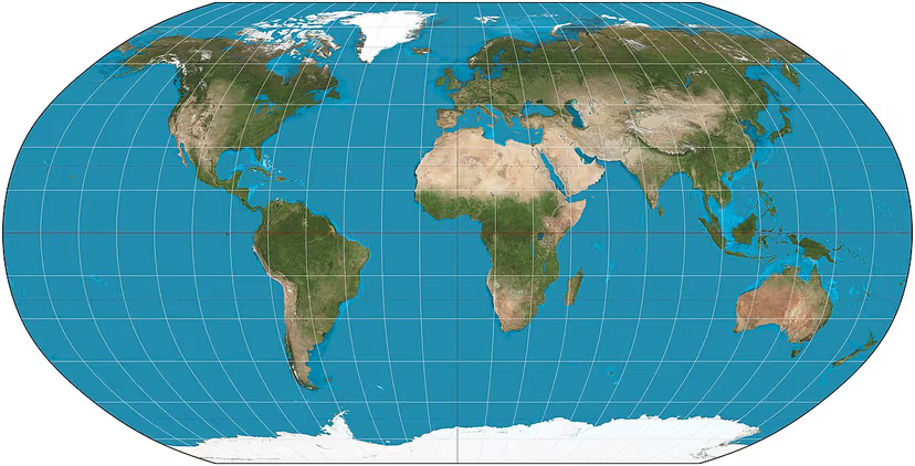
Robinson Projection
Modified version of Mercator projection
land masses smaller → most accurate
still some distortion
Peters Projection
Distorts shape a lot by squishing them horizontally
Square shape → better in that way compared to Robinson but still distorts shape, valuing size more
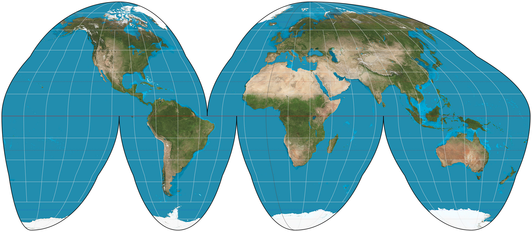
Goode Homolosine Map Projection
MInimizes distortion of landmasses and represnts their relative size
Orange peel looking
Bad for navigation and measuring distances due to breaks in map
Remote Sensing
Gathers information from satellites that orbit the earth or other craft above the atmosphere.
GIS
Global Information System
Computer system that is able to stack multiple digital maps and geospatial data sets
GPS
Global Positioning System
use locations of satellites to determine location of user
Toponym
Names of places (relate to the historical influences or other influences)
Cultural Ecology
study of how humans adapt to the environment
Environmental Determinism
Possibilism
Environmental Determinism
The belief that landforms and climate are the most powerful forces shaping human behavior and societal development while ignoring the influence of culture.
Basically saying the environment fully determine the actions and accomplishments of people in an area.
→ old assumption → possibilism is contemporary
Possibilism
acknowledges limits on the effects of the natural environment and focuses more on the role that human culture plays. Different cultures may respond to the same natural environment in diverse ways, depending on their beliefs, goals, and available technologies
Basically yeah there is environmental determinism but how a culture functions also is important.
In the Netherlands a lot of their land is covered by water → making dams to gain back land → possibilism