ERTH2404-L8: Soils and Erosion
 Call Kai
 Learn
Learn Practice Test
 Spaced Repetition
 Match
Match Flashcards
 Knowt Play
1/114

There's no tags or description
Looks like no tags are added yet.
Name | Mastery | Learn | Test | Matching | Spaced | Call with Kai |
|---|
No analytics yet
Send a link to your students to track their progress
115 Terms
Earth’s external processes
Weathering
Erosion
Formation of soil
Earth materials can be subdivided into…
Rocks
Soils
Fluids
Geotechnical engineering
Geotechnical engineering: branch of civil/geological engineering that focuses on the behavior of soil, rock, and groundwater and how these materials interact with human-made structures.
Roles of geotechnical engineers
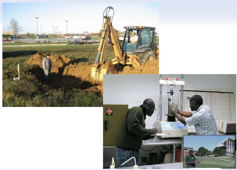
Study the properties of soils and rocks
Evaluate site conditions before construction
Design foundations, slopes, retaining walls, embankments, and tunnels
Assess natural hazards such as landslides, soil liquefaction, and ground settlement
Soil
Soil is a material composed of fragments from pre-existing rocks but lacking strong cement between particles
How do detrital sedimentary rocks form?
Detrital sedimentary rocks form after the lithification of fragments
Soil: soil science perspective
The soil science perspective (pedology, agriculture):
• Organic-rich weathered zone that supports the growth of
plants
• Focus: interrelation between physical, chemical and
biological properties of soils
Soil: engineering perspective
The engineering perspective (soil engineers):
• A soil is any material that can be excavated by a shovel
• Focus: behavior of soils under load
Soil: geological perspective
The geological perspective:
• Portion of unconsolidated material lying above bedrock*
• Focus for geologists: links between soils and the formation of
various geological material like clay, metallic ores, etc. Also,
indicator of past climates.
• Geologists rarely refer to soils as civil engineers do.
• The soils of civil engineers is for geologists:
• Unconsolidated deposits
• Surficial (superficial) deposits
• Drift if of glacial origin.
Bedrock
Bedrock: relatively hard, solid rock that commonly underlies altered rock, sediment, or soil. No unconsolidated deposits is found beneath bedrock.
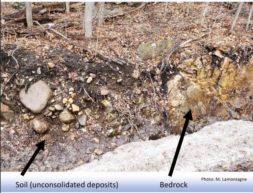
Outcrop
Outcrop: A portion of bedrock visible at the surface.
Typical composition by volume of a soil which yields good plant growth
45% Mineral matter
5% Organic matter
50% Pore space:
25% Air
25% Water
Soil Composition
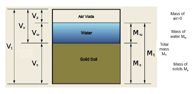
Total volume of soil

Volume of void space

Volume of air
Va
Volume of water
Vw
Volume of solids
Vs
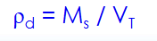
Mass of solids
Ms
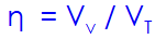
Porosity [%]
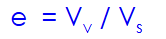
Void ratio [%]
Dry density [kg/m3]
Parent materials
Parent material: rock from which the soil developed
Residual soils (sedentary)
Residual soils (sedentary): The soils that hold its position of their formation, without transporting; parent material is the underlying bedrock
Transported soil
Transported soil: material has been carried from the location of origin to the location of deposition, by natural processes:
Water
Glaciers
Wind
Important aspect of canadian soils
*** In Canada, most soils are transported soils (glaciers covered most of the territory, removed old loose material and left behind till after melting). Opposed to residual soils
Types of transported soils
Alluvial soils
Lacustrine soils
Marine soils
Glacial soils
Eolian soils
Colluvial soils (colluvium)
Alluvial soils
Alluvial soils: soils transported by rivers and streams
• Gravel, sand, silt with coarse/fine horizons commonly alternating
Lacustrine soils
Lacustrine soils: soils transported and deposited beneath a lake surface
Marine soils
Marine soils: soils transported and deposited in deltas, seas or oceans
Glacial soils
Glacial soils: soils transported by glaciers
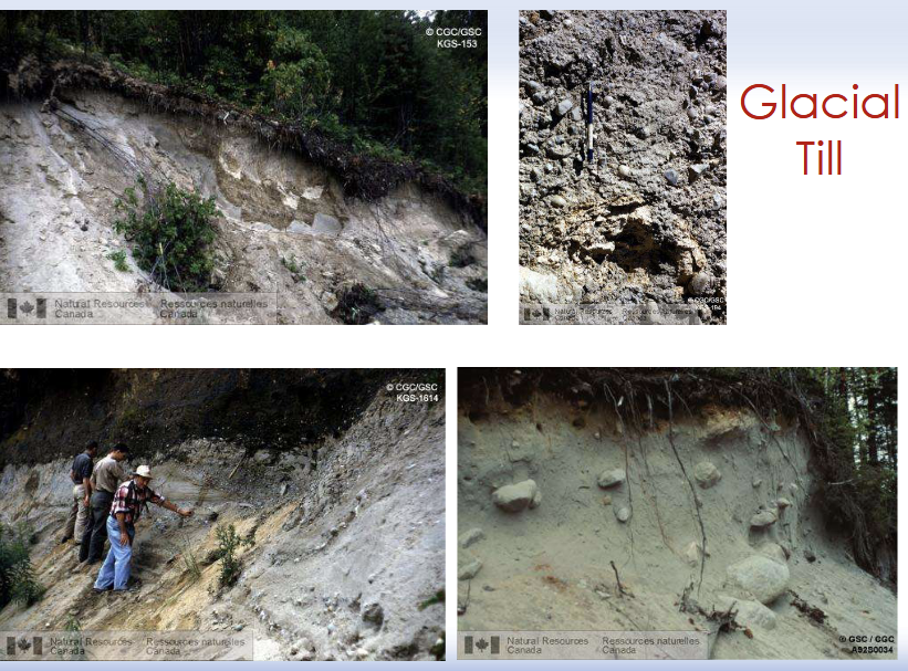
Glacial till
Glacial till
Till: in geology, unsorted material deposited directly by glacial ice and showing no stratification, can be debris left behind by melting glaciers
If deposited directly by the ice sheet, till is composed of particles of different sizes
Glaciofluval
Glaciofluvial (water circulation around glaciers)
• Sand and gravel
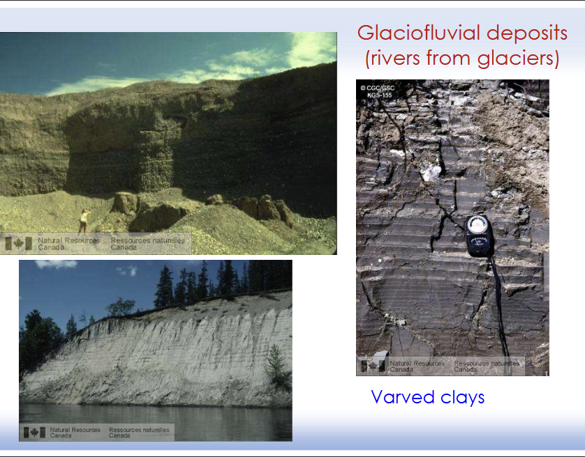
Glaciolacustrine/glaciomarine
Glaciolacustrine/glaciomarine (near-glacier deposits in lakes, seas)
• Clay and silt
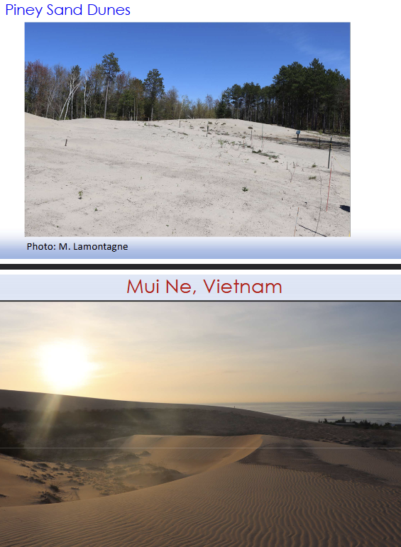
Eolian soils
Eolian soils: soils transported by wind
• Homogeneous particle size (silt and clay-size
particles)
• High porosity
• In arid regions, fine-grained soils made of silt and
clay
• Also called Loess
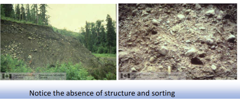
Colluvial soils (colluvium)
Colluvium (deposits at base of slopes)
Colluvial soils (colluvium): soils transported downhill by gravity, either slowly (creep) or catastrophically (mass movement)
• Material moved downhill by gravity
• Mix of rock fragments, soil, and debris
• Typically found at the foot of hills or steep slopes
• Usually angular and unsorted
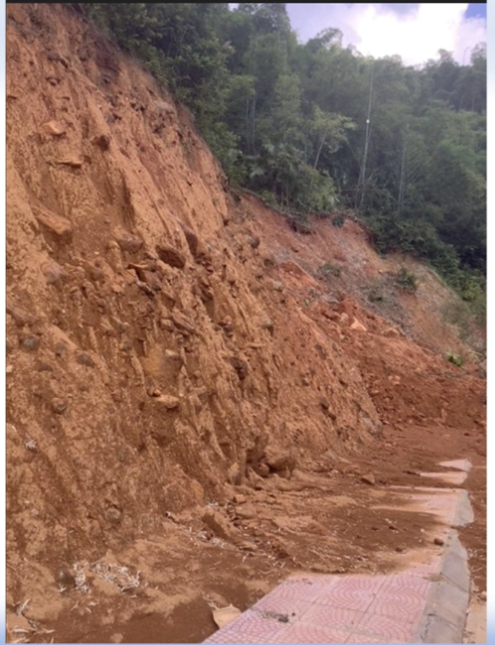
Colluvium (Vietnam)
Material moved downhill by gravity
Mix of rock fragments, soil, and debris
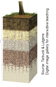
Soil profile
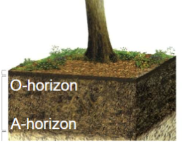
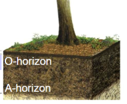
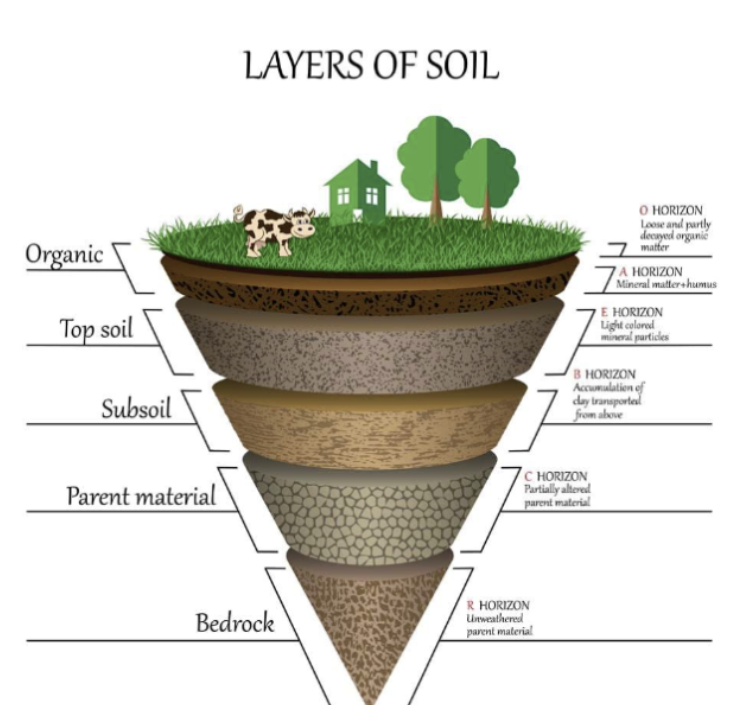
The soil profile is a vertical section of the soil that depicts all of its horizons.
_________________________________________________________________
Soil forming processes operate from the surface downward
Soil scientists have developed a classification scheme based on horizons
Horizon
Horizon: individual layer with distinctive properties
O-horizon
O-horizon: organic matter (ex: dead leaves)
A-horizon
A-horizon:
• Mineral matter mixed with humus (partially decomposed organic matter)
• Dark color
• High biological activity
• Also called topsoil
E-horizon
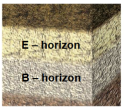
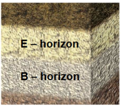
E-horizon: (in Canada: called Ae)
• Mostly mineral particles with
little organic matter
• Light color, grey
• Zone where soluble substances are leached away by rain water
B-horizon
B-horizon (syn. subsoil)
• Zone where substances leached out from above layers accumulate (enriched in metals leached from the A horizons)
Leaching
Leaching: process by which soluble material in the soil (e.g. soluble minerals, nutrients, contaminants) are washed into a lower layer of soil – or – are dissolved and carried away by water
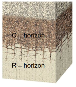
C-horizon
C-horizon:
• Partially altered parent material
• Residual soils: weathered bedrock
• In transported soils: unconsolidated material (e.g. glacial till, stream sediments)
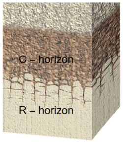
R-horizon
R-horizon:
• Unweathered bedrock
Layers of soil
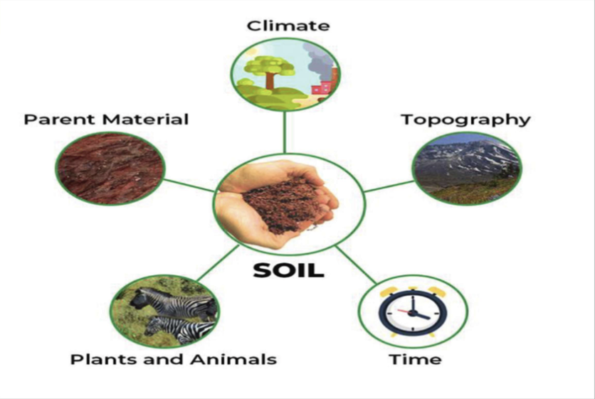
Factors controlling soil development
Climate: the most critical factor
Organisms
Relief (Topography)
Parent material
Time
CLORPT, for short
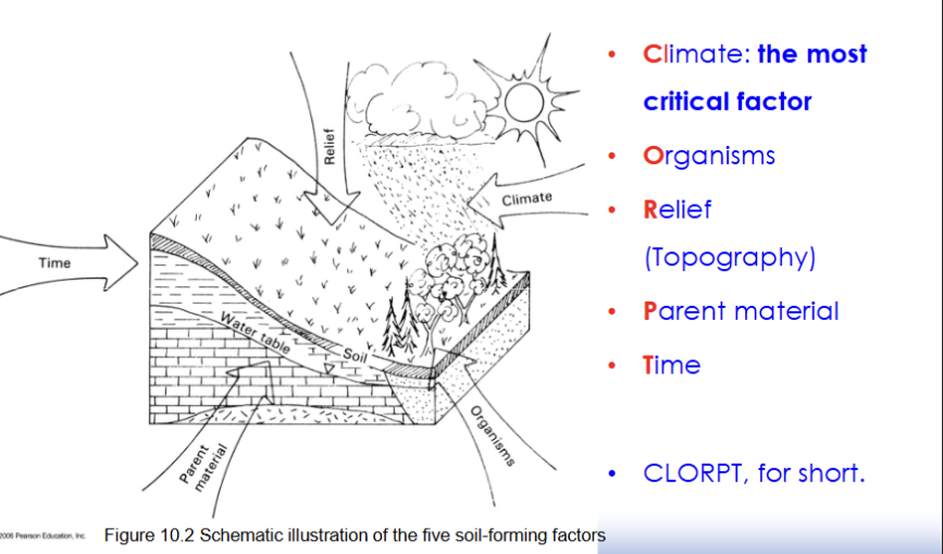
Factors controlling soil development
Climate
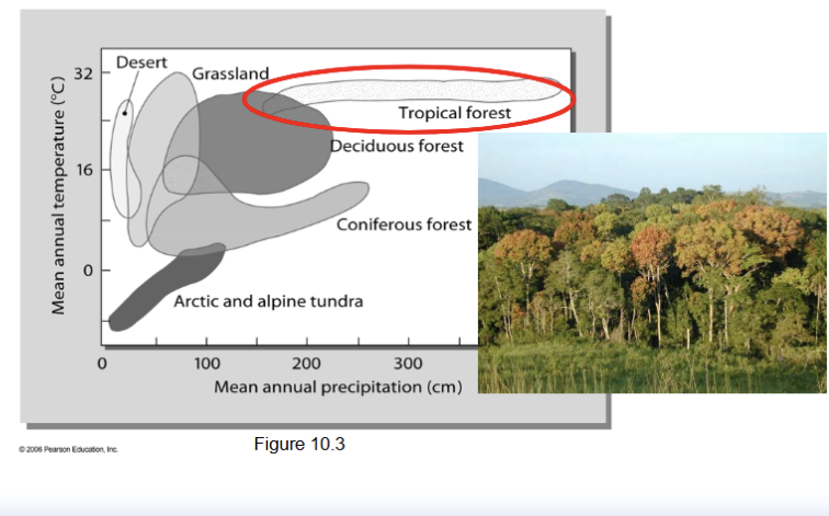
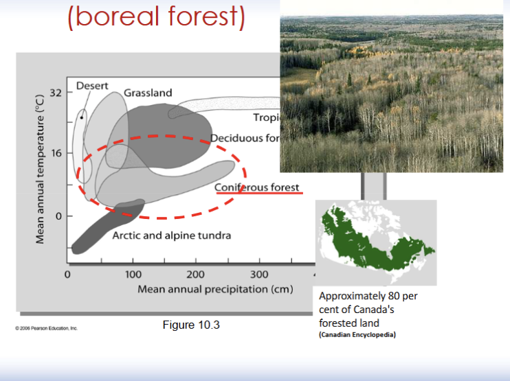
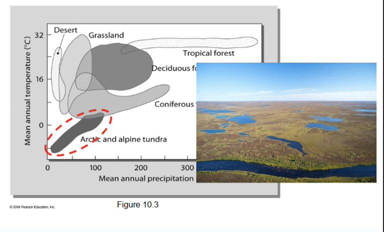
Affected by temperature and precipitation
Climate: temperature
• High T: more evaporation, less infiltration
• Cold T: less evaporation, more infiltration
Climate: precipitation
• Concentrated in one season or spread over the year
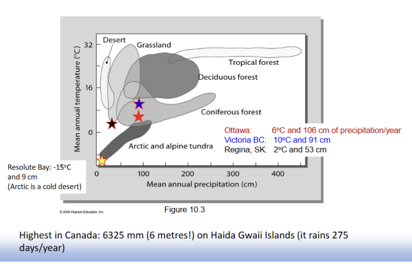
Climate: Tropical forest
Climate: Coniferous forest (boreal forest)
Climate: Arctic and alpine tundra
Climate (Ottawa, Victoria, Regina)
Ottawa: 6 C and 106 cm of precipitation/year
Victoria BC: 10 C and 91 cm
Regina, SK: 2 C and 53 cm
Resolute Bay: -15 C and 9 cm (Arctic is a cold desert)
Highest in Canada: 6325 mm (6 metres!) on Haida Gwaii Islands (it rains 275 days/year)
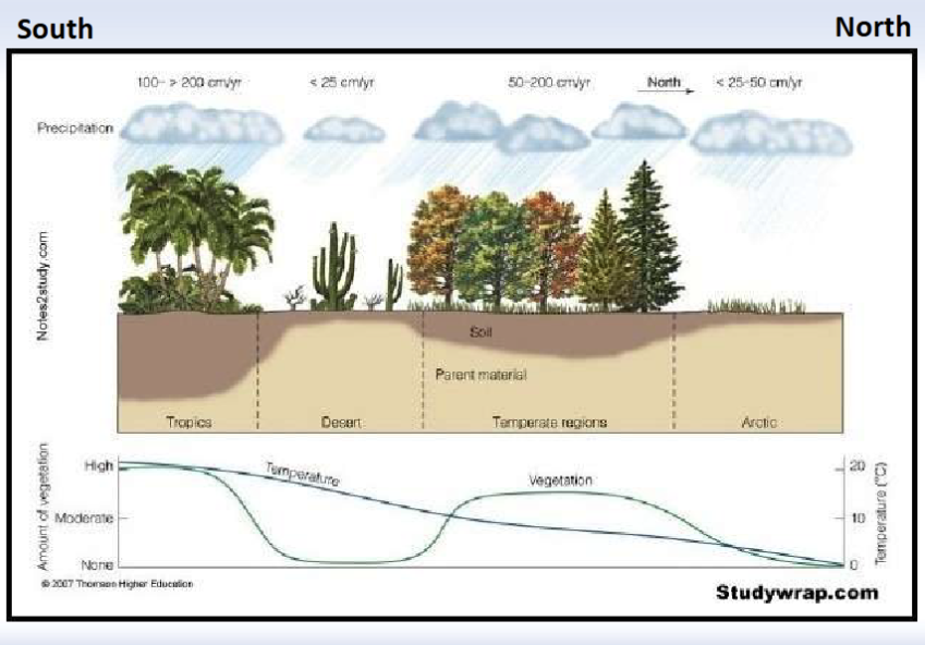
Relationship between precipitation, amount of vegetation, temperature, and parent material depending on the biome
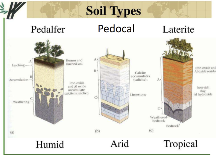
Soil in semi-arid and arid climates
Pedocal
• Pedo (soil) + cal (calcium)
• Soil enriched in calcium carbonate content and low organic matter. white-ish color
• Soil associated with dry grasslands
• Covers southern Saskatchewan and most of the western U.S.
Soils in temperate and humid regions
Pedalfer
Name origin: Ped (soil) + al (aluminum) + fer (iron)
Topsoil (A horizon): Sandy
• Light-colored
• Acidic because rainwater leaches many minerals
Subsoil (B horizon):
• Accumulates aluminum, iron, oxides, and clay
• Brown in color
Where they form: Mostly under forest vegetation, especially common under conifer forests, Generally fertile soils.
Found in most of southern Canada, The eastern United States
Soils in hot and wet tropical climates
Intense leaching
• Soluble elements (Na, K, Ca, Mg, Si) carried away by water
• Insoluble elements (Fe, Al) are left in place
• High relative concentration of (Fe, Al)
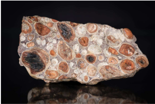
• Formation of laterites
• Rusty red, historically used as building material, easily cut into bricks
• Example: bauxite (aluminium ore)
Bauxite
The main ore of aluminum (Mineral Gibbsite Al(OH)3, not found in Canada).
Mines in Australia, Guinea, China, Brazil, Jamaica...
Canadian aluminum production depends on imported bauxite and abundant hydroelectric power.
It contains about 40-60 per cent alumina (aluminum oxide, Al2O3)
Soil types depending on climate
Organism Factor
Plants and animals
mix and aerate soil
Relief Factor
• Thin soil on steep slopes
• Thick soil on flat or undulating surfaces
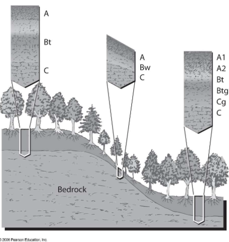
Topography Factor
Topography: controls position of soil in landscape
Parent material
• Glacial deposits: the majority of parent materials in Canada
• Silica-rich igneous rock (e.g. Eastern North America): -------- sandy, acidic soil
• Limestone (e.g. Western North America): ------ clay, slightly alkaline soil
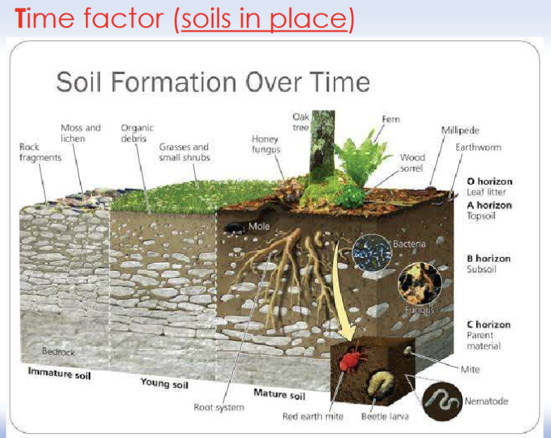
Time Factor
In fact, one centimeter of topsoil can take several hundred years or more to develop.
Soil formation rates vary across the planet:
The slowest rates occur in cold, dry regions (it can take more than 1,000 years to produce 1 cm)
The fastest rates are in hot, wet regions (still very slow: several hundred years for 1 cm).
Objectives of engineering properties
• to make quantitative measurement of standard properties
• To assess suitability of soil to withstand load from structures
Cohesion
Cohesion: inherent shear strength of soils mostly due to the attracting forces between individual clay particles
• Cohesion means "stickiness"
Controlling factor is particle size
• Silt and clay: cohesive
• Sand and gravel: cohesionless
Different properties applicable to:
• Cohesionless soils (free running)
• Cohesive soils (clay, silt, with cohesive strength )
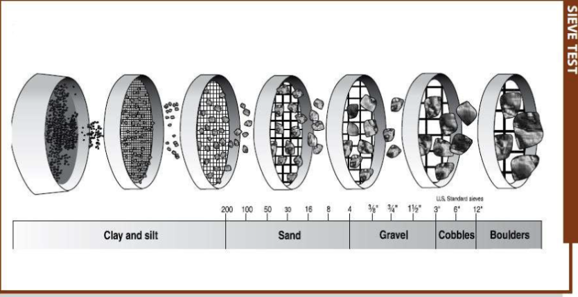
Grain size distribution
• Measured by a sieve analysis
• Laboratory test in which the soil is passed through a series of sieves with successively smaller openings
• Results plotted as a grain-size distribution curve
Sieve Analysis
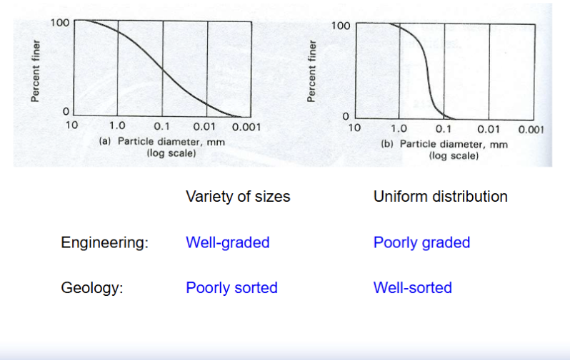
Grain-size distribution curves
Variety of sizes
Engineering: Well-graded
Geology: Poorly sorted
Uniform distribution
Engineering: Poorly-graded
Geology: Well-sorted
Properties of Cohesionless soils
Engineering impact of well graded versus poorly graded soils
• Water drainage: poorly graded (well sorted) has better drainage
(because there are more void spaces in a poorly graded soil)
• These properties impact compressibility, shear strength
Properties of Cohesive Soils
Consistency: Very soft → Exudes between fingers
Consistency: Soft → Easily mouldable
Consistency: Firm → Strong finger pressure required
Consistency: Stiff → Can be indented with fingers, but not moulded
Consistency: Very stiff → Indented by sharp object
Consistency: Hard → Difficult to indent
Properties of Cohesive Soils
Consistency is determined by clay fabric
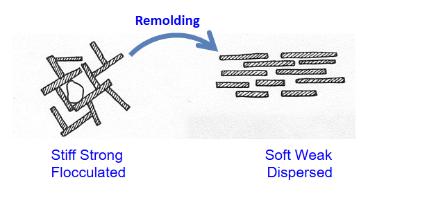
Properties of Cohesive soils
Remolding: disturbance of the soil by natural processes or during lab tests
• Clay can change from flocculated to dispersed fabric during remolding with a significant loss of strength
Sensitivity: strength in undisturbed conditions / strength in remolded conditions
Classification Systems
The purpose of a soil classification system is to group together soils with similar properties or attributes.
Unified Soil Classification System
British Soil Classification System
ASTM - American Society for Testing and Materials
AASHTO - American Association for State Highway and Transport Officials
Unified Soil Classification System: Major divisions
Major divisions:
Coarse-grained soils:
Classified according to sieve analysis
• Gravel
Coarse 75 mm to 19 mm sieve
Fine 19 mm to No. 4 sieve
• Sand
Coarse No. 4 to No. 10 sieve
Medium No. 10 to No. 40 sieve
Fine No. 40 to No. 200 sieve
Fine-grained soils:
Classified according to Atterberg limits (Liquid Limit)
• Silt
• Clay
Unified Soil Classification System: Grain size, grain-size distribution, liquid limit symbols
Grain size symbols:
Gravel G
Sand S
Silt M
Clay C
Organic soil O
Peat Pt
Grain-size distribution symbols:
Well-graded W
Poorly-graded P
Liquid limit Symbols:
High LL (>50) H
Low LL (<50) L
Soils Hazards
1. Settlement
2. Expansive clay
3. Liquefaction
4. Subsidence
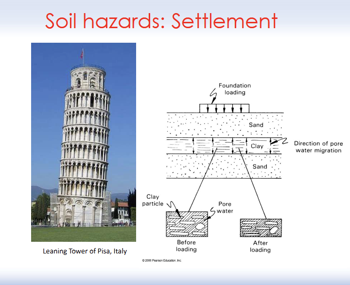
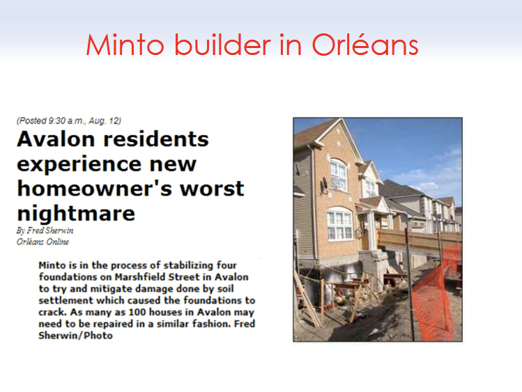
Soil Hazard: Settlement
Settlement: Soil deforms under load, leads to volume decrease under a structure
• Tendency of soil to decrease in volume termed compressibility
• Consolidation test
• Test for Void Ratio (e = Vvoid / Vsolid)
Soil Hazard: Liquefaction
Liquefaction: phenomenon in which the strength of soil is reduced by vibrations, shaking, and loading
• Occurs in saturated sandy soils in which the space between particles is filled with water
• Under normal circumstances, sand responds to increased stress by the expulsion of pore water
• Under rapid stress, particles become suspended within pore water
Soil Hazard: Expansive Soil
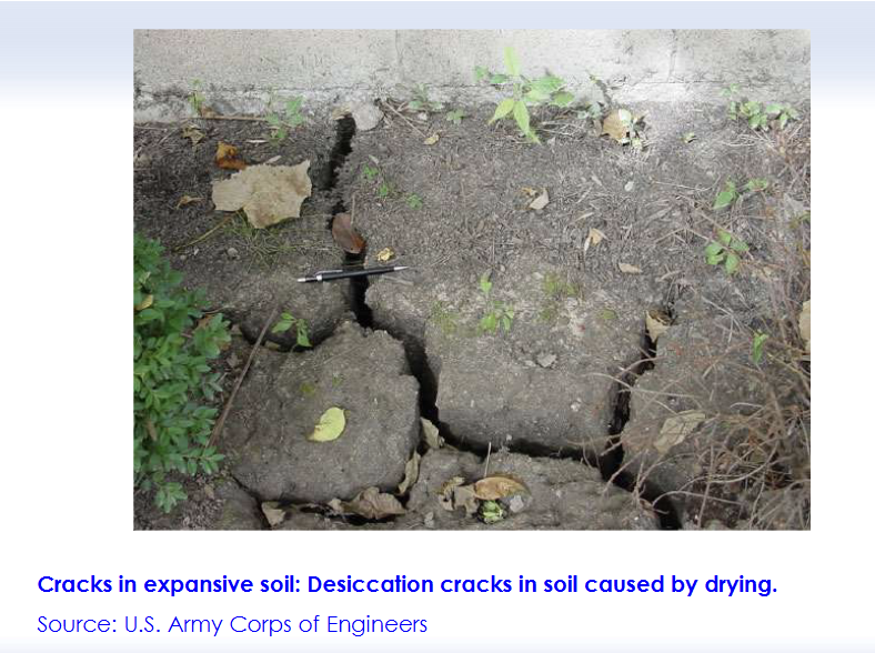
Expansive soil: a soil that tends to change volume in response to changes in moisture content
• High moisture content = Swelling
• Low moisture content = Shrinking
• Expansive soils are a significant and costly natural hazard
• Volume increase of ≥ 3% is potentially hazardous
• Climate, vegetation,topography arer important factors
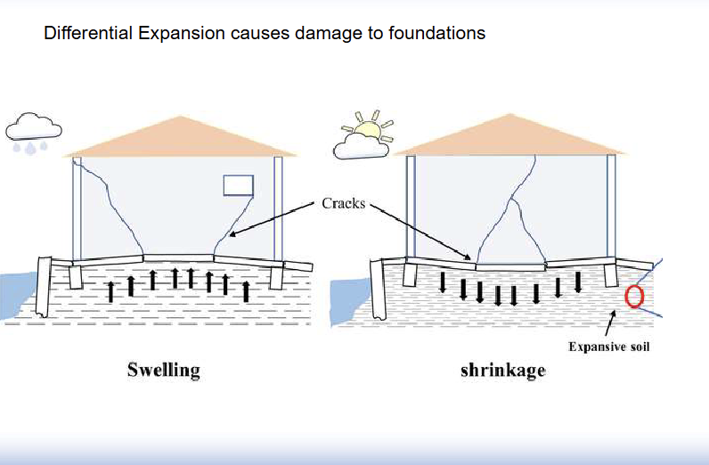
Soil Hazard: Expansive soil (Vertisols)
• Expansive soil is often related to the presence of swelling clays
• Due to the presence of smectite clay group
• Montmorillonite, Smectite, Bentonite
• Heaving and cracking of:
• Floor slabs, walls, sidewalks, driveways, and patios
• Ruptured pipelines and underground infrastructure
• Acute problem is central plains of Canada
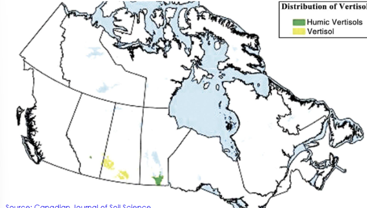
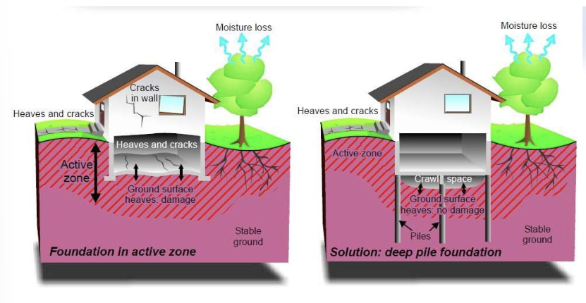
Engineering solutions to expansive soils
Deep foundations that reach below the active swelling zone
Soil stabilization with lime or cement
Proper drainage around buildings
Flexible pavement designs for roads
Soil Hazards: Subsidence
Subsidence: sinking of the land surface
The principal causes are:
• aquifer-system compaction,
• drainage and decomposition of organic soils,
• underground mining,
• oil and gas extraction,
• hydrocompaction,
• natural compaction, sinkholes,
• and thawing permafrost
• U.S. National Research Council, 1991
• + postglacial readjustment in Canada
______________________________________________________________
Effects of land subsidence include:
damage to buildings and infrastructure such as roads and canals
• increased flood risk in low-lying areas,
• lasting damage to groundwater aquifers and aquatic ecosystems
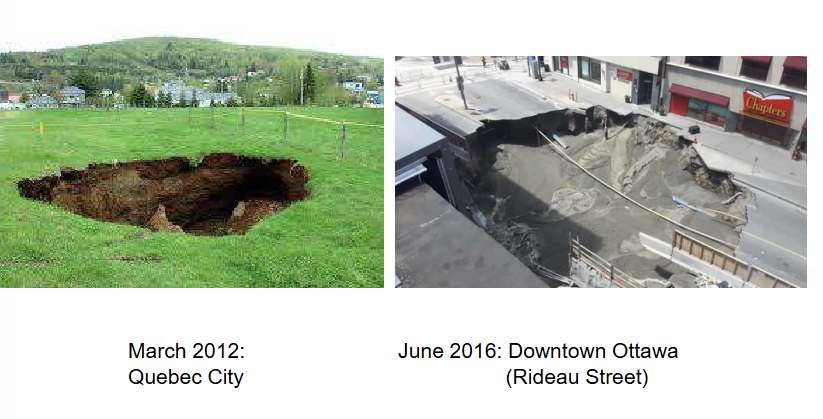
Soil Hazard: Rapid subsidence - sinkhole
Sinkhole: circular area of subsidence caused by
collapse into subterranean void
• Occur typically in soluble sedimentary rocks
• Example: limestone
• Diameter ≈ tens of metres
_______________________________________________________________
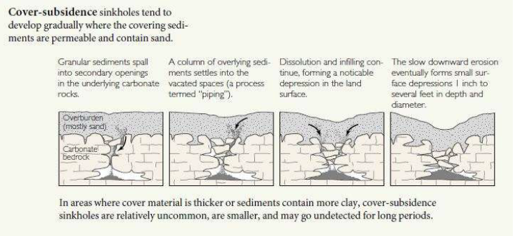
Cover subsidence (as seen in diagram)
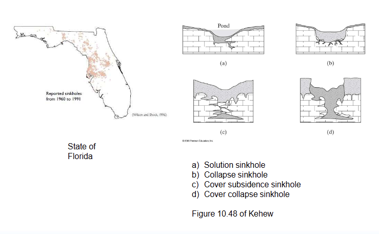
Cover subsidence
Sinkholes near us
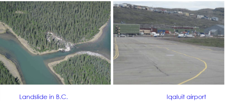
Thawing permafrost
Soil Hazard: subsidence - compaction
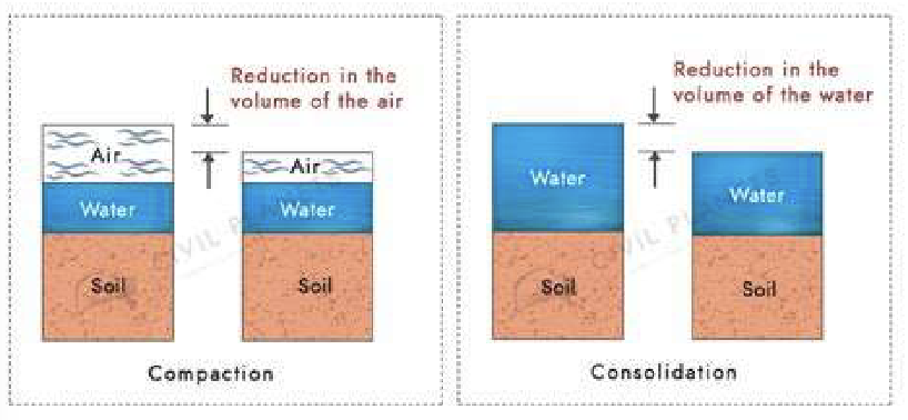
Compaction: reduction in volume of a soil under load caused by realignment of soil particles into a denser packing
• Densification by expelling air→ occurs mainly in unsaturated soils→ water content stays essentially the same
• All types of soils can be compacted by moving grains closer together
Soil Hazard: subsidence - consolidation
Consolidation: (geotechnical sense) reduction in volume of a water-saturated soil as water flows out under load
• Consolidation by removal of subsurface fluids is usually
initiated by human activity (e.g. pumping, drainage)
• Irreversible
• It takes time for water to flow through fine-grained soil
• Slower than compaction
Difference between Compaction and Consolidation
Erosion
Erosion: detachment and transport of rock fragments by the action of agents such as...
Agents of Erosion
• Liquid water → Surface water and wave erosion
• Ice → Glaciers / Avalanches
• Wind → Eolian erosion
• Gravity → Mass movement
Factors controlling erosional rate
• Rainfall
• Intensity , duration
• Soil characteristics
• Porosity, permeability, moisture content, grain size and shape
• Topography
• Orientation of slope, slope angle, length of slope
• Vegetation
• Type and distribution
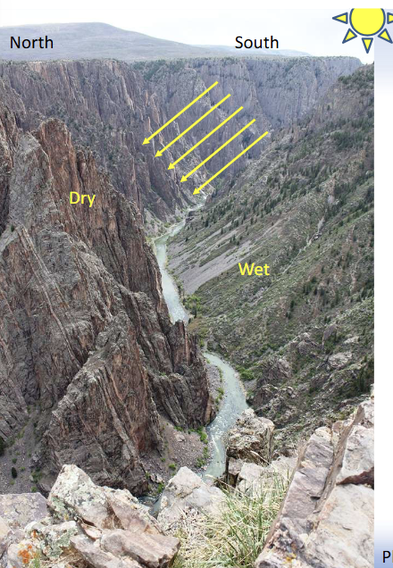
Black Canyon of the Gunnison, Colorado
The South rim (to the right) is facing the North: it weathers faster than the North face...
South rim does not receive heat from the Sun keeping moisture, accelerating weathering by freeze-thaw and chemical action
The Gunnison River erodes the material
What is the most effective erosion agent?
Running surface water is the most effective erosion agent
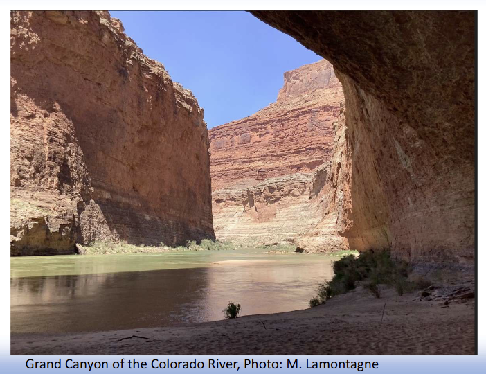
Grand Canyon Highlights
• ~70 Million years ago plate tectonic caused Colorado plateau to rise
• ~5M years ago, Gulf of California opened up & lowered the river’s base
• Delta in elevation formed
