Physical Geography of North America
1/14
There's no tags or description
Looks like no tags are added yet.
Name | Mastery | Learn | Test | Matching | Spaced | Call with Kai |
|---|
No analytics yet
Send a link to your students to track their progress
15 Terms
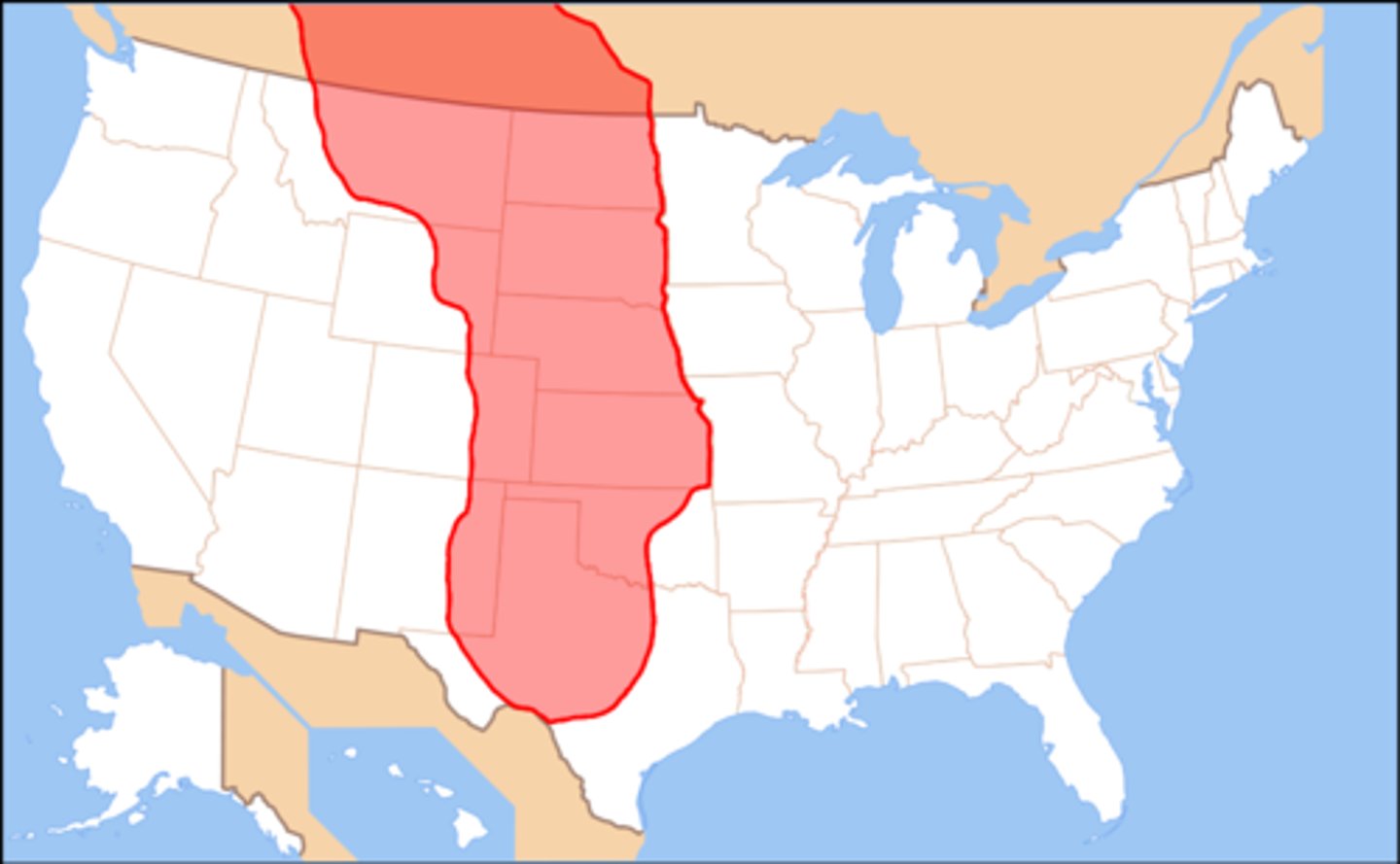
Great Plains
A mostly flat and grassy region of western North America
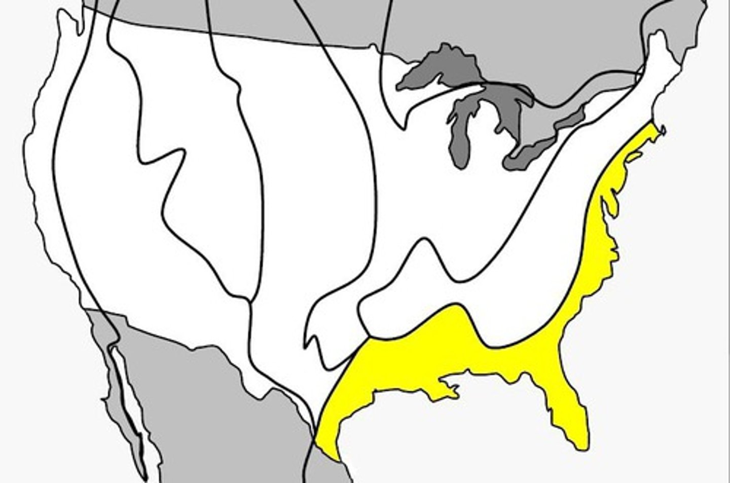
Atlantic Coastal Plains
Flat, lowland areas along the Atlantic, full of marshes, rivers, and wetlands
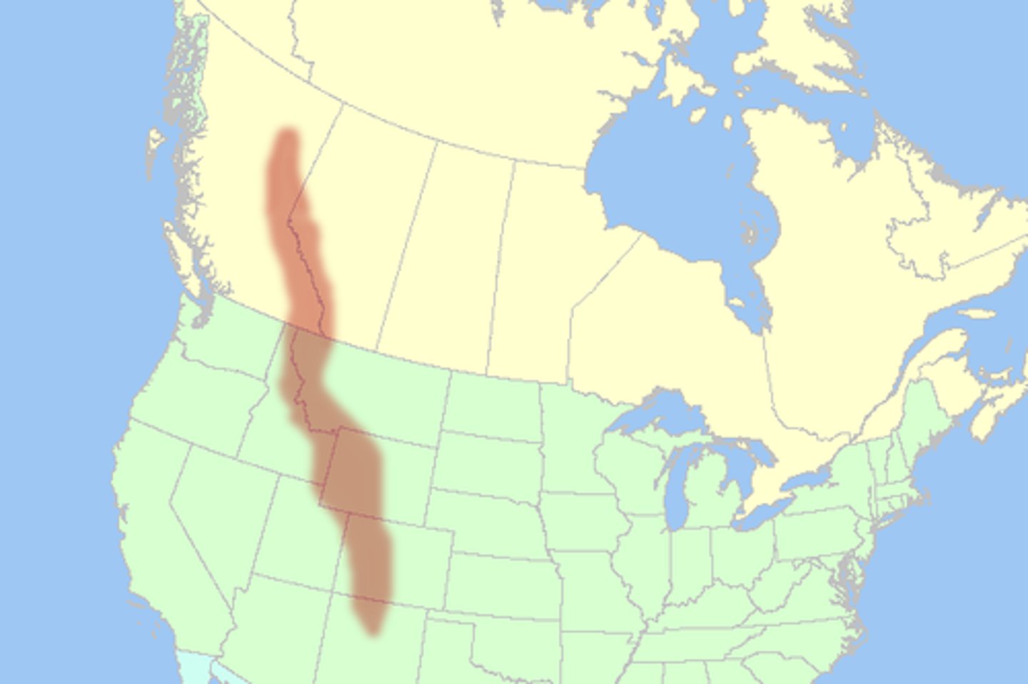
Rocky Mountains
The major range of western Canada that starts in Alaska and ends in the United States
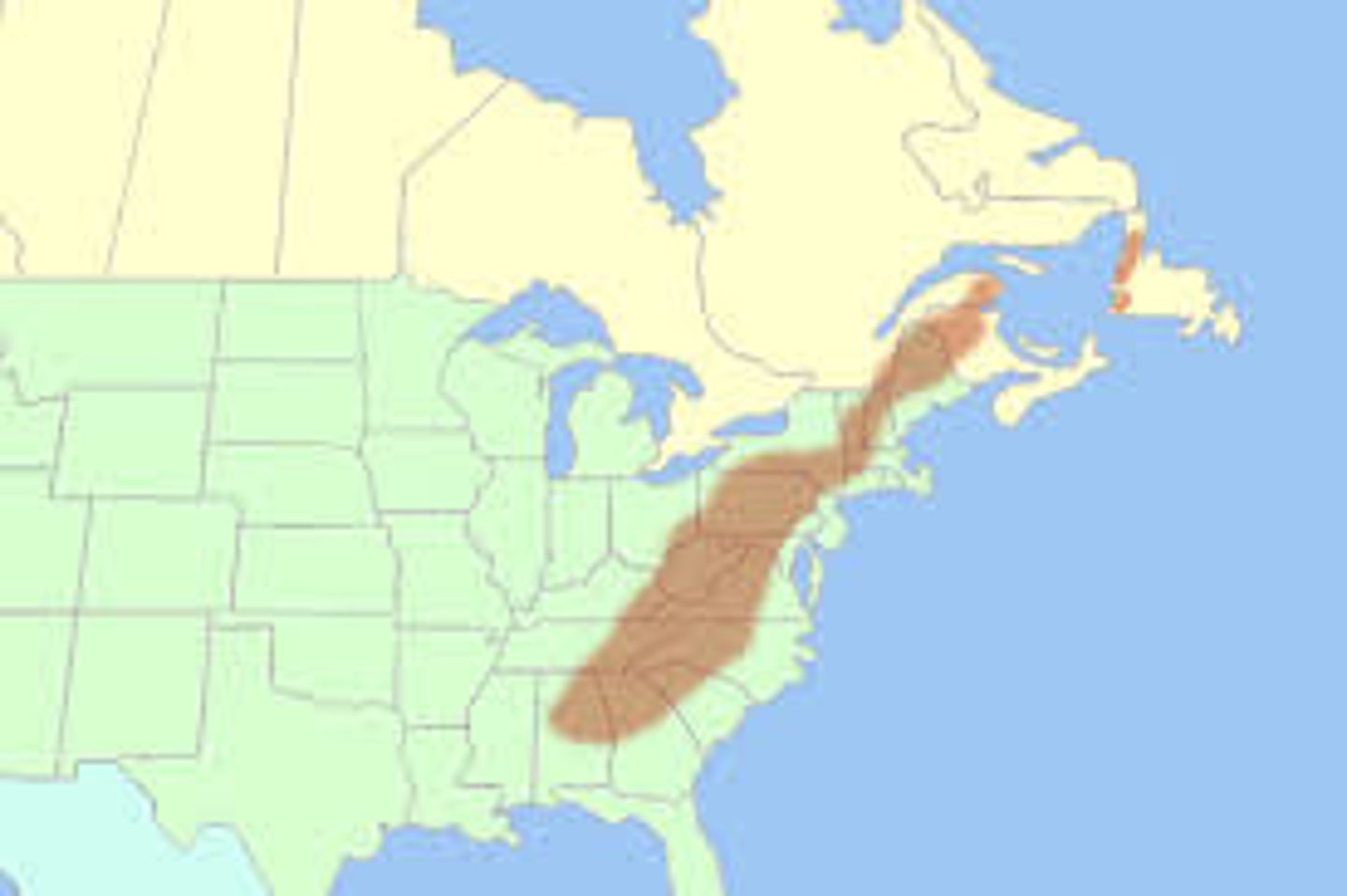
Appalachian Mountains
A mountain range that stretches from along eastern United States

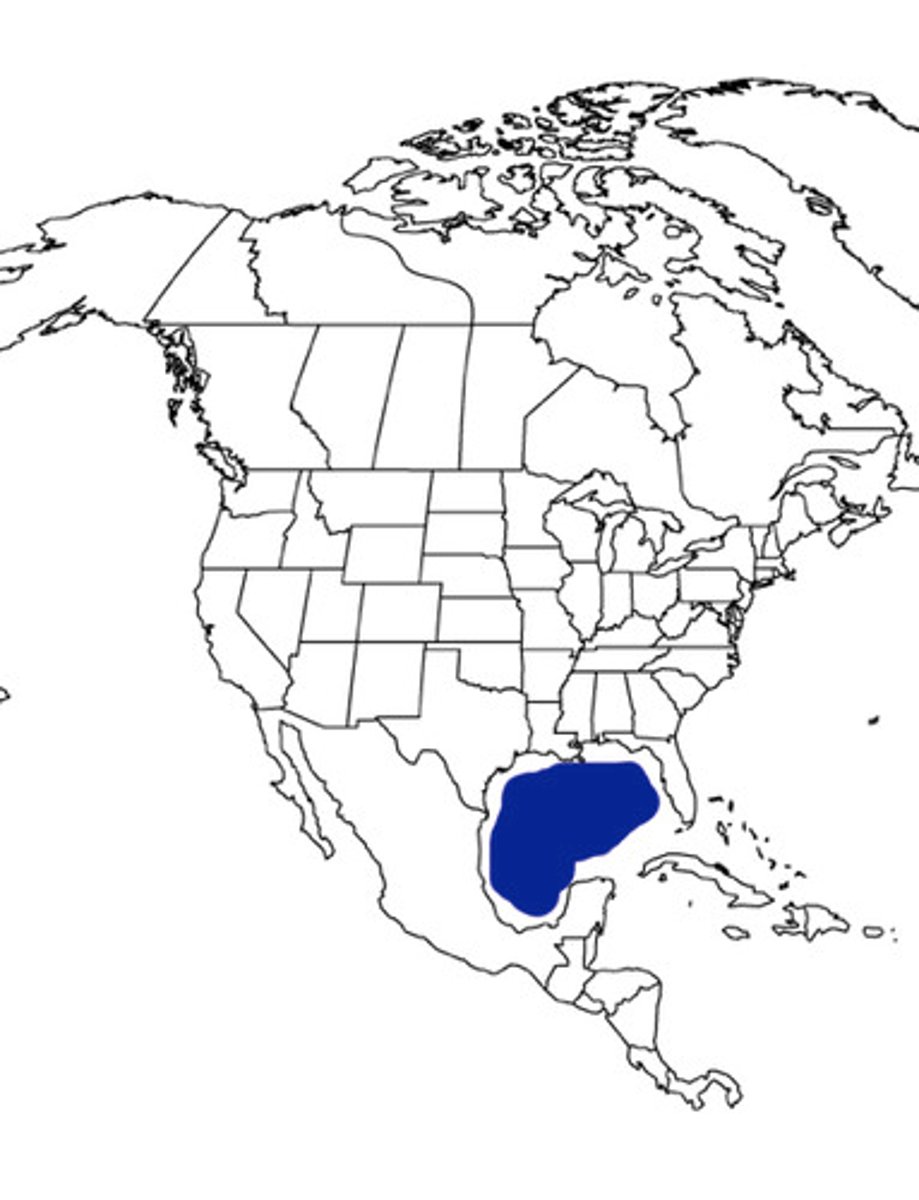
Gulf of Mexico
Body of water that forms Mexico's eastern border
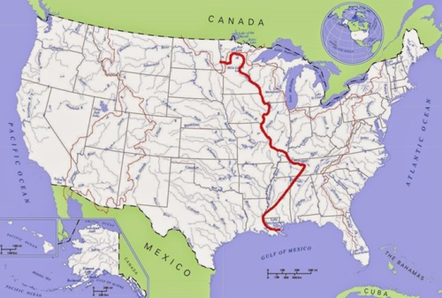
Mississippi River
The largest river and chief waterway of the United States
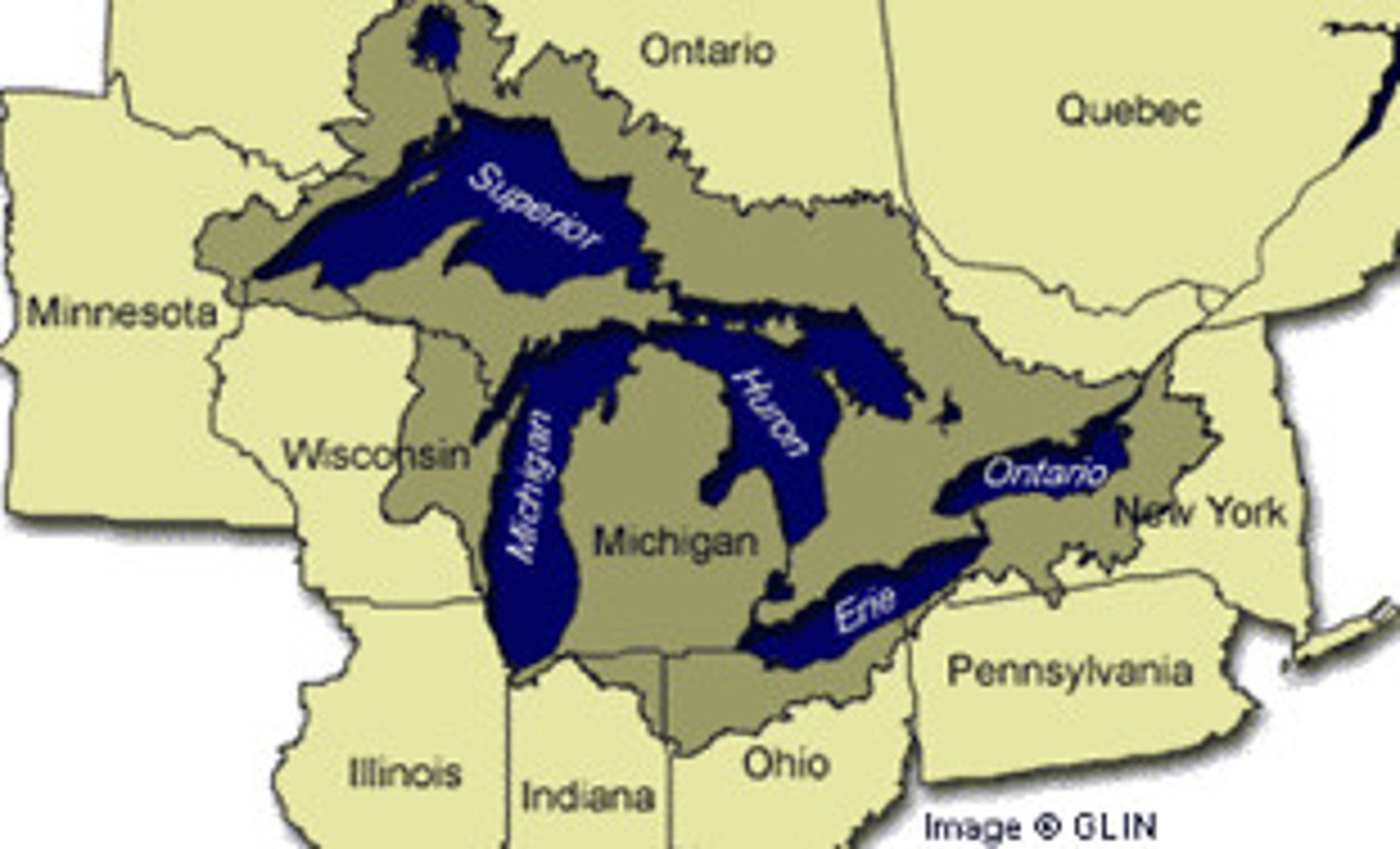
Great Lakes
The largest group of freshwater lakes in the world. They create a natural border between Canada and the US.

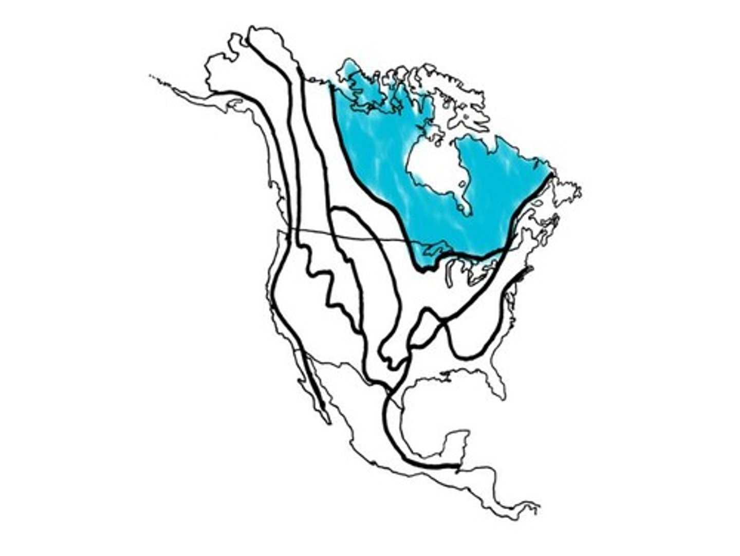
Canadian Shield
a U-shaped region of ancient hilly rock that curves around the Hudson Bay
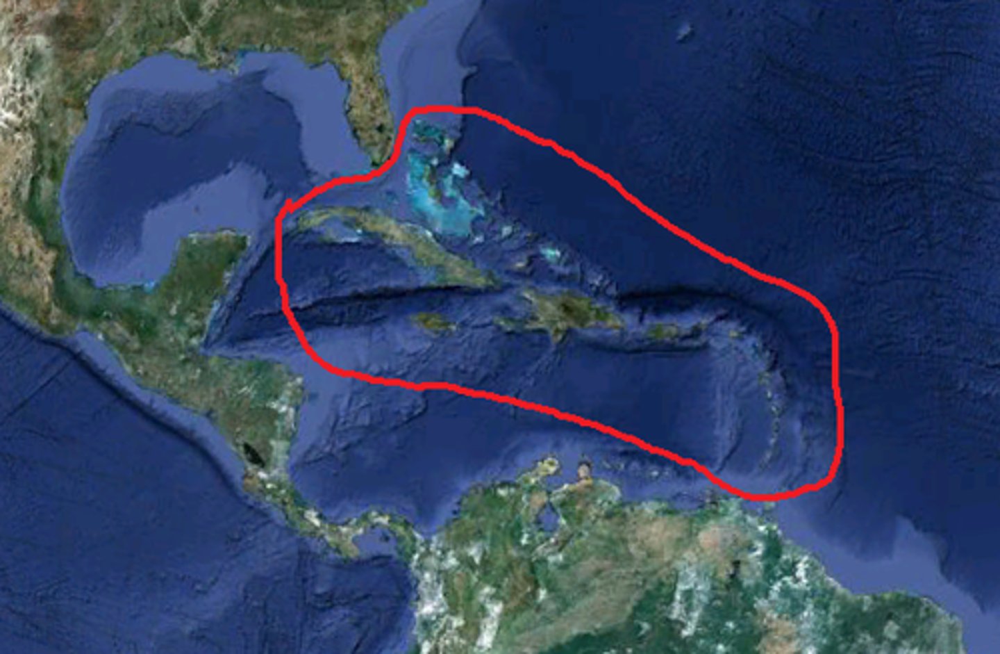
Caribbean Islands
About 7,000 islands in the Caribbean Sea, some of which are rocky, sandy, or volcanic.
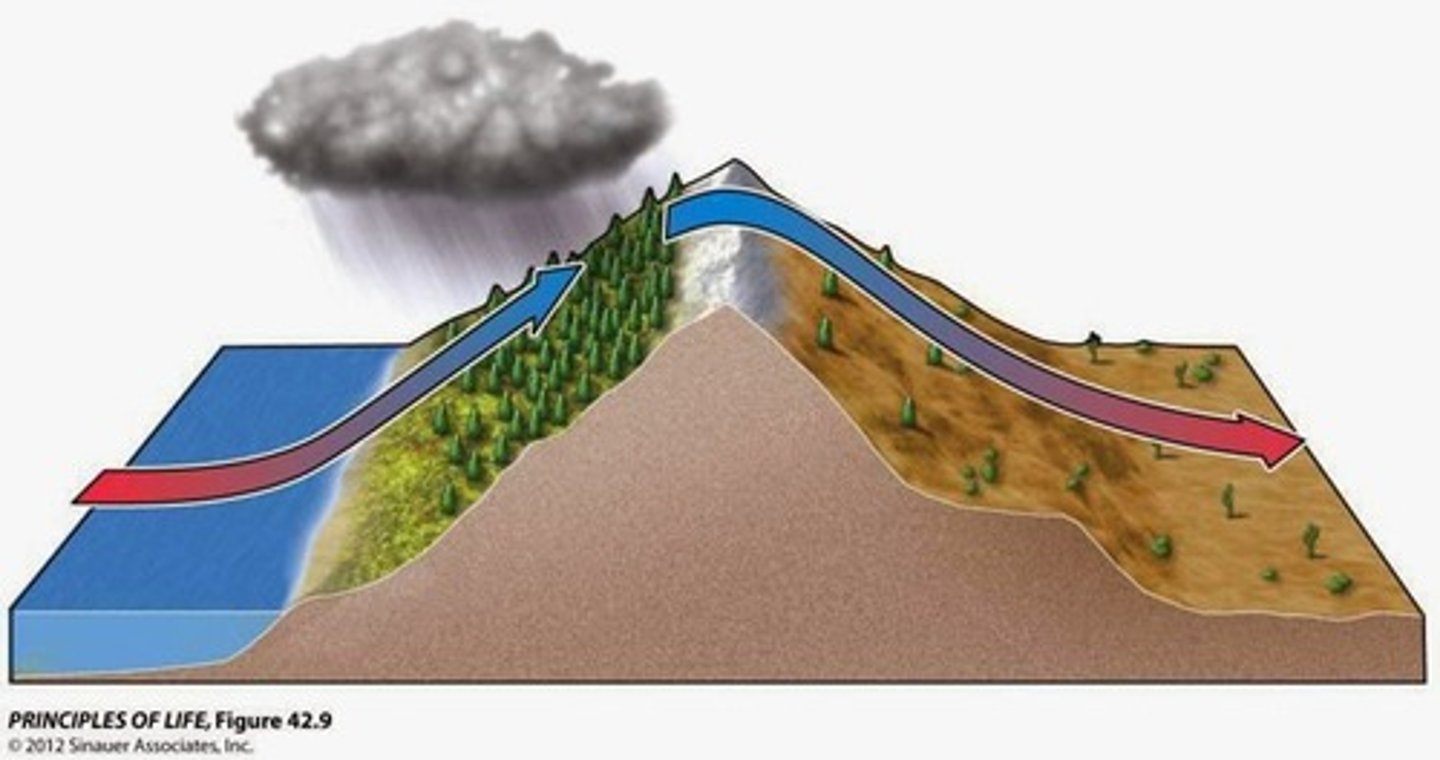
Rainshadow
The process by which rising air on one side of a mountain releases all of its moisture so that the opposite side receives only dry air. Can create a desert.
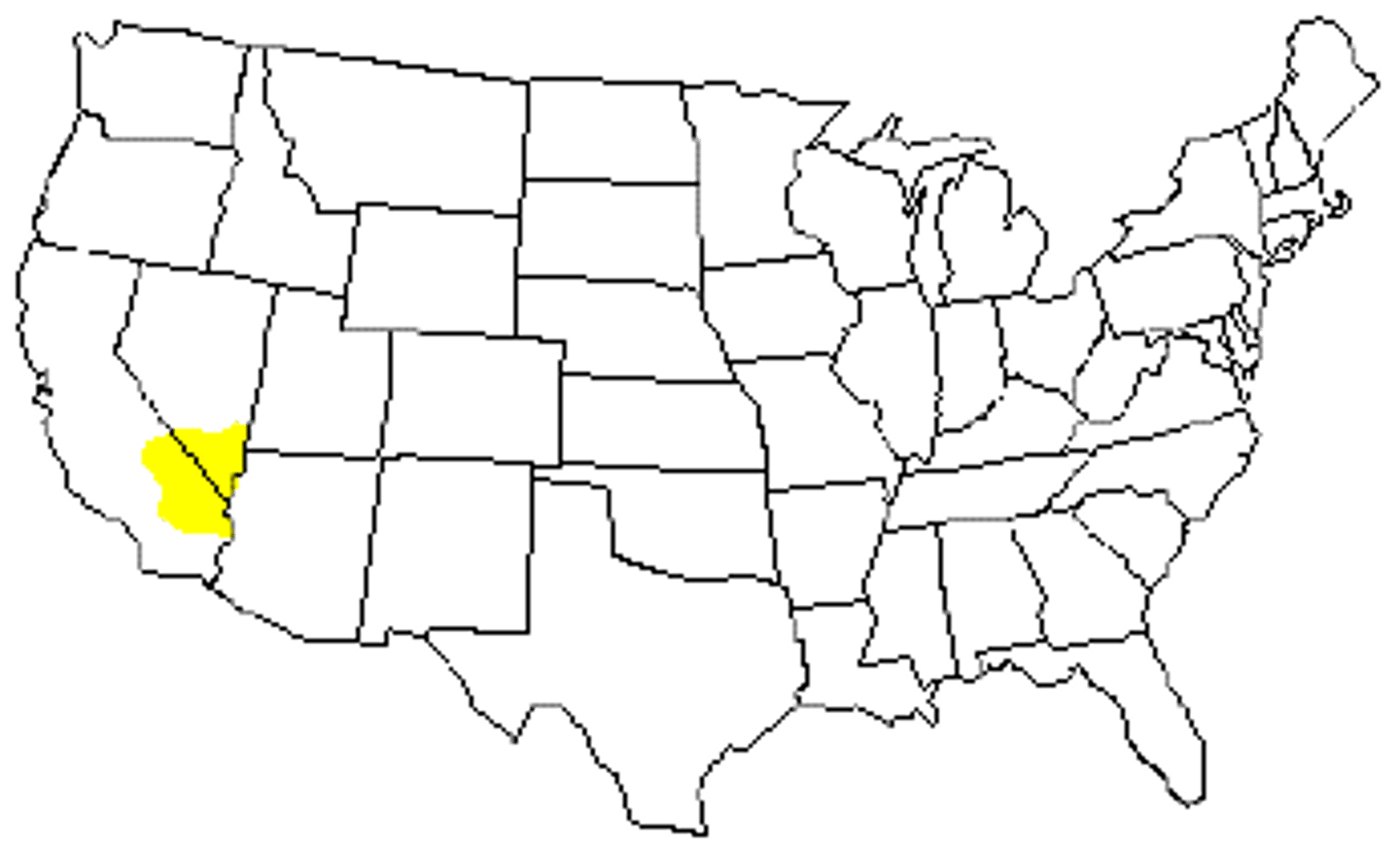
Mojave Desert
This desert is caused by a rainshadow and is entirely in the United States.
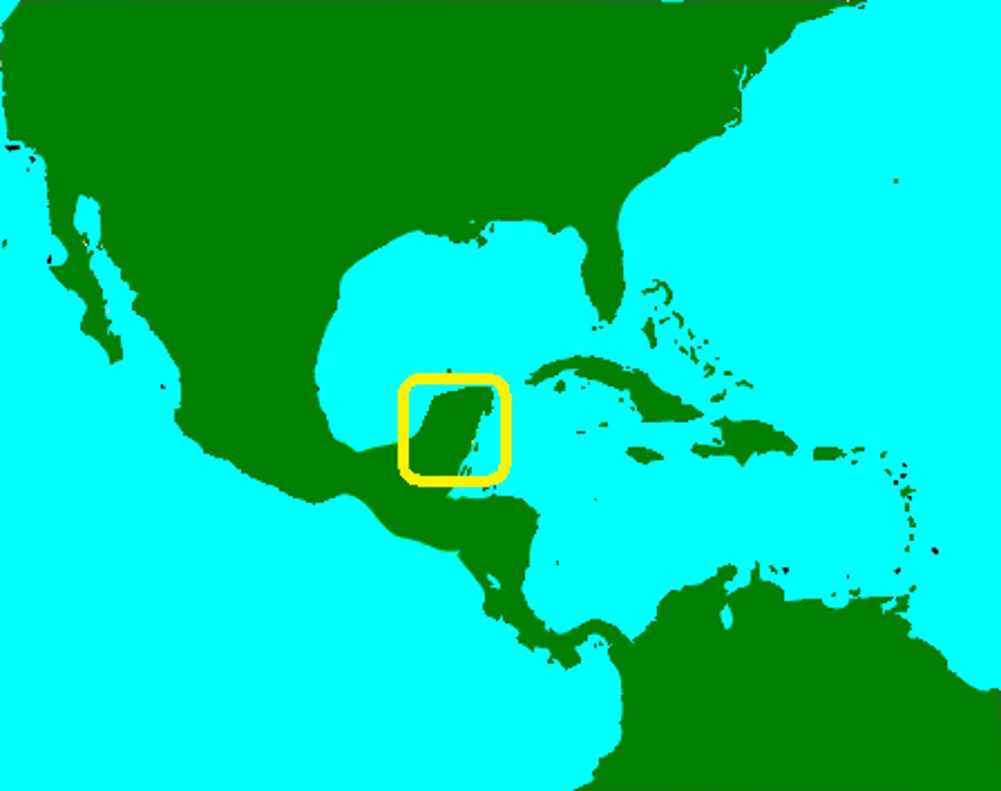
Yucatan Peninsula
A large peninsula that separates the Caribbean Sea from the Gulf of Mexico
Appalachian Mountains
A mountain range that stretches from eastern Canada south to Alabama.
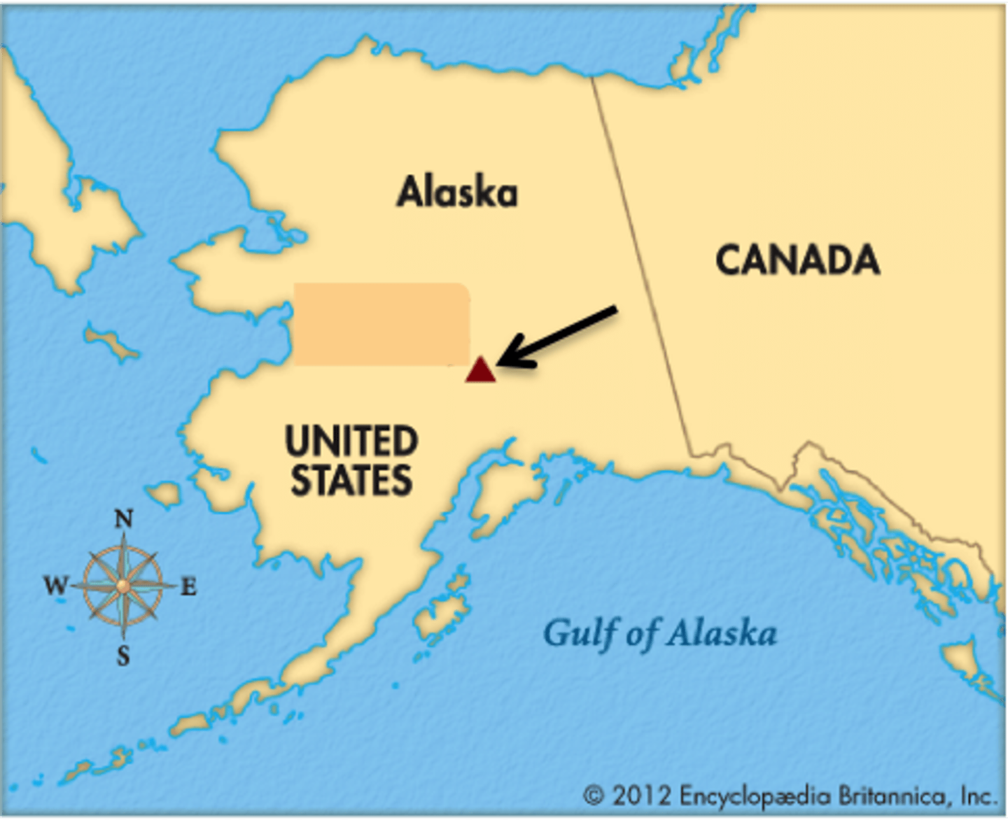
Mt. Denali
tallest peak in North America, found in Alaska
Great Lakes
a group of five freshwater lakes of the central North America between the United States and Canada