4 Intro Hydrology: Water balance and precipitation
 Call Kai
 Learn
Learn Practice Test
 Spaced Repetition
 Match
Match Flashcards
 Knowt Play
1/34

There's no tags or description
Looks like no tags are added yet.
Name | Mastery | Learn | Test | Matching | Spaced | Call with Kai |
|---|
No analytics yet
Send a link to your students to track their progress
35 Terms
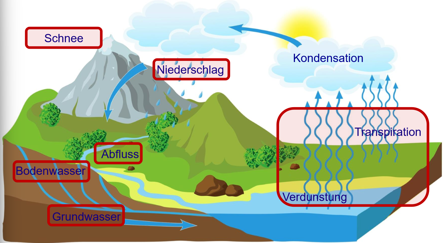
What are the elements of the hydrological cycle?
Evapotranspiration
Condensation
Precipitation
Snow
Runoff
Soil water
Ground water
What is the history of the hydrological cycle?
concept dates back to 3000 BP (before present), described based on guess work, mythology and religious convictions
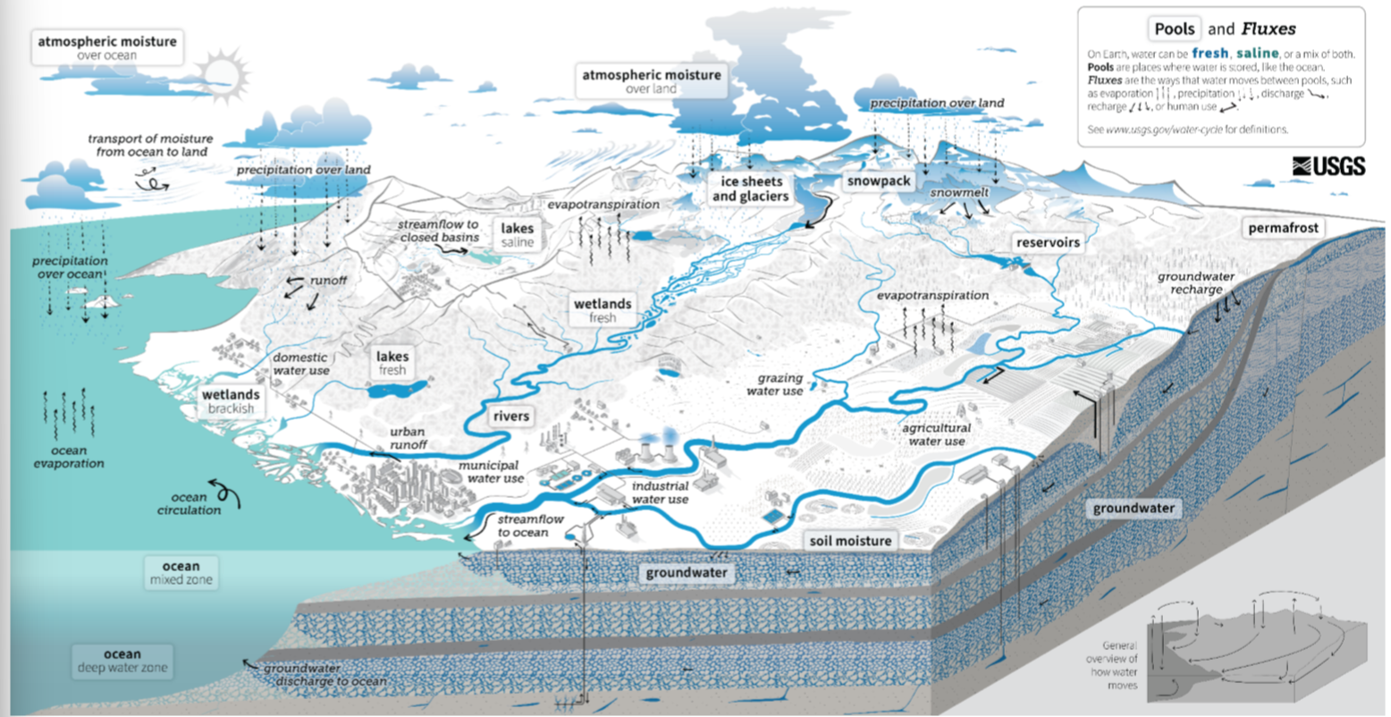
What are issues of the hydrological cycle?
only show one direction (e.g. no precipitation above the oceans which is actually the biggest flux)
groundwater is a river below the surface
no human activities (e.g. groundwater pumping, hydro power)
What does a newer water cycle look like?
What is Einzugsgebiet in English? 2 terms
catchment
watershed
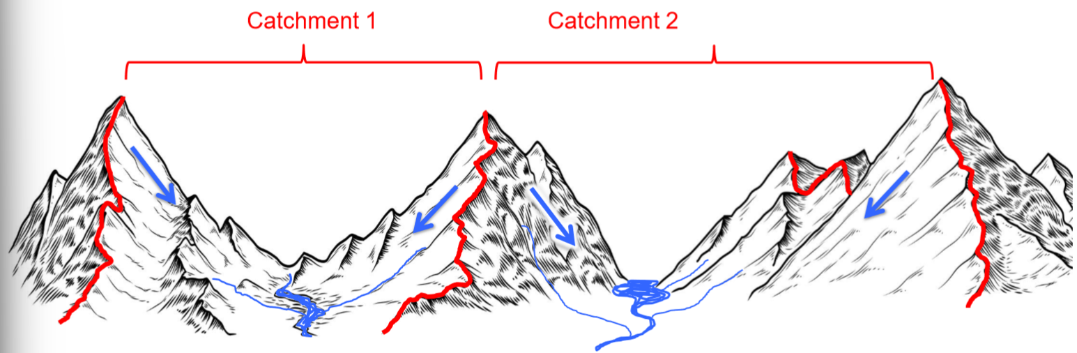
How do you define the boundaries of the catchment?
surface topography → water divides
We take the highest points in the landscape and look at which direction (→ which direction) water flows when it rains
What can you use to see the surface topography?
map with contour lines
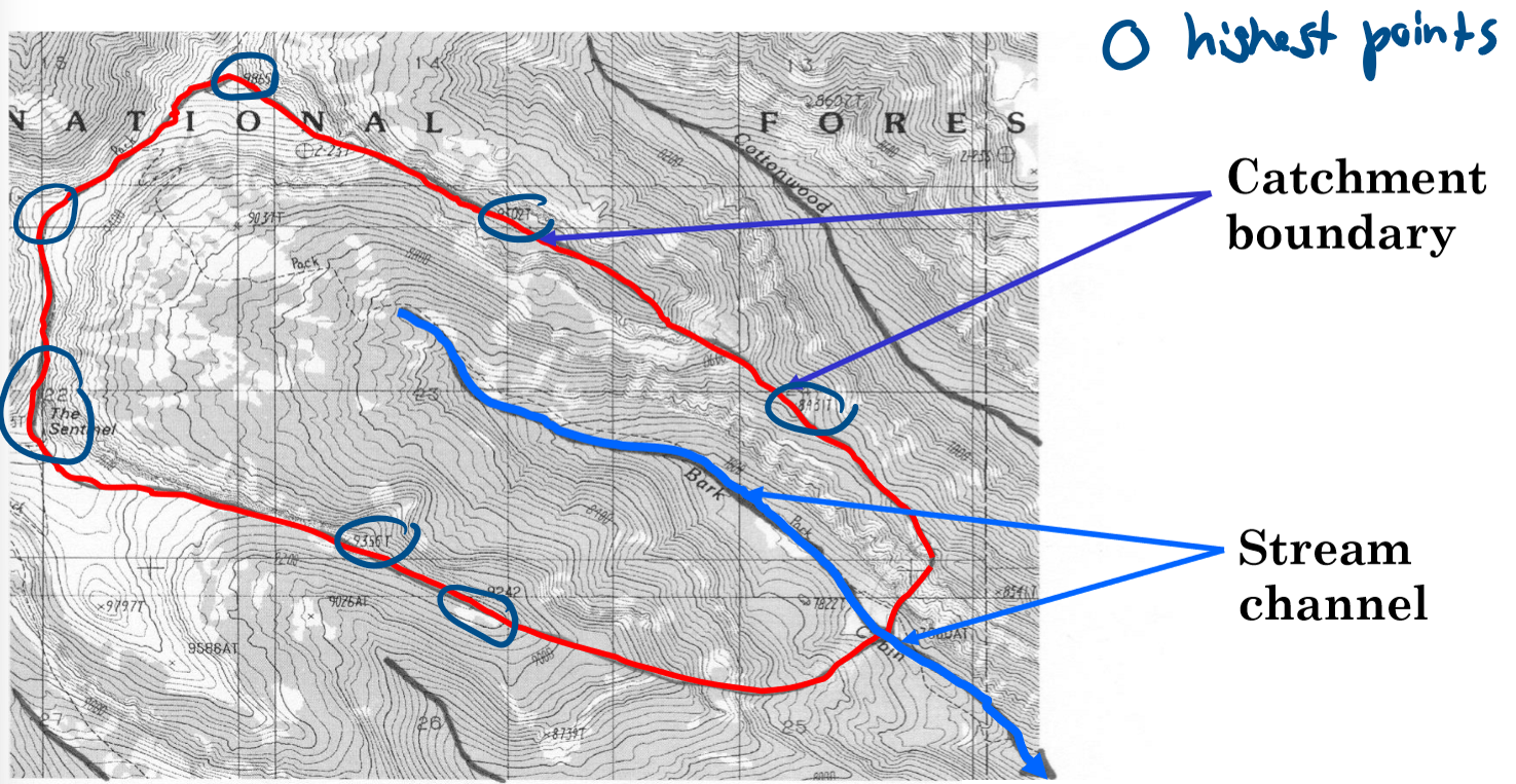
What is the issue with water divides?
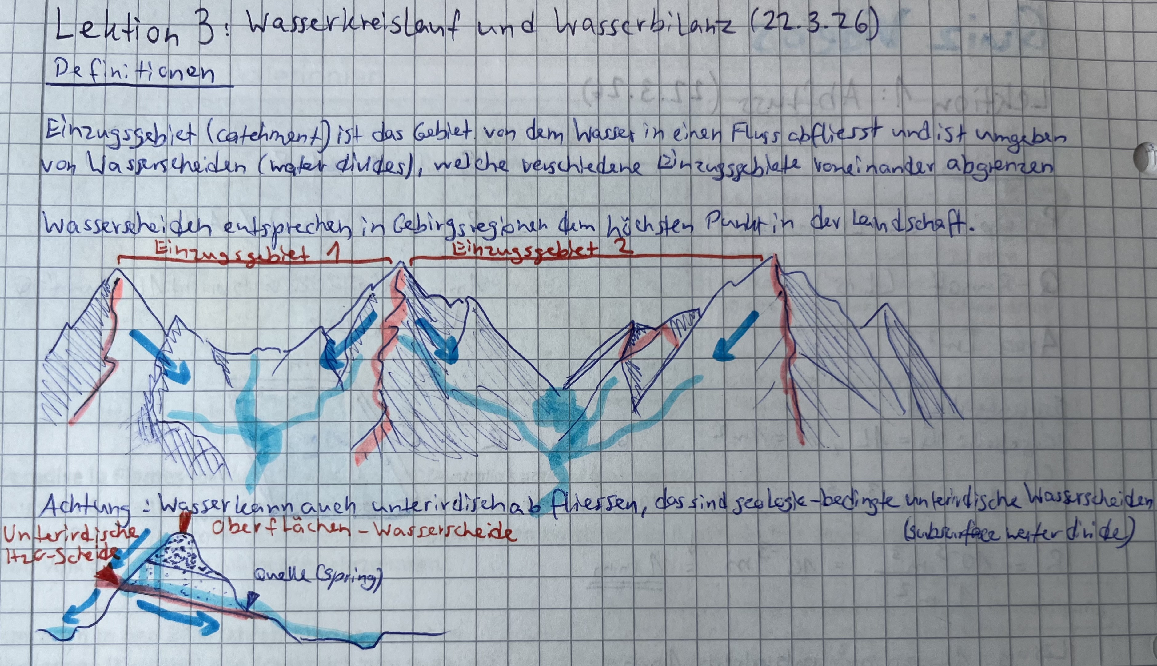
Where is this especially relevant?
subsurface water divides
The topography only shows surface water divides, majority of the water flows through permeable layers of soil
Geology matters, especially in Karst areas
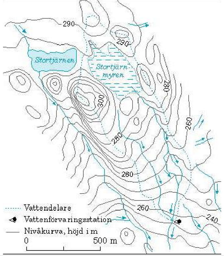
Why is the delineation of water divides difficult for flat area?
Countries with lots of flat areas don’t have many high points in the landscape
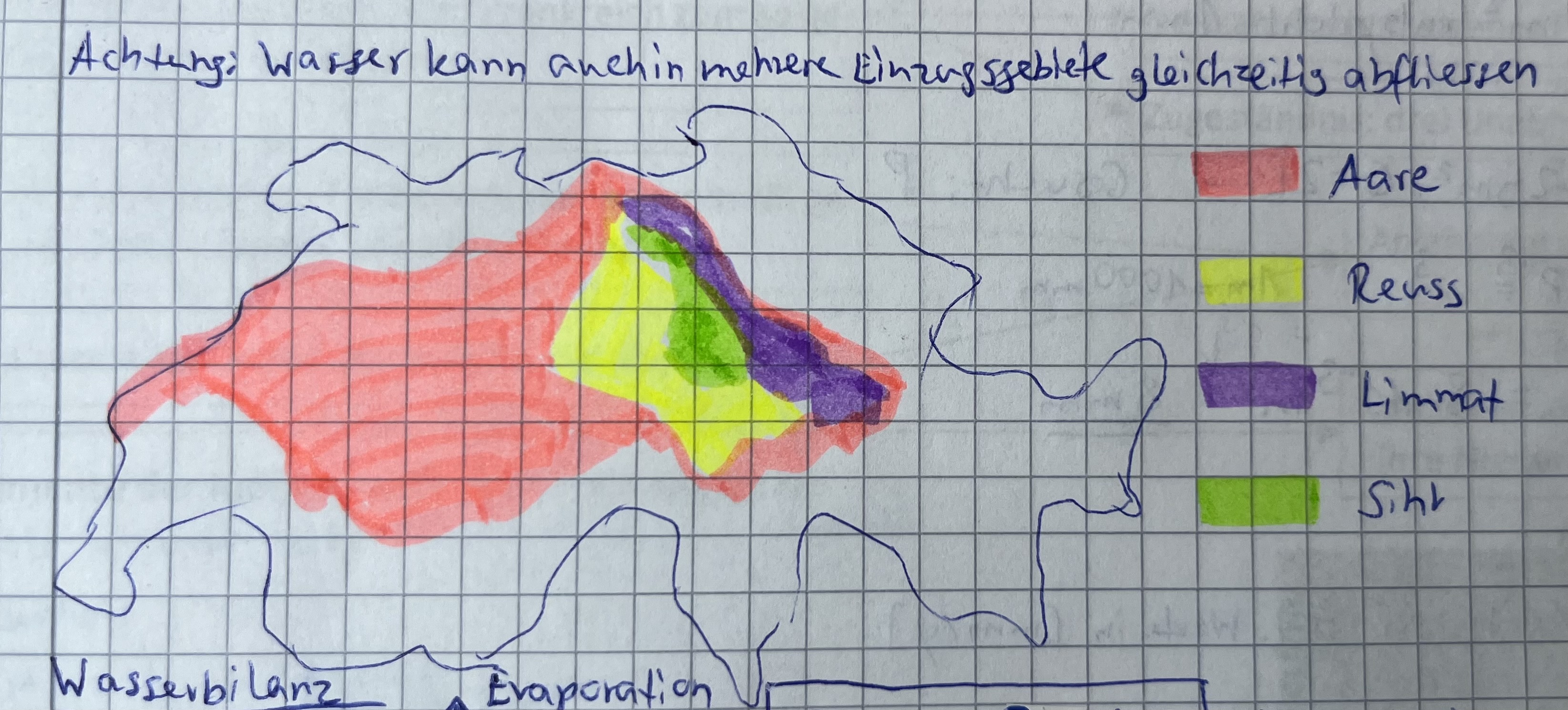
How can catchments interact with each other?
A smaller catchment can be included in a bigger catchment etc.
Water balance:
Definition
Accounting for the catchment area, includes the influx, outflux and storage
Water balance:
Formula and units
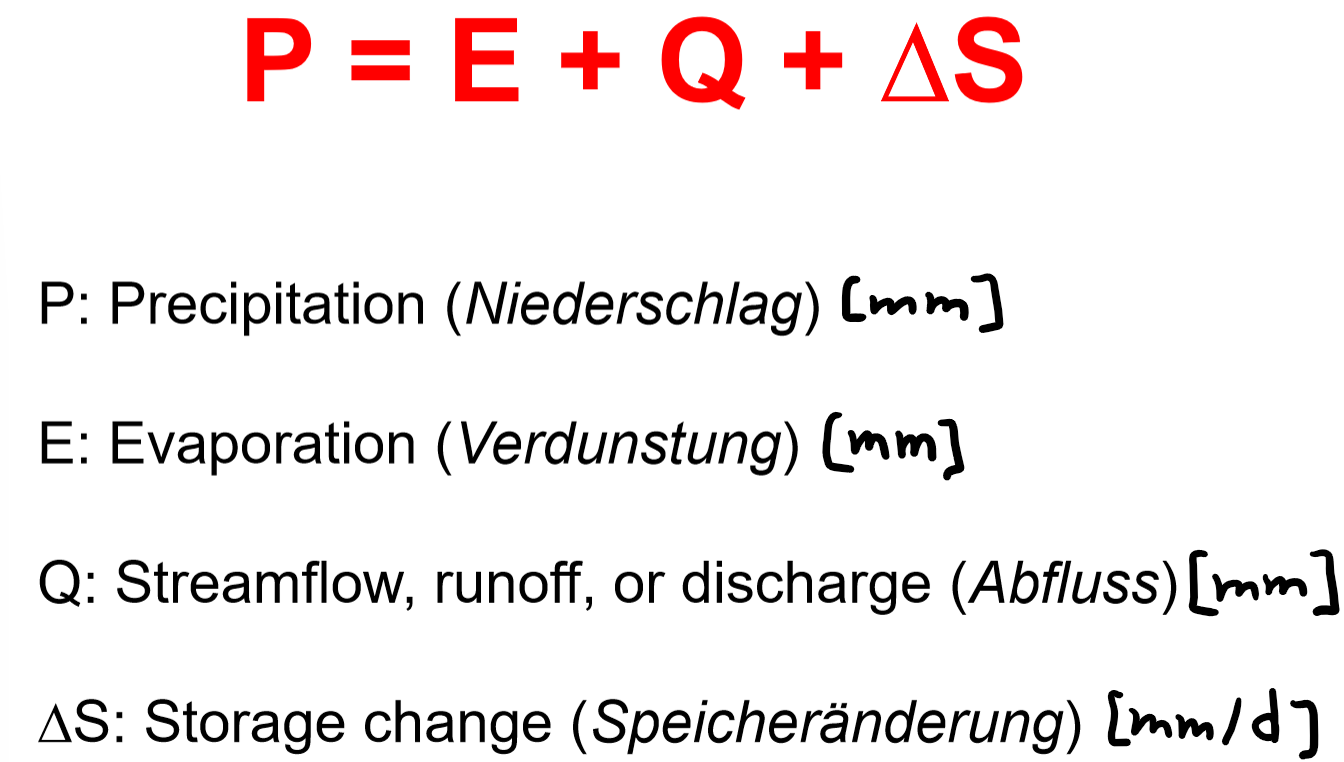
Water balance:
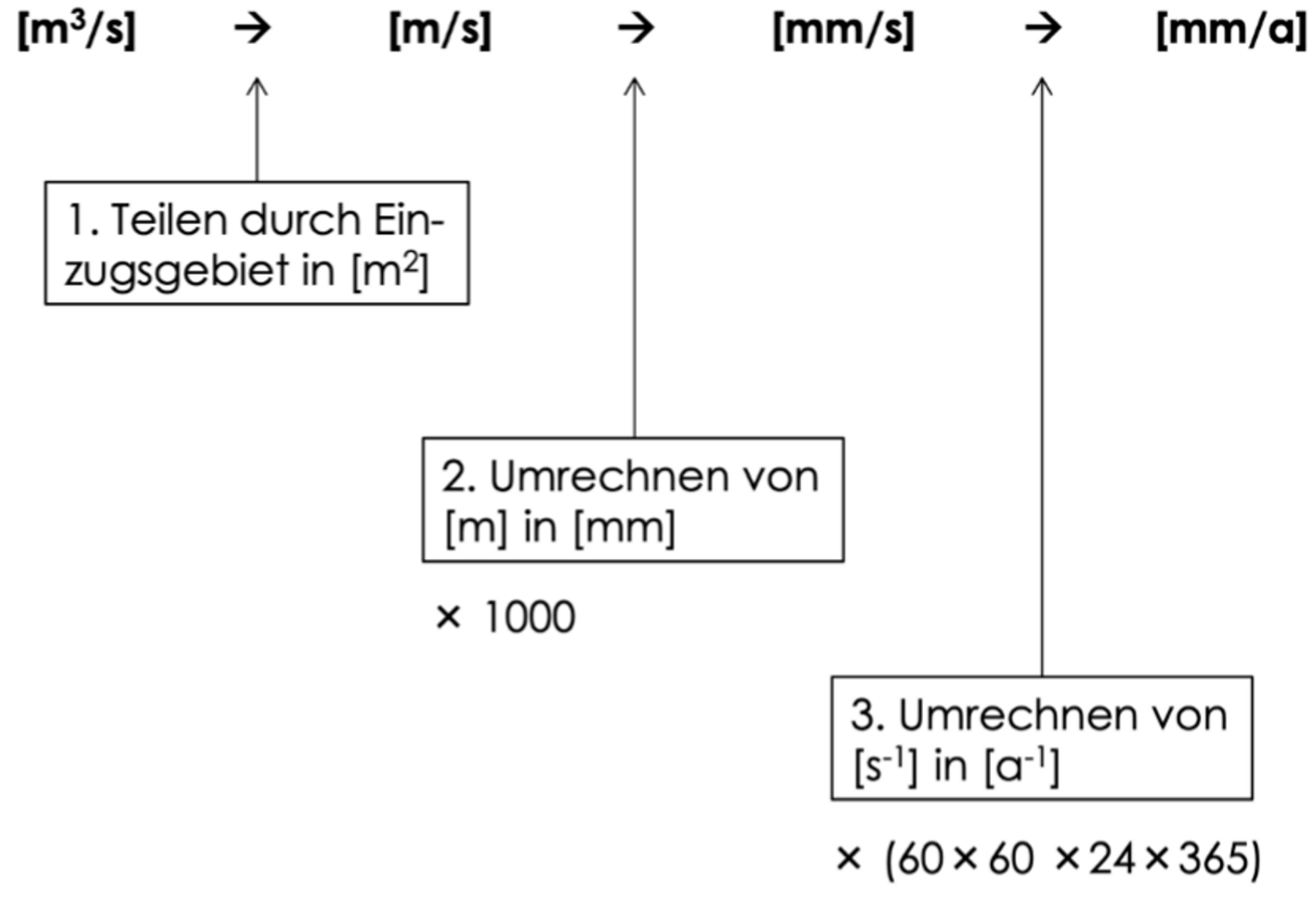
What is important for unit conversion?
Discharge → specific discharge
Height → volume
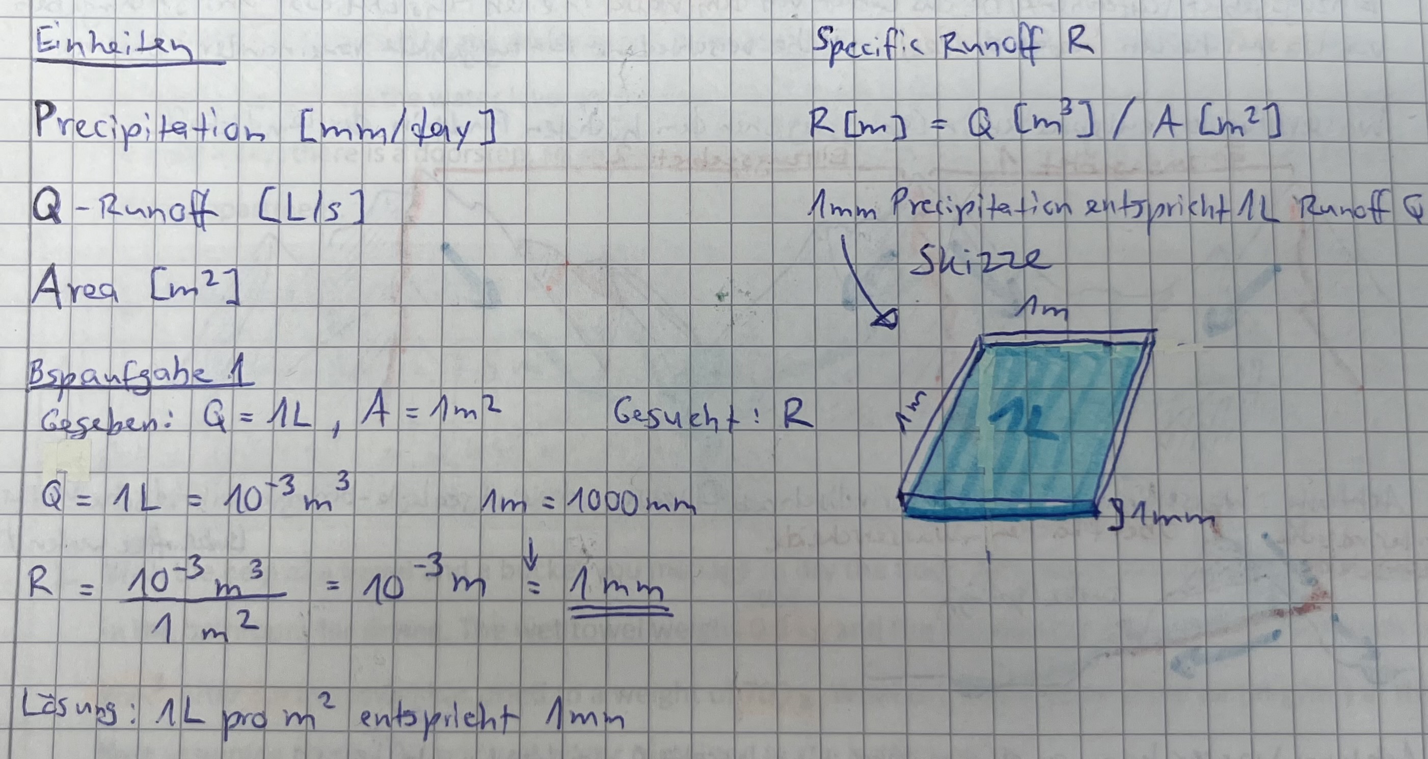
Water balance:
What is the height of 1L water on 1 m2?
Water balance:
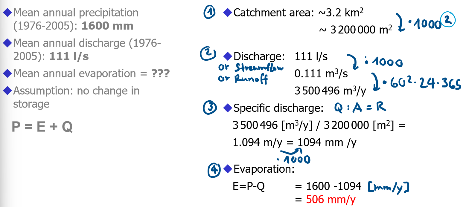
Example Rietholzbach
What are the steps?
What is the water balance in Switzerland?
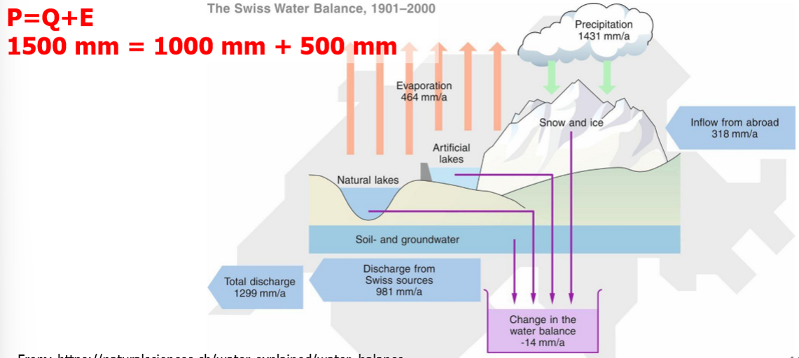
How has the water balance in Switzerland changed from 1900 to 2010?
slight changes in precipitation and discharge because of climate change
Precipitation:
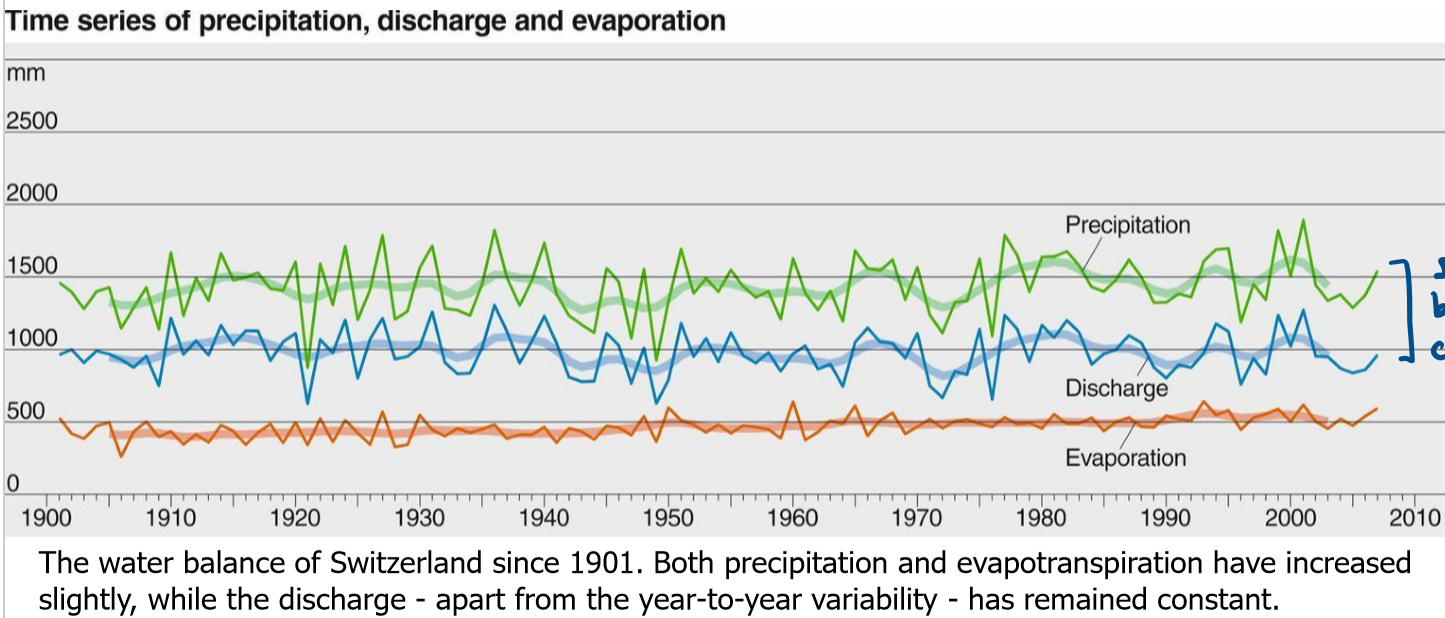
How does it form?
Where is which type typical?
convective: typical for summer thunderstorms
orographic: mountaneous regions
frontal: regions that receive tropical air
Precipitation:
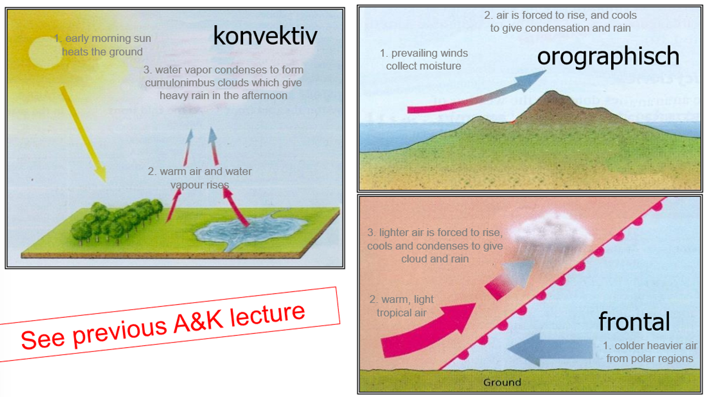
Side view of orographic precipitation
Precipitation:
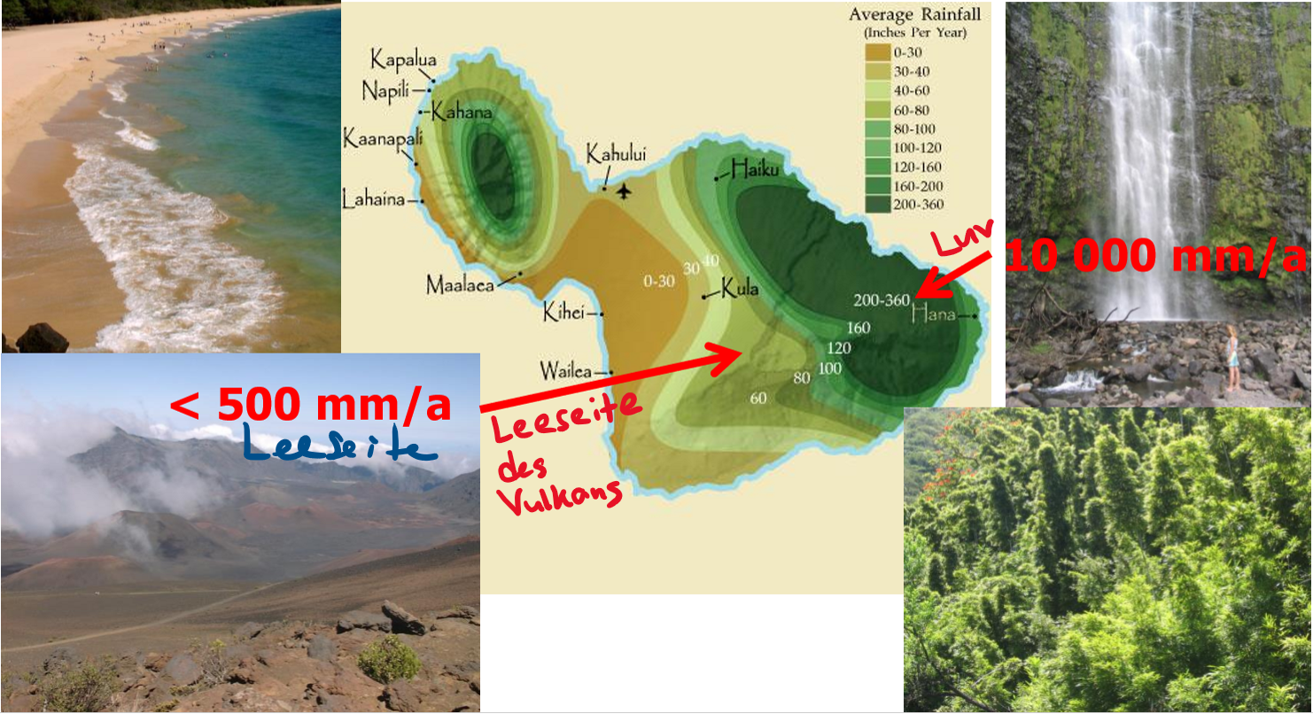
How is precipitation spatially distributed across Maui, Hawaii?
Precipitation:
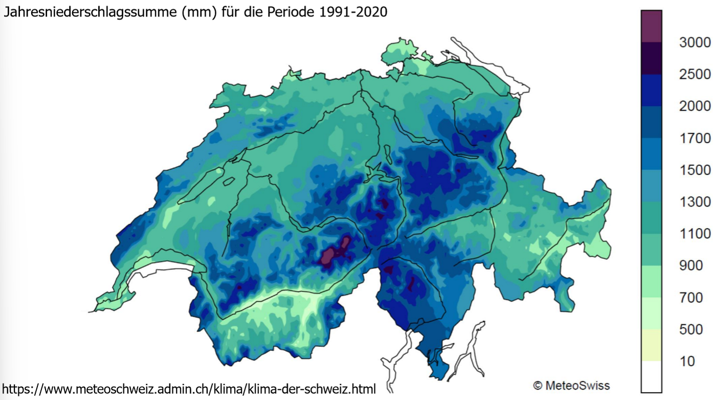
How is precipitation spatially distributed across Switzerland? (annual precipitation)
Alpennordseite: konvektiv
Alpensüdseite: orographisch, frontal
ganze Schweiz
Precipitation:
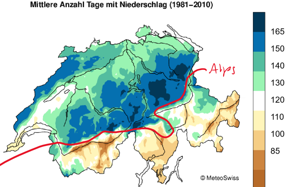
How is precipitation spatially distributed across Switzerland? (precipitation days)
in Ticino and Valais there is a low number or precipitation days, however when it occurs it’s in form of a heavy rainfall
Precipitation:
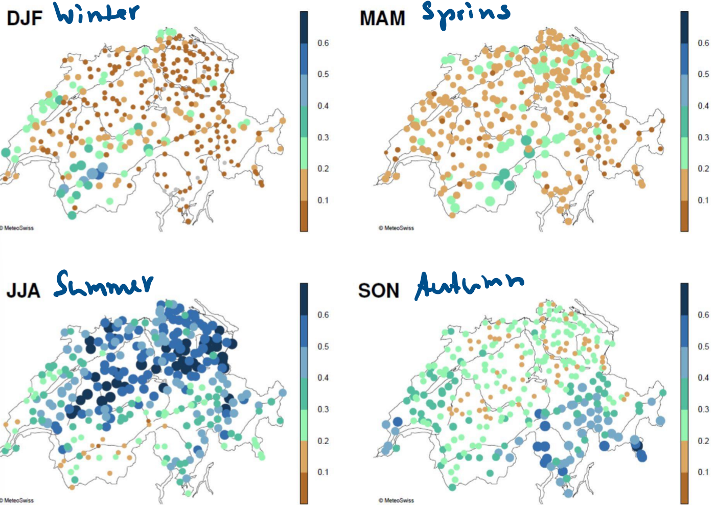
How is precipitation spatially and seasonally distributed across Switzerland? (1-day max precipitation)
summer: afternoon/evening, convective, thunderstorms
winter: entire day
Precipitation:
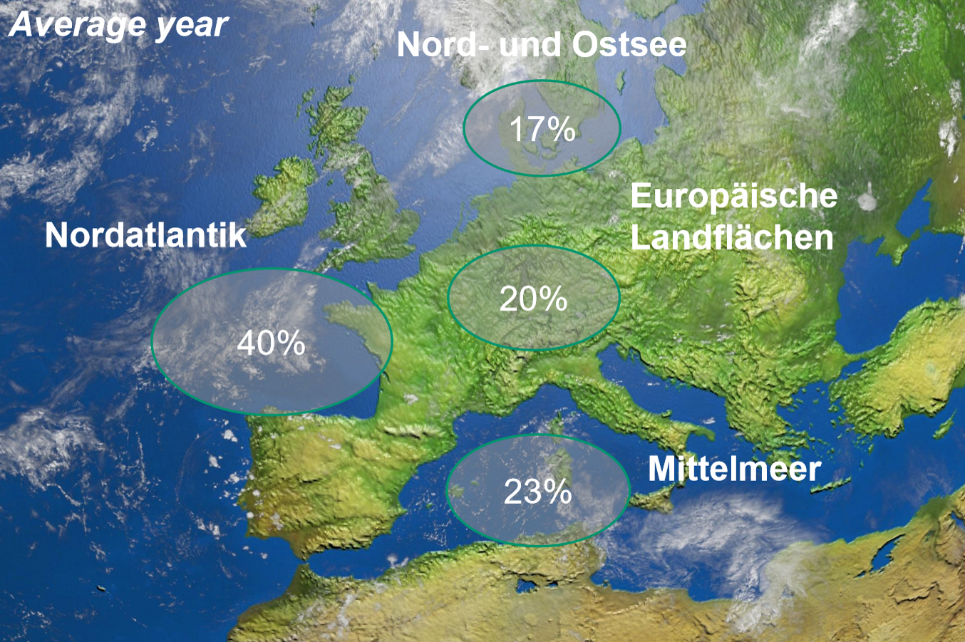
Where does what percentage of Europe’s rainfall occur?
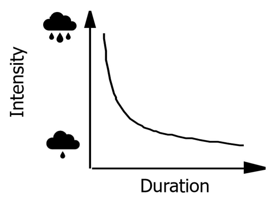
What is the relation between maximum intensity and duration?
What is the intensity duration curve used for?
intense - short
light - long
→ used for predictions
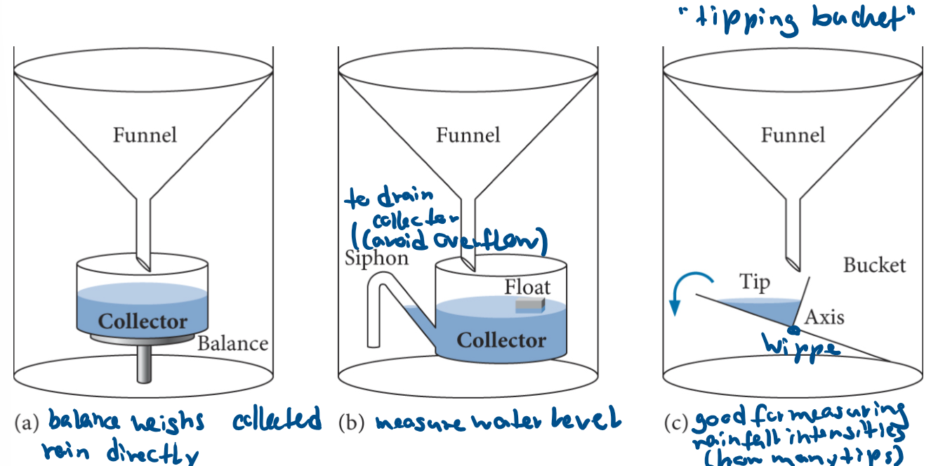
How is precipitation measured?
precipitation gauges
totalisator (with windshield)
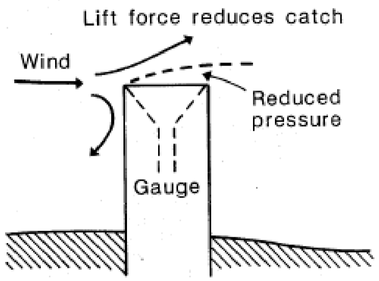
What are measurement errors and issues?
catch errors
splash (ok if 1.5 - 2m above ground)
evaporation
low intensity rain / fog / snowflakes
instrument errors (continuous gauges)
observer errors (manual read gauges)
wind (increased wind speed at the gauge orifice carry away small drops)
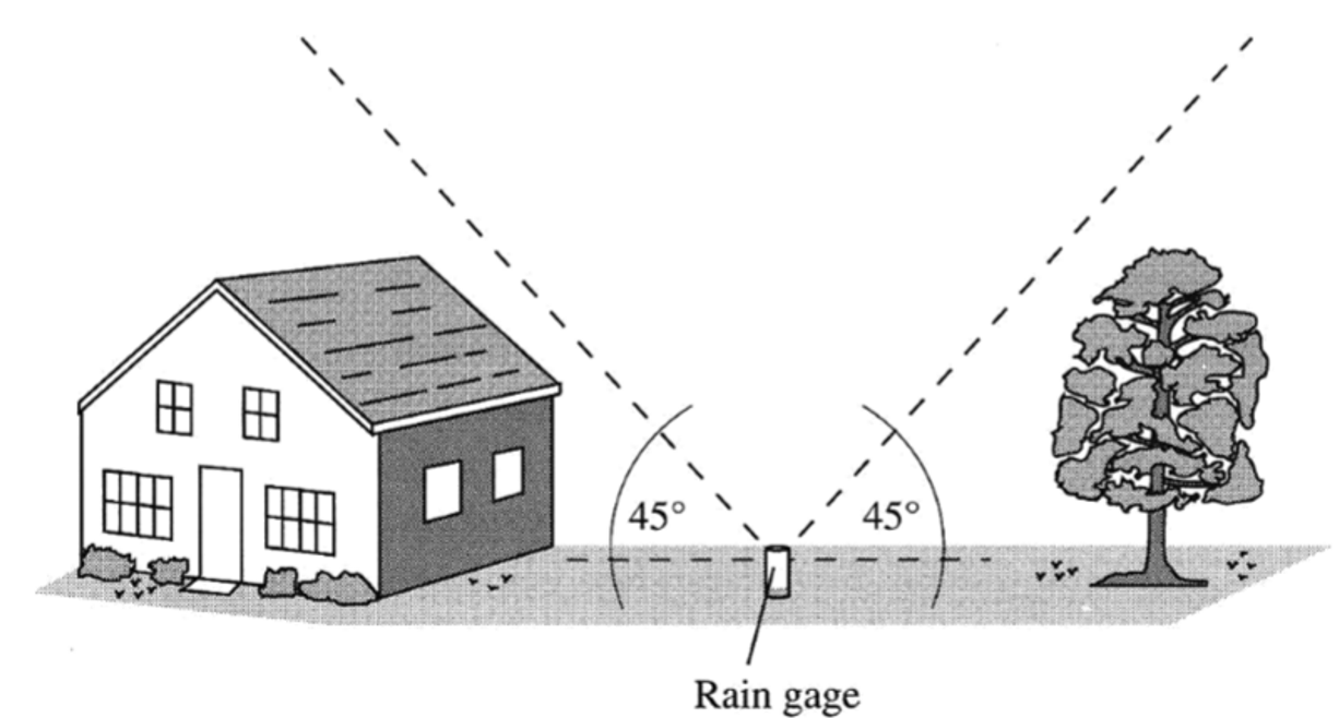
How should a rain gauge be located?
2x the height of the obstruction (preferably 4x) away
45° cone above rain gauge should be empty
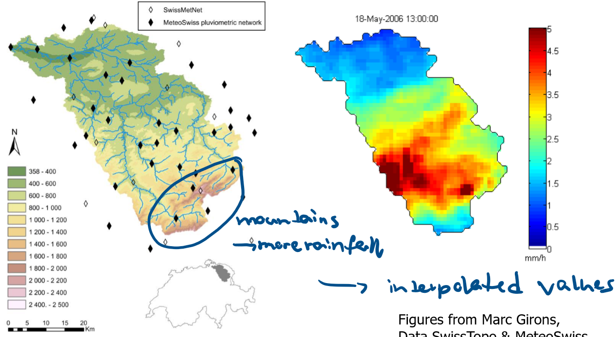
How is the precipitation distributed spatially in the Thur catchment?
mountains increase rainfall on the windward side (luv)
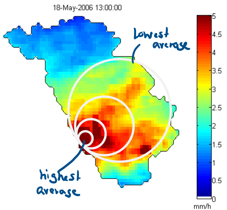
What can be observed about the change in average intensity with area in the Thur catchment?
creating the average for high-intensity events creates a gap between the averages, because the sizes of the areas are different
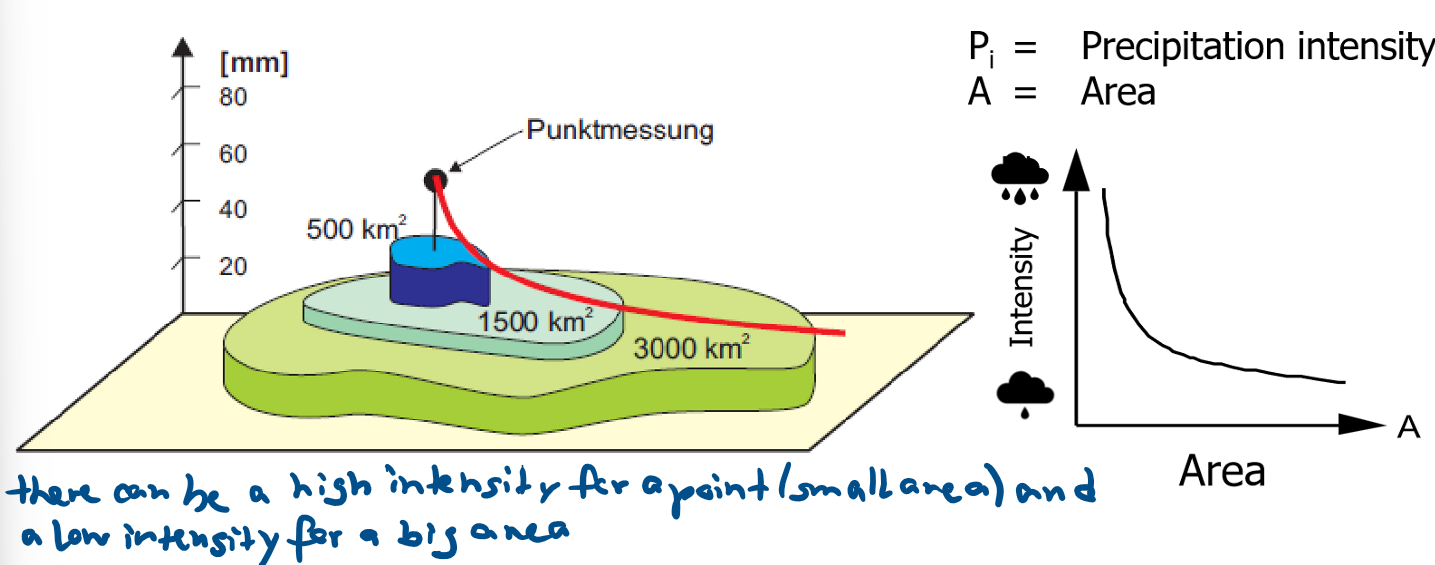
How does average rainfall behave in relation to area?
there can be a high intensity for a point (small area) and a low intensity for a big area
What ways are there to determine the spatial distribution of a catchment?
arithmetic mean
Thiessen polygons
Isohyet method
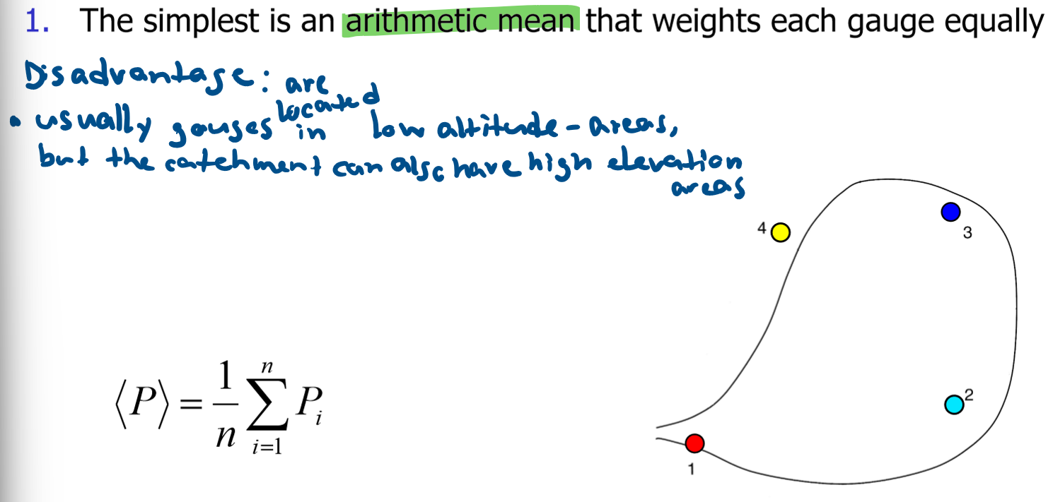
How does the arithmetic mean work?
What is the disadvantage?
each gauge is weighted equally and the mean is calculated
Disadvantage: usually gauges are located in low-altitude areas, even if the catchment also has high elevation areas
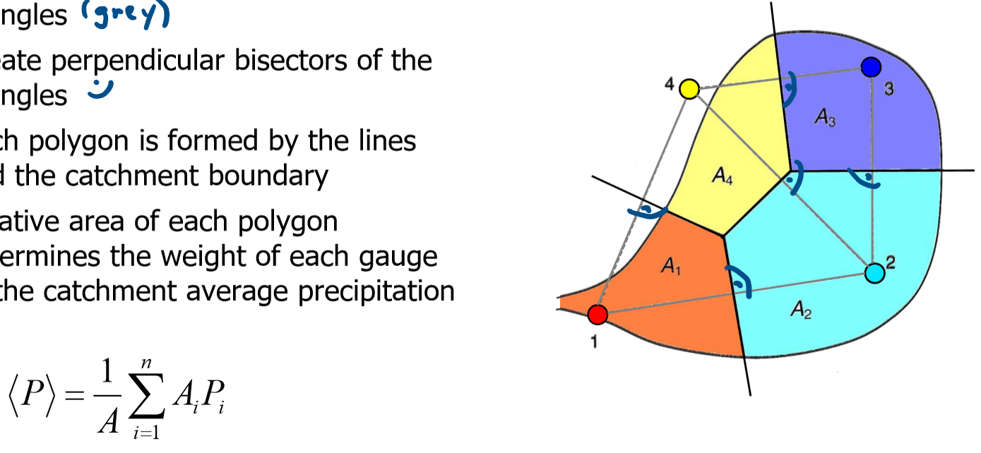
How do the Thiessen polygons work?
What is the advantage?
◆ The area is divided into n subregions, each centered on each of the n rain gauges
◆ All points in each subregion are closer to their central gauge than any other gauge
◆ Assume uniform precipitation for each subregion
◆ Each gauge represents a sub-area Ai
◆ The spatial average is calculated by weighting the individual stations with their representative area
Advantage: suitable for flat countries, because there are little changes in altitude
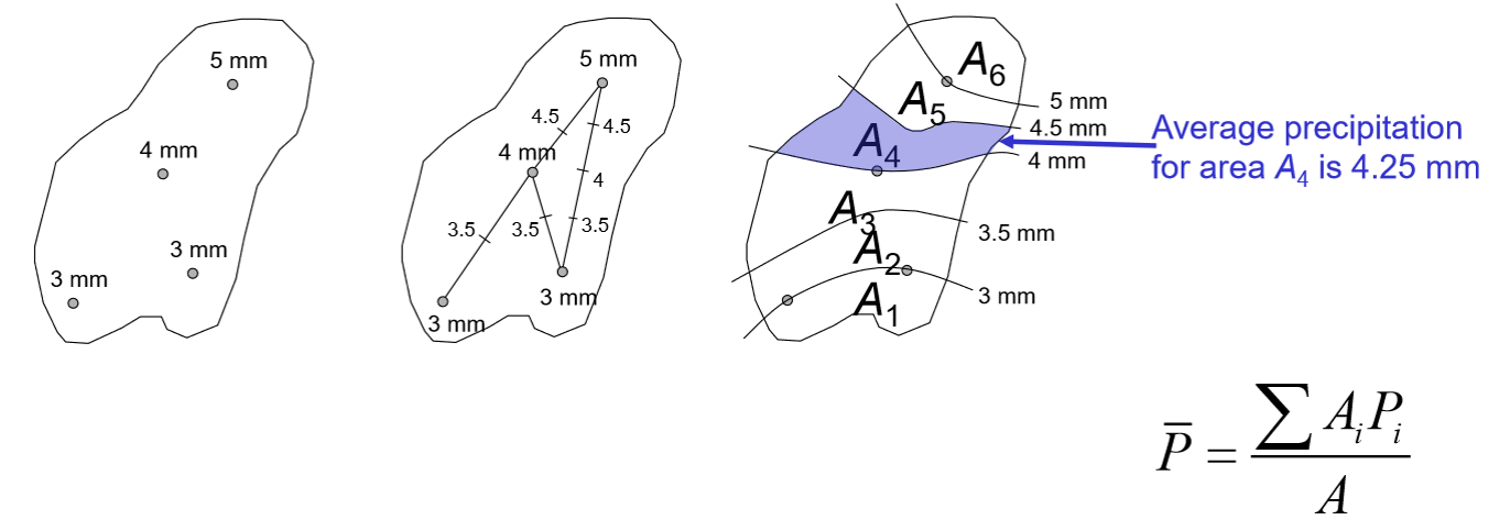
How does the isohyet method work?
interpolate the measured values at the gauges
→ draw isohyet lines of equal precipitation
→ calculate spatial average by weighing the gauges with their area