AP Human Geography
1/103
There's no tags or description
Looks like no tags are added yet.
Name | Mastery | Learn | Test | Matching | Spaced | Call with Kai |
|---|
No analytics yet
Send a link to your students to track their progress
104 Terms
Political Map
Map displaying political boundaries; countries, counties, cities, parks, etc.
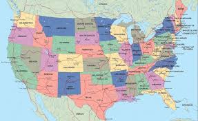
Physical Map
Map illustrating natural features such as mountains, rivers, and terrain. It often shows elevation and landforms.
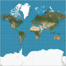
Mercator Projection
Pros: Accurate shape and direction; great if navigating with a compass
Cons: not correct sizing, very distorted
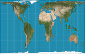
Gall-Peter’s Projection
Pros: Accurate size
Cons: Shape is very distorted
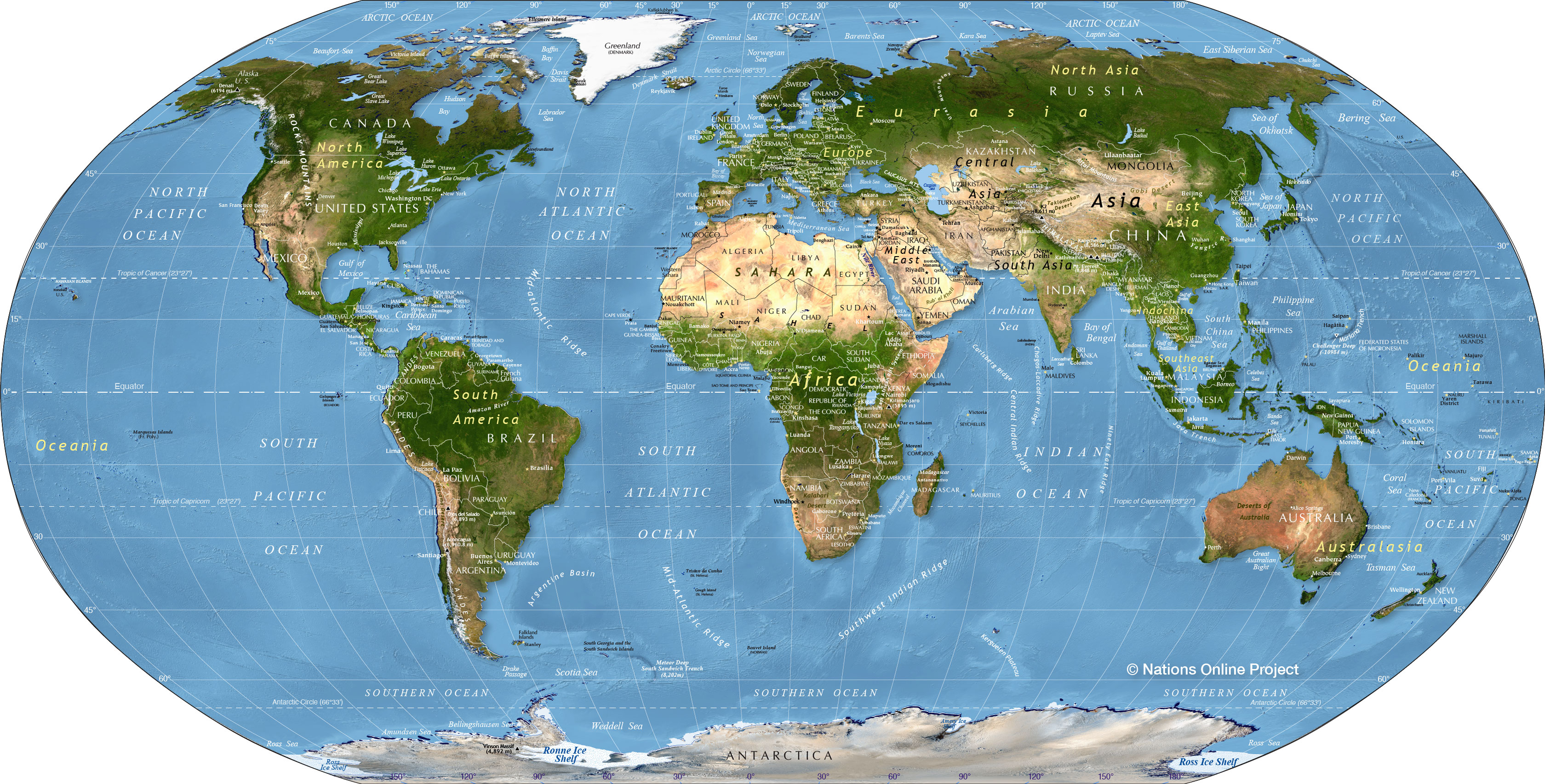
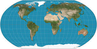
Robinson Projection
Pros: Kinda able to preserve size and shape
Cons: neither size or shape is accurate
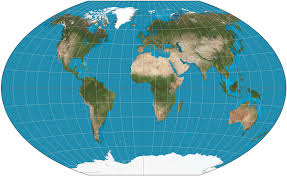
Winkel Tripel Projection
Pros: Kinda able to preserve size and shape
Cons: Neither size or shape is accurate (but better than the Robinson projection)
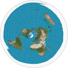
Polar Azimuthal Projection
Pros: Size, shape and direction are generally accurate
Cons: can only see half the world
Reference Maps
shows boundaries, names of locations, roads, railroads, coastlines, rivers and lakes. think political map or physical map.
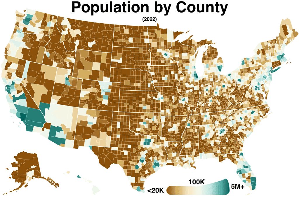
Thematic Map
map specifically designed to show a particular theme connected with a specific geographic area. Ex. Choropleth, Dot Density, Graduated Symbol Map, Isoline, Cartogram, Mental Map.
Choropleth
Uses varying shades of color corresponding to a data set
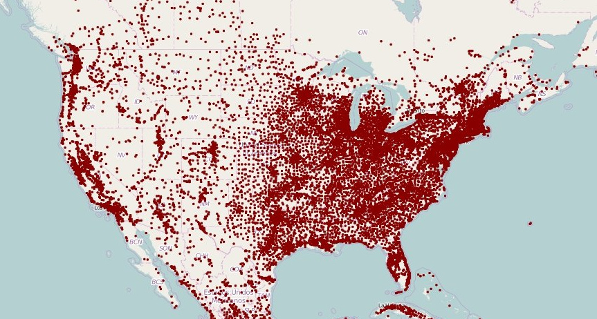
Dot Density
A dot is placed every time a variable is present.
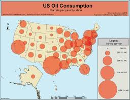
Graduated Symbol Map/Proportional Symbol Map
symbols are used proportional the size of the data
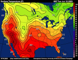
Isoline Map
lines drawn on a map connecting data points
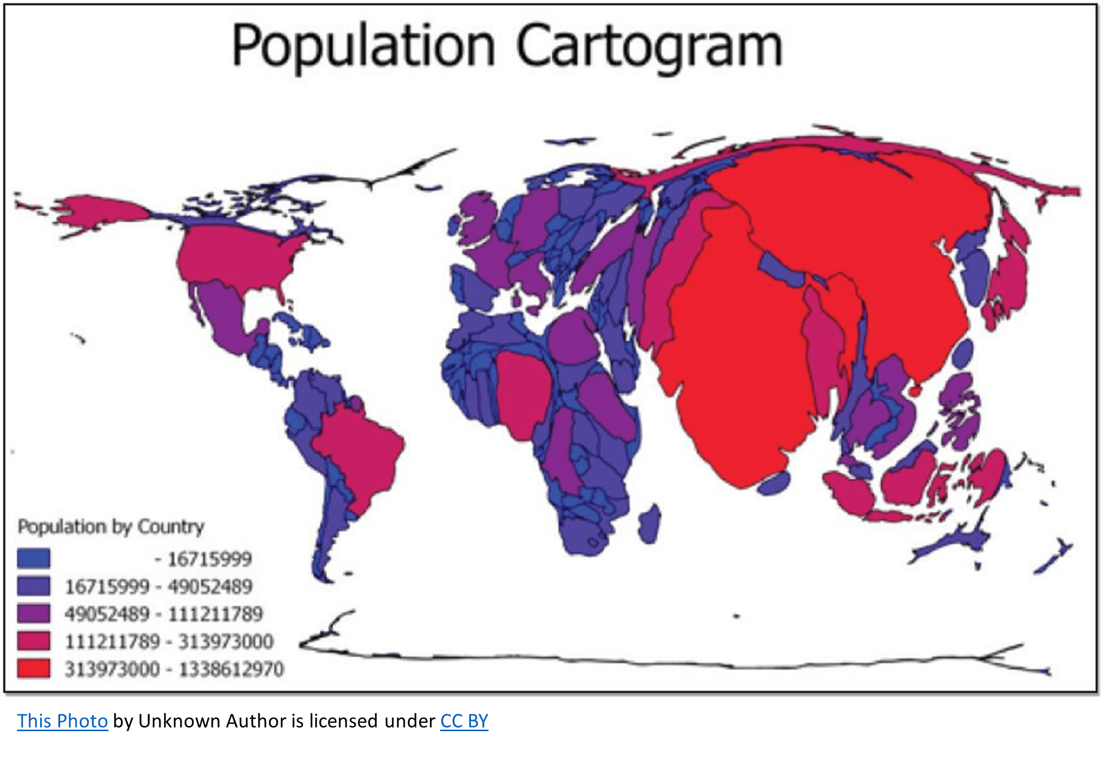
Cartogram
geographic size is altered to be proportional to the data set it is presenting
Mental Map
A map drawn from a person’s point of view without using any reference maps for help
4 Types of Distortion on Maps
direction, distance, size and shape
Map Scale
Distance on the map compared to the distance on the earth
What has more distortion? Smaller or larger scale map?
smaller scale map has more distortion
Smaller Scale Map
More spread out, can see more
Larger Scale Map
zoomed in, can see less of earth
Geographic Scale
how big is the geographic space? what do you see on the map? (whole picture)
Scale of Analysis
At what level is the data being analyzed. (what the whole picture is being split up into)
Types of Scales
world, regional, national, local
GI Science
The analysis of data about Earth acquired through satellite and other electronic information technology.
Geographic Positioning Systems (GPS)/Satellite Navigation Systems
A system that determines the precise position of something on Earth. Three satellites needed.
Remote Sensing
Acquisition of data about Earth’s surface from a satellite or other long-distance methods. images from a camera on airplane, satellite, space station, etc.
Geographic Information Systems (GIS)
Captures data, stores, queries and displays geographic data. (computer programs) Ex. Google maps.
Formal/Uniform Region
State, country, county, etc. You know when you’re in and out of it. At least one common characteristic in this region.
Functional/Nodal Region
Region formed around a node
Principal of Distance Decay
Farther from the source-more dies out, less likely to be adopted or used, etc
Vernacular/Perceptual Region
No defensive borders, people believe it exists, foggy edges, based on stereotype or perception.
Absolute Location
ways to describe a fixed location that never changes. Ex. Address and coordinates
Relative Location
The position of a location in relation to another location
Geographic Site Factors
Describes the physical characteristics of a place, whether it’s natural or human made
Geographic Situation Factors
Describes a location of a place in relation to other places and geographic features around it
Environmental Determinism
Natural Environments place an encompassing influence on human activity in shaping a society
Possibilism
Although the natural environment establishes some limits on a society, Human agency and culture is the ultimate factor in that societies development
Spatial Association
Two or more things on earth’s surface related through a cause and effect relationship
Space
the gap between two objects
Connection
the relationship of people across space
Density
frequency of something occuring in an area
Stage 1 of the DTM
High CBR, High CDR. Low NIR, Low pop.
No country today, most of Human history, hunting and gathering food.
Stage 2 DTM
High CBR, dropping CDR, rapidly increasing NIR, rising pop.
North America and Europe - Industrial Revolution, rest of the world - medical revolution. characterized mainly by dropping CDR
Stage 3 DTM
CBR starts to drop, NIR starts to drop, pop increases, CDR continues to decrease.
starts when CBR goes down, encouraging family planning, education increases, more live in cities, more urbanization
Stage 4 DTM
pop continues to grow from pop. momentum, CDR decreases slightly, meets with decreasing CBR, which causes NIR = ZPG (zero population growth)
education increases, esp women, waiting longer to be married and have family, living costs increases, ZPG
Stage 5 DTM
negative NIR, rising CDR, decreasing CBR, decreasing pop.
Norway, Denmark, japan; population momentum ends, CBR drops CDR increases = negative NIR, elderly population = high dependency ratio
Population Momentum
time period after the CBR has dropped but the population still grows due to the number of people in reproductive years
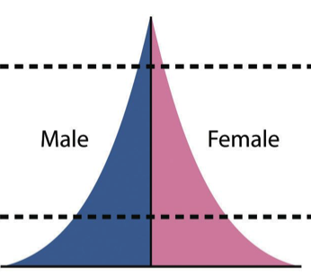
Stage 1
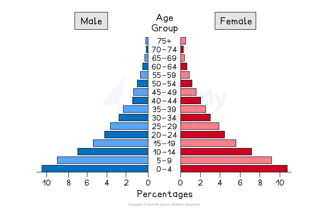
Stage 2
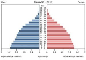
Stage 3
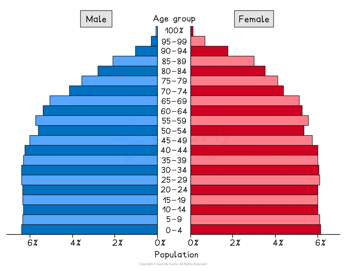
Stage 4
Stage 5
Thomas Malthus
Believed population will grow geometrically, food will increase arithmetically. we will run out of resources. Proven wrong
Neo-Mathusians
modern day people who believe population will outstrip the earth of it’s resources. believe malthus calculations were wrong but his prediction will come true for the future. believe societies need ZPG, TFR of 2.1
Anti-Natalist Policy
belief population is growing too fast, running out of resources.
policies such as 1 child, taxes on kids, family planning
Pro-Natalist Policies
from shrinking populations, shrinking workforce
policy ex. tax breaks for children, financial support for doctors and hospitals, affordable child care.
Push Factors
factors that push people to leave a location
Demographics
population characteristics/statistics
Pull factors
factors that entice people to move to a location
voluntary migration
permanent movement by choice
forced migration
permanent movement compelled by cultural or environmental factors
Net it/out migration
more people moving in or out of country?
Refugee
people forced to migrate from home country and cannot return due to fear of persecution/death
Asylum Seeker
someone who has moved to another country in hopes as being recognized as a refugee
Internally Displaced Person
someone forced to migrate, but not across international border
Step Migration
migration that follows a series of steps or stages towards a final destiny
Intervening obstacle/opportunity
environmental or cultural feature of the landscape or a favorable circumstance that alters and intended route.
Diffusion
spread of an idea/feature
Relocation diffusion
spread of an idea/feature through movement of people
Expansion Diffusion
spread of an idea in an additive process
Hierarchal Diffusion
type of expansion diffusion; spread from people or nodes of authority to other persons
Contagious Diffusion
type of expansion diffusion; a rapid, widespread diffusion throughout the population
Stimulus Diffusion
a spread of an underlying principal
cultural hearth
where a major culture began then spread outward
Assimilation
process of a minority group or culture adopting the dominant groups culture
acculturation
balancing of two cultures while adapting to the prevailing culture of the society
Syncretism
when aspects of different cultures blend together and form something new and unique
Multiculturation
presence of several distinct cultural or ethnic groups
Toponym
a place name
Sequent Occupance
the notion that successive societies leave their cultural imprints on a place, each contributing to the cumulative cultural landscape
Creole Language
a fully formed language created by a mix of other languages. usually colonizer language mixed with native language
Pidgin Language
grammatically simplified language made up of 2 or more languages, one of the languages usually used for trade
Placelessness
uniform, homogenous landscapes. loss of a location’s unique culture identity leading to a landscape that looks like it could be from anywhere.
homogeneous
the same, uniform
heterogenous
different, unique
Sense of Place (2 answers)
A. the distinctiveness of unique character of a particular location and regions
B. your relationship with a place, feeling and perception for you
Cultural Landscape
combination of cultural, economic and natural elements that make up any landscape
Ethnic Religion
relates closely to culture, ethnic heritage and to the physical geography of a particular place
Universalizing religion
seeks to convert new believers, global and universal in spread
Cultural Relativism
an unbiased way of viewing another culture; not judging based on your own culture
Ethnocentrism
judging another culture in terms of ones own standards and culture;; believe your culture is better
Artifact
the “stuff” of culture; material manifestations of culture (tangible)
ex. chopsticks, navajo jewelry, smart phone
Sociofact
the ways we act in culture; institutions, structures and rules that shape and unite a culture
ex. religious institutions, political parties, schools, customs
Mentifact
the ways we think in culture. the central beliefs, guiding ideas and values in a culture that endures over time.
ex. religion, folklore, concepts of self, social taboos
Christianity Religious Architecture
crosses, high vaulted ceilings, arches, steeples, stained glass, paintings, murals, Jesus scenes from bible, open areas with seating n rows
Islamic Religious Architecture
mosque!!! domes, crescent moon, prayer hall - big open carpeted area w/ high ceilings and chandeliers, geometric designs, no idols or images, Arabic writing, courtyard with wash basin
Judaism Religious Architecture
synagogue, star of David, a lot of wood/mahogany, onion dome, geometric patterns and stained glass, platform upfront
Hindu Religious Architecture
lots of symbols, sculptures, many statues of gods/animals, covered statues, usually colorful
Buddhism Religious Architecture
lots of red and gold (symbols of good luck and prosperity), swastika, East Asia, dharma wheel, fancy roofs, lotus flower (purity and enlightenment), statues of Buddha, pagoda - Buddhist relic (weird stacky things)
Hinduism Diffusion
ethnic religion, relocation diffusion