Geology 101 Exam 4
1/119
There's no tags or description
Looks like no tags are added yet.
Name | Mastery | Learn | Test | Matching | Spaced | Call with Kai |
|---|
No analytics yet
Send a link to your students to track their progress
120 Terms
Hydrologic Cycle
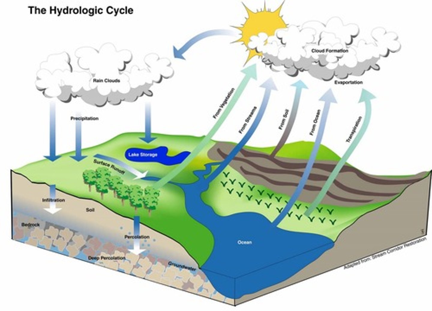
Evaporation
liquid water to water vapor
Precipitation
water vapor to liquid water
Sublimation
ice to water vapor
Runoff
process that occurs when precipitation that falls on land runs across the ground surface and enters a stream or lake; forms small rills which will eventually create creeks and streams; promoted by development
Infiltration
when precipitation that falls on land is soaked into the ground and enters a groundwater reservoir
Storage
water is taken out of circulation; usually because it is frozen in glacial ice and snow
Sheet Flow
when runoff initially flows in broad, thin sheets across the ground
Infiltration Capacity
amount of water that run offs versus sinking into the ground; 5 factors for determining: 1) intensity and duration of rainfall 2) how wet the soil was prior 3)soil texture 4) slope of the land 5) vegetation coverage
Rills
tiny channels caused by development of threads of currents; carry water to stream
Two main ways water flows?
Laminar Flow and Turbulent Flow; velocity is primary factor
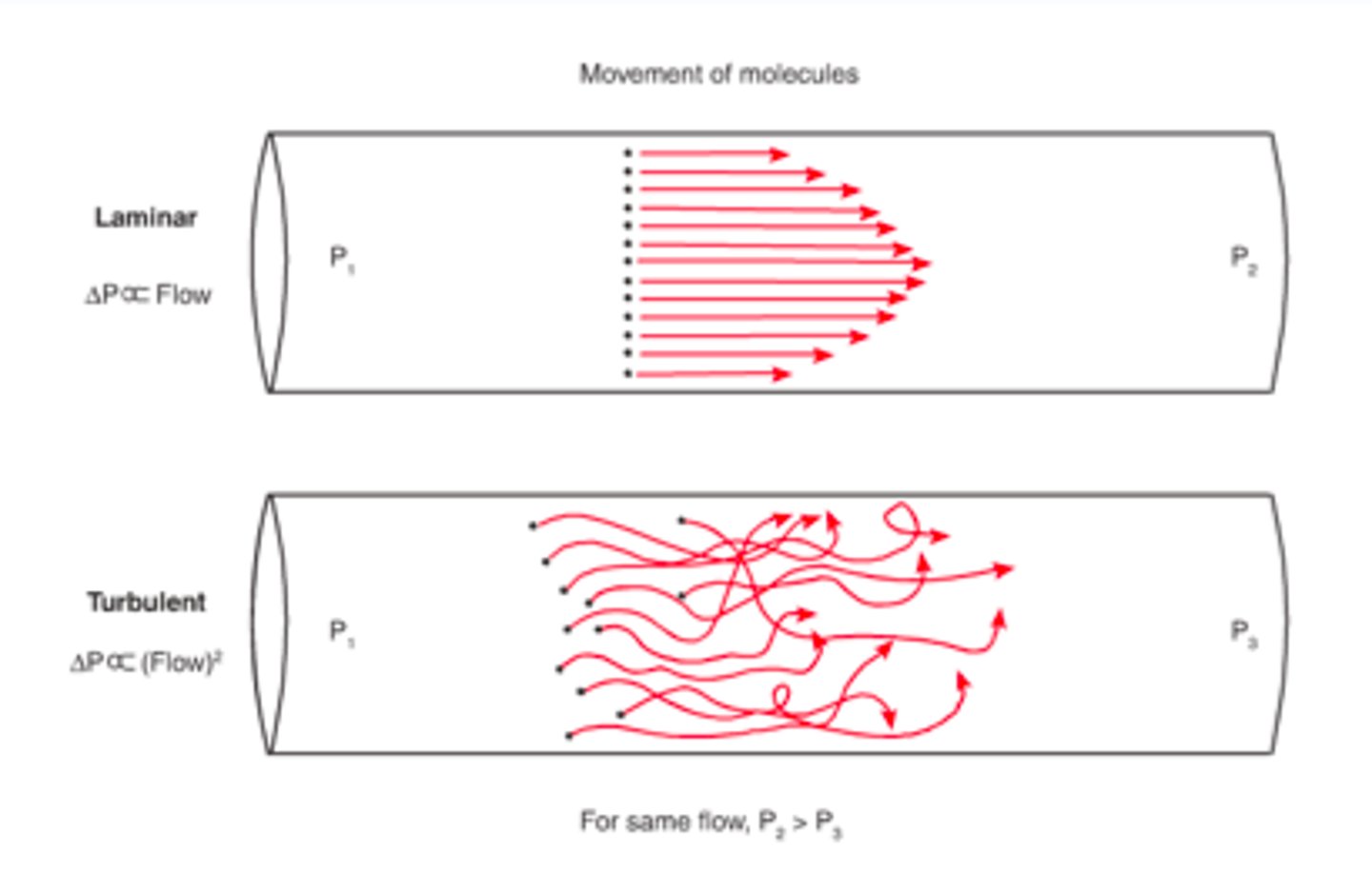
Laminar Flow
water particles flow in straight-line paths that are parallel to the channel; no mixing; smooth channel at low velocities
Turbulent Flow
water moves in energetic and erratic fashion; characterized by swirling, whirlpool-like eddies; effective in eroding a stream channel and keeping sediment suspended; rough channel at rising velocities
One of major factors in determining velocity is...
the gradient
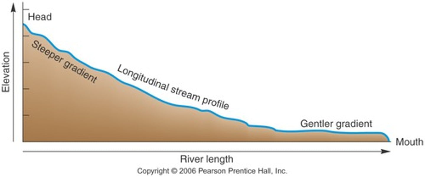
Gradient of a Stream
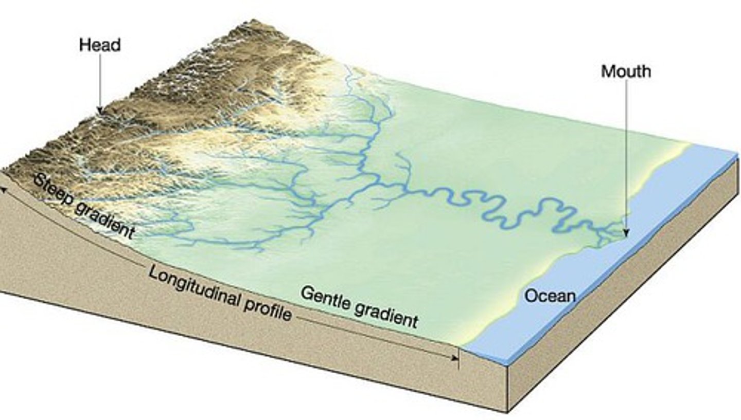
the vertical drop of a stream over a fixed distance; vary from one stream to another as well as along the stream course; most streams have preferred profile: high gradient near its headwaters with decreasing gradient as it reaches sea-level
Discharge of a Stream
amount of water flowing past a certain point in a given time of unit; not constant
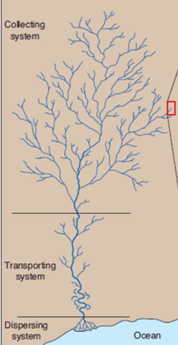
Stream Anatomy
Tributaries
larger branching channels
Trunk Stream
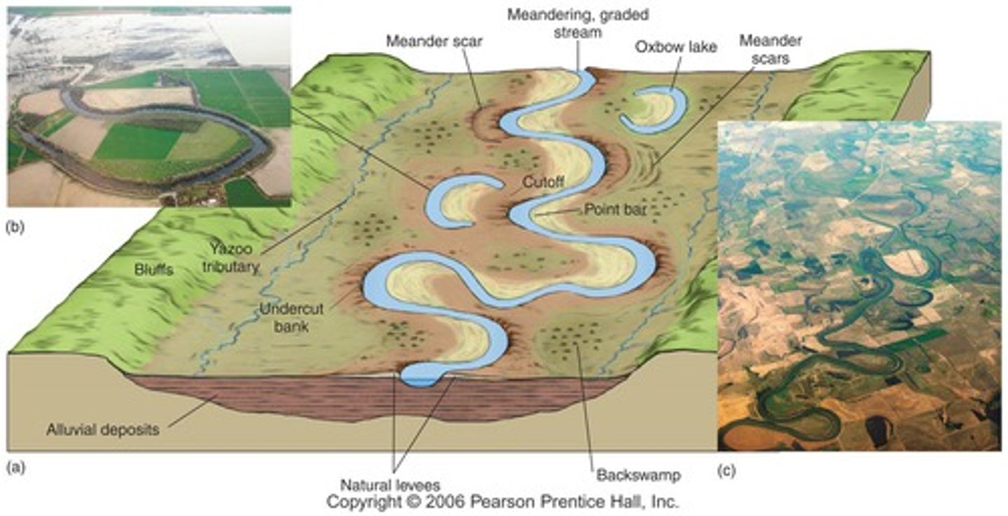
Main stream; covers greatest part of transport area; broad, flat floodplain; erosion forms cut banks while deposition forms point bars
Headlands
many tributaries; valleys are v-shaped; channels are straight; erosion of substrate
Mouth
stream enters lake/ocean; fan of distributaries forms as sediment load is deposited (delta or alluvial fan)
Longitudinal Profile
head to mouth; usually concave

Watersheds/ Drainage Basin
form source of water in a stream; separated by divides
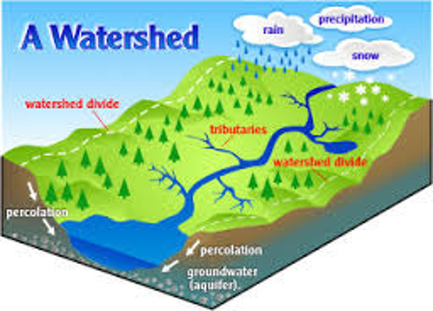
Drainage Divide
higher land that bounds a drainage basin; separates it from other drainage basins
Dendritic Drainage Pattern
forms where underlying bedrock is uniform and resistant to erosion; controlled by slope of land
Radical Drainage Pattern
streams divide from central area; usually volcanic cones and domal uplifts
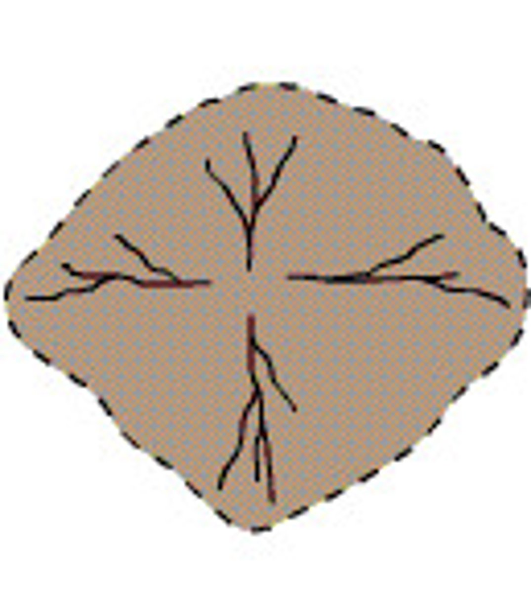
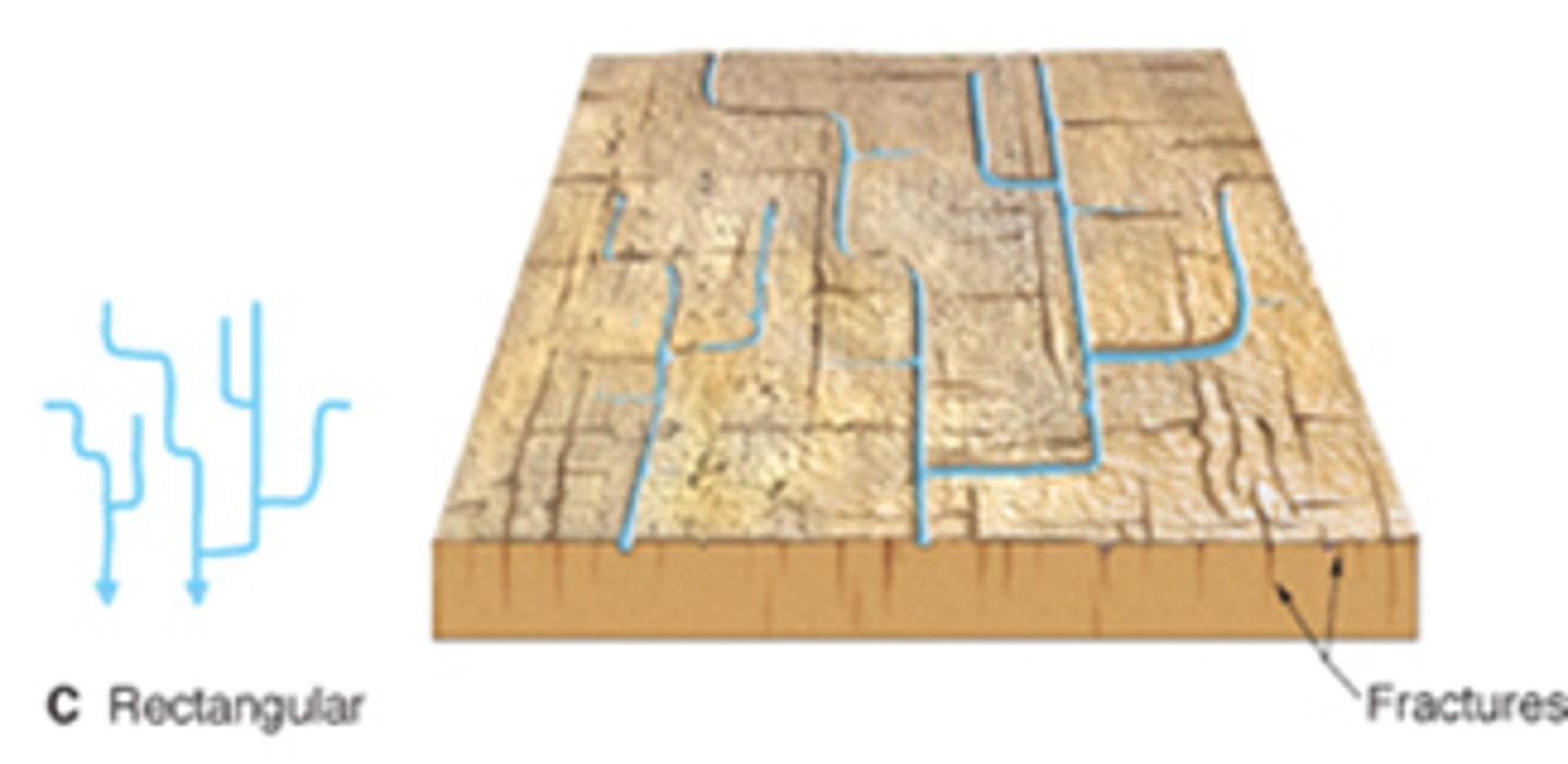
Rectangular Drainage Pattern
bedrock is crisscrossed by joints and faults
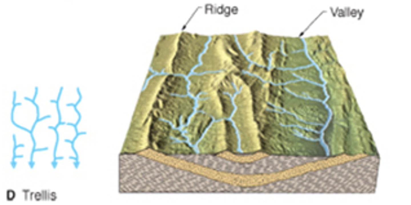
Trellis Drainage Pattern
forms in areas of underlain by alternating resistant and less resistant rock
Three ways streams rode their channels?
1) lifting loose consolidated particles
2) abrasion
3) dissolution
Three ways streams transport their loads?
1) dissolved load
2) suspended load
3) bed load
Dissolved Load
loads transported in solution; most of dissolved materials supplied by groundwater; amount depends on water chemistry, type of rock groundwater has percolated through, climate
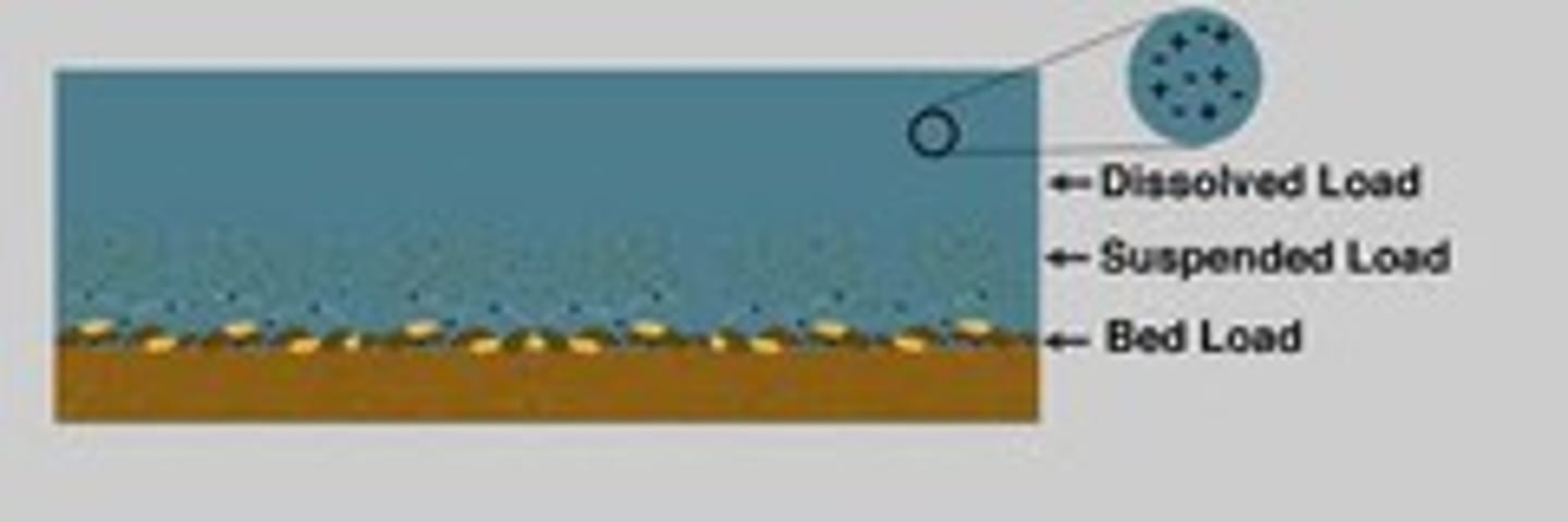
Suspended load
loads transported in suspension (fine sand, silt, clay particles); usually largest proportion of load
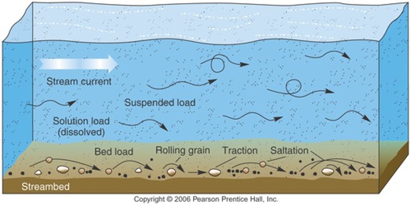
Bed Load
loads transported along bottom of channel; particles are too large to be in suspension;
Flooding
levees created during floods and serve to stabilize channel overtime; in subsequent floods, water can cut through levee at crevasse and deposits fine sediment outside of the channel
Stream Erosion and Changing Landscape
Groundwater
flows from regions of recharge to regions of discharge; driven by gravity and water pressure
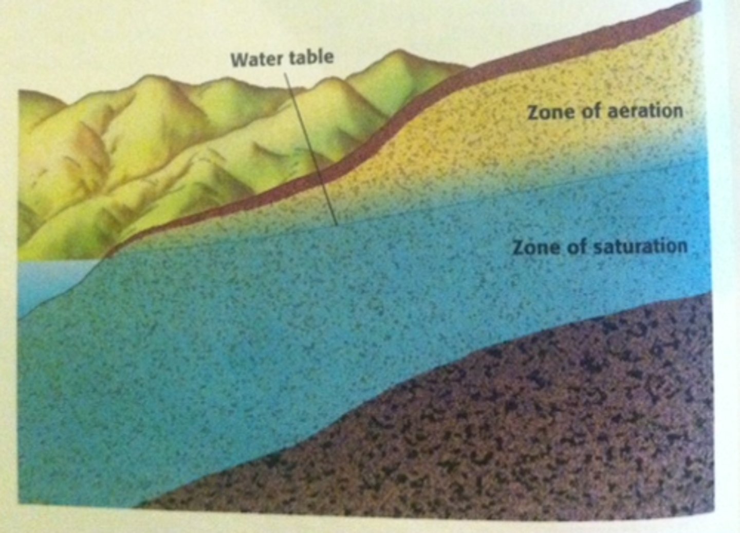
Zone of Aeration
includes capillary fringe, intermediate belt, and soil moisture zone; water held tightly by surface tension within tiny passages

Zone of Saturation
all open spaces in sediment and rock are filled with water
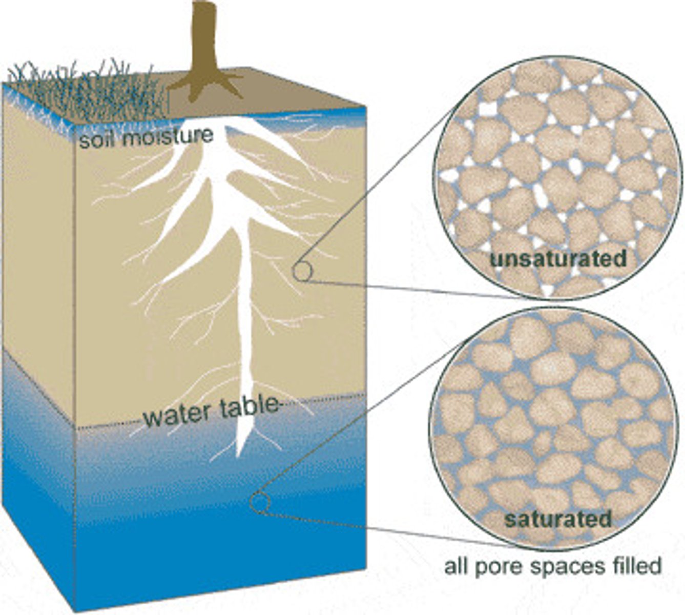
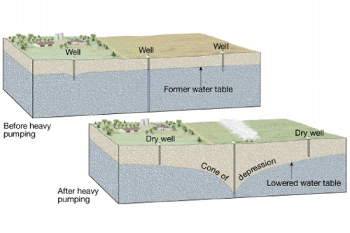
Water Table
upper zone of saturation; important in predicting productivity of wells; explains changes in flows of streams and springs; accounts for fluctuation of levels of lakes; defined by well depths; moves slowly and at different rates depending on location; piles up beneath high areas between streams; subsides during droughts
Aquifers
permeable rock strata or sediment that transmit groundwater freely; permeable and porous; opposite of aquitard
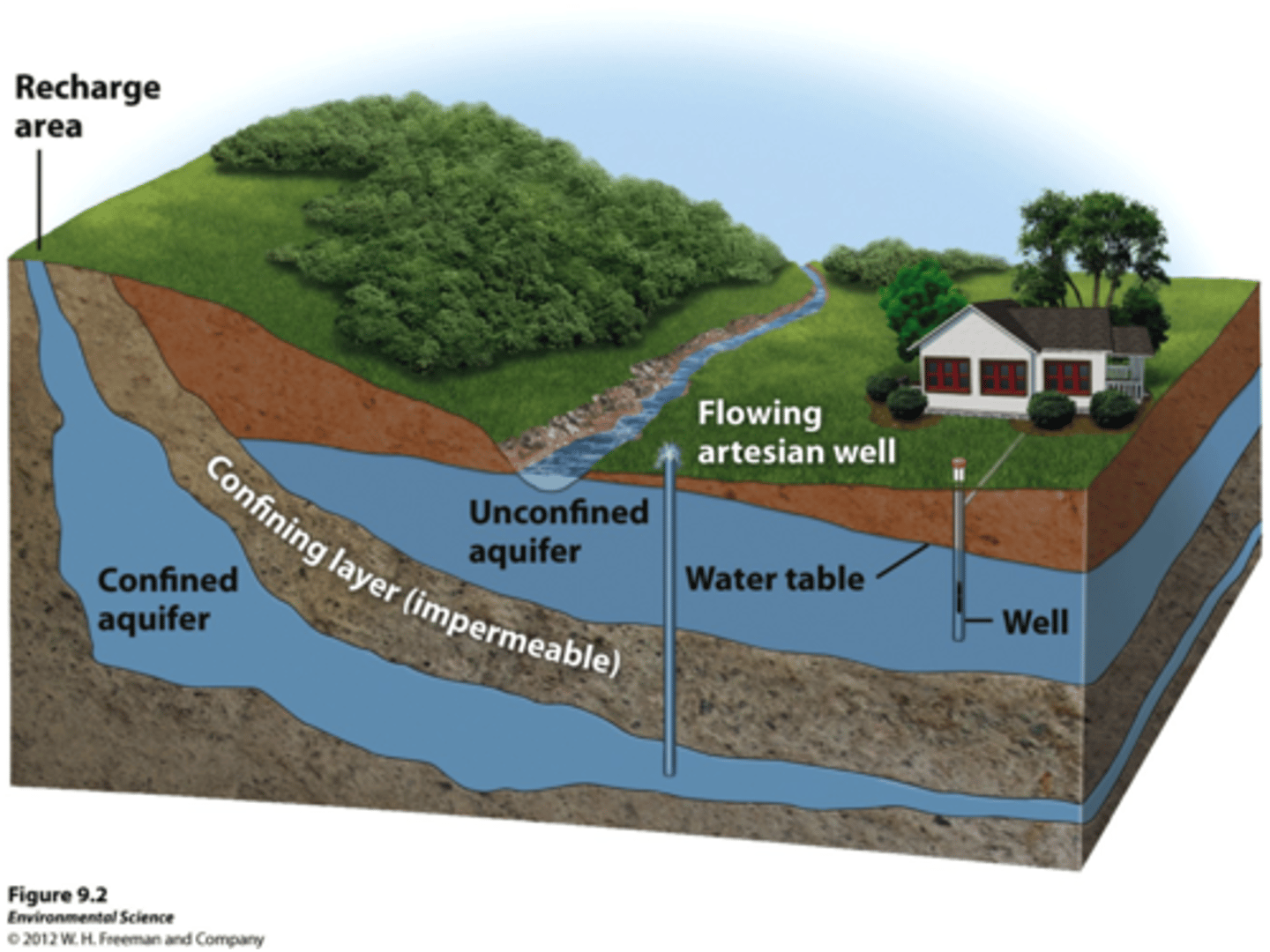
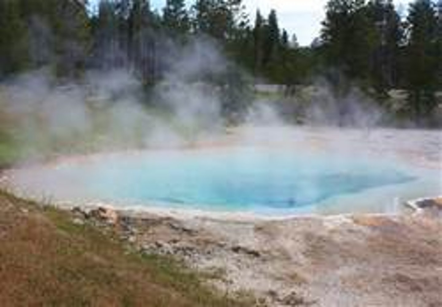
Springs
occurs whenever water table intersects earth's surface; common reason is vertical or horizontal changes in permeability
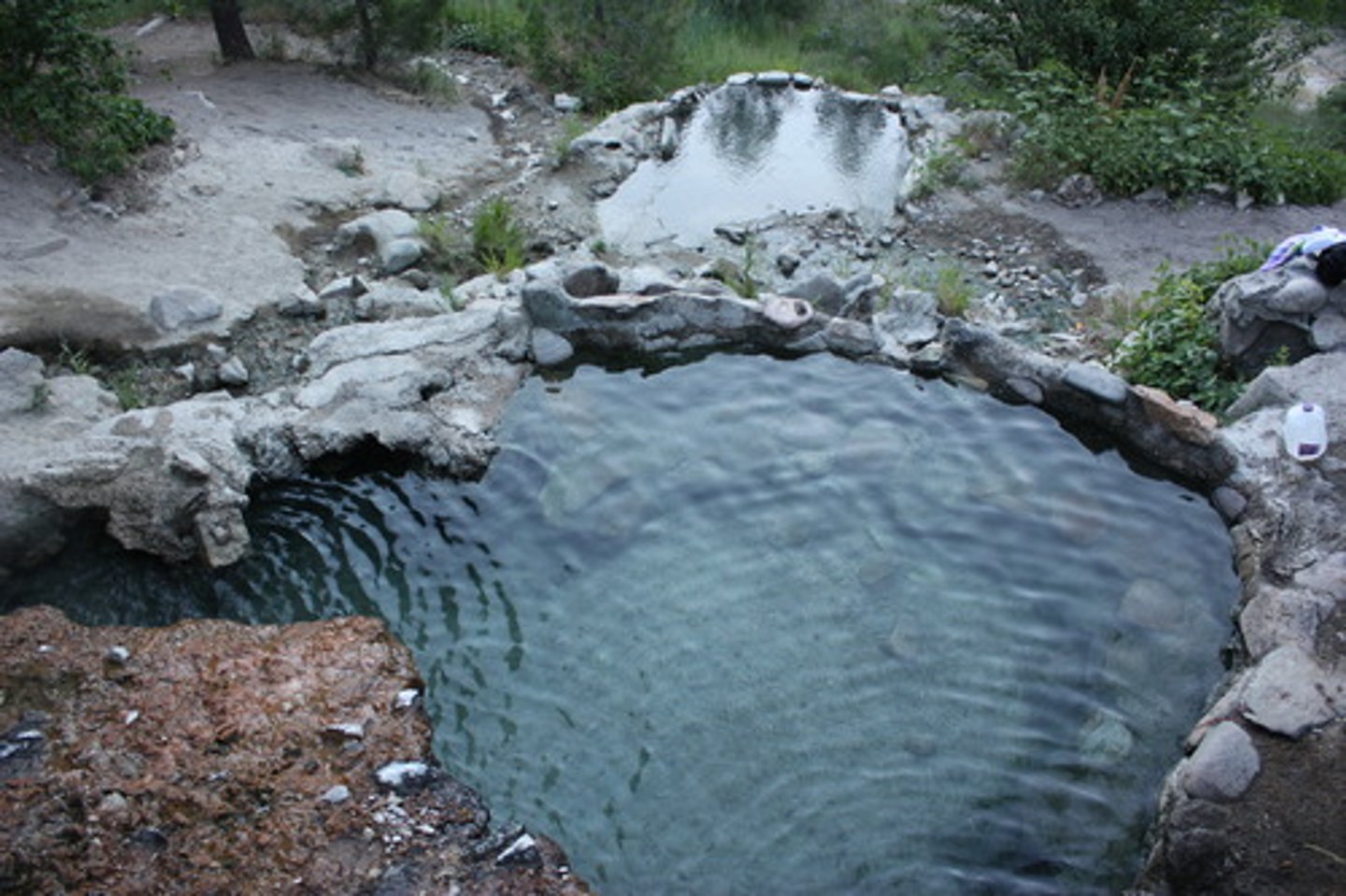
Hot Springs
springs that have discharge water that is 10-15° warmer than average annual local air temperature; source of heat from cooling igneous rock or nearby magmatic body; western US
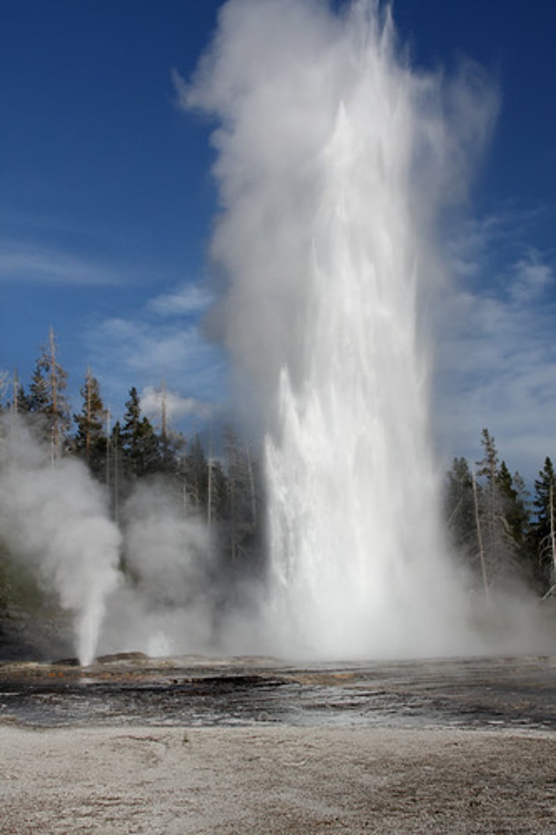
Geysers
intermittent hot springs or fountains in which columns of water are ejected with great force at various intervals; usually associated with active volcano; can reach 100-200 ft
Well
a hole bored into the zone of saturation; small reservoirs into which groundwater migrates and is pumped to the surface; pumping produces cone of depression in water table around well base, can permanently lower water table
Artesian Well
any situation in which groundwater under pressure rises about level of aquifer
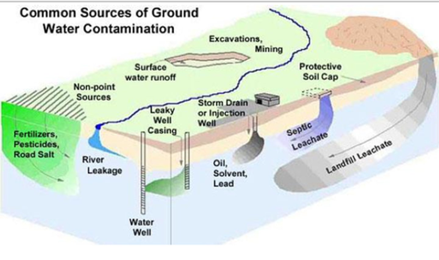
Plume of Contamination
sewage and aquifers; follows groundwater flow; movement dependent on geological features
Groundwater Contamination
caused by human products such as pesticides, sewage, fertilizer, gasoline, and chemicals; wells can be contaminated by reversal of groundwater flow in overpumped regions
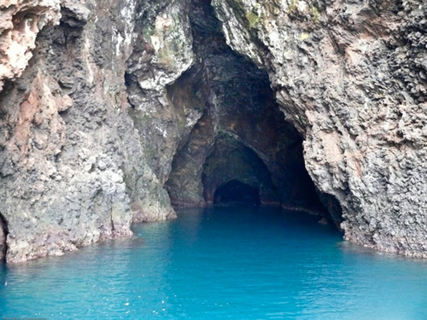
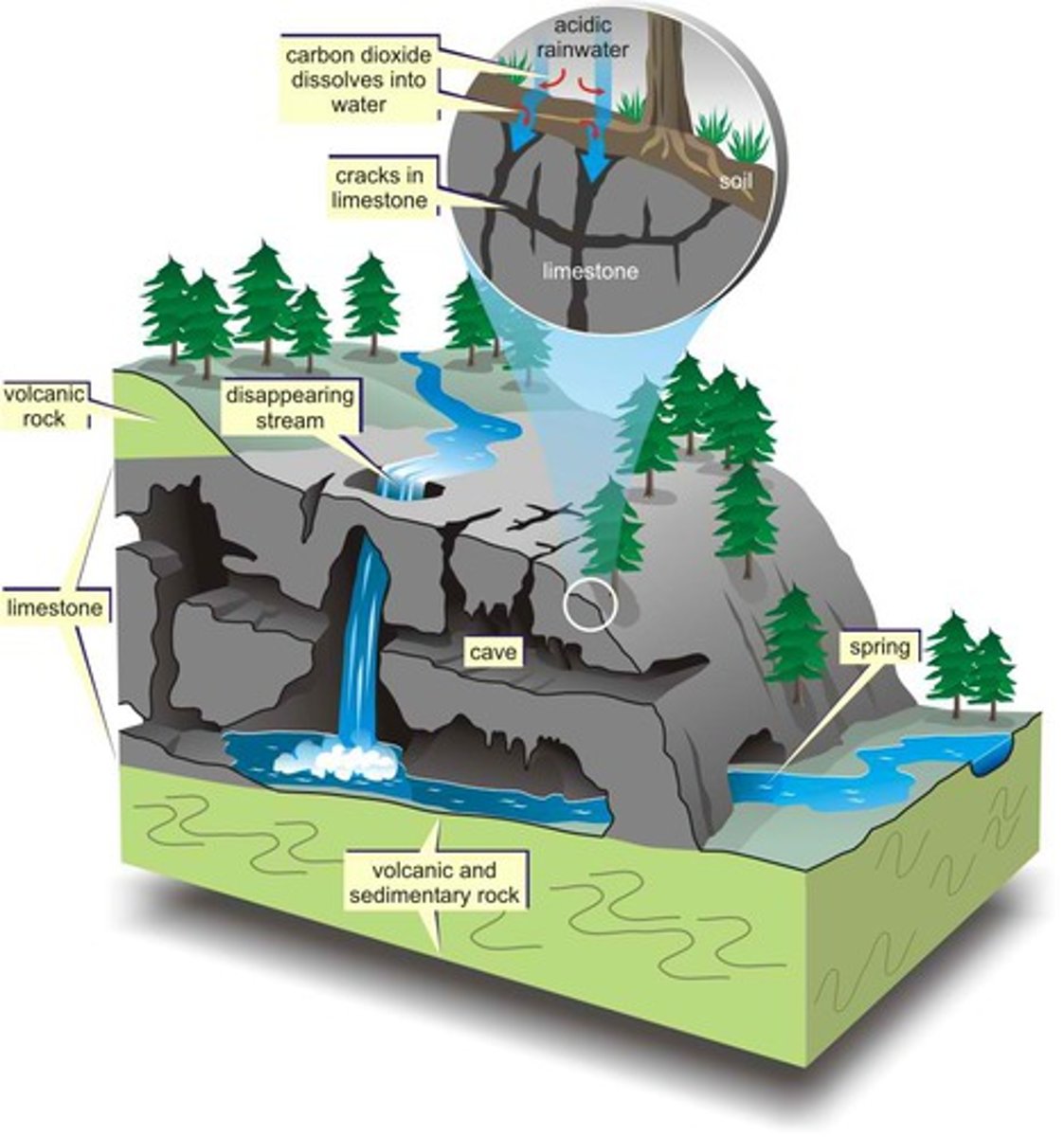
Caves
usually etched in limestome; has variety of calcite deposits from dripping water (speleothems) such as stalactites, stalagmites, straws, flowstone, etc.
Sinkholes
caused by collapse of caves
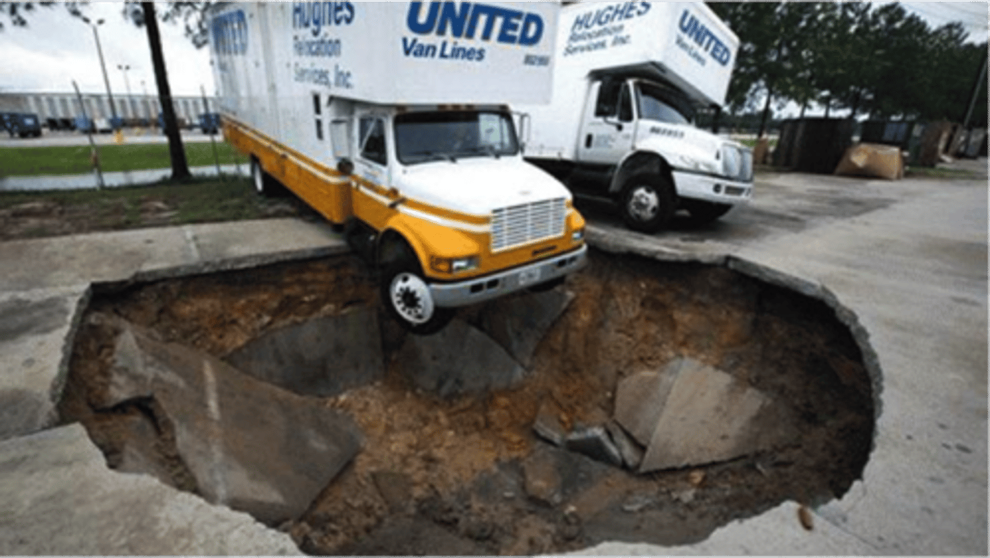
Karst Topography
landscapes that have been shaped by dissolving power of groundwater; punctuated by sinkholes; lack surface drainage; limestone dissolves under soil
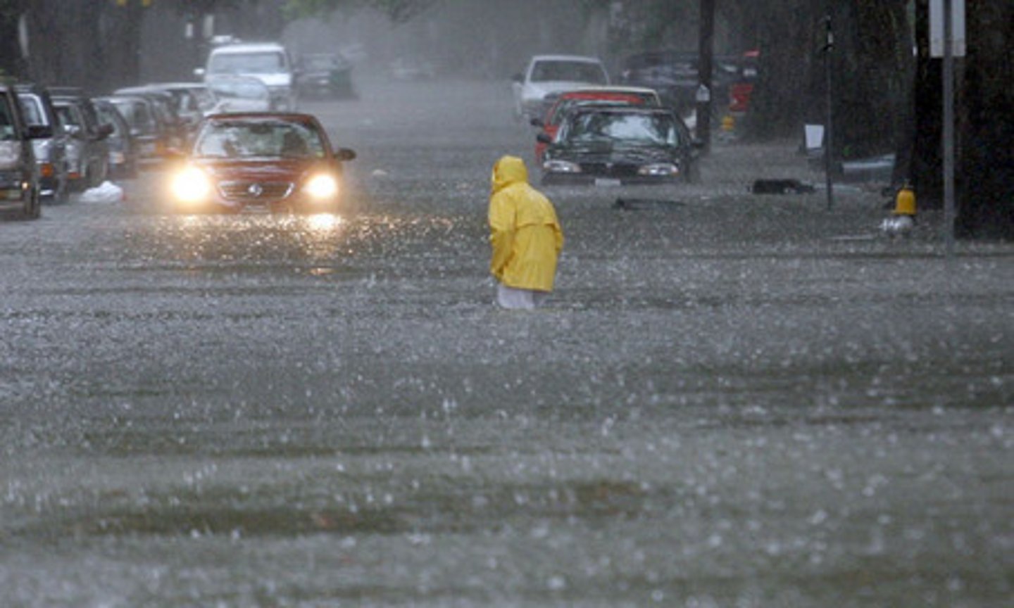
Causes of Floods
torrential rains rapidly dumping large amounts of water, long period of continuous rain (ground saturated), rapid snowmelt along large drainage basin, failure of dam or levee
Regional Floods
disasters in slow motion; result from unusually heavy rains and/or snow melt throughout a season over a broad area

Flash Floods
occur very rapidly; affect only small areas; result from intensive rain events or dam failures; most dramatic in desert areas; little warning
Flood Frequency Curve
shows maximum annual discharge for a stream plotted against probability of occurrence; based on data collected over many years; stages are discussed as 10-year, 50-year, and 100-year with 10%, 5%, and 1% likelihood of occurance in any given year
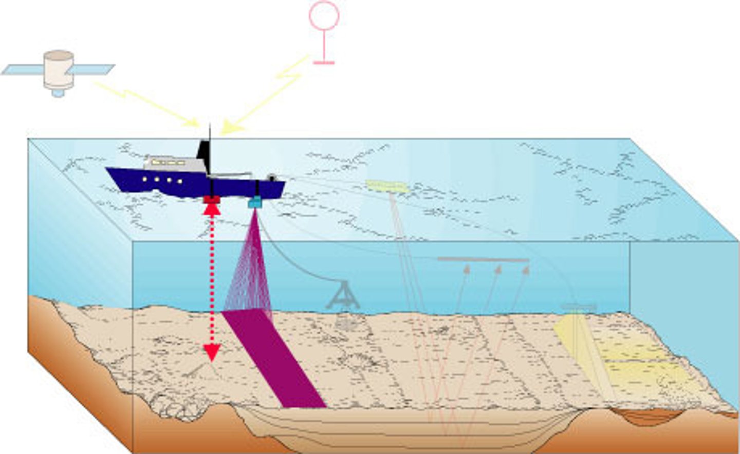
Bathymetric Profile
A map of the ocean floor that shows the ocean depth by using sonar signals; continental shelves, slopes, rises, abyssal plains, and mid-ocean ridges
Global Ocean Circulation
dependent on temperature and salinity; cold water sinks to the bottom at poles and creeps towards equator; warmer seas- circulation induced by evaporation and produces denser and more saline water, freezing of water increases salinity, rainfall decreases it
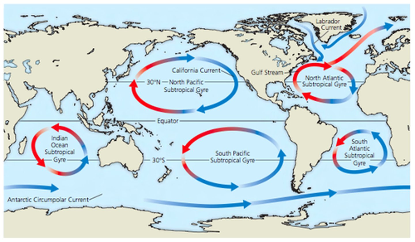
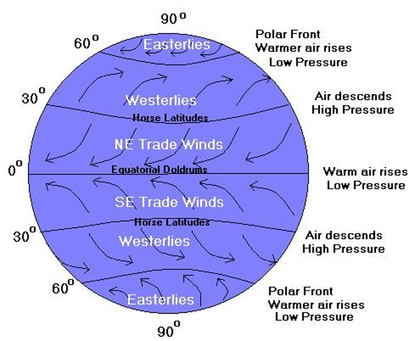
Coriolis Effect
effect of Earth's rotation on the direction of winds and currents; causes surface ocean currents generated by wind to not flow parallel to wind; flow in circular paths called gyres; northern hemisphere= clock-wise and deflected to right, southern hemisphere= counter clock-wise and deflected to left, equator= western
Waves
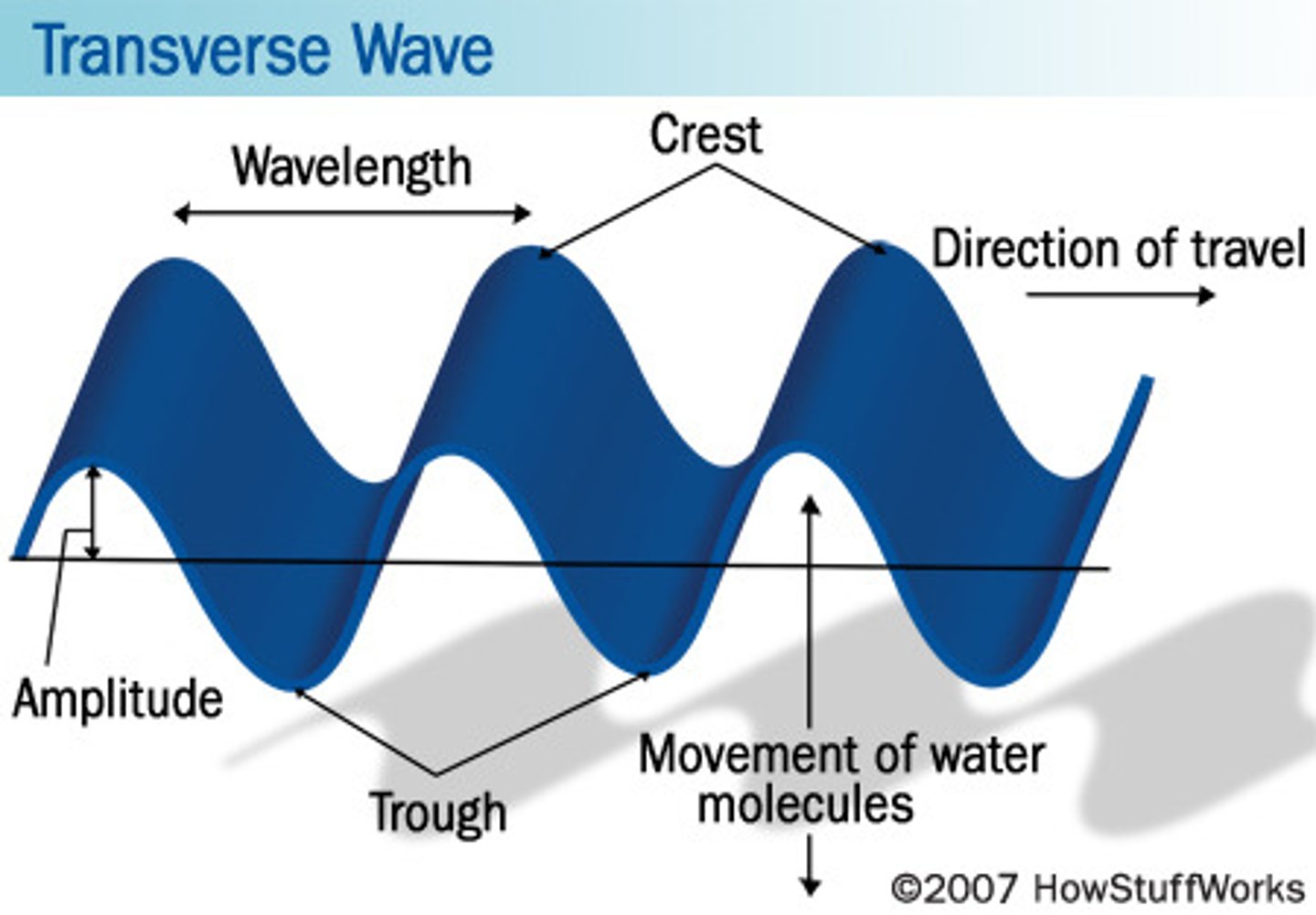
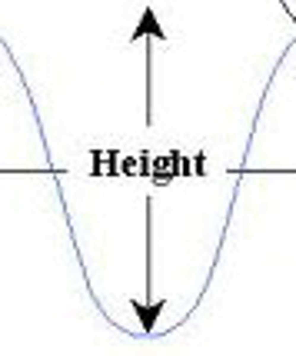
Wave Height
measured vertically from trough to crest
Wavelength
measured horizontally from crest of one wave to crest of next
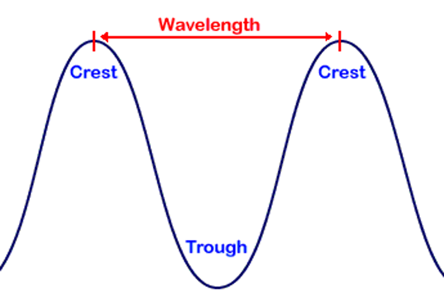
Wave Period
time required for one full wave to pass a fixed position
Wave Height, Length, and Period determined by...
wind speed, length of time wind has been blowing, and the distance wind has traveled over open water (fetch)
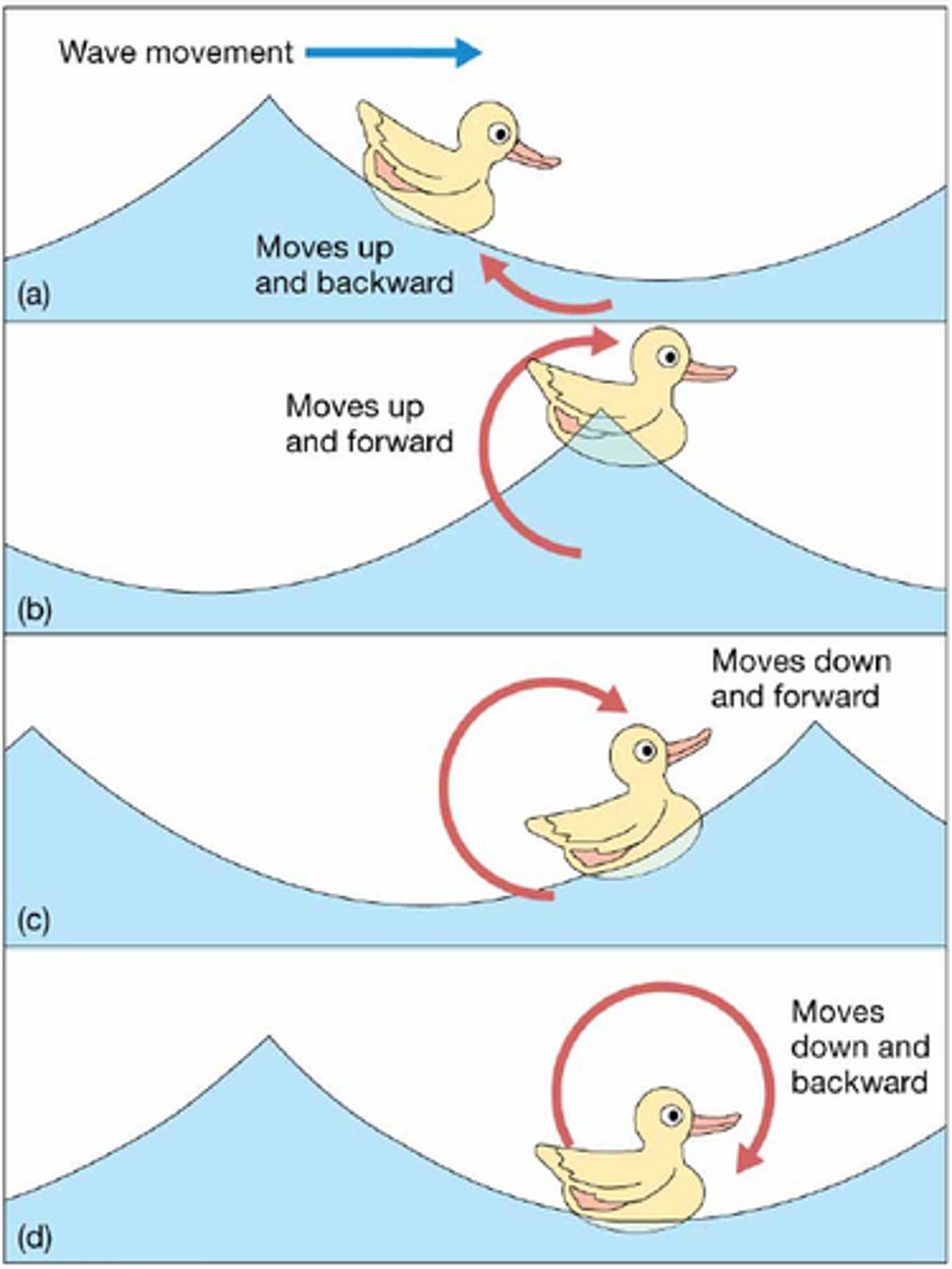
Waves moves in...
circular motion; passing wave is transmitted down into water column
Breakers
waves breaking into foam as they approach or dash against the shore
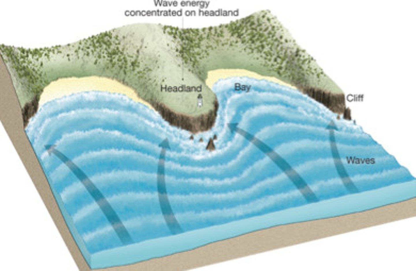
Refraction of Waves
refracted towards headlands; erodes headlands and deposits material on beaches
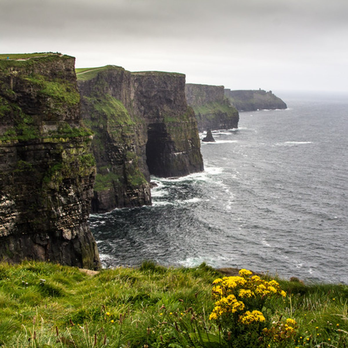
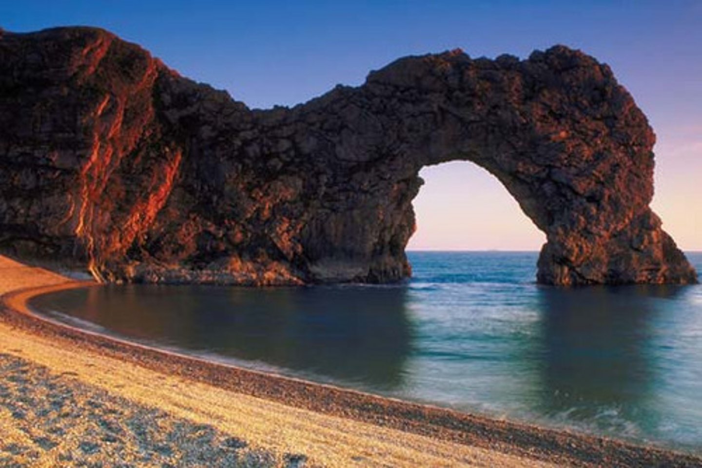
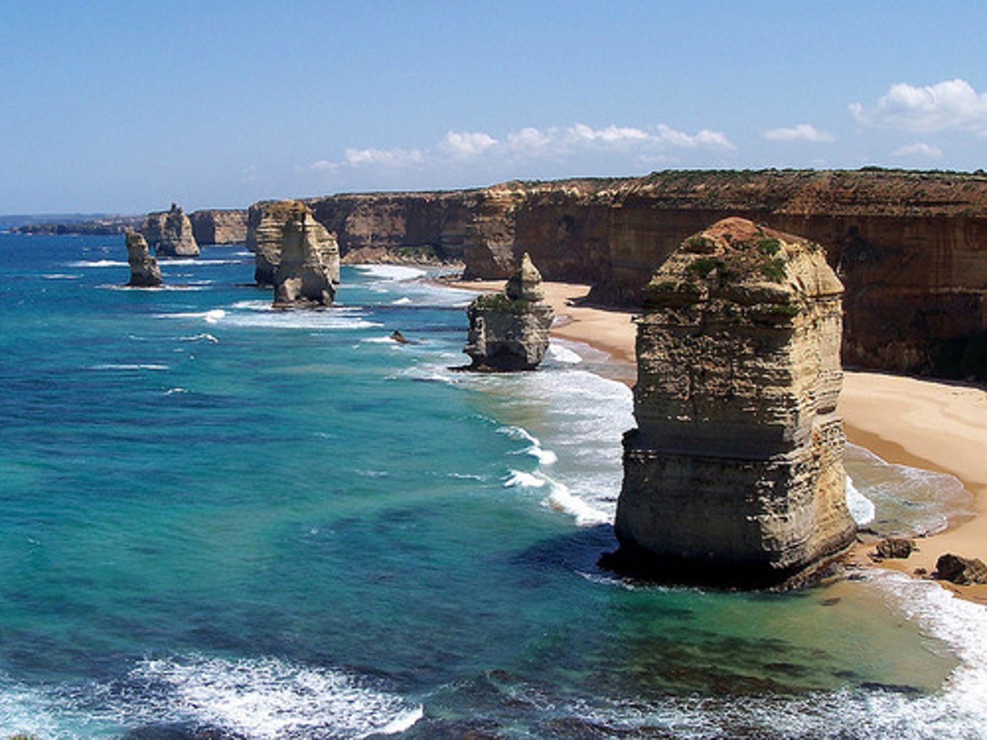
Erosional Wave Features
wave cut cliff, sea arch, sea stack
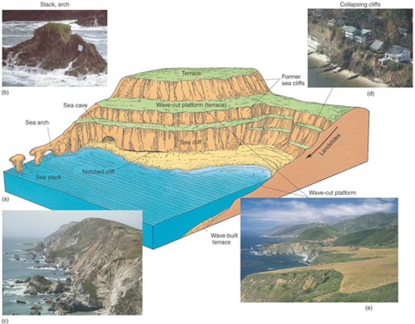
Wave Cut Cliff
cliffs created by erosion
Sea Arch
erosional hole in a headland; caused by wave action and erosion
Sea Stack
towers of bedrock that have been isolated by concentration of erosional effects of refracted waves
Depositional Features
tombolo, baymouth bar, spit
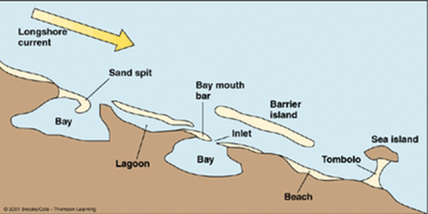
Tombolo
ridge of sand connecting headland area to island immediately offshore; depositional feature
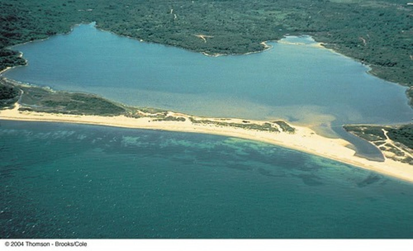
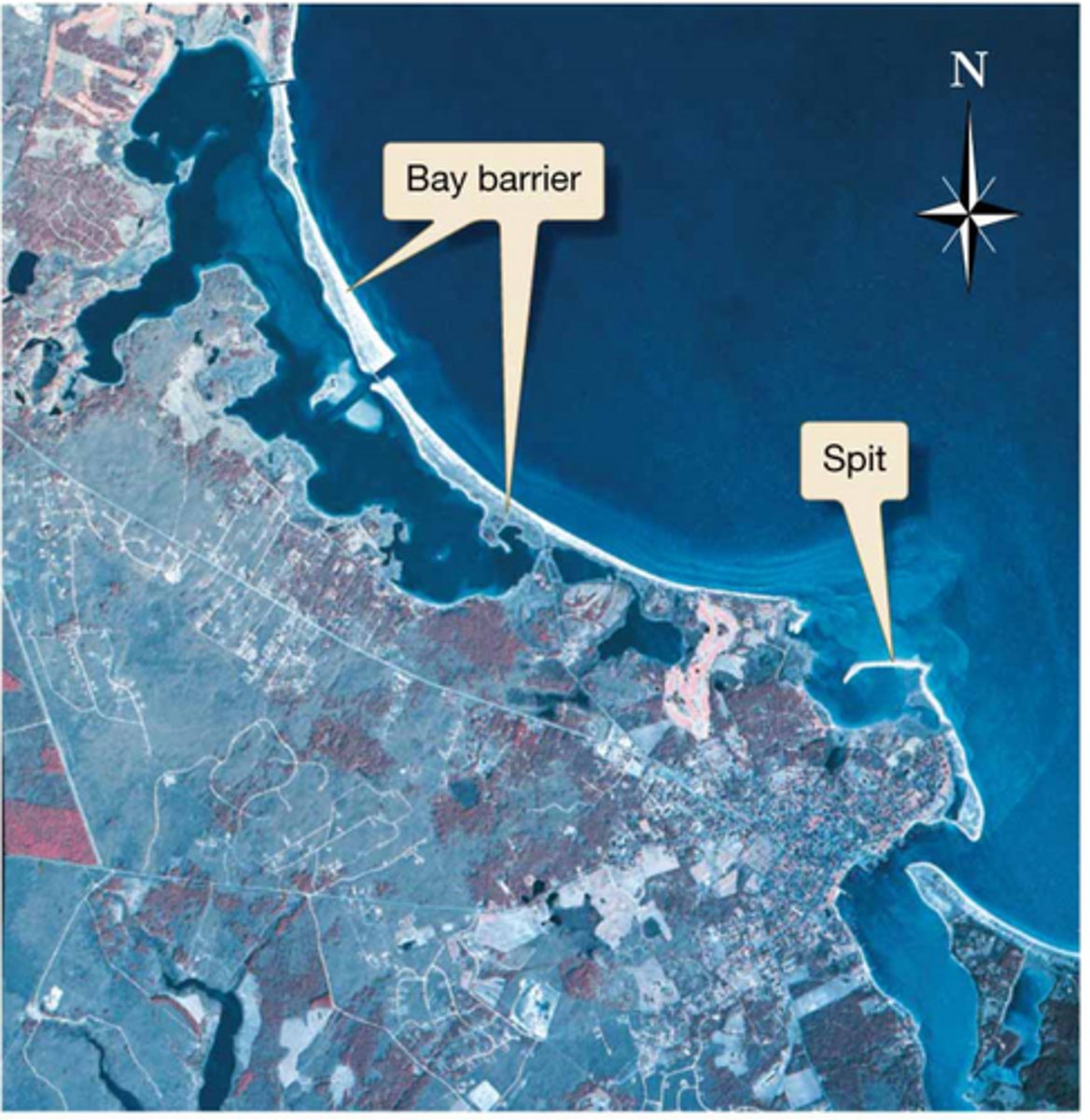
Baymouth Bar
a sandbar that completely crosses a bay, sealing it off from the open ocean
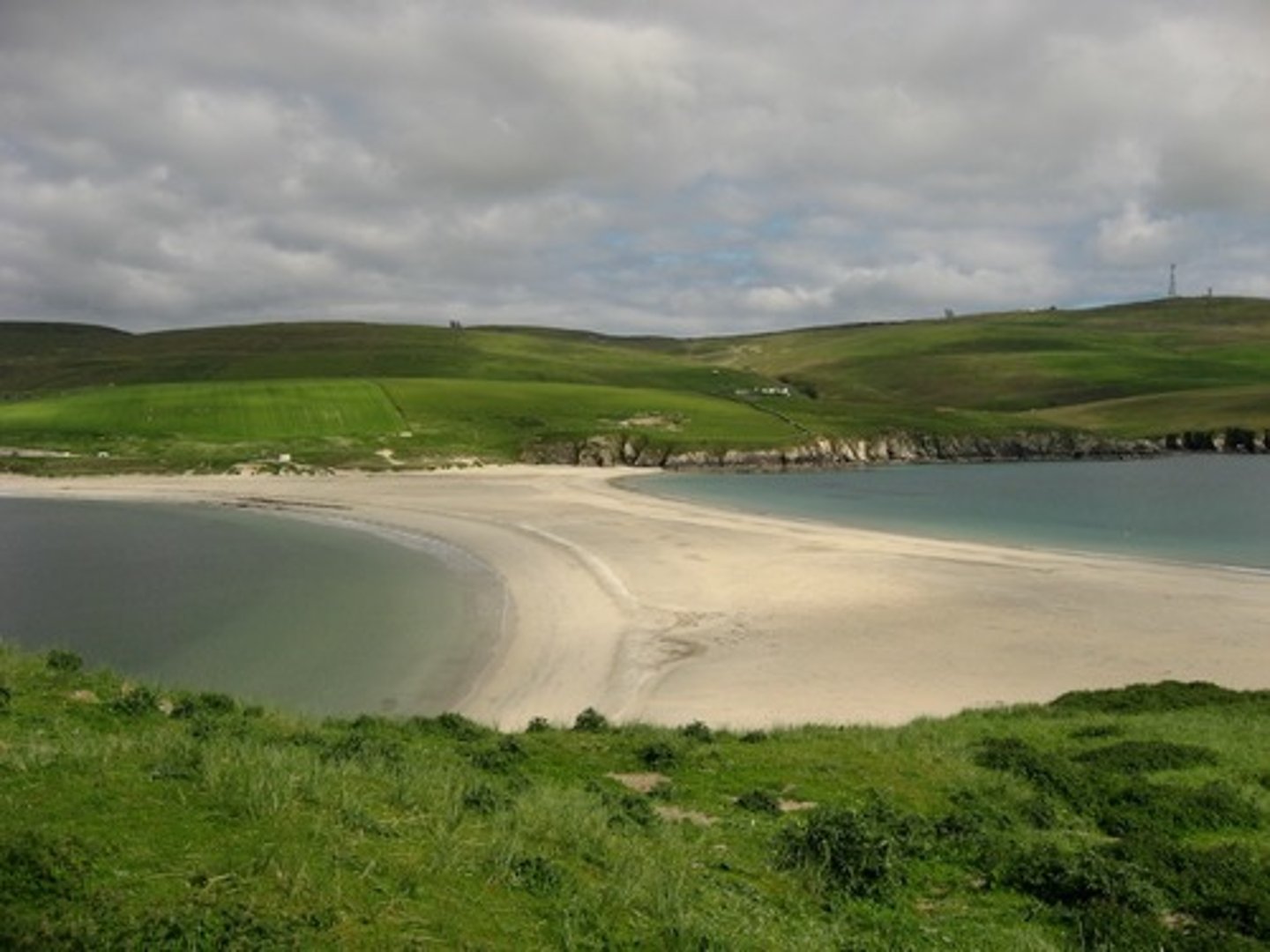
Sand Spit
where the coastline indents landward, beach drift stretches beaches out into open water to create
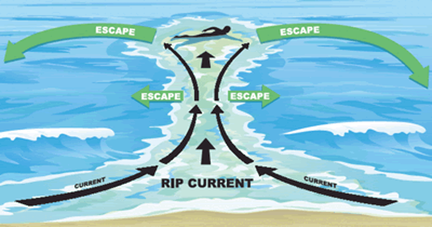
Rip Current
form when strong wind and waves force excess water up onto the beach, water accumulates to a critical point and flows all together down a beach and escapes offshore
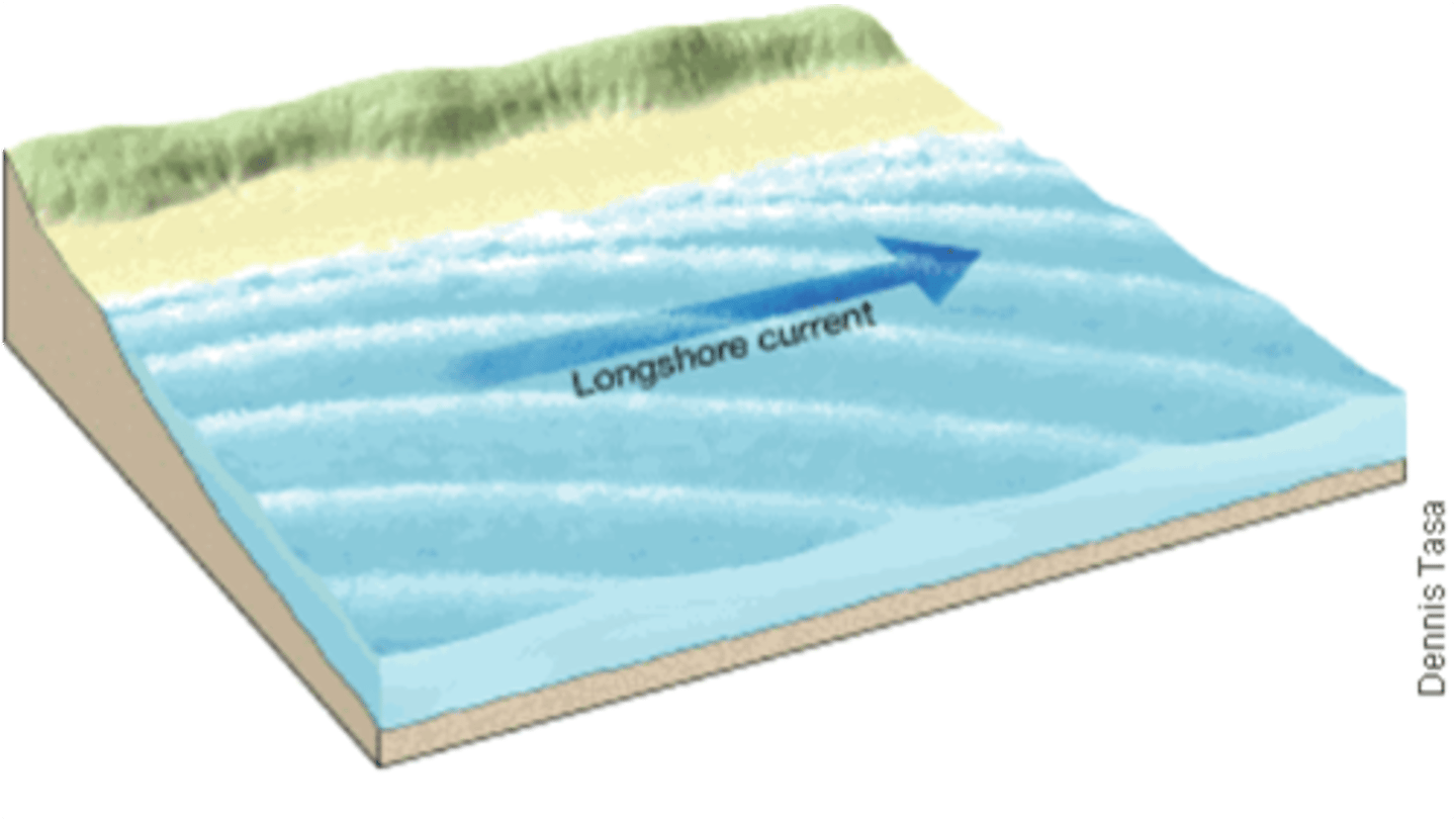
Longshore Current
caused by water and sand grains carried up the beach at a zig-zag angle
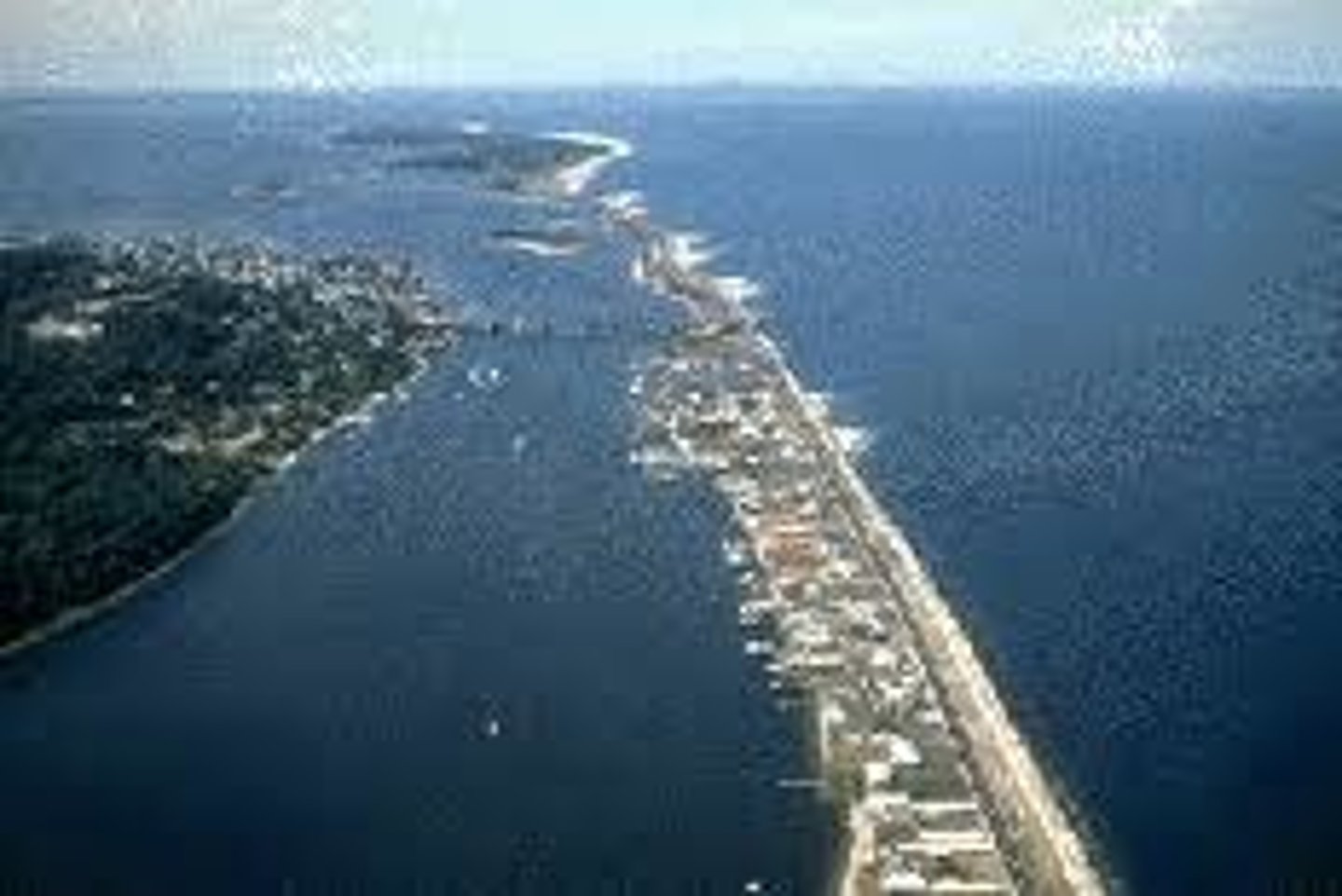
Barrier Islands
depositional feature; ridges of sand that run parallel to the coast, separated by lagoon
Most beaches in general are...
ephemeral (not permanent), change seasonally and cyclically
Hard Stabilization Features
most human attempts to combat beach drift and other forms of beach erosion have been futile; jetties, groins, breakwaters, seawalls

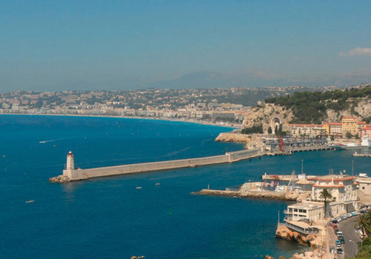
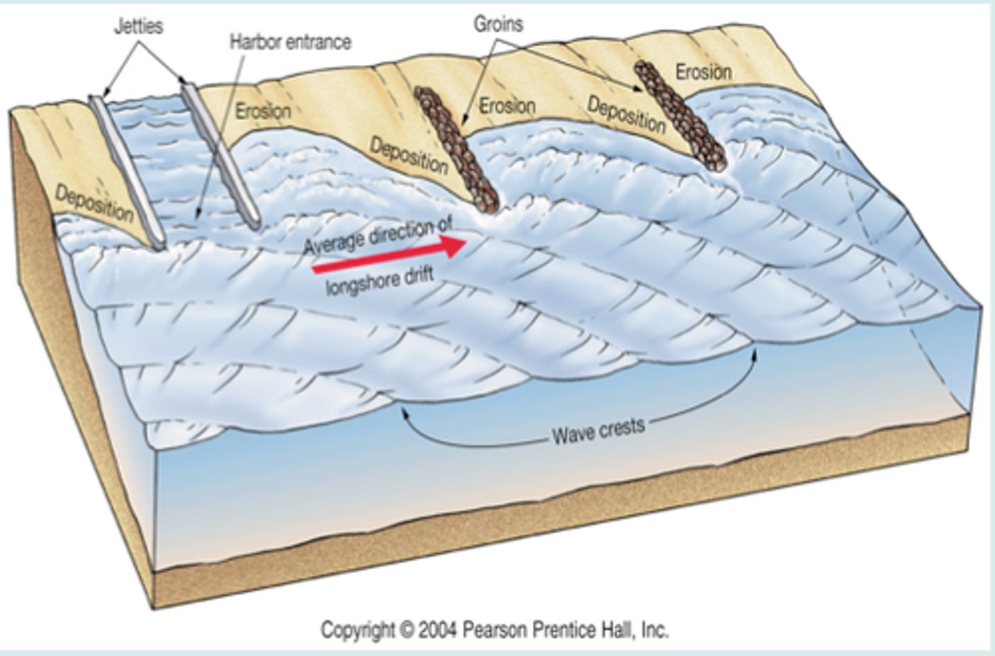
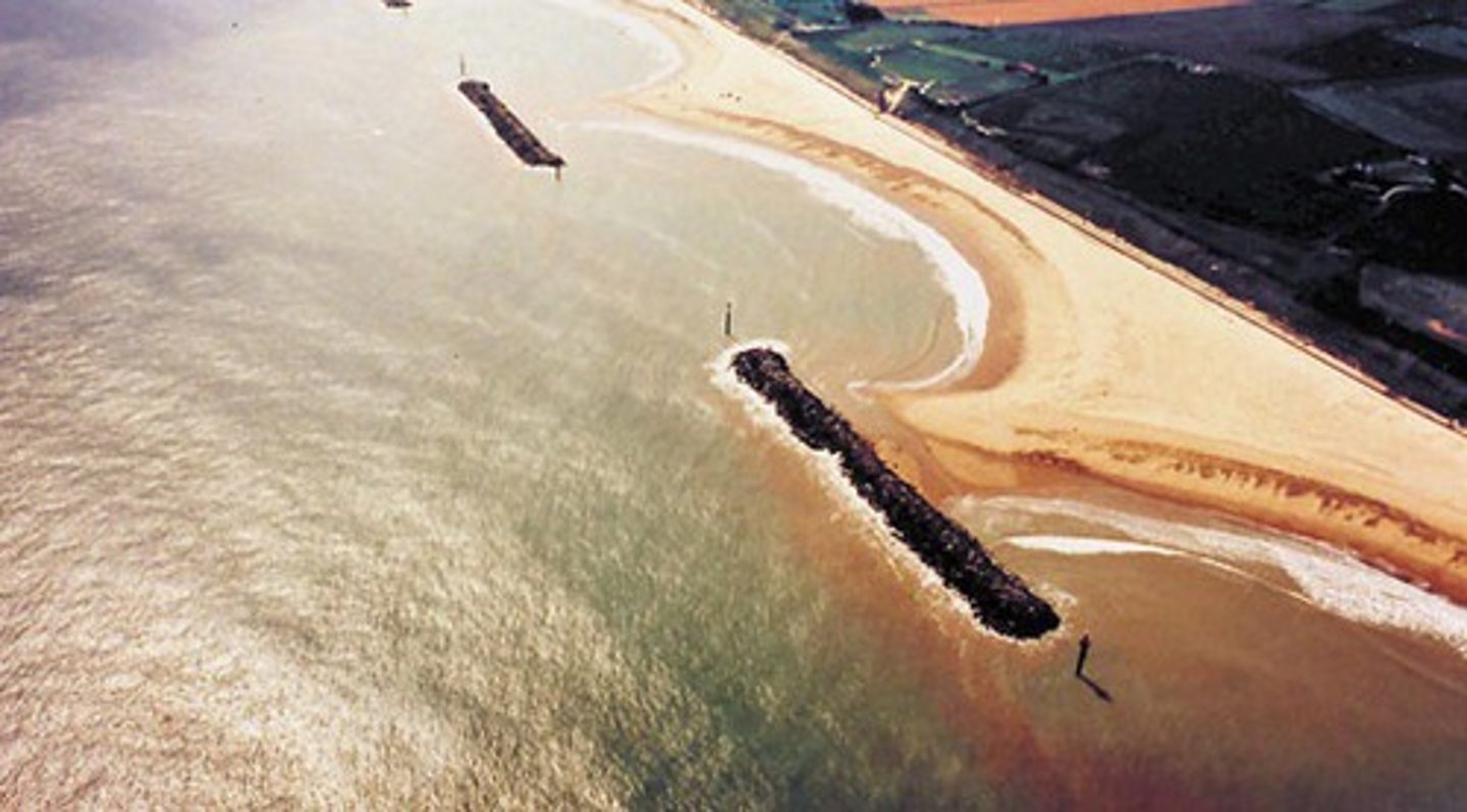
Jetty
serve to keep the entrance of harbors and bays free of shallow sand, however erosion is typical adjacent to the jetties
Groins
increase sand deposition in the region directly upcurrent but increase erosion rates in the region directly downcurrent; small jetties
Breakwaters
a barrier built out into a body of water parallel to coast; protect a coast or harbor from the force of waves; create calm area for boats; lead to greater deposition of sand, displacing water
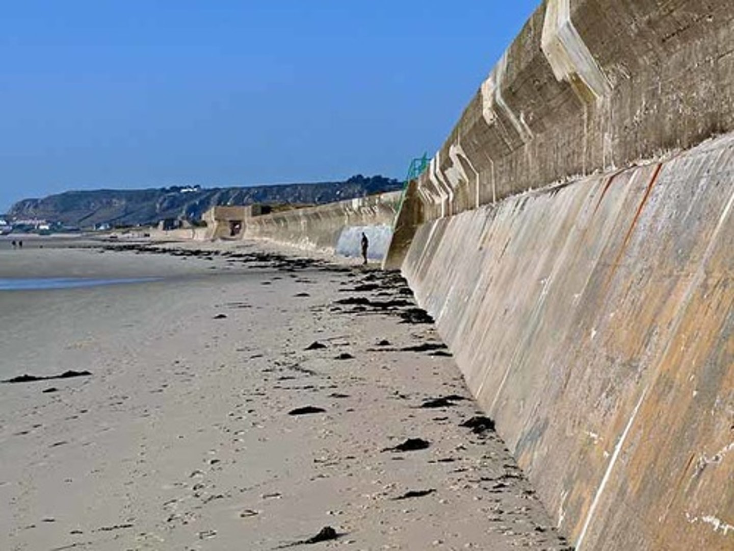
Sea Wall
built between beach and area of development; successful at protecting property, but lead to erosion of the entire beach
Beach Renourishment
taking sand from offshore or other adjacent areas and putting it on beaches to prevent loss from erosion; successful; expensive and not permanent solution
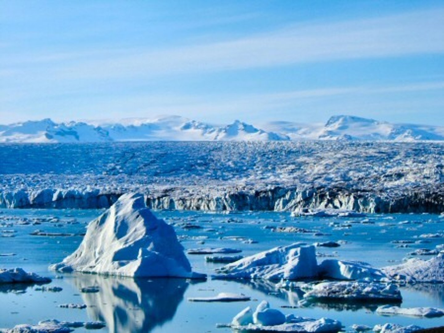
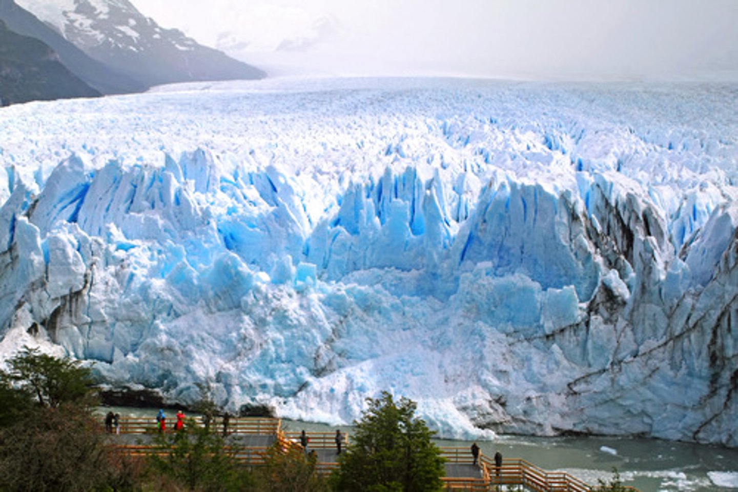
Glaciers
A large mass of recrystallized ice on land that shows evidence of being in motion or of once having moved
3 Types of Glaciers
alpine, continental, piedmont
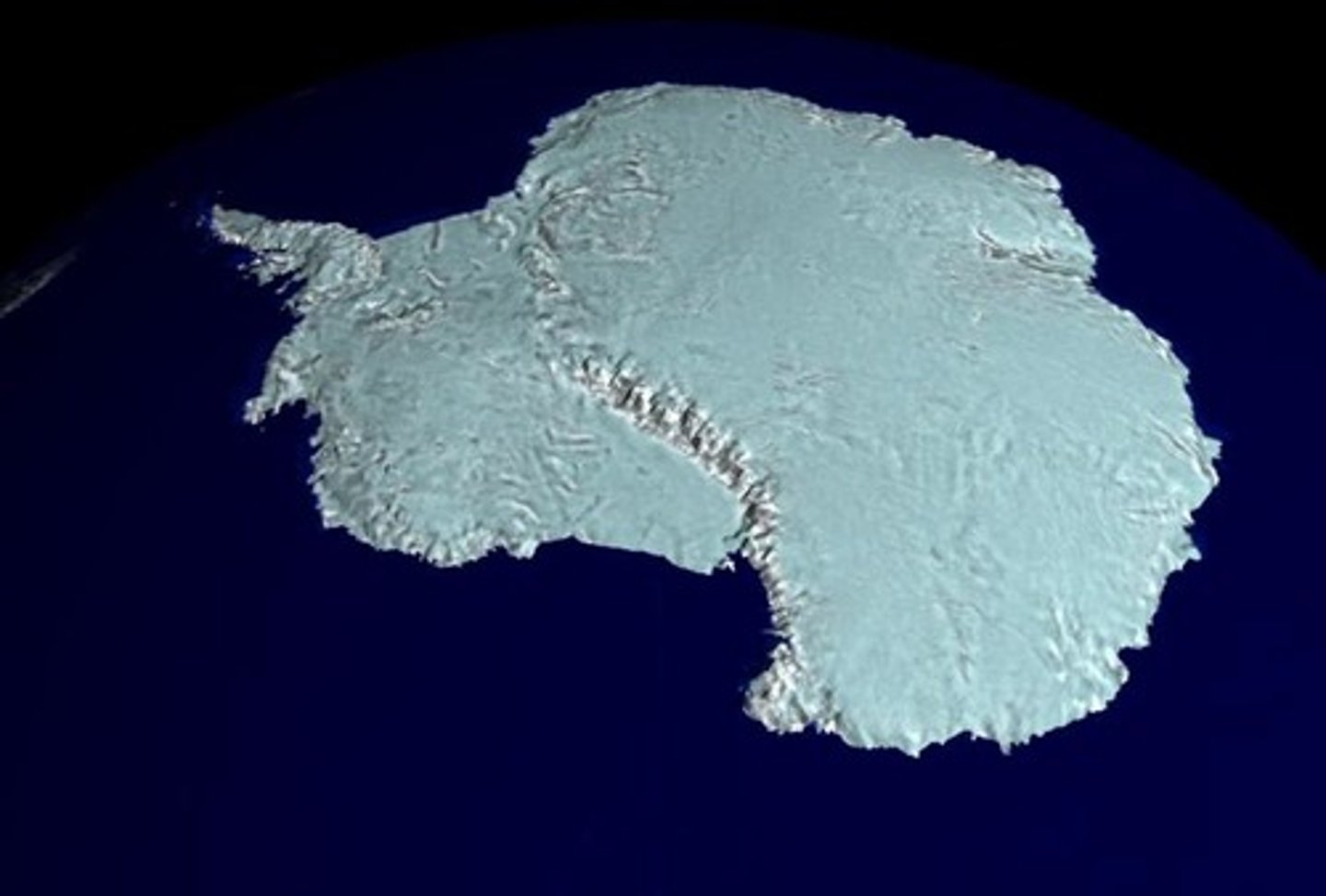
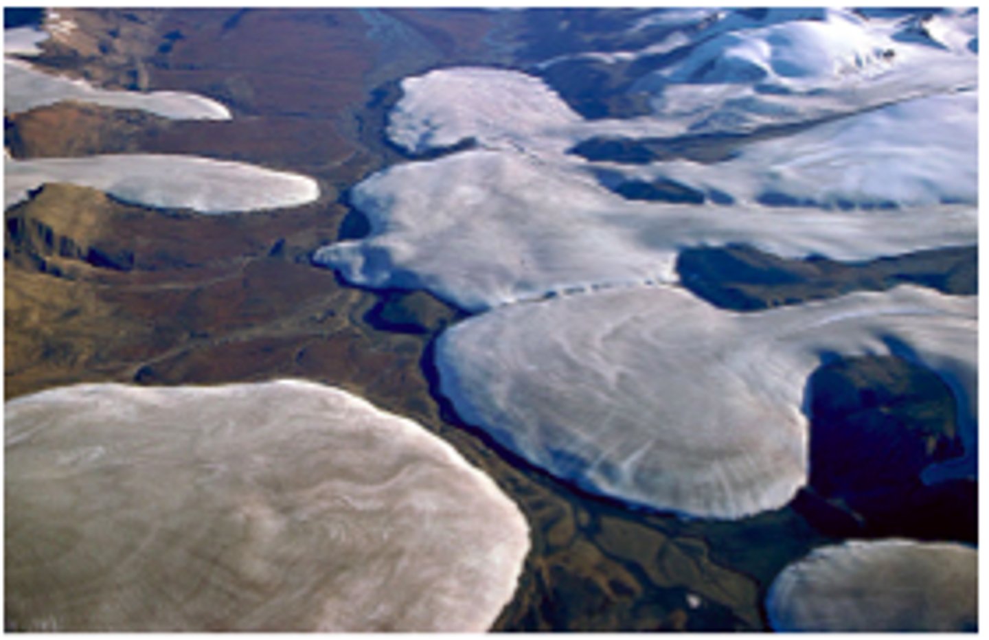
Continental Glaciers
(ice sheets) large, broad, slow-moving glaciers that cover large portions of continental areas; flow because of pressure applied by the weight of ice at their source areas
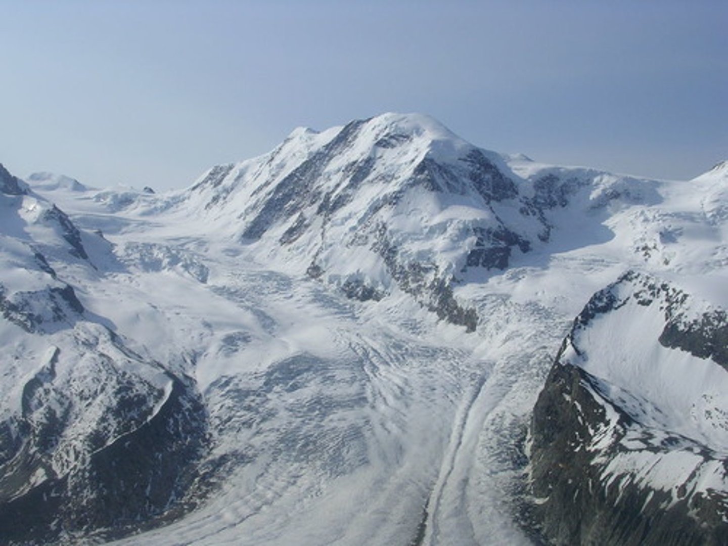
Alpine Glaciers
(valley) restricted to valley areas at high
elevations; resemble rivers of ice; moves down slopes
Piedmont Glaciers
exit the confines of a valley and spread out laterally over a broad and relatively flat area; occur where alpine glaciers encounter a broad flat plain and spread out
Two Ingredients for Glacier Formation
1) low temperature (high elevation or high latitude)
2) snow compressed into ice
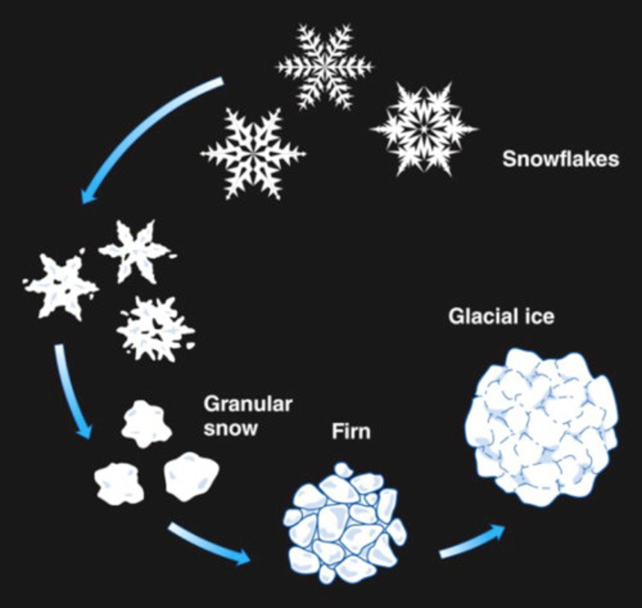
Granular Ice
50% air
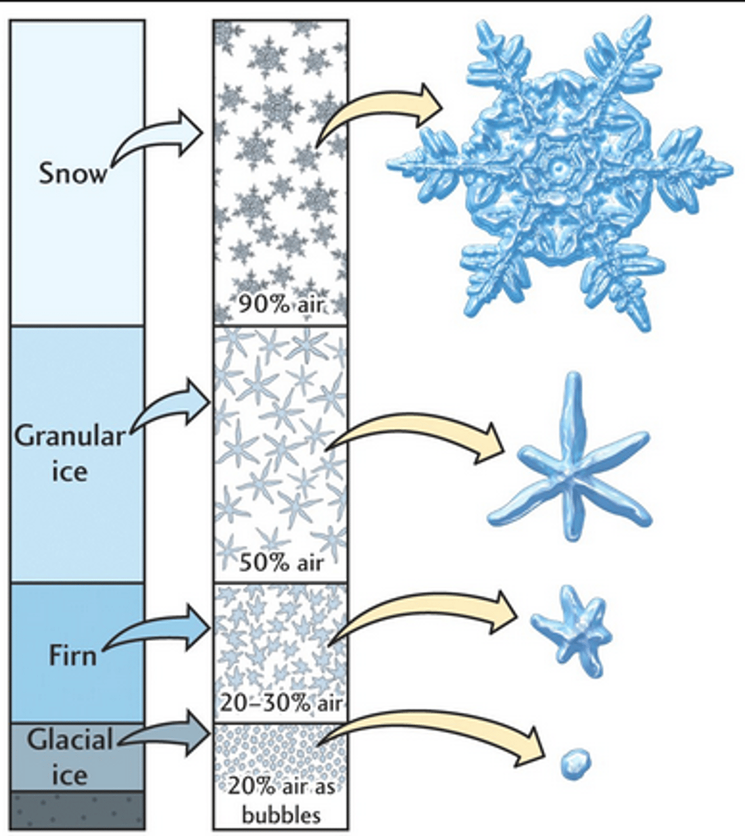
Firn Ice
20-30% air
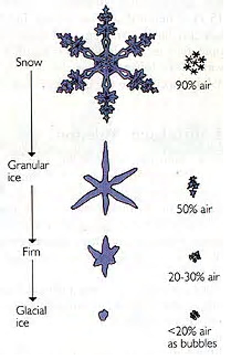
Glacial Ice
20% air as bubbles trapped in ice
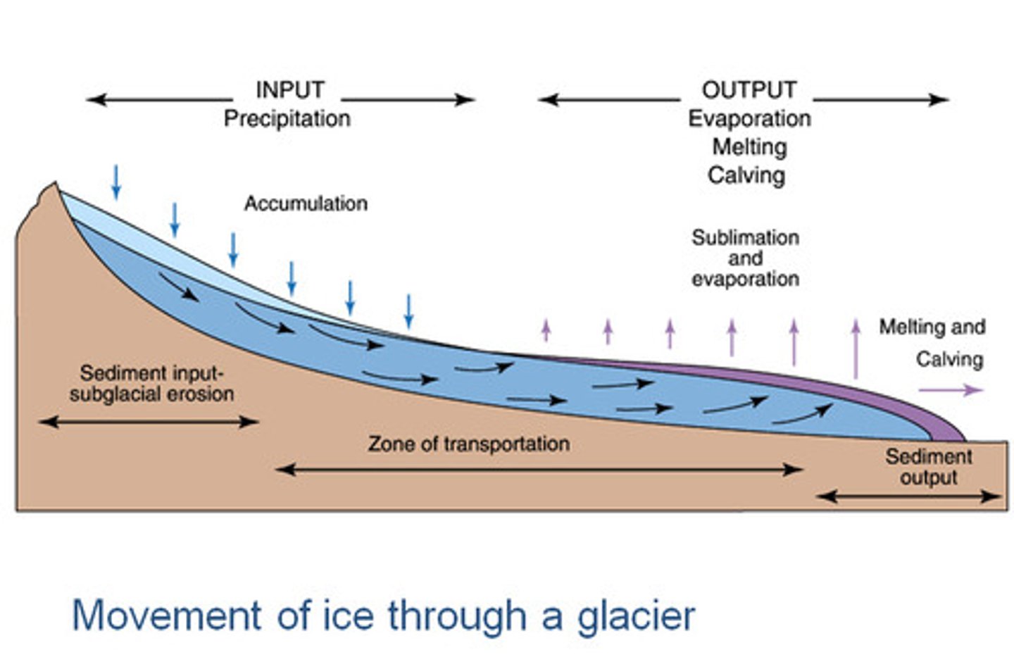
Movement of Glaciers
glacial ice in zone of accumulation flows down-slope; move as a result of amount of snow accumulating compared to the amount of glacier melting at the toe
Anatomy of a Glacier
zone of accumulation, zone of ablation, snow line, terminus,
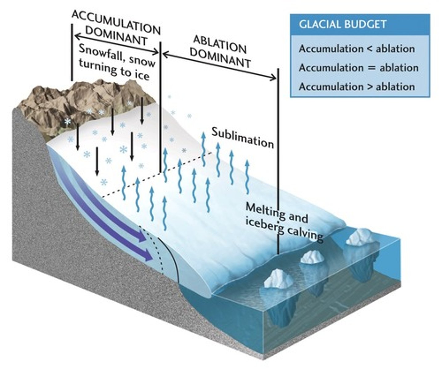
Zone of Accumulation
Area of net snow addition
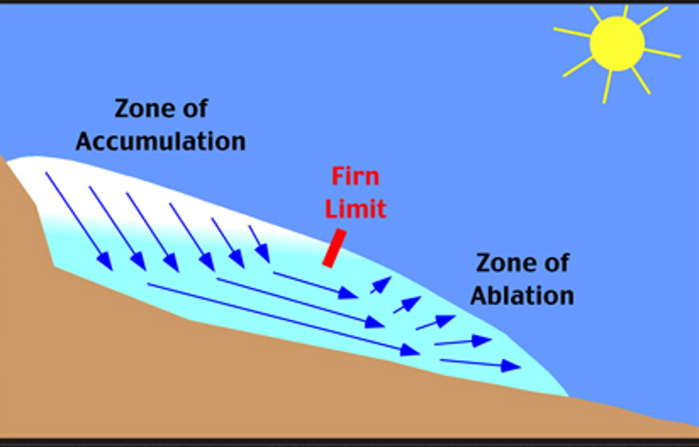
Zone of Ablation
Area of net ice loss
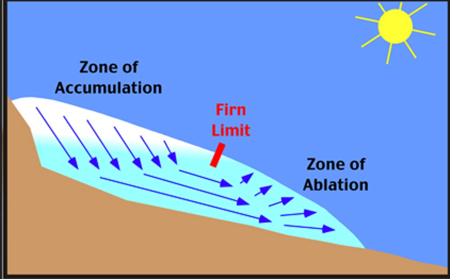
Snow Line
The elevation above which snow remains all year long
Terminus
end of glacier
Mountain and continental glaciers produce a variety of...
distinctive erosional and depositional
features
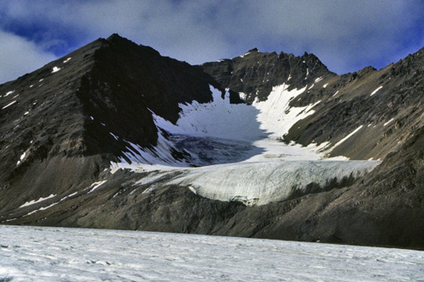
Cirques
Bowl-shaped basin high on a mountain